Google Map |
USA :: Joshua Tree :: Ryan Mountain |
GPS Track |
|
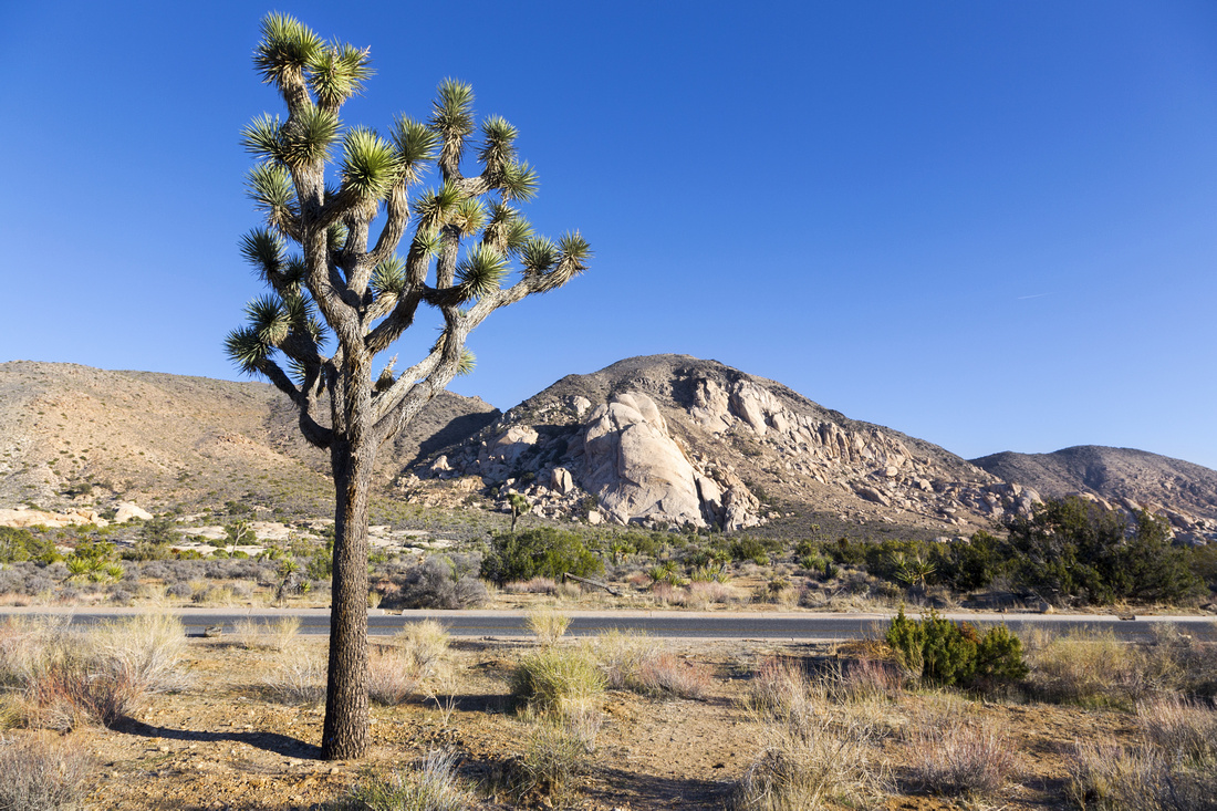
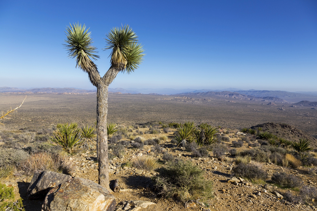
Ryan Mountain from Hall of Horrors Parking lot. Ascent trail contours slopes on left side towards notch just right of Joshua Tree |
| Trip Summary | |||
February 21, 2022Most Joshua trails are generally flat, but Ryan Mountain punches a bit of elevation gain and feels like real hiking. It is also very popular with hordes of social media hiker generation littering the trail. Don't let this deter you - ascent line is quite aesthetic and panoramic views from the top are fantastic. There are several camping areas nearby, but if staying in motel driving distance from either Joshua Tree or Twenty Nine Palms is under an hour. National Park passes are required; I always recommend getting annual pass both in Canada/US regardless of length of your stay.
Trailhead is along main Park Boulevard artery, about 10 min west of Skull Rock but before Hall of Horrors. Park brochures with maps are available in one of several Visitor Centers. Parking might be challenging depending on time of year; my visit was for February long weekend and I had to circle several minutes till spot opened up. Going is flat initially to marked Sheep Pass campground junction; turn right. Rocky trail contours on west side and rises moderately towards the saddle, visible from Park Boulevard (see lead photo on this page). Views really open up and final bit to wide summit plateau is very enjoyable. You are not likely to have it to yourself, but solitude can be found by descending slightly on east side and finding shelter behind rock outcroppings. Return is the same way, although I am reasonably sure there is plenty off-trail exploration possible on south side of the peak.
Outing is quite short - about 5km return, so it can be combined with other objectives for full day in the park. On my visit I continued to "Hall of Horrors" and meandered aimlessly for about an hour, then finished the day on Barker Dam loop trail; highly recommended. I will try to eventually compose meaningful Barker report on the site |
|
Gallery |
|||
|
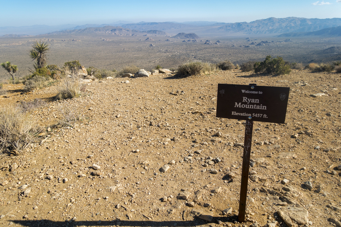
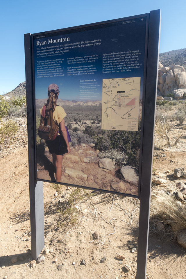
Ryan Mountain Trailhead Table at Park Boulevard Parking Lot |
|||
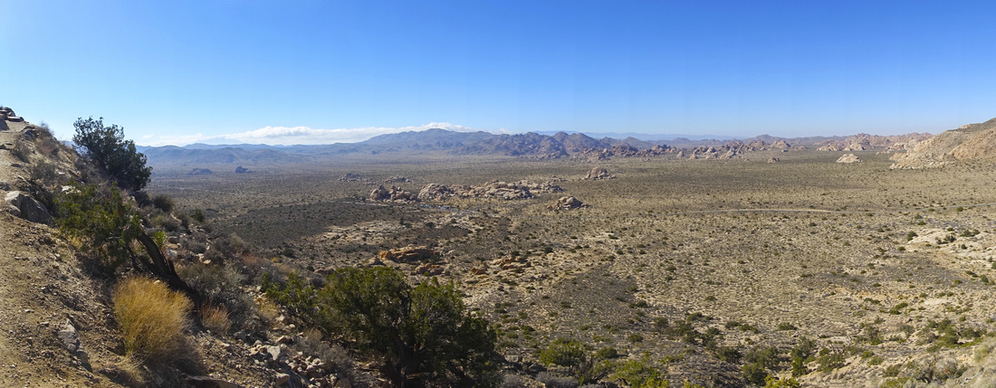 Joshua Valley Panorama Joshua Valley Panorama Panoramic view of Core area as Ryan trail starts contouring west slopes. Rock outcropping in the middle is called "Hall of Horrors" and is well worth visiting
 |
|||
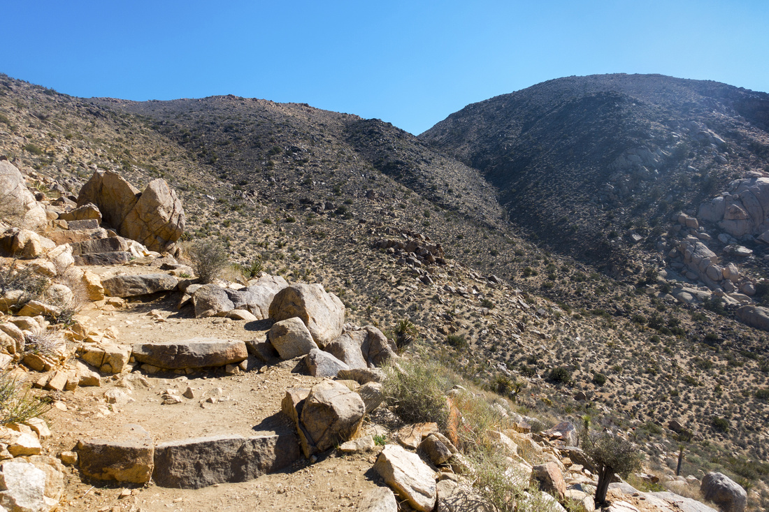 Staircase Trail
Shallow Staircase steadily gaining elevation on lower part of Ryan trail Staircase Trail
Shallow Staircase steadily gaining elevation on lower part of Ryan trail |
|||
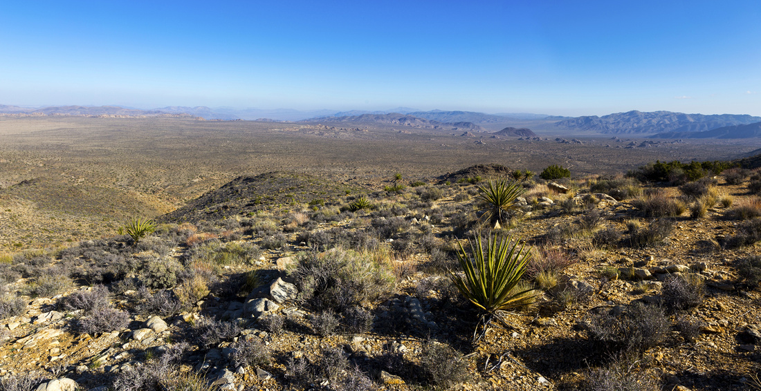
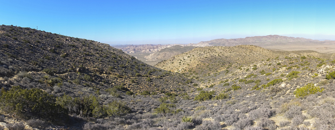 Shoulder Panorama
View back from the shoulder ~15min below Ryan summit. Note trail gently rising center left Shoulder Panorama
View back from the shoulder ~15min below Ryan summit. Note trail gently rising center left |
|||
 Joshua Tree
Single Isolated Joshua Tree at shoulder looking east Joshua Tree
Single Isolated Joshua Tree at shoulder looking east |
|||
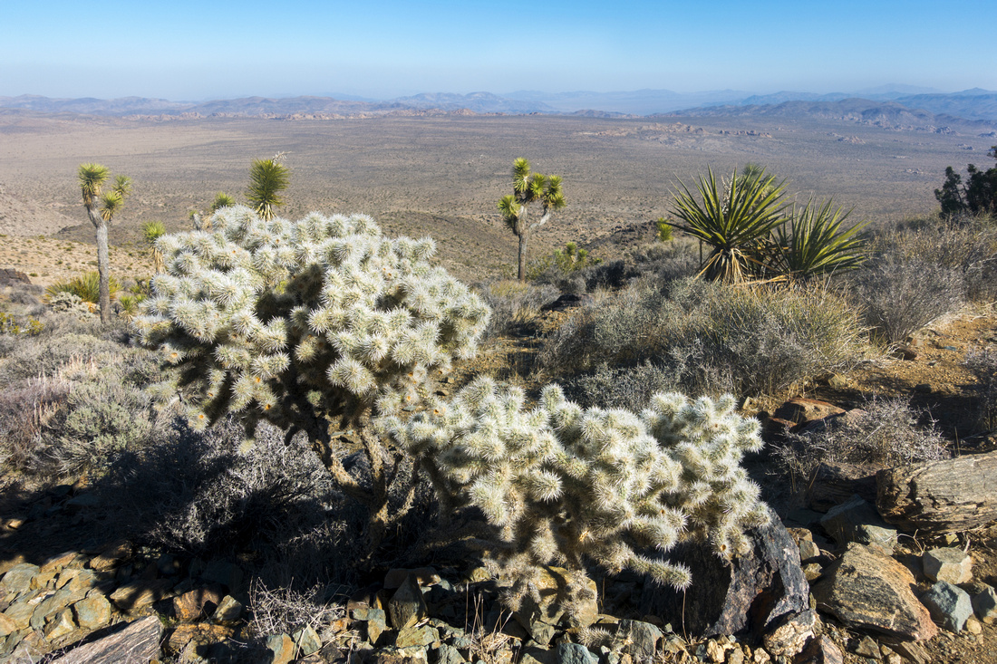 Cholla Garden
Cholla Cactus Patch just below Ryan summit Cholla Garden
Cholla Cactus Patch just below Ryan summit |
|||
 Ryan Summit
1670m Summit of Ryan Mountain with great 360 views. Often windy, but nice sheltered spots can be found by descending a bit on east side Ryan Summit
1670m Summit of Ryan Mountain with great 360 views. Often windy, but nice sheltered spots can be found by descending a bit on east side |
|||
 Ryan Panorama
Panoramic view east across Sonoran Desert from sheltered spot below Ryan summit Ryan Panorama
Panoramic view east across Sonoran Desert from sheltered spot below Ryan summit |
Abstract
| Overall Difficulty | D2/3 | Moderately steep trail with rocky sections | |||
| Scenery | Sweeping 360 Panorama Sonoran Desert and Joshua Tree National Park Core Area | ||||
| Trail/Marking | Excellent | Official wide trail with trailhead map and marked junctions | |||
| Suggested Time | 2 hrs | Return time, incl. ~30 min summit break. Fit trail runner can probably do it under an hour, but why | |||
| Elevation | Start: 1350m Max: 1670m Total: ~320m | Round Trip: ~5km | |||
| Gear | Day Hikers are sufficient. Hiking pole(s) will help on descent | ||||
| Water | Dry Hike. Carry 1-2L, depending on season | ||||
| Dog Friendly | No | Dogs are allowed in Joshua Park, but must stay within 50m from road, picnic area or campground and are prohibited on hiking trails | |||
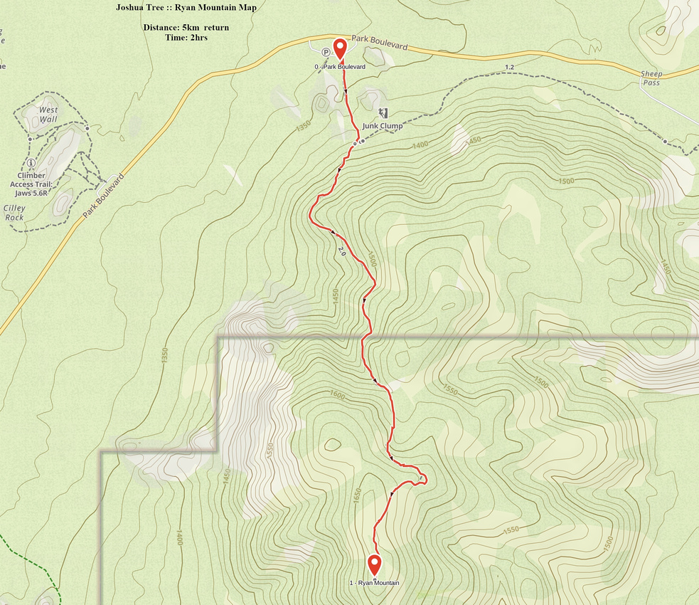 Ryan Mountain GAIA Map
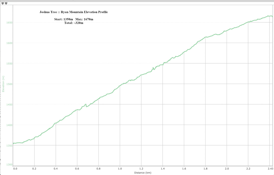 Ryan Mountain Elevation Profile