Google Map |
USA :: Joshua Tree :: Lost Horse Mine |
GPS Track |
|
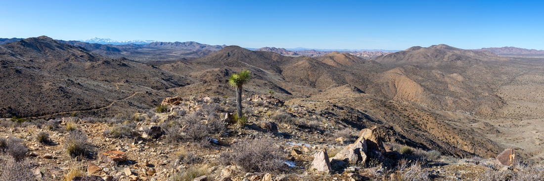
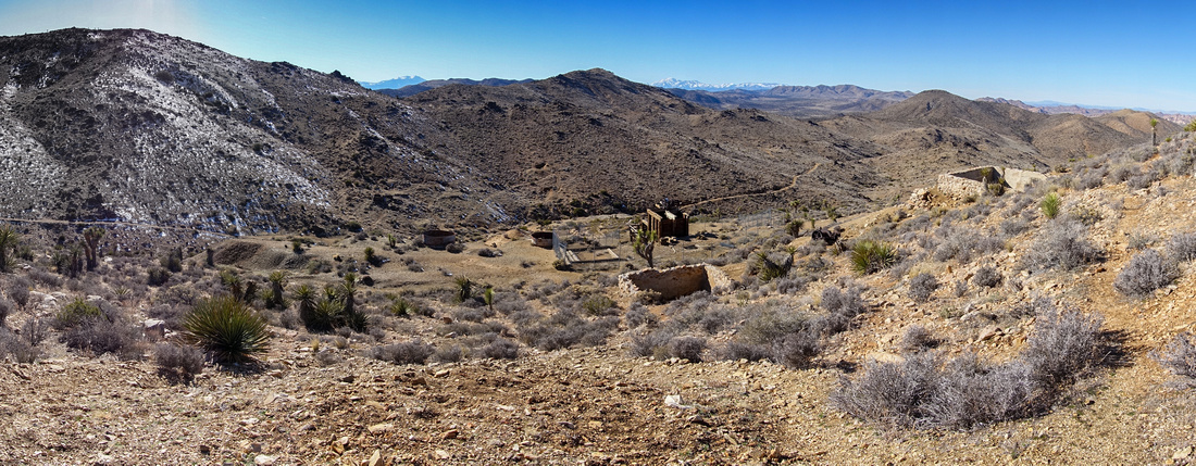
Panoramic view across Mojave Desert and Joshua Tree National Park from Ridge above Lost Horse Mine. Snow Covered distant San Gorgonio Range, Highest in Southern California (3506m) upper center left |
| Trip Summary | |||
February 11, 2024Overall probably the most rewarding moderate hike in the Joshua Tree National Park, leading to Historic Gold and Silver Mine site. Access is via unpaved Lost Horse Mine Road, branching off Keys Park Road. When dry it is easily passable by cars. Parking lot at end of Road is small and will fill quickly on weekends; roadside parking is not allowed. Most people simply hike shorter north side and come back the same way, but if time allows full loop is the way to go. South side is super scenic and solitude will allow full appreciation of this very special area. Loop can be hiked either way and there is no particular advantage either way. I went in CW direction and this is how this how this narrative and gallery are presented.
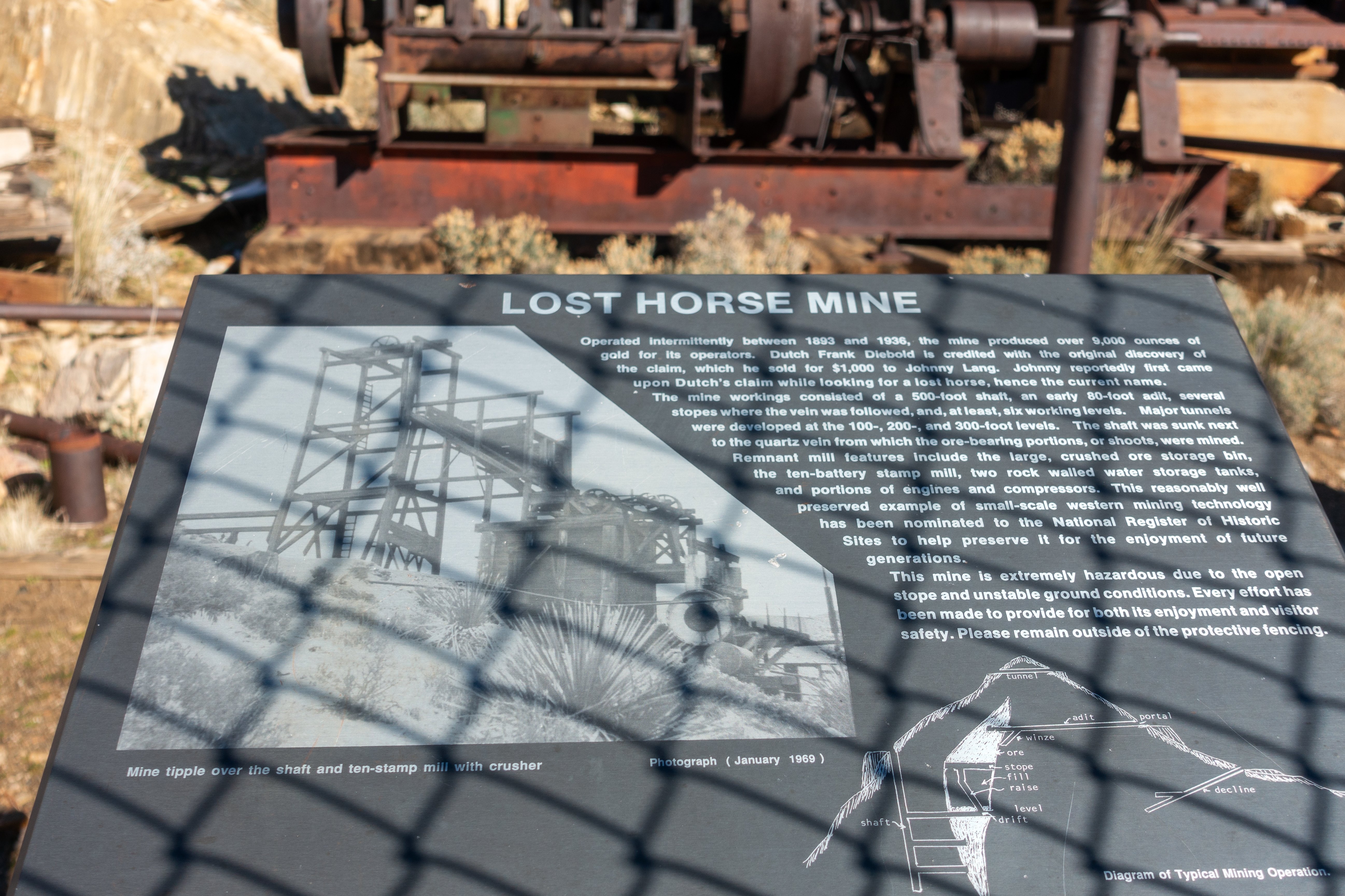
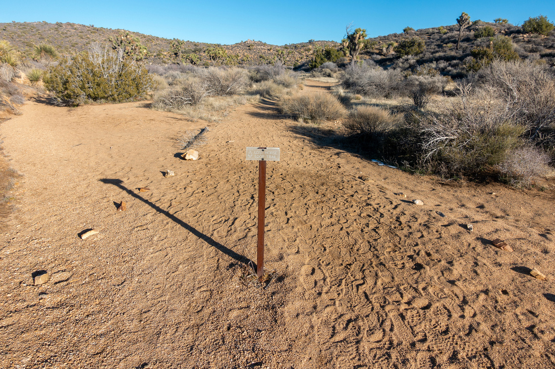
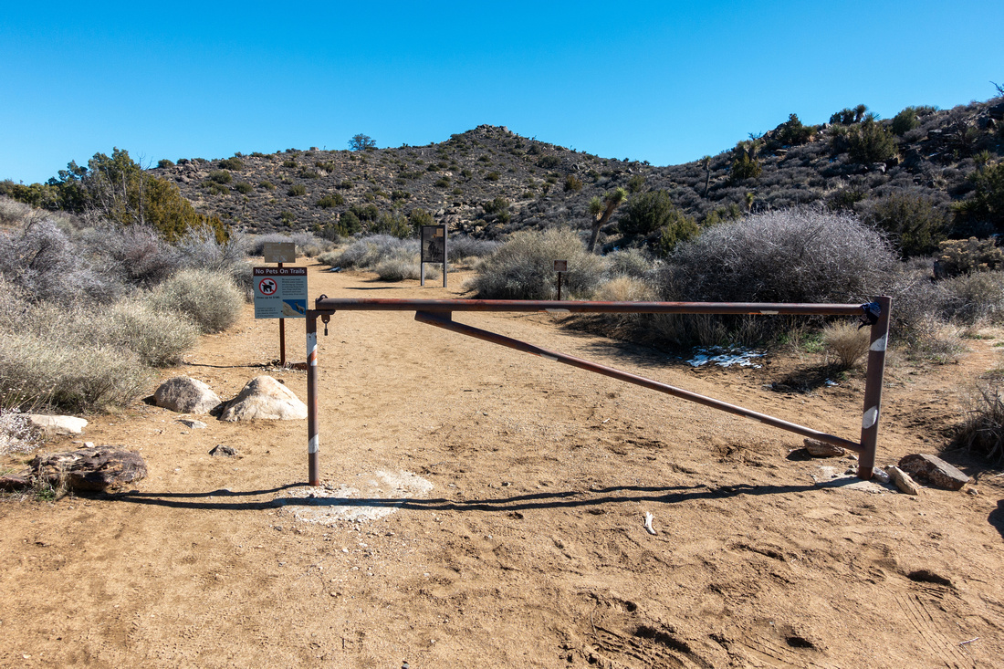
North side trailhead is just behind the gate at far end of Parking lot, together with Historic Data and Trail Map. Trail rises gently on open hillside and is very undemanding; make sure you turn back frequently as views west to distant San Gorgonio Range are terrific on clear Day - see Gallery. Mine is reached within an hour. Main site is behind the fence to prevent vandalism; graffiti can be spotted on rusted machinery. Climbing Hilltop above the Mine is a must as it offers simply spectacular 360 views of the Park. There are plenty of spots to sit and have lunch here.
For the loop continue on trail that climbs briefly south past the mine, then after descending somewhat steeply starts wide contour across several small rises and valleys. This return is about twice longer but well worth. On my trip in Feb '24 there was unexpected surprise waiting ~35-40min past the mine - remnants of old house with stone chimney and rusted bed frame. Last part of south trail hikes across valley floor (great camping, if allowed) crossing couple of sand washes where trail signs point the right direction. Trail ends at Lost Horse Mine Road ~100m before the parking lot; this info is helpful if you plan hiking in CCW direction. |
|
Gallery |
|||
|
|
|||
 |
|||
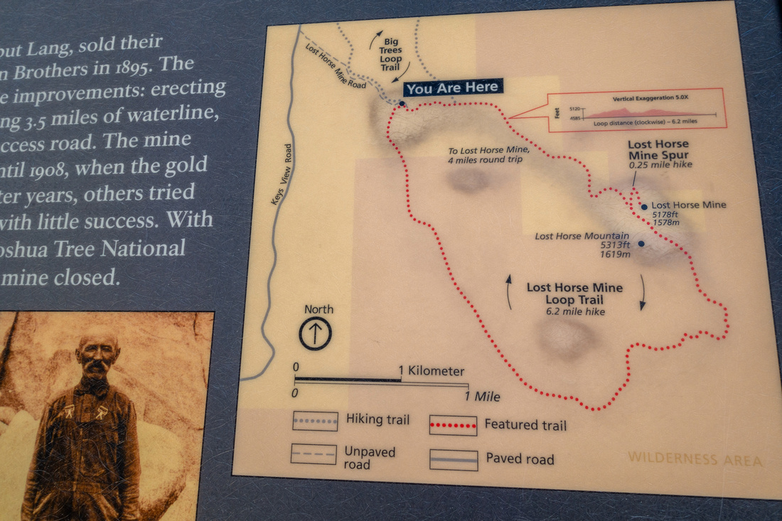 Trailhead Map Trailhead Map Closer Look at Lost Horse Mine Hiking loop Map
 |
|||
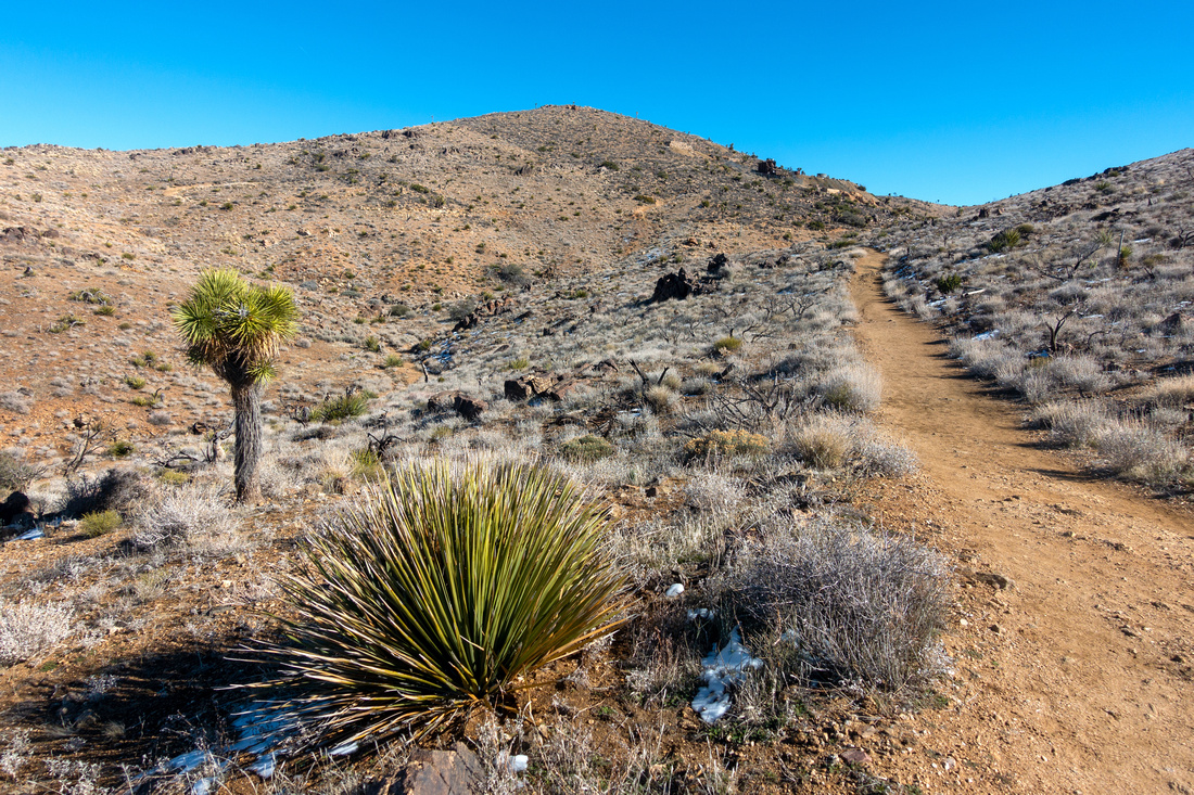
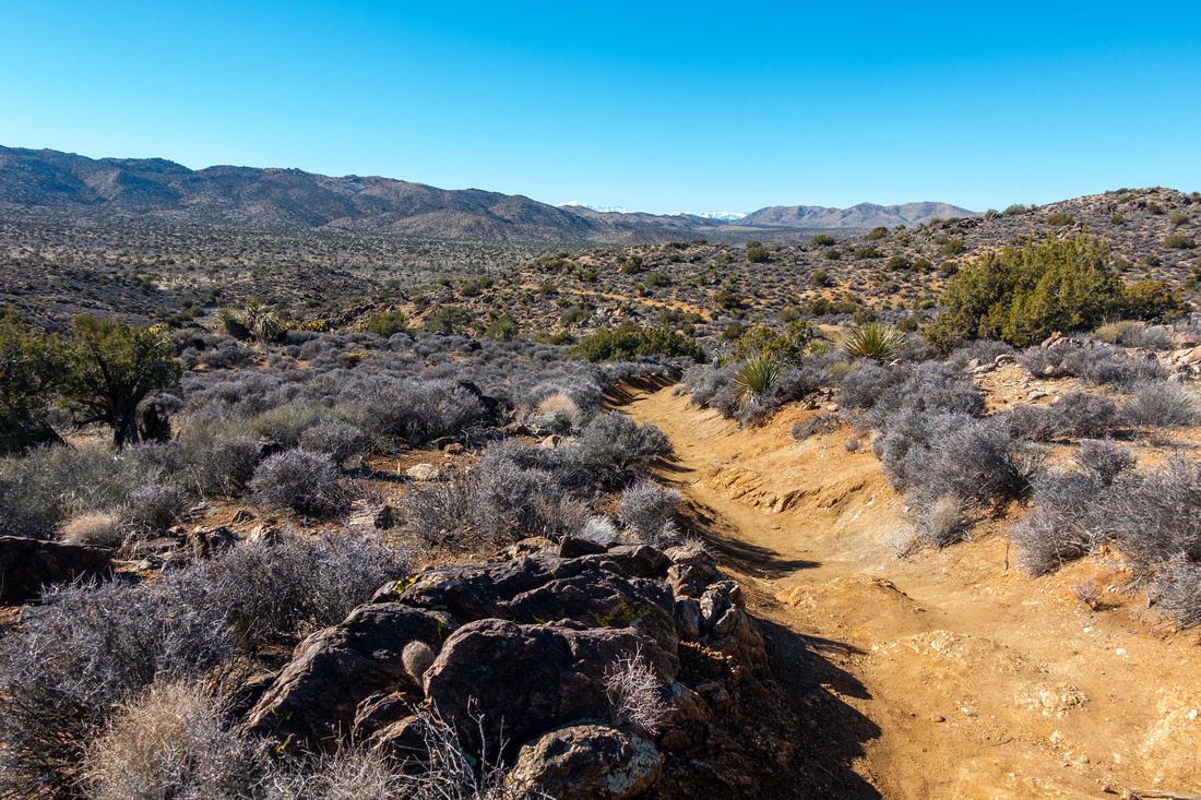 Lost Horse Mine Trail
Looking back along well defined and gentle north side trial Lost Horse Mine Trail
Looking back along well defined and gentle north side trial |
|||
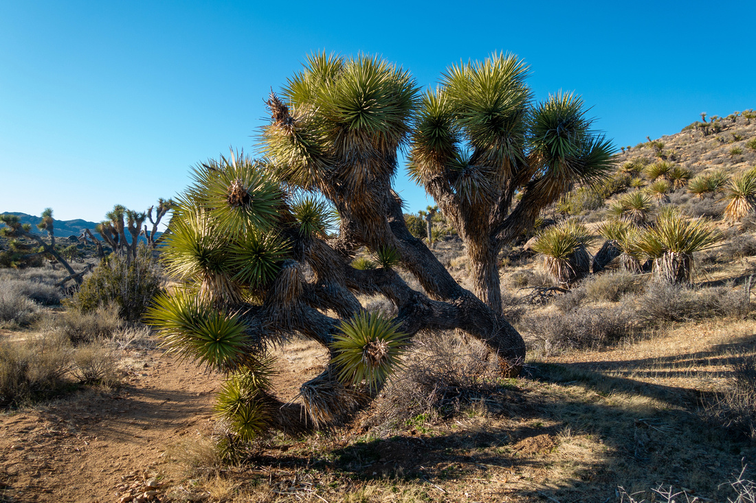
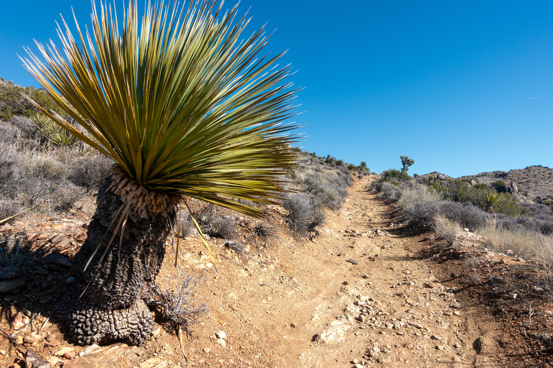 Yucca Cactus
Interesting looking Trailside Joshua Yucca Cactus Tree Yucca Cactus
Interesting looking Trailside Joshua Yucca Cactus Tree |
|||
 Mine Trail
Approaching Lost Horse Mine, just right of upper center. Climbing Hilltop above the mine is a must Mine Trail
Approaching Lost Horse Mine, just right of upper center. Climbing Hilltop above the mine is a must |
|||
|
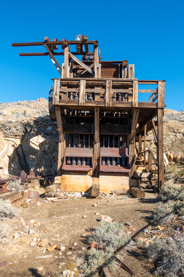
Main Mine Platform is fenced to prevent vandalism and graffiti. Sony Rx100 is priceless for such occasions as you can push tiny lens through fence opening |
|||
 |
|||
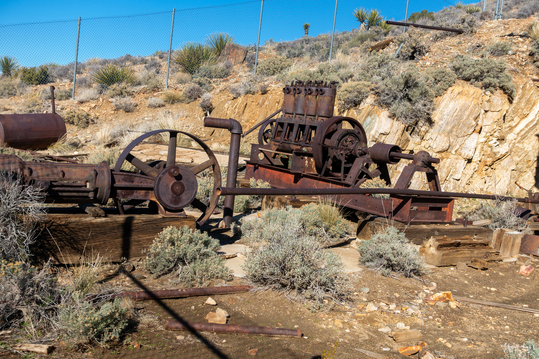 Rusted Mine Relics
More rusted Mining artifacts inside the Fenced enclosure Rusted Mine Relics
More rusted Mining artifacts inside the Fenced enclosure |
|||
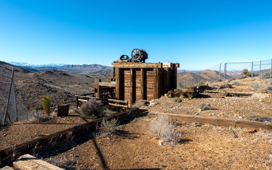 Lost Horse Mine
Looking west across Sonoran Desert to distant snow covered San Gorgonio Range Lost Horse Mine
Looking west across Sonoran Desert to distant snow covered San Gorgonio Range |
|||
 Settlement Ruins
Human settlement remains above The Mine Settlement Ruins
Human settlement remains above The Mine |
|||
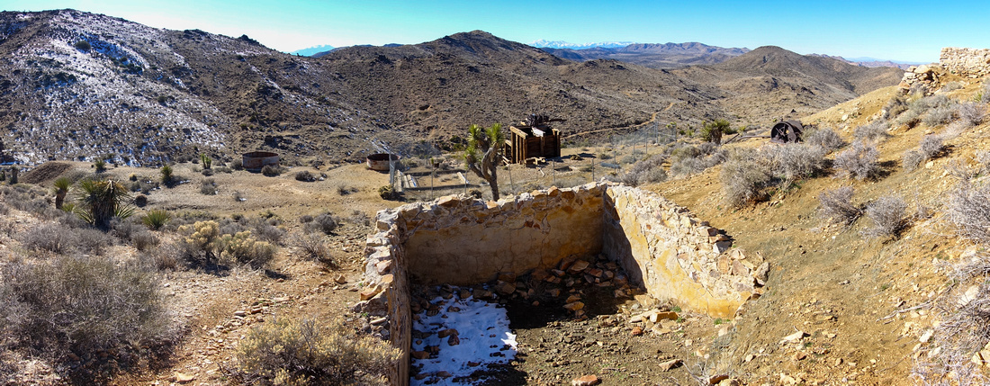
 Lost Horse Panorama
Westerly panorama from Mine Hilltop; Note Trail. South side loop continues on the left side Lost Horse Panorama
Westerly panorama from Mine Hilltop; Note Trail. South side loop continues on the left side |
|||
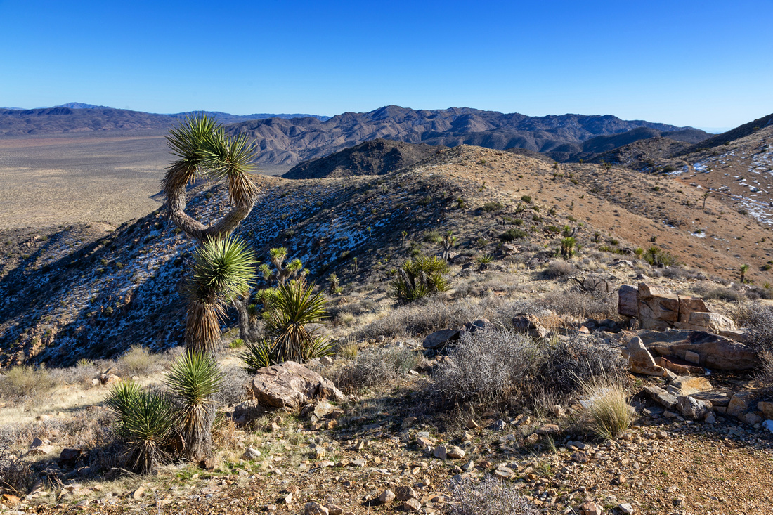 HIlltop Views
Beautiful views south from Lost Mine HIll with unique Joshua Tree left Foreground HIlltop Views
Beautiful views south from Lost Mine HIll with unique Joshua Tree left Foreground |
|||
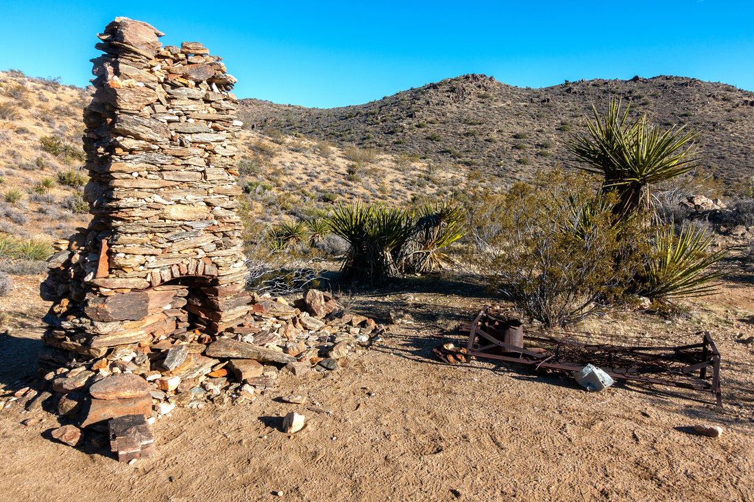 Stone Chimney
Old House Remains on south side loop with stone chimney and rusted bed frame Stone Chimney
Old House Remains on south side loop with stone chimney and rusted bed frame |
|||
 Wash Trail Sign
In last part South side trail crosses several sand washes; Signs point in right direction Wash Trail Sign
In last part South side trail crosses several sand washes; Signs point in right direction |
|||
 Joshua Tree
Another interesting Joshua Tree as south side trail approaches Lost Horse Mine Road closing the loop Joshua Tree
Another interesting Joshua Tree as south side trail approaches Lost Horse Mine Road closing the loop |
Abstract
| Overall Difficulty | D2/3 | Moderately steep parts with rocky sections | |||
| Scenery | Lost Horse Mine Relic. Sweeping 360 Panorama of Joshua Tree National Park. Distant San Gorgonio Range on Clear Day | ||||
| Trail/Marking | Excellent | Official wide trail with trailhead map. All junctions are marked | |||
| Suggested Time | 4 hrs | For full loop. 2.5 hrs for OnB via shorter north side | |||
| Elevation | Start: 1415m Max: 1590m Total: ~370m | Round Trip: ~11km (Loop) | |||
| Gear | Day Hikers are sufficient. Hiking pole(s) helfpul | ||||
| Water | Dry Hike. Carry 1-2L, depending on season | ||||
| Dog Friendly | No | Dogs are allowed in Joshua Park, but must stay within 50m from road, picnic area or campground and are prohibited on hiking trails | |||
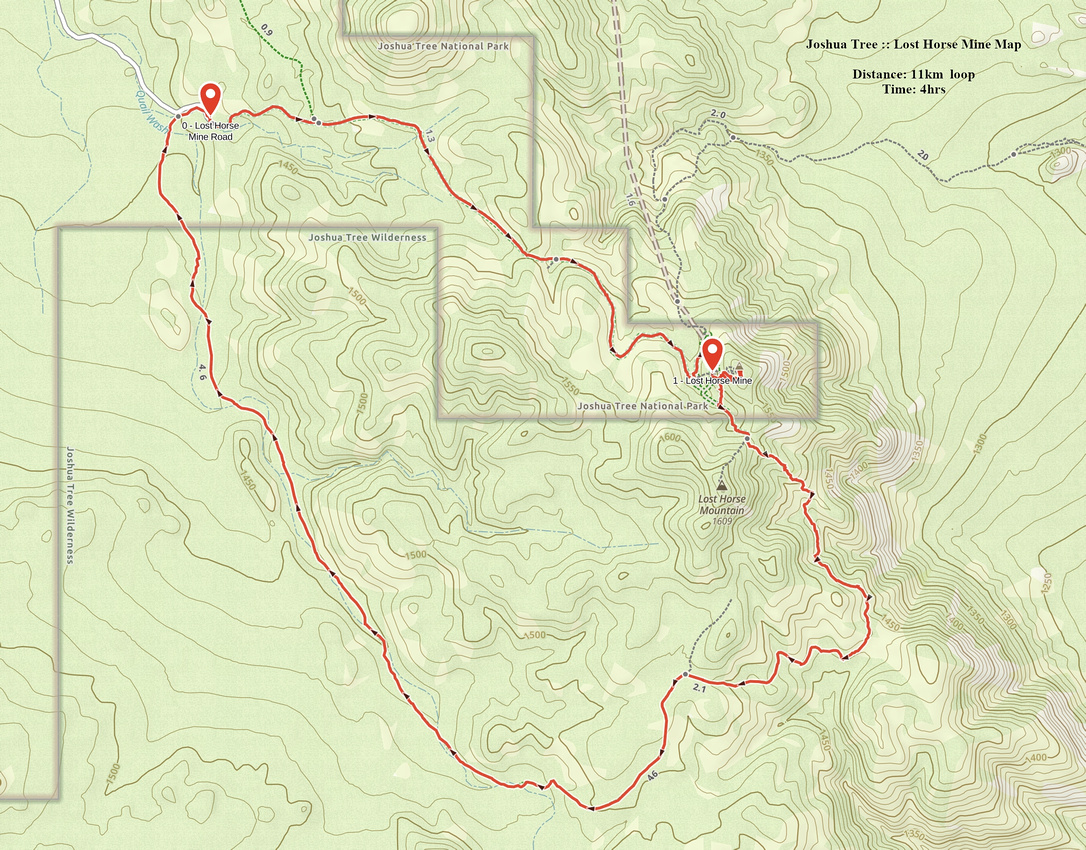 Lost Horse Mine GAIA Map
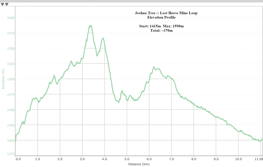 Lost Horse Mine Loop Elevation Profile