Google Map |
Rockies :: Kootenays :: Stanley Glacier |
GPS Track |
Stanley Glacier telephoto from top of Headwall in upper Valley |
|||
| Trip Summary | |||
July 9, 2018Stanley Glacier trail is one of most scenic day hikes in Kootenay National Park. Official Parks trail leads into spectacular glacial valley below Stanley Peak. It also serves as mountaineer approach for mixed snow/ice climb on steep west side. Hikers that are comfortable with talus slopes and light scrambling can explore upper valley beyond end of maintained trail. Recommended option is hike to top of Headwall below the glacier and clockwise loop return culminating with descent below sheer west side cliffs that host several well known ice climbs in winter. Continuing past the Headwall is entirely off-trail but well worth optional extension.
From parking on south side of Banff-Radium Highway (Hwy 93) some 2km west of Banff/Kootenay Park boundary, follow well defined trail to mouth of valley through area of old burn, now slowly reclaimed by young growth. Trail switchbacks gently for 2.5km (~170m) vertical then levels for another km or so following Stanley Creek into the valley. End of maintained trail is reached within an hour at top of talus bench (roughly an hour of moderate pace from trailhead). Well defined talus trails on both sides of upper valley are seen from here and loop is logical choice. Clockwise direction is highly recommended both from lighting perspective (photography) and scenic aspect. Talus trail on east side is steep-ish and poles will help in this part. Most people stop at top of Headwall, but by following glacial creek one can scramble further to upper waterfalls draining the Stanley Glacier. This is also the favorite bivi site by mountaineers ascending Stanley Peak via Kahl route. Coming back to the Headwall find trail on the west side that makes spectacular traverse beneath sheer cliffs. Few minutes beyond rock-hop creek crossing tumbling spectacularly from above you reach "The Cave" -- one of biggest highlights of the day. (do not go spelunking if not equipped properly). Final part before rejoining the maintained trail offers great views of "The Nemesis" -- hardest waterfall climb on the planet when first ascended in 1974. |
|
Gallery |
|||
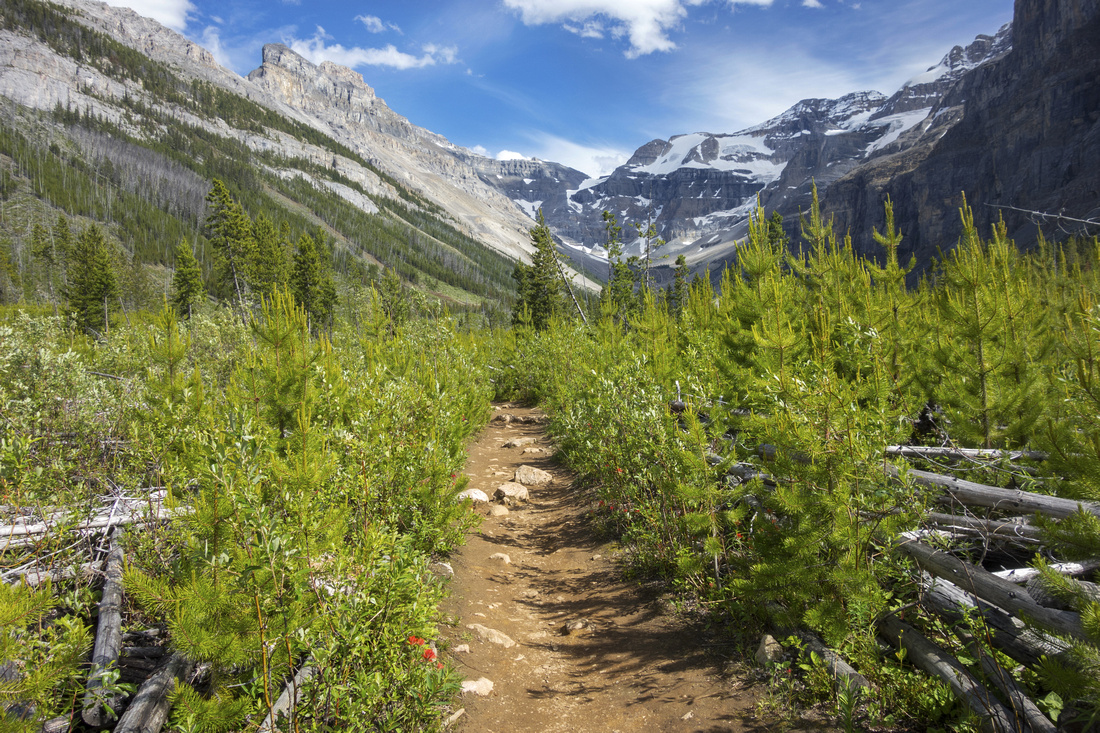 Young Growth
Trail at mouth of valley passing through old burn area now with young growth Young Growth
Trail at mouth of valley passing through old burn area now with young growth |
|||
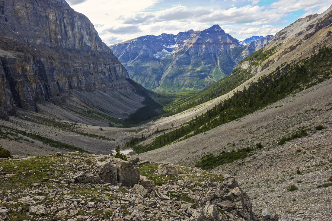
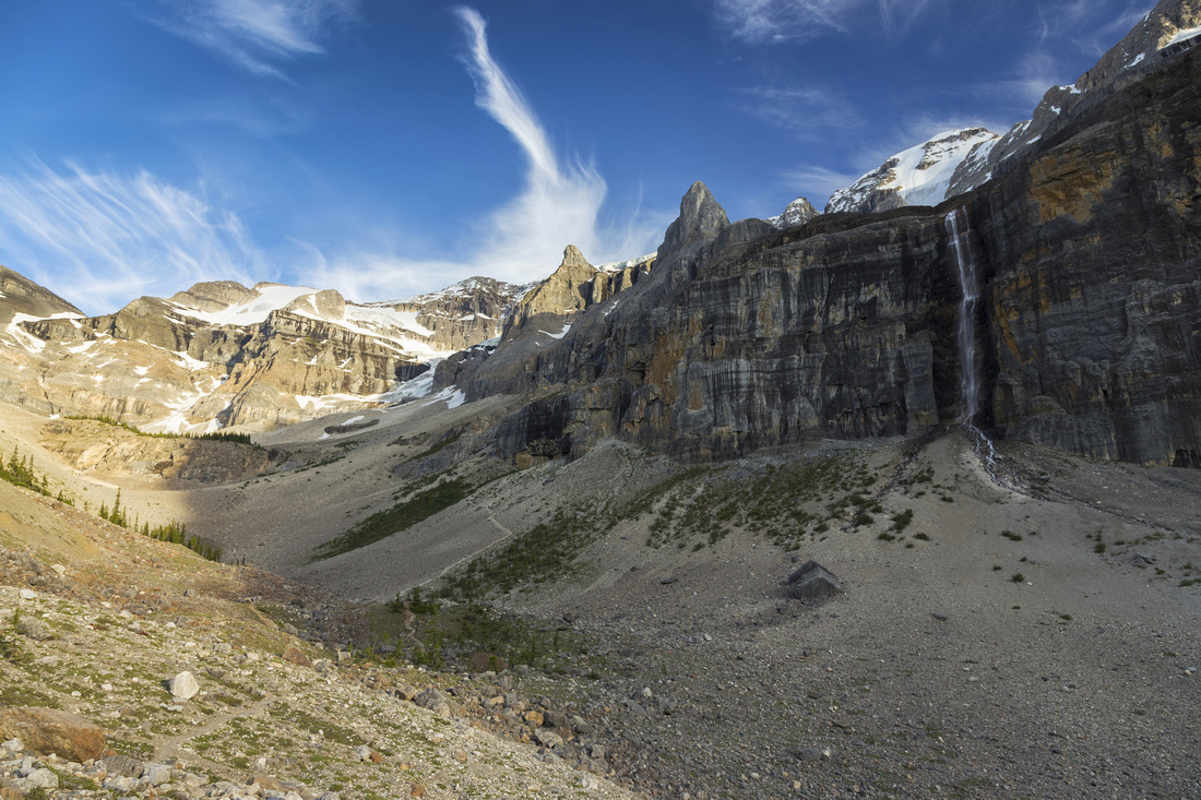 Upper Valley
View from bench near end of maintained trail. Upper Headwall center left. "Nemesis" waterfall right. Note scree trail in center - return leg of upper valley loop. Upper Valley
View from bench near end of maintained trail. Upper Headwall center left. "Nemesis" waterfall right. Note scree trail in center - return leg of upper valley loop. |
|||
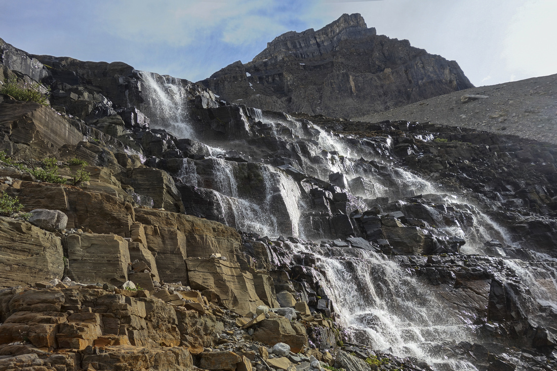
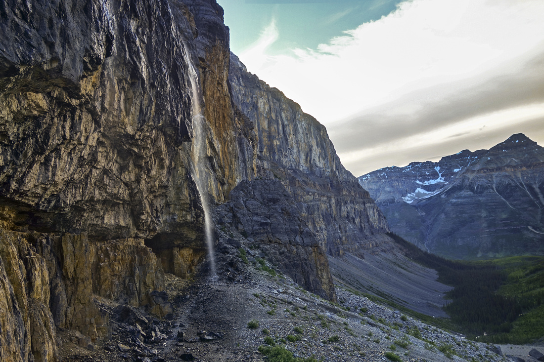
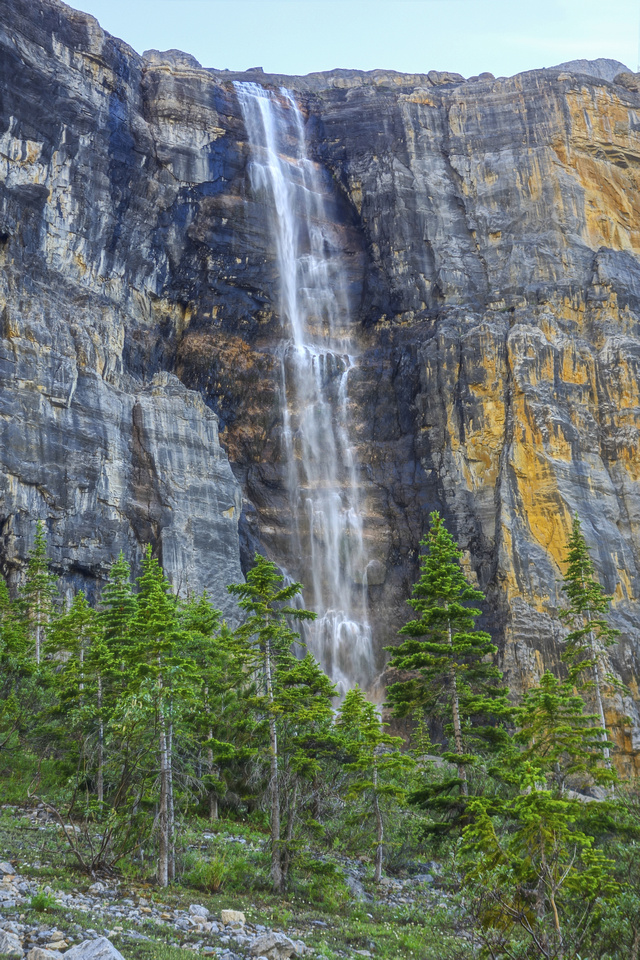
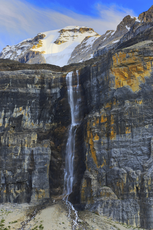 Nemesis Waterfall
Closer look at "Nemesis"; first climbed in 1974 and at that time hardest ice climb on the planet Nemesis Waterfall
Closer look at "Nemesis"; first climbed in 1974 and at that time hardest ice climb on the planet |
|||
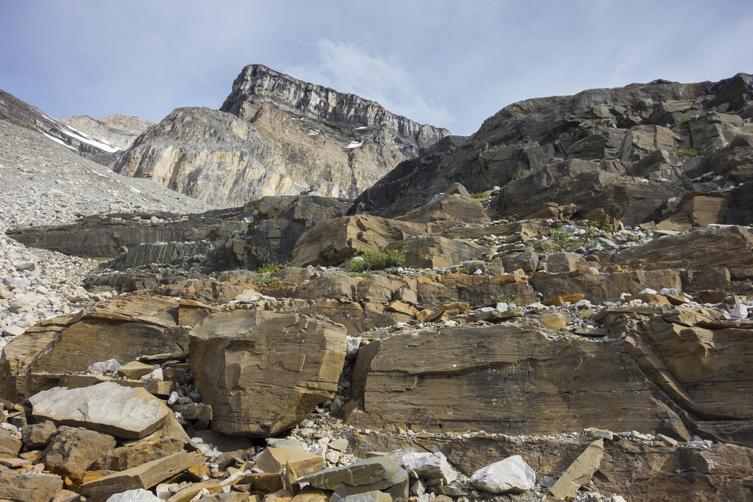
 Top of Headwall Top of Headwall
View back from top of Headwall. Well defined scree trail to the right is suggested for inbound leg. Mt. Whymper (Kane moderate) distance center |
|||
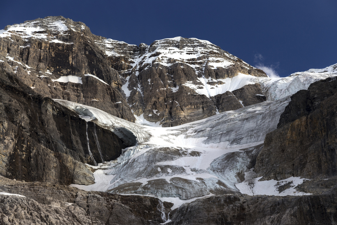
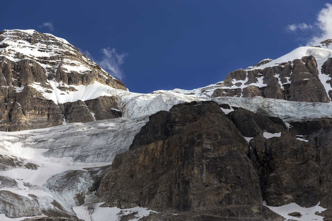
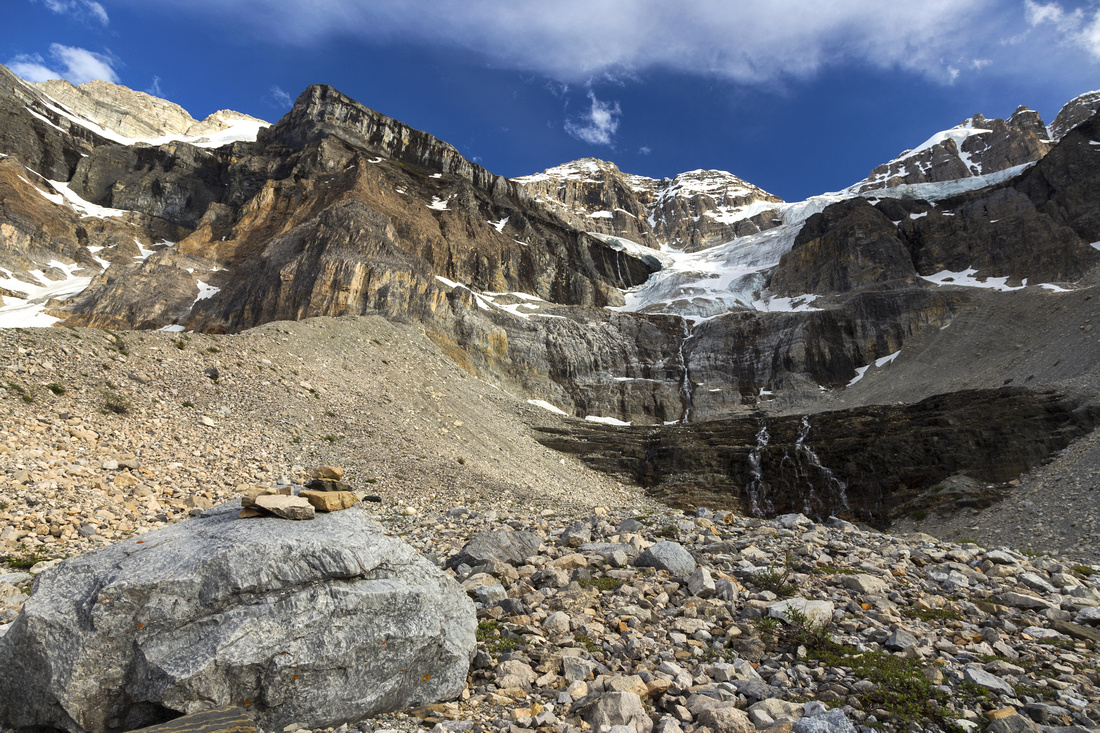 Stanley Glacier Stanley Glacier
Glacial bench above the Headwall with view of Stanley Glacier snout. Mountaineers approach via glacial moraine to the right. It is possible to scramble by lower waterfall to upper bench |
|||
 Lower Waterfall Lower Waterfall
Scrambling by lower waterfall. Easiest to climb directly up nicely broken sets of ledges directly to climber left of the water |
|||
 Ledge Scramble Ledge Scramble
Scrambling up the ledges. Talus slope far left is terribly lose with big chunky blocks that roll easily and best avoided |
|||
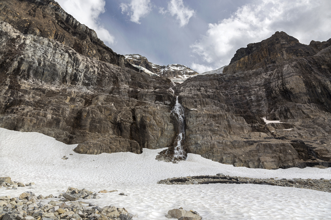 Stanley Waterfall Stanley Waterfall
Glacial bench below upper Waterfall; beautifully desolate and wild place |
|||
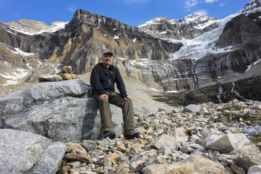 Office Selfie Office Selfie
Taking a break in "my office" on the way back |
|||
 Stanley Glacier Stanley Glacier
One more telephoto of Stanley Glacier lower part before heading back towards Nemesis and the Cave |
|||
 Cave and Waterfall Cave and Waterfall
Approaching "the Cave" on loop return descent |
|||
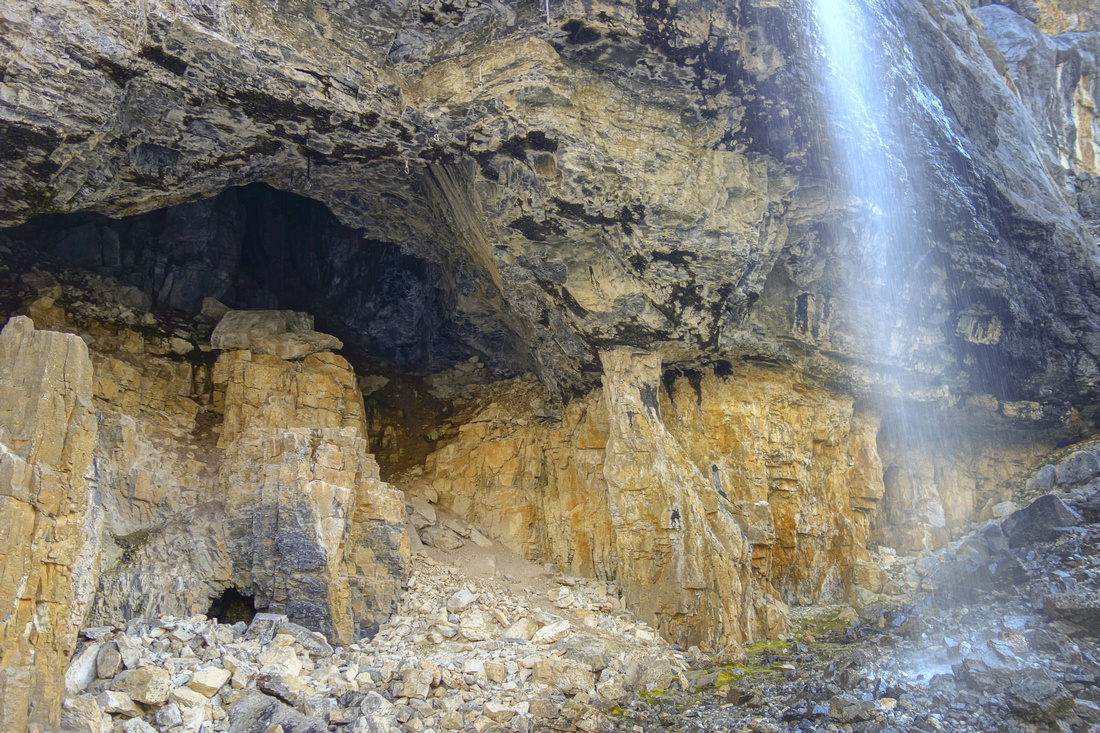 The Cave The Cave
"The Cave" - deep and inhabited by bats, great place to explore with right equipment -- with water spray from Stanley Glacier above right by the entrance! |
|||
 Nemesis Nemesis
Another look at the "Nemesis" on descent towards end of maintained trail |
Abstract
| Overall Difficulty | D3/4 | Easy trail hiking to end of maintained trail. Talus slopes and off-trail easy scrambling in upper valley. | |||
| Snow Factor | S4 | Trail traverses steep avalanche slopes on east side (note debris) and is not a safe place for in unstable snow conditions | |||
| Scenery | Stanley Glacier and Sheer Rock Walls. Spectacular waterfalls and "The Cave" on west side of the valley. | ||||
| Trail/Marking | Very Good | Official Parks Canada trail in first part, followed by well defined talus slopes trail with good footbed. Off-trail in upper valley beyond the Headwall with easy scrambling. | |||
| Suggested Time | 5 hr | Summer time including additional exploration in upper valley and full loop. 2 - 2 1/2 hours if going just to the end of official trail | |||
| Elevation | Start: 1560m Max: 2250m Total: ~750 m | Round Trip: ~15km | |||
| Gear | Light hikers if going only till end of official trail. Full boots and poles for upper valley. | ||||
| Water | Several creeks and waterfalls draining Stanley glacier. No need to carry more than 1L | ||||
| Dog Friendly | Yes | Please keep pets on leash (parks sign near trailhead) | |||
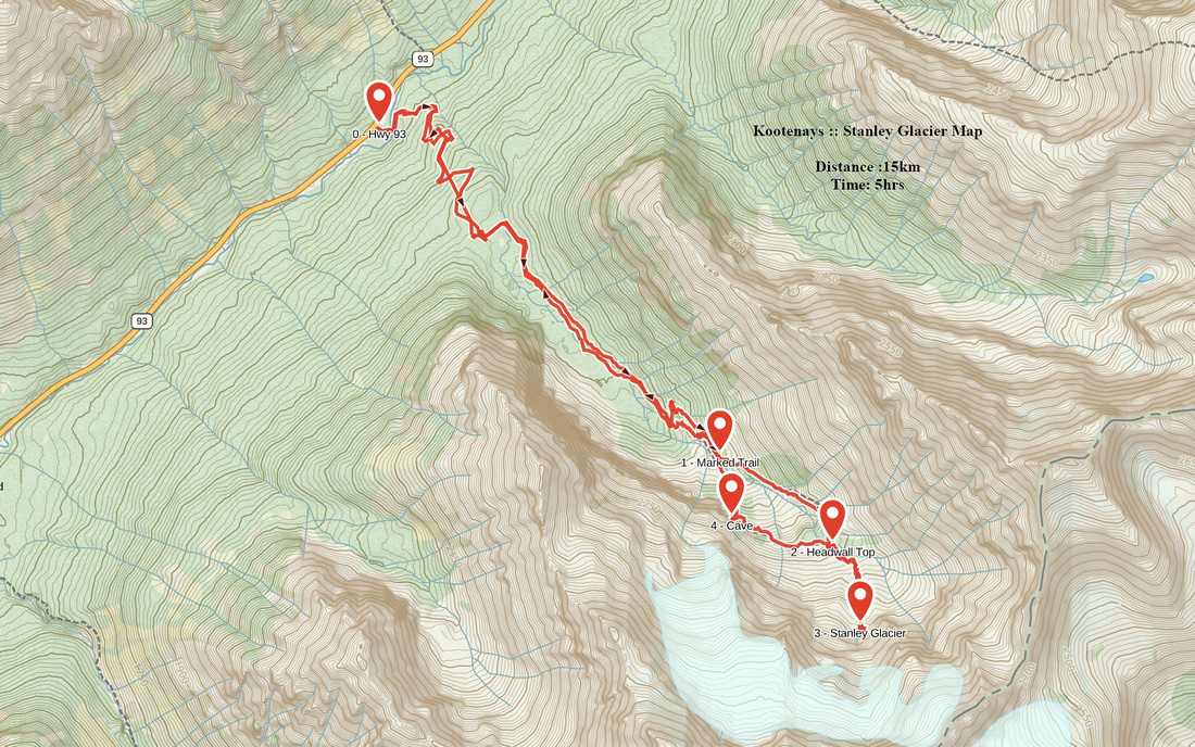 Stanley Glacier GAIA Map
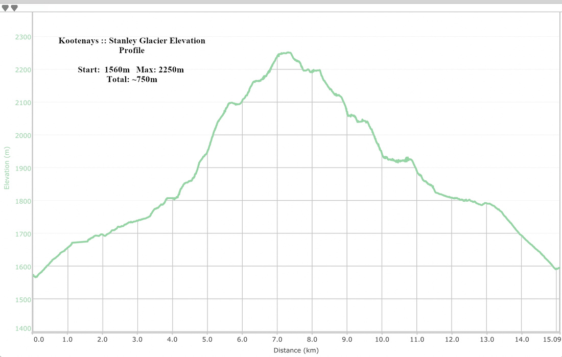 Stanley Glacier Elevation Profile