Google Map |
Rockies :: Icefields :: Sunset Pass |
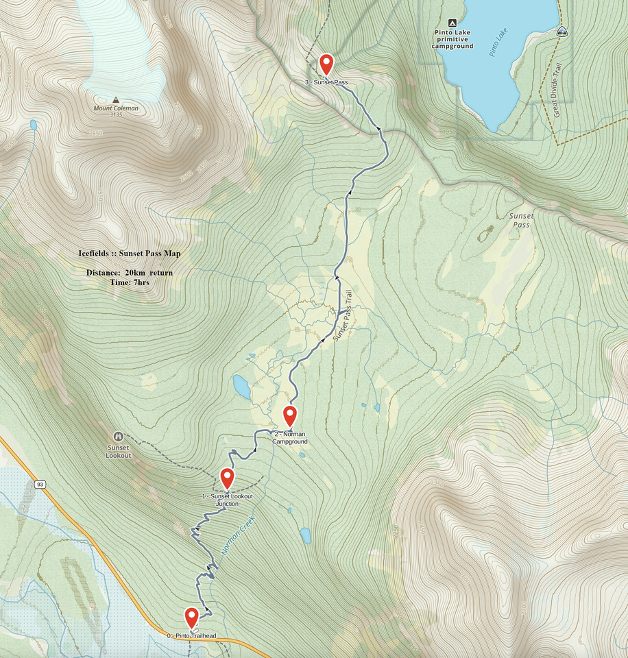
GPS Track |
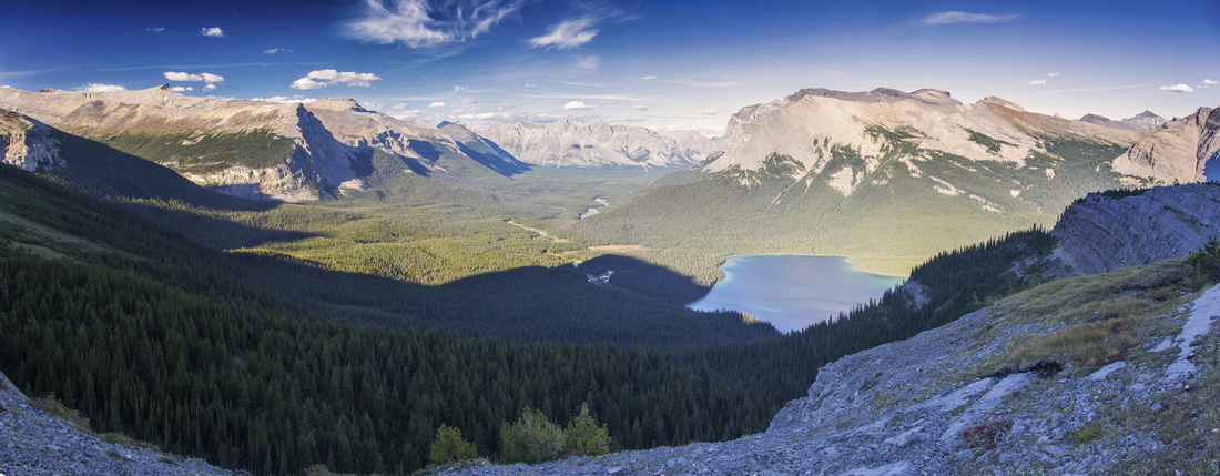 
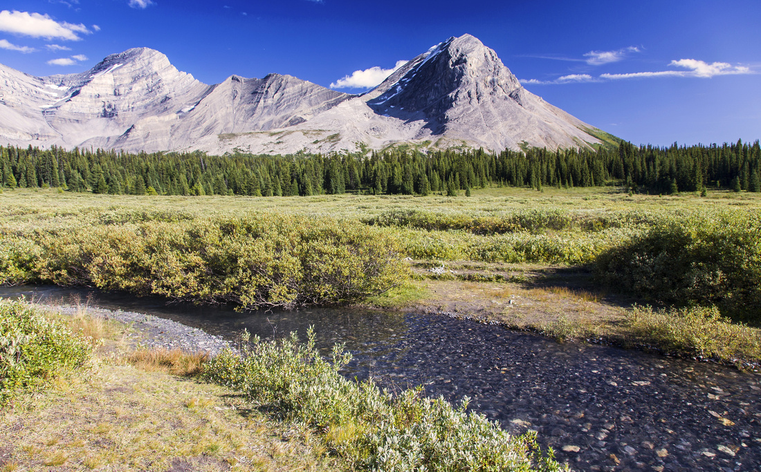
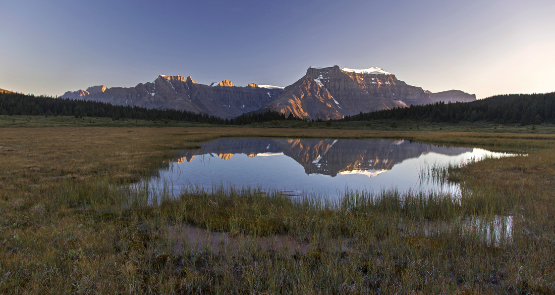
Cline River valley from Sunset Pass environs just before trail starts descent to Pinto Lake (center right) |
|||
| Trip Summary | |||
August 15, 2016This is very scenic day-hike or easy backpack to expansive Norman creek meadows below Mt. Coleman and ending at superb viewpoint of Pinto Lake near Sunset Pass. Since it lies on east side of Icefields Parkway, it is best done in the afternoon when sun will be behind you. Mid-afternoon views of Pinto Lake from Sunset Pass are amazing! There are several options to extend the day: From easy side trip to Sunset Lookout to long day difficult Kane scramble up Mt. Coleman. Backpackers also sometimes utilize this trail as entry or exit point to Cline River and White Goat Wilderness.
Parking is at Sunset Pass trailhead on east side of Icefields Parkway ~16km north from Saskatchewan River Crossing. Follow wide and well-defined trail that ascends on the left side of Norman Creek gorge. There are limited views of the creek ~1km from the start; endless switchbacks follow. This part is bit of a slog so treat it as necessary evil for beautiful scenery that awaits. Grade eases after Sunset Lookout junction ~3km mark and soon you reach first viewpoint small tarn with views of Mt. Coleman. Trail climbs on the other side and emerges to west end of Norman meadows, about 1 - 1.5 hrs from trailhead. From here on trip is extremely scenic! Trail crosses Norman creek on good bridge and leads to official Norman Lake Campground (No5). This is very nice spot with picnic tables right at the edge of forest with amazing views of Mt. Coleman. There is outhouse, food storage and nearby creek provides water source. It would be an excellent choice for beginner' backpack.
From the campground trail continues towards Sunset Pass, still some 5km away. Further up is one confusing part; trail seems to continue along the creek, but arrows have been placed --presumably by Parks Canada-- pointing to trail on the other side of the creek. Both trails will actually work; if you are heading for Pinto Lake it is faster to cross the creek; if going just for the viewpoint both work equally fine. There is no bridge but usually by late summer it is very easy although you might have to take your boots off. Continue on the other side of the creek through bushy area, then climb through semi-open forest to highpoint and Banff Provincial Park boundary. Trail descends briefly and eventually emerges to Sunset Pass at north end of open ridge above Pinto Lake. This is the logical turnaround point for day-hikers. (Backpackers note that there is campground at Pinto lake). If you have some extra time, it is well worth following this ridge south. There is no trail, but none is needed. Within 15 minutes or so you end at beautiful viewpoint directly above Pinto Lake. From here you can aim more directly back towards Norman meadows intercepting the other trail along the way.
Sunset Lookout Option: From junction ~3km from trailhead, follow trail up for about 15-20 minutes to open platform and great views of Mt. Amery and Alexandra River valley. Mid-morning views are nothing short of spectacular!
Mt. Coleman: For (very) experienced scramblers only. Past the Norman campground leave the trail and head left across the meadows. Goal is to bushwhack through intervening forest at far end of the meadows to base of obvious talus gully leading to saddle and Coleman west ridge. This gully is huge slog and will seem never ending. From the saddle turn right and scramble up; crux is near the top as you must scramble sections of exposed and crumbly ridge to 3135m high summit. For more details see Alan Kane "Scrambles in the Canadian Rockies" guidebook, or this online report. |
|
Gallery |
|||
 First views of Mt. Coleman after ~4km of steady ascent
 |
|||
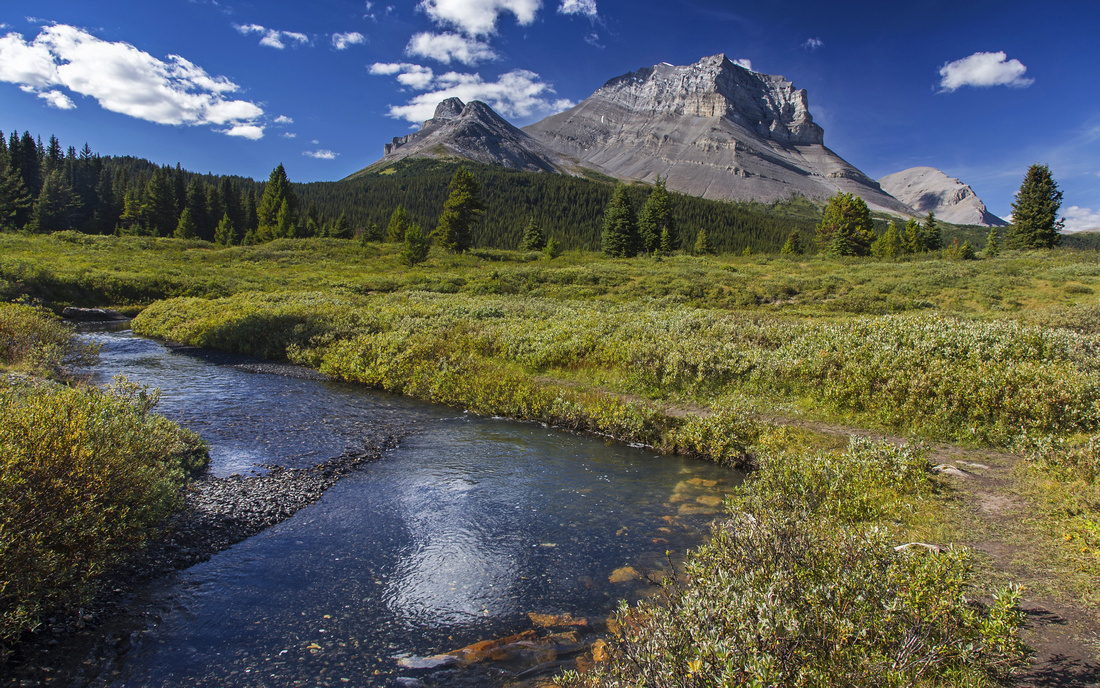 Delightful meadows hiking by Norman Creek
 |
|||
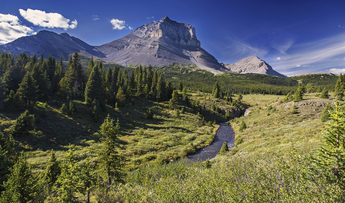 Upper part of the meadows past Norman campground
 |
|||
 Non-bridged creek crossing in upper meadows
 |
|||
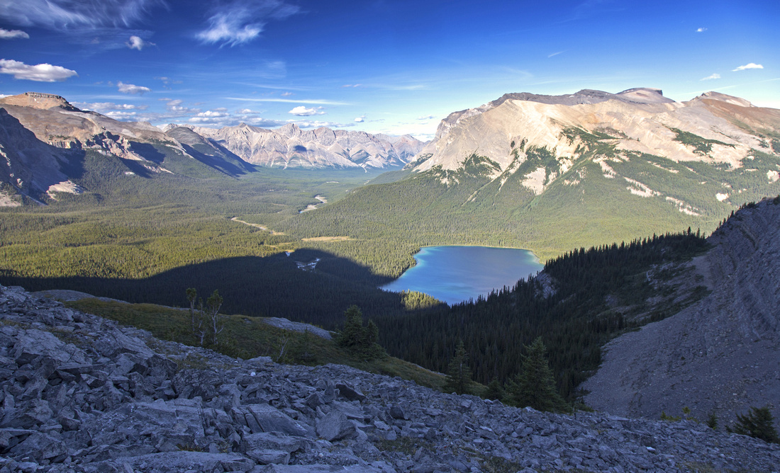 View of Pinto Lake from little bump above Sunset Pass
 |
|||
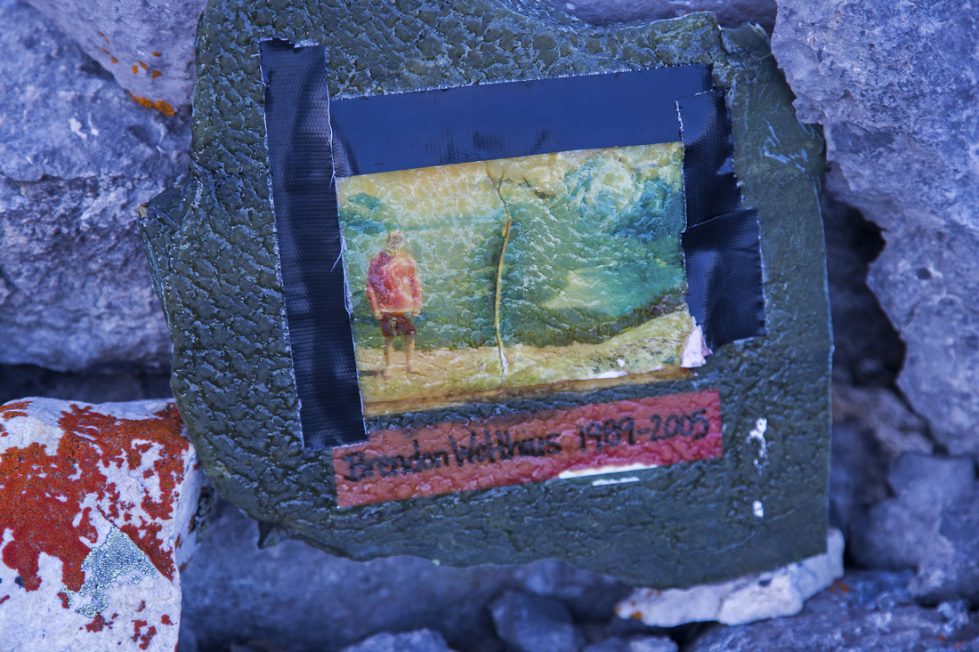 Sunset Pass Memorial just before trail starts descent to Pinto Lake
 |
|||
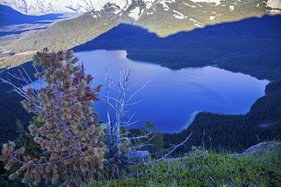 Another view of Pinto Lake just south of Sunset Pass
 |
|||
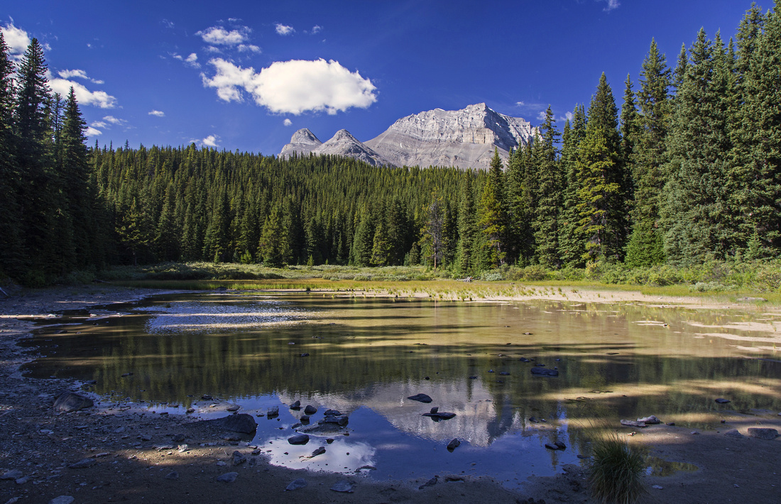
 Reflections of Mt. Amery in Norman meadows on return
 |
Abstract
| Overall Difficulty | D3 | Moderate steep switchbacks to Norman meadows. Non-bridged, but easy creek crossing | |||
| Snow Factor | S3 | Low avalanche risk as steep part is below tree cover. Short daylight hours might make trip to the pass challenging | |||
| Scenery | Fantastic Norman meadows under towering Mt. Coleman. Beautiful Pinto Lake from the pass. Views of Mt. Amery and Alexandra river valley from Sunset Lookout | ||||
| Trail/Marking | Very Good | Official park trail with signposts. Trail becomes less defined and bit bushy in the meadows, but still easy to follow | |||
| Suggested Time | 7 hr | Return time to Pinto Lake viewpoint from Icefields Parkway. Add 1/2 - 1 hr for side trip to Sunset Lookout. If camping at Norman campground, it will take ~2hrs from the highway with overnight pack. Very long day for Mt. Coleman | |||
| Elevation | Start: 1450m Max: 2200m Total: ~850m | Round Trip: 20 km (Pinto Lake Viewpoint) | |||
| Gear | Day Hikers preferred to full hiking boots in summer conditions | ||||
| Water | Norman creek and side streams in the meadows. First part of the hike (~5km) is dry - carry 1+ L | ||||
| Dog Friendly | Yes | Standard bear country precautions | |||
 Sunset Pass GAIA Map
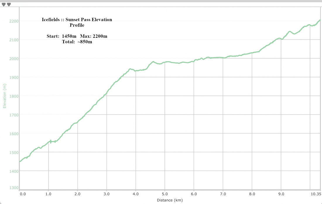 Sunset Pass Elevation Profile