Google Map |
Rockies :: Icefields :: Caldron Lake |
GPS Track |
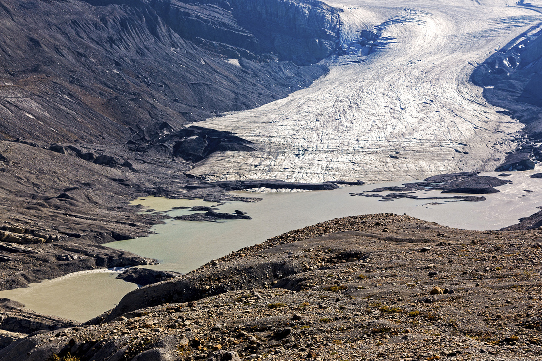
Peyto Peak and Caldron Lake from gentle talus slopes on north side of Caldron Basin |
|||
| Trip Summary | |||
September 15, 2013Exceptional hike in the heart of Icefields leading to glacially fed basin below Peyto and Mistaya peaks. This once relatively benign outing has become much more involved after spring floods of 2013 have destroyed bridge over Peyto creek. To hike to Caldron lake and back is feasible as day trip, but considering higher water level of Peyto creek in the afternoon backpack might be better idea. Besides, there are many other well-worth opportunities for further exploration from strategically placed bivi near Caldron lake including straightforward ascent of Caldron peak or scramble of Mistaya mountain. Visit of talus bench just above toe of Peyto glacier is recommended option on return; couple of glaciology huts blend fantastically with environment and provide additional photo opportunity. Lower part of mountaineer route up Peyto glacier can also be surveyed from there.
Drive Icefields Parkway 42km north from junction with Trans-Canada at Lake Louise. At Bow Summit turn left and park at lower parking lot. Elbow your way up tourist walk-up leading to platform overlooking Peyto Lake. Despite the crowds it is worth stoping for a second as this is one of most photographed viewpoints in the Rockies and frequently found in various calendars. From here hike consists of following parts:
Ascent of Caldron Peak: South summit, rising above north end of the lake is not the highest but can be incorporated as long day trip from Bow summit. It is as straightforward as it looks and it leads in just over an hour to the summit cairn. Neadless to say, views are outstanding. Only mild challenge is crumbling rock band about halfway up and it can be negotiated without much difficulty. To continue to north and true summit would require a rope and climbing ability due to steep drop; this part is not scrambling. Correct approach is to hike around the base of south peak without gaining much elevation, then angle up much scree. Views are not any better, so it appeals only for hard-core peakbaggers. Ascent of Mistaya Peak: Mistaya is snowcaped peak directly across Caldron lake as you first see it after traversing talus bench. Ascent is much more involved and requires good route-finding. Head around Caldron lake to its west end, then climb through several rock bands to upper ridge (class 3). This ridge can be followed in its entirety towards the summit.
Pleasant hiking-only alternative is high point of the basin - saddle between Caldron and Mistaya peaks. Takes only about 40 minutes from rock hop of lake outlet and grants great views of Barbette glacier. There is no trail or cairns, but way is obvious. |
|
Gallery |
|||
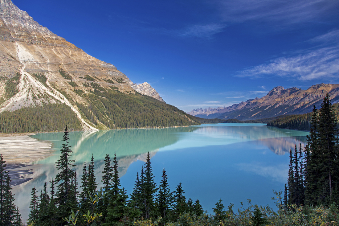 Peyto Lake on descent from Bow Summit
 |
|||
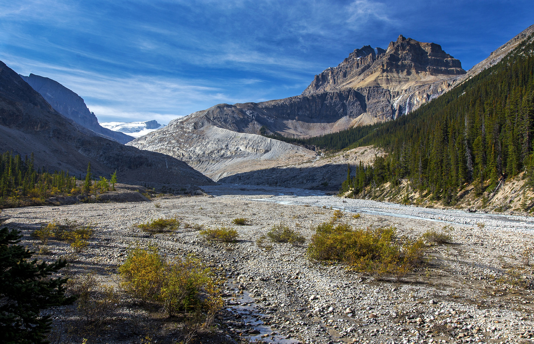 Glacial flats with ascent moraine under Peyto peak
 |
|||
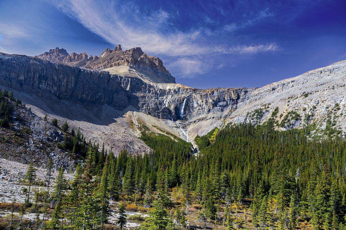 Waterfall draining Caldron lake. Peyto Peak above
 |
|||
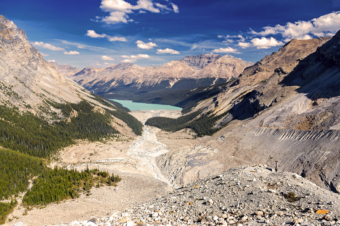 Peyto lake and glacial flats from top of ascent moraine
 |
|||
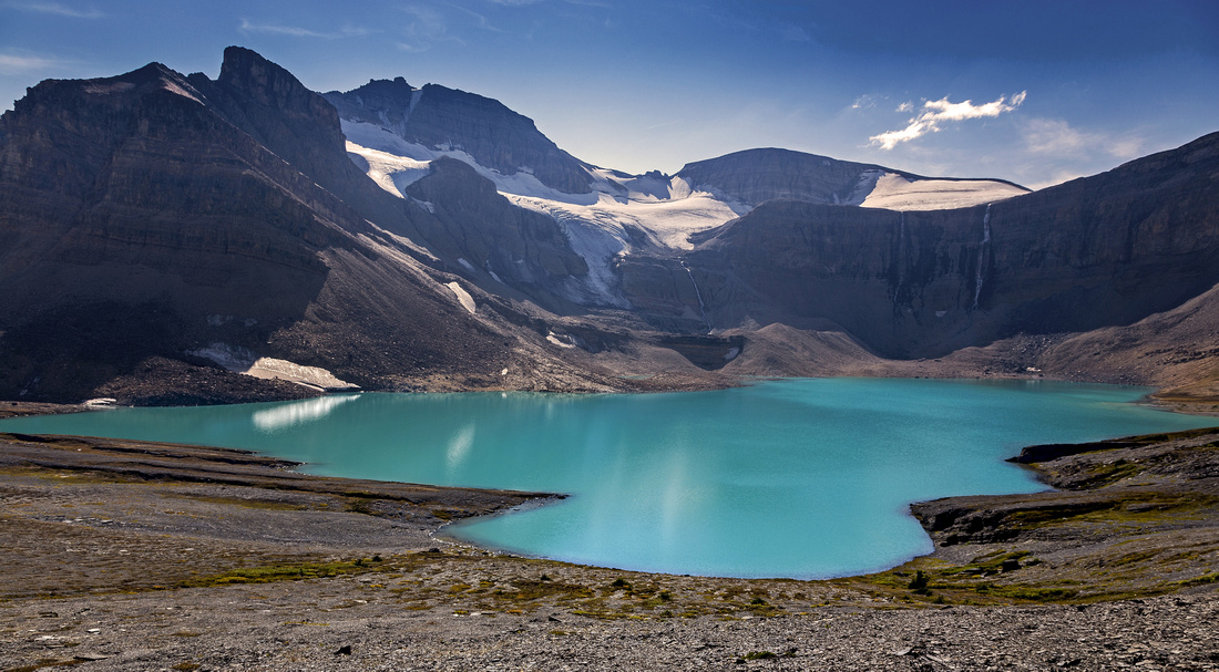
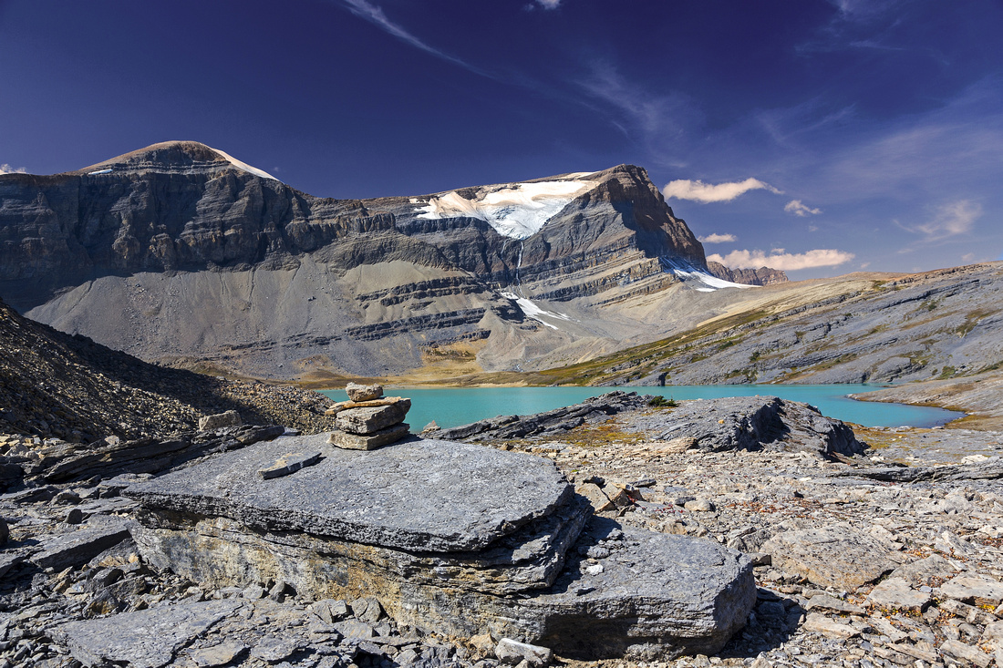 Classic view of Caldron basin with Mistaya peak on horizon
 |
|||
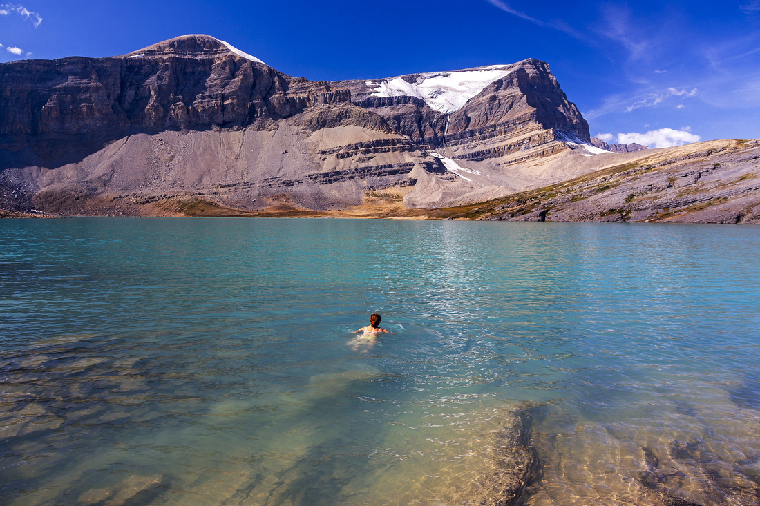 Swimming in Caldron Lake. Not for the faint of heart!
 |
|||
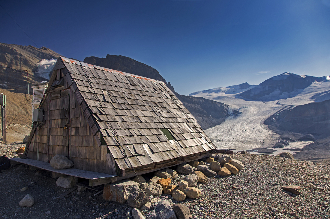 Glaciology Hut and Peyto glacier
 |
|||
 Peyto Glacier toe and normal access route to Peyto Hut
 |
Abstract
|
Overall Difficulty |
Knee high ford of Peyto creek. Steep and loose lateral moraine followed by exposed talus bench traverse |
||||
|
Snow Factor |
Not a feasible winter objective. Steep slopes below Peyto peak are major hazard |
||||
|
Scenery |
Fantastic views of Peyto lake and glacier. Caldron basin is very pristine and untouched |
||||
|
Trail/Marking |
Poor/None |
Initially good trail deteriorates and disappears in Peyto glacial flats. Route with occasional cairns afterward |
|||
|
Suggested Time |
6-8hr |
Return time for Caldron Lake only. Add 2-3 hr for false or 4-5 hr for true summit of Caldron Peak |
|||
|
Elevation |
Start: 2100m Max: ~2500m Total: (+850m) (-440m) |
Round Trip: 20km (Caldron Lake only) | |||
|
Gear |
Hiking boots, poles and gaiters. Pair of old sandals for creek ford are essential |
||||
|
Water |
Peyto glacial outflow and Caldron creek. Caldron Lake in upper basin. Carry 1-2L |
||||
|
Dog Friendly |
No |
Peyto creek ford likely puts trip off limits. If bridge is repaired, standard griz-country precautions. |
|||
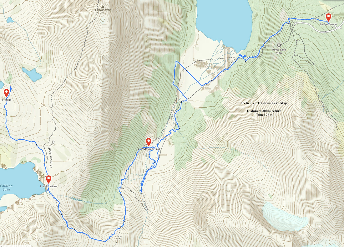 Caldron Lake GAIA Map
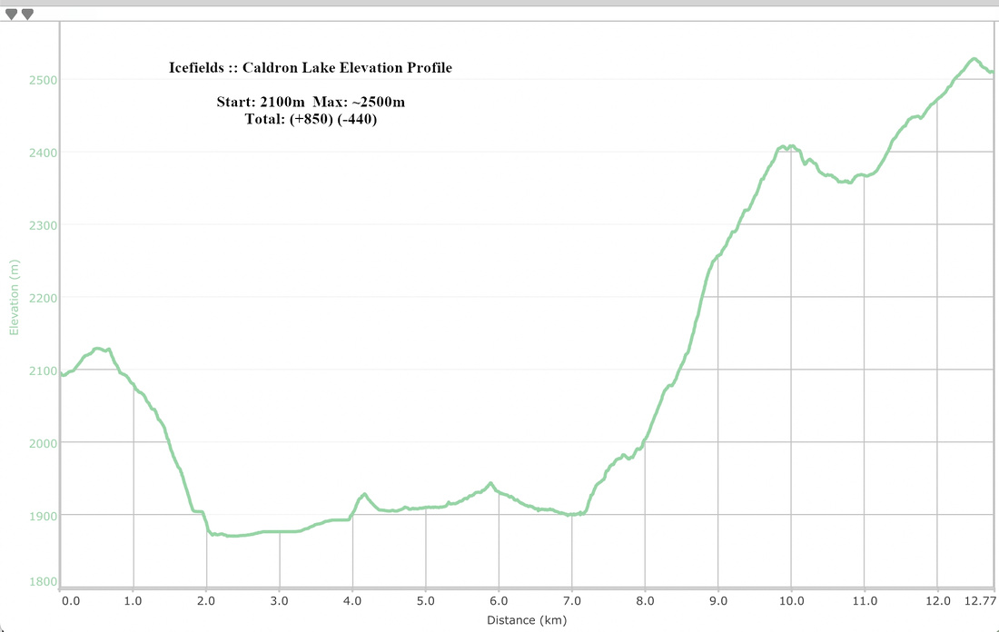 Caldron Lake Elevation Profile