Google Map |
Rockies :: Canmore and Bow Valley ::Acephale Crags |
GPS Track |
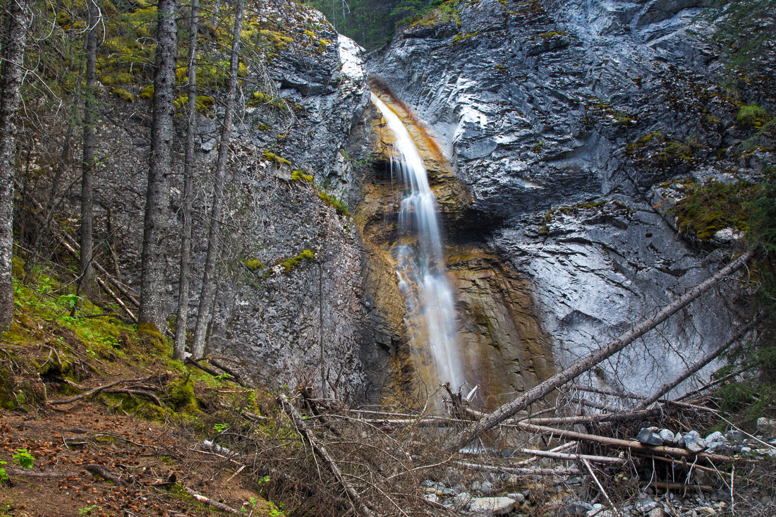 
Acephale Waterfall. Trail continues to the left and climbs steeply to exposed slabs |
|||
| Trip Summary | |||
June 3, 2016
This is a short hike to base of crag that provides some of "hardest rock climbing in the Canadian Rockies, if not all of Canada" (quote from Kananaskis Country trail guide, Vol 3 4th Edition - orange). It is nice after work hike best done in late spring when Acephale waterfall will have good size and thus appeal to photographers (did you bring the tripod?). Crags are reached some 20-25 minutes past the waterfall and -if you are lucky- will provide an opportunity to watch the climbers prove their worth. There is one short semi-exposed section directly above the waterfall which looks worse than is. Fixed plank bridges the tricky part and there are chains for assistance that are not really required, but could be helpful in wet conditions. Crux of the day is finding the "trailhead" - it is not marked, and not obvious.
Park at regular Quaite trailhead in eastbound lane of Trans-Canada highway just east of Heart overpass (if coming from Calgary make a U-turn at the overpass). There is no official pullout, but there are always several cars parked there and it should not be a problem to recognize. Cross the gate and follow Quaite valley road to marked junction and turn right onto a trail that runs parallel to Trans-Canada back towards Heart Mountain. Walk this trail till you reach the clearing, then head along the powerline. Acephale trail starts on left (east) bank of Acephale creek within few minutes. All this should take no more than 15-20 minutes from the parking. Follow this trail upstream, keeping right on junction (left is return leg of Heart mountain horseshoe). Trail gains bit of elevation, then descends to creek level and continues along the left bank. Soon you are at the waterfall and there are several good spots to setup the tripod.
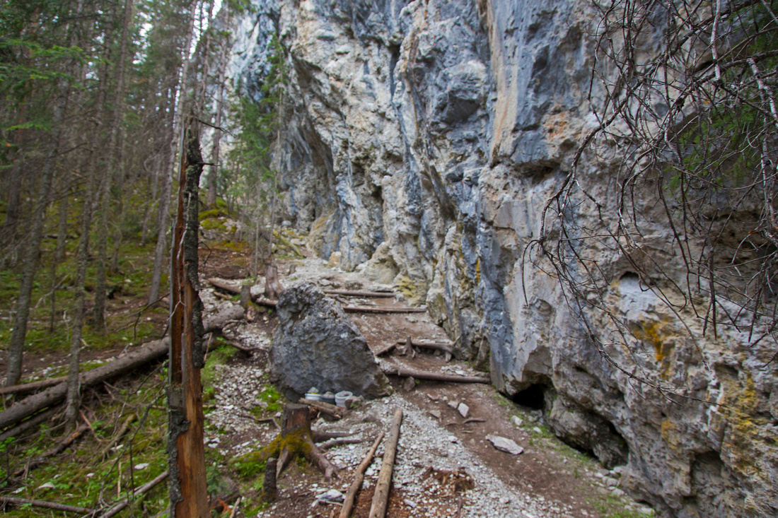
Trail continues rising steeply on couple of switchbacks, then traverses section with chains and drops back to the creek above the falls. Rest of journey is in creek-bed where several sections have been washed out. Watch for large cairn about 20 minutes past the falls and turn right on a good trail. It exits to base of climbing wall. Also note the climber descent trail from the crags on the right side. There are no signs of traffic past this spot, so return the same way -- although it might be possible to scramble on the left (east) side of Acephale creek and intersect Heart horseshoe trail higher up. |
|
Gallery |
|||
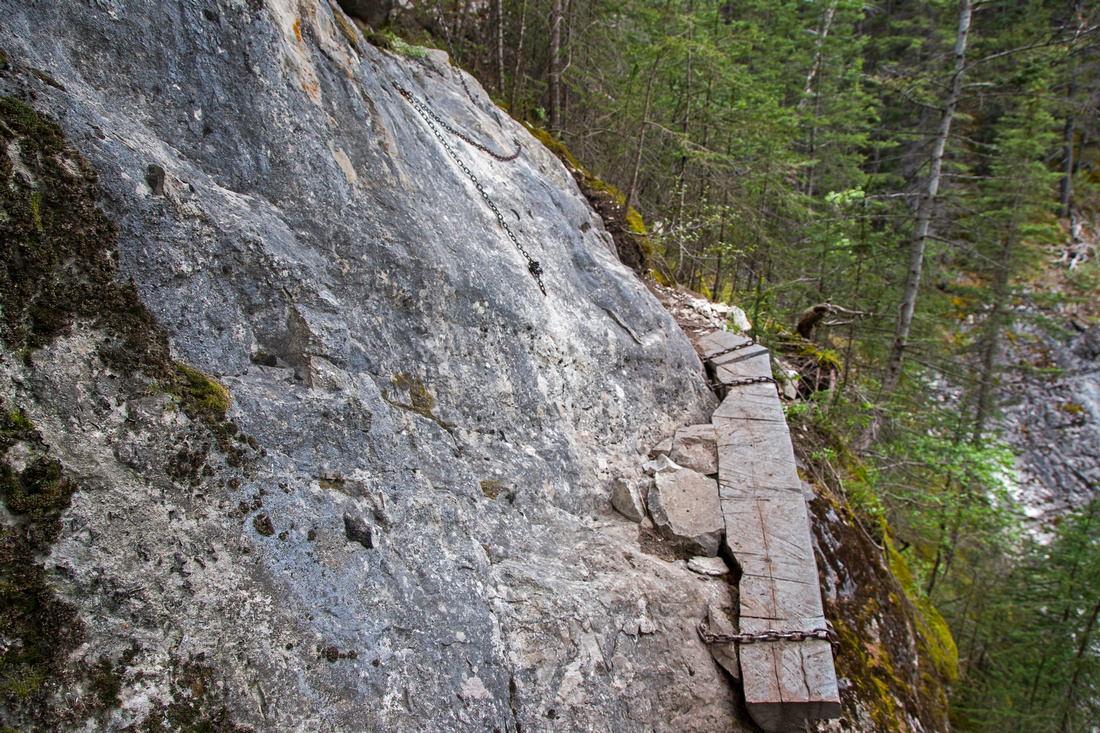 Semi-exposed ledge traverse above Acephale Falls
 |
|||
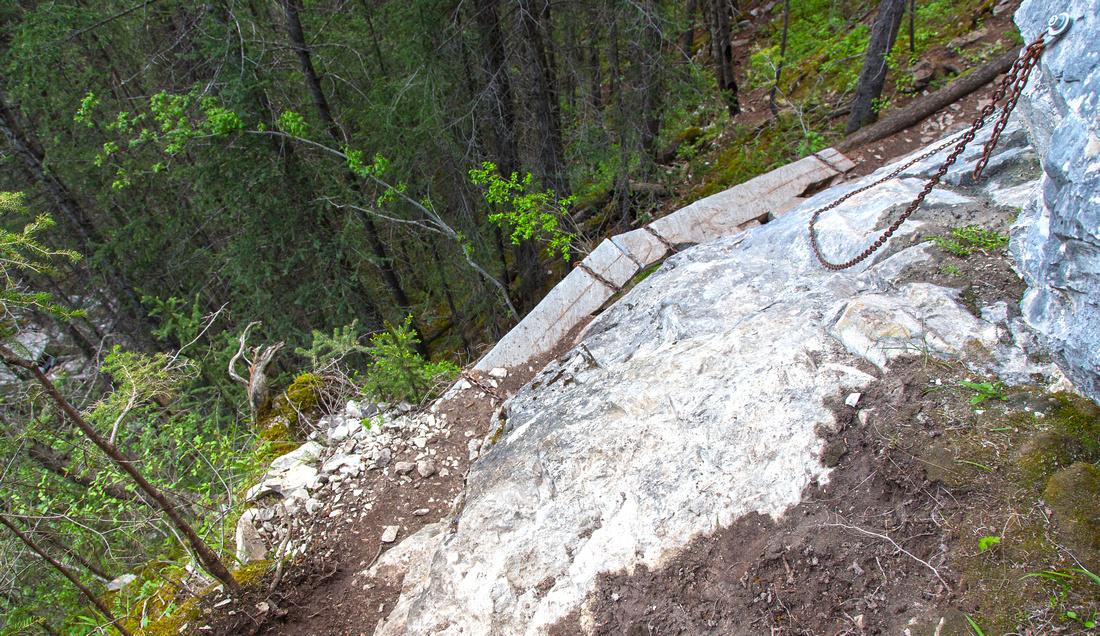 Crux section from above. Chain is not really required
 |
|||
Climbing wall has several routes indicated with ring pitons |
|||
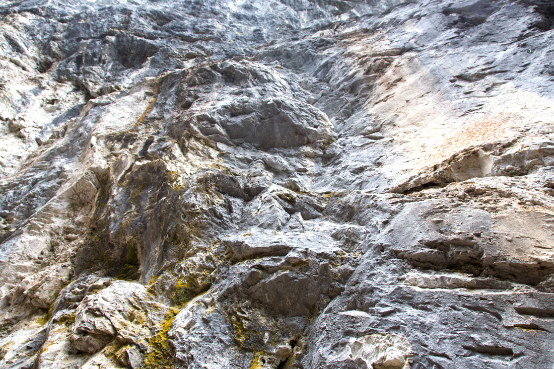 Closer look at "one of most difficult sport climbs in Canada"
 |
Abstract
| Overall Difficulty | D2/3 | Moderate angled forest hiking with couple of rougher sections. Continuing past Acephale Falls to the Crags harder with one with one mildly exposed section with chains followed by rock-hopping in the creek bed | |||
| Snow Factor | S2 | Creek bed likely icy in winter, but otherwise safe and due to low elevation likely snow free good part of the winter | |||
| Scenery | Nice waterfall and small pools of Acephale creek. Impressive rock at the crags | ||||
| Trail/Marking | Good/Poor | Generally well defined trail with washed out sections. No signs and trailhead might be hard to find | |||
| Suggested Time | 2 - 2.5 hr | Under 2 hours return if going just to the falls. Add ~45 min return to the crags | |||
| Elevation | Start: 1285m Max: 1610 m Total: ~350 m | Round Trip: ~7 km | |||
| Gear | Light hikers. Single hiking pole could be helpful for stability in the creek bed | ||||
| Water | Acephale creek. Hike is short - do not carry more than 0.5L | ||||
| Dog Friendly | Yes | Black bears are often seen in Heart mountain area in late spring/early summer | |||
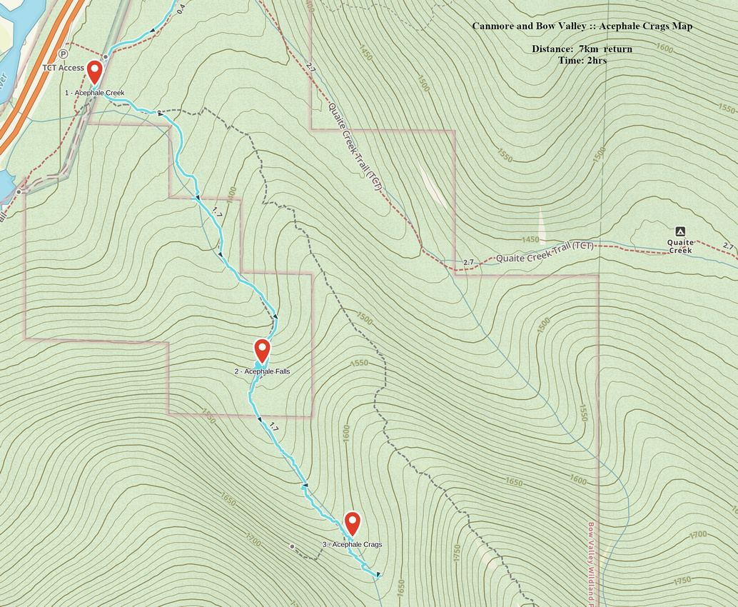 Acephale Crags GAIA Map
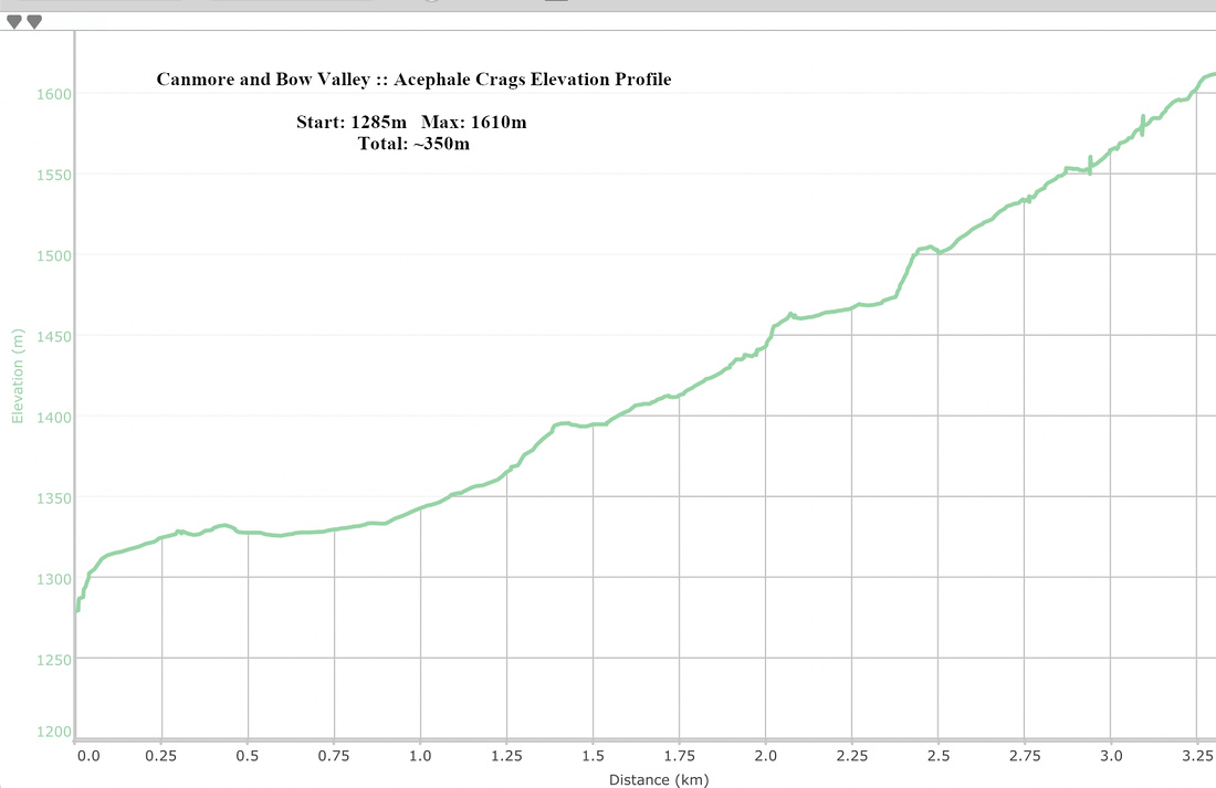 Acephale Crags Elevation Profile