Google Map |
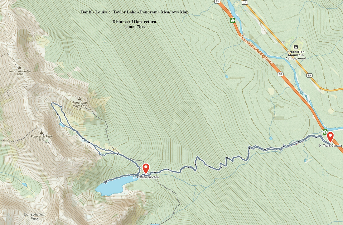
Rockies :: Banff-Louise ::Taylor Lake - Panorama Meadows |
GPS Track |
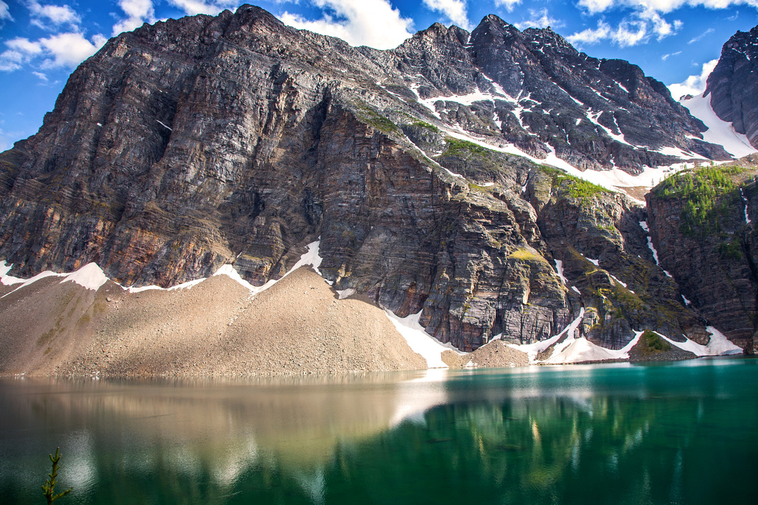 
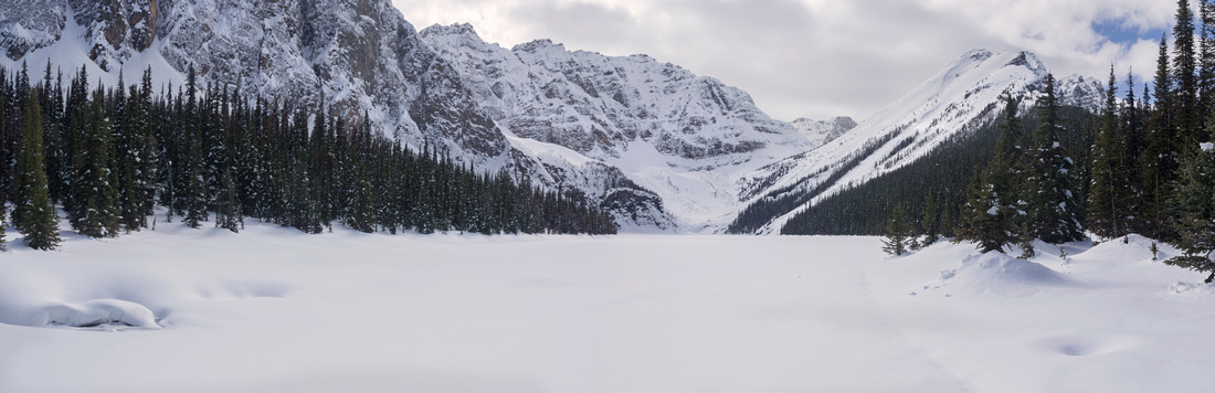
Mt. Bell from halfway around north side of Taylor Lake |
|||
| Trip Summary | |||
June 29, 2016
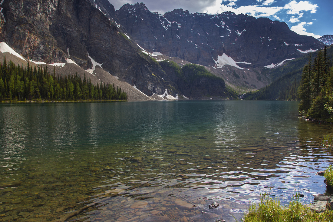
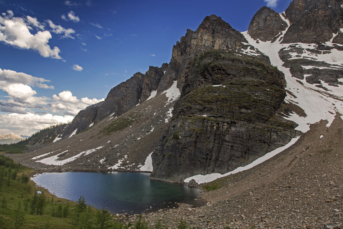
Taylor lake is one of largest back-country lakes in Banff National Park. It is popular as both hiking and back-packing destination, as there is official Parks Canada campground at lake east shore. Besides beautiful scenery, it is also fisherman paradise and anglers can often be seen scattered along lake north shore. Campground is usually quite busy on sunny summer weekends, but there are several options for extending the trek. Good trail forks to the left just before Taylor lake and leads to larch cirque hosting pretty O'Brien Lake (this is also starting point for moderate Kane scramble up Mt. Bell). It is worth following rough trail on lake north shore for different perspective, as well as some deep beautiful emerald pools. The most attractive option is one valley across to the north -- Panorama meadows, dotted by larches and hosting set of tarns each more beautiful than the other.
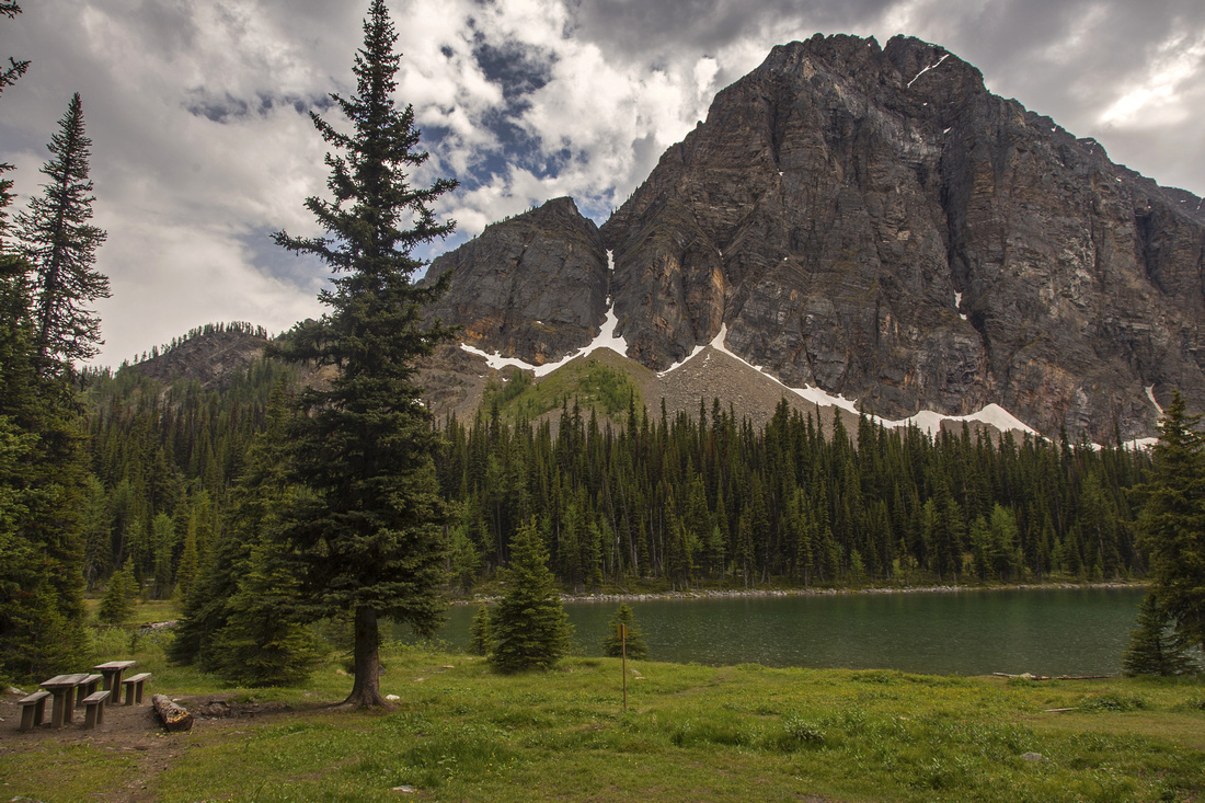
Parking is at west side of Trans-Canada highway, about 10 minutes north from Castle Junction. If coming from Banff look for sign, as you have to cross to the opposite side of highway! Trail to Taylor Lake is just over 6km long and not that exciting as it is mostly under tree cover. Trail is wide and grade moderate - it takes about 1 1/2 hour and 580 vertical to the lake. (Coming down it is much faster and you can trail-run most of the way!). About 1 km before the lake is bridged crossing of Taylor creek and excellent chance to (re)fill water bottle. Past O'Brien junction final bit is through boggy and muddy area - stay to the right. It is also mosquito infested in prime season -- did you bring the bug spray? Campground is in pretty setting, with couple of picnic tables, bear hang and outhouse. There are no assigned tent-sites, but there are several flat spots to pitch your tent.
Rough trail made by fisherman continues along the north shore. Initially it is well defined, but soon disappears in thickets of bush and deadfall. Going is still reasonably easy, and worth-while as scenery improves the further you go. Eventually about 3/4 of the way you come to a halt; cliffs extend to the lake shore, and to continue you are forced to trash up steep slopes. This route is sometimes used by explorers linking Consolation Lakes and Taylor lake, but there is no defined trail and bushwhack is pretty bad.
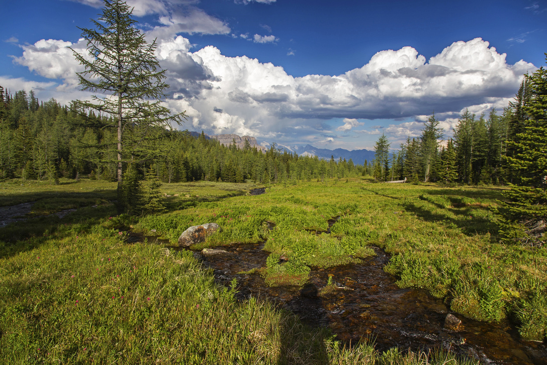
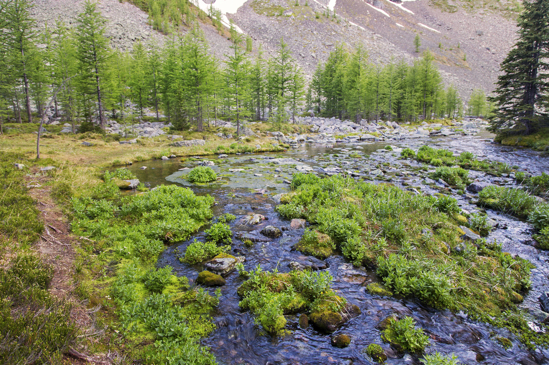
For Panorama meadows follow good trail that starts near the food cache back at the campground. Park sign warns that "Trail is not maintained past this point", but do not let this discourage you! Going is easy and in about 15 minutes you emerge at east end of the meadows. Views open up, and pretty stream draining the "Lake District" comes along. At this point trail vanishes but it is not needed anymore. There are many options; one is to follow left side of the valley linking the lakes, then at top below Panorama ridge where grass turns to talus angle right and either loop back or scramble grassy ridge above for aerial view. Optimal time for visit is mid-morning when sun is behind you. In early fall when larches are turning gold, this is as close to hiking paradise as Rockies can offer.
In winter or early spring it is possible to cross frozen Taylor Lake on skis or snowshoes. This adventure offers sublime experience and likely total solitude. Beware of large avalanche slope coming off east end of Panorama Ridge and give it a wide berth. Of course, venture onto the lake surface only when it is absolutely safe to do so; falling through the ice into cold lake would probably result in death!
|
|
Gallery |
|||
 Classic view of Taylor lake from east side
 |
|||
 View towards Mt. Bell from Taylor lake back-country campground
 |
|||
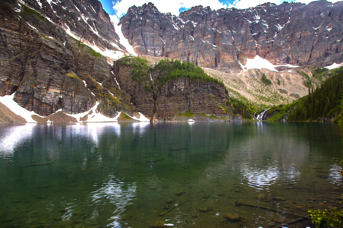 View towards twin waterfall at west end of Taylor lake
 |
|||
 Looking back as trail emerges to Panorama Meadows
 |
|||
 Larch island on south side of Panorama Meadows
 |
|||
 One of several beautiful lakes in upper part of the valley
 |
|||
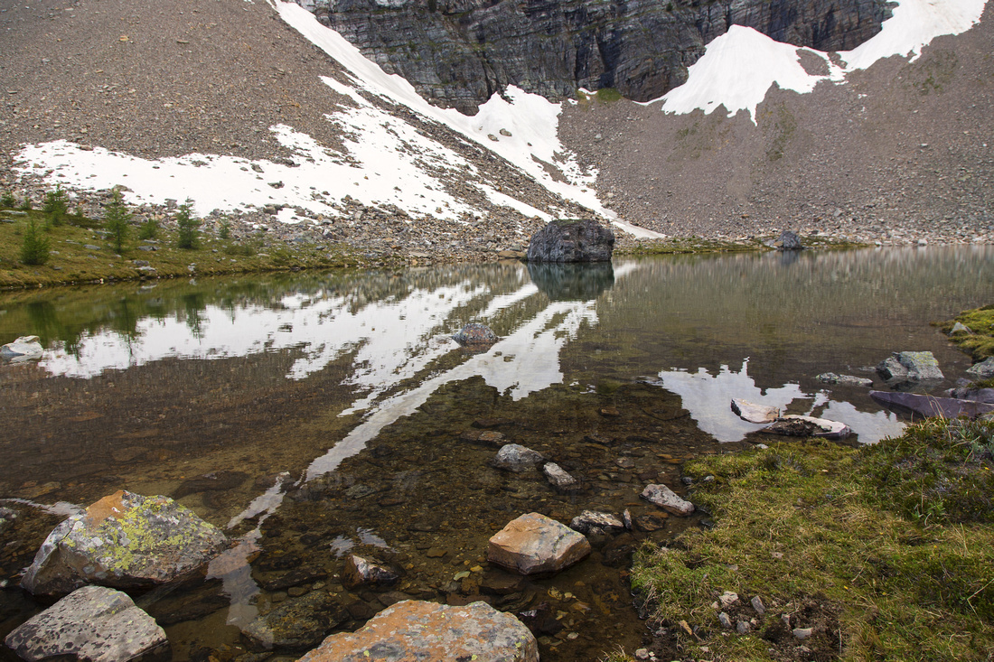 Last body of water as meadows turn to talus below Panorama ridge
 |
|||
|
Snowshoe Trip across frozen Taylor Lake |
|||
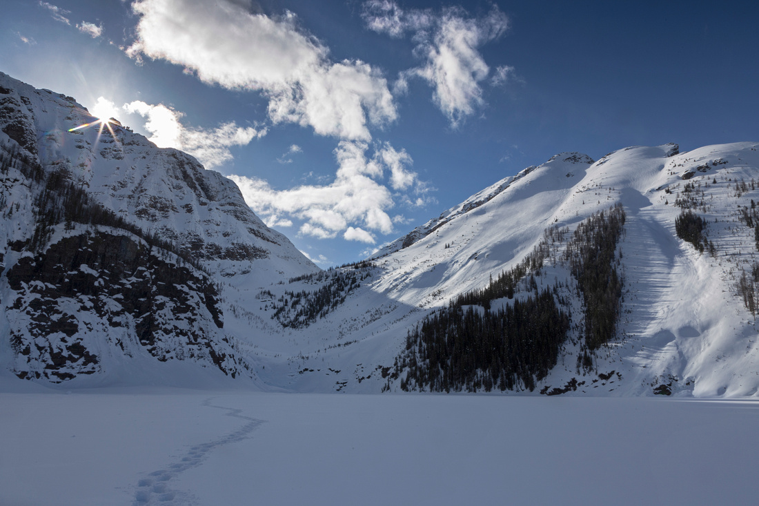
 Panoramic view of Taylor Cirque on April '19 snowshoe trip
 |
|||
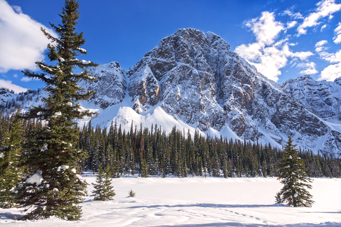 Mt. Bell from Taylor Lake campground buried by snow
 |
|||
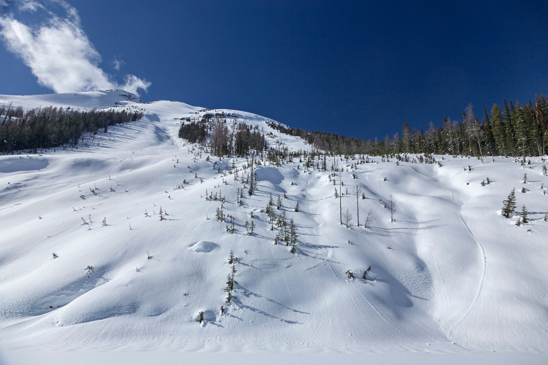 Avalanche Slope off east end of Panorama Ridge
 |
|||
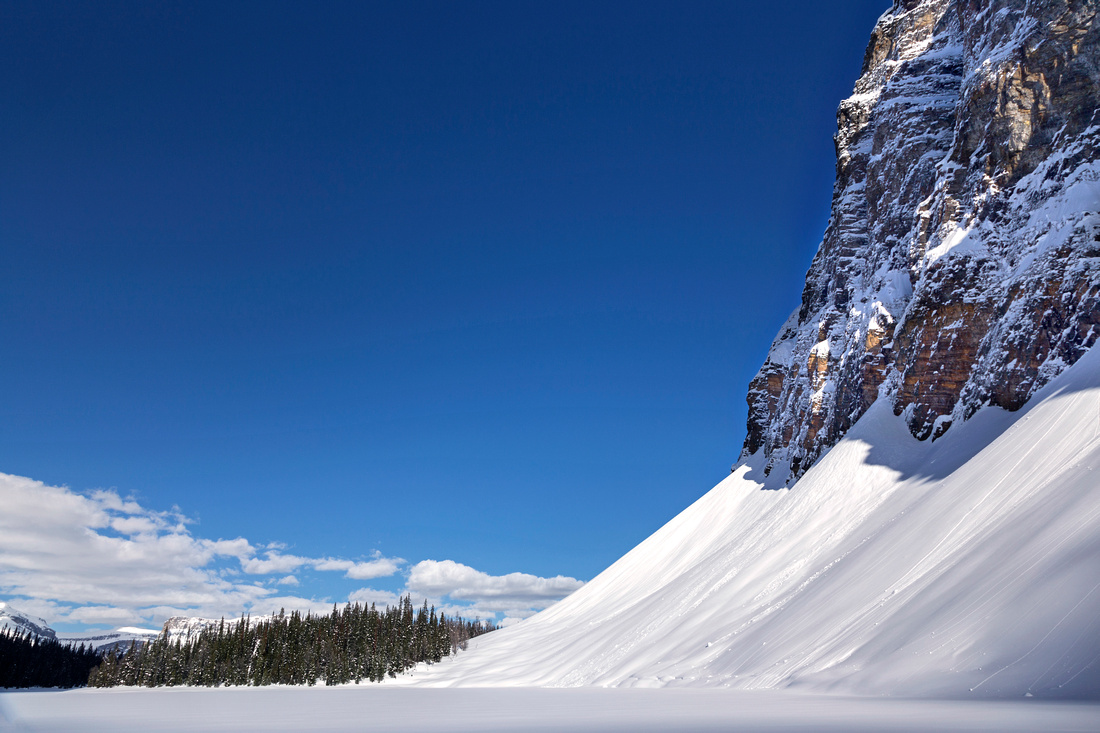 South side of Taylor Lake under Mt. Bell in winter
 |
|||
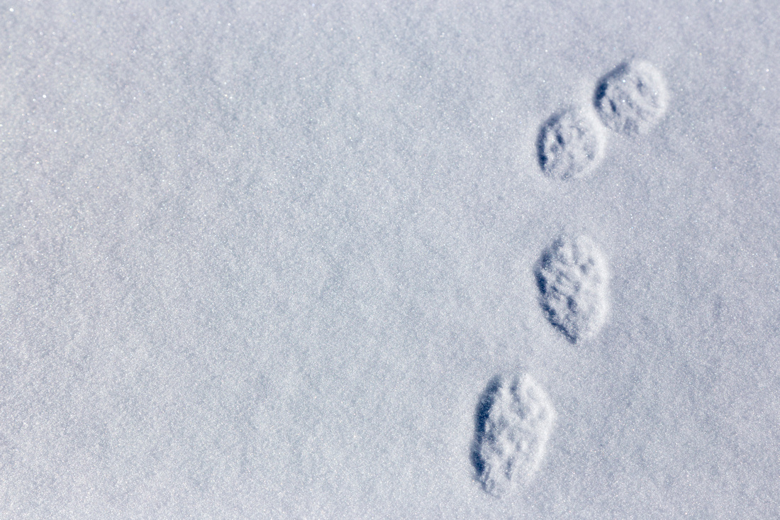 Hare tracks on frozen Taylor Lake
 |
|||
 Consolation Pass above frozen Taylor Lake
 |
|||
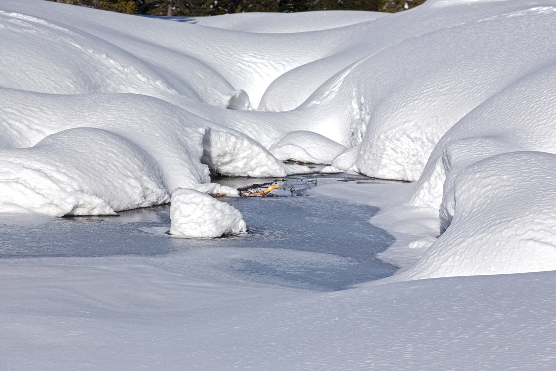 Taylor Lake outlet starting to thaw
 |
|||
Abstract
| Overall Difficulty | D3 | Trail hiking. Bushwhack along north side of Taylor lake (optional). Easy rock-hop over streams in Panorama Meadows | |||
| Snow Factor | S3 | Sometimes cross-country skied in winter (Chic Scott) or moderate snowshoe with no avalanche danger. Extension to Panorama Meadows will be longer and more difficult. | |||
| Scenery | Beautiful hanging lake below rugged north aspect of Mt. Bell. Pretty Panorama meadows with several tarns - one of best places to see larches in fall season. | ||||
| Trail/Marking | Excellent | Official Parks trail to Taylor Lake with signposts. Rough fisherman trail if exploring north side of the lake. Trail disappears in Panorama meadows but is not necessary | |||
| Suggested Time | 6-7 hr | 3-4 hours if going just to the lake. Much room for further exploration adds several hours, depending on your choice | |||
| Elevation | Start: 1480m Max: 2370 m Total: ~900 m (top of Panorama Meadows. ~650m if going just to Taylor Lake) |
Round Trip: ~21 km (~14 km if going just to the lake) |
|||
| Gear | Day hikers are sufficient. Backpack gear for overnight stay at Taylor lake campground | ||||
| Water | Taylor creek (bridged crossing) near lake outlet, but dry until then. Small streams and tarns in Panorama Meadows. Carry 1.5L | ||||
| Dog Friendly | Yes | Be courteous as trail and back-country campgrounds are very popular. Standard bear precautions in Panorama Meadows. | |||
 Taylor Lake - Panorama Meadows GAIA Map
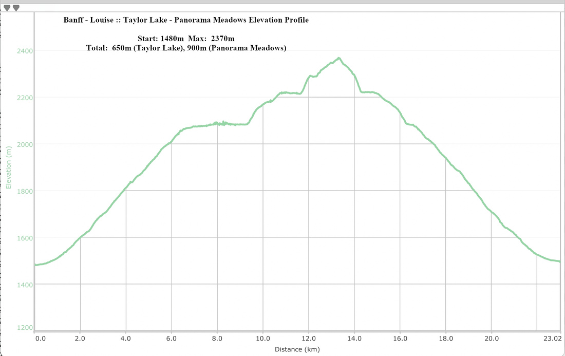 Taylor Lake - Panorama Meadows Elevation Profile