Google Map |
Rockies :: Banff-Louise :: Pumpkin Traverse / Unity Peak |
GPS Track |
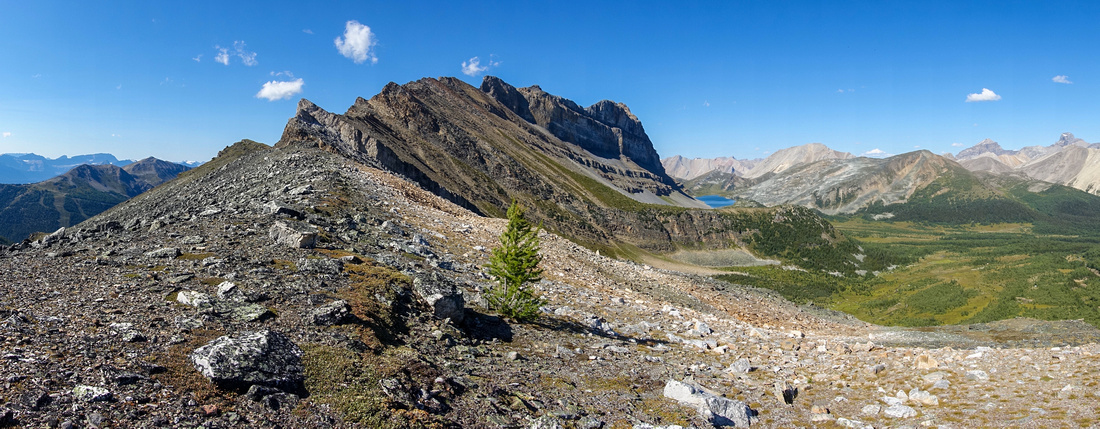 
Terrific Panorama north from Unity - Redoubt col. Secluded out of radar "Pumpkin" valley center right; Redoubt Lake in the distance |
|||
| Trip Summary | |||
September 1, 2024
Pumpkin Traverse is well known ski-touring Trip. (Parks Canada used to train staff here in orange ski-parkas, hence unofficial name). Classic line follows Lipalian - Purple Mound - Unity Peak ridgeline, before dropping in secluded Alpine valley east of Mt. Redoubt then closes the loop by following standard Skoki Lodge access. This page describes such loop around Redoubt Mountain in summer conditions; It can also be used as beta for easiest Unity Peak access from head of Purple Valley.
First order of business is to reach low col north of Unity Peak. Leave Skoki Trail 10-15min past end of Temple Lodge road; junction is unmarked, but it will be just before the bridge across creek draining Purple Valley - see first Photo in Gallery. Trail is fairly well defined for short time only and vanishes after climbing out of forest. Rest of the journey is entirely off-trail before reconnecting with Skoki Trail at Boulder Pass. Cross somewhat boggy meadows and head towards talus slope below Redoubt - Unity ridge. There are many possible routes, but by far the easiest climbs up patches of grass and rubble towards obvious gendarme above. Stay on vegetation as much as possible as rubble and boulder fields are horribly lose. You can go either side of the gendarme; I went left, then after scrambling up angled diagonally to low point of Unity ridge - about 3hrs from Fish Creek Parking lot. This line is good choice in summer only; in winter these slopes are big avalanche trap. I've witnessed huge release during Wolverine Ridge snowshoe trip.
"Pumpkin" Valley is directly on the other side, but dropping down immediately will not work as there are cliffs below. Two routes exist:
Next hour or so is the most delightful hiking one can have in Banff National Park. Soft meadows, gurgling creeks and abundance of larches - probably largest concentration I've seen in Skoki. In 2nd half of September this entire valley must literally be on fire. Eventually angle left and hike up somewhat steep grassy bench that tops out near south end of Redoubt Lake. Very scenic hike around east side of the lake (easy rock hop of outlet around the middle that creates sizeable waterfall lower down) leads to Ptarmigan Lake viewpoint; you can then drop on either side to intercept Skoki Trail. Going right will be longer but entirely on grass, while shorter left side has some boulders to navigate but is short and won't present problems. Final bit is standard hike from Boulder Pass down Skoki trail to Temple Lodge access road.
This loop could be done in either direction, but I believe CCW as described here is considerably better option. It is easier to climb Unity Ridge above Purple Valley than to descend it, and overall route-finding is simpler. Regardless, be ware of grizzlies in Pumpkin Valley; on my first attempt way back in 2017 I was turned back by two huge grizzlies just below Redoubt Lake.
|
|
Gallery |
|||
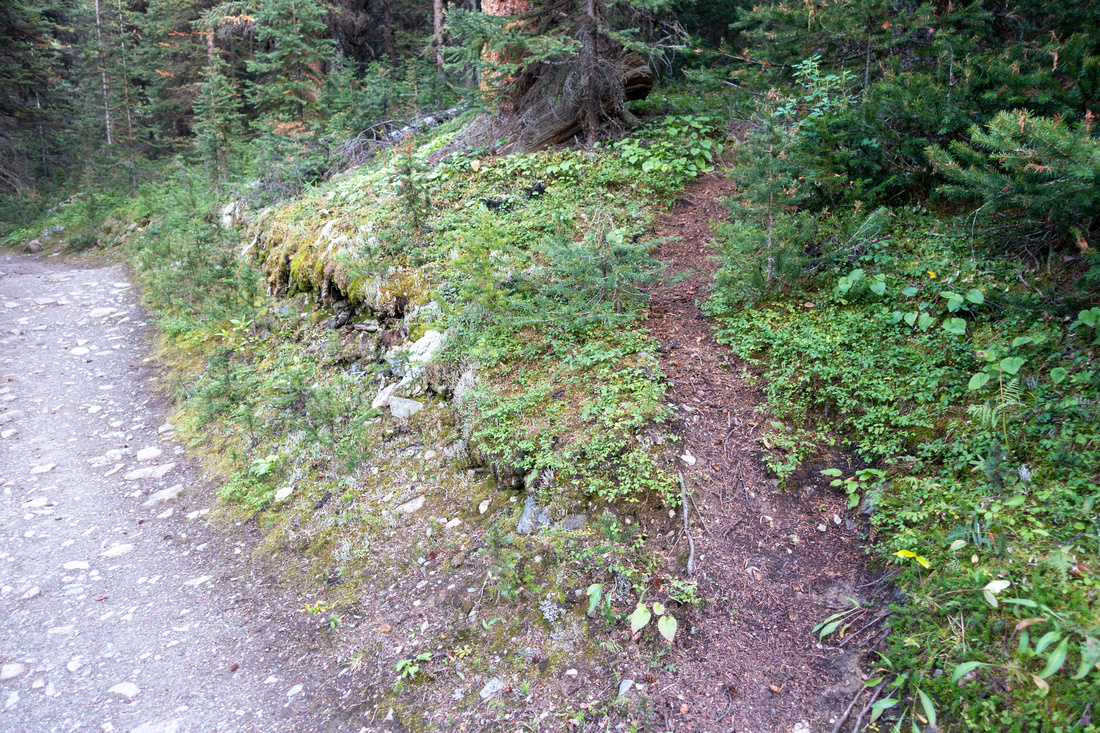 Wolverine Junction Wolverine Junction Unsigned Junction ~10 min from Skoki Trailhead, just before twin bridge over creek draining Purple Valley
 |
|||
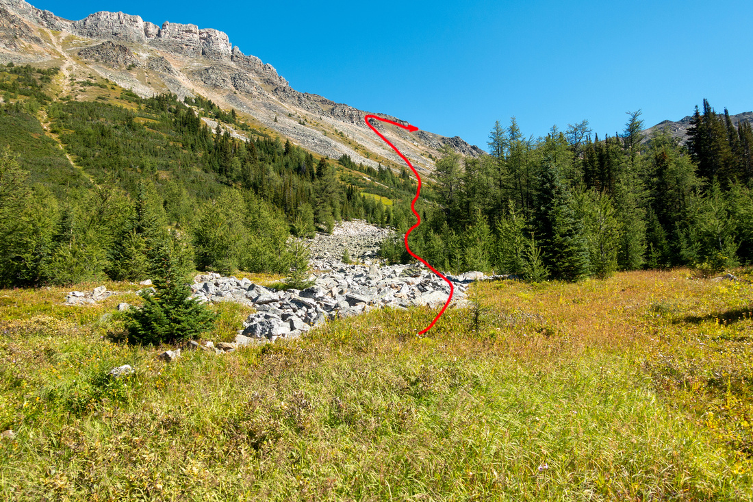 Unity Route Unity Route Red line indicating approximate Unity Ridge line of ascent
 |
|||
 Unity Slope Unity Slope Ascending mixed slope of steep grass and rubble. Aim for obvious gendarme just right of upper center and stay on vegetation as much as possible
 |
|||
 Unity Peak Unity Peak Steep ascent angle with view of Unity Peak. All gullies below Unity are much more difficult compared to relatively straightforward line described here
 |
|||
 Purple Valley Purple Valley Terrific westerly Panorama looking over entire Purple Valley. Lipalian - Purple Mound ridgeline upper left, Wolverine Ridge center. Louise group behind
 |
|||
 Unity Col Unity Col Topping up at Redoubt - Unity col
 |
|||
 Pumpkin Panorama Pumpkin Panorama Easterly Panorama from the col. Redoubt Lake left. Do not start descending to Pumpkin Valley right away as there are cliffs below
 |
|||
 |
|||
 Unity Ridge Unity Ridge Hiking up broad ridge towards Unity Peak. Start descent into Pumpkin Valley (left) around here
 |
|||
 Sawback Range Sawback Range Sawback Range to the SE is major scenic highlight. Bonnet Peak and Glacier right of center
 |
|||
 Pumpkin Route Pumpkin Route Red line indicating approximate route through Pumpkin valley after descending steep upper parts of Unity Slope
 |
|||
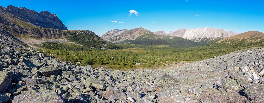 Pumpkin Boulders Pumpkin Boulders Traversing short boulder slope at head of Pumpkin valley. Next hour of hiking is one of most beautiful you can possibly have in BNP
 |
|||
 White Meadows White Meadows One of many scenic Highlights in Pumpkin Valley that likely sees no human visit in summer season. Kane Brachiopod - Anthozoan ridge below, behind is Baker - Wildflower classic Sawback Trail segment
 |
|||
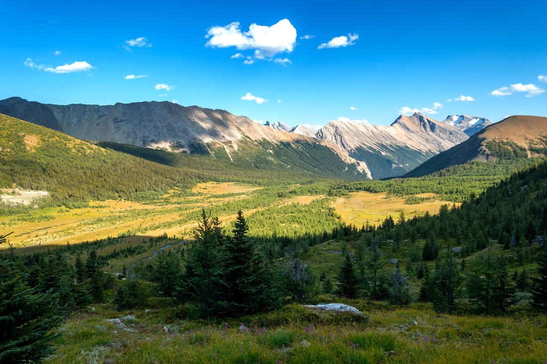 Redoubt Terrace Redoubt Terrace View back to Pumpkin valley while ascending grassy ramp to south end of Redoubt Lake
 |
|||
 Redoubt Lake Redoubt Lake South End of Redoubt Lake, also very rarely visited. ~15-20min walk on right side is super scenic
 |
|||
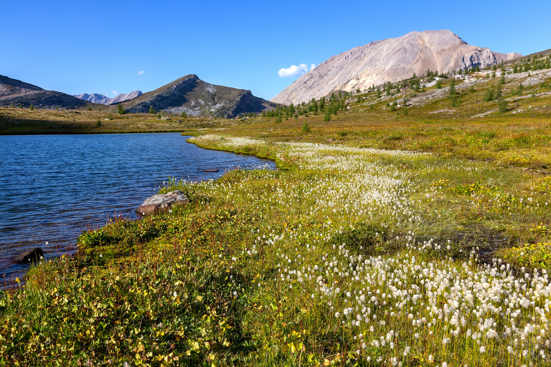 Redoubt Lake Redoubt Lake Approaching north end of Redoubt Lake. Packer Pass/Peak just left of center, Fossil Peak upper right
 |
|||
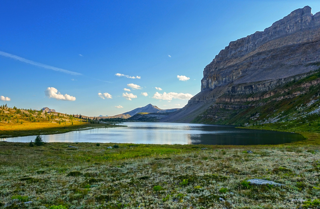 Redoubt Lake Redoubt Lake One last view of Redoubt Lake before starting drop to Ptarmigan Lake/Skoki trail. Unity Peak distant center
 |
|||
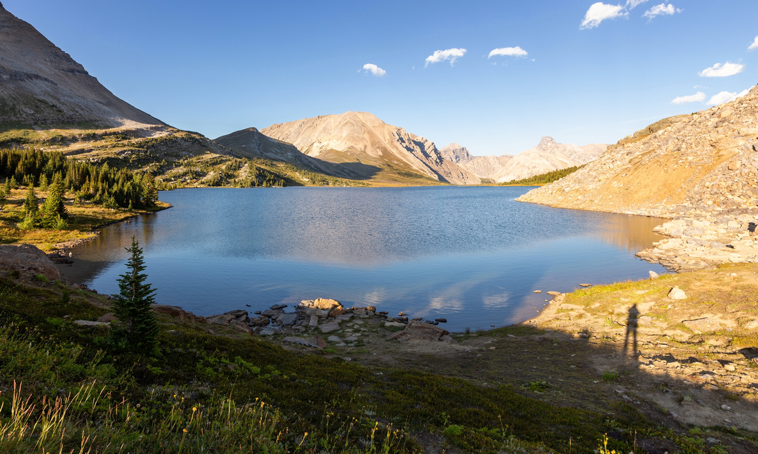 Ptarmigan Lake Ptarmigan Lake Mandatory shot of Ptarmigan Lake at Boulder Pass after closing Pumpkin Traverse and rejoining main Skoki Trail
 |
Abstract
| Overall Difficulty | D5 | Steep Talus slopes. Routefinding | |||
| Snow Factor | S3 | Well known ski touring trip with moderate avi danger descending east slopes of Unity Peak | |||
| Scenery | Purple Valley. Fantastic view from Unity ridge (lead photo). Secluded "Pumpkin" valley. Redoubt Lake and classic Skoki | ||||
| Trail/Marking | None | Entirely off-trail with no cairns or flags after leaving Skoki trail | |||
| Suggested Time | 7 hr | OnB from end of Temple Lodge road. Add ~1.5hrs return time roadwalk from Fish Creek Parking | |||
| Elevation | Start: 2020m (Temple Road) Max: ~2600m Total: ~850m (+300m x 2) | Round Trip: 14km (+4km x 2) | |||
| Gear | Hiking boots and poles (skis in winter + avalanche gear). GPS helpful | ||||
| Water | Several streams in Purple and Pumpkin Valleys. Carry ~1L in summer | ||||
| Dog Friendly | Yes | No on-leash restrictions. Note that Skoki is prime griz-country and several dog related accidents have occurred in the past | |||
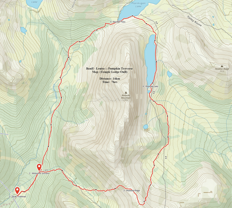 Pumpkin Traverse GAIA Map
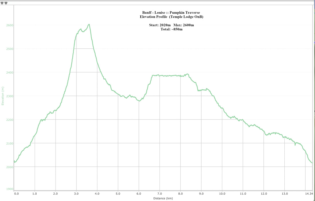 Pumpkin Traverse Elevation Profile