Google Map |
Rockies :: Banff-Louise ::Bourgeau Lake and Mountain |
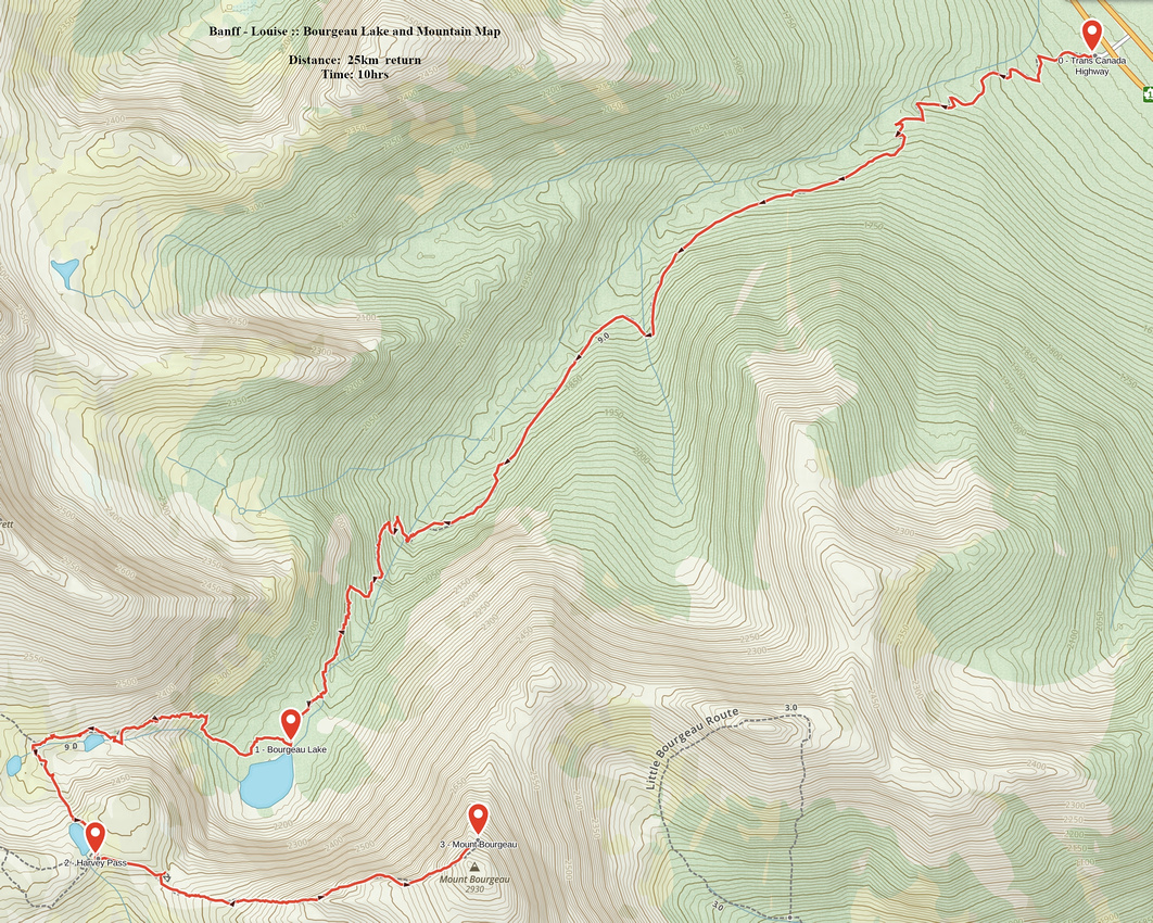
GPS Track |
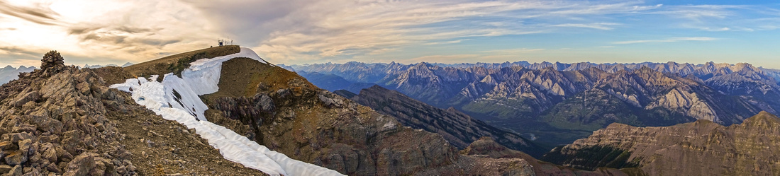 
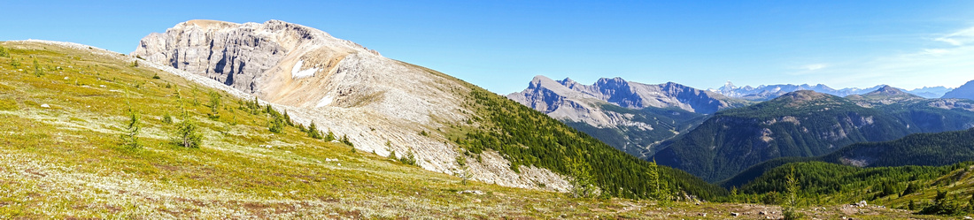
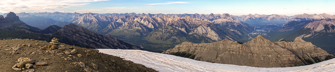
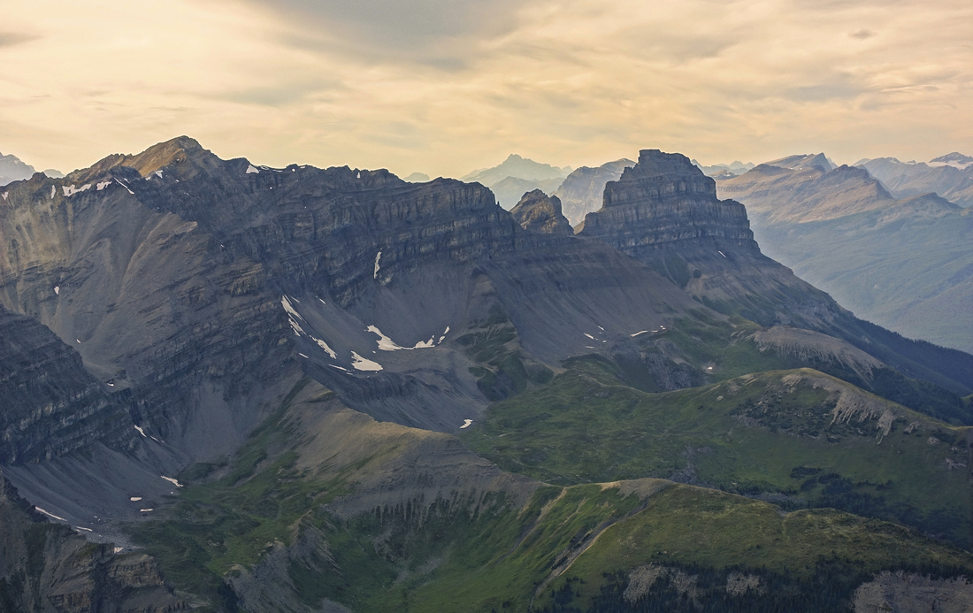
Panoramic view of Bourgeau summit ridge from south end; highest point with weather station left of center. Bow Valley right |
|||
| Trip Summary | |||
August 20, 2019
Mt. Bourgeau is perfect hikers peak. You reach almost 3000m summit without having to use your hands with well beaten trail most of the way. It is also one of easiest 1500m vertical you are likely to do. Trip is still fairly long (~25km return) so degree of fitness is required. Bourgeau lake trail is busy, but you lose most of the crowds in alpine leading to Harvey Pass. Views are fantastic and offer more than adequate reward for the effort. Highly recommended outing, regardless how far you decide to go.
First part is forested 7.5km hike on official Parks trail to Bourgeau Lake. Parking lot on west side of Trans-Canada highway (~15km west of Banff) is signed, but fairly small & fills fast on sunny summer weekends -- get in early! Follow wide trail initially gaining elevation via wide switchbacks, then settling for long traverse above Wolverine creek valley. Bridge over Wolverine creek higher up has been washed out & not repaired as off this writing (summer '19), but rock-hop is easy. Lovely cascade thundering down the headwall is one of scenic highlights. Past creek crossing trail is more rough and steeper; eventually it exits to lovely alpine meadows and approaches east shore of Bourgeau Lake, ~2hrs of moderate pace from the parking. Almost half of elevation gain has been gained to this point.
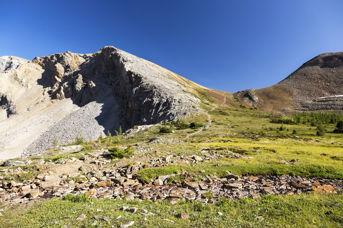
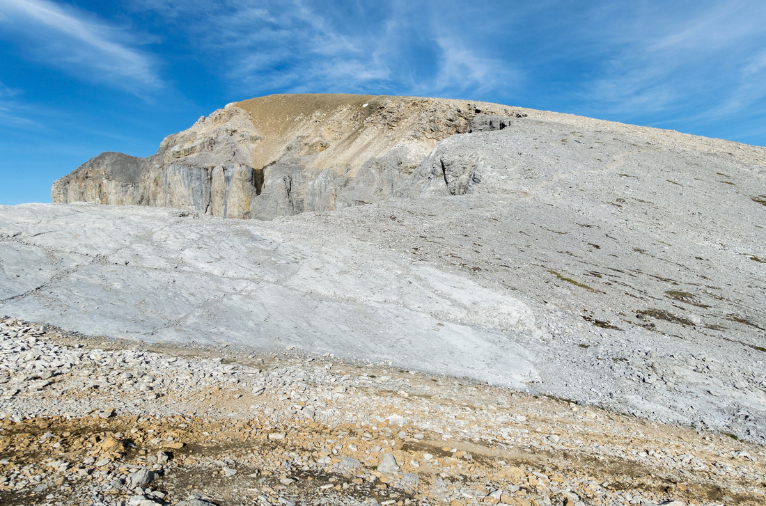
Continue on trail at north side of Bourgeau Lake; brief forest stint is often muddy. Switchbacks up talus slope lead to beautiful unnamed alpine lake in cirque above. Trail loops around the lake then rises gently to Harvey Pass, complete with yet another rather unexpected tarn. Remainder of the ascent is as easy as it looks. Hike up broad ridge with trail most of the way; ~1.5 hrs from the pass. Just one section higher up remotely resembles a scramble; brief crossing over boulder field that can be done with hands in your pockets. Trail then resumes and exits to wide summit plateau, complete with permanent weather station with solar panels. Hike a bit north for bird-eye view of Bourgeau Lake -- it will be quite striking to note how high you are since ascent was so gentle and effortless. South end of summit ridge offers great view of Sunshine ski area as well as distant Mount Assiniboine. Return the same way will be almost twice as fast as the ascent. |
|
Gallery |
|||
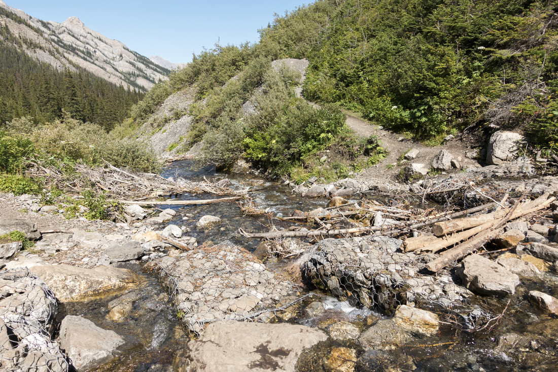 Creek crossing below Bourgeau Lake headwall, looking back. Bridge was washed out in 2013 spring floods but rock hop does not present problem in second part of the summer
 |
|||
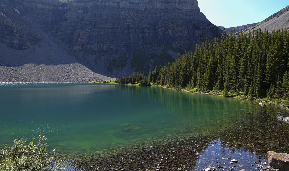
 Bourgeau Lake east shore, after ~2hrs of steady hiking. Optimal light for photos is mid to late morning. Camping is not allowed
 |
|||
 Another shot of Bourgeau Lake. Trail continues on right side and climbs talus to gap upper right, then loops around to Harvey Pass
 |
|||
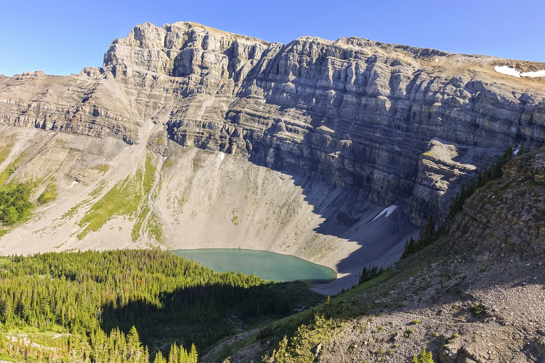 View back to Bourgeau Lake from top of talus slope leading to Harvey Pass. Mt. Bourgeau behind
 |
|||
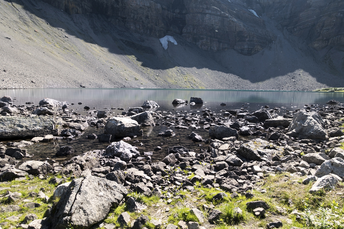
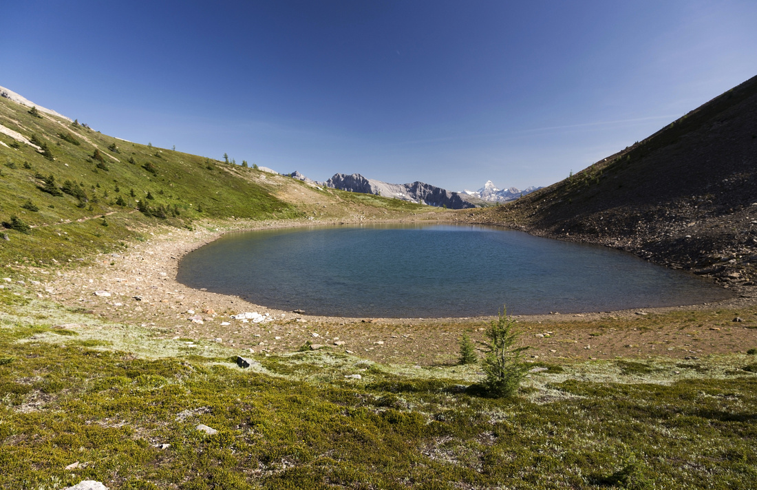
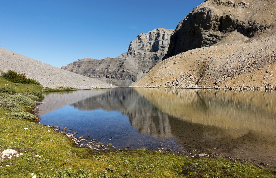 Beautiful unnamed lake in glacial cirque below Massive range looking back
 |
|||
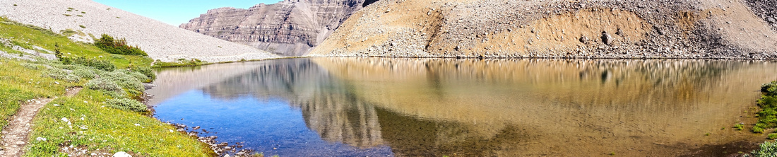 Panoramic view of unnamed lake as trail turns south and starts ascent to Harvey Pass
 |
|||
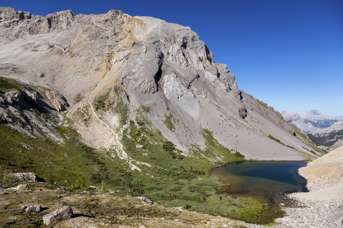 Pausing for short break on grassy bench below Harvey Pass with fantastic view behind. Note trail
 |
|||
 Trail rising gently up meadows and soft shale to Harvey Pass
 |
|||
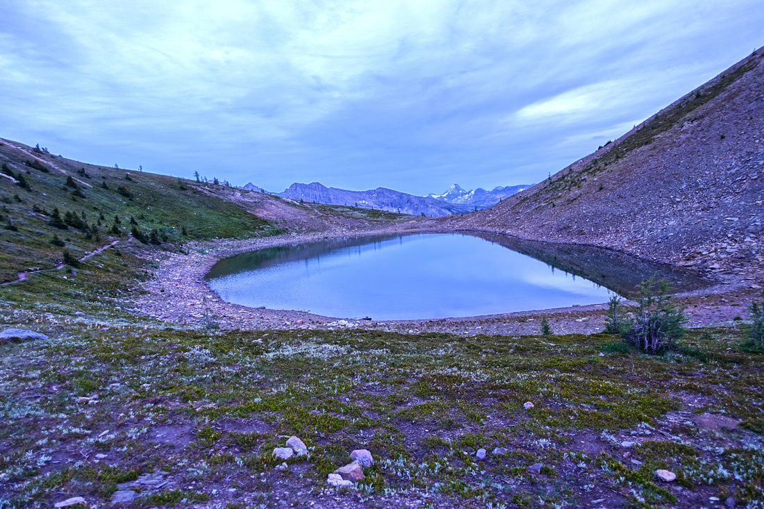
 Beautiful unexpected tarn at Harvey Pass; Mt. Assiniboine distance center right
 |
|||
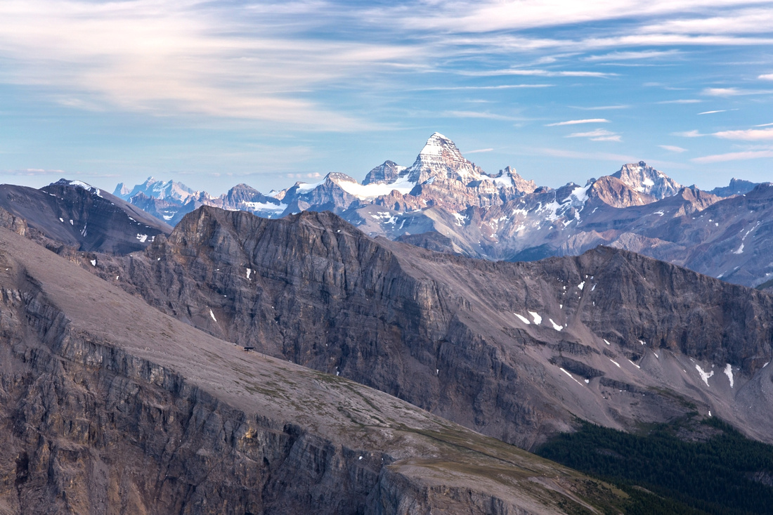
 Panoramic view south from Harvey Pass. Gentle Mt. Bourgeau ascent ridge left; summit is ~1.5 hrs away with distinct trail most of the way up. Sunshine core area and distant Mt. Assiniboine center right
 |
|||
 Final part of the ascent; as easy as it looks. Note trail rising left to right in talus slope above
 |
|||
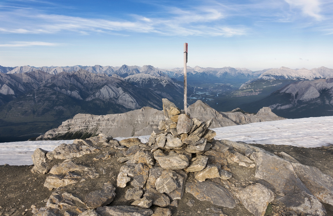 Summit cairn at 2907m summit of Mt. Bourgeau, according to GPS. Banff and Bow Valley just right of center behind
 |
|||
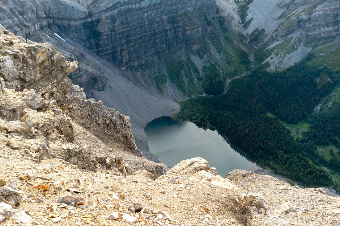 Bird eye view of Bourgeau Lake. You must descend a bit on north side for this view; be careful as terrain gets steep and lose
 |
|||
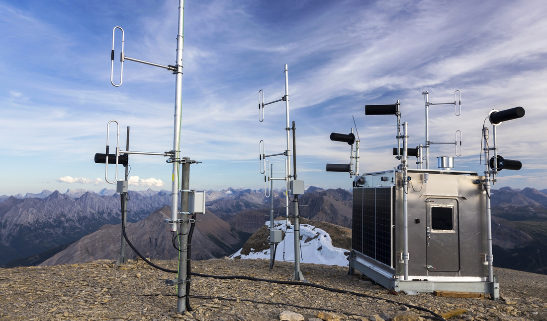 Permanent Meteorological station powered by solar panels on Mt. Bourgeau; south ridge behind
 |
|||
 Panoramic view of Bow Valley from the summit. Pilot Mountain far left
 |
|||
 Closer look at Pilot Mountain and delightful alpine area below Massive Range
 |
|||
 Telephoto of Mt. Assiniboine a.k.a "Matterhorn of the Rockies" from south end of Bourgeau summit ridge
 |
|||
 Harvey Pass tarn on descent
 |
|||
Abstract
| Overall Difficulty | D5 | Mostly trail hiking with one brief rocky section on summit ridge. Some steep sections. Considerable overall distance and cumulative elevation | |||
| Snow Factor | S3 | Steep talus slope above Bourgeau Lake, but rest of the ascent avoids avalanche terrain & is feasible as ski trip but probably too long for snowshoes in short winter days | |||
| Scenery | Entire trip past Bourgeau lake is above treeline with several lakes and alpine meadows. Far reaching views to Bow Valley peaks and front ranges of Banff National Park | ||||
| Trail/Marking | Very Good | Official maintained Park trail to Bourgeau lake with signposts; well defined afterwards with just one brief rocky bit in final part of the ridge above Harvey Pass | |||
| Suggested Time | 9-10 hr | Moderate pace in summer conditions. Descent is considerably faster | |||
| Elevation | Start: 1420m Max: 2910 m Total: ~1500 m | Round Trip: ~25 km | |||
| Gear | Full hiking boots and Hiking poles | ||||
| Water | Wolverine creek on Bourgeau Lake approach, several streams below Harvey Pass. Carry 1-2 L | ||||
| Dog Friendly | Yes | Please keep dogs under control on popular Bourgeau Lake trail for courtesy to other hikers. Standard back-country travel precautions | |||
 Bourgeau Lake and Mountain GAIA Map
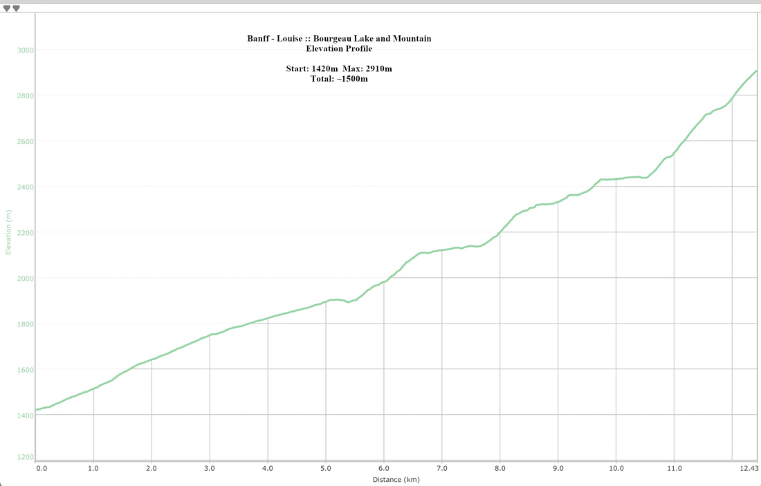 Bourgeau Lake and Mountain Elevation Profile