| Sawback Trail :: Forty Mile Rainbow |
|
This segment describes "Fitch Variation" of Sawback Trail between Mystic Junction (FM19) and Flint's Park (CR31). On my visit, according to overall strategy, I made a "basecamp" at FM19 then dayhiked with light pack; this gave me plenty of time to explore fantastic - and not quite expected - Forty Mile Summit and beyond Alpine area. There are two major highlights situated at opposite sides of main corridor - Sawback and Rainbow Lakes. Most Sawback backpackers simply hike through missing both, and that is the shame due to extraordinary beauty and overall remote feel. After hiking to Forty Mile summit I made a loop: First visited Sawback Lake, then looped back via lower Rainbow Lake Connector and back to Forty Mile as indicated below |
|
Mystic Junction - Forty Mile Summit - Sawback Lake |
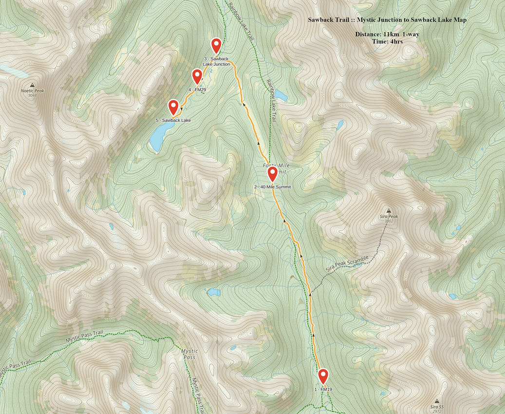 Mystic Junction to Sawback Lake GAIA Map
 Mystic Junction to Sawback Lake Elevation Profile
|
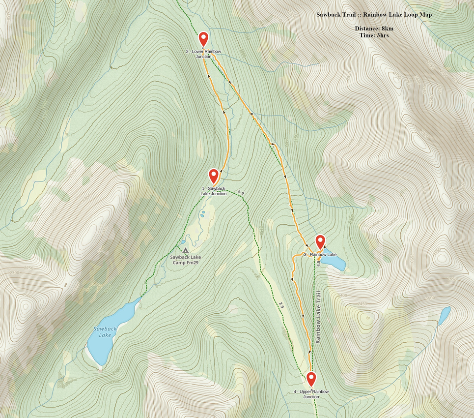
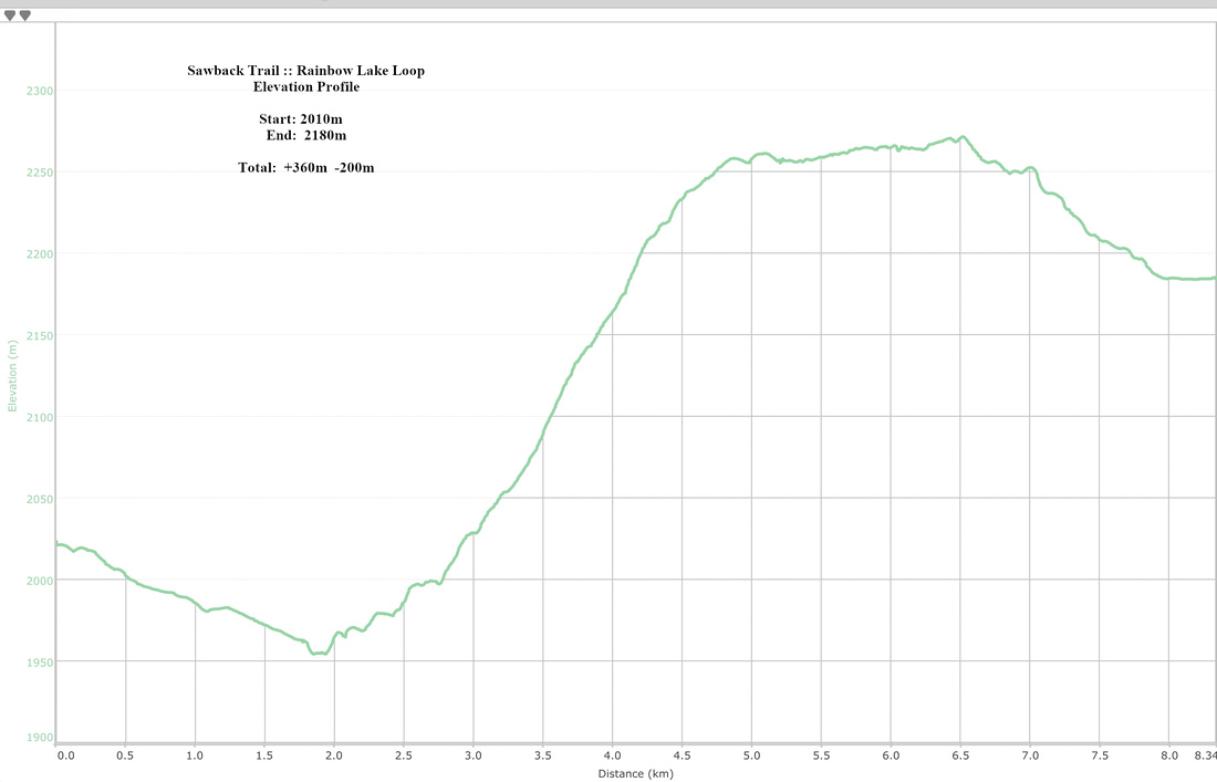
Rainbow Lake Loop |
|
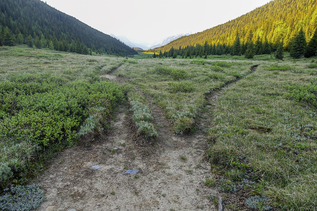
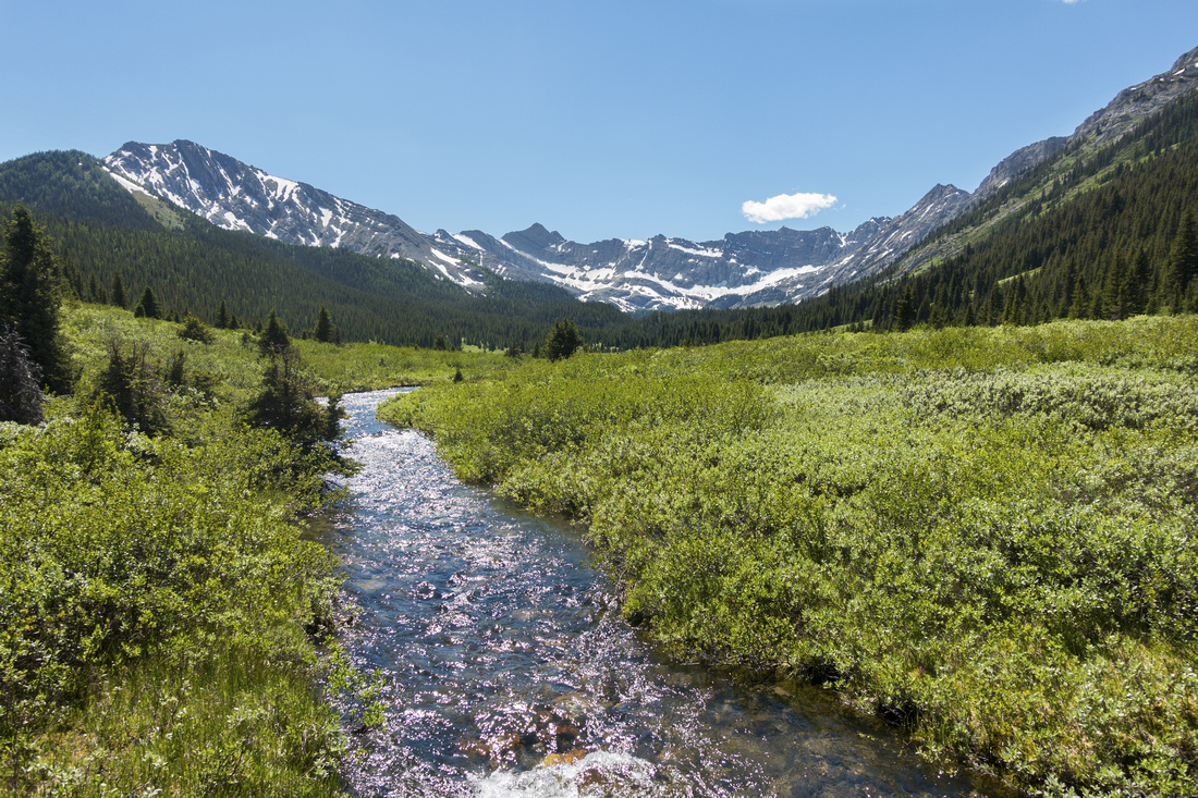
Section between FM19 and Forty Mile Summit is ~6.5km and mostly forested. There are two trails: Horse that stays lower mostly following the creek, and Hiker Bypass on east side. Horse trail should be avoided by all means as it is deeply rutted and has many non-bridged creek crossings. However Hiker Bypass was not smooth sailing either, with many fallen trees and collapsed bridges; apparently Parks Canada is not maintaining this trail anymore. There were also large amount of huge frogs on trail the whole day and it took real effort sometime not to step on them, as they moved quite slowly. Hiker and Horse trail rejoin ~1km before Forty Mile summit; extraordinary alpine meadow ~2km long. Upper Rainbow Lake connector splits on the east side roughly halfway along the meadow. It is not signed and easy to miss - see last photo in gallery. Trail then descends steeply ~150m vertical and crosses Sawback creek on good bridge to junction: Sawback Lake left in ~2km, Flint Park right ~4km. CR31 campground is halfway to the lake and would be great base to further explore the valley.
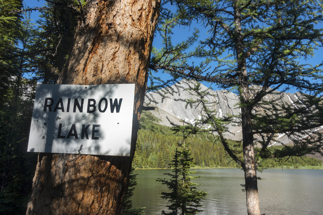
After visiting Sawback Lake I dropped ~30min down Flint trail to lower Rainbow connector. Fallen park post missing sign was yet another example of Parks not maintaining this area anymore. Rainbow creek crossing is directly below and there is no bridge. Hike to the lake will take good hour, but it is very beautiful mostly on semi-open escarpment with great views to the west - see gallery. Eventually it merges with upper connector by big larch few minutes before the lake. Rainbow lake is extraordinary, to say the least. There are larches all around and it would make great late September destination too - only if it wasn't so far. In 2015 Parks Canada flew batch of Westslope Cutthroat trout from Sawback to Rainbow Lake, attempting to preserve this fish species native to Banff National Park. Ridge above the lake on south side begs to be hiked; it would provide great views of Mt. Sira, and looking at maps one could probably descend on the other side to next valley south which contains yet another wilderness lake, likely never visited - so much room for exploration. Upper Rainbow connector to Forty Mile summit is shorter and after couple of switchbacks gradually descends to main trail ~45min from the lake.
Backpackers making through hike will have some logistic issues visiting both Sawback and Rainbow Lakes. Most practical approach is probably to stash heavy overnight pack at Forty Mile summit, then hike upper Rainbow Connector out-and-back. Same strategy can then be used at Sawback/Flint junction for visit to Sawback Lake. |
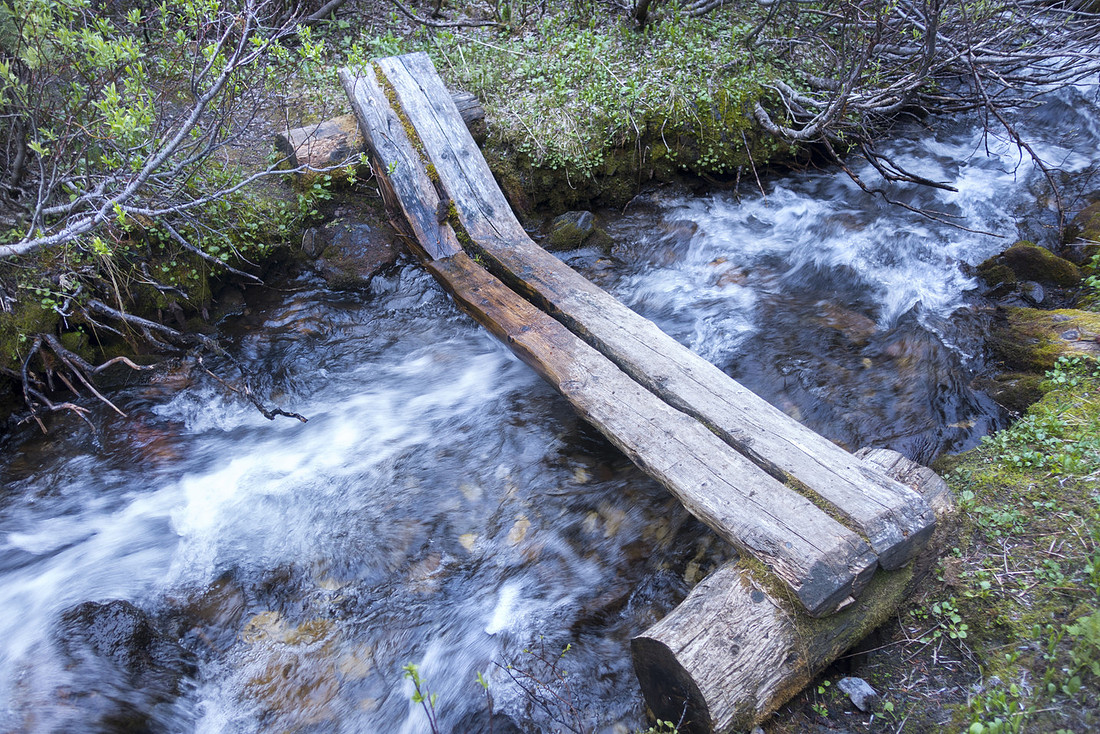 Hikers Bypass
One of several decaying bridges on "Hikers Bypass" between FM19 and Forty Mile Summit Hikers Bypass
One of several decaying bridges on "Hikers Bypass" between FM19 and Forty Mile Summit |
|||
 Horse Junction
Park Table as Hikers Bypass merges with Horse trail just below Forty Mile Summit Horse Junction
Park Table as Hikers Bypass merges with Horse trail just below Forty Mile Summit |
|||
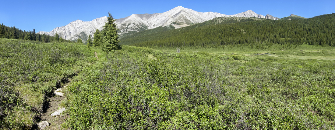
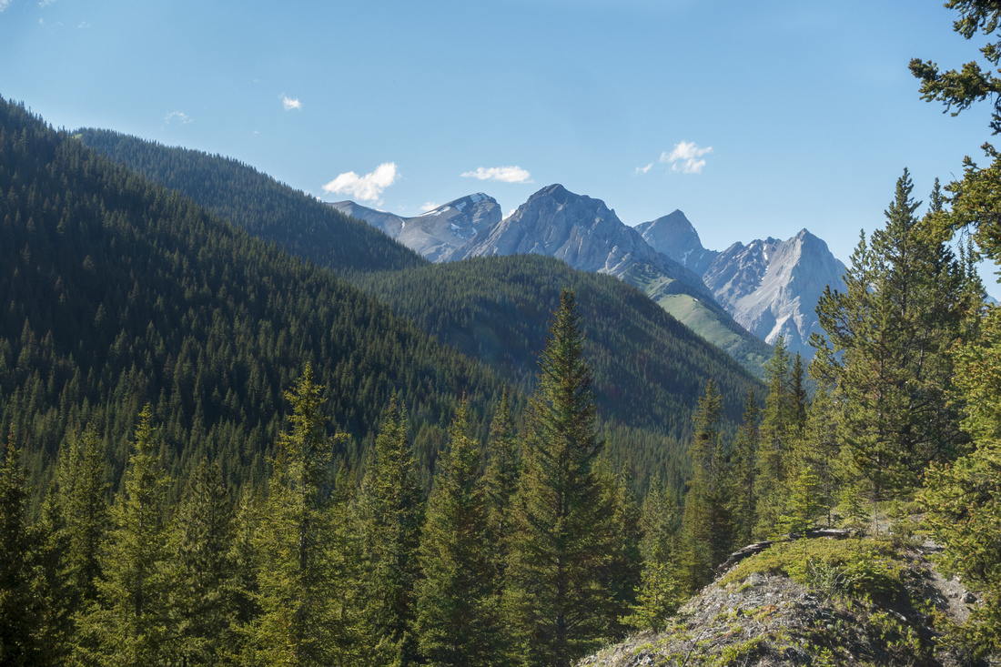
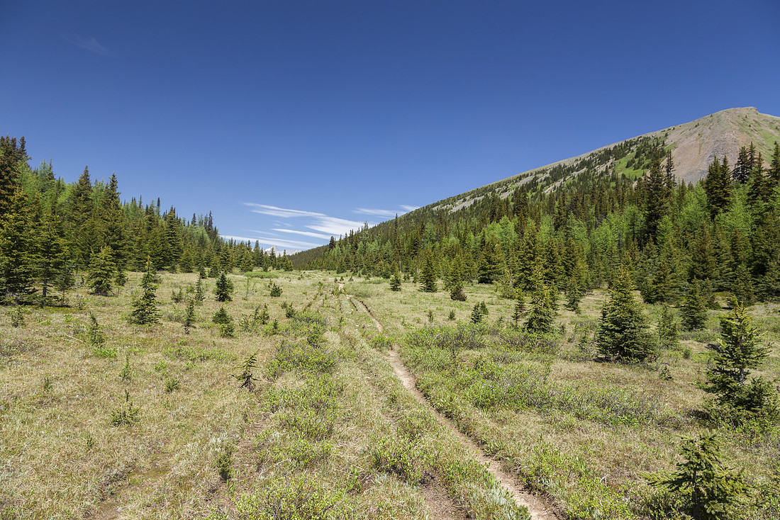 Forty Mile Summit
 - incredible 2km stretch of classic Rockies high Alpine Meadow Forty Mile Summit
Forty Mile Summit - incredible 2km stretch of classic Rockies high Alpine Meadow |
|||
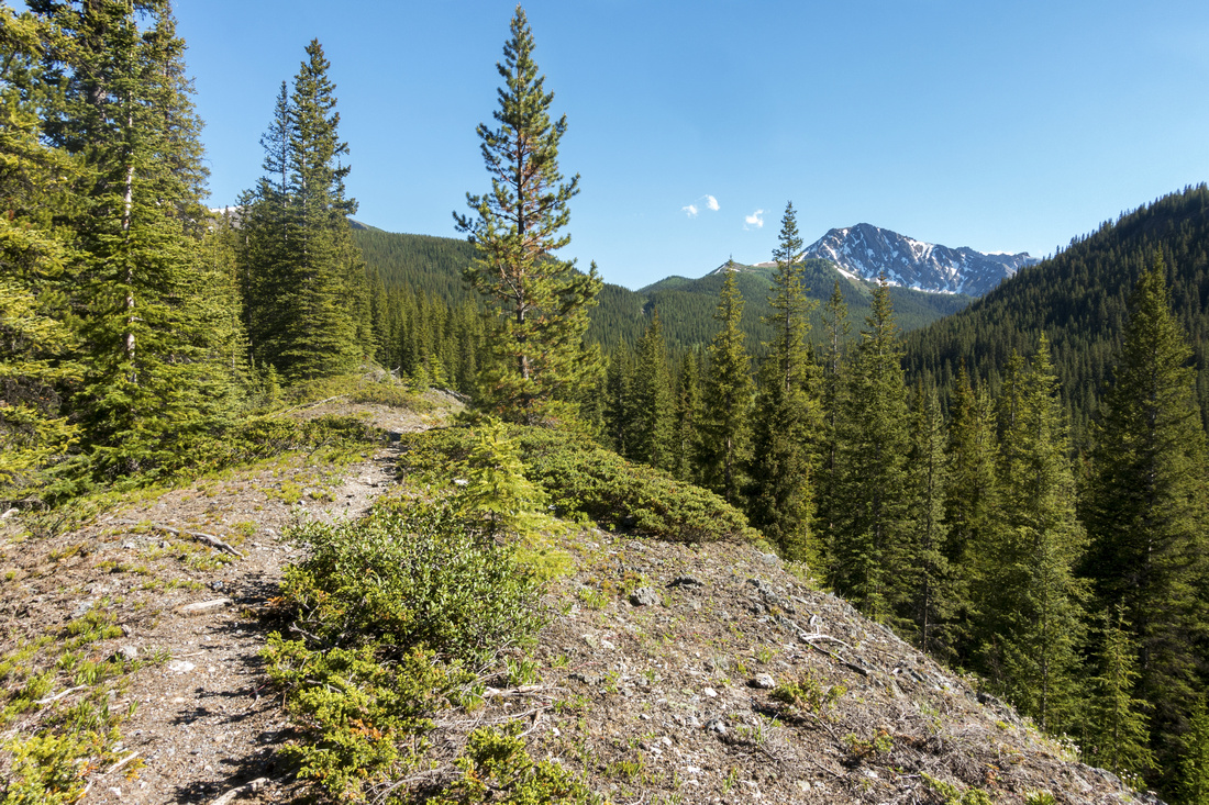
 Forty Mile Summit
Terrific View of Mt. Sira (upper center right) from Forty Mile Summit Forty Mile Summit
Terrific View of Mt. Sira (upper center right) from Forty Mile Summit |
|||
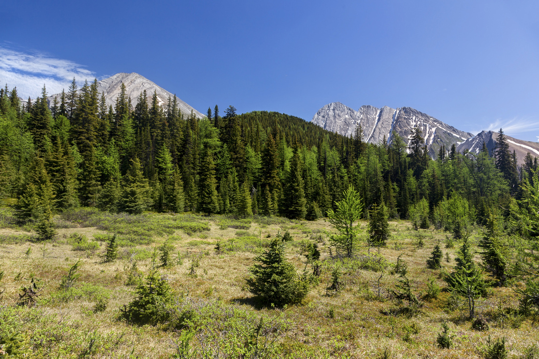
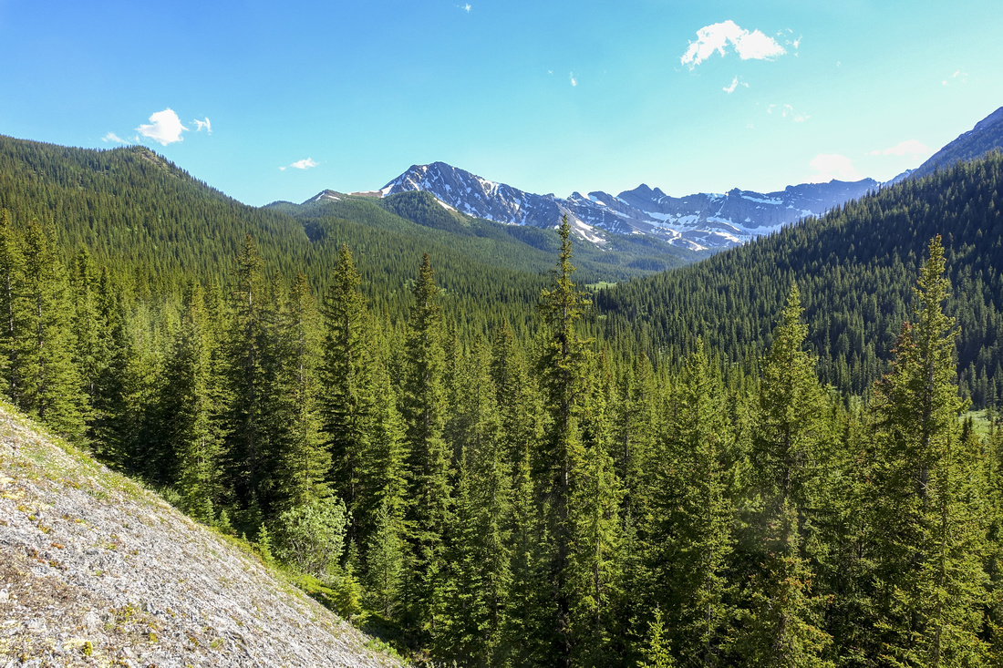
 Forty Mile Meadow
North Part of Forty Mile Meadow with distant views to Cascade North Fork above Flint's Park. Upper Rainbow Trail splits to the right just before this spot Forty Mile Meadow
North Part of Forty Mile Meadow with distant views to Cascade North Fork above Flint's Park. Upper Rainbow Trail splits to the right just before this spot |
|||
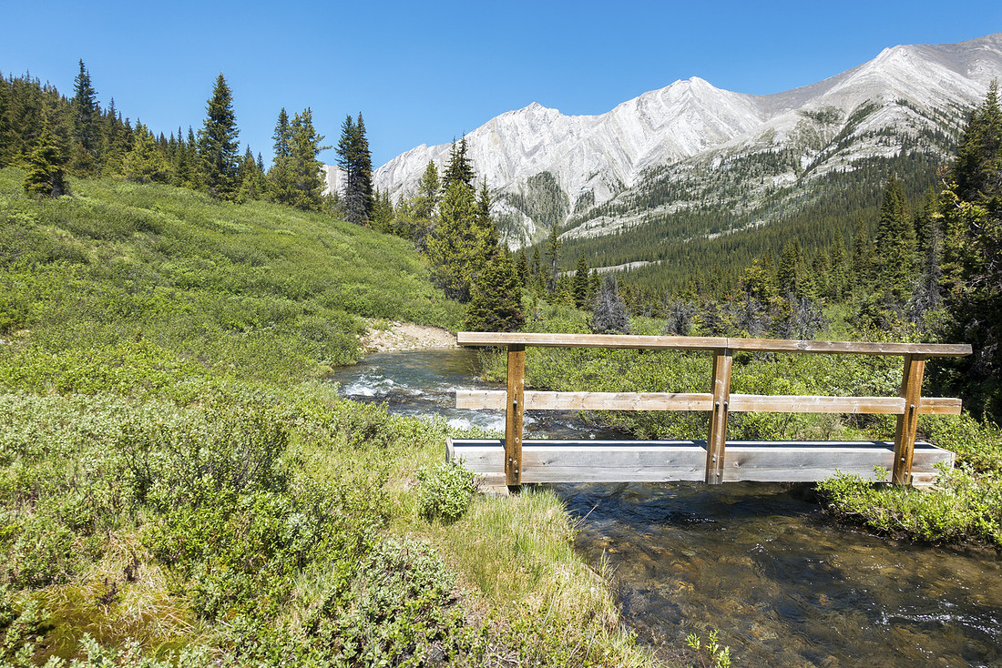 Sawback Creek Bridge
Hikers Bridge over Sawback Creek after steep, but short descent from Forty Mile Summit Sawback Creek Bridge
Hikers Bridge over Sawback Creek after steep, but short descent from Forty Mile Summit |
|||
|
|
|||
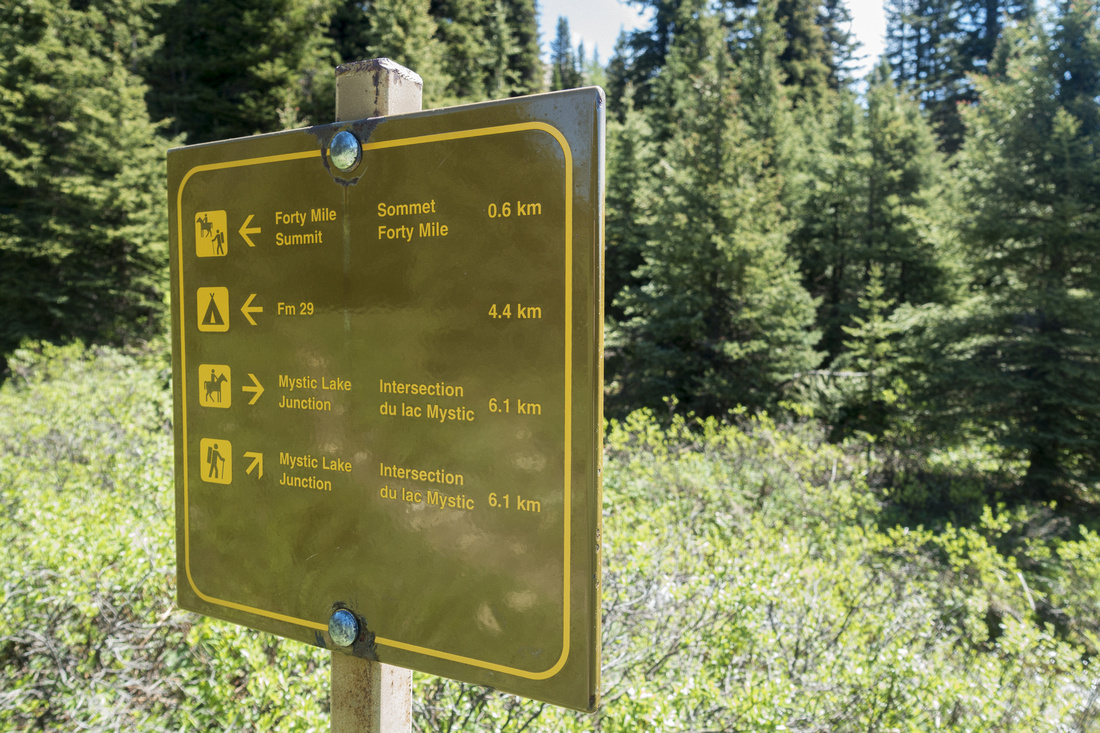
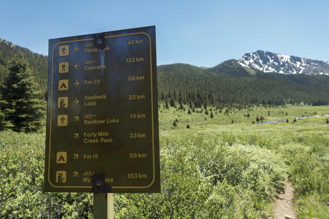 Sawback Lake Junbction
Park Table at Sawback Lake Junction; FM29 campground is ~15 min from here. Fitch Variation continues north towards Flint Park. Sawback Lake Junbction
Park Table at Sawback Lake Junction; FM29 campground is ~15 min from here. Fitch Variation continues north towards Flint Park. |
|||
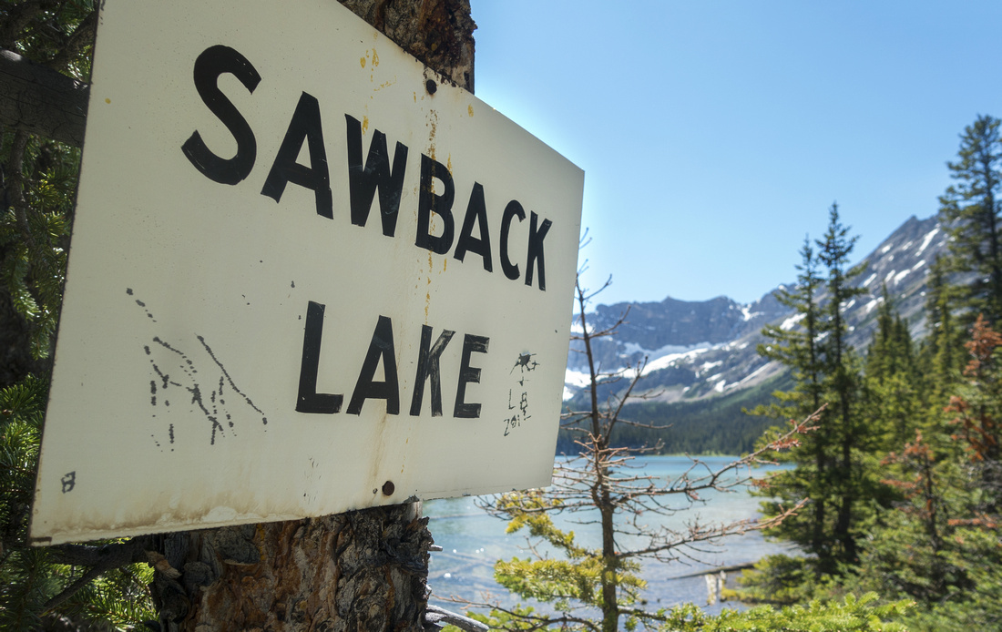
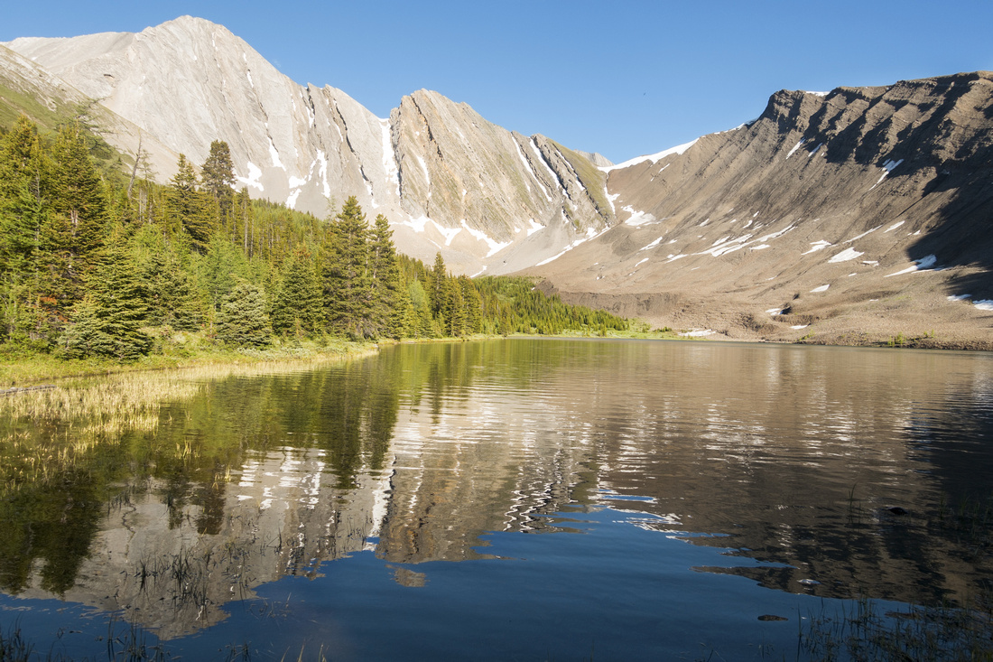
 Sawback Lake
 Outlet after brief ascent of semi-forested headwall on good trail Sawback Lake
Sawback Lake Outlet after brief ascent of semi-forested headwall on good trail |
|||
 Sawback Lake Table
Weathered Park Table at Sawback Lake Outlet; I've seen similar on several eastern BNP backcountry lakes Sawback Lake Table
Weathered Park Table at Sawback Lake Outlet; I've seen similar on several eastern BNP backcountry lakes |
|||
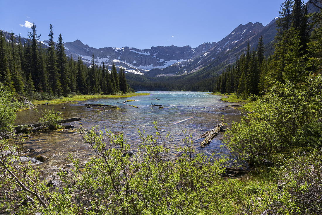
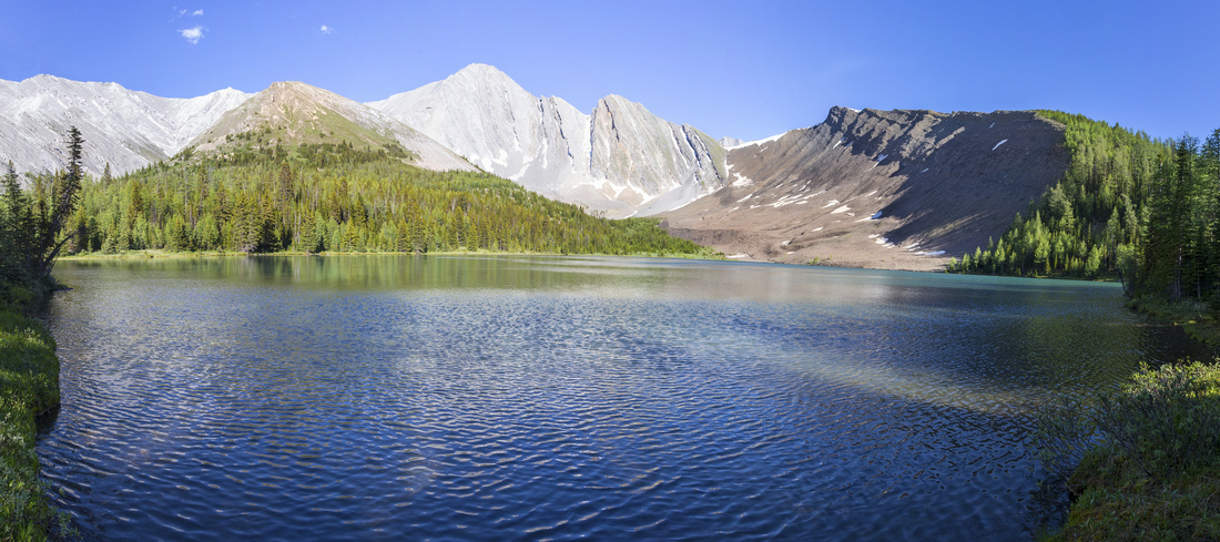
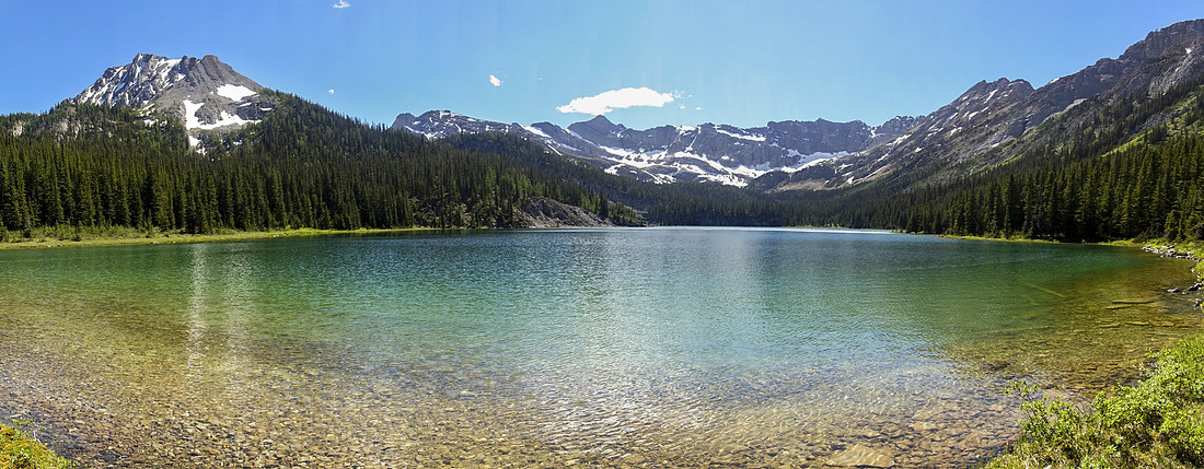 Sawback Lake
Gorgeous Sawback Lake Panorama; one of most beautiful BNP backcountry lakes I've seen. Faint trail exists on right (north) side. Optimal light for photography is in the morning, ideal if you are camping at FM29. Sawback Lake
Gorgeous Sawback Lake Panorama; one of most beautiful BNP backcountry lakes I've seen. Faint trail exists on right (north) side. Optimal light for photography is in the morning, ideal if you are camping at FM29. |
|||
 Sawback Lake
Another shot of Sawback Lake looking back towards outlet from little nook on north side Sawback Lake
Another shot of Sawback Lake looking back towards outlet from little nook on north side |
|||
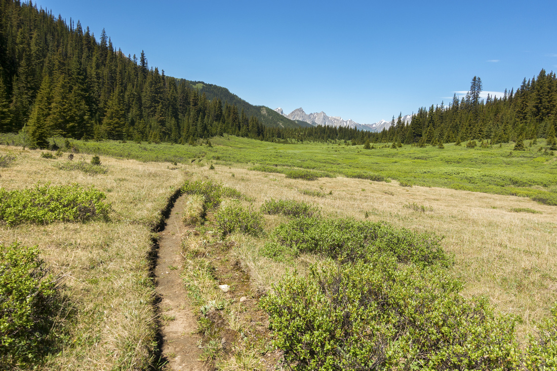
 Sawback Meadows
Hiking back from Sawback Lake towards Flint Park/Forty Mile junction Sawback Meadows
Hiking back from Sawback Lake towards Flint Park/Forty Mile junction |
|||
 Lower Rainbow Junction
Lower Rainbow Lake Connector by decayed Park table without sign anymore. This is looking back towards Forty Mile; Rainbow trail is left Lower Rainbow Junction
Lower Rainbow Lake Connector by decayed Park table without sign anymore. This is looking back towards Forty Mile; Rainbow trail is left |
|||
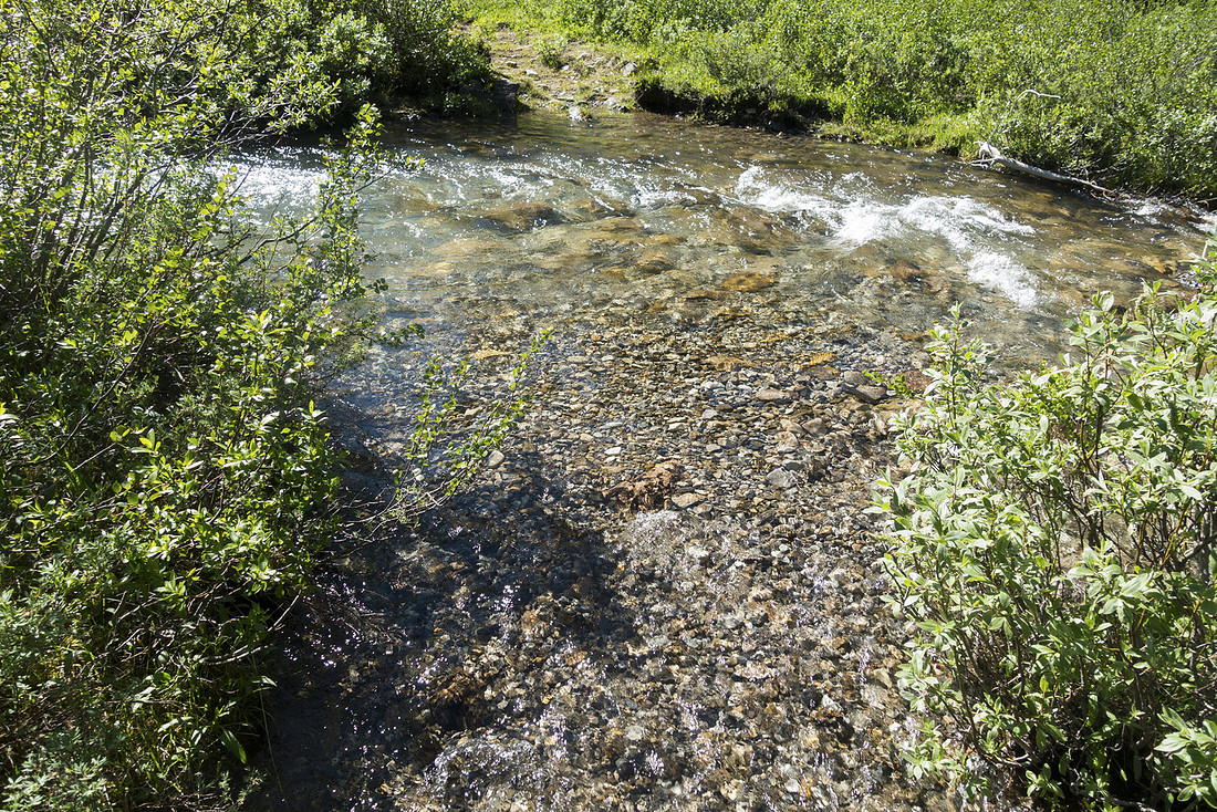 Rainbow Crossing
Unavoidable creek crossing at Lower Rainbow connector; this is looking back towards Flint trail Rainbow Crossing
Unavoidable creek crossing at Lower Rainbow connector; this is looking back towards Flint trail |
|||
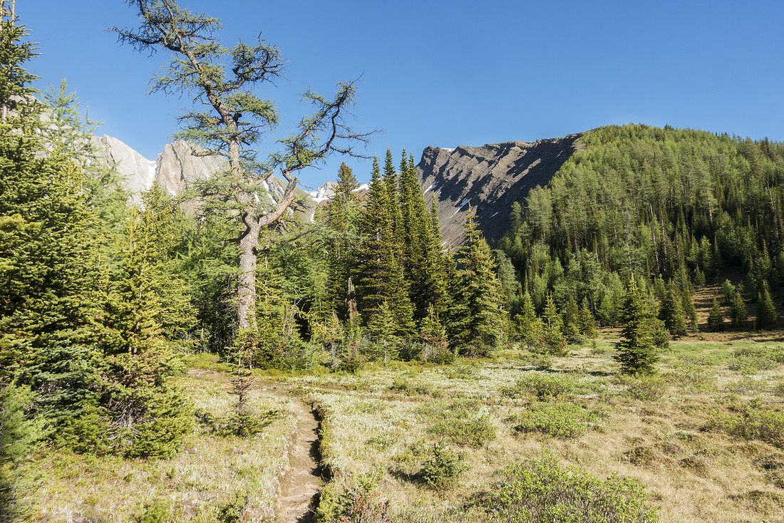
 Rainbow Escarpment
Great hiking on semi-open ridge towards Rainbow Lake cirque Rainbow Escarpment
Great hiking on semi-open ridge towards Rainbow Lake cirque |
|||
 Block and Noetic
Noetic Peak (center) and Block Mountain (right) looking north from lower Rainbow Lake trail Block and Noetic
Noetic Peak (center) and Block Mountain (right) looking north from lower Rainbow Lake trail |
|||
 Rainbow Escarpment
Looking west towards Sawback Lake environs, already quite far away, from lower Rainbow Lake connector. Forty Mile summit upper center left Rainbow Escarpment
Looking west towards Sawback Lake environs, already quite far away, from lower Rainbow Lake connector. Forty Mile summit upper center left |
|||
 The Big Larch
Lower and Upper Rainbow Lake trails merging by that tall larch center left. Lake is just a few minutes away The Big Larch
Lower and Upper Rainbow Lake trails merging by that tall larch center left. Lake is just a few minutes away |
|||
 Rainbow Table
Similar Park table as earlier at Sawback Lake Rainbow Table
Similar Park table as earlier at Sawback Lake |
|||
 Rainbow Lake
Panorama of Secluded and rarely visited Rainbow Lake from west side. "Larch Ridge" upper right Rainbow Lake
Panorama of Secluded and rarely visited Rainbow Lake from west side. "Larch Ridge" upper right |
|||
 Rainbow Lake
Unnamed peak reflected in calm water of Rainbow Lake by the outlet Rainbow Lake
Unnamed peak reflected in calm water of Rainbow Lake by the outlet |
|||
 Rainbow Lake
Another shot of very picturesque Rainbow Lake after crossing the Outlet. Larch hammock where trail ends is far center right. "Larch Ridge" directly across Rainbow Lake
Another shot of very picturesque Rainbow Lake after crossing the Outlet. Larch hammock where trail ends is far center right. "Larch Ridge" directly across |
|||
 Upper Rainbow Junction
Upper Rainbow Lake trail junction to the right after returning to Forty Mile Summit Upper Rainbow Junction
Upper Rainbow Lake trail junction to the right after returning to Forty Mile Summit |
|||
Abstract
| Overall Difficulty | D3 | Sections with deadfall on Horse bypass to 40Mile summit. Some rocky/rooty parts. Mid-calf creek ford on lower Sawback connector | |||
| Snow Factor | S2 | No avalanche danger, but remoteness of the area does not lend itself for winter trip | |||
| Scenery | Forty Mile Summit Alpine Meadows. Beautiful Sawback and Rainbow Lakes | ||||
| Trail/Marking | Very Good | Official park Trail over Forty Mile Summit to Flint's Park with marked junctions. Hikers Bypass from FM19 likely not maintained. Rainbow Lake connectors not marked | |||
| Suggested Time | 7-8hrs | Loop return from FM19 or FM19-CR31 through hike with Sawback Lake/Rainbow Lake side trips | |||
| Gear | Full Hiking Boots, Poles and Overnight gear | ||||
| Water | Forty Mile creek, Sawback and Rainbow Lake outlets. No need to carry more than 1L at any time | ||||
| Dog Friendly | No | Although I've seen backpackers with dogs on Forty Mile, this is strongly discouraged because of overnight logistics | |||