Sawback Trail :: Forty Mile Creek / Mystic Lake |
||||
|
Usual first leg of Sawback Trail. Starting from Mt. Norquay ski area trail descends to Forty Mile Creek and follows its length upstream towards Mystic Junction. Trail is mostly forested but wide and gentle allowing fast travel. About halfway in is FM10 - Cockscomb backcountry campground - which can also be used in case of late start.
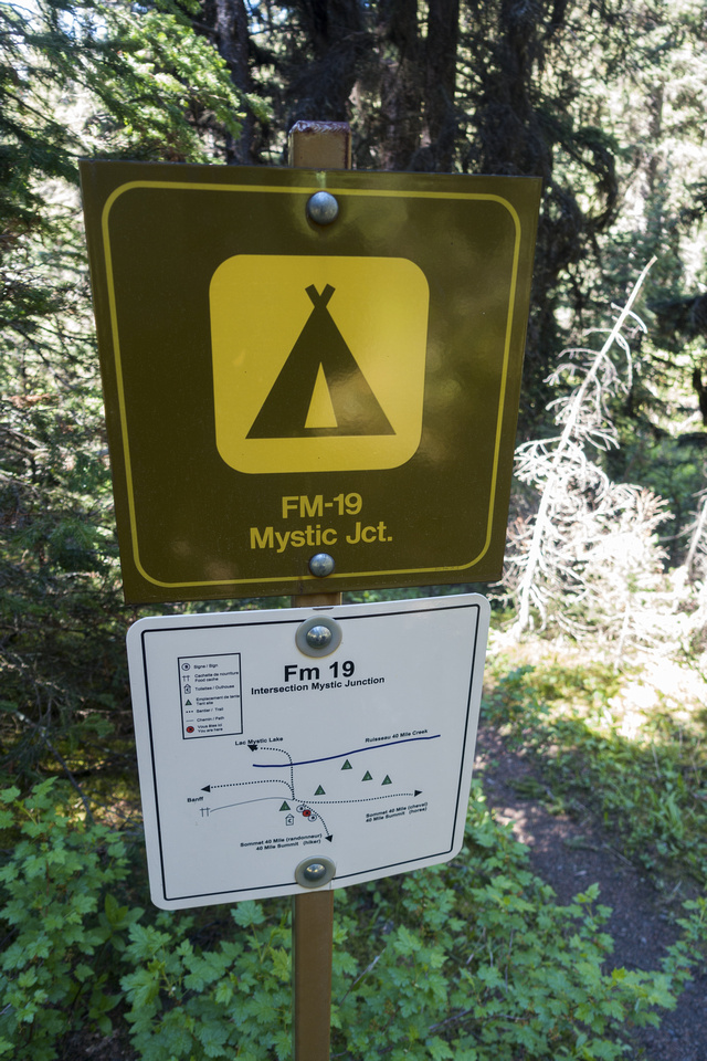
For reasons that defy logic, main Norquay resort parking lot is usually barricaded in summer which requires completely unnecessary ~500m extra walk. After passing main lodge and ranger cabin is possible confusion: marked Cascade Amphitheater / Elk Summit trailhead on the right side, that also has Forty Mile posted. This was valid in old days when Forty Mile Trail split off Elk trail after descending to the bridge. This old trail is not maintained anymore; instead, stay on ski road past ranger cabin reaching proper Forty Mile Trailhead in ~15minutes. Wide trail, more like a road, descends gradually to new bridge ~4km mark and crosses to west side. On my trip out of curiosity I decided to follow old trail; while still passable and flagged, it had couple of bad washouts that forced much sidehilling; entirely not worth. Another thing worth keeping in mind is that this valley is major grizzly bear corridor. I've run into largest griz I've ever seen just past FM10; staring contest that ensued luckily ended with bear trashing up the forest. Carry your bear spray. Eventually you reach marked Mystic Junction 4-5 hrs from Norquay trailhead - this is the place to leave main trail if you are spending the night at MI22. Otherwise proceed for another 0.5km to Hikers/Horse junction and turning left descend to FM19.
On my visit in July '22 I decided to set 2 night "basecamp" at FM19, then spend full day exploring the area with light pack, same strategy that worked well at Johnston Creek Valley. Word about FM19 - it is in forested area right by Forty Mile creek on East side. There were only 5 tent pads while food prep area ,separated by fair distance, had newer picnic table, fire ring and 6 metal lockers. Two things are worth noting: 1) FM19 is already on Horse trail, so if continuing towards Forty Mile summit (as for Fitch Variation), you will need to backtrack few minutes to Hikers Bypass 2) It is not necessary to walk back on main trail to Mystic Junction; good foot bridge is right in the campground from where intersection with Mystic Pass trail by Mystic Lake Warden cabin is only 10-15 minutes away. |
||||
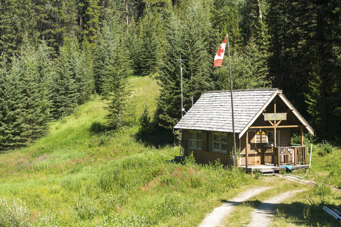 Norquay Ranger Cabin Norquay Ranger Cabin Ranger Cabin just below Mt. Norquay Ski Lodge. Just below trail forks right for Cascade Amphitheater / Elk Summit; stay on Ski Road for another ~15min to Forty Mile Trailhead
 |
|||
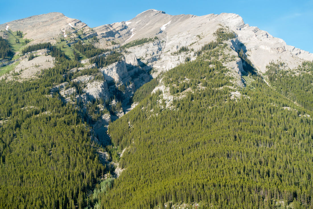 Cascade Mountain
Nice views of Cascade Mountain from as trail leaves Ski Road at Forty Mile Trailhead Cascade Mountain
Nice views of Cascade Mountain from as trail leaves Ski Road at Forty Mile Trailhead |
|||
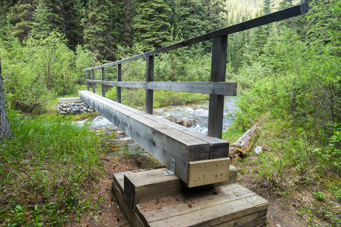
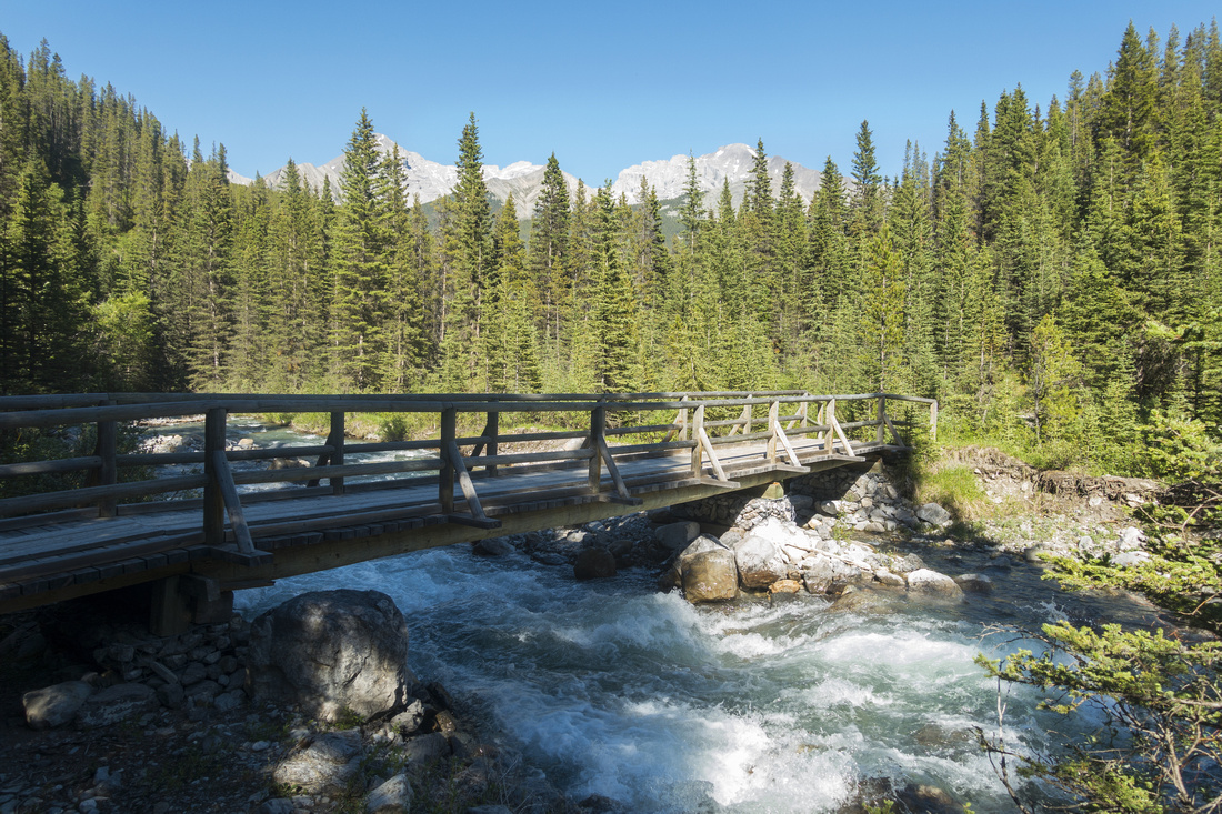 Forty Mile Bridge
Sturdy Bridge over 40 Mile Creek ~4km from Mt. Norquay as trail crosses to west side, looking back. Good spot for break and water resupply Forty Mile Bridge
Sturdy Bridge over 40 Mile Creek ~4km from Mt. Norquay as trail crosses to west side, looking back. Good spot for break and water resupply |
|||
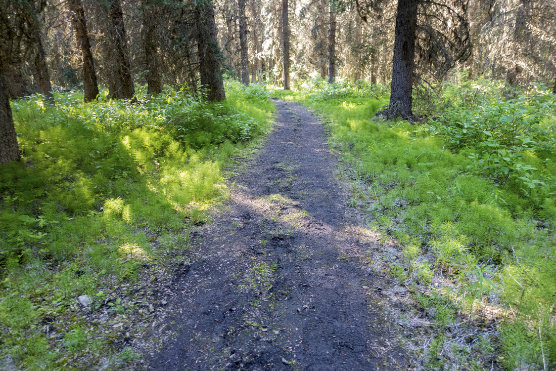 Forty Mile Trail
Typical section of wide and easy traveled Forty Mile Trail Forty Mile Trail
Typical section of wide and easy traveled Forty Mile Trail |
|||
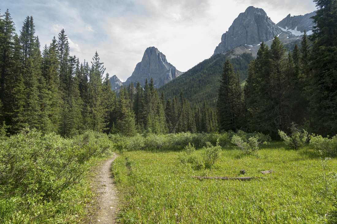 FM10 Meadows
Brief opening just past Mt. Cockscomb campground (FM10) with views of Mt. Louis and Mt. Fifi FM10 Meadows
Brief opening just past Mt. Cockscomb campground (FM10) with views of Mt. Louis and Mt. Fifi |
|||
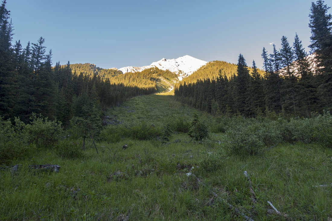 Avalanche Slope
Crossing one of several avalanche slopes below Mt. Brewster between FM10 and FM19 Avalanche Slope
Crossing one of several avalanche slopes below Mt. Brewster between FM10 and FM19 |
|||
|
FM19 Backcountry Campground just past Mystic Junction |
|||
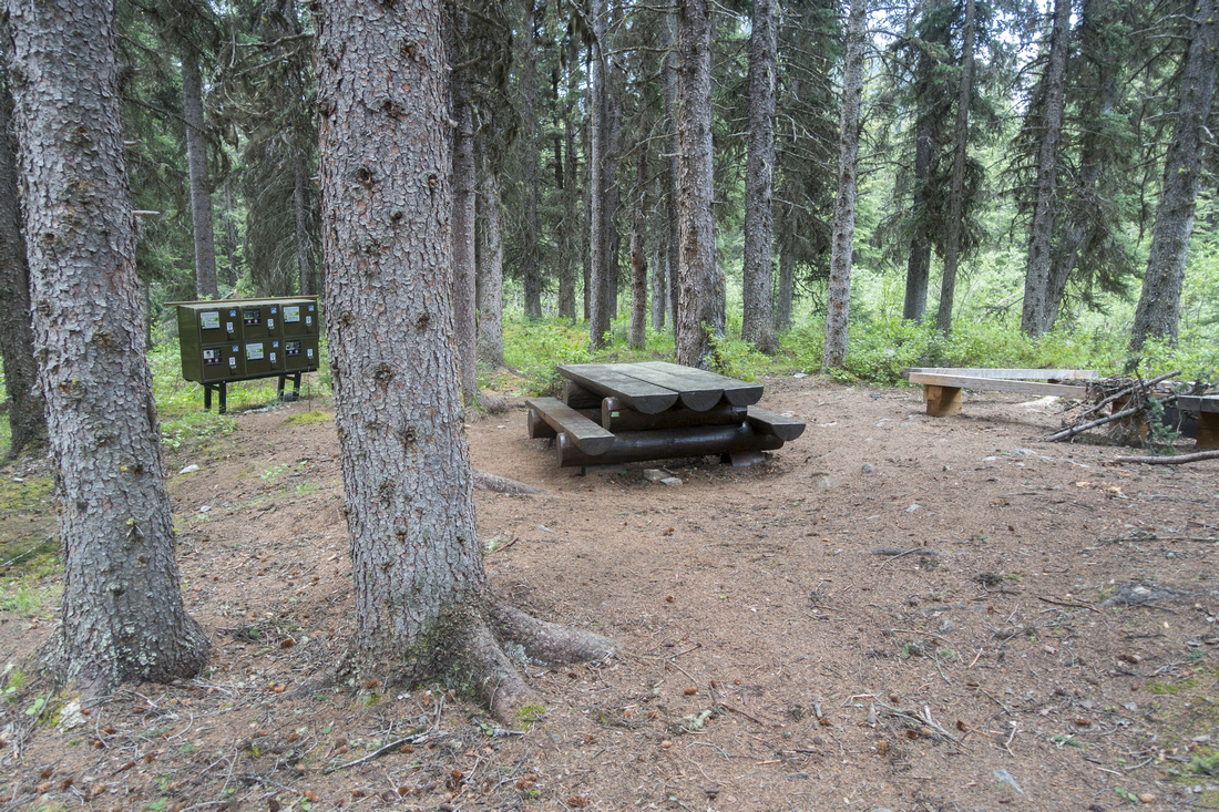 FM19 Kitchen
Main Food Preparation area at FM19 with lockers, picnic table and firepit right by Forty Mile Creek (out of picture, to the right) FM19 Kitchen
Main Food Preparation area at FM19 with lockers, picnic table and firepit right by Forty Mile Creek (out of picture, to the right) |
|||
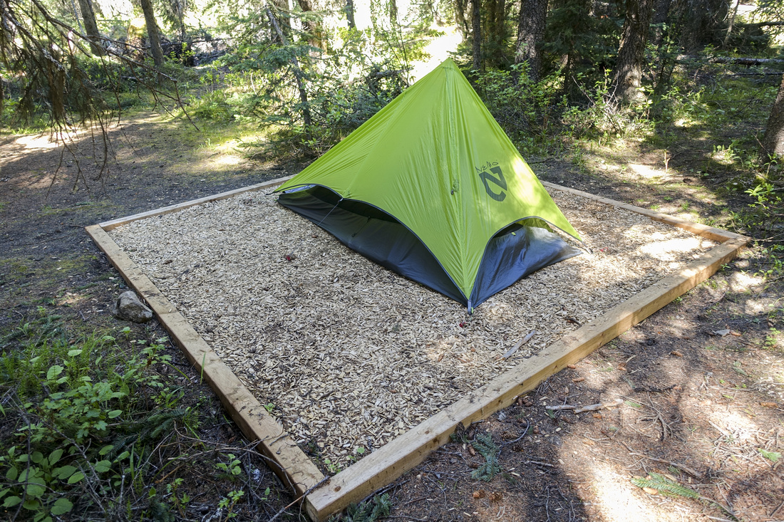 FM19 Tent Pad
Tent Pad #5 at FM19, fair distance away from Food Prep area FM19 Tent Pad
Tent Pad #5 at FM19, fair distance away from Food Prep area |
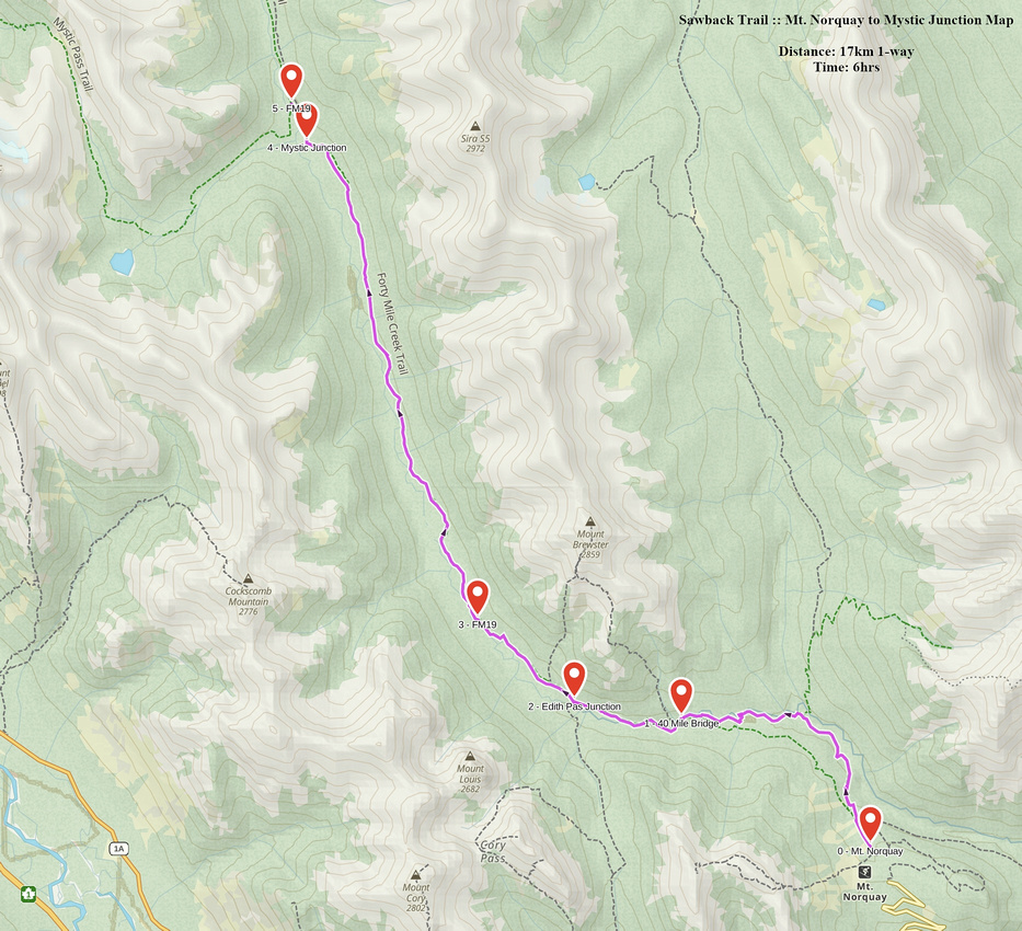 Mt. Norquay to Mystic Junction GAIA Map
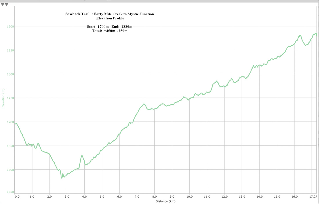 Mt. Norquay to Mystic Junction Elevation Profile
Mystic Lake |
Regardless of how you planned second day Mystic Lake visit is a must. If you are doing classic variation over Mystic Pass, it is very short side trip (0.5km one way from Mystic Pass / Mystic Lake junction 15min past MI22). If you are doing Fitch Variation you can hike with light pack after setting the camp at FM19, or first thing in the morning with early rise. It will take ~3hrs return. For photographers keep in mind Mystic Lake has much better light in first part of the day due to the position of the sun.
 FM19 Bridge
New bridge over 40 Mile Creek at FM19 leads to Ranger Cabin in ~10 minutes
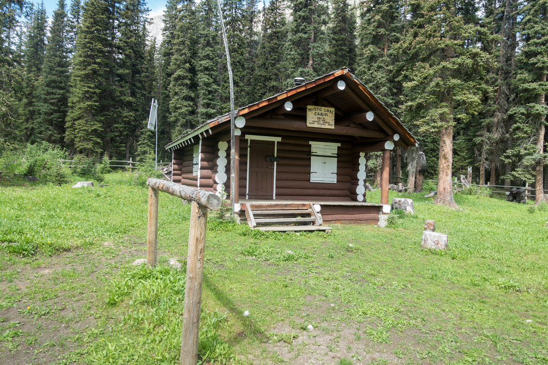 Mystic Lake Cabin
Mystic Lake Ranger Cabin. Classic Sawback Trail continues west towards MI22 and over Mystic Pass to Johnston Creek Valley
Mystic Lake Cabin
Mystic Lake Ranger Cabin. Classic Sawback Trail continues west towards MI22 and over Mystic Pass to Johnston Creek Valley
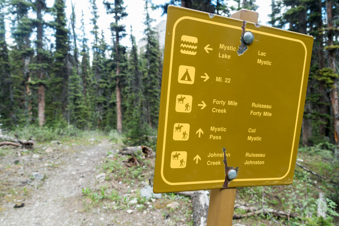 Mystic Table
Mystic Lake/Mystic Pass junction about 1km beyond MI22 campground
Mystic Table
Mystic Lake/Mystic Pass junction about 1km beyond MI22 campground
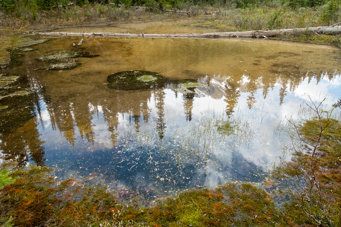 Mystic Reflections
Mystic Peak reflected in shallow pond just before Mystic Lake
Mystic Reflections
Mystic Peak reflected in shallow pond just before Mystic Lake
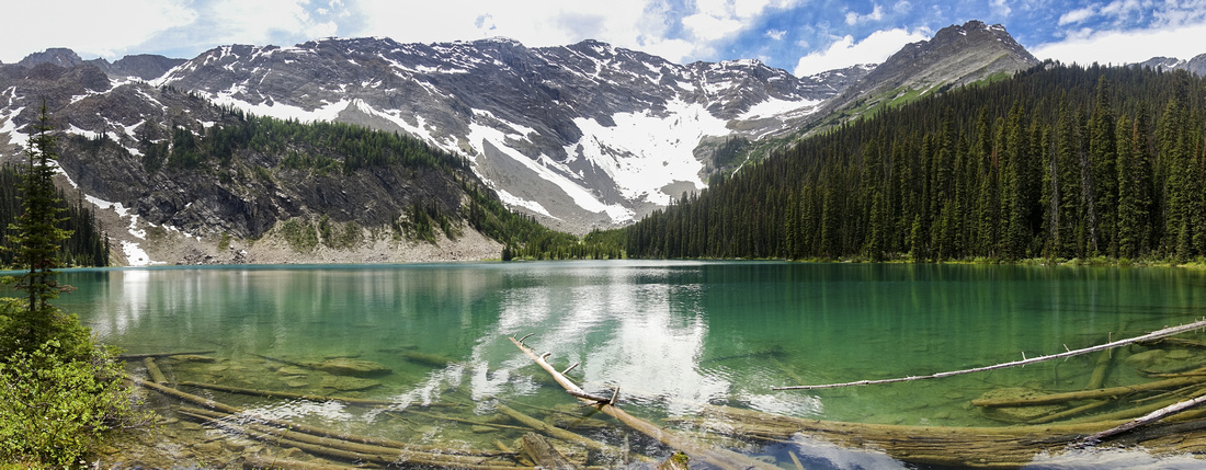 Mystic Lake
Beautiful Mystic Lake, a must Sawback Trail side trip
Mystic Lake
Beautiful Mystic Lake, a must Sawback Trail side trip
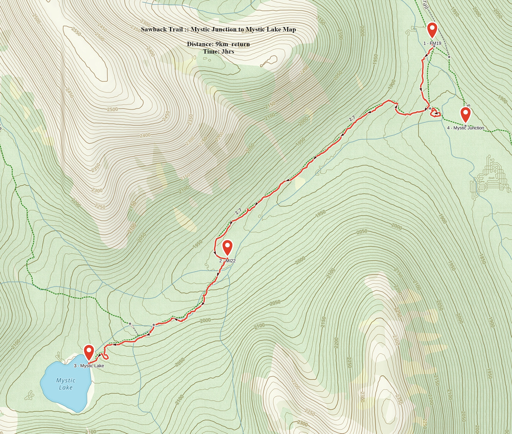 Mystic Junction to Mystic Lake GAIA Map
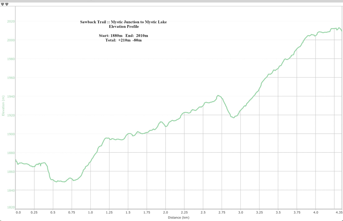 Mystic Junction to Mystic Lake Elevation Profile
Abstract
| Overall Difficulty | D2 | Mostly wide and level trail with couple of drainage crossings and rooty sections | |||
| Snow Factor | S2 | No avalanche danger, but although sometimes done by cross-country skiers total length not practical in winter. | |||
| Scenery | Forested walk with occasional glimpse of Mt. Louis, Fifi and Mt. Brewster. Beautiful Mystic Lake (side trip) | ||||
| Trail/Marking | Excellent | Official park maintained trail with bridged creek crossings and marked junctions to FM19. Boggy sections with deadfall for Mystic Lake | |||
| Suggested Time | 5-6 hrs | Mt. Norquay to FM19 with overnight pack. 2-3 hrs for Mystic Lake side trip (return to FM19) | |||
| Elevation |
|
Distance:
|
|||
| Gear | Full Hiking Boots, Poles and Overnight gear | ||||
| Water | Forty Mile creek and several side streams. No need to carry more than 0.5L at any time | ||||
| Dog Friendly | No | Although I've seen backpackers with dogs on Forty Mile, this is strongly discouraged because of overnight logistics | |||