Google Map |
Rockies :: Banff-Louise :: Fairholme Benchlands |
GPS Track |
|
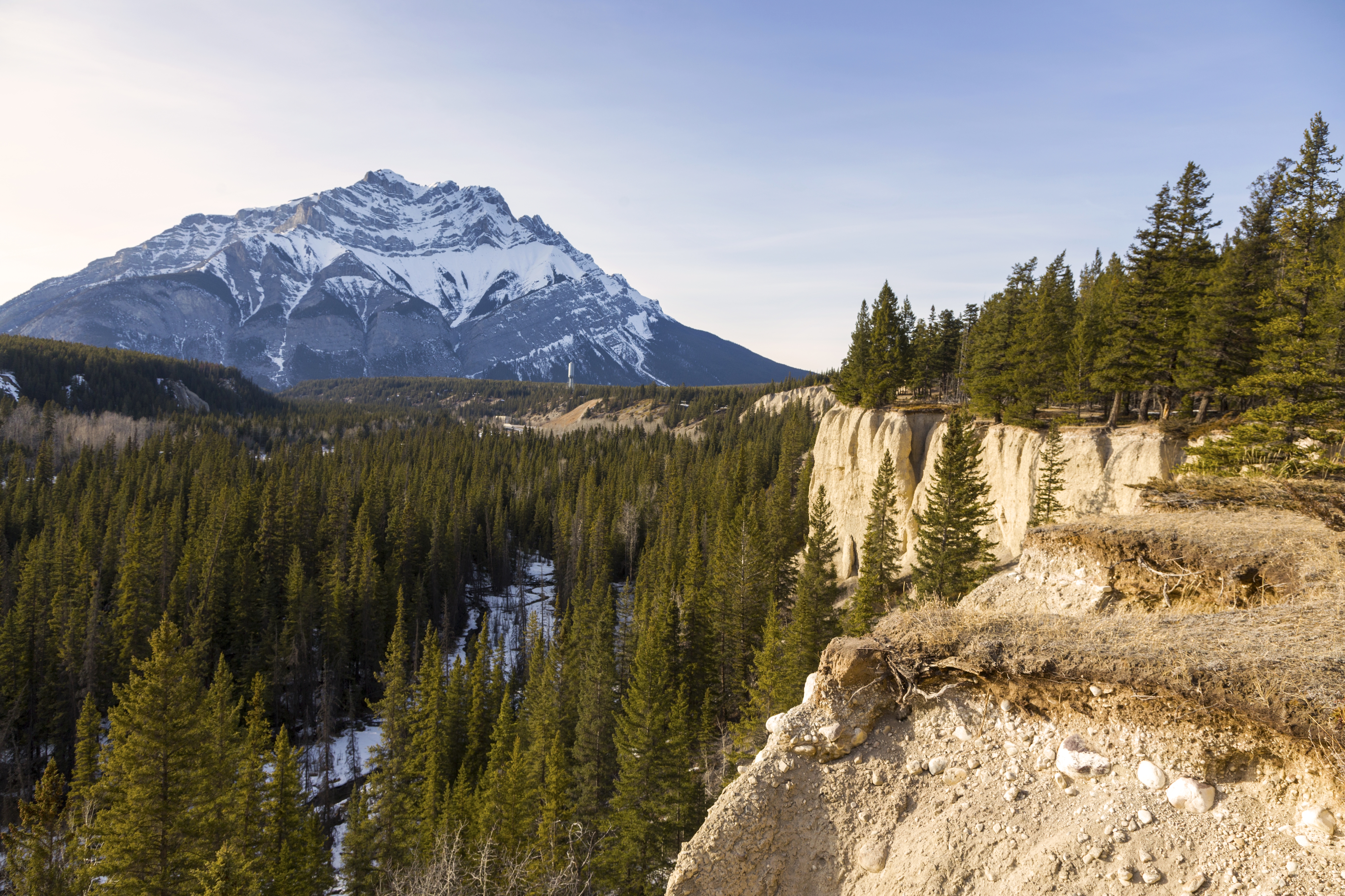
Fairholme Benchlands looking down Bow Valley towards Canmore. South part extending down grassy ridge on photo accessed from Johnson Lake is closed seasonally from April 1 - July 15, while north part, a.k.a "Water Tower Trail, to Cascade Ponds is open year round |
|||
| Trip Summary | |||
Multiple Dates, last Apr 20, 2024
Fairholme Benchlands is beautiful semi-open Montane ridge on north side of Trans-Canada Highway as one drives past BNP east gate towards Banff. Conceivably one could hike this way all the way from Cascade Ponds on Lake Minnewanka road all the way to Harvie Heights in Canmore. Ridge is sunny and often dry even in winter, offering spectacular views of Rundle Range as well as Cascade Mountain. North end between Cascade Ponds and Johnson Lake, also known as "Water Tower Trail" is most frequently hiked and is also popular with mountain bikers. South part past Johnson Lake has faint trail and is probably even more scenic, but there is no specific end -- one can hike as far as time and desire allows. However Parks Canada discourages use of this part, and officially close the area between April 1 - July 15. This page presents "Water Tower Trail"; for bit more info about South part see Johnson Lake.
One can start either from Cascade Ponds or from Johnson Lake, but Cascade Ponds are preferred simply because there is less driving! Return is the same way, so scenery will be the same. From large picnic area parking at Lake Minnewanka road cross the wooden bridge, turn left then watch for wide and well used trail climbing forested bump to the right. Initial part is the only steep bit and can be a bit tricky when icy. There are several wood steps here (erosion prevention) - mountain bikers beware. Trail then levels and next 1/2 hour or so are spend on delightful winding semi-open ridge with beautiful views. Only distraction is inevitable noise from Trans-Canada highway below. Within an hour trail reaches large meadow and Water Tower. Old weathered Parks sign, that might not even stand for long, informs "3.9km to Cascade Ponds, 1.7 km to Johnson Lake". Remainder is walk on gravel road, used for Water Tower vehicle access. Nearby sign indicates this might have been old burial site of Anthracite Mining Town. Finally road reaches Johnson Lake by outlet just below picnic area. Return the same way, or if you wish to extend the day, you can loop hike around Johnson Lake or continue to South Benchlands. Note that obvious trail by lake outlet simply descends to Trans-Canada and does not connect to Water Tower trail. It does pass by neat hidden waterfall just past wooden bridge that is worth checking out. |
|
Gallery |
|||
 Cascade Ponds Cascade Ponds Cascade Ponds below Mt. Cascade (L). Water Tower trail starts after crossing the bridge (center) and climbs forested hill right
 |
|||
 Cascade Ponds Junction
Junction at Far End of Cascade Ponds; go right. Snowy peak in the distance is Mt. Astley Cascade Ponds Junction
Junction at Far End of Cascade Ponds; go right. Snowy peak in the distance is Mt. Astley |
|||
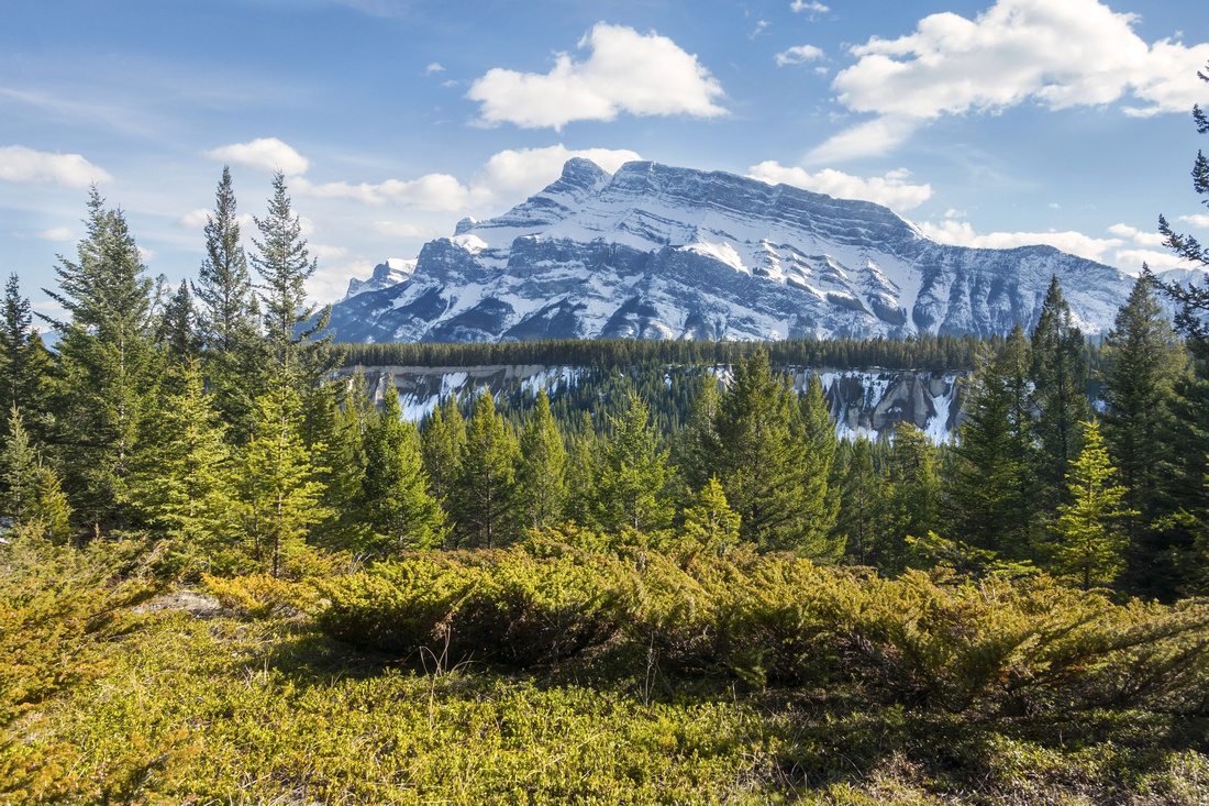 Rundle Range
 from lovely semi-open montane ridge leading to Water Tower Rundle Range
Rundle Range from lovely semi-open montane ridge leading to Water Tower |
|||
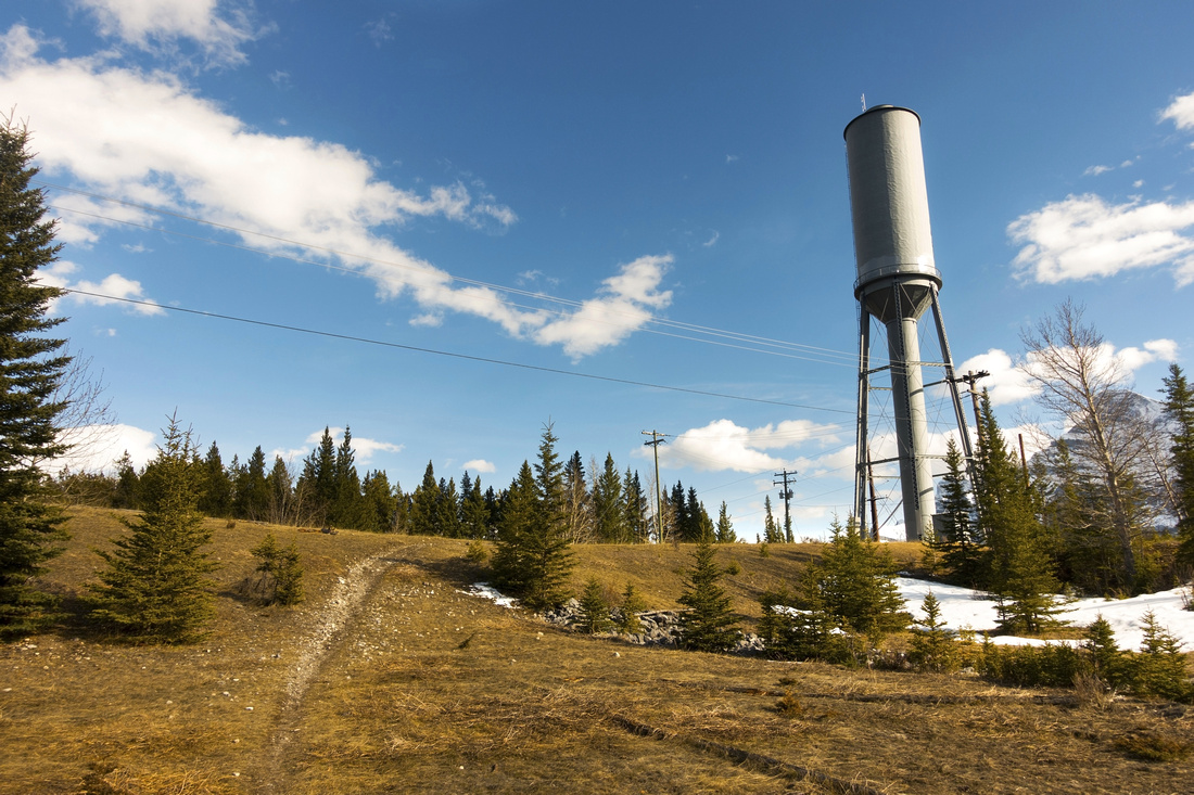 The Water Tower
Water Tower, landmark seen from Trans-Canada just east from Banff/Minnewanka exit . Old weathered Park sign claims "3.9 km to Cascade Ponds, 1.7 km to Johnson Lake" The Water Tower
Water Tower, landmark seen from Trans-Canada just east from Banff/Minnewanka exit . Old weathered Park sign claims "3.9 km to Cascade Ponds, 1.7 km to Johnson Lake" |
|||
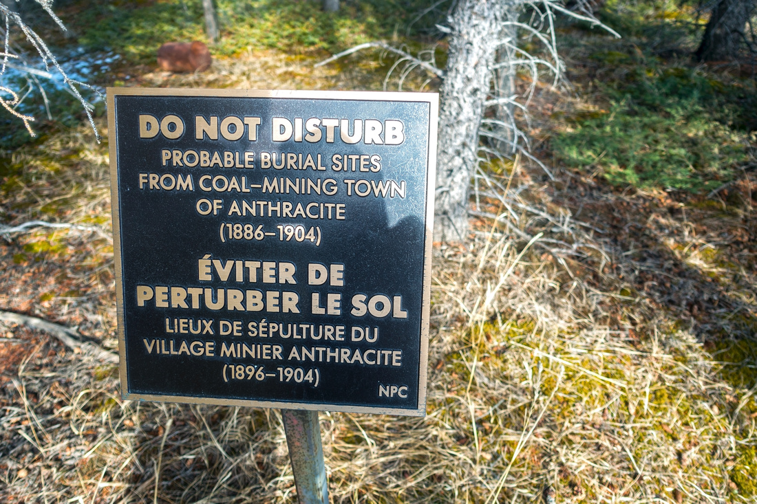 Anthracite Burial Site
Table indicating possible anthracite coal-mining town burial site ~5min past the Water Tower Anthracite Burial Site
Table indicating possible anthracite coal-mining town burial site ~5min past the Water Tower |
|||
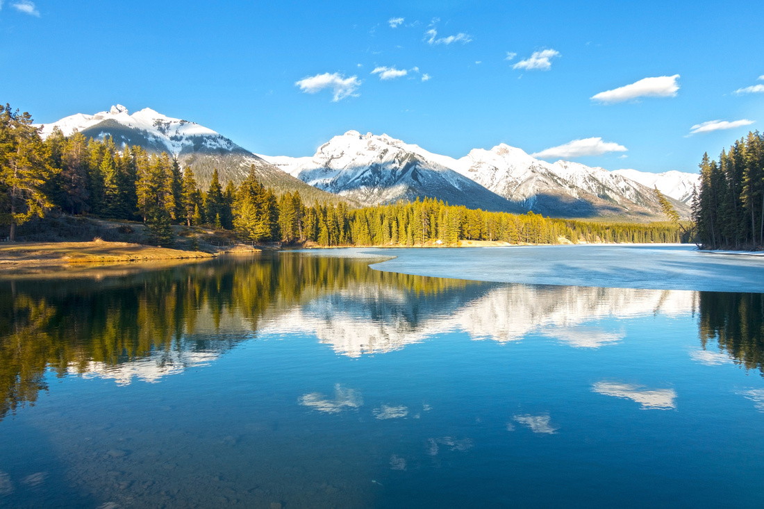 Johnson Lake
Beautiful Johnson lake with snowy peaks of Fairholme Range on Horizon as Tower trail joins lakeshore trail near the outlet Johnson Lake
Beautiful Johnson lake with snowy peaks of Fairholme Range on Horizon as Tower trail joins lakeshore trail near the outlet |
|||
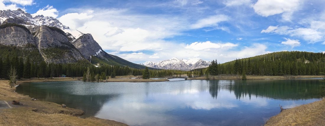
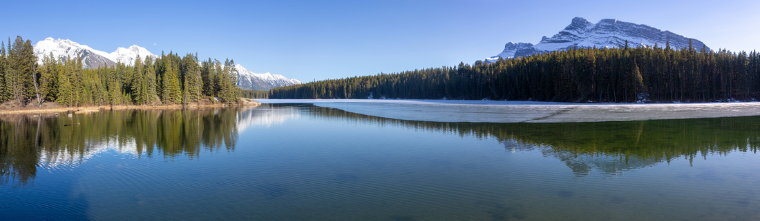 Johnson Lake
 Panorama in 2nd half of April '24 Johnson Lake
Johnson Lake Panorama in 2nd half of April '24 |
|||
|
|||
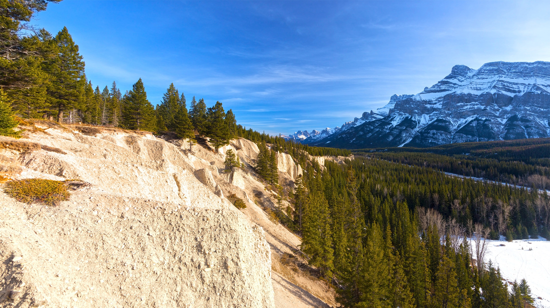
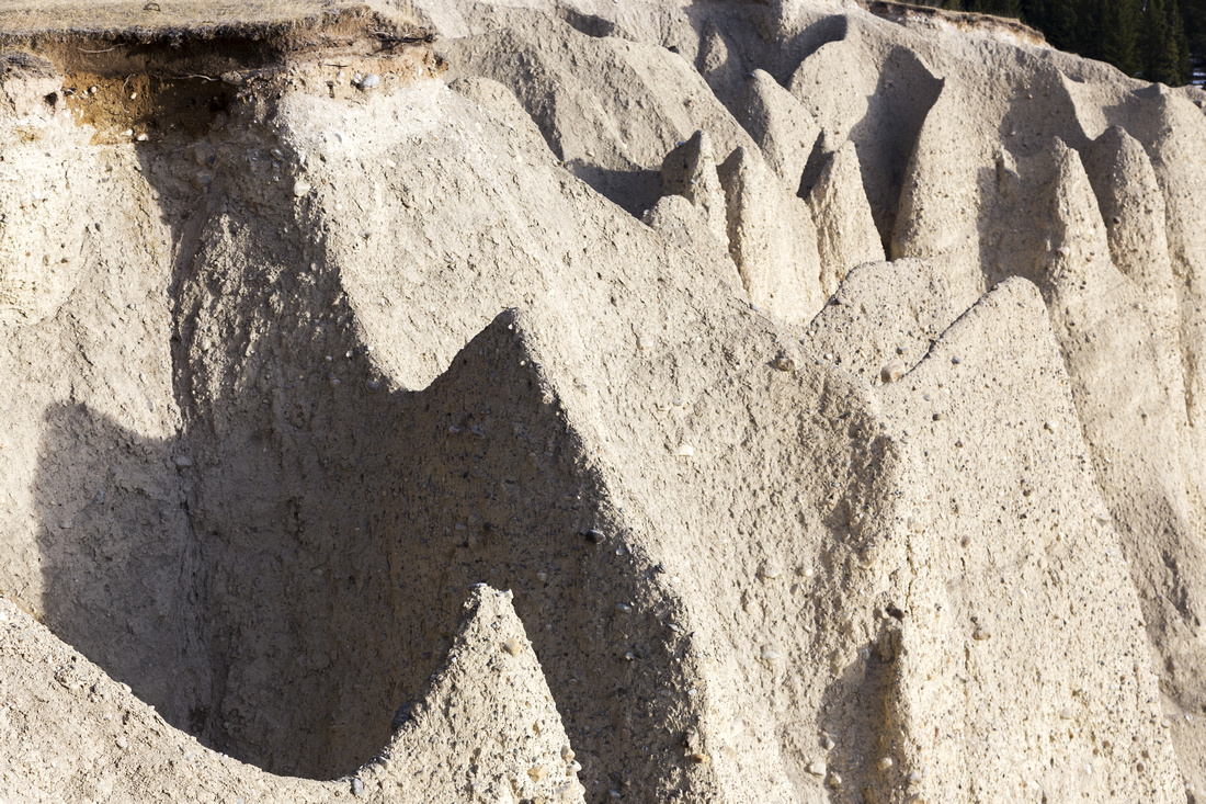 Sandstone Cliffs
Eroded Sandstone Cliffs below south part of Benchlands Ridge Sandstone Cliffs
Eroded Sandstone Cliffs below south part of Benchlands Ridge |
|||
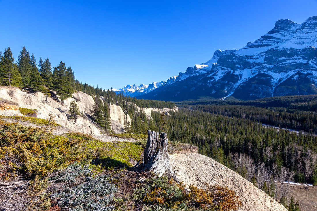 Fairholme Benchlands
View down Benchlands Ridge in 2nd half of April '24 Fairholme Benchlands
View down Benchlands Ridge in 2nd half of April '24 |
|||
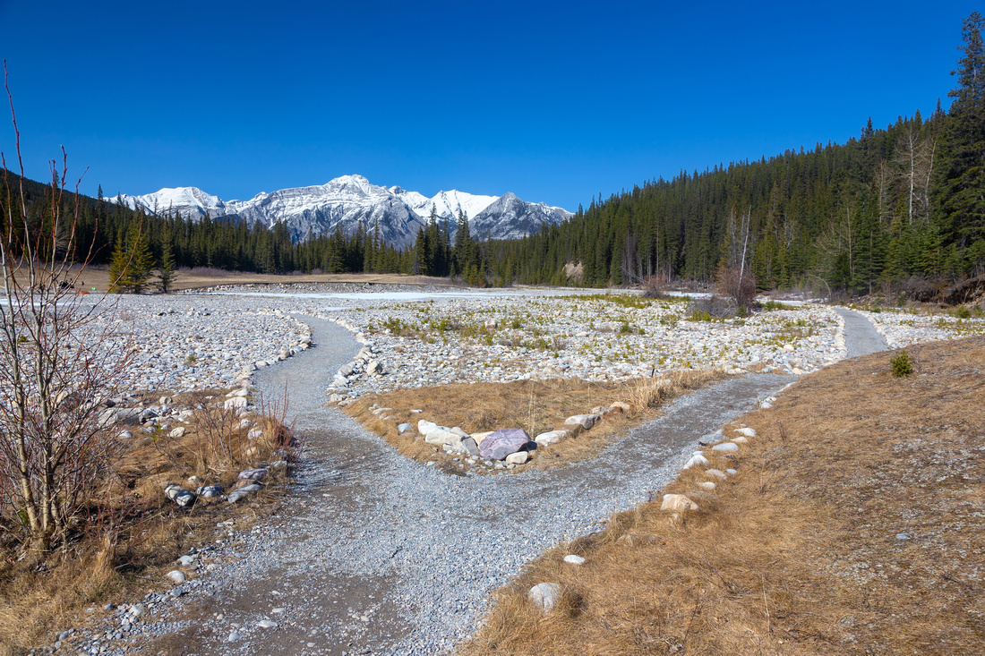
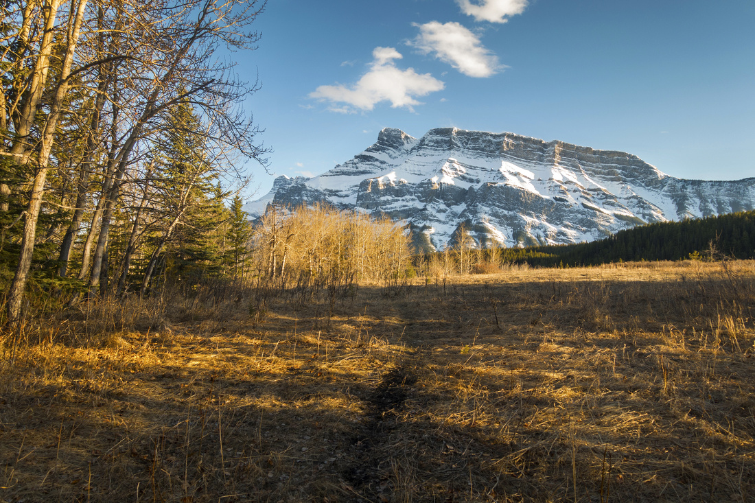 Aspen Meadows
 with view of Rundle Range at Trans-Canada level below Tower Trail Aspen Meadows
Aspen Meadows with view of Rundle Range at Trans-Canada level below Tower Trail |
Abstract
| Overall Difficulty | D2 | Meandering ridgewalk with one steeper, but short part. Minor seasonal rock-hop creek crossings | |||
| Snow Factor | S1 | Sunny exposure often dries out trail throughout the winter. Rise above Cascade Ponds might be icy | |||
| Scenery | Delightful montane ridge with great views of Rundle and Fairholme Ranges. Cascade Ponds and Johnson Lake | ||||
| Trail/Marking | Very Good | Wide and well defined trail. Neither end (Cascade Ponds or Johnson Lake) is marked | |||
| Suggested Time | 3-5hr | 3hr just for Tower Trail round trip. Add 1-2 hr if venturing down south Benchlands, depending far you decide to go | |||
| Elevation | Mainly flat with initial rise above Cascade Ponds (~100m) |
Round Trip: ~10km (Tower Trail). Add 3-4km for south Benchlands |
|||
| Gear | Day Hikers. Micro-spikes might be useful for icy sections in winter | ||||
| Water | Johnson Lake outlet and seasonal creeks. Trail is short; carry max 1L | ||||
| Dog Friendly | Yes | Standard back-country precautions. Be courteous to mountain bikers. Please keep control of your pet at Cascade Ponds and Johnson Lake as these are major tourist areas | |||
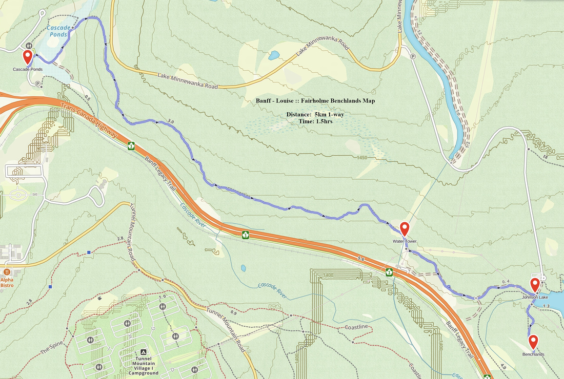 Fairholme Benchlands GAIA Map
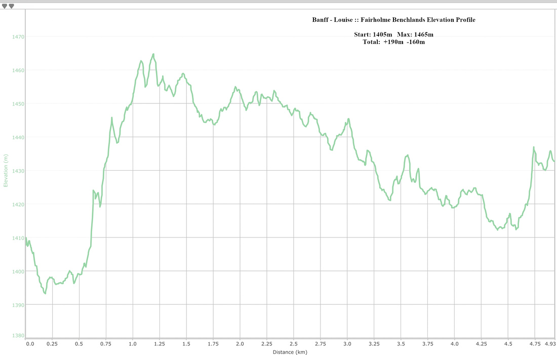 Fairholme Benchlands Elevation Profile