Google Map |
Rockies :: Banff-Louise :: Citadel Peak |
GPS Track |
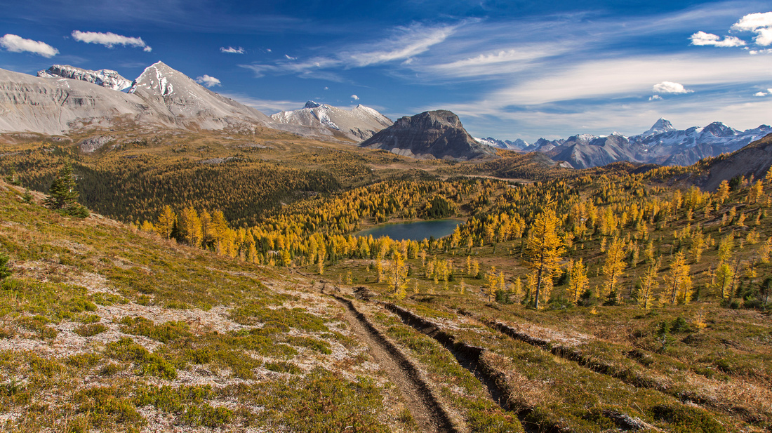 
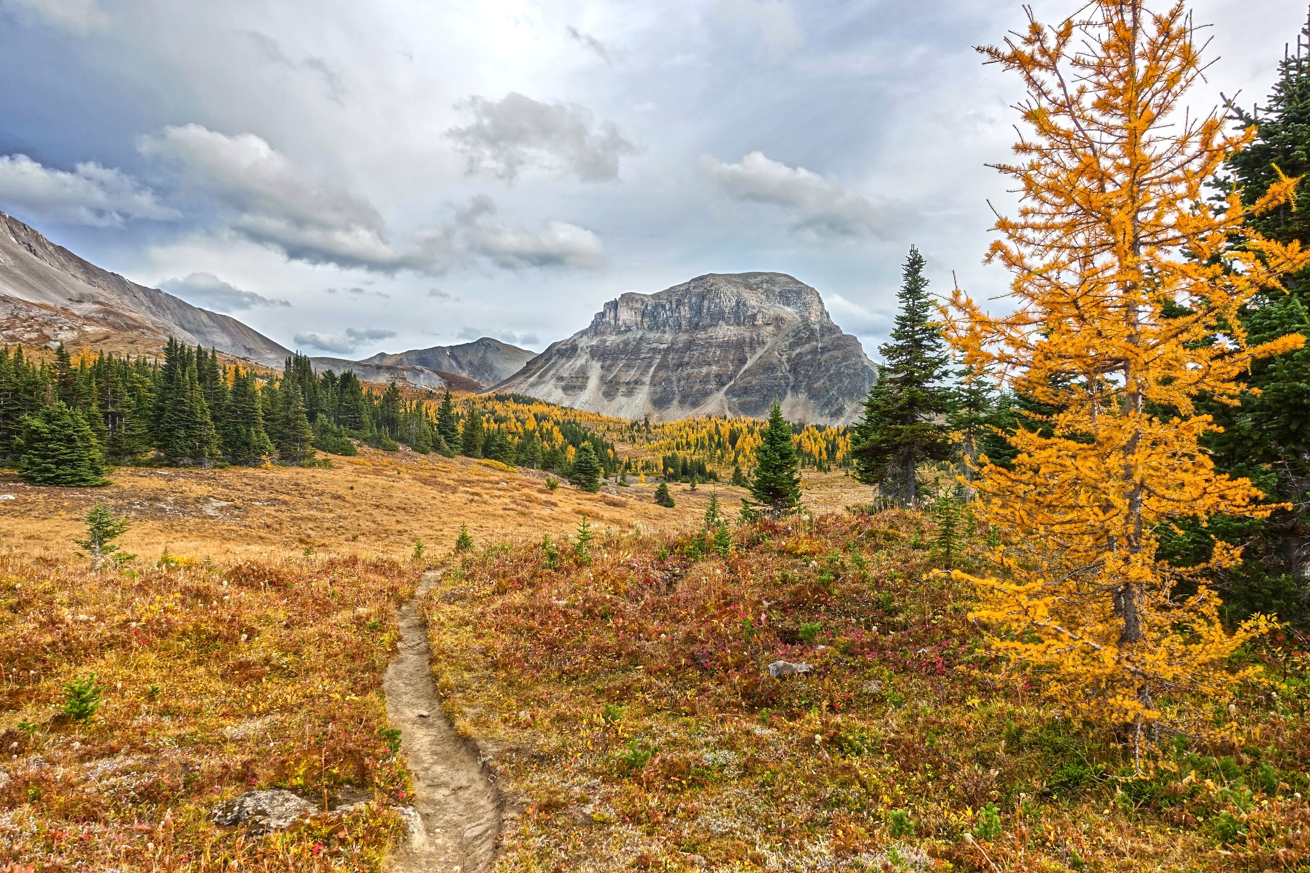
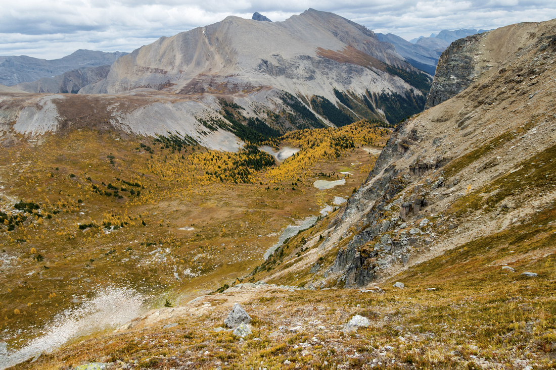
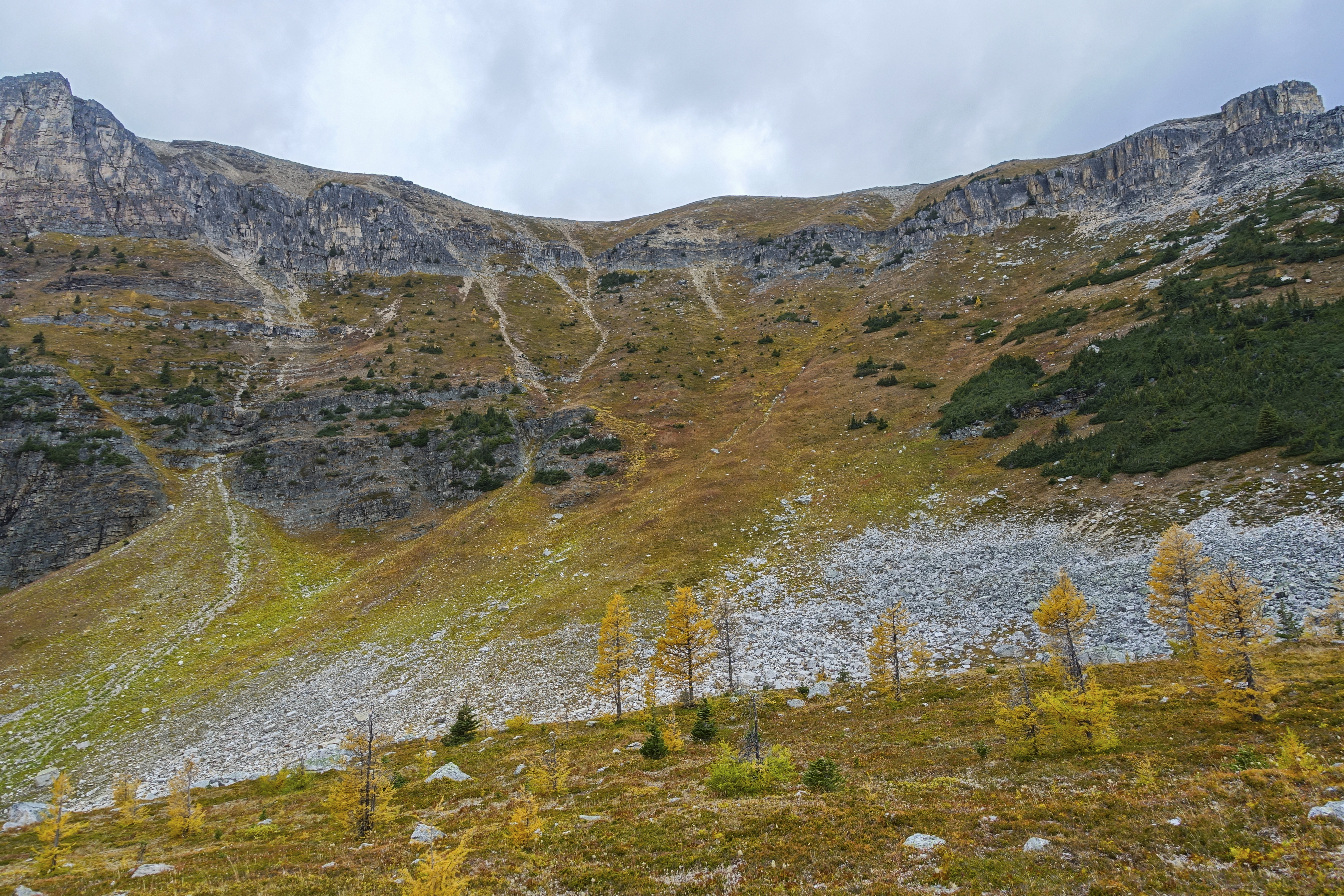
Panoramic View from Quartz Hill towards Citadel Peak. Howard Douglas Lake surrounded by golden larches below. Picture taken on a previous year trip |
|||
| Trip Summary | |||
September 21, 2020
Citadel Peak is frequently overlooked despite steady flow of backpackers bound for Mt. Assiniboine. Towering above Citadel Pass it provides great views and is well worth either on its own or side trip during Assiniboine backpack. Approach is spectacular with several hours of prime alpine hiking, specially during golden autumn larch color change. Trip is feasible as day hike from Sunshine Village, but camping at Howard Douglas campground is valid option. Wild bivi at nearby Fatigue Pass is another possibility that allows ascent of nearby Fatigue peak and several others. 5.5km Sunshine access road can be walked or cycled; in summer investing in regular tourist bus (when running - in 2020 it was cancelled due to COVID-10 pandemic) is worth considering as overall distance is wee bit long for out-and-back dayhike. Abstract stats are given for upper Sunshine Village return.
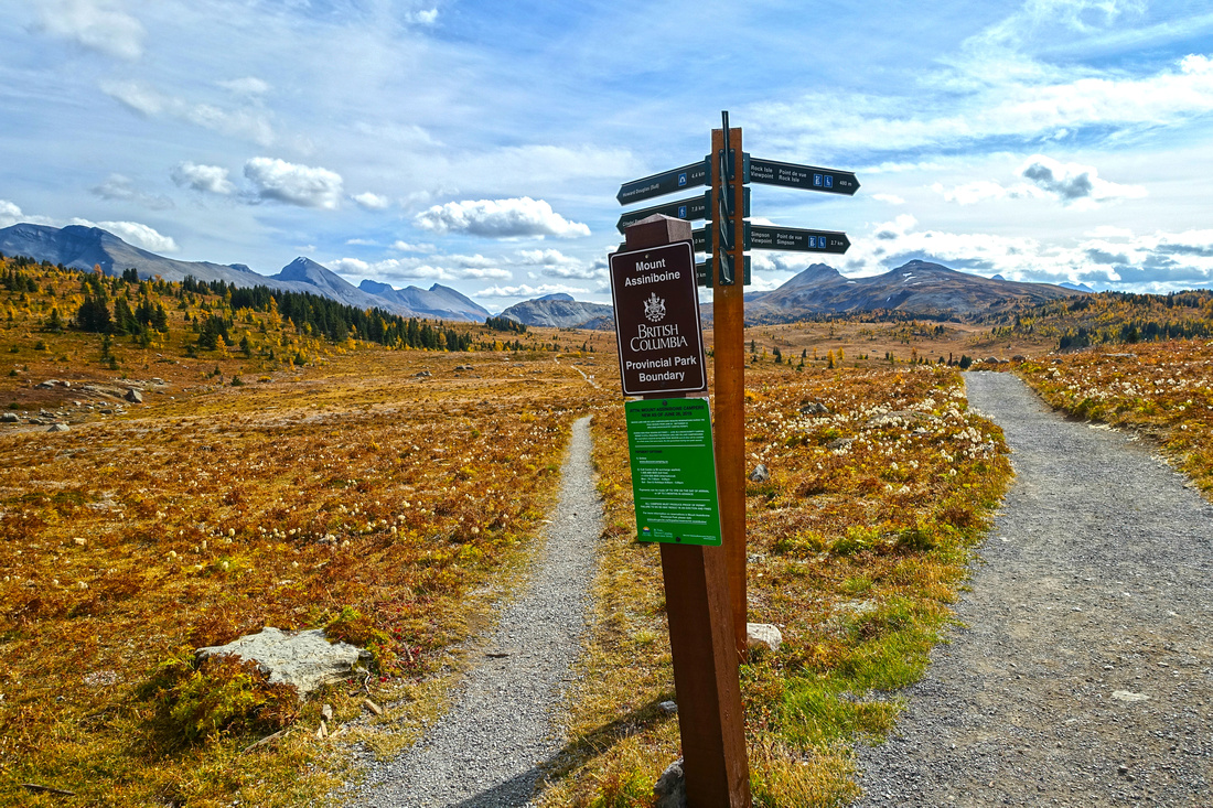
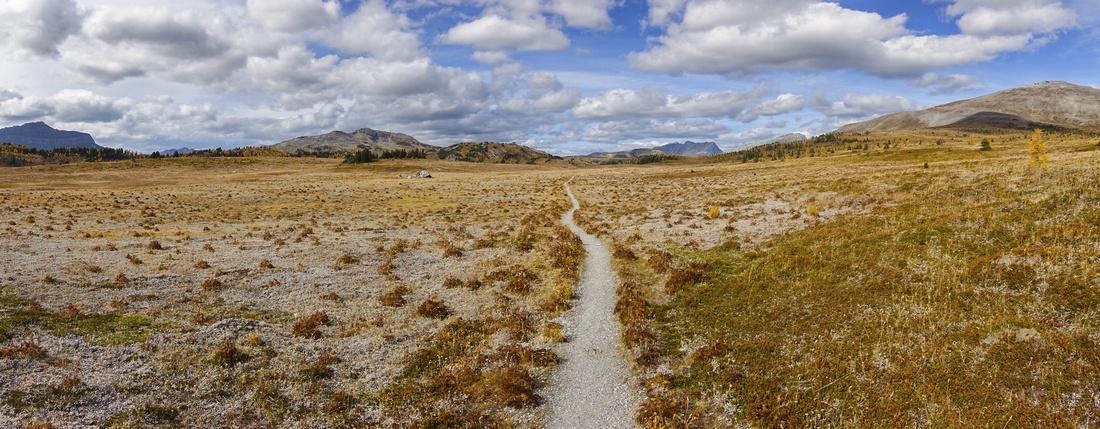
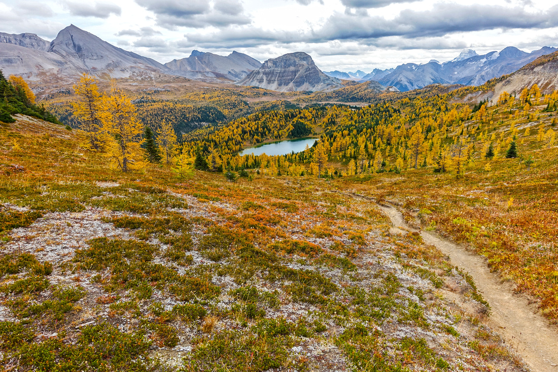
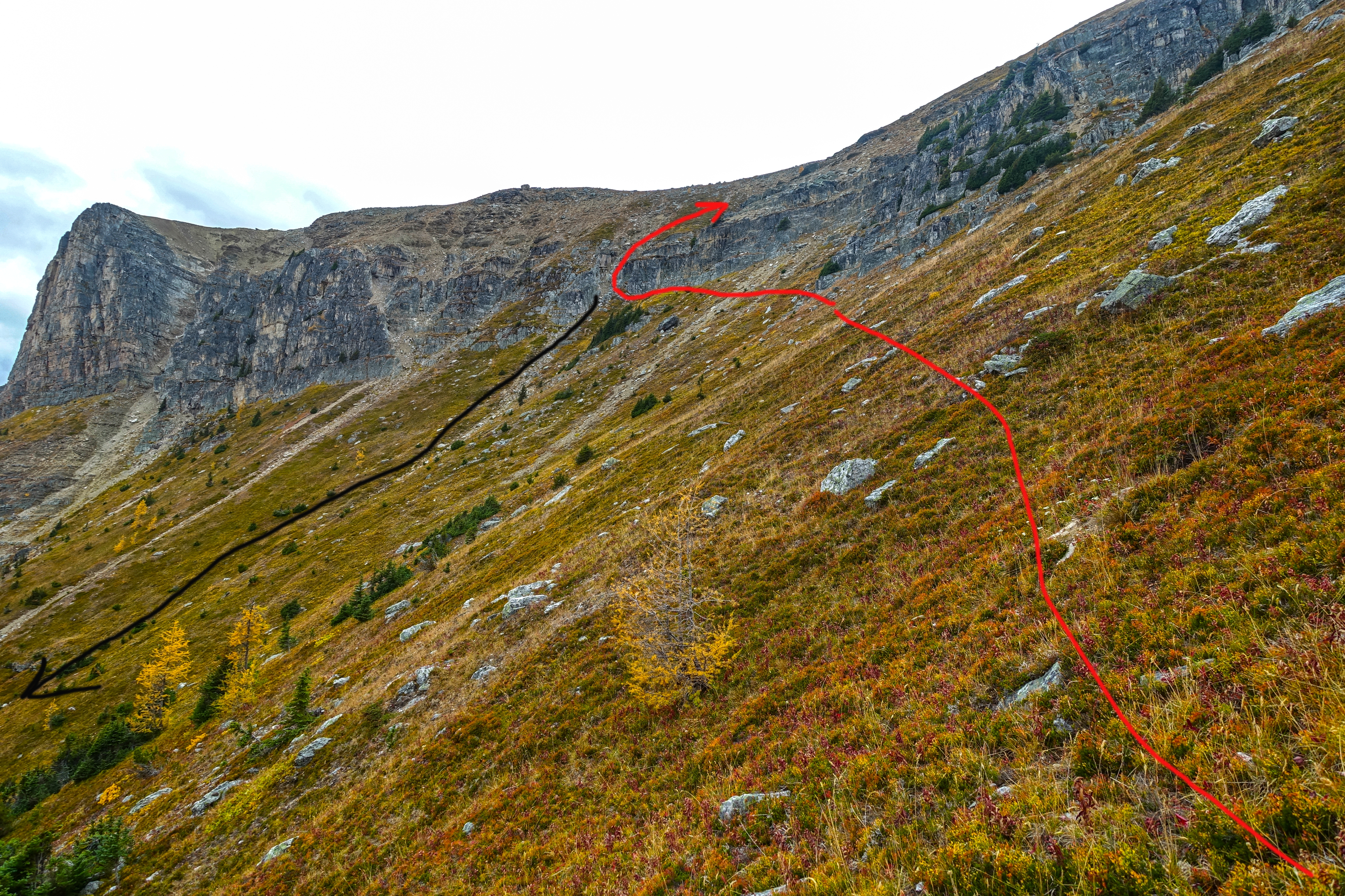
Follow Rock Isle lake trail to BC/Alberta provincial border and Continental Divide; take signed left fork for Mt. Assiniboine, about 20-25min from upper Sunshine Village. Several kilometers of spectacular alpine hiking follow. Trail dips briefly through stint of larch forest, then rises through series of switchbacks to Quartz Hill Pass (lead photo). Views are simply outstanding. Descend to Howard Douglas lake (campground is on east side and has metal lockers, picnic bench and dedicated tent pads). Continue over equally beautiful Citadel Meadows and climb to Citadel Pass; ~2.5 - 3 hrs of moderate pace from Sunshine Village. Assiniboine backpackers can stash their heavy overnight pack here; Citadel Peak side extension will take 1.5-2 hrs only. Assiniboine trail descends on the other side, but do not follow it; instead angle right and up, aiming for center part of grassy slope. Peeling cliffs in upper part can be tackled at several places and offer various degree of difficulty. Easiest gully in left part is nothing but steep hiking, but grade will tire you. Be ware of heather when wet as it can be slick, specially on descent. Above the gully angle right to highest point that has summit cairn, but usually no register. If time allows walk over to south end for in-your-face of Mt. Assiniboine a.k.a "Matterhorn of the Rockies". On descent, instead of sidehilling back to Citadel Pass, descend directly down and intersect trail some 200m below Citadel Pass. Return the same way to either Howard Douglas "base camp" or Sunshine Village. |
|||
|
Gallery |
|||
 Great Divide Junction
 ~20min above upper Sunshine Village Terminal. Rock Isle Lake right, Mt. Assiniboine left Great Divide Junction
Great Divide Junction ~20min above upper Sunshine Village Terminal. Rock Isle Lake right, Mt. Assiniboine left |
|||
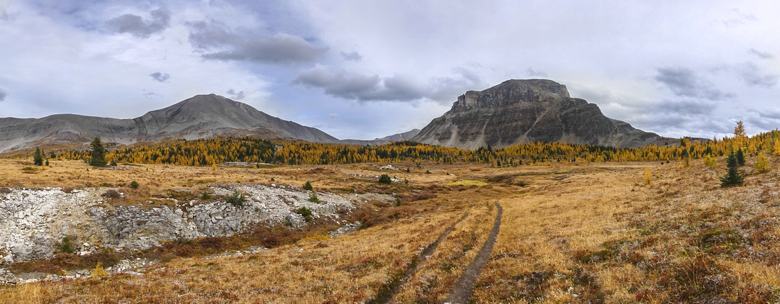
 Sunshine Meadows Panorama
Panoramic view back north across Sunshine Meadows hiking towards Quartz Hill. One of most delightful Alpine Meadows in Canadian Rockies Sunshine Meadows Panorama
Panoramic view back north across Sunshine Meadows hiking towards Quartz Hill. One of most delightful Alpine Meadows in Canadian Rockies |
|||
 Quartz Hill Pass
Quartz Hill Views towards Howard Douglas Lake and still distant Citadel Peak. Unfortunately weather conditions were not as good as on title photo Quartz Hill Pass
Quartz Hill Views towards Howard Douglas Lake and still distant Citadel Peak. Unfortunately weather conditions were not as good as on title photo |
|||
|
|||
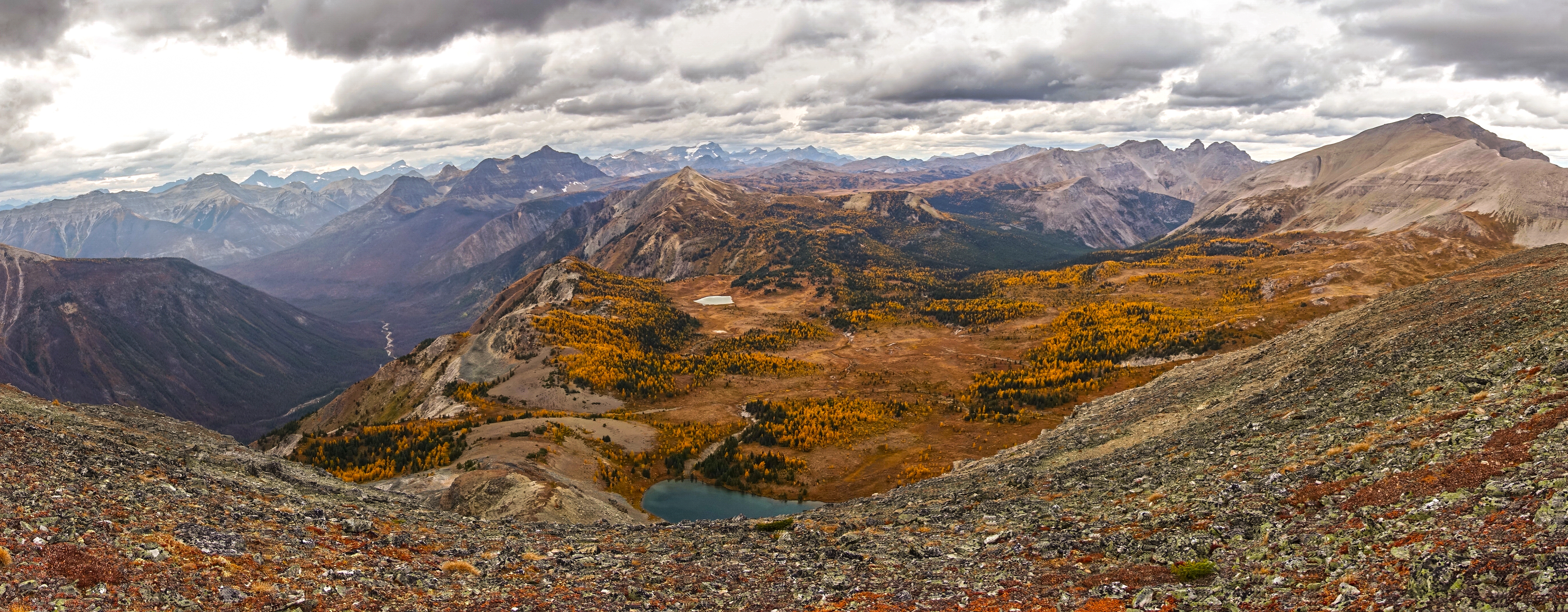
 Citadel Meadows Panorama
Easy Talus gully breaching the cliffs - just steep hiking Citadel Meadows Panorama
Easy Talus gully breaching the cliffs - just steep hiking |
|||
|
|||
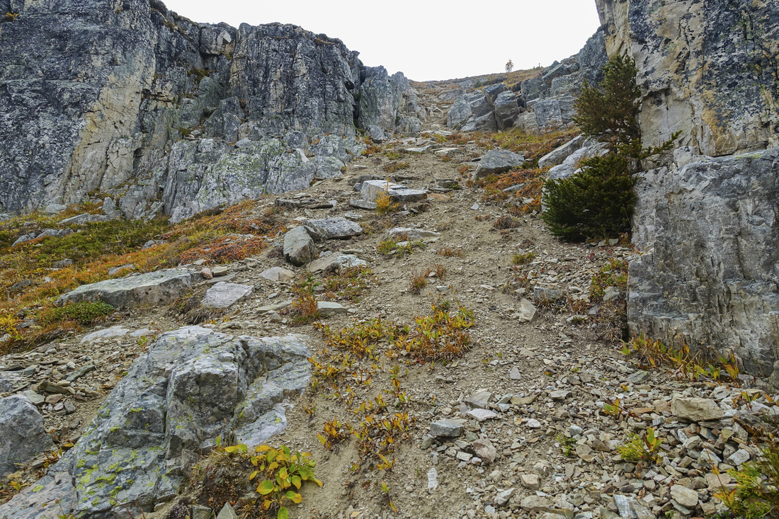 Citadel Crux Gully
Easy Talus gully breaching the cliffs - just steep hiking Citadel Crux Gully
Easy Talus gully breaching the cliffs - just steep hiking |
|||
 Above Crux Gully
View back after scrambling through the gully; remainder of ascent is back on grass. Fatigue Pass center left Above Crux Gully
View back after scrambling through the gully; remainder of ascent is back on grass. Fatigue Pass center left |
|||
|
|||
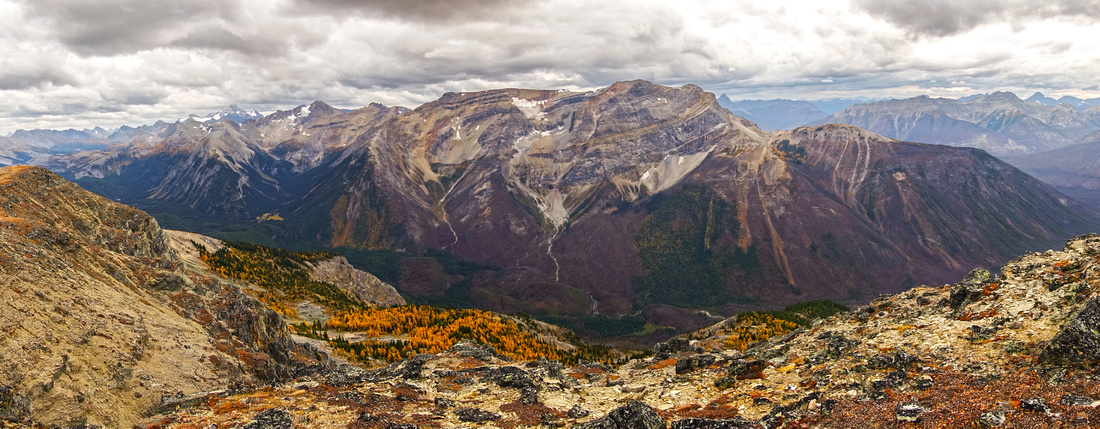 Simpson Ridge Panorama
 to the west, with obvious wildfire burns that make access very hard Simpson Ridge Panorama
Simpson Ridge Panorama to the west, with obvious wildfire burns that make access very hard |
|||
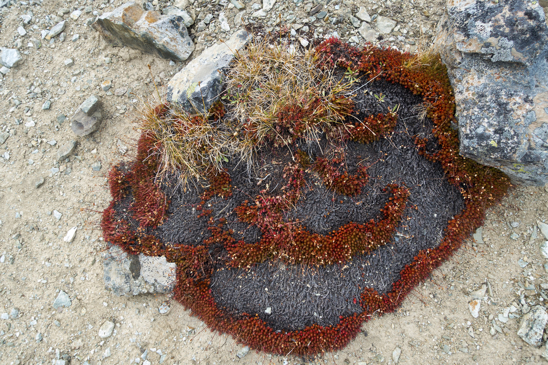 Heart Shaped Lichen
Interesting bit of vegetation that somehow managed to survive on Citadel summit plateau Heart Shaped Lichen
Interesting bit of vegetation that somehow managed to survive on Citadel summit plateau |
|||
|
|||
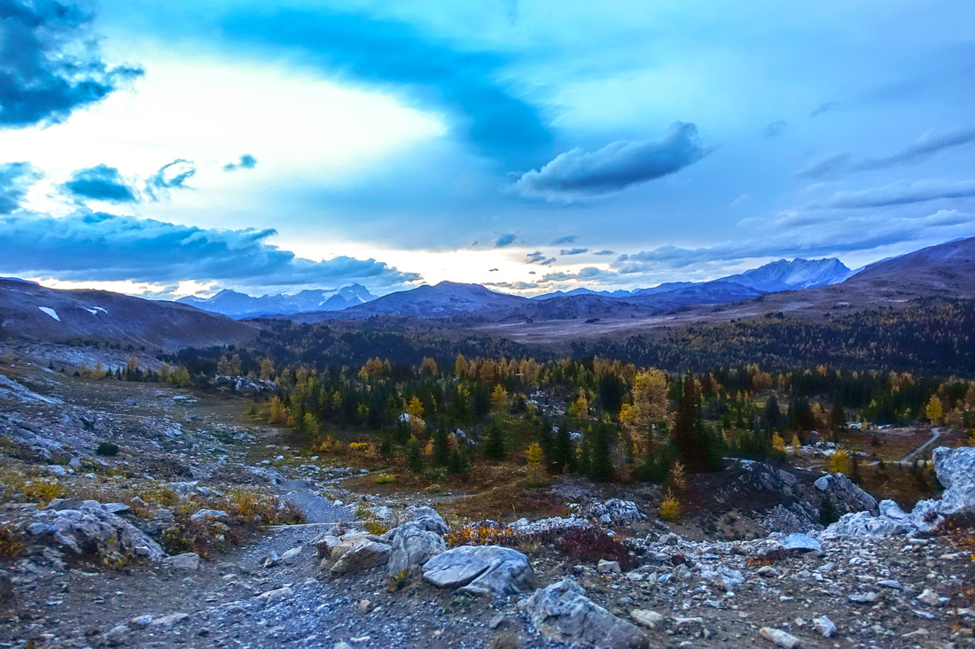 Quartz Hill Sunset
Beautiful Sunset Skies from Quartz Hill Pass on return Quartz Hill Sunset
Beautiful Sunset Skies from Quartz Hill Pass on return |
|||
Abstract
| Overall Difficulty | D4 | Gentle Trail hiking to Citadel Pass, followed by steep but grass slope ascent that can be slippery and dangerous when wet. Significant overall if done as out-and-back day | |||
| Snow Factor | S2(4) | Easy travel to Citadel Pass. Steep east facing ascent slope could be avalanche trap and requires stable snow conditions | |||
| Scenery | One of most expansive alpine meadows in Canadian Rockies. Specially recommended as Autumn Larch Trip | ||||
| Trail/Marking | Very Good/None | Official Trail with signposts to Citadel Pass, none after | |||
| Suggested Time | 7-8 hrs | Time estimate from upper Sunshine Village. Add ~2hrs if walking Sunshine Road. 4-5hrs return from Howard Douglas Lake campground | |||
| Elevation | Start: 2150m Max: 2610m Total: +700m -300m (from Sunshine Village | Distance: (Sunshine Village return): 21 km | |||
| Gear | Day hikers sufficient in summer conditions. Hiking poles highly recommended for steep slope after Citadel Pass. Skis and avalanche gear in winter; distance likely too long for snowshoes | ||||
| Water | Howard Douglas Lake outlet and seasonal creeks in Citadel Meadows. Carry ~2L | ||||
| Dog Friendly | Yes | Standard back-country travel precautions. Grizzly bears are often seen in Sunshine Meadows | |||
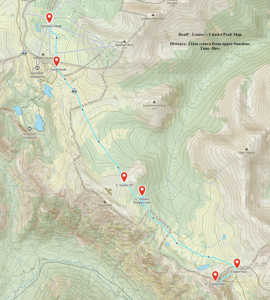 Citadel Peak GAIA Map
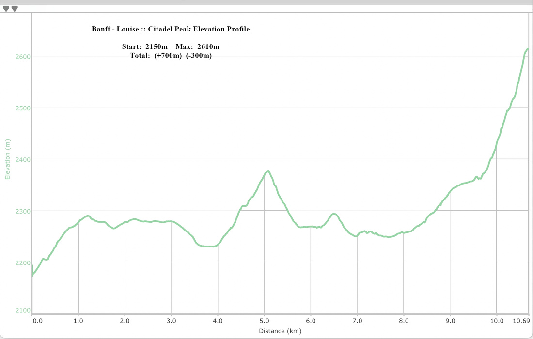 Citadel Peak Elevation Profile