Google Map |
Rockies :: Banff-Louise :: Armor Peak |
GPS Track |
|
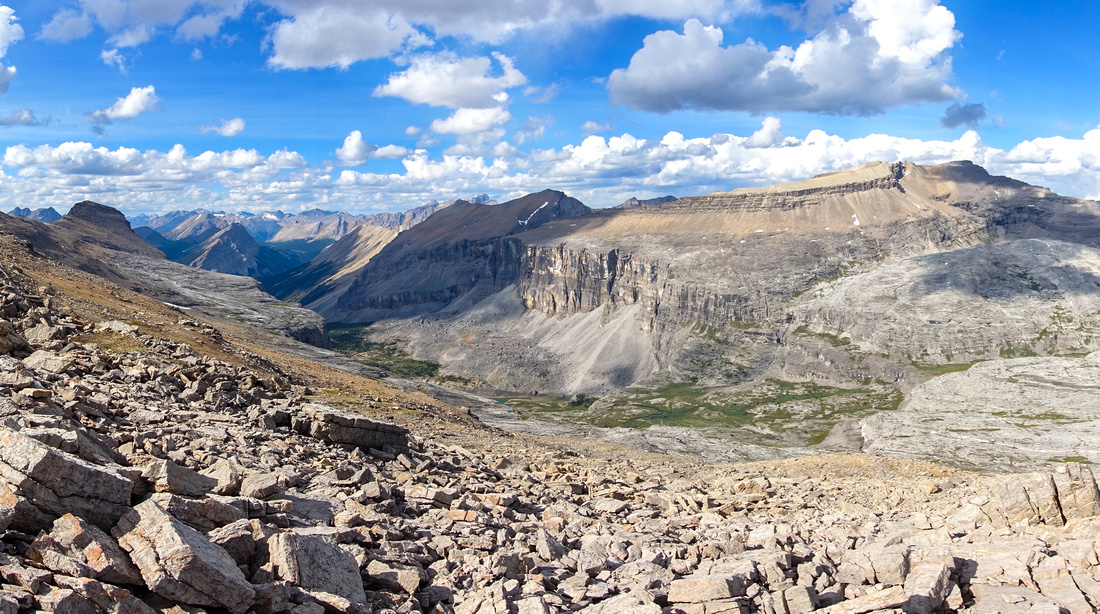
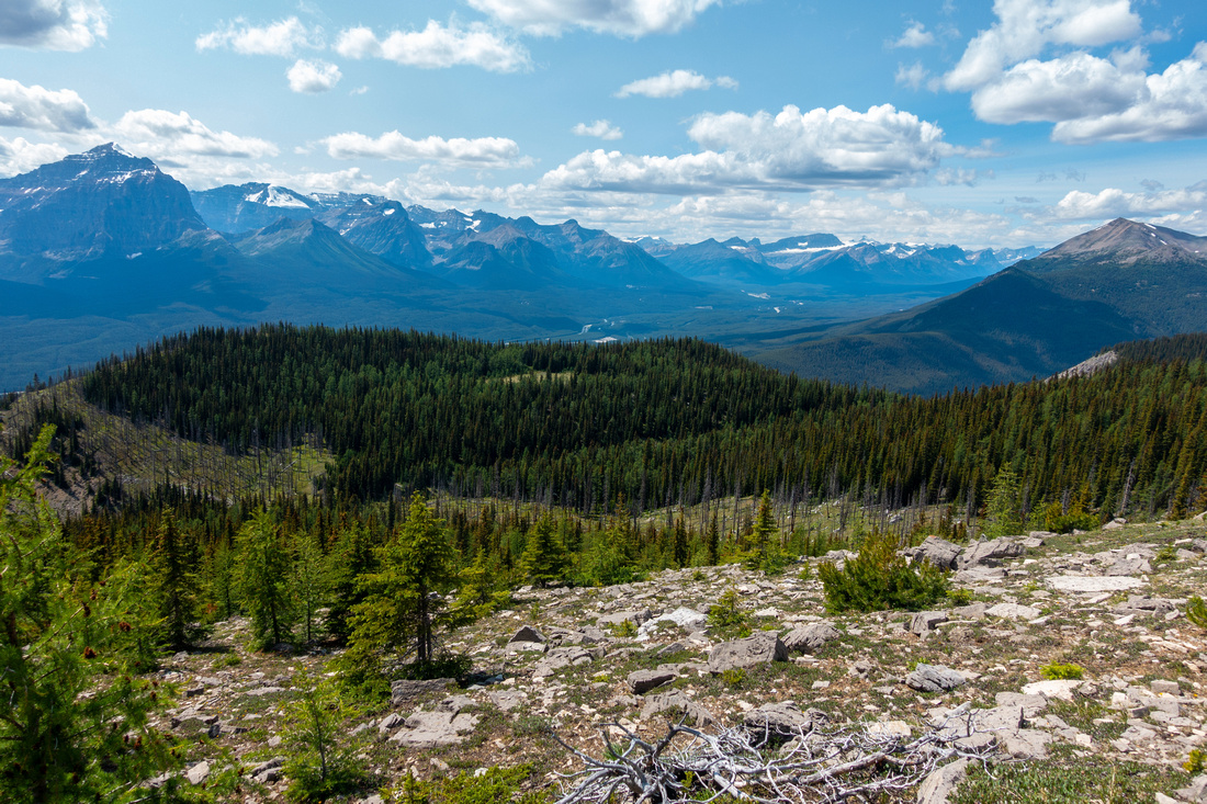
"Wonder Valley" between Protection Ridge and Mt. Pulsatilla (R). Armor Peak extreme center left |
|||
| Trip Summary | |||
July 2, 2023
Armor Peak is north end of Protection Ridge, seen as long line of cliffs on east side as one drives from Lake Louise towards Castle Junction. Route is not technical, but long and requires fair amount of fitness. Approach to treeline is via unofficial Baker Creek Mine trail (sometimes also called Protection Mountain Trail), starting from Bow Valley Parkway (1A) some 12km north from Castle Junction. Parking is at pullout on west side of the road, and unsigned - it will be roughly halfway between Baker Creek Chalets and Protection Mountain Campground. See first photo in gallery, use GPS track download. Narrow trail is mostly well defined and generally easy to follow. It will take 2.5hrs of moderate pace for ~6km and ~900m vertical to treeline below the mine. Trail vanishes in larch meadows and this is good spot to turn back if not going further.
From the mine traverse horizontally right (south) couple of gullies without gaining much elevation, then head up talus slope that is longer than it appears. Upper half is steeper and fairly lose; stay climber right on ascent for some solid rock as scree spurs to the left are better for descent. This slope would be avalanche trap in winter and no-go zone. Upon topping up (~1.5hrs from the mine), turn left and traverse ridge crest heading north towards obvious highpoint - Armor Peak. Several bumps along the way cause some elevation loss/gain, while final part to the summit has some shifting boulders but only last few meters is hands on scrambling. With shallow snow cover this part could be problematic from stability perspective. This ridgewalk will take ~1.5hrs, roughly 3 hrs from the mine. In 2023 summit had (pink) register with only handful of entries.
Views are fantastic as expected, in particular Bulwark Peak to the north and Protection Mtn to the east. Specially intriguing is Mitella Lake deep below. Bivi by the lake would likely be fantastic in total solitude, but it is very hard to get there - technical descent from Wonder Valley, horrendous trash from Baker Creek side. Return is the same way; take care descending lose talus below Protection Ridge to the Mine. Outing is very long and I was quite beat on my trip, stumbling back to the car in total darkness after hiking last part with headlamp. |
|
Gallery |
|||
  View from unmarked trailhead on Bow Valley Parkway between Protection Campground and Baker Creek Chalets. Trail is on left side
 |
|||
 Mine Sign
Old Weathered Table ~1km into the hike. It will take at least 2hrs from here to treeline Mine Sign
Old Weathered Table ~1km into the hike. It will take at least 2hrs from here to treeline |
|||
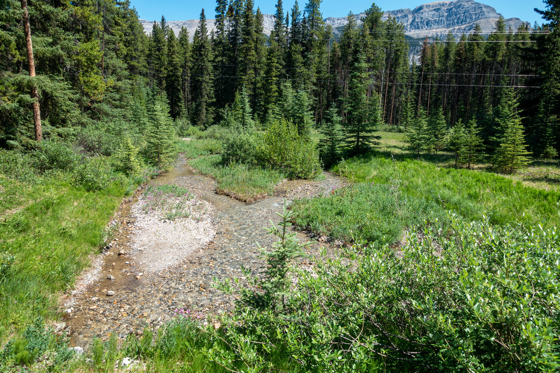
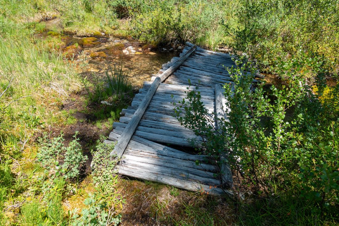 Marsh Area
Old decaying wood bridge crossing muddy flats section Marsh Area
Old decaying wood bridge crossing muddy flats section |
|||
 Forest Trail
Trail starts sustained ascent after 45min, gaining ~800m vertical in less than 3km Forest Trail
Trail starts sustained ascent after 45min, gaining ~800m vertical in less than 3km |
|||
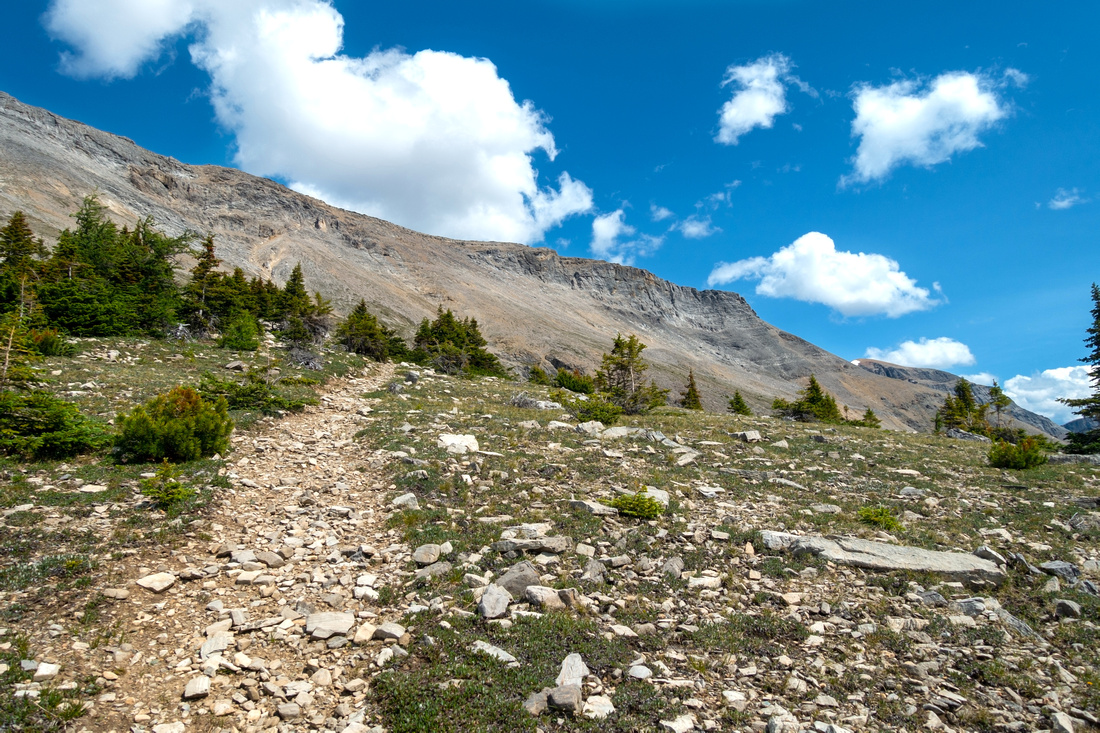 Treeline Meadows
Trail vanishing above Treeline by old miners settlement site. 2.5hrs of moderate pace from parking Treeline Meadows
Trail vanishing above Treeline by old miners settlement site. 2.5hrs of moderate pace from parking |
|||
 Bow Valley
Westerly Panorama from treeline; Louise group center left. This is excellent spot for a break Bow Valley
Westerly Panorama from treeline; Louise group center left. This is excellent spot for a break |
|||
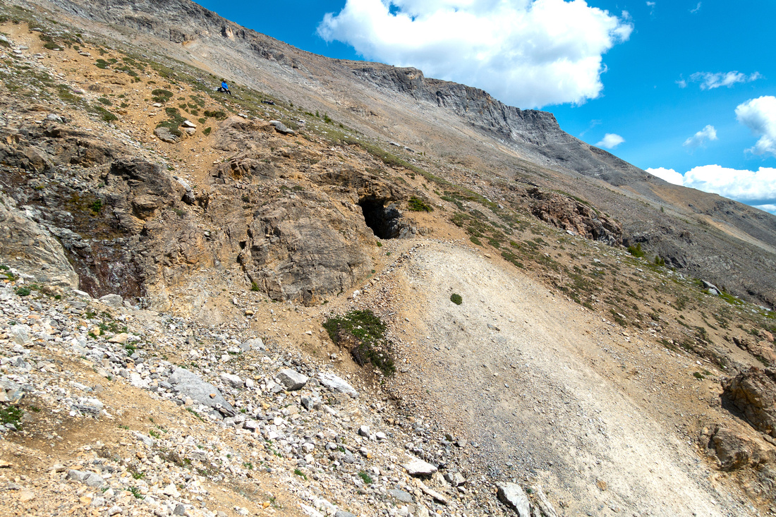 Baker Creek Mine
 Entrance is logical turnaround point if not continuing to the Ridge Baker Creek Mine
Baker Creek Mine Entrance is logical turnaround point if not continuing to the Ridge |
|||
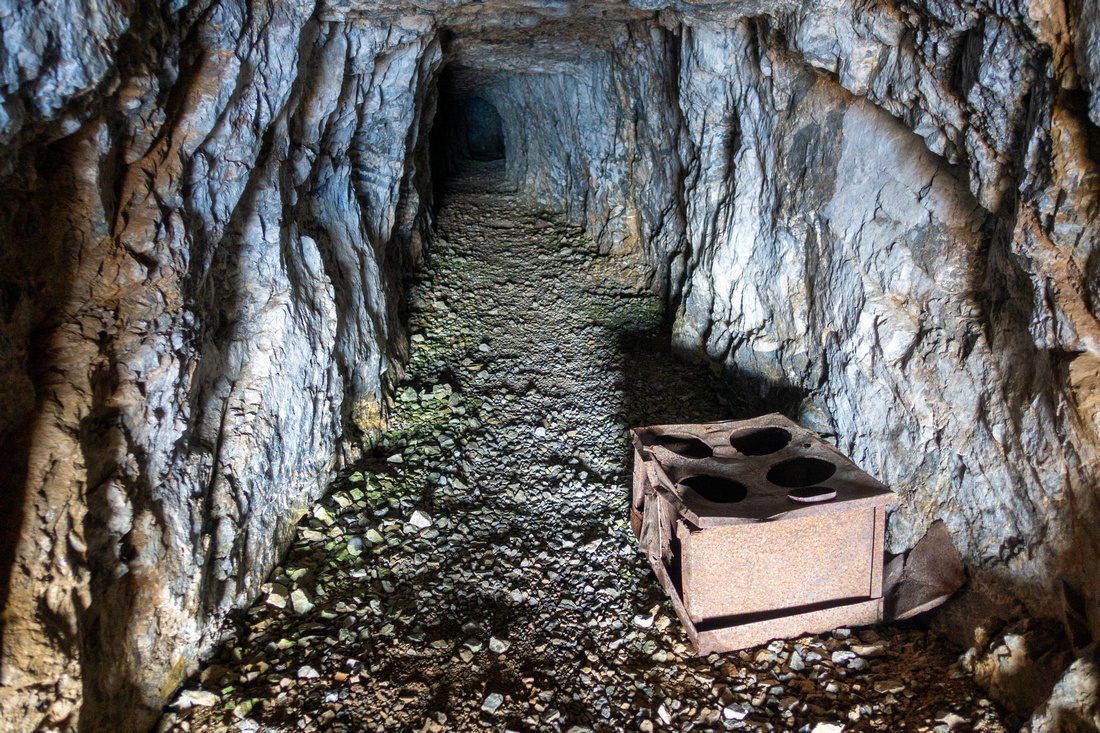 Mine Shaft
Fairly shallow Baker Creek Mine, safe to explore, could provide shelter in inclement weather Mine Shaft
Fairly shallow Baker Creek Mine, safe to explore, could provide shelter in inclement weather |
|||
 Scramble Route
Approximate Protection Ridge scramble line. Going up angle right as there is more solid rock, while scree spurs to the left are better suited for descent. Seasonal water gully is last chance to top up water Scramble Route
Approximate Protection Ridge scramble line. Going up angle right as there is more solid rock, while scree spurs to the left are better suited for descent. Seasonal water gully is last chance to top up water |
|||
 Steep Angle
Taking a breather as talus slope steepens in upper part. Mine area lower left Steep Angle
Taking a breather as talus slope steepens in upper part. Mine area lower left |
|||
 Protection Ridge
Reaching Protection Ridge after ~1.5hrs of scree bash from the mine. Note cairn / wooden pole for return Protection Ridge
Reaching Protection Ridge after ~1.5hrs of scree bash from the mine. Note cairn / wooden pole for return |
|||
 Protection Ridgewalk
~2.5km Ridgewalk to Armor Peak (center). Bypass intervening bumps on left (west) side. Right (east) slope on this photo is considerably more lose and utterly unpleasant Protection Ridgewalk
~2.5km Ridgewalk to Armor Peak (center). Bypass intervening bumps on left (west) side. Right (east) slope on this photo is considerably more lose and utterly unpleasant |
|||
 "Problematic" Bump
Looking back at bump I made a mistake by trashing on east side (left, shade) going in "Problematic" Bump
Looking back at bump I made a mistake by trashing on east side (left, shade) going in |
|||
 Armor Panorama
Losing some elevation from last bump to saddle below Armor Peak. Route ascends summit bump on right side and besides shifting boulders is easier from what this photo might suggest. Only last few minutes offer some easy hands-on scrambling Armor Panorama
Losing some elevation from last bump to saddle below Armor Peak. Route ascends summit bump on right side and besides shifting boulders is easier from what this photo might suggest. Only last few minutes offer some easy hands-on scrambling |
|||
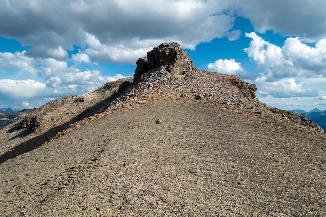
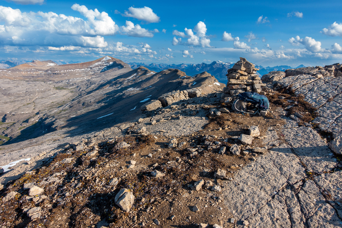 Armor Peak
Summit cairn at 2985m high Armor Peak had Pink Register; My entry was only second for 2023 Armor Peak
Summit cairn at 2985m high Armor Peak had Pink Register; My entry was only second for 2023 |
|||
 Bulwark Peak
Striking Bulwark Peak to the north is not scramble territory anymore Bulwark Peak
Striking Bulwark Peak to the north is not scramble territory anymore |
|||
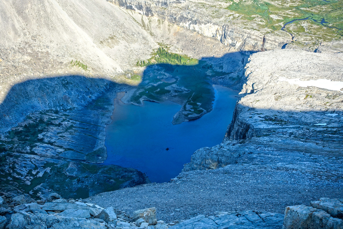 Mitella Lake
Rarely seen and even more rarely visited Mitella Lake below Armor Peak. Descent from Wonder Valley is technical and requires ropes, while trash via west drainage / Baker Creek is horribly overgrown Mitella Lake
Rarely seen and even more rarely visited Mitella Lake below Armor Peak. Descent from Wonder Valley is technical and requires ropes, while trash via west drainage / Baker Creek is horribly overgrown |
|||
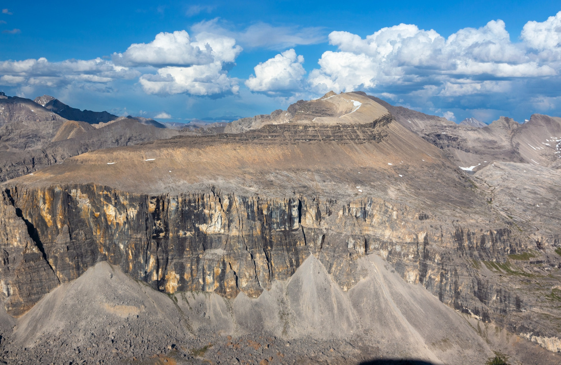 Protection Mountain
 directly across. It is a scramble, but very hard to do in a day due to remoteness. Best strategy is probably bivi somewhere in Wonder Valley, approaching either via standard Rockbound Lake / Stuart Knob or via Protection Ridge Protection Mountain
Protection Mountain directly across. It is a scramble, but very hard to do in a day due to remoteness. Best strategy is probably bivi somewhere in Wonder Valley, approaching either via standard Rockbound Lake / Stuart Knob or via Protection Ridge |
|||
 Protection Basin
Looking south from Armor summit; length of Protection Ridge with intervening bumps that needs to be negotiated to the right Protection Basin
Looking south from Armor summit; length of Protection Ridge with intervening bumps that needs to be negotiated to the right |
|||
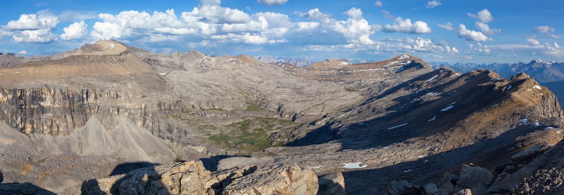
 Television Peak
Kane "Television Peak" (upper center right) on return; scramble via Protection Ridge is feasible. Wonder valley left; green patch has running water and would likely be great bivi spot Television Peak
Kane "Television Peak" (upper center right) on return; scramble via Protection Ridge is feasible. Wonder valley left; green patch has running water and would likely be great bivi spot |
Abstract
|
Overall Difficulty |
Shifting and lose talus. Some hands-on scrambling. Huge cumulative elevation gain |
||||
|
Snow Factor |
Considerable avalanche danger on steep slope above Baker Creek mine. Wet snow in shoulder season will make shifting boulders slippery and dangerous; wait for dry conditions |
||||
|
Scenery |
Protection Mountain, Wonder Valley, Pulsatilla Mountain. Aerial view of rarely seen Mitella Lake. Many BNP Eastern Ranges Peaks |
||||
|
Trail/Marking |
Poor |
Unofficial narrow trail to treeline, Route after with some cairns |
|||
|
Suggested Time |
11 hrs |
Return in summer (dry) conditions for Armor Peak, subtract ~2 hrs Protection Ridge south highpoint. 5-6 hrs return for Mine Only. Wonder Valley not feasible as day hike |
|||
|
Elevation |
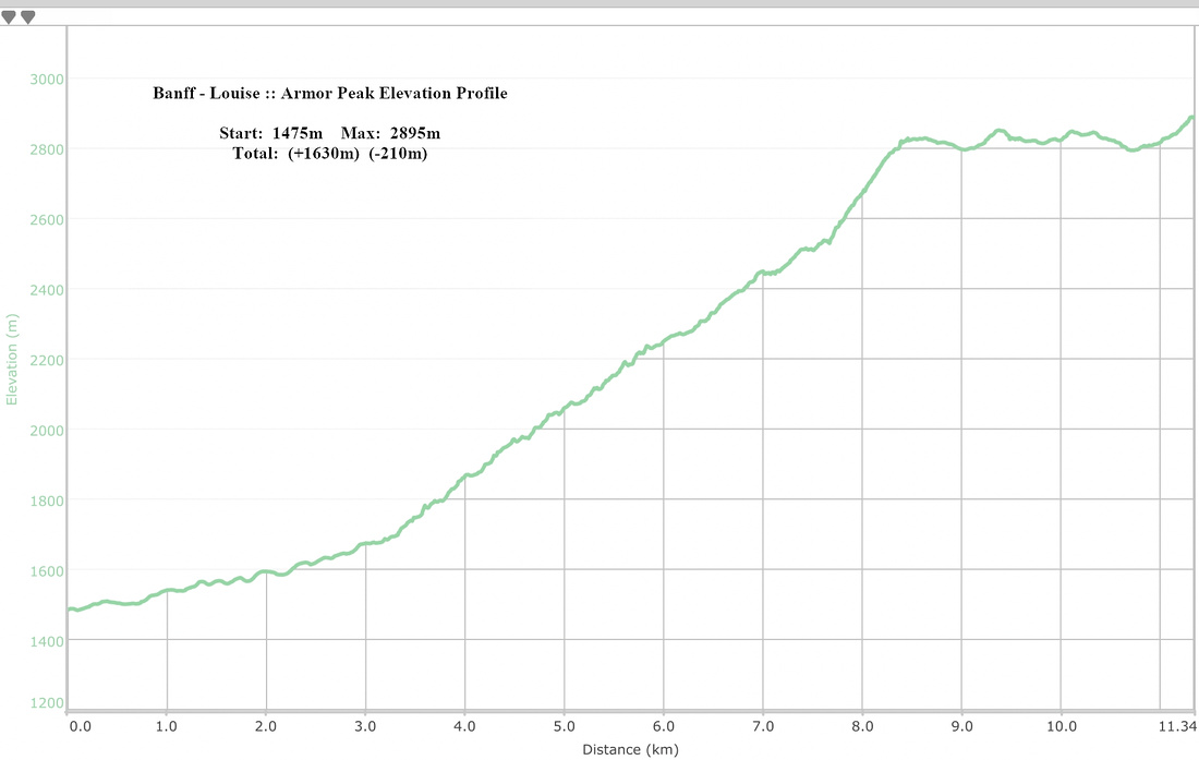
Start: 1475m Max: 2895m Total: ~1840m (+1630, -210) |
Round Trip: ~22km | |||
|
Gear |
Full hikers a must. Poles super helpful for talus scramble. Helmet mandatory in group. Headlamp recommended due to overall length, depending on season |
||||
|
Water |
Drainage creek below treeline. Seasonal water gullies by the mine dry out later in summer |
||||
|
Dog Friendly |
Yes |
Standard Back-country precautions |
|||
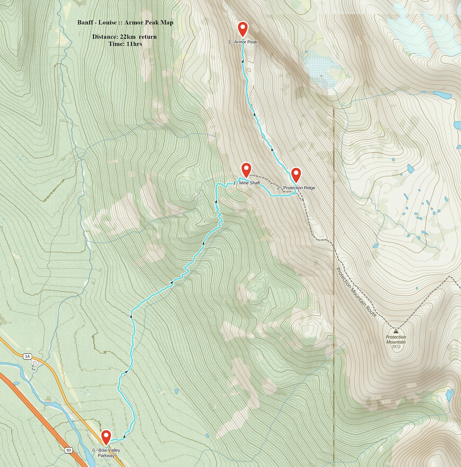 Armor Peak GAIA Map
 Armor Peak Elevation Profile