Google Map |
Rockies :: Alberta Foothills :: Siffleur Falls and Kootenay Plains Ridge |
GPS Track |
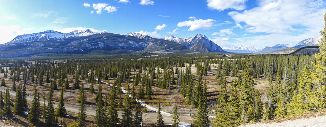 
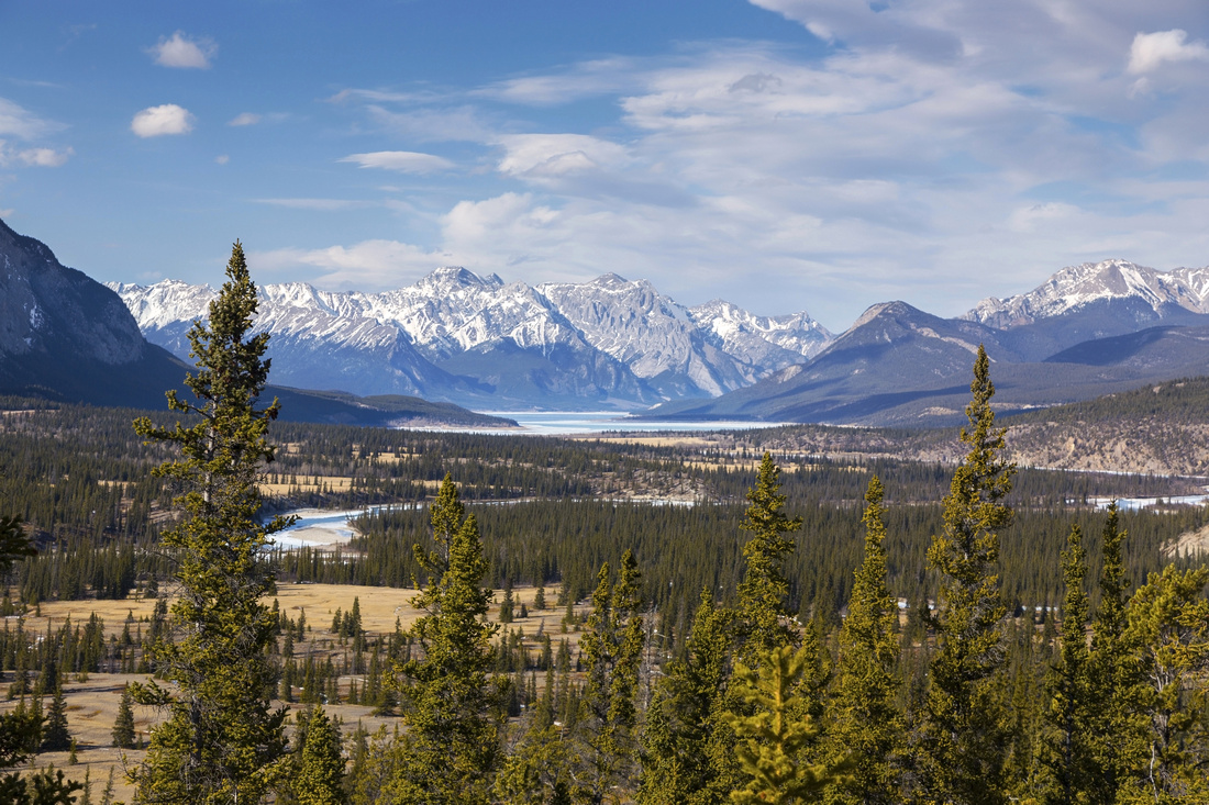
Panoramic View of Kootenay Plains Ecological Reserve from grassy Montane Ridge rising at south side of North Saskatchewan River. Siffleur Falls trail crosses delicate meadows on wooden planks, center left |
|||
| Trip Summary | |||
March 18, 2021Beautiful and probably most famous easy hike along David Thompson corridor with much room for further exploration. Visiting the end of Siffleur River that originates high on Clearwater Pass in eastern Banff National Park feels special! Suspension bridge over North Saskatchewan River is outstanding engineering work. Canyon below lower falls is spectacular, but also could be dangerous if staying too close to the edge of precipice - obey signs and stay behind the railings. Beyond lower falls and end of maintained trail (reached within 50min from the parking) trail continues to second and third waterfall. See here for good report and visuals. This part is not hiked often, but it is very peaceful and simply beautiful; when crowds choke the main trail in full season, you might be able to find solitude here. Note that camping is not allowed, despite several outstanding campsites by the edge of river. Beyond 3rd waterfall trail reaches sign at edge of Siffleur Wilderness and becomes faint. It can be followed with lots of bushwhacking for several days till eventually entering Banff National Park, ~1.5km from Dolomite/Siffleur junction and well-known Dolomite Circuit. This journey is long and tedious and will appeal only to dedicated back-country explorers. Alternate and historically often used traverse is via Whiterabbit Pass, ~35km from David Thompson Highway. This trail forks off main Siffleur Falls trail right after second bridge crossing, but is not marked.
On return it is recommended to explore gentle ridge rising above Kootenay Plains. Easiest way is to head up as planks crossing the plains end; there is well defined switchbacking trail here. It vanishes once you reach open montane plateau above. Explore as much as you want. With enough time, it is possible to traverse all the way to lower Siffleur falls. Faint trail also exists on north side of Siffleur River; it forks off main trail just before Siffleur River bridge.
Trailhead is on south side of David Thompson Highway. Turnoff to large parking area with 2nd world war memorial, picnic area and dry washrooms is marked - watch for signs approximately 62 km west of Nordegg and 21 km east of the Banff National Park boundary. |
|
Gallery |
|||
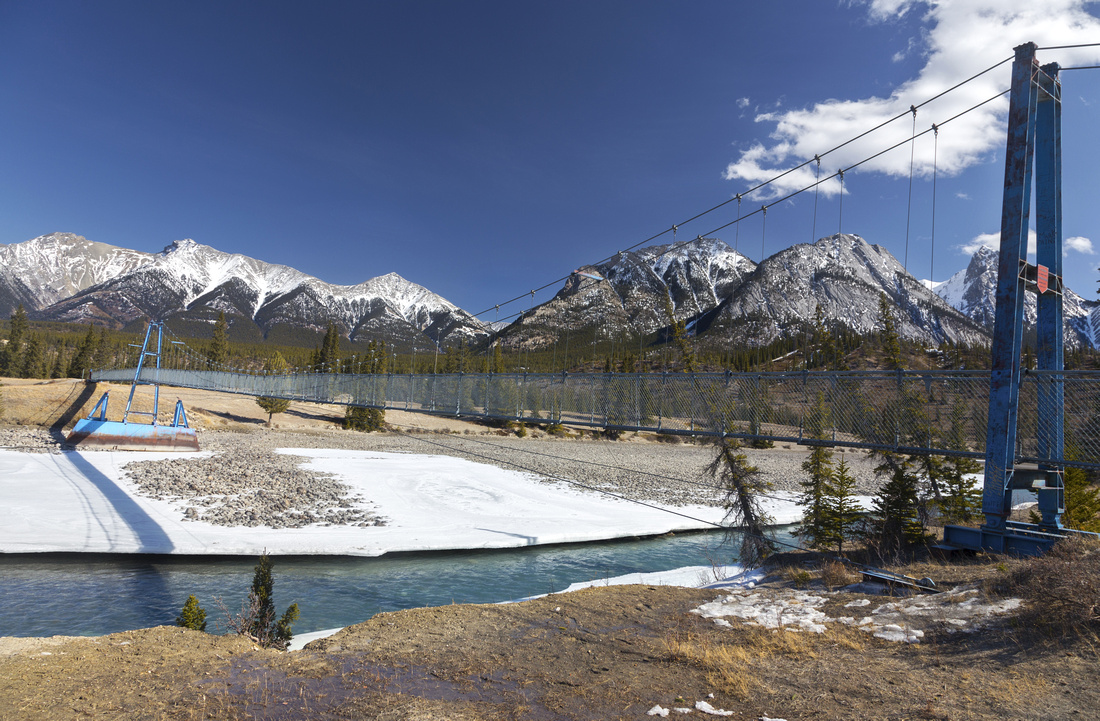 Suspension Bridge
Beautifully Engineered Suspension Bridge over North Saskatchewan River ~10 min from the trailhead. Horse traffic is explicitly forbidden Suspension Bridge
Beautifully Engineered Suspension Bridge over North Saskatchewan River ~10 min from the trailhead. Horse traffic is explicitly forbidden |
|||
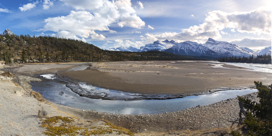 North Saskatchewan River
 lazily meandering at valley floor. "Kootenay Plains Ridge" upper left; old wagon trail traverses beneath. Distant snowy peaks of Siffleur wilderness on Horizon North Saskatchewan River
North Saskatchewan River lazily meandering at valley floor. "Kootenay Plains Ridge" upper left; old wagon trail traverses beneath. Distant snowy peaks of Siffleur wilderness on Horizon |
|||
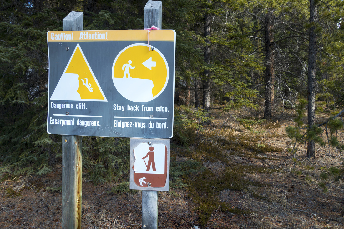 Cliff Warning
Sign warning hikers to stay on forest trail above Siffleur creek. Path above the canyon is exposed and potentially dangerous when snowy or slippery Cliff Warning
Sign warning hikers to stay on forest trail above Siffleur creek. Path above the canyon is exposed and potentially dangerous when snowy or slippery |
|||
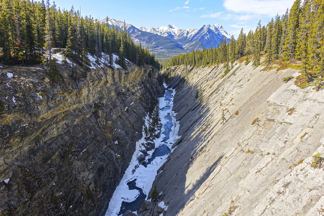 Siffleur Canyon
Looking downstream just before Siffleur Falls. This picture probably illustrates best why trail hugging ridgetop can be dangerous Siffleur Canyon
Looking downstream just before Siffleur Falls. This picture probably illustrates best why trail hugging ridgetop can be dangerous |
|||
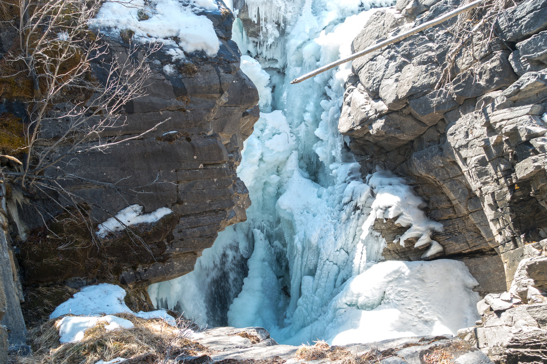 Siffleur Falls
Frozen Siffleur Falls in mid-March. Stay behind the railings for your safety! Siffleur Falls
Frozen Siffleur Falls in mid-March. Stay behind the railings for your safety! |
|||
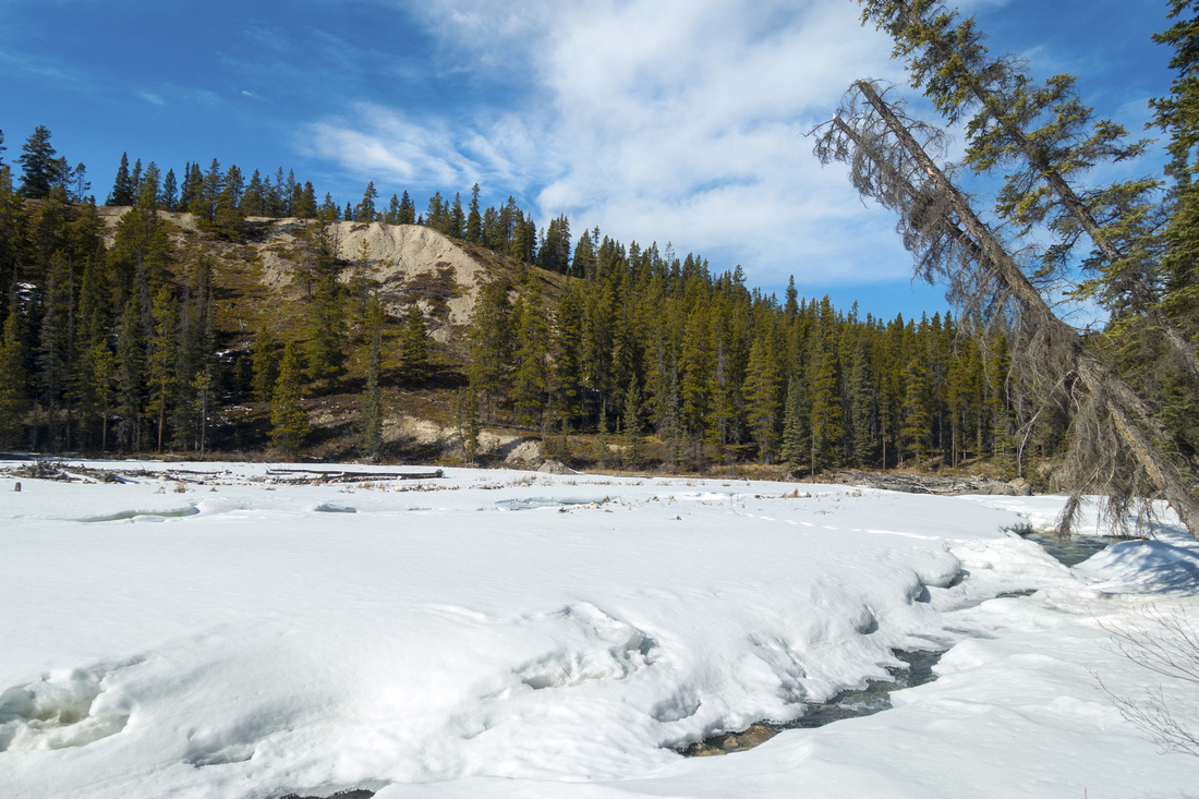 Above The Falls
Area above Siffleur Falls; likely quite refreshing in summer. "Kootenay Plains Ridge" across; faint trail exists on the other side. Main trail continues upstream for another 3.5 km to upper falls and Siffleur Wilderness boundary Above The Falls
Area above Siffleur Falls; likely quite refreshing in summer. "Kootenay Plains Ridge" across; faint trail exists on the other side. Main trail continues upstream for another 3.5 km to upper falls and Siffleur Wilderness boundary |
|||
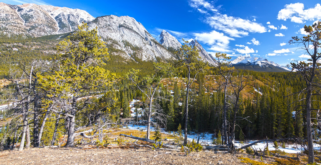 Kootenay Plains Ridge
Beautiful and open Montane Ridge at north side of Siffleur Creek that can be followed (no trail) for long time Kootenay Plains Ridge
Beautiful and open Montane Ridge at north side of Siffleur Creek that can be followed (no trail) for long time |
|||
 Abraham Lake
Distant Abraham Lake from "Kootenay Plains Ridge". Mt. Cline just left of center Abraham Lake
Distant Abraham Lake from "Kootenay Plains Ridge". Mt. Cline just left of center |
Abstract
| Overall Difficulty | D2 | Gentle trail with bridged river crossing with some exposed sections above Siffleur canyon. Moderately steep, but short ascent (optional) of "Kootenay Plains Ridge" | |||
| Snow Factor | S1 | Valley floor walk with no avalanche danger, usually snow free early in season. Icy sections in early spring | |||
| Scenery | Impressive Siffleur River Canyon and Waterfall. Sweeping scenery of front ranges, dry montane forest and distant Abraham Lake. | ||||
| Trail/Marking | Excellent | Signed trailhead, trail markings with posts. Wide trail with bridged river crossings (even available on Google Street View!) | |||
| Suggested Time | 2-5 hrs | Lower Siffleur Falls can be hiked (return) under 2 hours. Continuing to 2nd, 3rd waterfall and Siffleur Wilderness Boundary requires additional ~1hr each way. Add 45min to an hour if exploring the ridge on return | |||
| Elevation | Start: 1340m Max: 1425m Total: ~220m (Lower Falls and Ridge) | Round Trip: ~9km (Lower Falls and Ridge) | |||
| Gear | Day hikers sufficient. Microspikes helpful in shoulder season. Snowshoes generally not required in winter | ||||
| Water | Siffleur River. Carry 0.5L | ||||
| Dog Friendly | Yes |
Keep dogs on leash for courtesy to other hikers as this is busy trail in full season. Standard wilderness precautions if venturing off trail on the Ridge |
|||
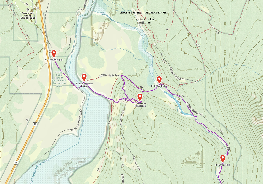 Siffleur Falls GAIA Map
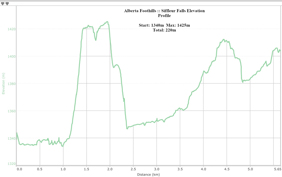 Siffleur Falls Elevation Profile