Google Map |
Rockies :: Alberta Foothills :: Lesueur Creek/Ridge |
GPS Track |
|
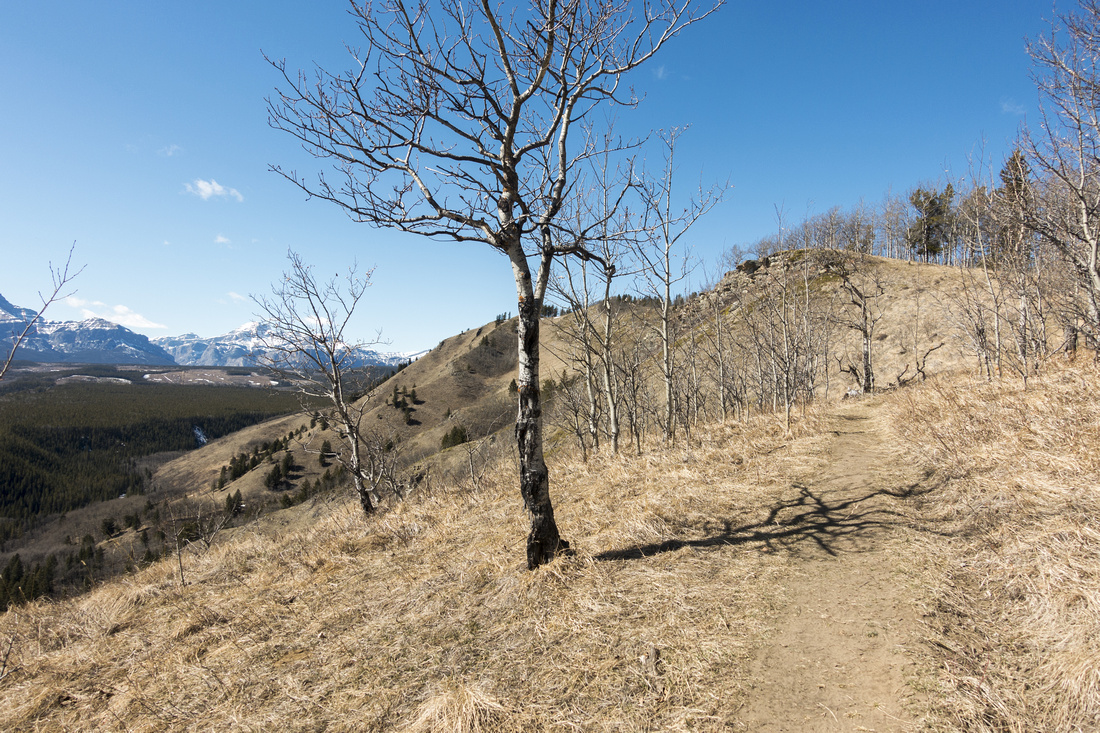
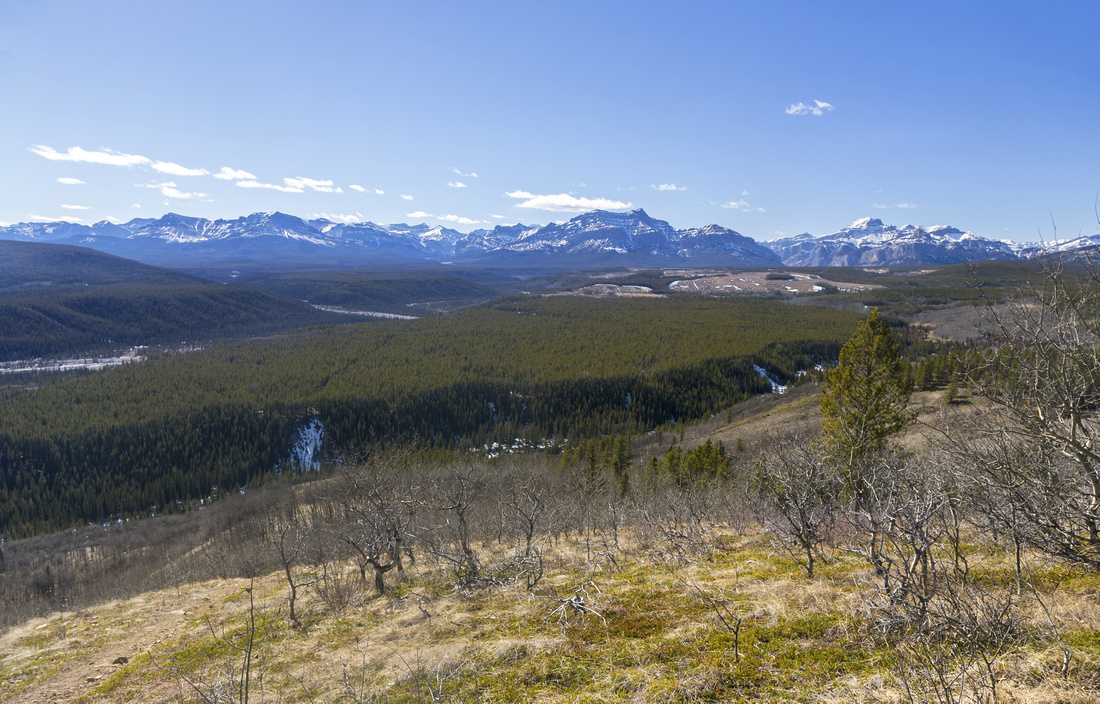
Panoramic view west towards Ghost area from Lesueur Ridge "Promontory" Viewpoint |
|||
| Trip Summary | |||
April 6, 2022Lesueur Creek/Ridge is fantastic early season objective. When everything else is plastered in wet snow, sunny south facing slopes are often dry and feel like a blessing after long snowy winter months. On my trip in early April originally planned for Ghost area I was stopped by snow washout at Lesueur Creek Bridge and had to change plans on the fly. It proved as excellent choice; dry grassy ridge with very photogenic Aspen trees and distant Ghost area Peaks provided serious sensory overload. K-country guidebook has Creek and Ridge as two separate trails, but it really should be just one. It would make little sense to do just one or the other, when they lead itself naturally into beautiful loop. CCW direction is far preferred as steep climb is done with early, westerly views along the ridge are fantastic, while lighting for creek return will be superb as sun will be behind. Shorter option, as presented in this report, utilizes trail - not mentioned in Daffern guidebook - dropping to the creek from "Promontary" viewpoint. Longer version, including side-trip to "Hill 385838" can not be recommended as large parts are in unremarkable forest along maze of OHV roads.
Trailhead - unofficial - is just before Lessueur Creek Bridge on Trans-Alta road, ~2.5km from Hwy 40. This section of infamous Ghost access driving is still not bad; there are some potholes and sharp rock, but any car can do it. Parking is either at side of the road, or a bit up on grassy pullout on north side. Trail, more resembling old road initially, quickly rises up to the junction where it splits; Up for the ridge, left for the creek. If go up the ridge first as suggested, this will be the point where you will close the loop. Upcoming rise to ridge crest is steep but not long; upon topping up fantastic views unfold. Going is very pleasant across several bumps for about half an hour when trail splits. To the left is "Promontory" viewpoint and excellent lunch break spot. Main trail continues along the ridge but is now mainly forested; far better alternative is to continue along faint trail descending from the viewpoint across grassy hillside, eventually intersecting Creek trail. This descent is probably most scenic part of the day - see gallery. From the junction you can explore creek trail to the west a bit, but it is not really worth. Going back along grassy hillside is another scenic highlight; trail travels above creek and is mostly open with many photo ops. Eventually close the loop at Ridge junction and hike back to the parking. |

|
Gallery |
|||
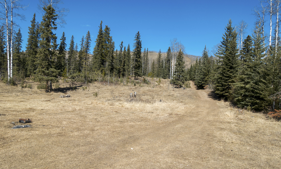 Trailhead Meadow Trailhead Meadow Trail starting from large meadow just before bridge over Lesueur Creek ~2.5km from Hwy40
 |
|||
 Ridge Junction
Unmarked junction ~15min from trailhead. Ridge trail (recommended direction) straight up, creek trail to the left (return route) Ridge Junction
Unmarked junction ~15min from trailhead. Ridge trail (recommended direction) straight up, creek trail to the left (return route) |
|||
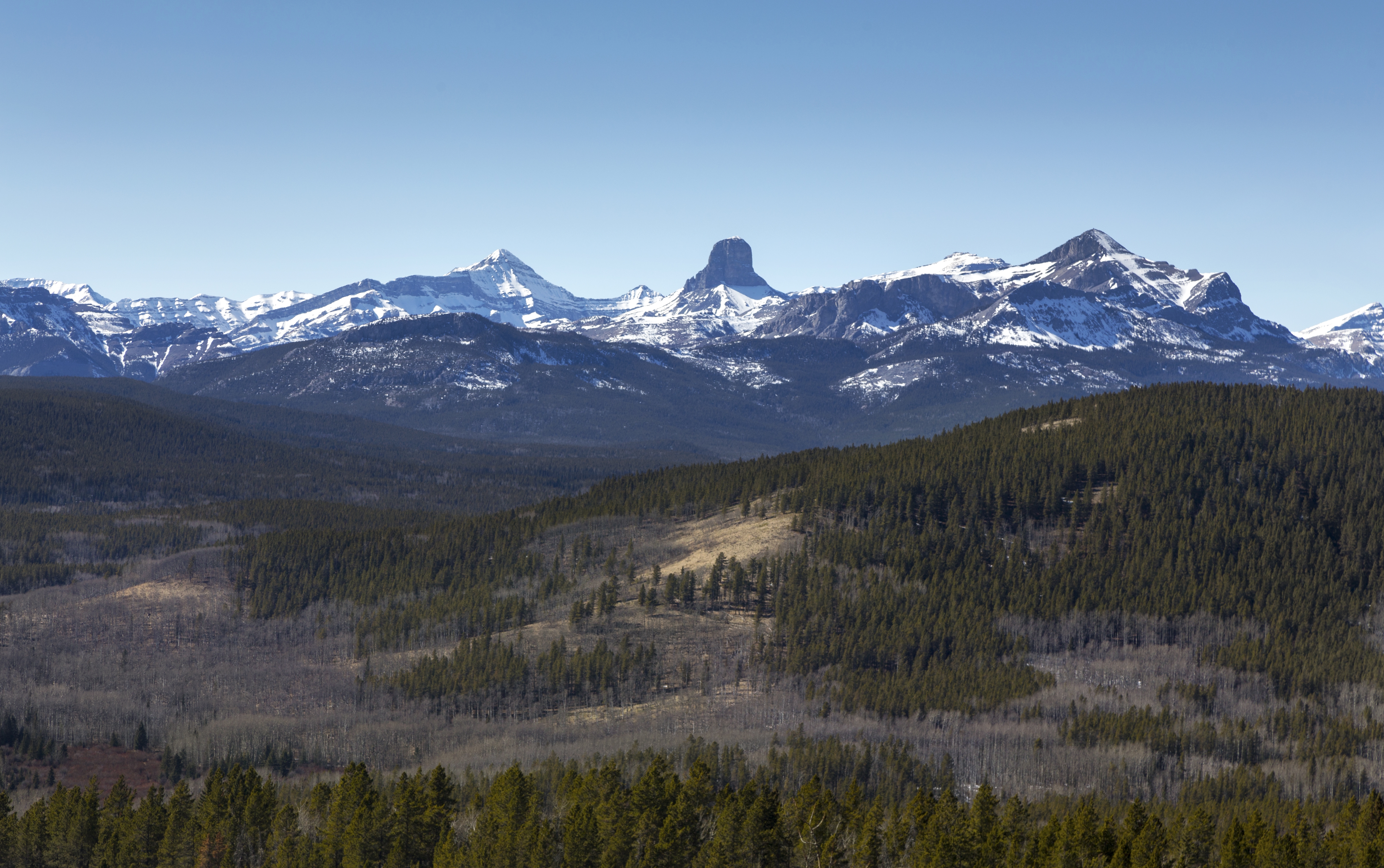
 Steep Incline
Steep grade up the hillside towards ridge crest; Ghost area peaks on Horizon offering scenic relief Steep Incline
Steep grade up the hillside towards ridge crest; Ghost area peaks on Horizon offering scenic relief |
|||
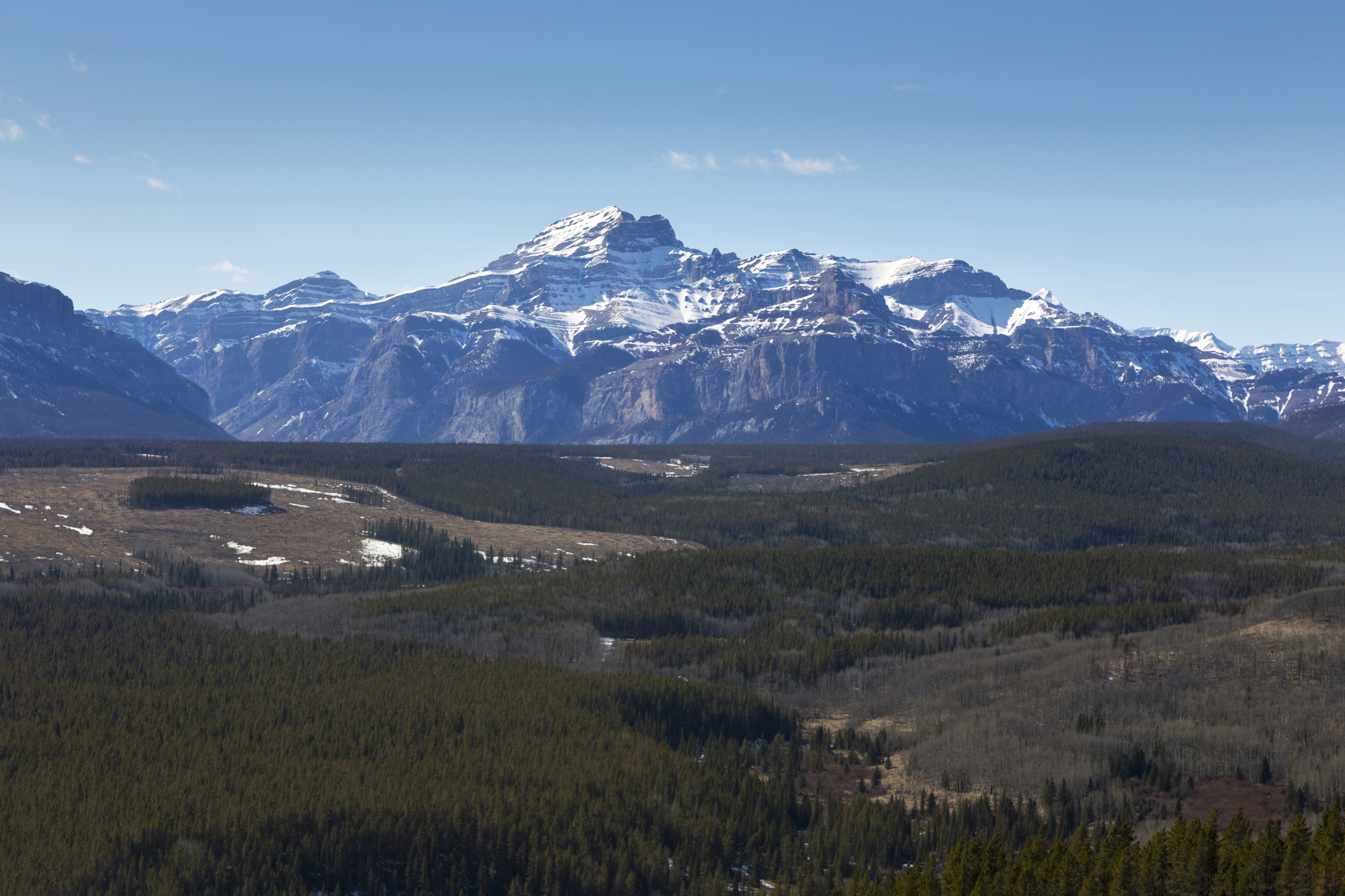
 Ridge Crest
East end of Lesueur Ridge and start of beautiful ridgewalk traverse Ridge Crest
East end of Lesueur Ridge and start of beautiful ridgewalk traverse |
|||
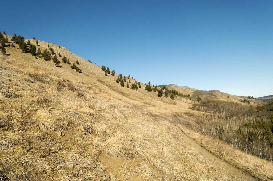
 Foothills View
Looking back towards the Foothills as trail gently meanders along the Ridge. Trailhead is forested area extreme center right Foothills View
Looking back towards the Foothills as trail gently meanders along the Ridge. Trailhead is forested area extreme center right |
|||
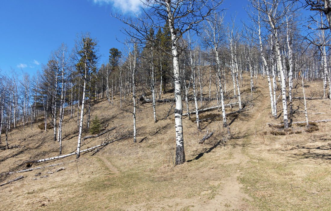
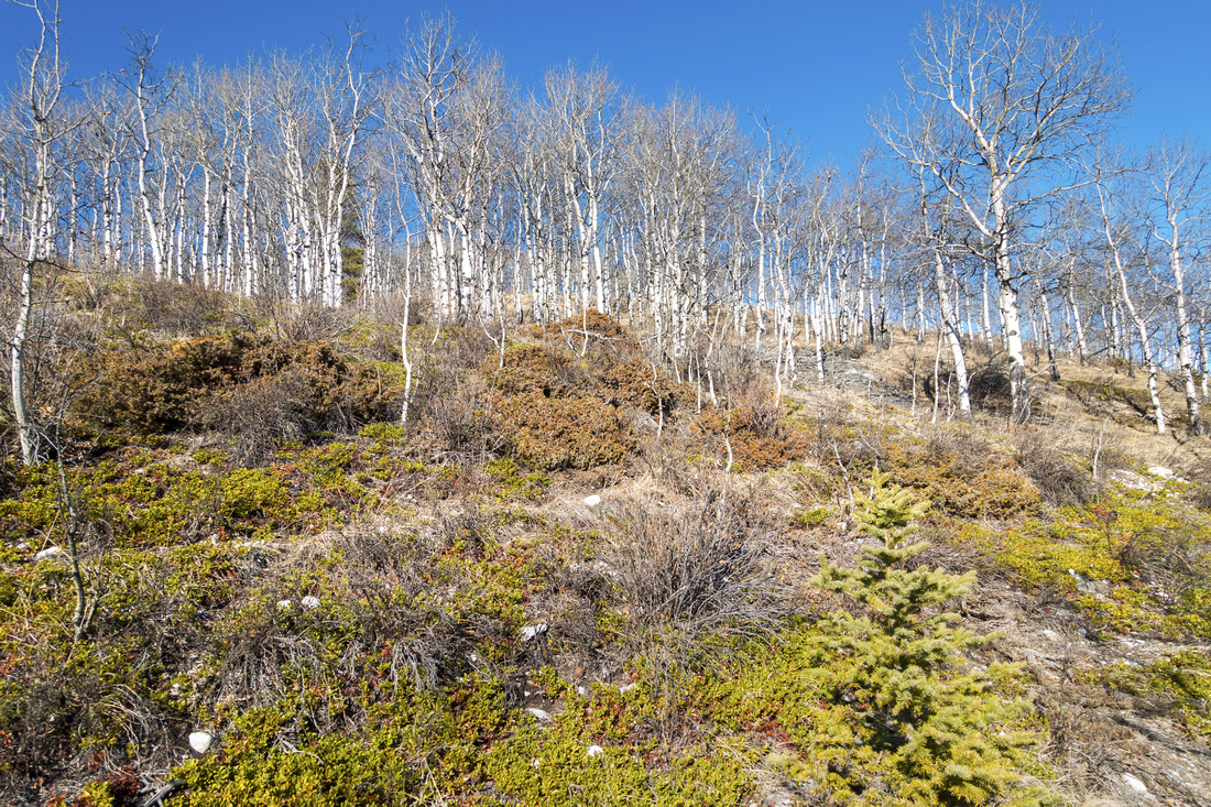
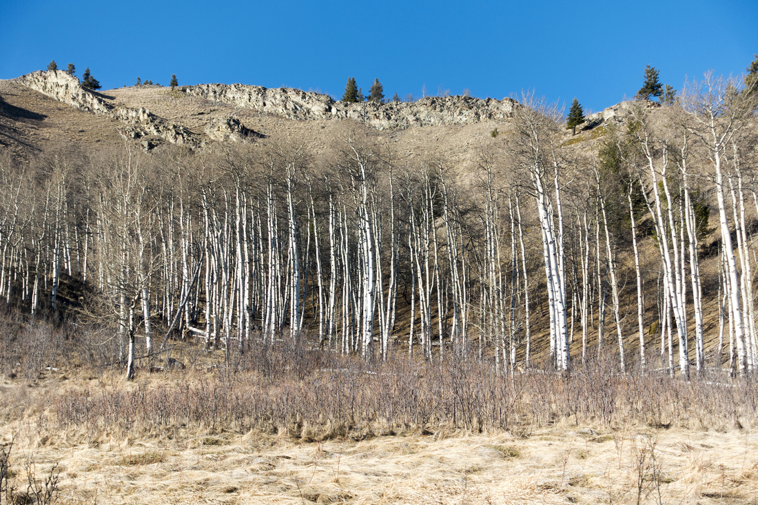
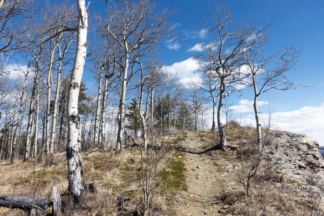 Aspens Hiking
Delightful stretch among Aspen trees on mostly open ridge crest Aspens Hiking
Delightful stretch among Aspen trees on mostly open ridge crest |
|||
|
|||
|
|||
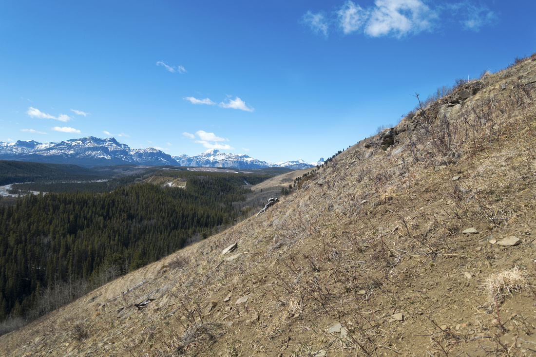
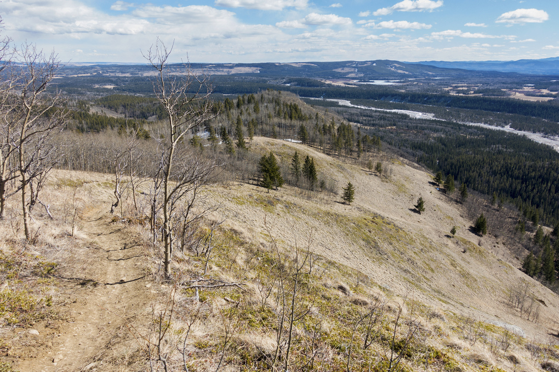
 Promontory Views
Open hillside trail with great views below "Promontory" viewpoint descending to Lesueur Creek below; much scenic option than continuing along ridgecrest Promontory Views
Open hillside trail with great views below "Promontory" viewpoint descending to Lesueur Creek below; much scenic option than continuing along ridgecrest |
|||
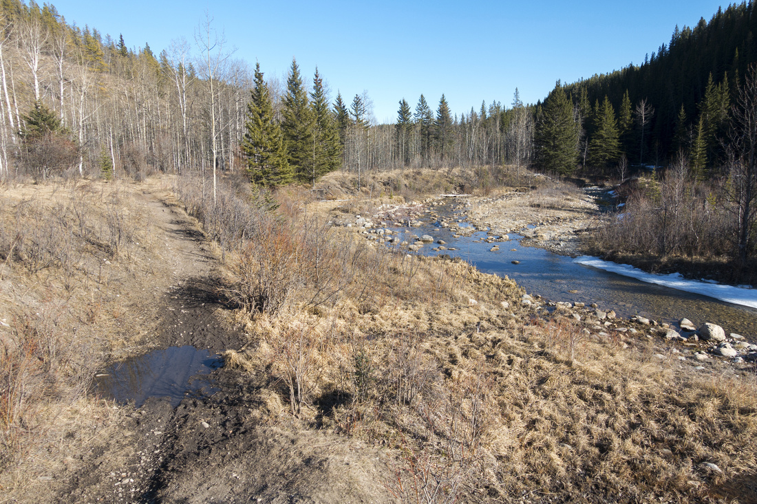 Lesueur Creek
Section of muddy Lesueur Creek trail, if exploring further west along the creek - not really worth Lesueur Creek
Section of muddy Lesueur Creek trail, if exploring further west along the creek - not really worth |
|||
 Spring Colors
Vibrant Spring Colors starting to show as Creek trails loops back along open hillside Spring Colors
Vibrant Spring Colors starting to show as Creek trails loops back along open hillside |
|||
 Grassy Slopes
Much scenic than perhaps expected, Lesueur Creek trail traverses open slopes considerably above valley bottom. Length of Ridge above Grassy Slopes
Much scenic than perhaps expected, Lesueur Creek trail traverses open slopes considerably above valley bottom. Length of Ridge above |
|||
 Aspen Slopes
Typical Alberta Foothills Scenery heading back along Creek trail; one could head up back to the ridge mostly anywhere Aspen Slopes
Typical Alberta Foothills Scenery heading back along Creek trail; one could head up back to the ridge mostly anywhere |
Abstract
|
Overall Difficulty |
Steep ascent to ridge crest. Possible muddy section on creek trail |
||||
|
Snow Factor |
South facing slopes usually dry when everything else is still plastered in snow. Winter trip might be icy or slippery |
||||
|
Scenery |
Aspen Forests, Meadows and Foothills with far reaching Ghost area panorama |
||||
|
Trail/Marking |
Good/None |
Trail generally well defined, but trailhead / junctions are not marked |
|||
|
Suggested Time |
3 hrs |
Shorter loop with relaxed pace. Add ~1 hour if extending to Hill 385838 (as per Daffern guide) |
|||
|
Elevation |
Start: 1380m Max: 1650m Total: ~400m |
Round Trip: ~7km | |||
|
Gear |
Day Hikers or Full Hiking boots. Poles helpful. Micro-spikes might be required if icy in early season. Snowshoes likely not necessary even in winter |
||||
|
Water |
Lesueur Creek (must be filtered). Carry ~1L |
||||
|
Dog Friendly |
Yes |
Standard Back-country precautions |
|||
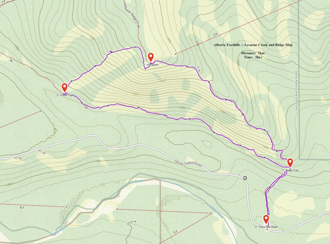 Lesueur Ridge GAIA Map
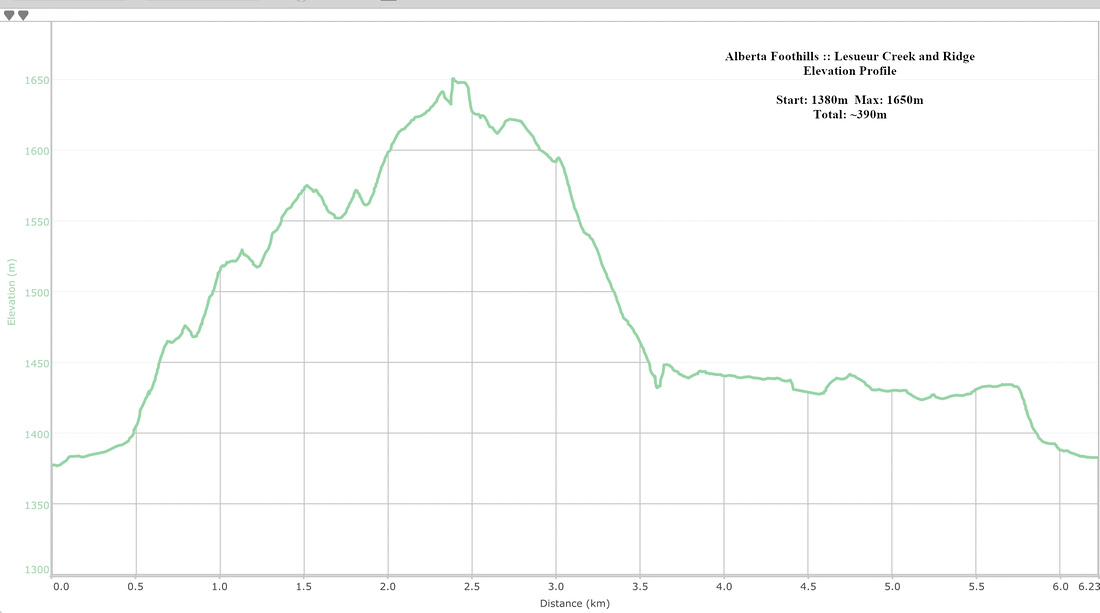 Lesueur Ridge Elevation ProfileLesueur Ridge Elevation Profile