Google Map |
Vancouver Island :: Comox - Strathcona ::Forbidden Plateau |
GPS Track |
|
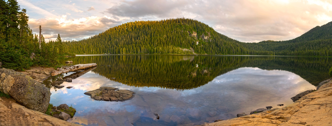 
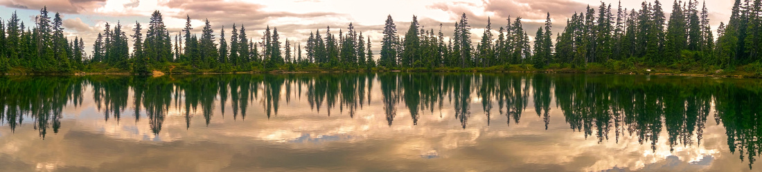
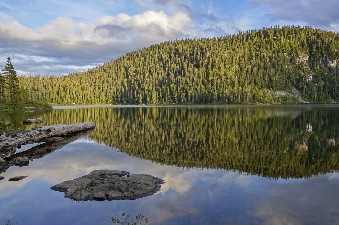
Panoramic View of Lake Helen MacKenzie on return, ~1 hr from trailhead. Return leg of the hike crosses low saddle far right between Mt. Elma (center) and Mt. Brooks (far right, just out of picture). |
|||
| Trip Summary | |||
June 21, 2019Forbidden Plateau is vast lake-dotted alpine plateau of open meadows and lush forest in "front ranges" of Strathcona Provincial Park. It is easily reached by 30min drive from Comox valley. In winter Mt. Washington resort is popular ski destination; in summer hikers benefit from well developed network of trails that offer something for everyone. For seasoned hiker / peakbagger it is just a teaser, as real riches lie deep in back-country -- Mount Albert Edward, Castlecrag Mountain and Mt. Frink to name a few. There are many excellent campgrounds managed by BC Parks, including awesome Eugene Croteau guest lodge at shore of Lake Croteau. Typical coastal wet climate dumps large amounts of snow in winter and higher elevations are still usually snowbound till early June. There is much space for exploration; presented here is clockwise loop visiting several lakes with optional Cruikshank Canyon overlook extension.
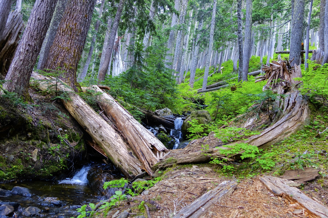
Trailhead is near Raven Lodge at end of Strathcona Parkway, ~20km from Island Highway exit 130. This road is quite steep & likely requires chains in winter conditions. Small wilderness centre offers coffee / refreshments as well as maps and guidebooks. Follow well signed trail downhill, then at first junction turn left -- this is where the loop ends on return. Well constructed boardwalks across "Paradise Meadows" are very impressive. Reverting to forest path, trail passes Battleship, Lady and Croteau Lakes until it reaches excellent back-country campground at Kwai lake. At far end of the lake is signed Circlet Lake / Cruikshank Canyon overlook junction. This is logical turnaround spot for day-hikers, while campers bound for Mt. Albert Edward will likely push for Circlet Lake.
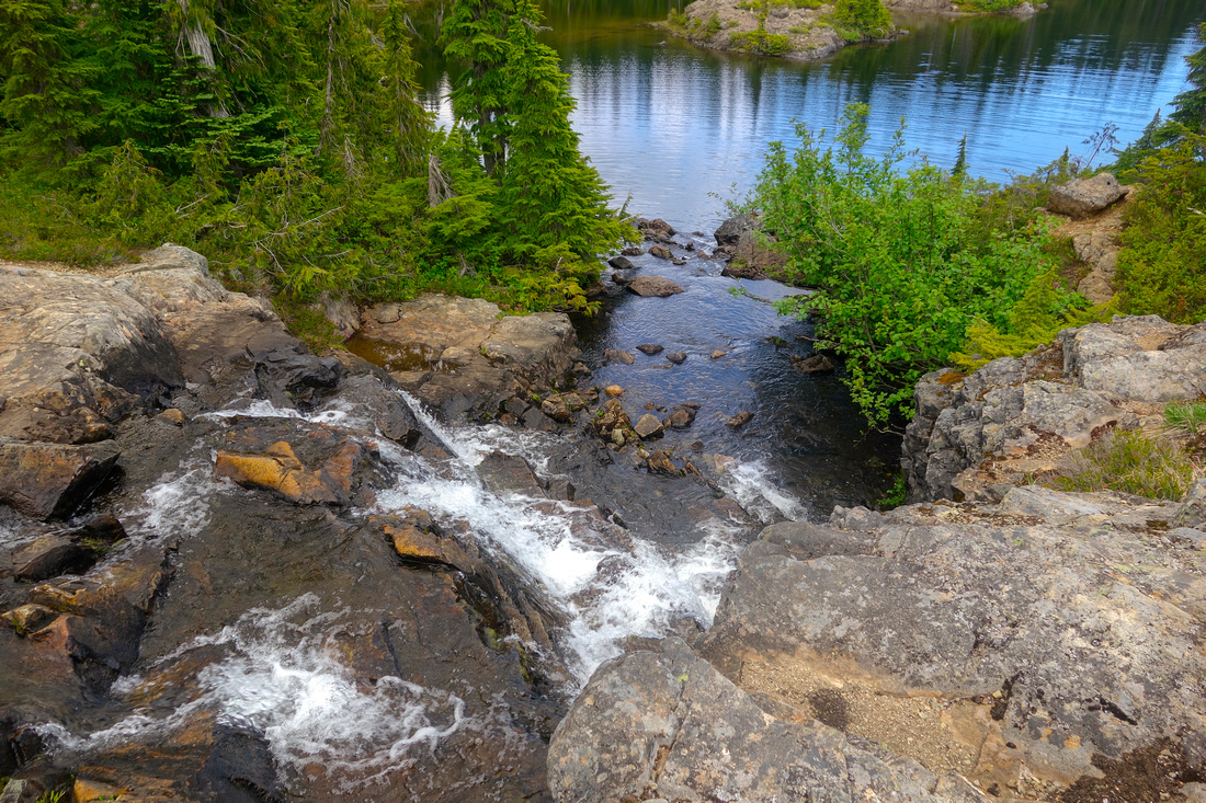
Highline return via Lake Helen MacKenzie is shorter, but trail is considerably more rough. After climbing to lovely alpine meadows and passing Ranger Cabin, it crosses Mt. Elma / Mt. Brooks saddle and traverses south side of Helen Mackenzie. This is typical "North Shore" territory, with rocks, roots and going is fairly slow. Open area by the lake is fantastic viewpoint (another campground nearby). From here you could take trail leading back to Battleship lake, but you'd miss lovely set of meadows and rushing creek draining Helen Mackenzie. Both legs finally meet at first signed junction 10min below the parking.
Craigshank Canyon overlook is recommended extension from Kwai lake. It will take about 1.5 hrs (return). It is probably the most scenic part of the day as terrain is mostly open and there are several tarns (Lake Mariwood and Lake Beautiful) as well as small waterfalls to admire. It is quite reminiscent of Al's Habrich ridge alpine above Sea-to-Sky gondola near Squamish on the Mainland. It ends at rocky plateau with great view of long ridge leading to Mt. Albert Edward. |
|
Gallery |
|||
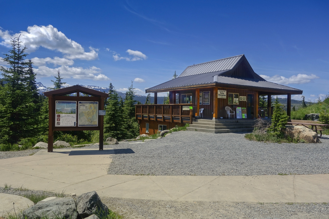 Strathcona Wilderness Visitor Center and Paradise Meadows Trailhead
 |
|||
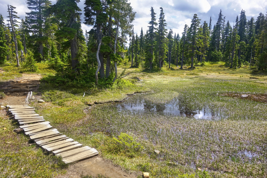
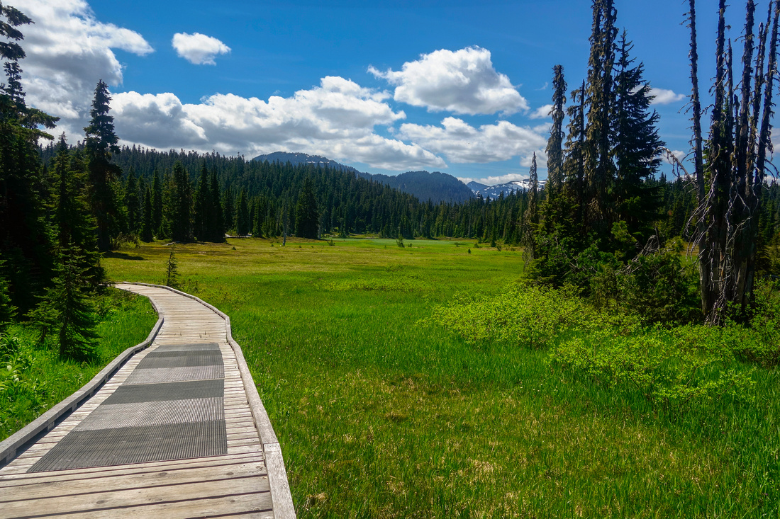 Paradise Meadows Boardwalk
 |
|||
 Battleship Lake 45min - 1hr from Trailhead
 |
|||
 Sub-alpine meadows hiking past Battleship towards Croteau Lake
 |
|||
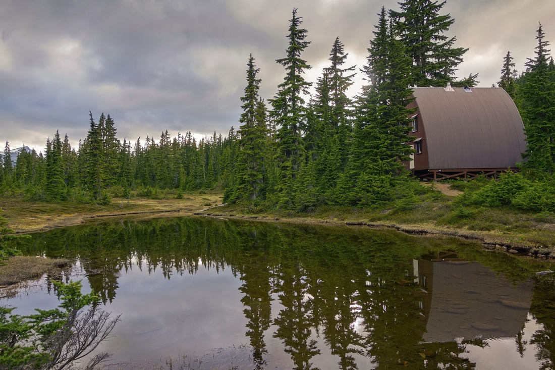
 Eugene Croteau Cabin, now serving as back-country shelter. Campground is nearby
 |
|||
 Croteau Lake from the porch; snowy Mt. Albert Edward in the distance
 |
|||
 Kwai Lake pano. Campground is on far left side. Circlet / Cruikshank junction far right
 |
|||
 Hoping over creek draining into Lake Beautiful in lovely alpine plateau on the way to Cruikshank overlook
 |
|||
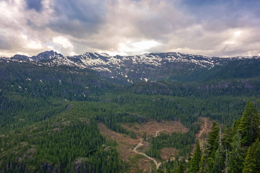 Cruikshank Canyon overlook. Long ridge leading to Mt. Albert Edward upper center. Circlet Lake is in the bowl below, hidden from view. Castlecrag mountain upper left. Note logged area below. With 4x4 it can be reached by following rough logging roads from Comox lake. From the end one might be able to trash up to Circlet Lake thus bypassing lengthy Forbidden Plateau hike, but benefits of such approach are questionable.
 |
|||
 Ranger Cabin below Elma/Brooks saddle on return
 |
|||
 Typical "North Shore" terrain hiking forested south slopes of Lake Helen Mackenzie
 |
|||
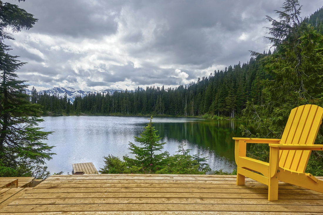
 Fab lake afternoon views of Lake Helen Mackenzie
 |
Abstract
| Overall Difficulty | D3/4 | Fairly long day-hike with moderate elevation gain with many ups and downs. Backpack to one of several campgrounds is valid option, as well as shorter half-day options that includes Battleship - Mackenzie loop only (D2) | |||
| Snow Factor | S2 | No avalanche danger, but full loop would be quite demanding as snowshoe day trip | |||
| Scenery | Sub-alpine meadows and lakes. Some old growth forest on south side of Lake Helen MacKenzie. Rugged peaks of Strathcona Park | ||||
| Trail/Marking | Very Good | Well defined trail, initially with boardwalks. All junctions are marked. Some rough sections. Wet and muddy conditions in early summer. | |||
| Suggested Time | 9hrs | Return time with moderate pace, including Cruikshank Canyon. 2.5-3 hrs for Battleship - Mackenzie loop only. | |||
| Elevation | Start: 1090m Max: 1260m Total: ~690m | Round Trip: ~23 km | |||
| Gear | Full hiking boots or day-hikers. Hiking poles helpful. Gaiters recommended in early season. Rain gear suggested, even if forecast is sunny. Map helpful as amount of trails / junctions could be confusing if first time in the area. | ||||
| Water | Several creeks / lake outlets (Lake Beautiful cascades on Cruikshank extension particularly good!) No need to carry more than 1L | ||||
| Dog Friendly | Yes | Standard back-country travel precautions | |||
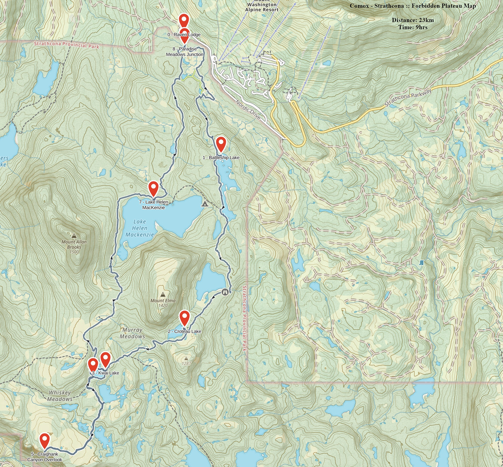 Forbidden Plateau GAIA Map
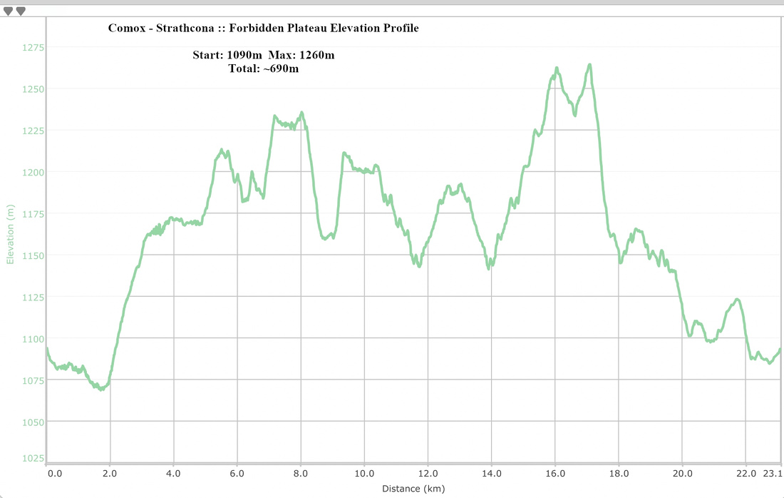 Forbidden Plateau Elevation Profile