Google Map |
USA :: Prescott :: Watson Lake Loop |
GPS Track |
 
Watson Lake Panorama from North Shore Trail Rest Stop. Watson Dam center left |
|||
| Trip Summary | |||
December 18, 2023Watson Lake is one of two reservoirs at the Granite Dells that was formed in the early 1900s when the Chino Valley Irrigation District built a dam on Granite Creek (other one is nearby Willow Creek Reservoir). Today it is an awesome resource in generally hot and waterless Arizona. There are several recreational points at west side of the lake with boat launch ramp and walking trails. Area is managed by City of Prescott that charges Parking Fees at access points; in return trails are maintained with signed junctions and trail maps (see Gallery).
On my visit I hiked a loop starting from south side Peavine Trailhead just off Prescott Lakes Parkway. Loop can be done in either direction and I don't think there is particular advantage one way or the other. Alternate access is via North side Flume Trail starting from East Granite Dells road, off Hwy 89. Peavine Trail is in fact old rail bed, today mostly used by cyclists and trail runners, but hiking trail splits soon after crossing expansive Riparian Habitat (Waypoint "1-Watson Lake", GPS Track download Top of Page). I decided on CCW direction and followed east side of the lake, then looped around on Over The Hill - North Shore - Discovery Trails back to Peavine. Most scenic part was probably Secret Cove on east side (short side trip off Peavine) and fairly rugged crossing of Granite Dells on North side near Watson Dam / Flume Trail junction, while best viewpoint was on North Shore trail ~10-15min before Watson Lake Park (lead photo on the Page). |
|
Gallery |
|||
 Peavine Trailhead
Welcome Sign at Peavine Parking Lot just below Prescott Lakes Parkway Peavine Trailhead
Welcome Sign at Peavine Parking Lot just below Prescott Lakes Parkway |
|||
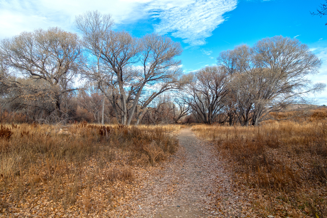 Peavine Trail
Pleasant Walk through Riparian Habitat at initial part of Peavine Trail Peavine Trail
Pleasant Walk through Riparian Habitat at initial part of Peavine Trail |
|||
 Watson Panorama
Panoramic view across south end of Watson Lake. Return loop via Discovery Trail is on the other side Watson Panorama
Panoramic view across south end of Watson Lake. Return loop via Discovery Trail is on the other side |
|||
 Watson Grassland
Most of the way it is far more scenic to follow Lakeshore trail as it meanders around small bays, while Peavine trail stays right Watson Grassland
Most of the way it is far more scenic to follow Lakeshore trail as it meanders around small bays, while Peavine trail stays right |
|||
 Secret Cove
Side trail leading to secluded Secret Cove is very scenic Secret Cove
Side trail leading to secluded Secret Cove is very scenic |
|||
 Secret Cove
 tucked between Granite Dells; likely great reprieve during Arizona summer heats Secret Cove
Secret Cove tucked between Granite Dells; likely great reprieve during Arizona summer heats |
|||
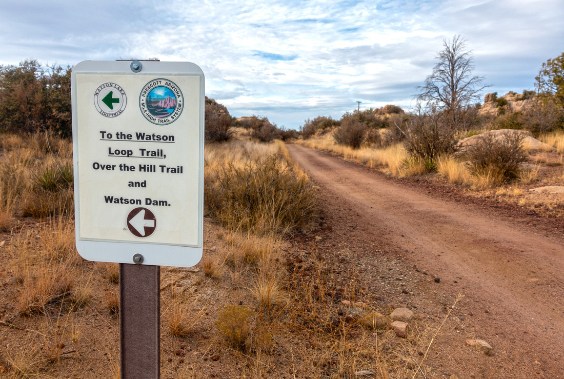 Over The Hill Junction
Peavine / Over The Hill trail signed junction; turn left for Watson Loop Over The Hill Junction
Peavine / Over The Hill trail signed junction; turn left for Watson Loop |
|||
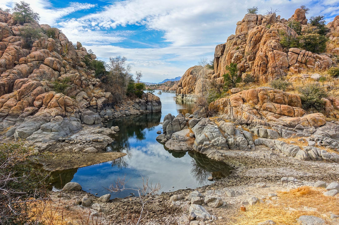
 Watson Dam
Over The Hill trail crossing Watson Dam Outlet Watson Dam
Over The Hill trail crossing Watson Dam Outlet |
|||
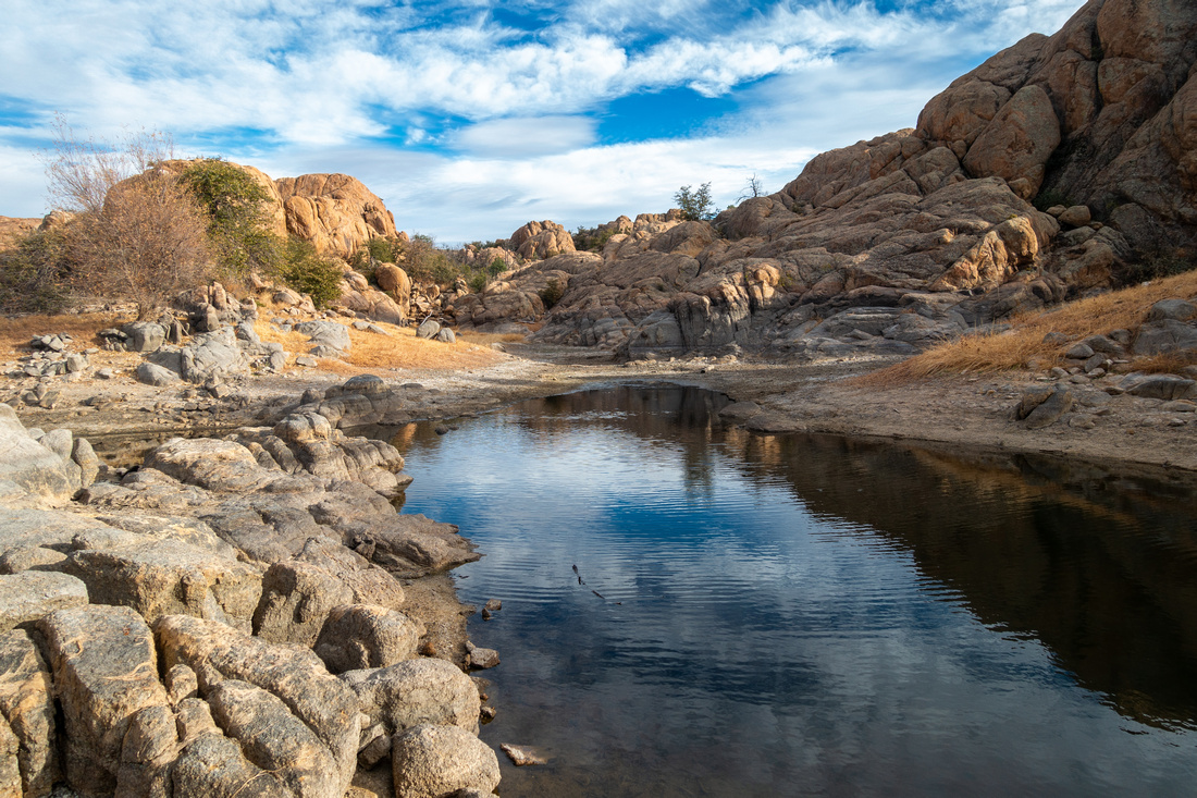
 Watson Dam
Small metal bridge over Watson Dam outlet Watson Dam
Small metal bridge over Watson Dam outlet |
|||
 |
|||
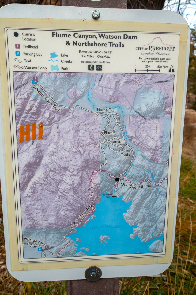 Flume Junction
Closer look at Flume Trail Junction Map Flume Junction
Closer look at Flume Trail Junction Map |
|||
 Watson Dam
 telephoto from North Shore Trail Rest Stop Watson Dam
Watson Dam telephoto from North Shore Trail Rest Stop |
Abstract
| Overall Difficulty | D2/3 | Some Rocky and Steeper sections along Over The Hill / North Shore trail at North Side | |||
| Scenery | Peavine Riparian Habitat. Granite Dells Rock Formations. Watson Dam and Lake with many small bays and coves | ||||
| Trail/Marking | Very Good | Trail occasionally difficult to follow while crossing Granite Dells. All junctions are marked | |||
| Suggested Time | 4hrs | Casual pace for full loop | |||
| Elevation | Start/Max: 1605m Min: 1550m Total: ~100m | Round Trip: ~19 km | |||
| Gear | Day hikers sufficient; hiking poles optional | ||||
| Water | Watson Lake / Dam creek outlet, but water must be treated. Carry 1L, more in summer | ||||
| Dog Friendly | Yes | Keep dog on leash at Watson Lake Park on west side | |||
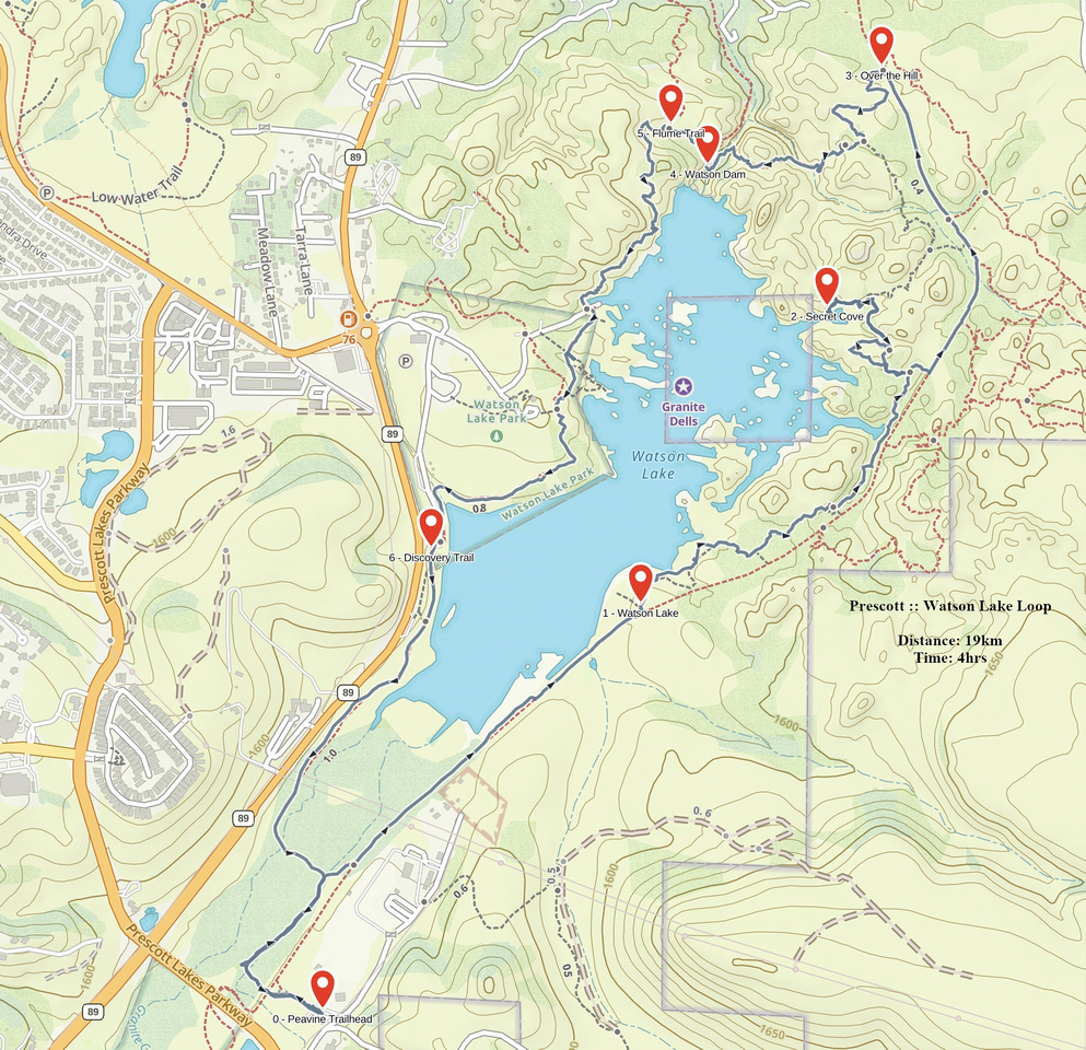 Watson Lake Loop GAIA Map
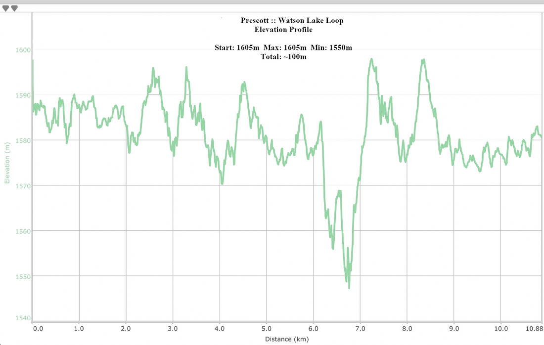 Watson Lake Loop Elevation Profile