Google Map |
USA :: Phoenix :: Vineyard Ridgeline |
GPS Track |
|
Roosevelt Lake and Bridge Panorama from Inspiration Point Scenic Overlook on Apache Trail. Vineyard Ridge Centre Left |
|||
| Trip Summary | |||
December 26, 2023
Superb Ridgewalk starting from Historic Roosevelt Lake Bridge at east end of Apache Trail and part of famous Arizona Trail. With 2 cars 1-way through hike ending at Mills Ridge trailhead is the most recommended way. Lacking alternate transportation, Out-and-back hike to Inspiration Point above Roosevelt Lake Dam is a must. On my visit I continued to Apache Lake viewpoint for another half an hour and enjoyed scenic Sunset over Salt River Valley. Trail is also used as approach for multi-day backpack into 4-Peaks wilderness.
For day trips from Phoenix area one can drive Hwy87 north from Scottsdale or Hwy60 east from Apache Junction. Distances are similar and it will take ~2hrs one way. Note that Apache Trail access is not possible as of 2019 due to extensive Road damage caused by floods east of Tortilla Flat; as off Dec '23 there were no plans for re-opening. Roosevelt Lake area is super scenic with several points of interest - Roosevelt Dam as well as Tonto Cliff Dwelling National Monument few km south of Roosevelt Bridge are a must. Parking is at roadside pullout just north of the bridge - first photo in the Gallery. Cross the road and find somewhat hidden Trailhead on the other side. Trail is well defined and it quickly gains elevation on well graded switchbacks, then traverses north side of Inspiration Point. Final section before the highpoint is rocky and a bit rough - hiking poles are helpful for stability on descent. Beyond the Inspiration point grade mellows and trail undulates across many small hills with typical Arizona Desert Landscape. Usual turnaround for OnB trips is Apache Lake viewpoint ~30min past Inspiration Point. On my trip I continued for another 15min or so, then turned back as trail headed for significant dip, then enjoyed spectacular walk under full Moon back to Roosevelt Lake.
Like many other hikes in this part of the world October - April is the best time; rest of the year it is just too hot. I thought lake might provide some reprieve, but learned this was simply not the case while casually chatting with Park Ranger in Lower Tonto Cliff Dwellings. This is highly recommended trip that still seems to be off-radar, even for locals.
|
|
Gallery |
|||
 Arizona Trail Head Arizona Trail Head Arizona Trail Table Map at East side Hwy188 pullout just before Roosevelt Bridge. Vinyeard Trail starts on the other side
 |
|||
 Inspiration Point Inspiration Point Vineyard Ridge seen from Inspiration Point Interpretive Overlook on Apache Trail
 |
|||
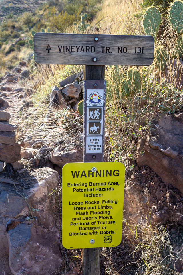 Vineyard Trail Head Vineyard Trail Head Vineyard Ridge Trailhead Table at West side of Hwy188
 |
|||
 Roosevelt Lake Bridge Roosevelt Lake Bridge Very scenic Roosevelt Lake Bridge is reason for frequent photo breaks as trail steeply gains elevation
 |
|||
  Roosevelt Lake and Bridge Panorama after steep ascent to Inspiration Point below Vineyard Mountain
 |
|||
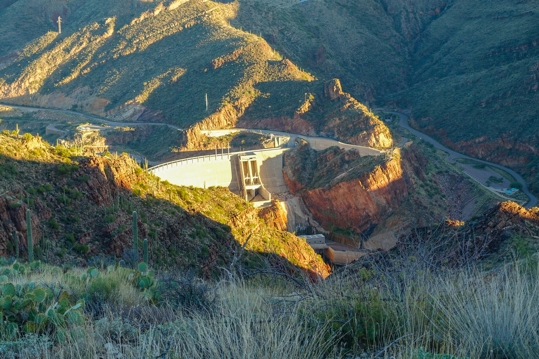 Roosevelt Dam Roosevelt Dam Roosevelt Dam Telephoto from Inspiration Point with paved portion of Apache Trail behind
 |
|||
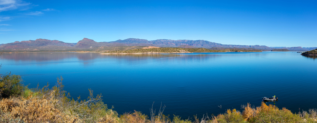 Roosevelt Lake Panorama Roosevelt Lake Panorama Panoramic View of Rosevelt Lake from Inspiration Point. Bull Mountain and Salome wilderness on the other side
 |
|||
 Cactus Trail Cactus Trail Undulating Trail traversing Vineyard Ridgeline beyond Inspiration Point
 |
|||
 Vineyard Grassland Vineyard Grassland Very pleasant hiking on wide grassy plateau on west side of Inspiration Point
 |
|||
 Apache Sunset Apache Sunset Apache Lake coming in view as Sun drops behind the Ridge and usual turnaround point for OnB Hikers
 |
|||
 Salt River Valley Salt River Valley Apache Trail between Mileposts 222 and 227 closed after extensive 2019 Floods Roadway Damage
 |
|||
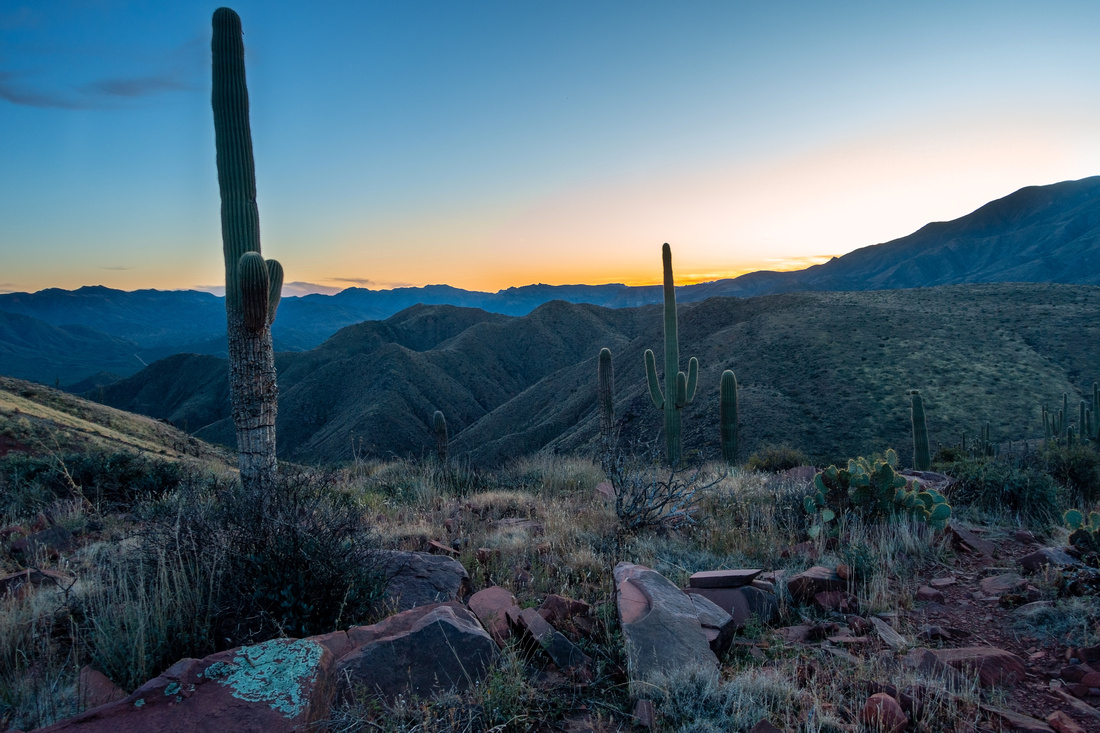 Vineyard Turnaround Vineyard Turnaround Sunset colours above distant Superstitions Wilderness. This was my turnaround point as Vineyard Trail started significant elevation loss
 |
|||
 Hunters Moon Hunters Moon Full Moon rising over Roosevelt Lake on return
 |
|||
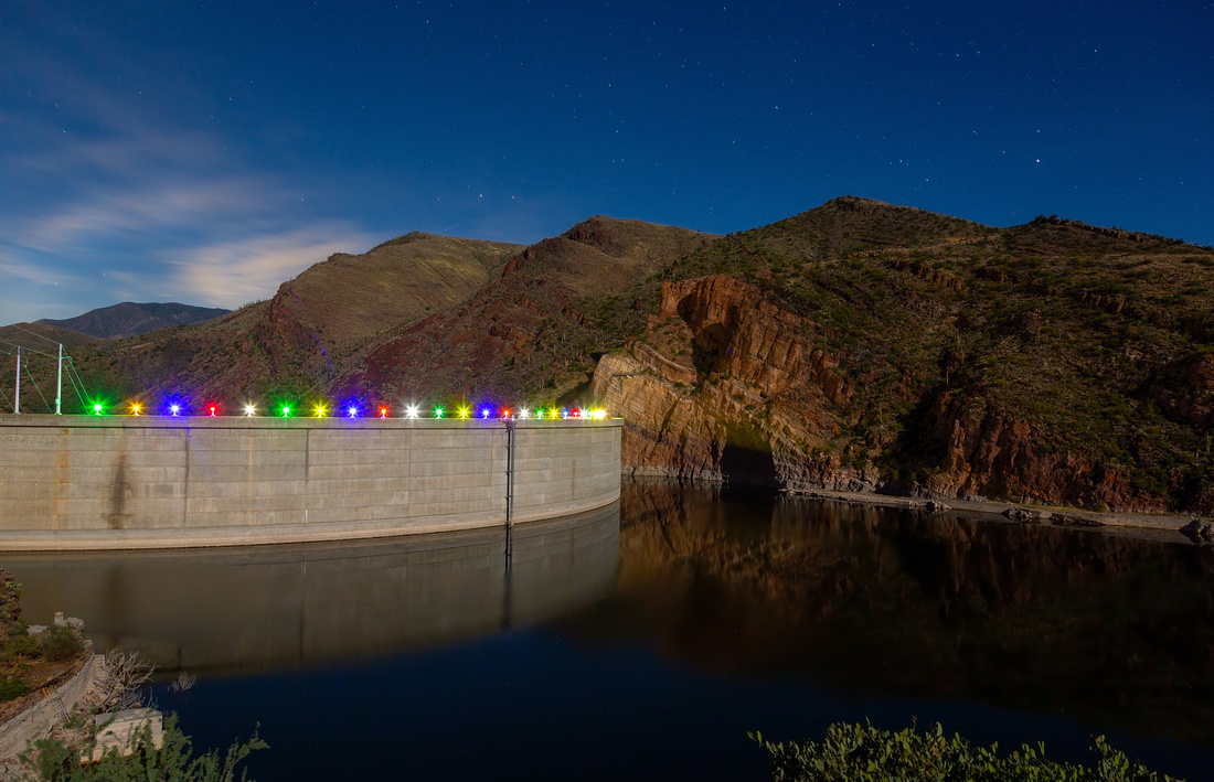 Inspiration Night Inspiration Night Roosevelt Dam and Vineyard Ridgeline Long Exposure Night photo from Inspiration Point Overlook after return
 |
Abstract
| Overall Difficulty | D3 | Steep ascent with rocky trailbed to Vineyard Mountain; mellow ridgewalk beyond | |||
| Scenery | Fabulous Roosevelt Lake Panorama. Distant Apache Lake and 4-Peaks/Superstitions Wilderness | ||||
| Trail/Marking | Good / None | Well defined Arizona Trail with signed Trailhead | |||
| Suggested Time | 3hrs | Return Time for Apache Lake viewpoint; 3-4hrs for 1-way traverse to Mills Ridge. Multi-day backpack into 4 Peaks wilderness | |||
| Elevation | Start: 670m Max: 1025m Total: ~450m | Distance: 11km return | |||
| Gear | Full hiking boots much preferred for ankle support on steep rocky terrain . Hiking poles very helpful for stability | ||||
| Water | No reliable water source. 1L in winter, in summer heat min 2L | ||||
| Dog Friendly | Yes | Watch for Rattlesnakes in Season | |||
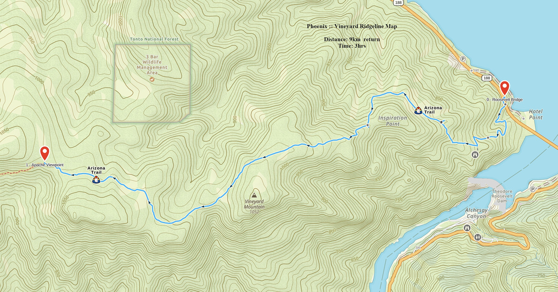 Vineyard Ridgeline GAIA Map
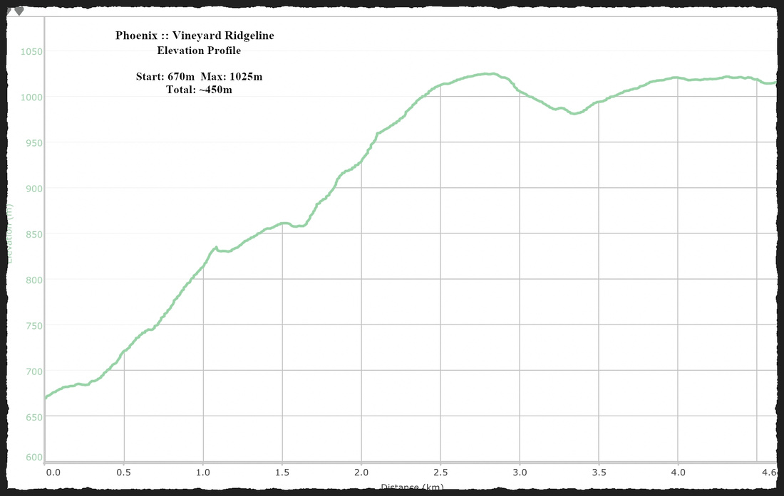 Vineyard Ridgeline Elevation Profile
