Google Map |
USA :: Phoenix :: Peralta Canyon |
GPS Track |
|
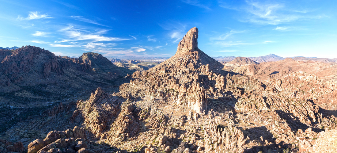
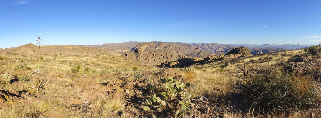
Panoramic view of Weavers Needle and Superstition Wilderness from viewpoint at end of Fremont Plateau |
|||
| Trip Summary | |||
December 20, 2021
Peralta Canyon is one of best hikes in Superstions Wilderness east of Phoenix. Main appeal is simply spectacular view of Weavers Needle, but there are many other eye candies along the way. One way traverse to Lost Dutchman area is possible but not advised - much better to spend time on Fremont Plateau "Alpine" or for highline ridge return. Canyon walls will provide some shade in mid to late afternoon, making trip a bit more bearable in summer months heat.
Trailhead is accessed from Hwy 60, some 5 miles east of Apache Junction; coming from Phoenix stay in left lane after freeway ends and watch for signs at traffic lights. Peralta Road is initially paved for about a mile, but then slowly deteriorates. It is still easily negotiated by low clearance sedans, but be mindful of couple of wash areas after rains. Parking lot is ~7miles from Hwy60 and will fill up easily on weekends. Several trails fork from trailhead and are all signed. Peralta Trail initially travels flat and within 10 minutes crosses dry drainage to right (north) side. Surface deteriorates considerably after crossing bit of slick-rock; trail bed is rocky and although not difficult requires constant focus. Some 45 min to an hour trail emerges to upper canyon and becomes incredibly scenic - see gallery. Fremont Saddle is reached 1:15 - 1:30 of steady pace; view of Weavers Needle will knock you off, even if was expected. Do not stop at the saddle; Peralta trail descends on the other side; turn right and follow spur trail across Fremont Plateau angling right towards the Needle. Going is spectacular here and more than enough reward for rather modest effort to get here. Trail ends at Lone tree viewpoint; it will probably be busy here, but more solitude can be found by scrambling rock outcrops on left or right side.
Optional highline return follows north Canyon ridge from Fremont Saddle. I have not hiked it personally, but according to guidebook there are several scrambling parts with route-finding. This option passes by fabled Geronimo Cave, seen from Peralta trail in upper part and offers wide reaching vistas most of the way. It will NOT connect with main trail before parking and will be considerably longer, so plan accordingly and make sure it is within your comfort level. Pleasant alternative is to visit only Geronimo Cave, then return back to Fremont saddle and hike out via the main trail.
|
|
Gallery |
|||
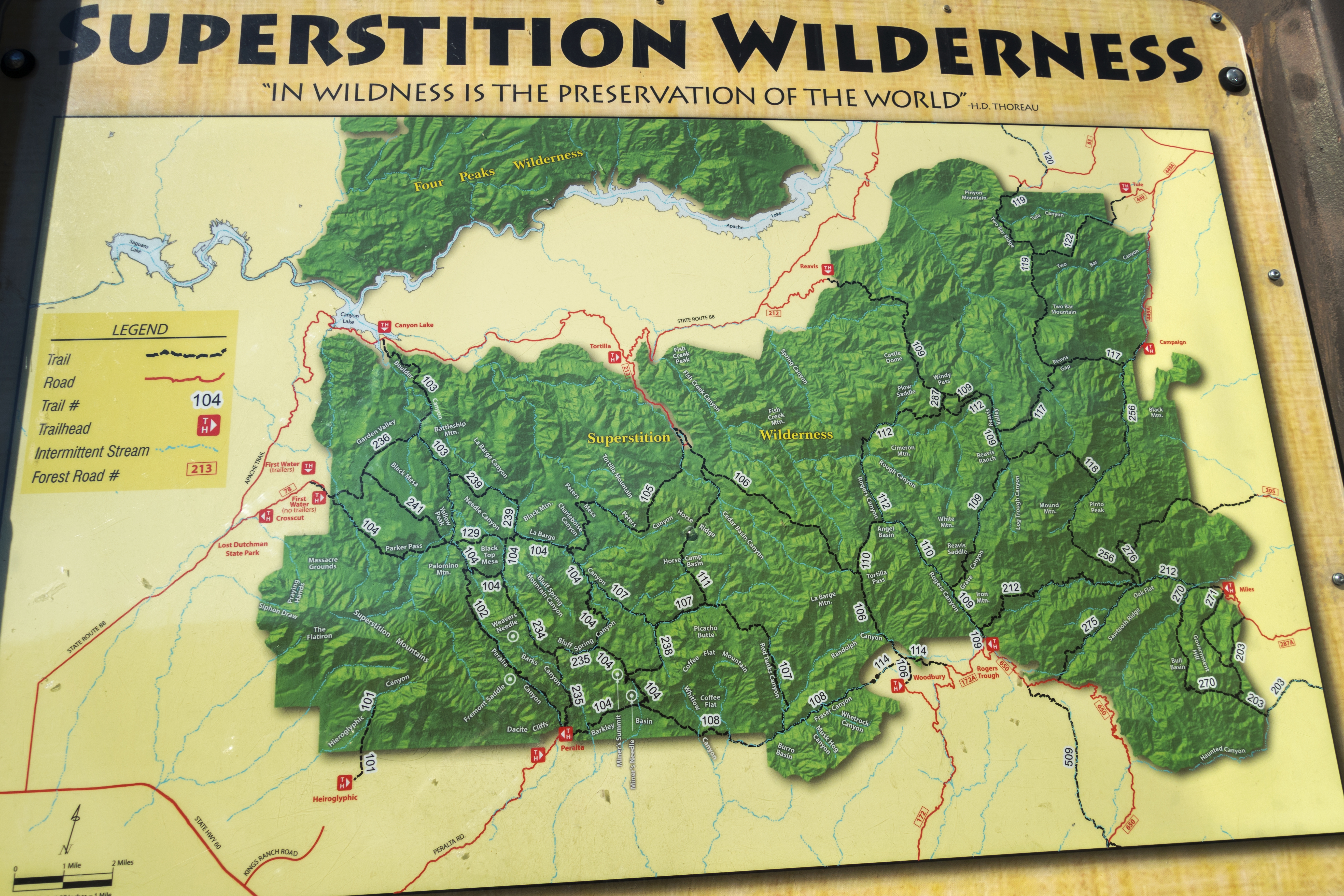
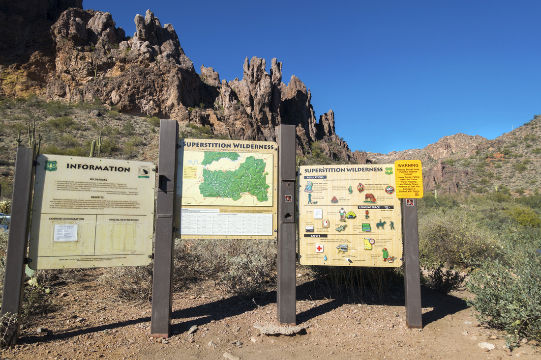 Peralta Trailhead Peralta Trailhead Information boards at Peralta Canyon Trailhead Parking
 |
|||
 |
|||
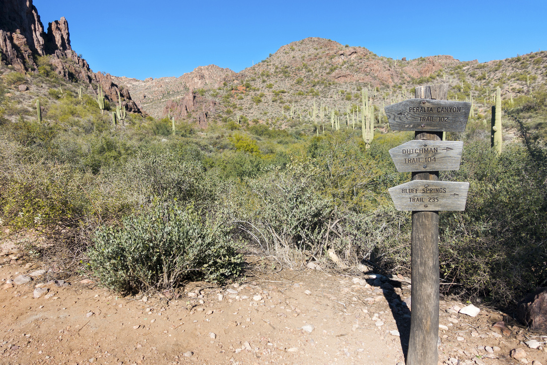 Trailhead Signpost
Several Trails branch off Peralta Canyon Trailhead - plenty of room for further exploration Trailhead Signpost
Several Trails branch off Peralta Canyon Trailhead - plenty of room for further exploration |
|||
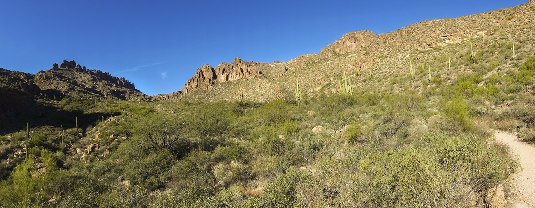 Lower Peralta Canyon
After crossing dry creek to right side, trail starts gradual ascent towards Fremont Saddle (wide "V" on horizon center left) Lower Peralta Canyon
After crossing dry creek to right side, trail starts gradual ascent towards Fremont Saddle (wide "V" on horizon center left) |
|||
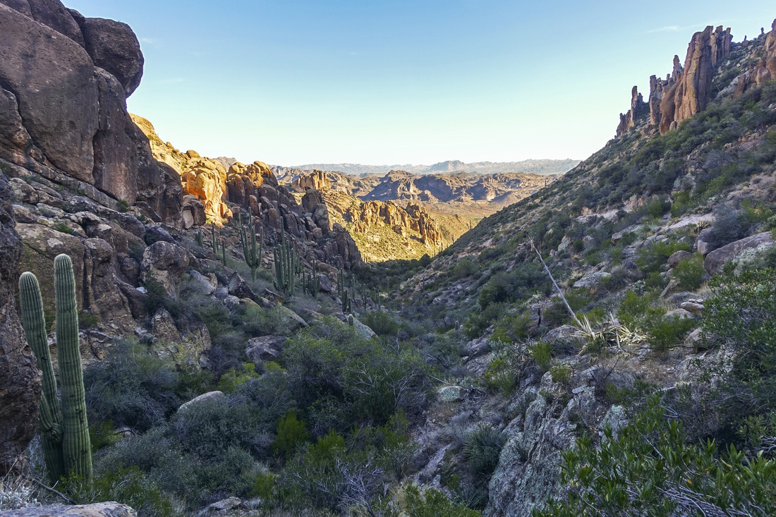 Peralta Canyon
Looking back length of Peralta Canyon from upper part. In mid-afternoon sun will move behind canyon walls providing welcome shade Peralta Canyon
Looking back length of Peralta Canyon from upper part. In mid-afternoon sun will move behind canyon walls providing welcome shade |
|||
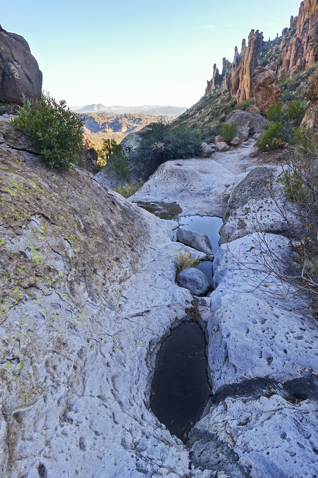 Shallow Pools
Shallow Rock Fissures filled with water - not a reliable source Shallow Pools
Shallow Rock Fissures filled with water - not a reliable source |
|||
 |
|||
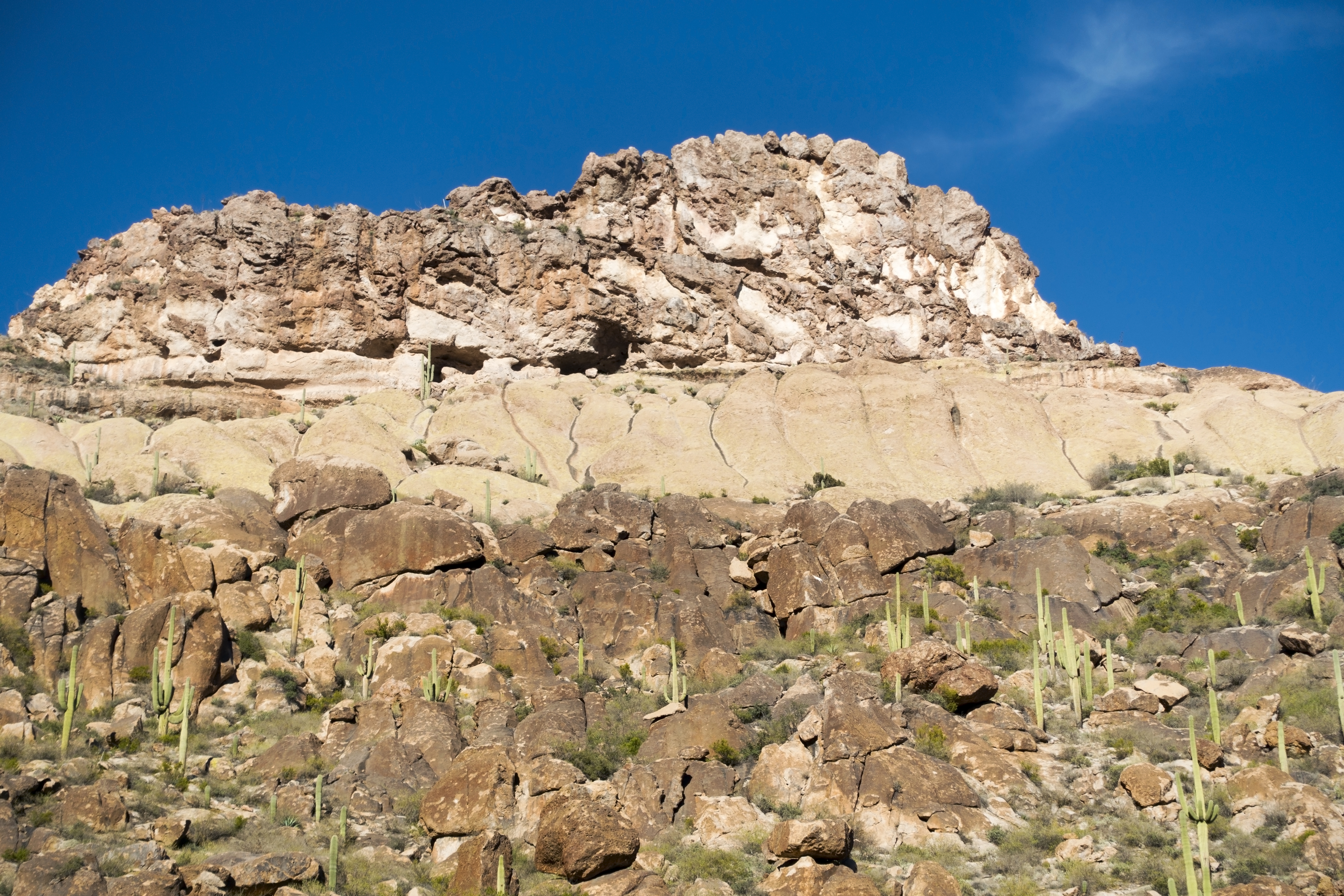
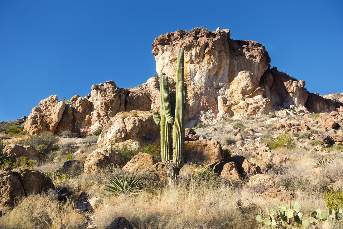
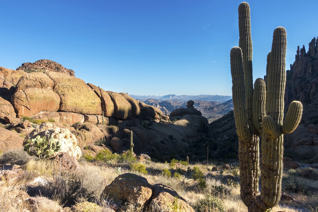 Saguaro Cactus
Ever present Saguaro Cactus, looking back as trail switchbacks upper slopes already above 1000m elevation, dotted with desert vegetation Saguaro Cactus
Ever present Saguaro Cactus, looking back as trail switchbacks upper slopes already above 1000m elevation, dotted with desert vegetation |
|||
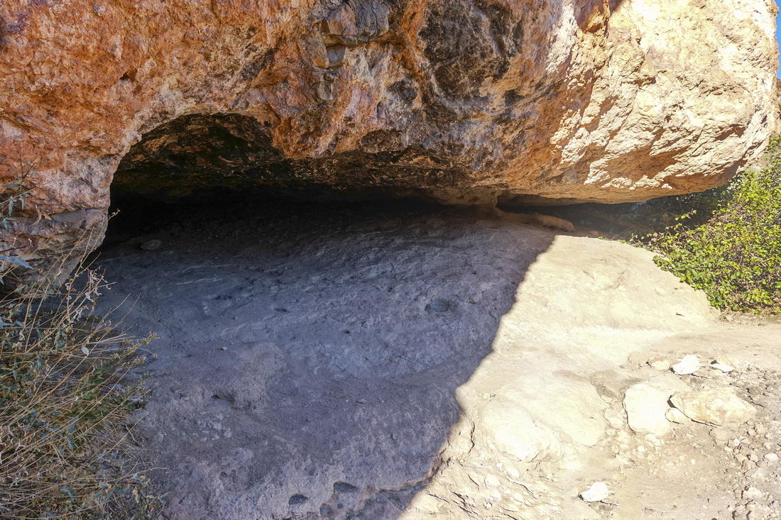 Shallow Cave
Shallow trailside cave ~15min before Fremont Saddle. Ceiling is low for much exploration, but still appears interesting Shallow Cave
Shallow trailside cave ~15min before Fremont Saddle. Ceiling is low for much exploration, but still appears interesting |
|||
 Alpine Hiking
Typical Desert "Alpine" hiking approaching Fremont Saddle Alpine Hiking
Typical Desert "Alpine" hiking approaching Fremont Saddle |
|||
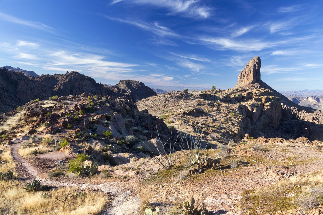
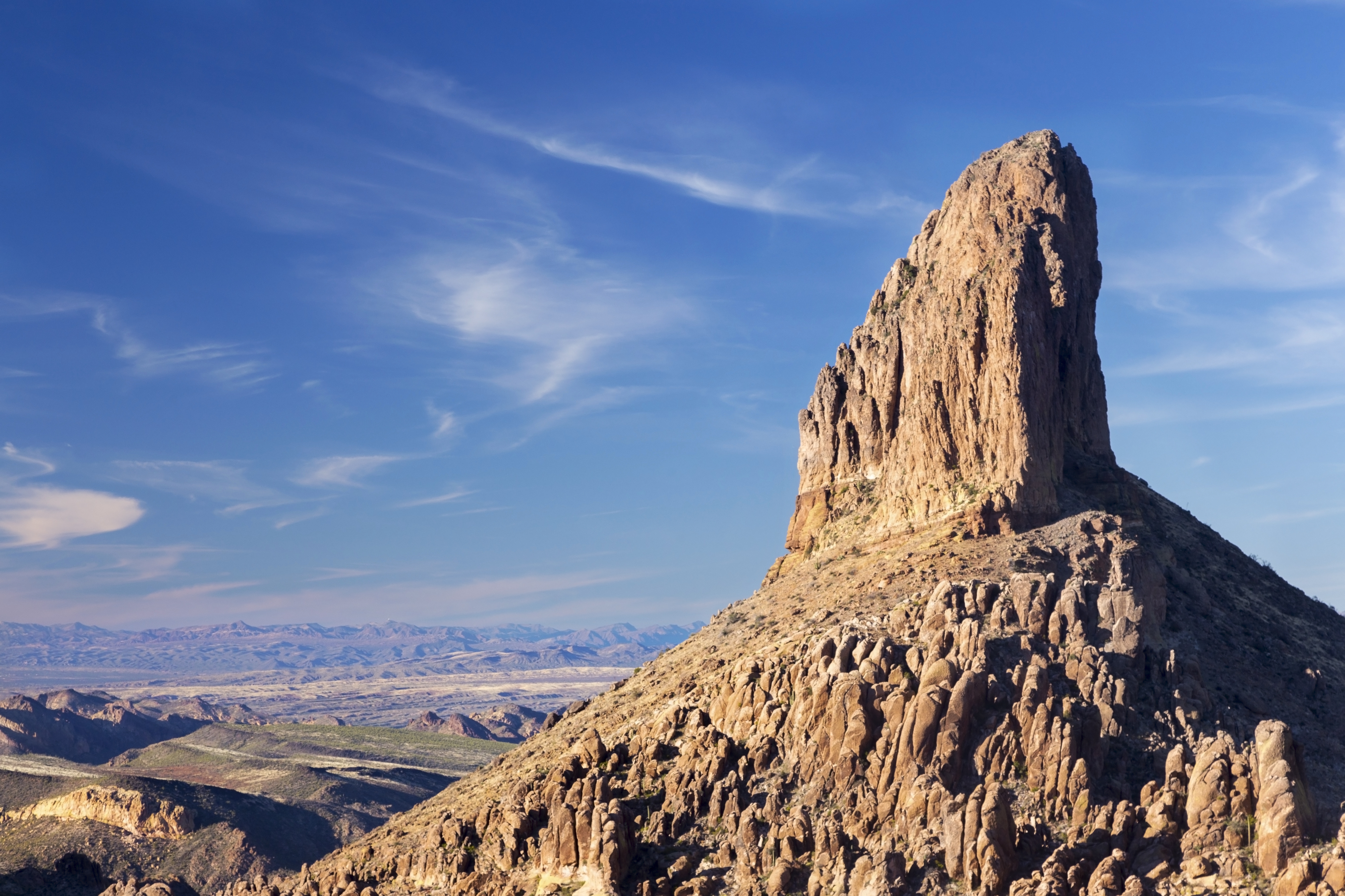
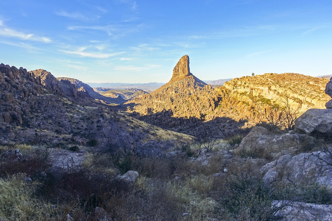 Fremont Saddle
Trademark Scenery at Fremont Saddle with Iconic Weavers Needle in center. Trail switchbacks on left side down towards Lost Dutchman area; turn right and hike Fremont Plateau towards the Needle that ends by distant tree center right, 10-15min from here Fremont Saddle
Trademark Scenery at Fremont Saddle with Iconic Weavers Needle in center. Trail switchbacks on left side down towards Lost Dutchman area; turn right and hike Fremont Plateau towards the Needle that ends by distant tree center right, 10-15min from here |
|||
 Fremont Plateau
Gorgeous Panorama on Fremont Plateau with distant Superstitions on Horizon. Ridge Highline trail splits on right side about here Fremont Plateau
Gorgeous Panorama on Fremont Plateau with distant Superstitions on Horizon. Ridge Highline trail splits on right side about here |
|||
 Weavers Hiking
Beautiful Trail circling Fremont Plateau towards Weavers Needle Viewpoint Weavers Hiking
Beautiful Trail circling Fremont Plateau towards Weavers Needle Viewpoint |
|||
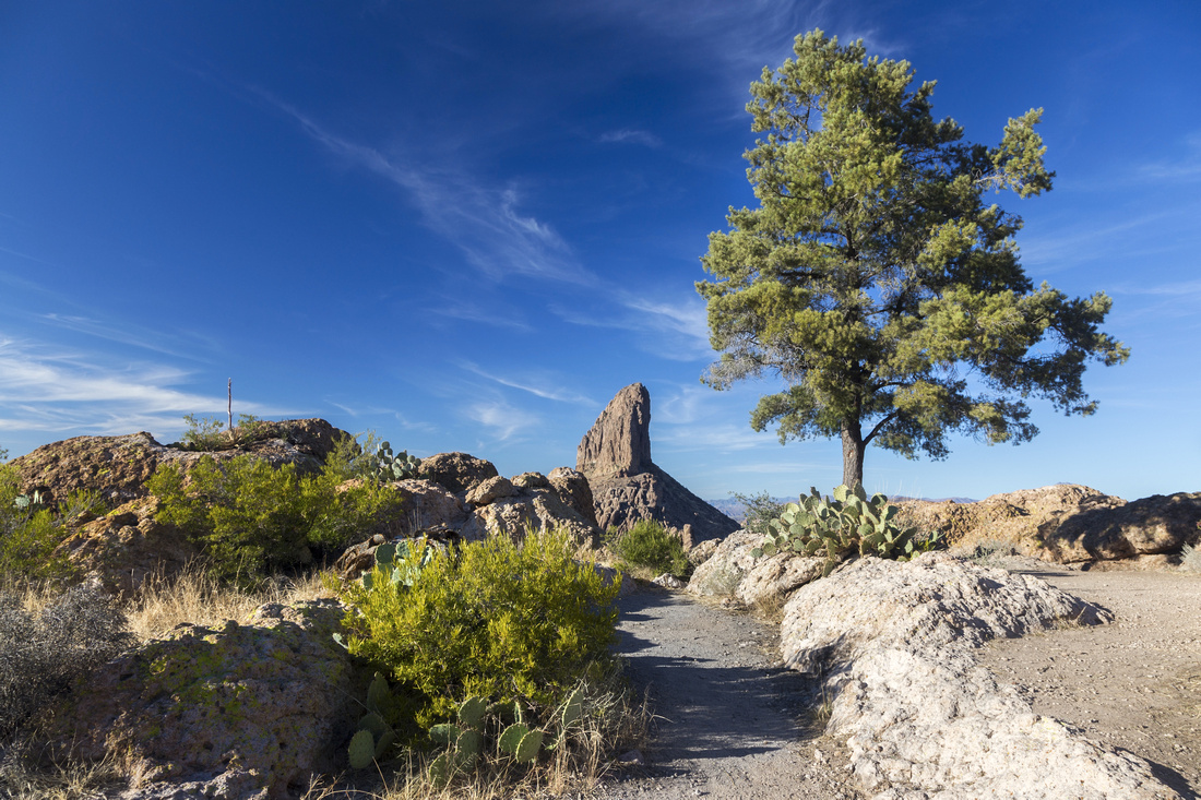 Needle Viewpoint
Trail end by that isolated tree visible from Fremont Saddle. Intervening gap towards the Needle is quite deep but I think it could be scrambled Needle Viewpoint
Trail end by that isolated tree visible from Fremont Saddle. Intervening gap towards the Needle is quite deep but I think it could be scrambled |
|||
 |
Abstract
| Overall Difficulty | D3(5) | Rocky sections with several small boulders that call for occasional use of hands (D3). Optional ridge return is harder with several class 3 rock steps and route-finding (D5) | |||
| Scenery | Beautiful canyon with multi-colored rock layers, caves and desert vegetation. Sweeping views of Superstitions Wilderness from Fremont Plateau. Spectacular Weavers Needle | ||||
| Trail/Marking | Very Good | Official trail is well defined with couple of slickrock crossings, but generally easy to follow. Some cairns on Fremont Plateau. Ridge return considerably more involved | |||
| Suggested Time | 4hrs | For Out-and-back via Peralta Trail. Add an hour for Highline Ridge return | |||
| Elevation | Start: 730m End: 1150m Total: ~450m | Round Trip: 10 km | |||
| Gear | Full hiking boots preferred for ankle support in rocky trail bed . Hiking poles very helpful for stability | ||||
| Water | No reliable water source. 1-2L in winter, in summer heat min 4L | ||||
| Dog Friendly | Yes | Assuming no extreme heat. Trail is fairly popular - keep control of your pet for courtesy to other hikers | |||
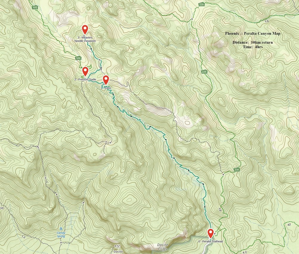 Peralta Canyon GAIA Map
 Peralta Canyon Elevation Profile