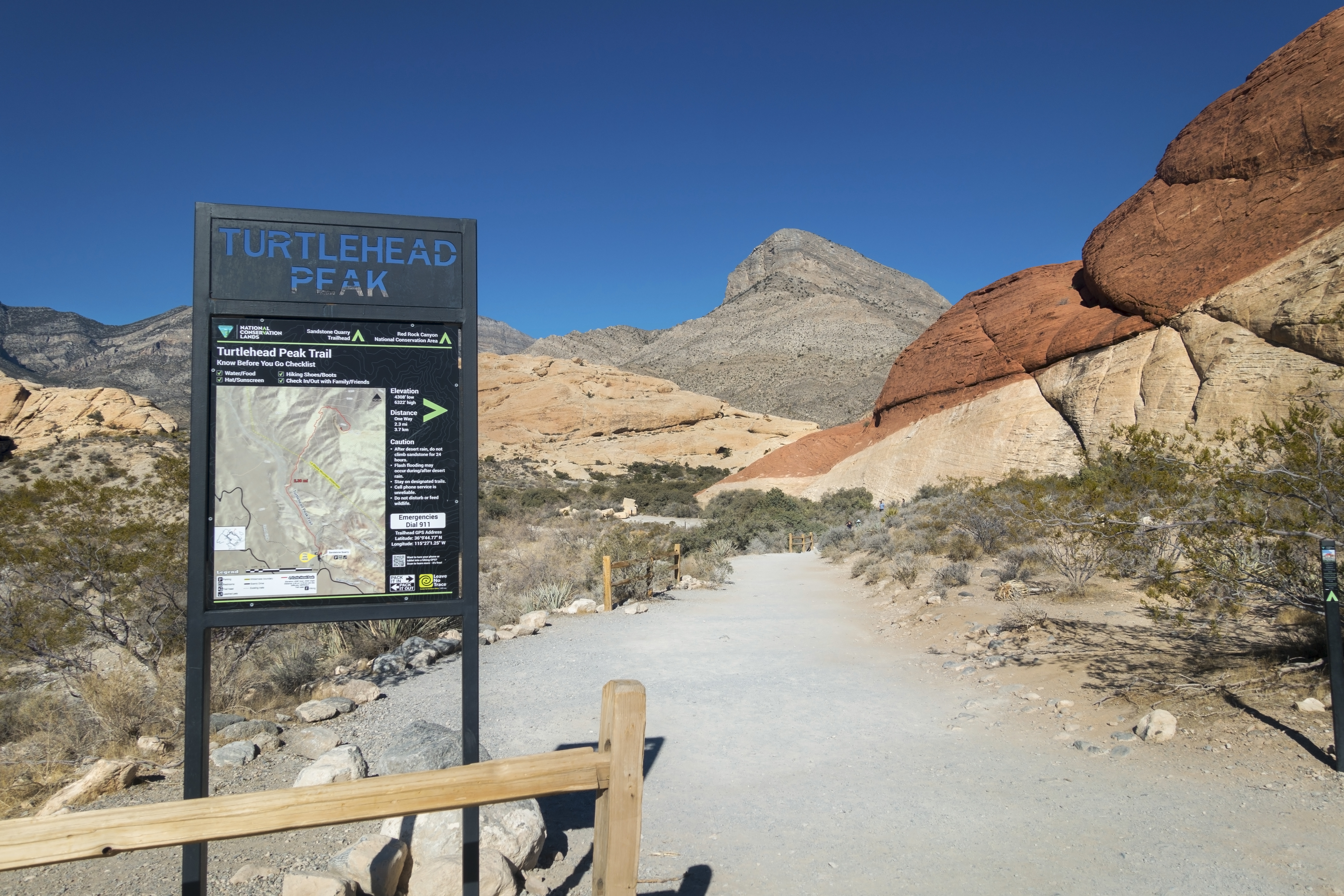
USA :: Las Vegas :: Turtlehead Peak |
|
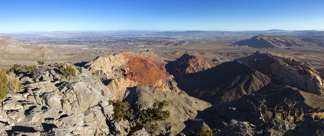
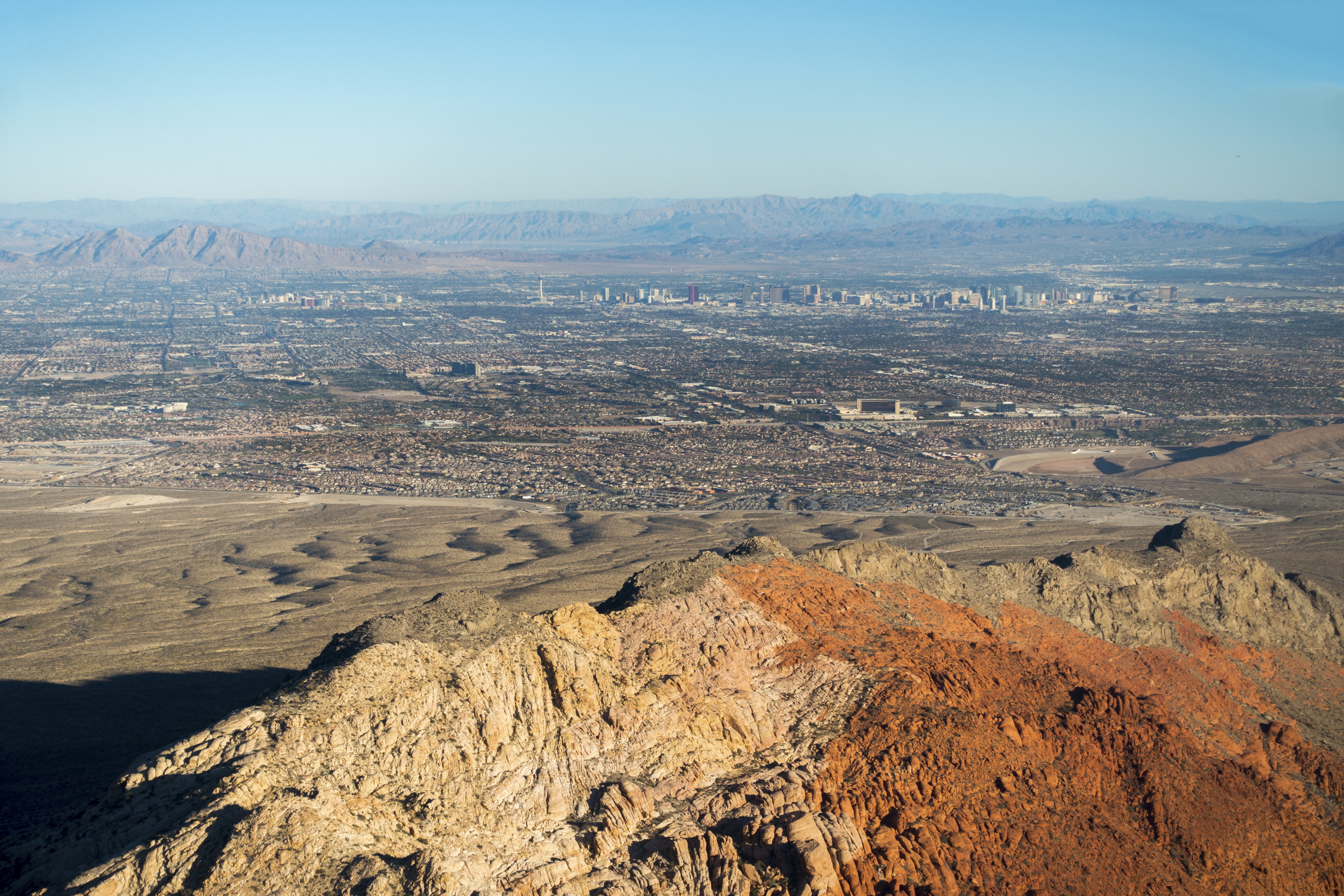
Summit Panorama with multi-colored rock layers and distant Las Vegas valley on Skyline |
|||
| Trip Summary | |||
November 30, 2021
Turtlehead Peak is short and sweet. Starting from upper Calico Rocks it gains respectful viewpoint with -almost- aerial view of entire Las Vegas basin. It lies in Red Rock National Conservation Area and fee is required. Trailhead is at Sandstone Quarry on 17-mile, one-way drive through the park. Note park open time, but do not worry if still in past posted closing as you will still be able to drive out. Just like any other desert hike in the area, summer trips are to be avoided due to extreme temperatures; optimal time is mid-October to mid-April.
Initial part is shared with Calico Tanks trail, but within 5 minutes Turtlehead trail splits to the left (signed junction). After passing through shallow canyon by some cream colored rocks, it aims directly towards the saddle to the left of the peak. Trail steepens and this is good time to return if weather is too hot, or just not feeling up to whole thing. Some eroded parts require use of hands, and last ~100m vertical below the saddle are the worst with several trails branching left or right - unique trail markers built from stones held by chicken wire point the direction. At the saddle great panorama unfolds north; peak directly across is "La Madre and El Padre", and part of access trail can be spotted. Final ascent on the backside will take ~30min. Trail branches again - stay on best defined path. All variations will converge near dead cedar three just below the summit.
Summit panorama is fantastic, even more so if you are lucky enough to have it to yourself. On my trip I descended a bit east (towards Las Vegas) and enjoyed lunch in total solitude, before retracing my steps back to the parking. |
|
Gallery |
|||
 |
|||
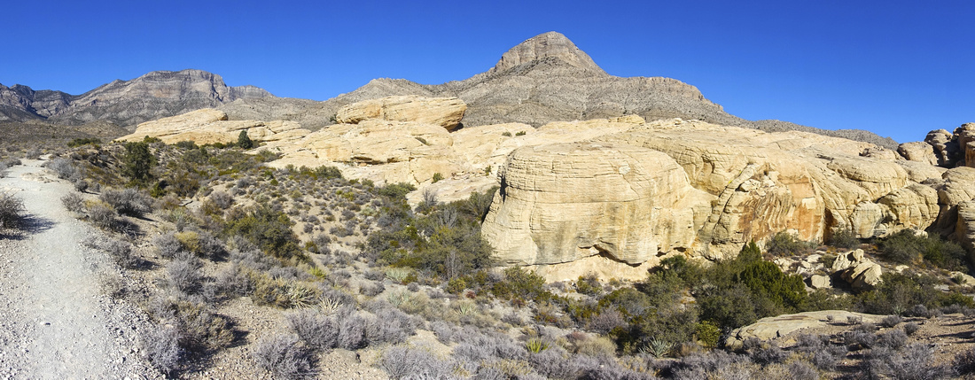
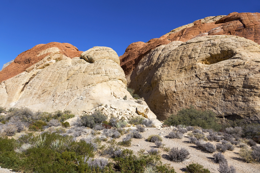 Calico Rocks Calico Rocks Closer look at wonderful Calico Rocks
 |
|||
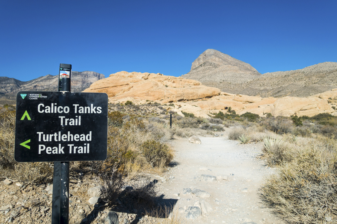 Turtlehead Junction
Signed junction ~5min into the hike; Calico Tanks straight, turn left for Turtlehead Peak Turtlehead Junction
Signed junction ~5min into the hike; Calico Tanks straight, turn left for Turtlehead Peak |
|||
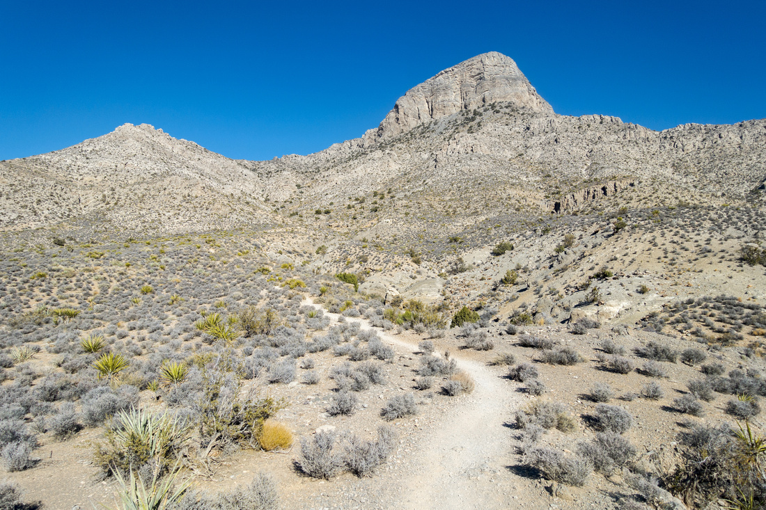
 Turtlehead Trail
Trail rising gently to the left of cream colored rock. Turtlehead Peak just right of center Turtlehead Trail
Trail rising gently to the left of cream colored rock. Turtlehead Peak just right of center |
|||
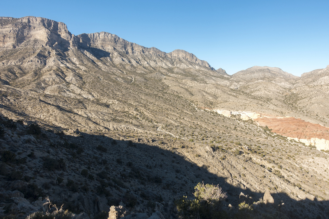
 Turtlehead Trail
Higher up aiming in direction of low saddle just left of center. Casual hikers turn around about here Turtlehead Trail
Higher up aiming in direction of low saddle just left of center. Casual hikers turn around about here |
|||
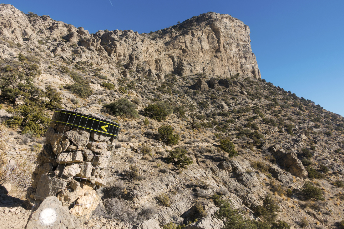 Trail Marker
Ascending the saddle with unique trail markers pointing the direction. This is the roughest part of trail bordering scrambling at times. Summit above Trail Marker
Ascending the saddle with unique trail markers pointing the direction. This is the roughest part of trail bordering scrambling at times. Summit above |
|||
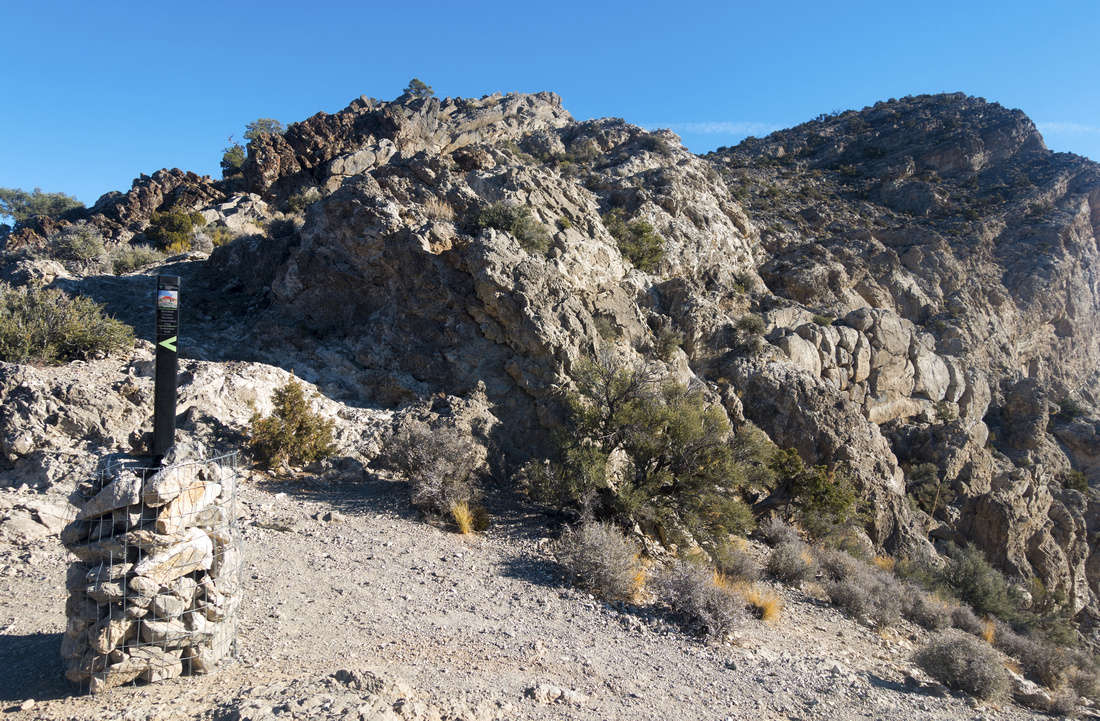 The Saddle
Trail marker at Turtlhead Saddle, past all difficulties. It will take ~1.5 hrs to here, going up, moderate pace The Saddle
Trail marker at Turtlhead Saddle, past all difficulties. It will take ~1.5 hrs to here, going up, moderate pace |
|||
 La Madre and El Padre
View of "Mother and Father" peaks north of Turtlhead Saddle; considerably longer, but not difficult ascent La Madre and El Padre
View of "Mother and Father" peaks north of Turtlhead Saddle; considerably longer, but not difficult ascent |
|||
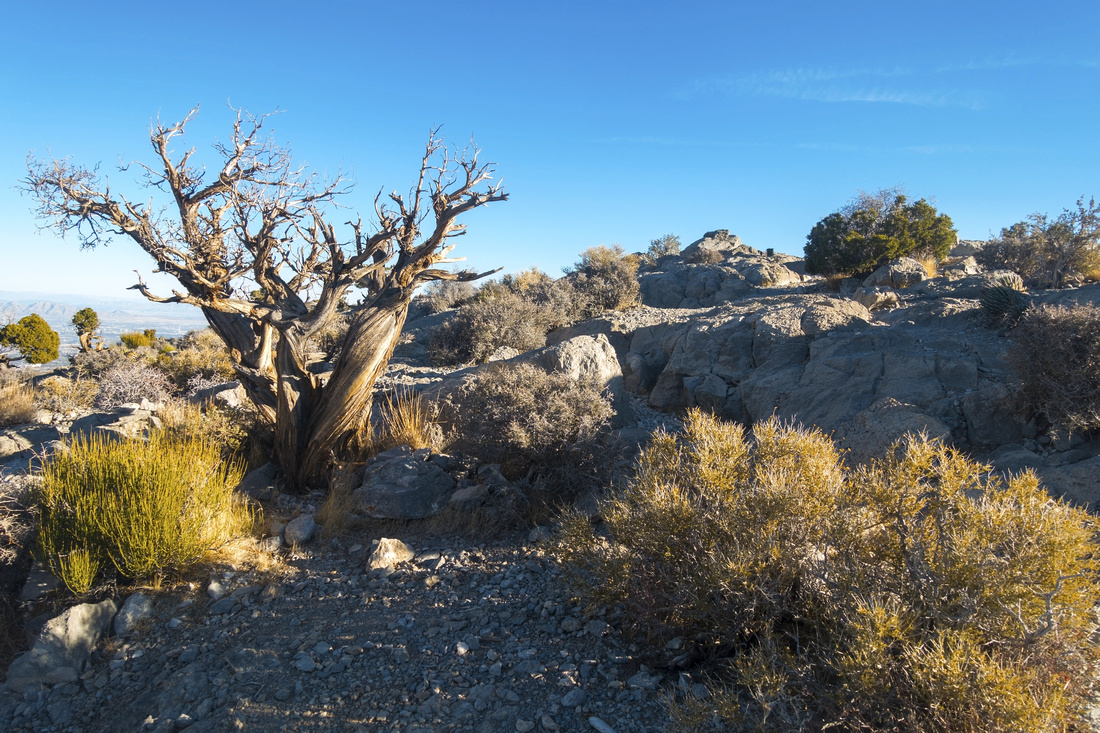 Dried Cedar
Variety of trails merge near Turtlehead Summit by this old, dried out Cedar tree Dried Cedar
Variety of trails merge near Turtlehead Summit by this old, dried out Cedar tree |
|||
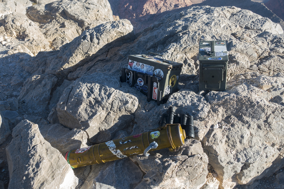 Register Variety
Three (!) different register canisters at the summit - most I've seen anywhere, all full - are testimony to overall popularity of this summit Register Variety
Three (!) different register canisters at the summit - most I've seen anywhere, all full - are testimony to overall popularity of this summit |
|||
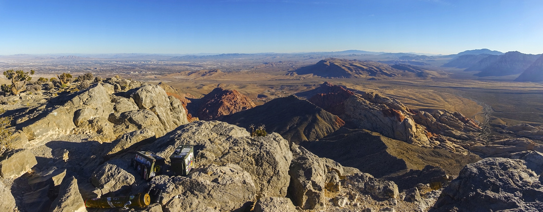 Summit Panorama
Panoramic view from Turtlehead summit by summit registers. Red Rock Core area to the right, Las Vegas distant center left Summit Panorama
Panoramic view from Turtlehead summit by summit registers. Red Rock Core area to the right, Las Vegas distant center left |
|||
 |
|||
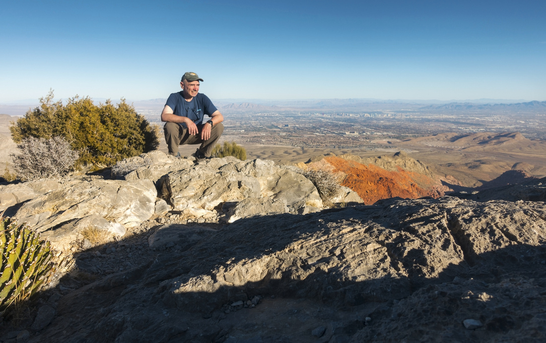 Summit Selfie
Rare selfie at Turtlehead summit with Las Vegas valley behind Summit Selfie
Rare selfie at Turtlehead summit with Las Vegas valley behind |
|||
|
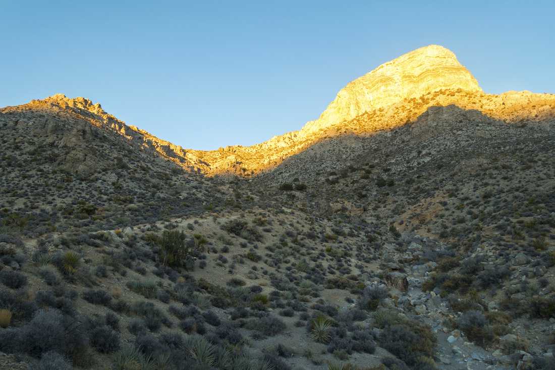
Late afternoon shade creeping in on descent |
Abstract
| Overall Difficulty | D4 | Moderately steep but relatively short ascent. Steep and eroded sectionsbelow the saddle requires occasional use of hands. | |||
| Scenery | Scenic Red Rock Canyon, Calico Rocks and Desert Landscapes. Aerial View of Las Vegas Basin from the summit | ||||
| Trail/Marking | Very Good | Signed junctions. Trail branches below the saddle and at peak backside assisted with stone markers | |||
| Suggested Time | 4hrs | Moderate pace, allowing for summit break. More in hot weather | |||
| Elevation | Start: 1340m End: 1920m Total: ~620m | Round Trip: 7 km | |||
| Gear | Full hiking boots preferred for ankle support. Hiking poles helpful. Sun protection | ||||
| Water | Entirely dry hike. 1-2L in winter, in summer heat min 4L | ||||
| Dog Friendly | Yes | Assuming no extreme heat. Keep control of your pet for courtesy to other hikers and to prevent rattlesnake bite accidents | |||