MapElevation |
USA :: San Diego :: Mount Soledad |
GPS Track |
|
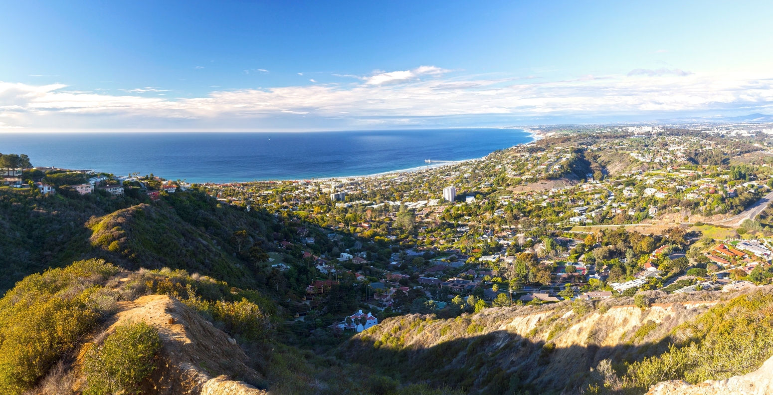
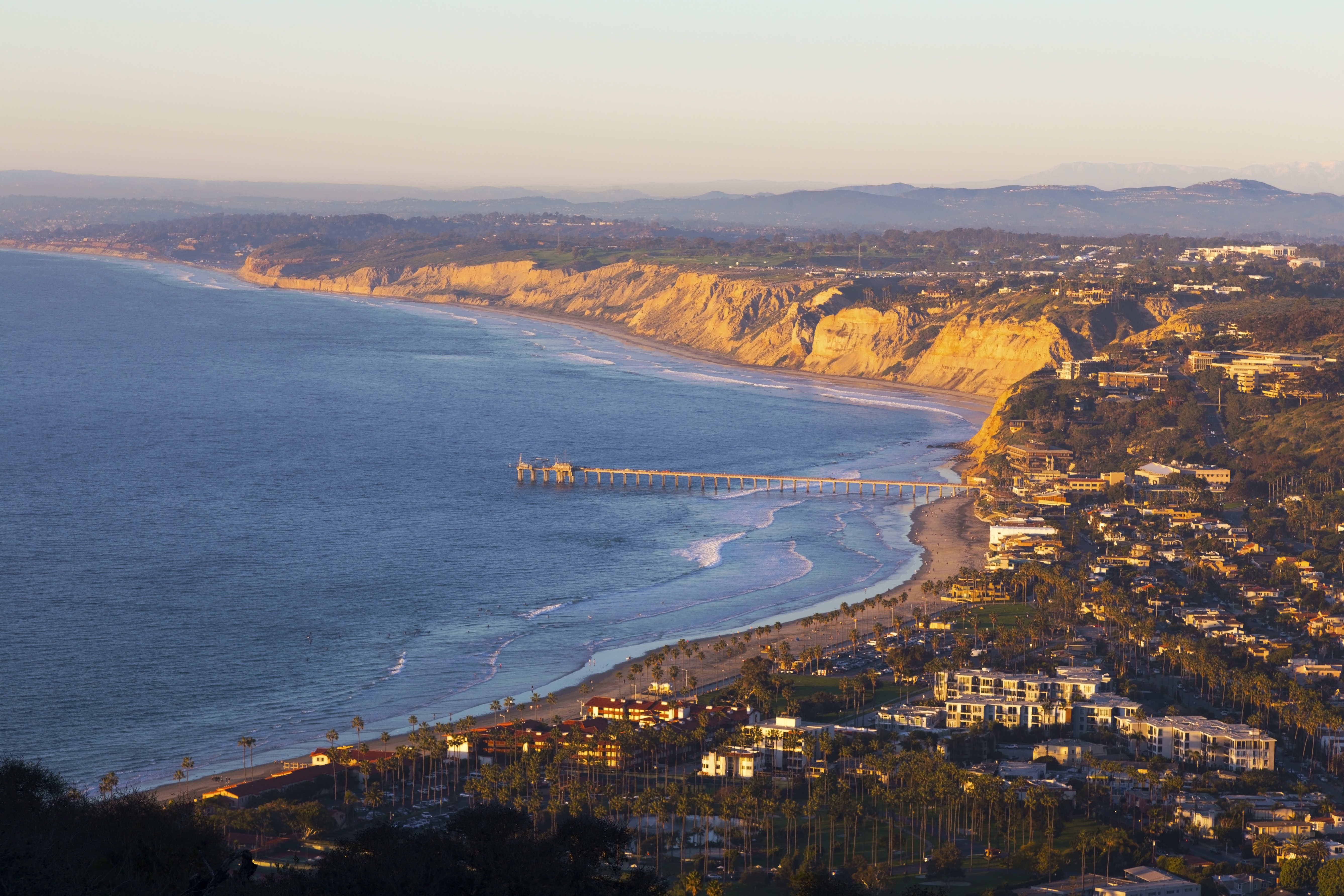
La Jolla Shores with distant Scripps Pier with curling Pacific California Coastline from Soledad Monument Viewpoint. Soledad Hill hike ends at hilltop extreme center left and does not connect directly with Monument area |
| Trip Summary | |||
January 13, 2022
Mount Soledad presents fantastic viewpoint over La Jolla / La Jolla Shores and Pacific Coastline towards Torrey Pines. It is a short jaunt that can be done in under an hour. Locals frequently come here to watch sunset, that can under right conditions be spectacular. Although it is possible to drive on rather confusing network of residential streets almost to the viewpoint, there is no parking space so it is better to stretch your legs and walk up from La Jolla village. There are several options; presented here is loop starting and ending at top of Exchange Drive.
From top of Exchange Drive where it becomes Soledad Avenue turn right into El Bahr street and walk up couple of minutes. After passing under the overpass, watch for Open Preserve Space trail splitting on the left side. Myriad of trails fork left and right so simply follow whichever direction you fancy. Fab views unfold below and it is more than enough reason to stop and look back frequently. Top is reached in 15-20min only; two park benches in fully cleared area are simply fantastic viewpoint! For return you can come down the same way, or for bit of a loop walk descend residential by following Encelia / Brodiaea / Romero / Country Club Drive streets (keep right all the time) to El Bahr street where you started.
Soledad National Veterans Memorial that should also be on your list is separate area that does not connect directly. It is best visited by driving up to huge parking lot directly below the Memorial. |
|
Gallery |
|||
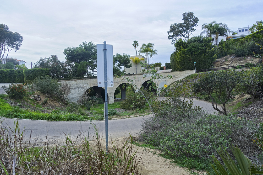 El Bahr Trailhead El Bahr Trailhead Entrance to La Jolla Heights Open Space Preserve by El Bahr Street
 |
|||
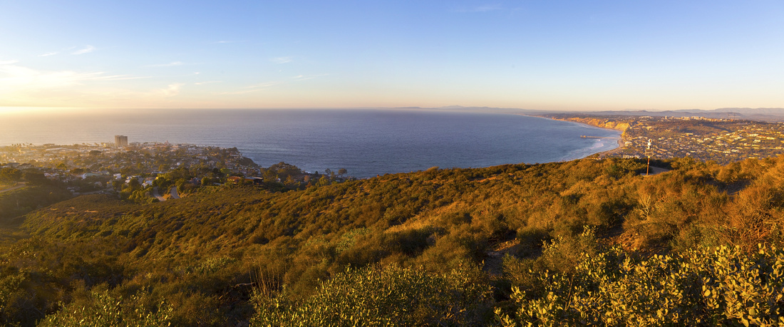 Pacific Coastline
Great views unfold as trail gains elevation to viewpoint. La Jolla left, La Jolla Shores/Scripps Pier/Torrey Pines right Pacific Coastline
Great views unfold as trail gains elevation to viewpoint. La Jolla left, La Jolla Shores/Scripps Pier/Torrey Pines right |
|||
 Wild Rose
After rainy winter wild flowers are abundant on open slopes Wild Rose
After rainy winter wild flowers are abundant on open slopes |
|||
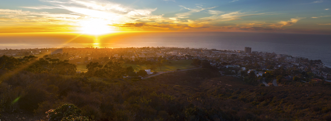 La Jolla Sunset
Pacific Sunset from viewpoint at top of Preserve. Loop descent on Country Club Drive by the Golf Course in center La Jolla Sunset
Pacific Sunset from viewpoint at top of Preserve. Loop descent on Country Club Drive by the Golf Course in center |
|||
 |
|||
 Soledad Memorial
Mount Soledad National Veterans Memorial Soledad Memorial
Mount Soledad National Veterans Memorial |
|||
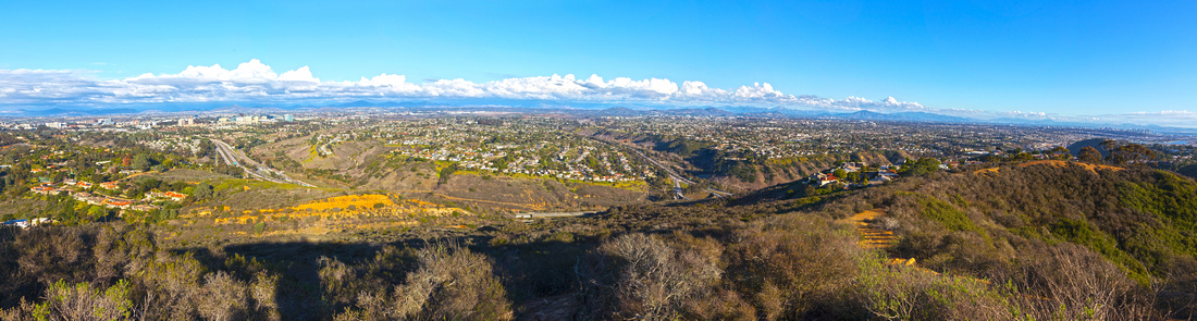 San Diego County
Panoramic View east across San Diego County from Soledad Memorial. I-5 curls in center, high-tech offices of Sorrento Valley right San Diego County
Panoramic View east across San Diego County from Soledad Memorial. I-5 curls in center, high-tech offices of Sorrento Valley right |
Abstract
| Overall Difficulty | D1 | Moderately steep but short ascent; walk on residential streets | |||
| Scenery | Sweeping Panorama of La Jolla / La Jolla Shores and Southern California Coastline. Fantastic Sunsets! Great views east across San Diego County from Soledad Memorial | ||||
| Trail/Marking | Good / None | Preserve entry table at top of El Bahr street only | |||
| Suggested Time | 1-2 hrs | Depending on how much time you want to spend enjoying views at top of the Hill. Soledad Memorial extra | |||
| Elevation | Start: 135m Max: 230m Total: ~100m | Round Trip: 2km | |||
| Gear | Running Shoes or Day Hikers. In winter windbreaker could be useful for extended stay at viewpoint | ||||
| Water | Carry 0.5L | ||||
| Dog Friendly | Yes | Popular area and dogs need to be under control at all times, specially for residential streets descent | |||