Google Map |
Rockies :: Banff-Louise :: C-Level Cirque |
GPS Track |
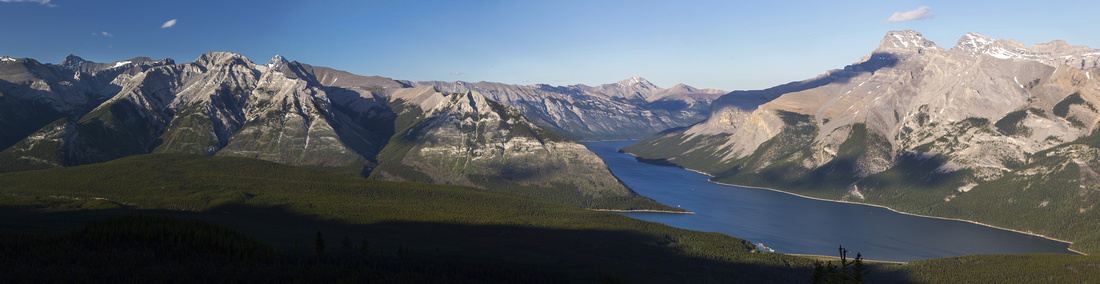 
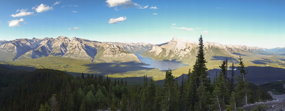
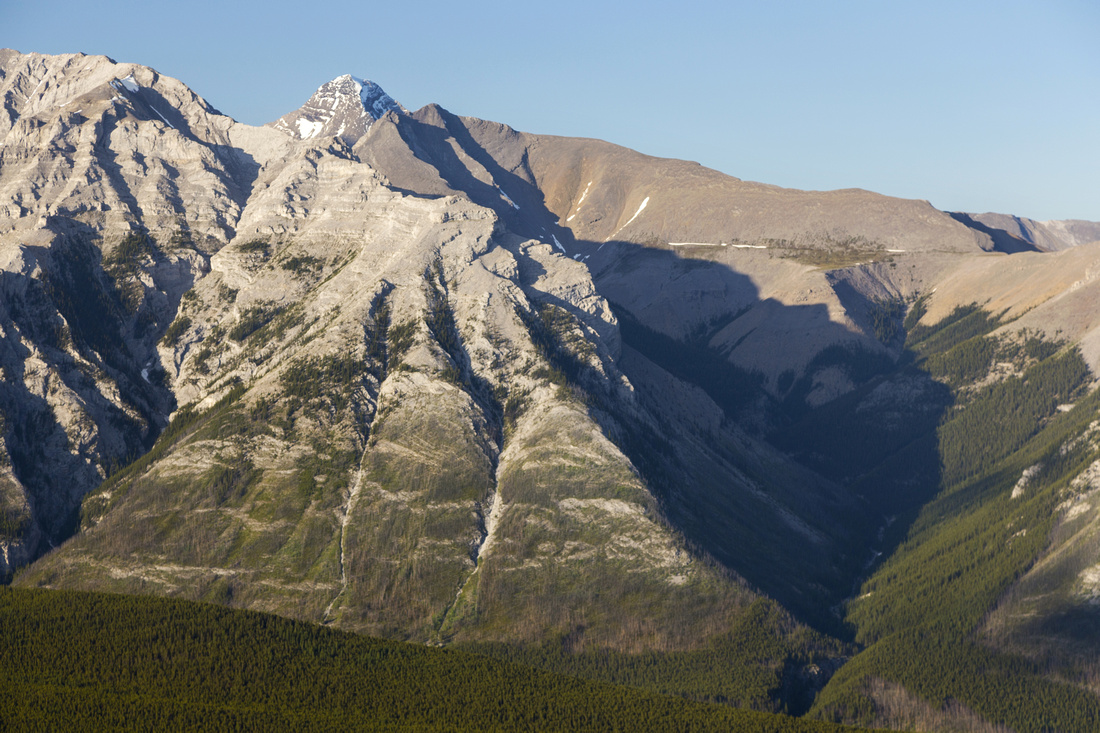
Panoramic View of Lake Minnewanka and Peaks of Fairholme Range from top of C-Level Cirque trail below Cascade Cliffs |
|||
| Trip Summary | |||
July 10, 2020
Possibly best half-day hike in Banff vicinity and excellent candidate for after-work exercise for Bow Valley residents. Trail is official and listed in Patton-Robinson Canadian Rockies Trail guide. Real reward is continuing past the Cirque where official trail ends to base of Cascade Mtn cliffs for sweeping panorama of Lake Minnewanka and Fairholme range (lead photo on this page). Added bonus is remains of old anthracite mining town 15-20min from trailhead.
Drive Lake Minnewanka access road, keeping straight at Johnson / Two Jack Lake junction. Turn left at signed upper Bankhead junction and park at large paved lot; this is also the trailhead for long cross-country journey that eventually ends at Yo-Ha-Tinda ranch in eastern part of Banff National Park. Trail starts at west end of parking lot; trailhead sign informs you there is 4.3km to the Cirque. Initially wide trail climbs for ~1.3km to old Anthracite Mining Town (15-20min). Make sure you take side trail to the right leading quickly to opening and beautiful view of Lake Minnewanka ("Mine Viewpoint" on GPS Track, download link on top of this page). Past old mine shafts trail narrows and becomes more rooty, but is still easily traveled. Couple of switchbacks and long traverse in south direction leads in another ~40min to mouth of C-Level Cirque. Note side trail (not marked) just before the opening -- it leads to small tarn, totally out of view; it is worth brief side trip. Official trail now ends, but it would be real shame not to continue as real reward is higher. Continue on trail rising on right side, stopping often to admire spectacular cliffs of Cascade Mountain. At top cross boulder field (cairns) then ascend wooded slope. Trail here is steep and quite eroded; caution required on descent (hiking poles very helpful). Finally near the top cross below second boulder slope through island of Larch trees then hike up to base of cliffs where trail ends. Views are simply spectacular, in particular Lake Minnewanka like a shining jewel reaching far towards Alberta Foothills. For scramblers of particular interest are drainages branching east of Stewart canyon and leading to several less ascended peaks at north side of Minnewanka. Return the same way. |
|
Gallery |
|||
 First Viewpoint of Lake Minnewanka ~15-20min from Upper Bankhead near old Anthracite Mining Town, same spot as in Patton-Robinson Canadian Rockies Trail Guide. Photo from 2018 trip
 |
|||
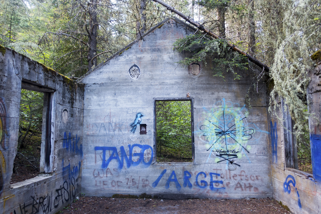 Graffiti at old Anthracite Mining Town ruins
 |
|||
|
|
|||
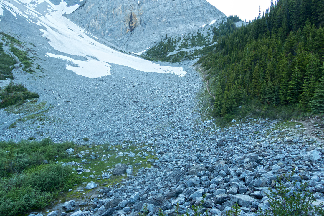 C-Level Cirque, about an hour of hiking from Trailhead. Trail continues to superior viewpoint at base of Cascade Mtn Cliffs upper right
 |
|||
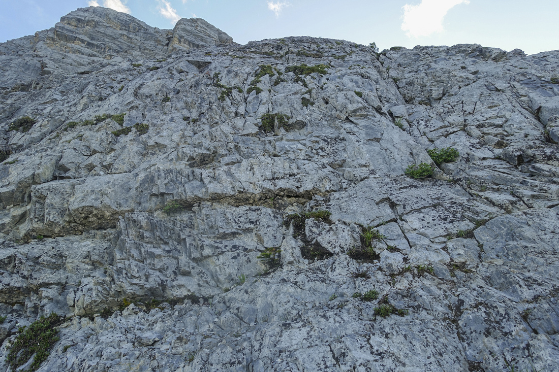 End of Hiking trail at base of Cascade Cliffs. This rock wall is very similar to (in)famous Pink Slab on standard scrambling route of Sky Pilot near Squamish in BC Coast Mountains
 |
|||
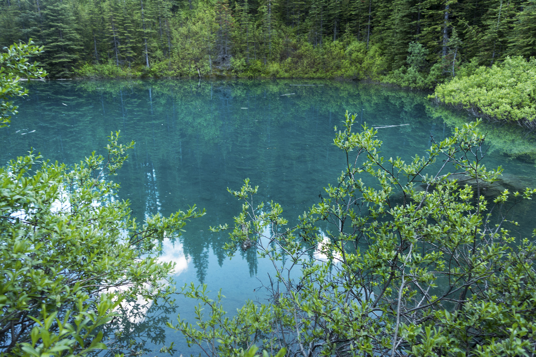
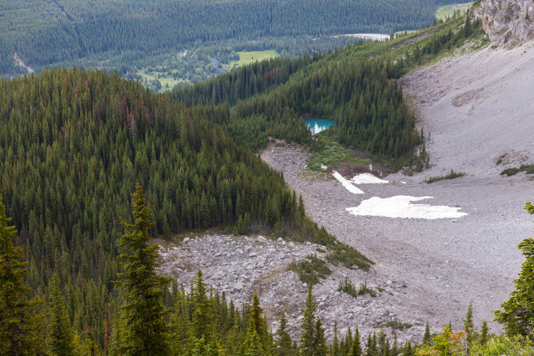 View back to C-Level Cirque from end of Hiking trail; note Tarn
 |
|||
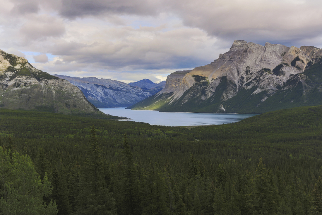
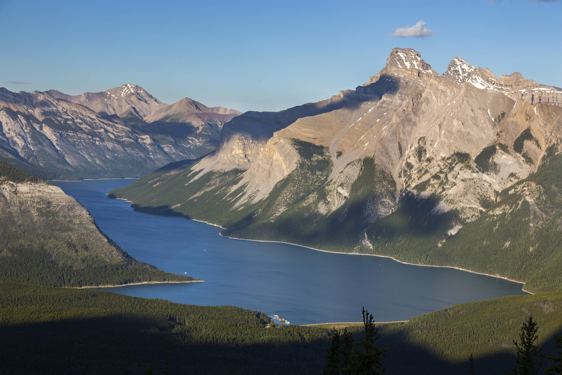 Beautiful Lake Minnewanka, one of most scenic places in Banff National Park
 |
|||
 Panoramic View of Cascade Corridor (L), Lake Minnewanka and Bow Valley (R) from end of Hiking Trail. C-Level Cirque bottom right
 |
|||
 Telephoto of interesting drainage branching off Stewart Canyon, showing potential route up beautiful ridge, likely superb viewpoint of Lake Minnewanka. Mt. Aylmer poking behind center-left
 |
Abstract
| Overall Difficulty | D2/3 | Easy trail hiking to Cirque. Boulder field crossing and steep parts if continuing to base of Cascade Cliffs | |||
| Snow Factor | S2(4) | No avalanche danger to Cirque. Steep slopes above are significant hazard | |||
| Scenery | Old Anthracite Mining Town. Sweeping views of Lake Minnewanka and Fairholme Range. Towering cliffs of Cascade Mountain | ||||
| Trail/Marking | Very Good | Official Parks Trail to Cirque, mostly well-defined above with couple of eroded sections and brief oulder field crossings | |||
| Suggested Time | 4hr | Return time to base of cliffs with relaxed pace. 2hrs sufficient if going just to the cirque | |||
| Elevation |
Start: 1490m Min: 2210m Total: ~750m (Base of Cliffs) |
Round Trip: ~11km (Base of Cliffs) | |||
| Gear | Day Hikers with good ankle coverage. Hiking poles recommended | ||||
| Water | Creek feeding small lake at bottom of Cirque, possibly dries out later in season. Carry 1L minimum | ||||
| Dog Friendly | Yes | Standard back-country travel precautions. | |||
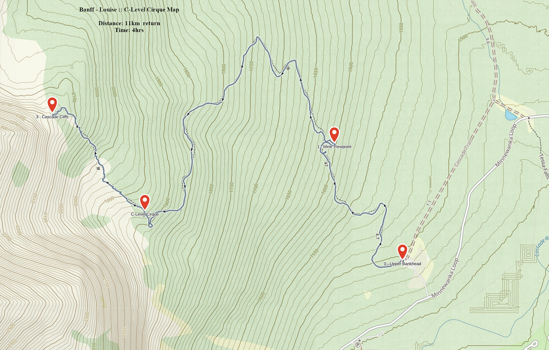 C-Level Cirque GAIA Map
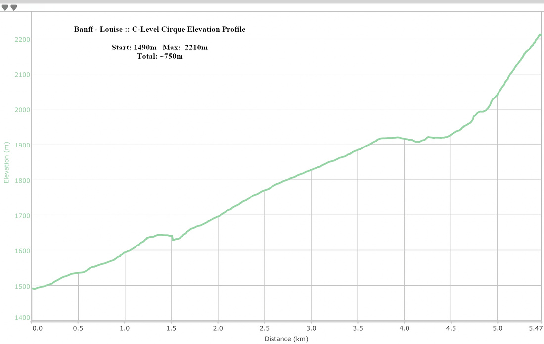 C-Level Cirque Elevation Profile