International :: Patagonia :: Mt. Aconcagua |
 
Horcones Mirador with Mt. Aconcagua in the background at first part of Confluencia basecamp access trail |
|||
|
Mt. Aconcagua, highest peak in South America (6,960.8 m or 22,837 ft), and one of Seven Summits. When I was younger I had plans to climb Aconcagua; but after extensive high-altitude trekking experiences (Kilimanjaro, Nepal) venturing above 4000m was not something I was ready to do anymore. However, having been over a week in Mendoza during second part of my Grand South-America journey Feb - Apr '23, I decided at least to visit Aconcagua park. Logical choice was dayhike to "Camp Confluencia", first overnight stop on Horcones climbing route.
Aconcagua logistics are quite convoluted. You can decide to do a day tour from Mendoza - several trekking companies offer that. This should be last option - way too overpriced, with far less freedom - DIY, as always is far better. Two issues need to be addressed:
The hike itself was beautiful, as expected. I had bluebird conditions and really enjoyed the whole thing. Trail itself is straightforward, but altitude is already high - most of the day was spent over 3000m. Gallery below is in chronological order with captions providing more information about that part. |
|
Gallery |
|||
 Horcones Trailhead
Aconcagua Provincial park entrance on Hwy 7, few minutes from Puente Del Inca Horcones Trailhead
Aconcagua Provincial park entrance on Hwy 7, few minutes from Puente Del Inca |
|||
 Visitor Center
Park Visitor Center with mandatory Permit Registration counter inside Visitor Center
Park Visitor Center with mandatory Permit Registration counter inside |
|||
 Aconcagua Cross
Catholic Cross near the Visitor Center Aconcagua Cross
Catholic Cross near the Visitor Center |
|||
 |
|||
 Horcones Trailhead
Post with distances at Horcones Trailhead. Hiking trail goes right while old road is to the left Horcones Trailhead
Post with distances at Horcones Trailhead. Hiking trail goes right while old road is to the left |
|||
 Horcones Panorama
Horcones Hiking towards Mirador just right of center. Laguna is extreme center left, just out of view Horcones Panorama
Horcones Hiking towards Mirador just right of center. Laguna is extreme center left, just out of view |
|||
 |
|||
 Mirador Del Cerro Aconcagua
Rx100 selfie at Horcones viewpoint Mirador Del Cerro Aconcagua
Rx100 selfie at Horcones viewpoint |
|||
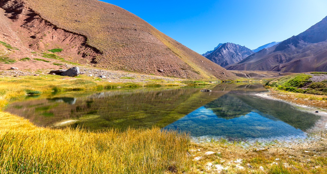 Laguna De Horcones
Beautiful Laguna De Horcones, rare body of water in arid volcanic Aconcagua landscape Laguna De Horcones
Beautiful Laguna De Horcones, rare body of water in arid volcanic Aconcagua landscape |
|||
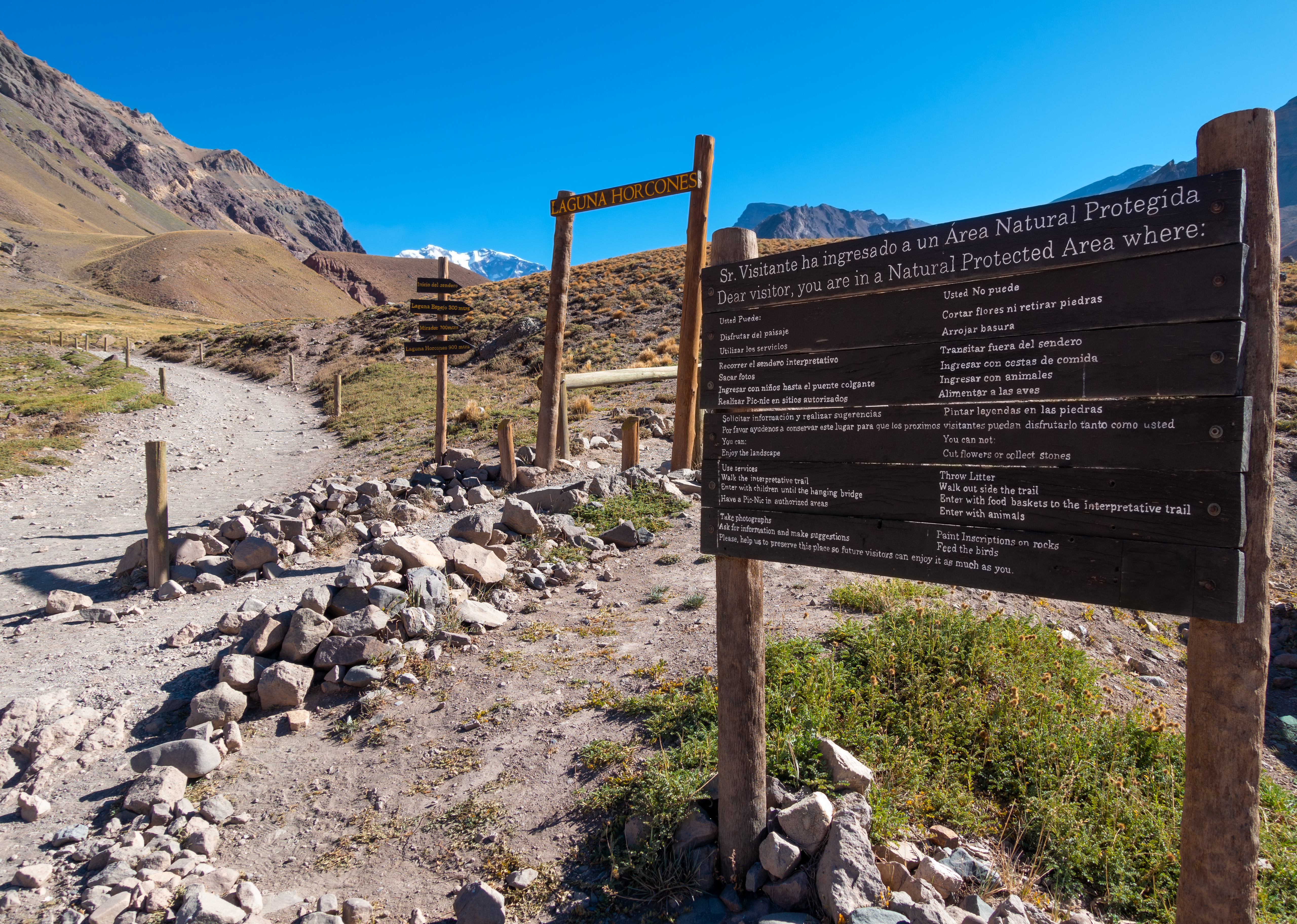
 Horcones Sign
Looking back just past Laguna De Horcones. Note posted altitude Horcones Sign
Looking back just past Laguna De Horcones. Note posted altitude |
|||
 Puente Colgante
Suspension Bridge and end of Laguna Horcones trail. Puente Colgante
Suspension Bridge and end of Laguna Horcones trail. |
|||
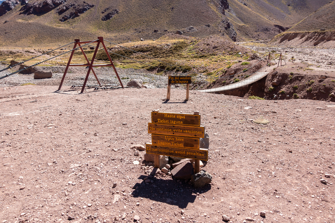 Permit Nonsense Sign
If you want to continue to Confluencia, 1.5 hrs from here, you need different permit (!). Not a joke Permit Nonsense Sign
If you want to continue to Confluencia, 1.5 hrs from here, you need different permit (!). Not a joke |
|||
 Puente Colgante
Another look at Horcones Suspension Bridge Puente Colgante
Another look at Horcones Suspension Bridge |
|||
 Confluencia trail
Gaining elevation in drainage canyon, already above 3000m. Confluencia is behind that grassy ridge distant center, 45-50min away Confluencia trail
Gaining elevation in drainage canyon, already above 3000m. Confluencia is behind that grassy ridge distant center, 45-50min away |
|||
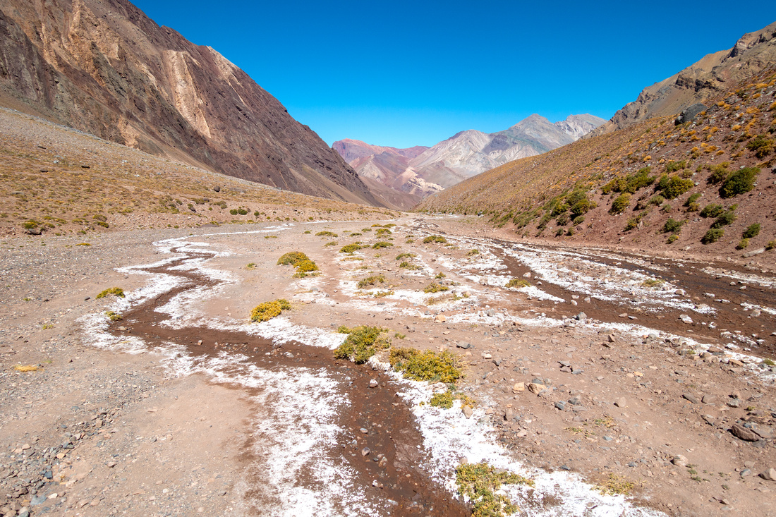 Confluencia Flats
Rocky flats just before Confluencia, looking back - note mineral salts from dried creek Confluencia Flats
Rocky flats just before Confluencia, looking back - note mineral salts from dried creek |
|||
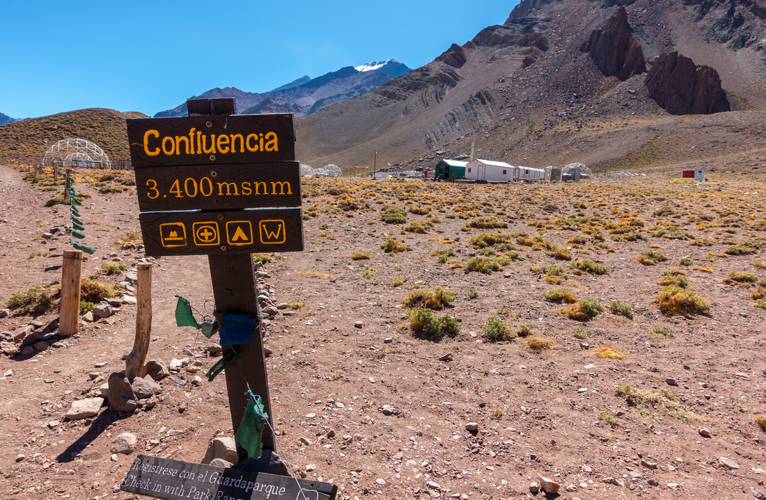 Confluencia Sign
Park sign at Camp Confluencia, usual first climber overnight. Took me 3hrs with daypack from trailhead. Note elevation Confluencia Sign
Park sign at Camp Confluencia, usual first climber overnight. Took me 3hrs with daypack from trailhead. Note elevation |
|||
 Camp Confluencia
Pano from water refill station. Day trekkers with Confluencia permit are allowed to climb that small hill just behind the camp Camp Confluencia
Pano from water refill station. Day trekkers with Confluencia permit are allowed to climb that small hill just behind the camp |
|||
 Camp Confluencia
Alternate look at Confluencia Tent Domes with more than half already taken down as it was end of season Camp Confluencia
Alternate look at Confluencia Tent Domes with more than half already taken down as it was end of season |
|||
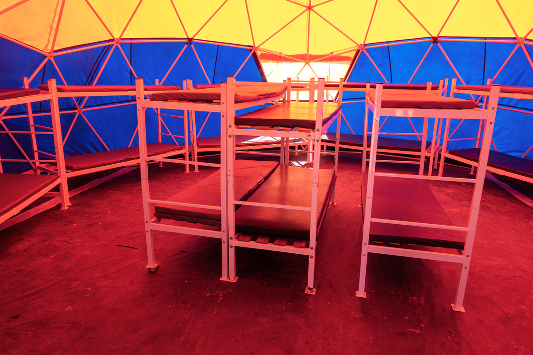 Tent Dome
Inside one of Tent Domes with bunk beds Tent Dome
Inside one of Tent Domes with bunk beds |
|||
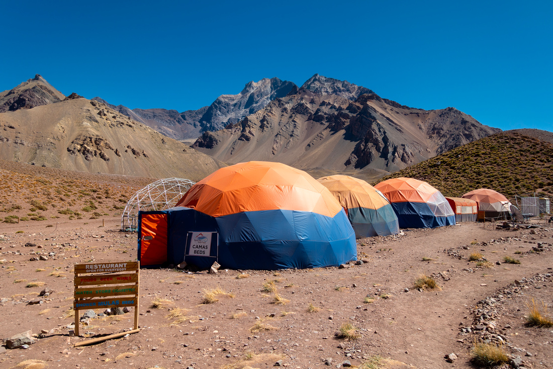 Confluencia Restaurant
Even Restaurant can be found - cooked meals, drinks too. Trekking is big business Confluencia Restaurant
Even Restaurant can be found - cooked meals, drinks too. Trekking is big business |
|||
 Camp Confluencia
Confluencia aerial view from hill above the camp. Registration checkpoint is green hut upper center left Camp Confluencia
Confluencia aerial view from hill above the camp. Registration checkpoint is green hut upper center left |
|||
 Confluencia Skyline
Aconagua trail continuing past Confluencia; next camp is Plaza Francia ~4200m and 5-6 hrs away. Confluencia Skyline
Aconagua trail continuing past Confluencia; next camp is Plaza Francia ~4200m and 5-6 hrs away. |
|||
 Confluencia Ridge
Ridgetop above Confluencia looking back was my Aconcagua turnaround point Confluencia Ridge
Ridgetop above Confluencia looking back was my Aconcagua turnaround point |
Even if lower part of trail to Horcones bridge was considerably more scenic, I was still glad I continued to Confluencia for overall Aconcagua experience. There was bit of expected longing at that Ridge above Confluencia "Why can't I keep going", but it was still overall fantastic day and something I will fully recommend to reasonably fit outdoor oriented traveller. Some stats to help plan your Confluencia Hike:
- Return Distance: ~14km
- Max elevation: ~3450m (Ridge above Confluencia Camp)
- Elevation gain from Visitor Center: ~550m
- Return Time: ~6hrs (3hrs up, 2 down, 1hr breaks)
- Water: At Visitor Center and at Confluencia, none in between
- Gear: Day hikers will suffice, hiking pole helpful