Google Map |
USA :: Phoenix :: Flatiron |
GPS Track |
|
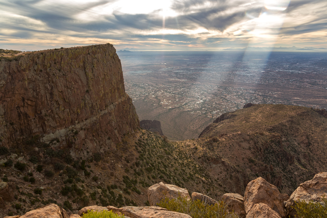
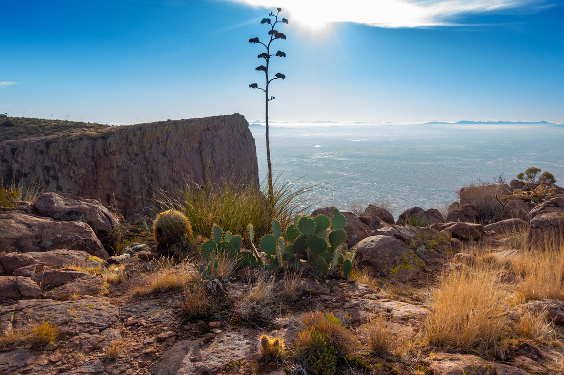
South Flatiron from North; Phoenix Valley of the Sun behind. Lesser Flatiron, less demanding alternative from top of Siphon Draw center right |
|||
| Trip Summary | |||
Multiple Dates, Last December 28, 2023
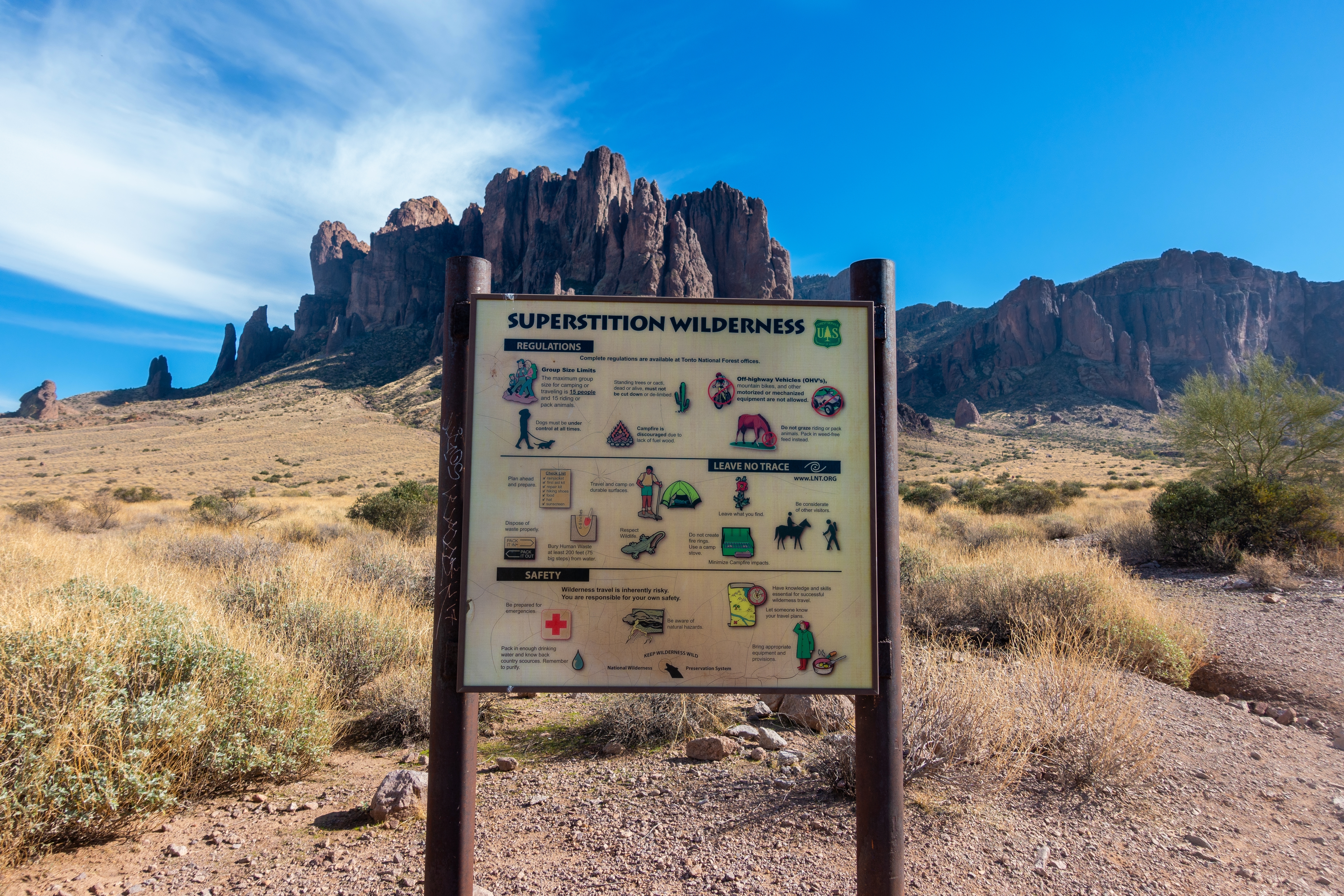
Flatiron is sometimes regarded Rite of Passage for seasoned Phoenix area Hikers. Starting point is Lost Dutchman Arizona State Park at west end of Superstitions Wilderness (10 USD day entrance fee). Car camping is pleasant option, but campground fills fast in season (winter) and on weekends. Ascent consists of 2 parts:
Despite not being technically too difficult, trip is tiring due to rough terrain that gets worse the further you go. Micro-terrain route finding skills are essential. Confusing part is about halfway up the scramble gully. Better defined 'trail' exits to climber right, but ends in difficult terrain - stay in the gully. Technical Crux is near the top; steep short class 4 rock step. Easier, but not obvious alternative is scramble up cleft on climber left where some low bush provides reliable 'veggie-belay' option (class 3). Descent is not much faster and requires fair amount of concentration. I've been to Flatiron twice, first time in my 50s and second in my 60s, and always had muscle pain the following day. Area is super popular, specially first part to top of Siphon Draw, and elbowing through the hordes might be the Crux. Scenic rewards are more than adequate though - see Gallery. If driving out the same day be weary of Lost Dutchman Gate closure (8pm in winter) in order not to get yourself locked out.
There are many options to extend the trip, from Ironview Peak scramble (class 3, add at least an hour RT) to multi-day 1 way Superstitions Wilderness traverse that ends in Carney Springs. Less demanding alternative is "Lesser Flatiron" (fork at top of Siphon Draw), pleasant easy hike to top of vast plateau below South Flatiron that does not connect to Main peak.
|
|
Gallery |
|||
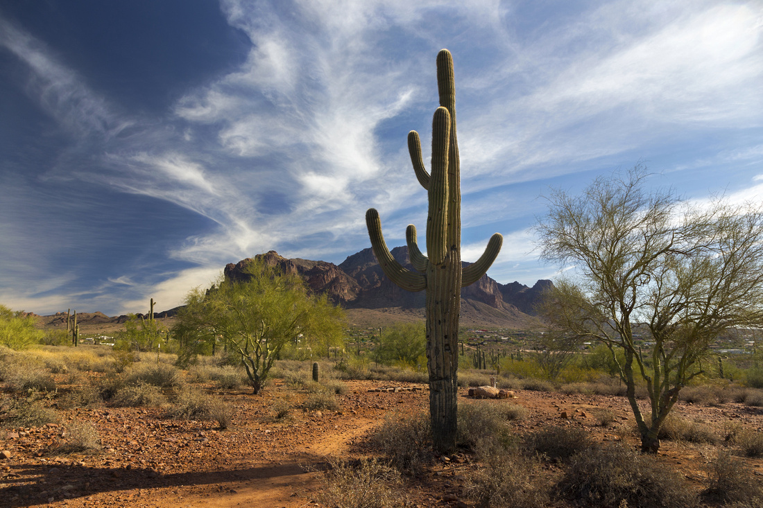 Saguaro Skyline Saguaro Skyline Trademark Saguaro Cactus near Trailhead; Superstitions Range behind
 |
|||
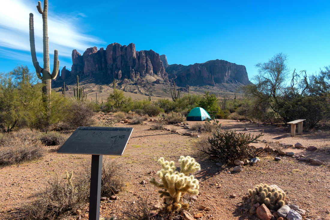 Lost Dutchman Campground
Initial Part of Siphon Draw Trail passing through Lost Dutchman Campground Lost Dutchman Campground
Initial Part of Siphon Draw Trail passing through Lost Dutchman Campground |
|||
 |
|||
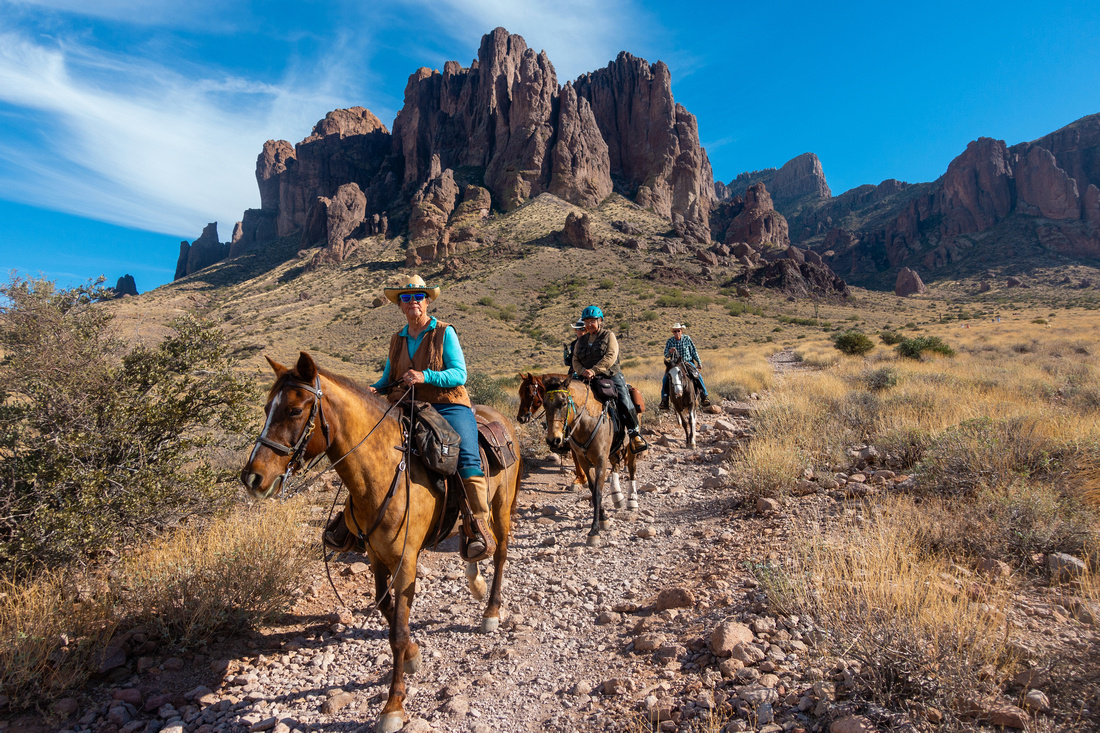 Horseriders
Siphon Draw Trail is shared with horseback riders Horseriders
Siphon Draw Trail is shared with horseback riders |
|||
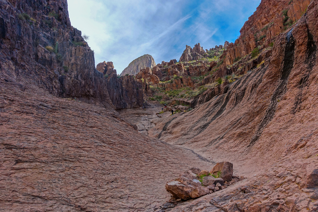
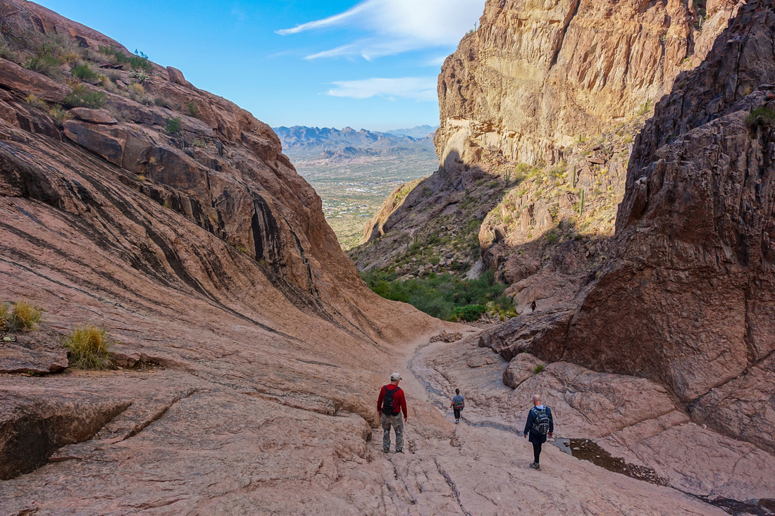
 Siphon Bowl
Going becomes more rough as trail circles on climber left side of lower Siphon Draw Siphon Bowl
Going becomes more rough as trail circles on climber left side of lower Siphon Draw |
|||
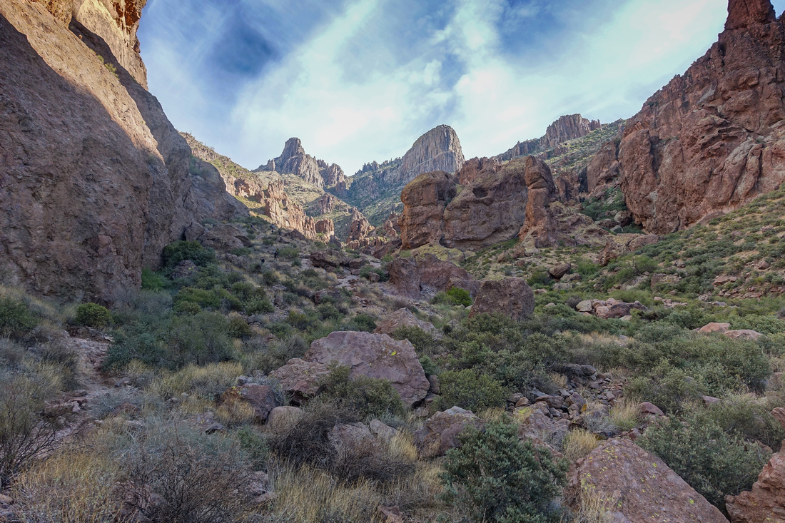
 Siphon Draw
Trail ends at slickrock in upper Siphon Draw; Flatiron poking above Siphon Draw
Trail ends at slickrock in upper Siphon Draw; Flatiron poking above |
|||
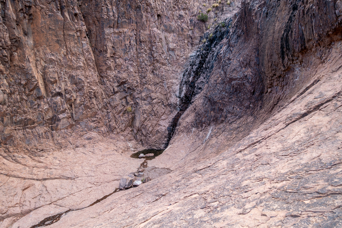 Siphon Waterfall
Seasonal Waterfall, only source of water with just a puddle remaining in December Siphon Waterfall
Seasonal Waterfall, only source of water with just a puddle remaining in December |
|||
 Siphon Crowds Siphon Crowds
Area is very popular and elbowing through the hordes, sometimes completely unprepared, could be the crux |
|||
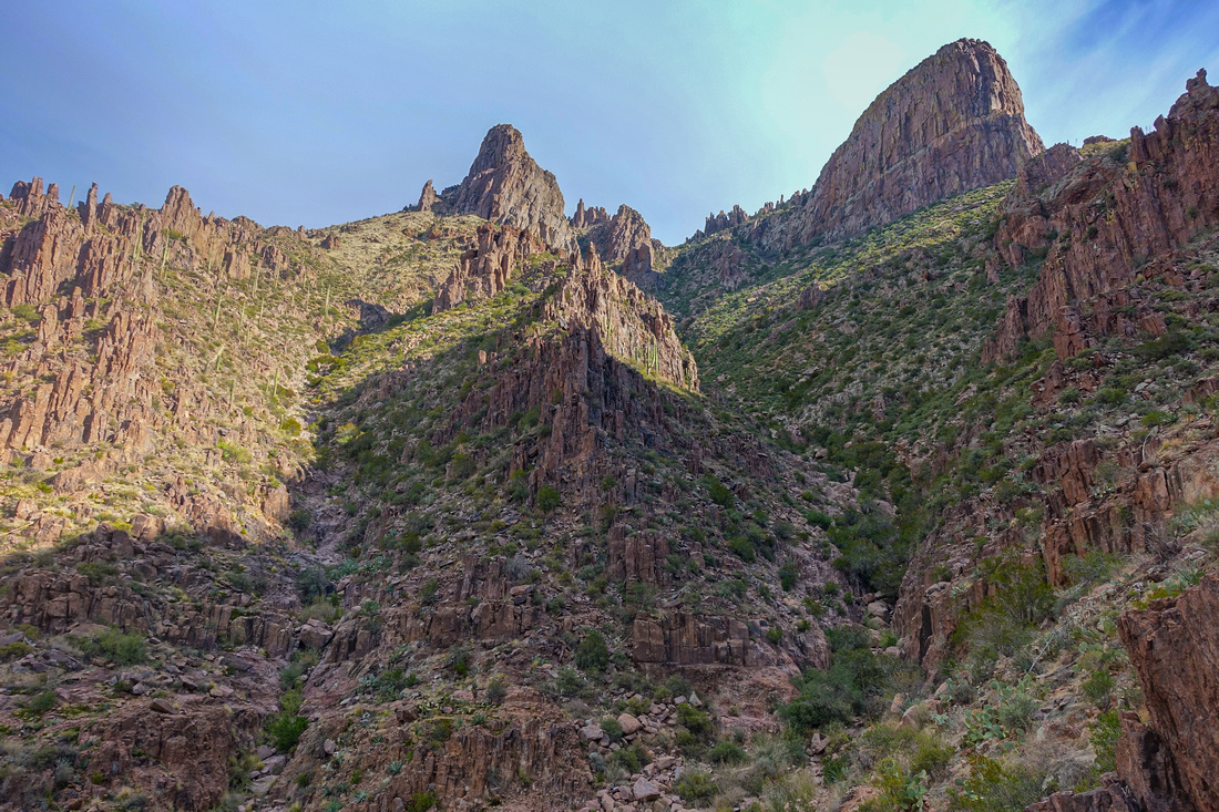 Ascent Gully
Ascent gully (right of center) after scrambling to saddle above Siphon Draw; North and South Flatiron above. "Lesser Flatiron" trail branches right about here Ascent Gully
Ascent gully (right of center) after scrambling to saddle above Siphon Draw; North and South Flatiron above. "Lesser Flatiron" trail branches right about here |
|||
 Ascent Gully
Looking down at one of easier sections in scramble gully. "Lesser Flatiron" upper left Ascent Gully
Looking down at one of easier sections in scramble gully. "Lesser Flatiron" upper left |
|||
 Superstition Peak
Granite Spires from saddle between two Flatirons after topping up ascent gully. Ironview Peak Scramble route heads up to the right of largest spire Superstition Peak
Granite Spires from saddle between two Flatirons after topping up ascent gully. Ironview Peak Scramble route heads up to the right of largest spire |
|||
 Flatiron View
Flatiron South from pleasant hiking trail to lower North Flatiron View
Flatiron South from pleasant hiking trail to lower North |
|||
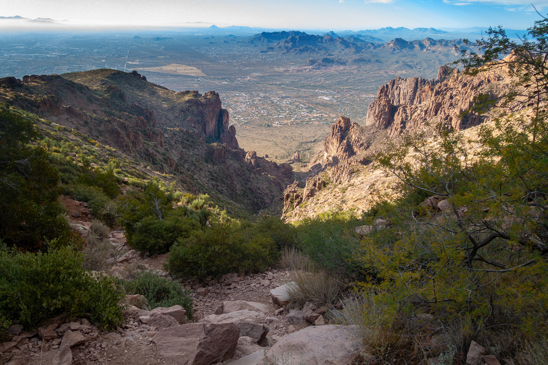
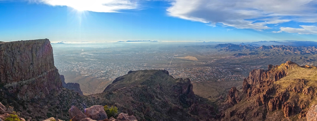 Valley of the Sun
Panoramic view across Phoenix Valley from North Flatiron. South (Main) peak left, "Lesser Flatiron" lower center Valley of the Sun
Panoramic view across Phoenix Valley from North Flatiron. South (Main) peak left, "Lesser Flatiron" lower center |
|||
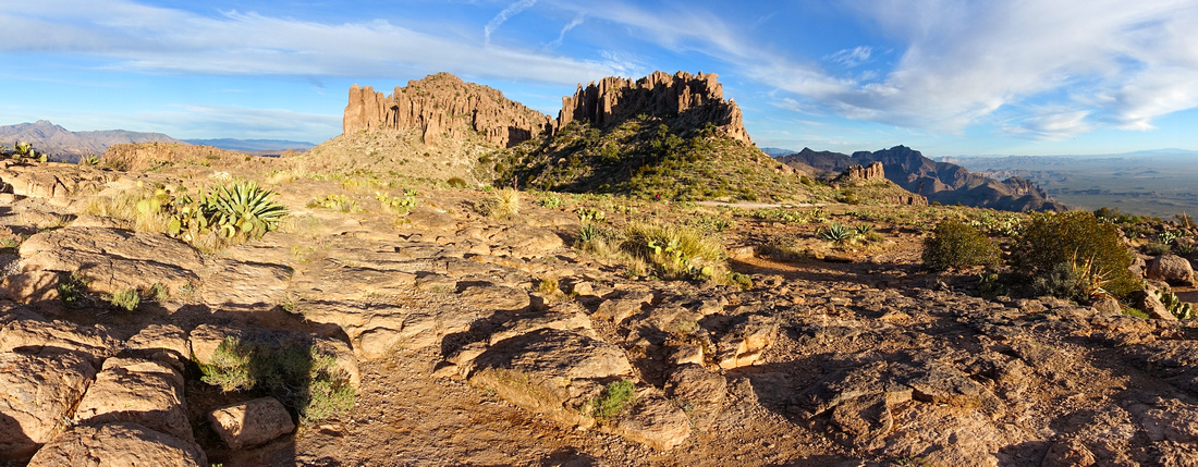 South Flatiron Panorama
Panoramic view east across Ironview Peak from South (Main) Flatiron South Flatiron Panorama
Panoramic view east across Ironview Peak from South (Main) Flatiron |
|||
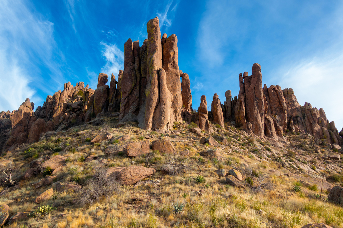
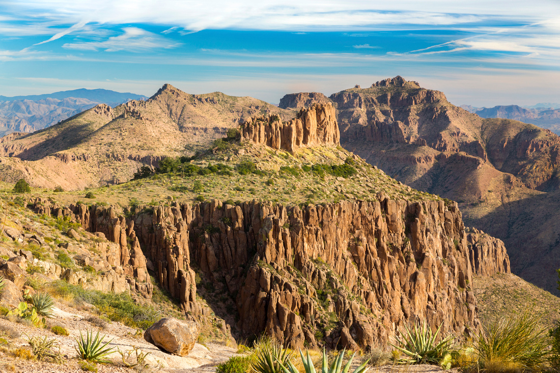 Superstitions Wilderness
 after descending on faint leading to climbing base of foreground Rock Obelisk Superstitions Wilderness
Superstitions Wilderness after descending on faint leading to climbing base of foreground Rock Obelisk |
Abstract
| Overall Difficulty | D6 | Scramble: Class 2 rock in Siphon Draw, sustained class 3 in gully with class 4 step near the top | |||
| Scenery | Lost Dutchman State Park and Siphon Draw. Aerial panorama of Phoenix Valley of the Sun and Superstitions Wilderness | ||||
| Trail/Marking | Good / None | Well defined and signed Park trail to Siphon Draw, route above. Some confusing parts in upper gully. Occasional faded white paint blazes | |||
| Suggested Time | 5-6hrs | Return Time. Add at least an hour if scrambling Superstitions Peak | |||
| Elevation | Start: 655m Max: 1435m Total: ~800m | Distance: 11km return | |||
| Gear | Full hiking boots much preferred for ankle support on steep rocky terrain . Hiking poles very helpful for stability | ||||
| Water | Seasonal Waterfall in Siphon Draw. No reliable water source. 1-2L in winter, in summer heat min 4L | ||||
| Dog Friendly | Yes | Crux Rock step at top of ascent gully might present a problem. Trail is fairly popular - keep control of your pet for courtesy to other hikers | |||
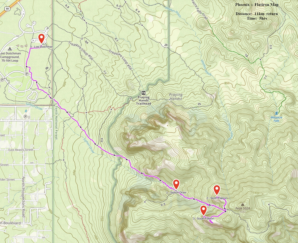 Flatiron GAIA Map
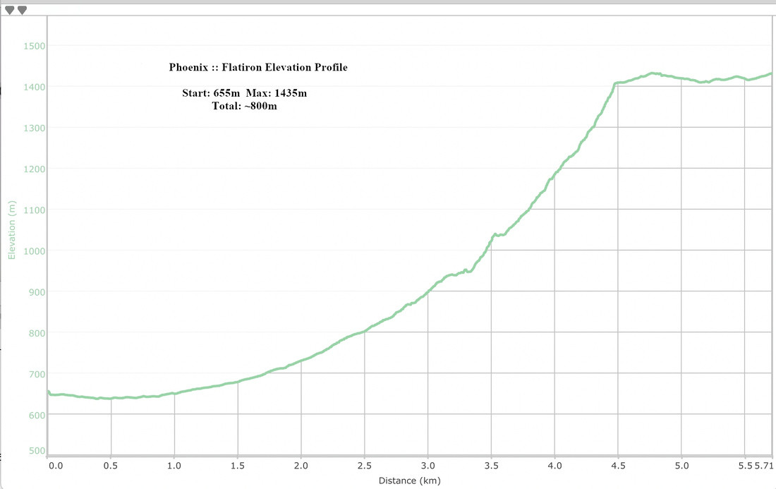 Flatiron Elevation Profile