Google Map |
BC Coast :: Sea to Sky :: Mt. Brunswick |
GPS Track |
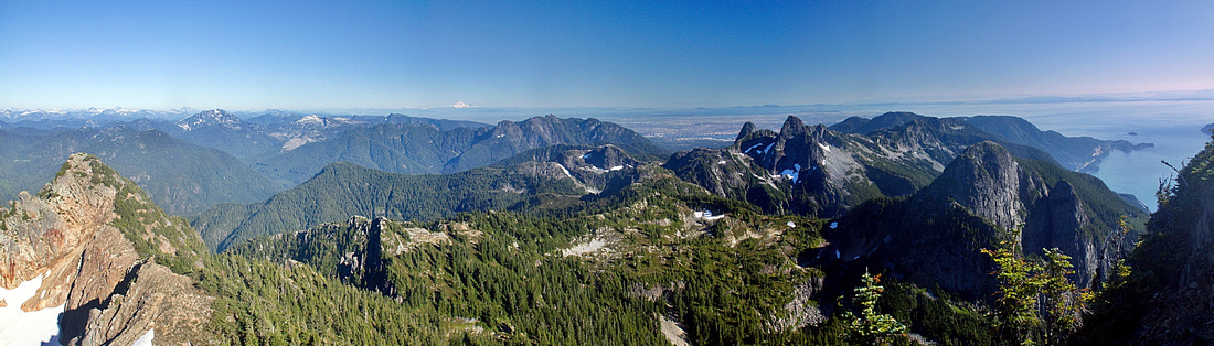 
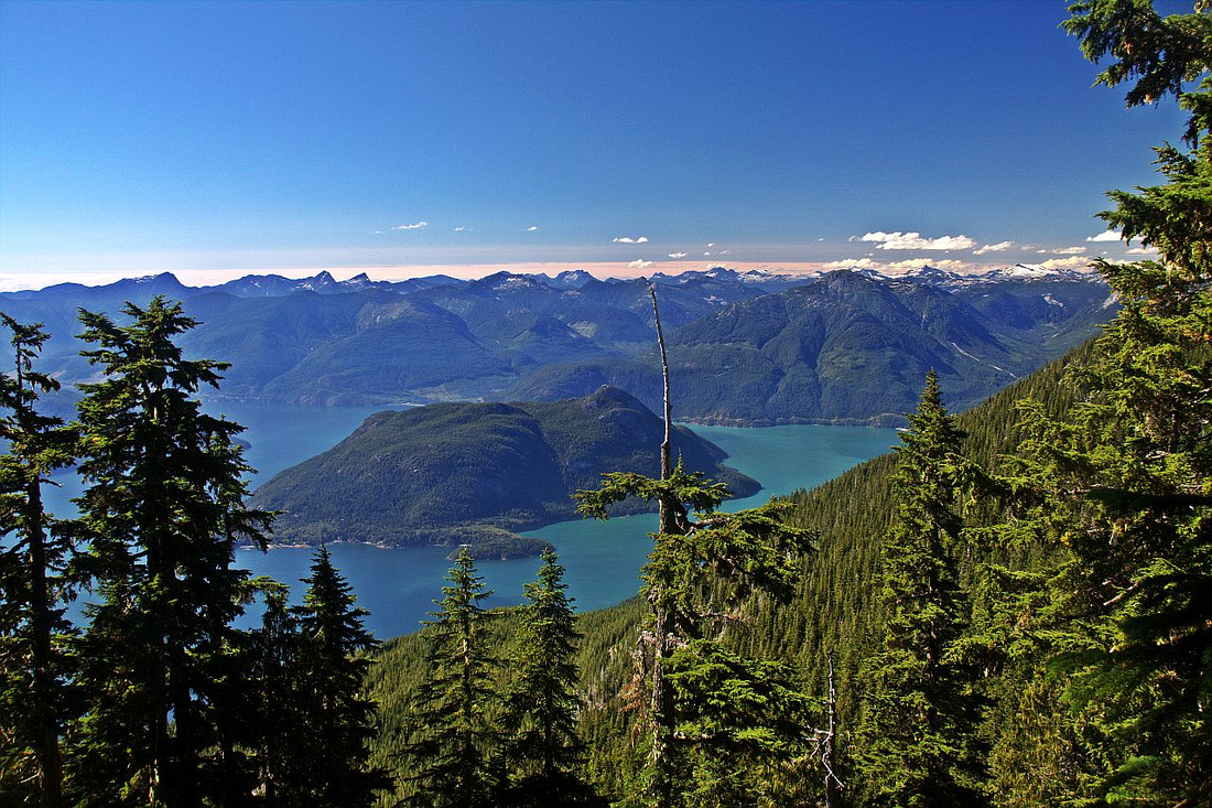
Panoramic View South from Summit of Mt. Brunswick, looking down HSCT spine. Lions just right of center, Mt. Harvey to its right. |
|||
| Trip Summary | |||
October 8, 2012Mt. Brunswick is classic Sea-to-Sky scramble. Just like for the other targets radiating from Lions Bay price must be paid in form of substantial elevation gain starting from near sea level. But outstanding views from the summit are more than adequate reward; in particular sweeping views of Howe Sound Crest spine. Alternate return option includes loop via backside of Mt. Harvey making it one of most rewarding day-trips in Sea-to-Sky area. Overnight is possible in Magnesia Meadows, but please avoid using NSR shelter except in case of real emergency.
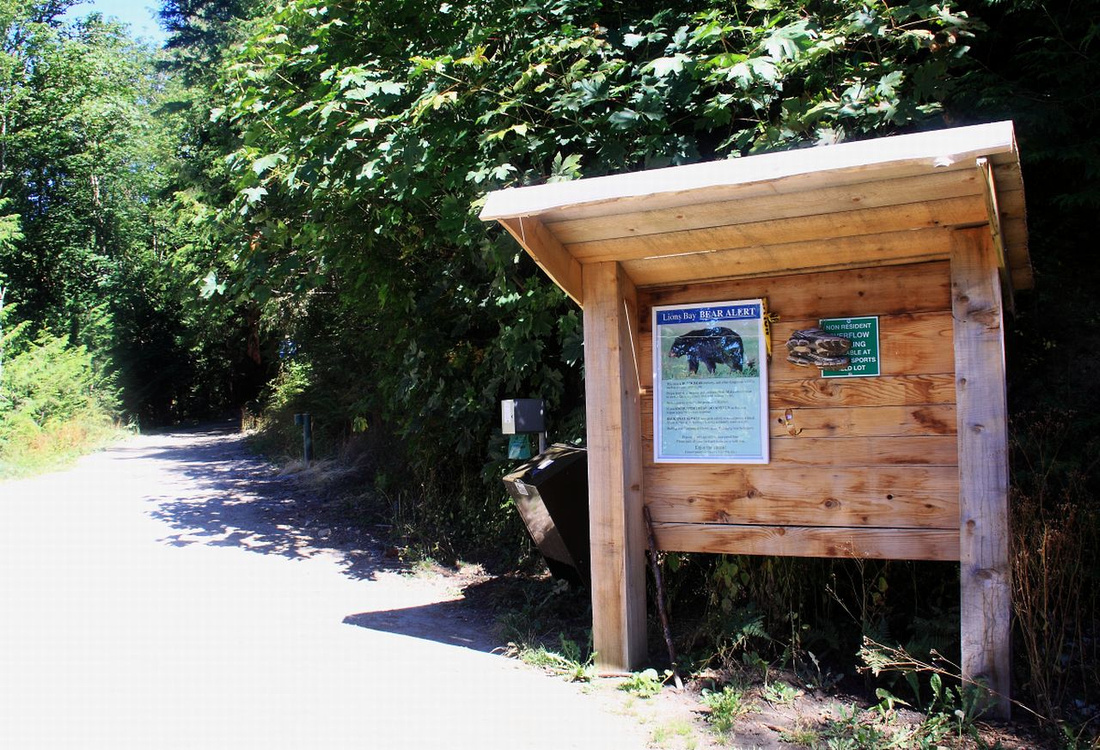
Park at Lions Bay, same as for Lions or Mt. Harvey. Small parking lot fills fast and you are likely to have to leave your vehicle lower in the village, probably by proverbial school. Hike up the logging road, keeping straight in about 40min (right fork is Binkert trail). Cross Magnesia creek soon after; in time of spring runoffs this can be bit challenging in the afternoon. This is also last reliable water source, so make sure you top up water bottle as real elevation gain is yet to start. Churn up stony road, keeping right at next junction (left fork is for Tunnel / Logger bluffs). In about 2 hours from Lions Bay this road finally comes to an end in bushy overlook. This is good spot for a break as trail becomes quite steep rising sharply towards junction with Howe Sound Crest Trail (HSCT), reached in another hour of steep hiking. Continue up even more steeply and finally exit to alpine shoulder between west and east summits. West summit is lower, but wrongly labelled as "Mt. Brunswick" on some topo maps. Fantastic panorama unfolds, including beautiful Howe Sound behind you and spell-binding "Lake District" -- Deeks, Brunswick and Hannover trio of pater-noster lakes in north portion of HSCT. Directly ahead is final summit ridge and it probably looks more difficult than it really is. It should be dry though. Scramble easily to first highpoint, then carefully drop to the notch. Final part looks problematic (see gallery), but hidden on the other side of exposed ridge is nice ledge than can be scrambled easily to the summit, which had remains of old helipad in 2012. This is normal turnaround point, although next bump east can also be visited without much trouble. Summit is wide on a sunny day views are simply breathtaking!
For return there are several options. Most people descend the same way, and it should be twice as fast (but also punishing on the knees due to steepness and overall elevation). More adventurous, but longer alternative is to turn left (south) on HSCT junction and hike over Magnesia Meadows to Harvey Pass (~1hr). Mt. Harvey can be scrambled from there, and although brutally steep this ascent is without real problems. Finally descend via normal Mt. Harvey trail back to trailhead. Magnesia Meadows can also be reached by continuing east from Brunswick summit, then carefully scrambling down when it becomes feasible. I have not tried this last part, but apparently it is only moderate scrambling. |
|
Gallery |
|||
 Lions Bay Trailhead. Parking lot is very small and you might have to leave your car lower in the village
 |
|||
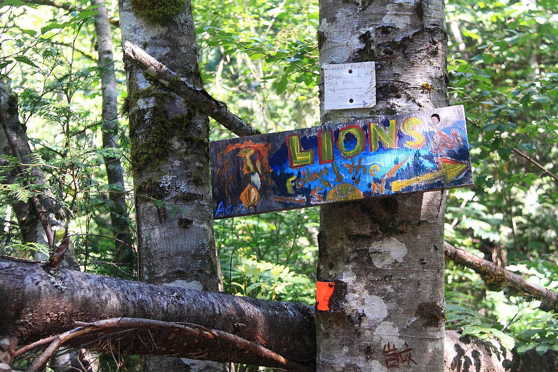 Binkert (Lions) Trail Junction. Keep straight for Brunswick
 |
|||
 Partial clearing with view of Bowen Island at bushy logging road end ~2hr from parking
 |
|||
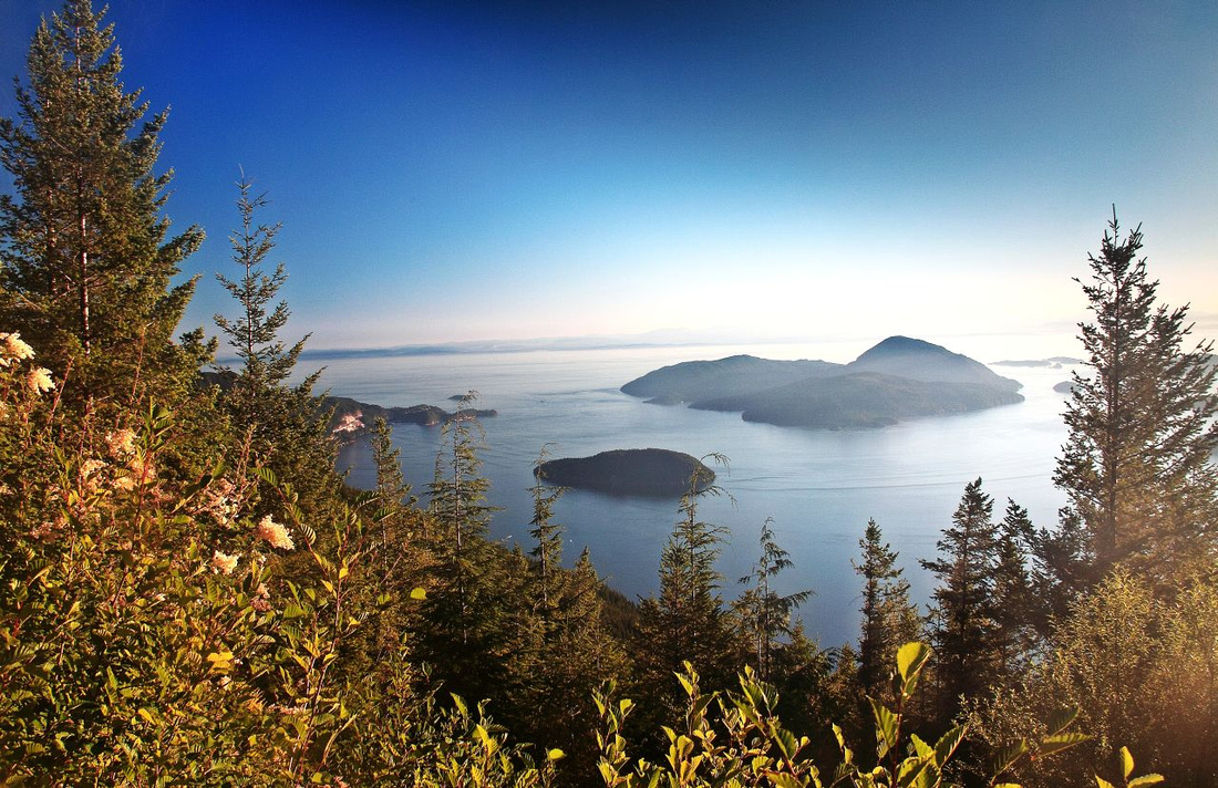
 Great views of Anvil Island and Sunshine Peninsula from clearing ~15min below HSCT junction
 |
|||
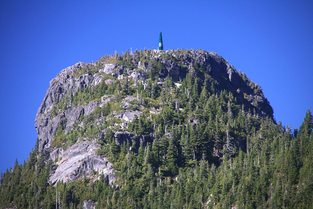 Great view of Hat, with microwave tower on top, as trail rises steeply above HSCT junction
 |
|||
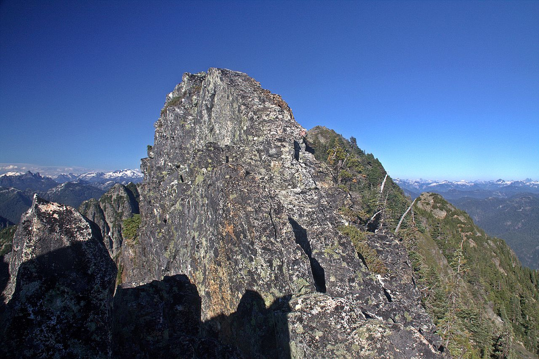
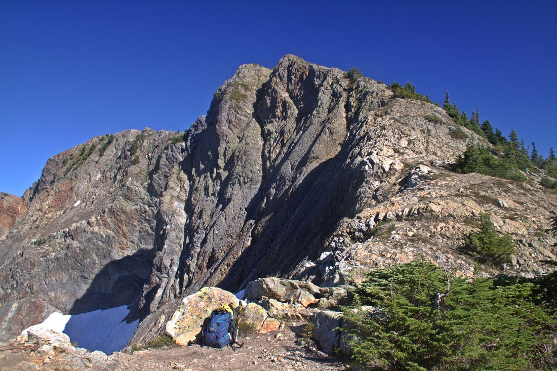 Final ascent ridge, much easier than this photo might suggest. Takes 15-20min to the summit
 |
|||
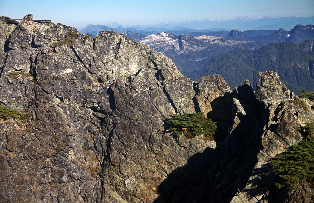 Crux, just before the summit. Cross carefully notch extreme right then scramble up on ledge on the other side
 |
|||
 Final bit, after crossing the notch. Easy ledge is to the right just out of the view
 |
|||
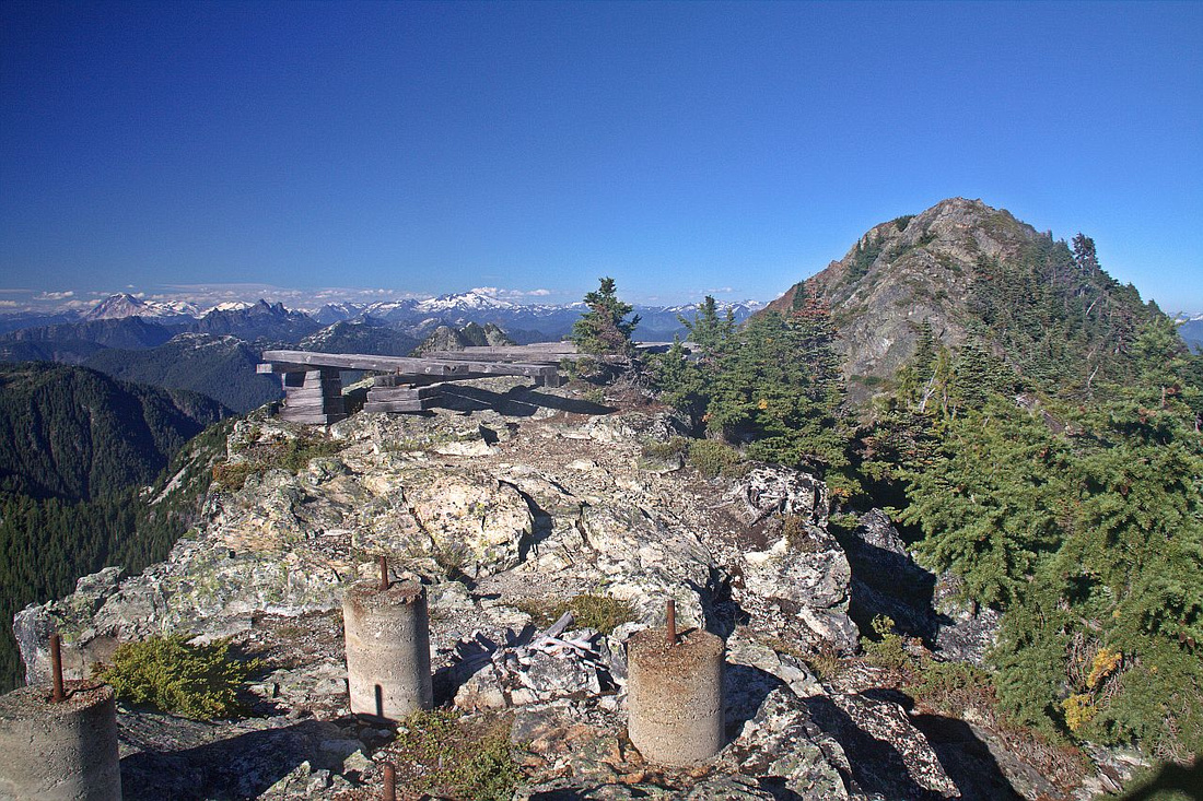 Remains of old helipad on Mt. Brunswick summit. One can continue easily to the next bump upper right but it is perfectly acceptable to stop here
 |
|||
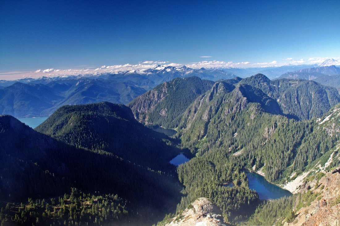 Beautiful view north to HSCT "Lake District" - Deeks, Brunswich and Hannover trio of pater noster lakes
 |
|||
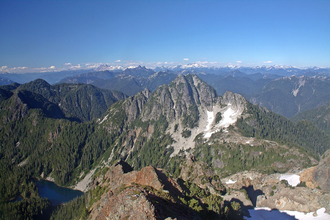 Mount Hannover, very difficult scramble. Both ascent gullies can be seen. Hannover Lake lower left
 |
|||
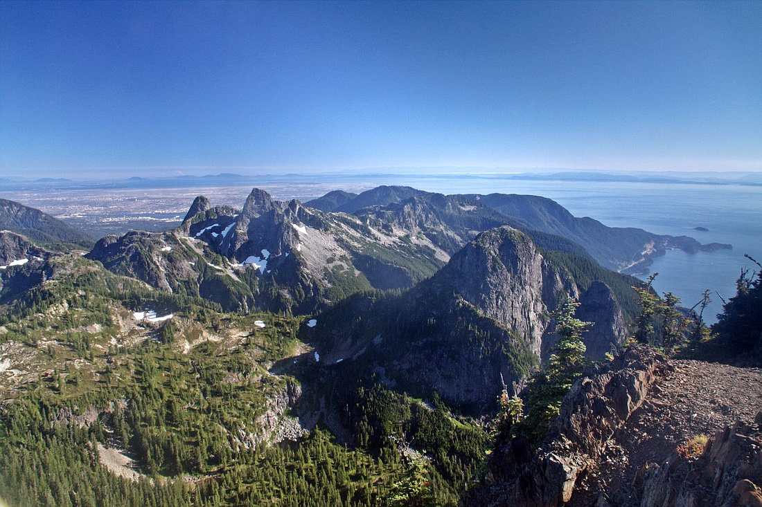 Lions and Harvey with beautiful HSCT spine from Cypress over Unnecessary Mtn. Magnesia Meadows lower left
 |
|||
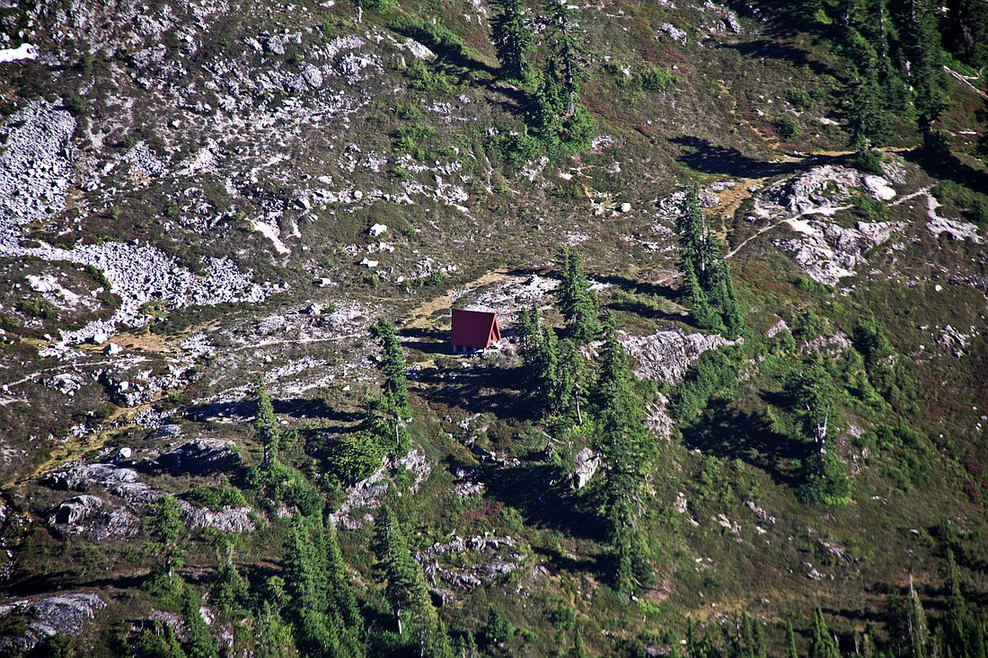 Closer look at Magnesia Meadows, with red-roofed NSR shelter, and one of most beautiful parts of HSCT
 |
|||
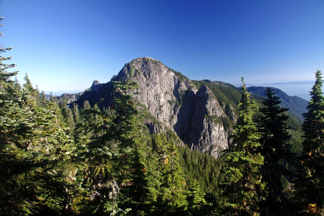 Closer look at Harvey on return. Alternate but considerably longer and more involved return is to continue on HSCT to Harvey Pass, scramble up steeply from east side and descend normal Harvey trail. Harvey Pup just right of center
 |
Abstract
| Overall Difficulty | D6 | Steep trail that gains ~1600m vertical in 7 km. Final ridge block is mildly exposed stiff class 2 / low class 3 scramble that should be dry | |||
| Snow Factor | S4 | Sometimes done as snowshoe trip in winter. Steep and exposed summit block. Check avalanche conditions. | |||
| Scenery | Exceptional Howe Sound panorama. Sweeping views of Howe Sound Crest and many distant peaks of Garibaldi and Tantalus range | ||||
| Trail/Marking | Good | Logging road followed by well defined trail to HSCT junction and final ridge | |||
| Suggested Time | 7-8 hr | 4-5hours one way, with faster descent. Alternate return via HSCT/Harvey will add ~1.5 - 2 hours | |||
| Elevation | Start: 220m Max: 1780m Total: ~1600m | Round Trip: 14km | |||
| Gear | Hiking Poles are essential. In late spring hard snow in steep parts might require traction (icers or crampons). In winter conditions ice-axe is essential for final part of the ridge before the summit.. | ||||
| Water | No reliable water source after crossing Magnesia creek ~1hr from parking. Carry 3 L minimum | ||||
| Dog Friendly | Yes | No on-leash restrictions. Final part of the ridge might prove challenging | |||
 Mt. Brunswick GAIA Map
 Mt. Brunswick Elevation Profile