Google Map |
BC Coast :: Sea to Sky :: Bowen Island - Mt. Gardner |
GPS Track |
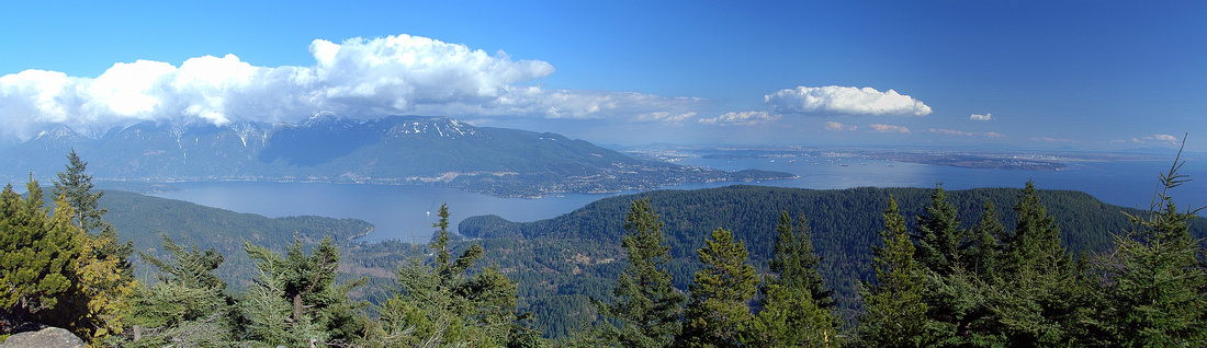 
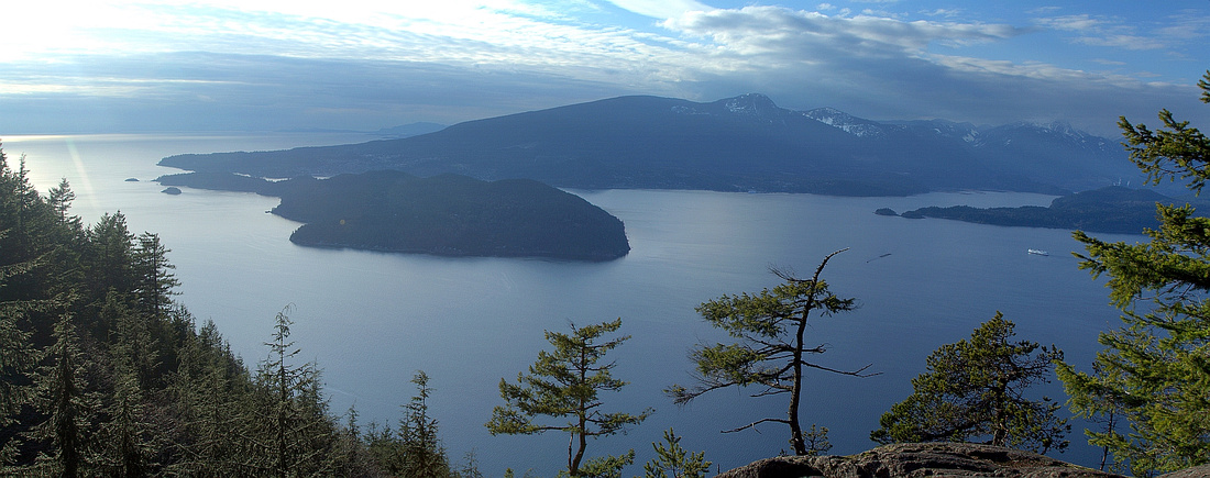
Panoramic View east from Mt. Gardner. Howe Sound Crest distance left |
|||
| Trip Summary | |||
March 23, 2013Mount Gardner is terrific day trip. Getting to trailhead involves ferry crossing to Snug Cove on Bowen Island, which adds to overall sense of adventure. There are several scenic highlights, including visit to Crippen Regional Park, Killarney lake and great panoramic views from the summit. Clockwise loop is recommended option because of fantastic viewpoint of Sechelt Peninsula and Sunshine Coast from west side descent. Due to low elevation hike is feasible year-round, but shady west slopes might harbor snow and/or icy sections in winter. Note last ferry crossing time back to Mainland in order not to get stranded overnight on Bowen Island! See this link for BC Ferries Schedule. Note that public parking is available in Horseshoe Bay, but it is expensive - while nearby street parking is next to impossible to find. If you live in metro-Van area, it is better to use translink.
From Snug Cove walk to Crippen Park entrance and follow signed wide trail(s) to Killarney Lake. Walk on wide trail on west side of the lake for ~10mins then transfer to Mt. Gardner Road above and watch for spur road branching uphill -- it leads to marked Mt. Gardner trailhead (see pics in Gallery). From there you follow signed Skid Trail to a junction; take left branch ("South Mt. Gardner Trail"). If you descend from the west side, this is where you will finish the loop. Trail rises moderately through some nice forest, then traverses east slopes on a good trail. Ignore marked South Summit shortcut, instead follow the main trail that loops on the south side before making the final dash to open summit and couple of strategically placed helipads (servicing of nearby telecommunication complex). On a sunny, clear day views are nothing short of fantastic and solitude will be hard to find, specially on a weekend!
If conditions allow, find west trail descending from second helipad. Initial section is steep, but soon it mellows and traverses some spectacular old-growth. This trail is definitely less used and you will have to keep focus although occasional flags keep you in right direction. About 45 mins from the summit you arrive to clearing and Sechelt Peninsula viewpoint; distant peaks of Tetrahedron park look specially impressive. From there descent is steeper again till you finally rejoin Skid Trail junction and close the loop. Then simply retrace your steps by Killarney Lake and back to Snug Cove. |
|
Gallery |
|||
 Trip starts with 20 min ferry crossing from Horseshoe Bay to Snug Cove on Bowen Island
 |
|||
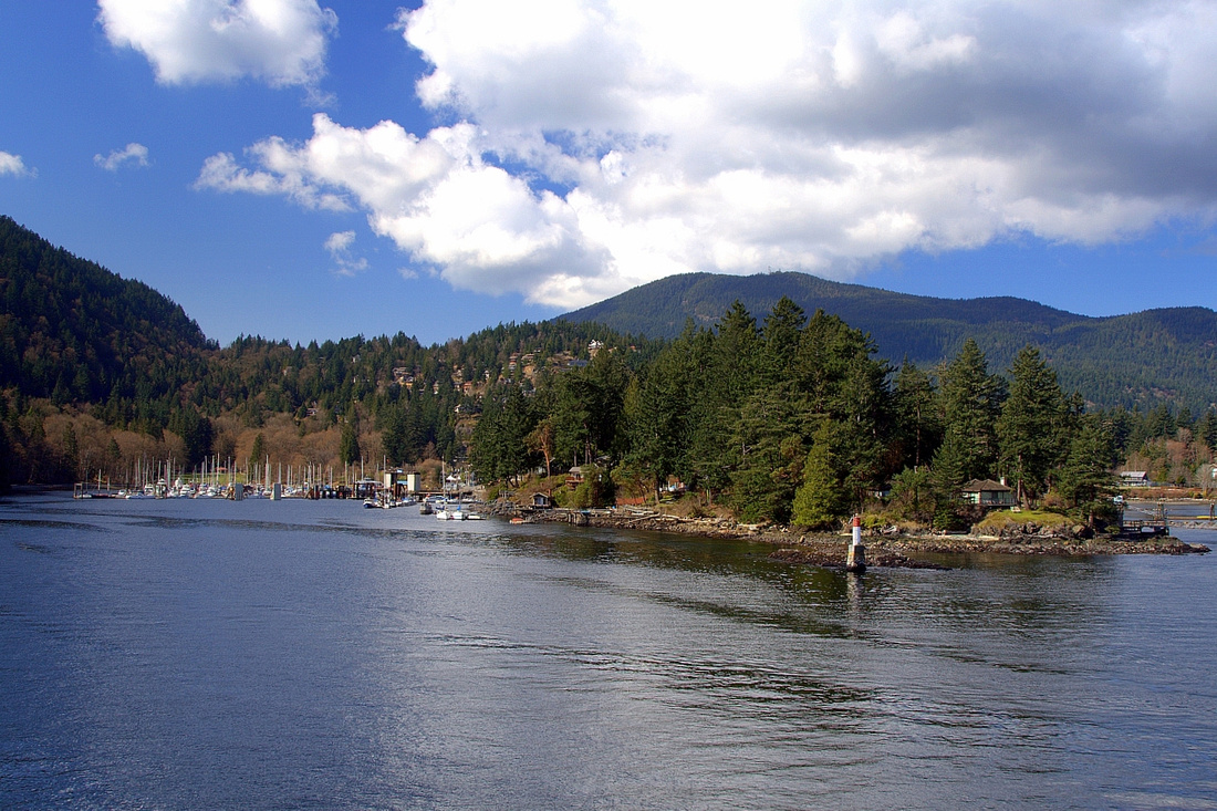 Entering Snug Cove. Mt. Gardner just right of center in the distance
 |
|||
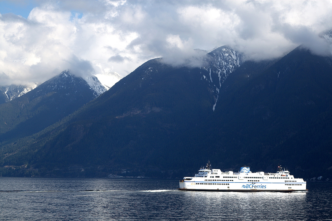
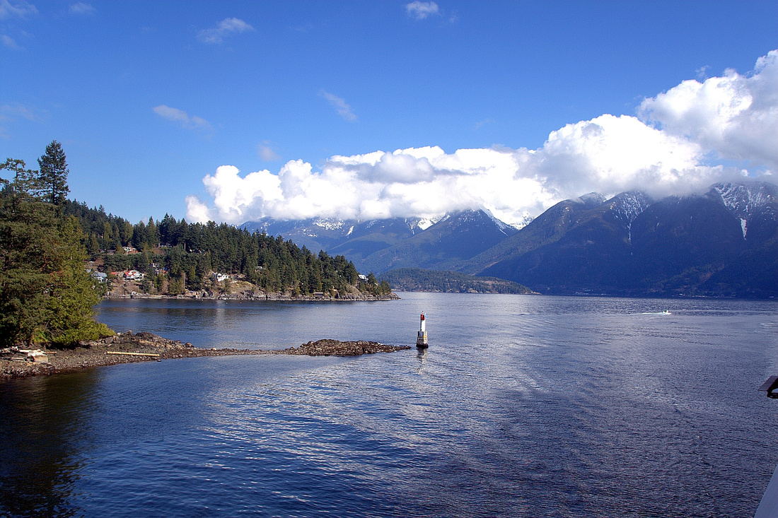 View back to cloud covered Howe Sound Crest as Ferry docks in Snug Cove
 |
|||
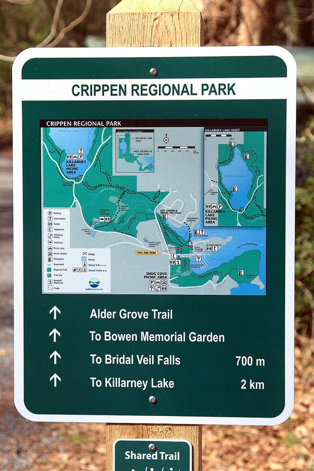 Crippen Regional Park Entrance
 |
|||
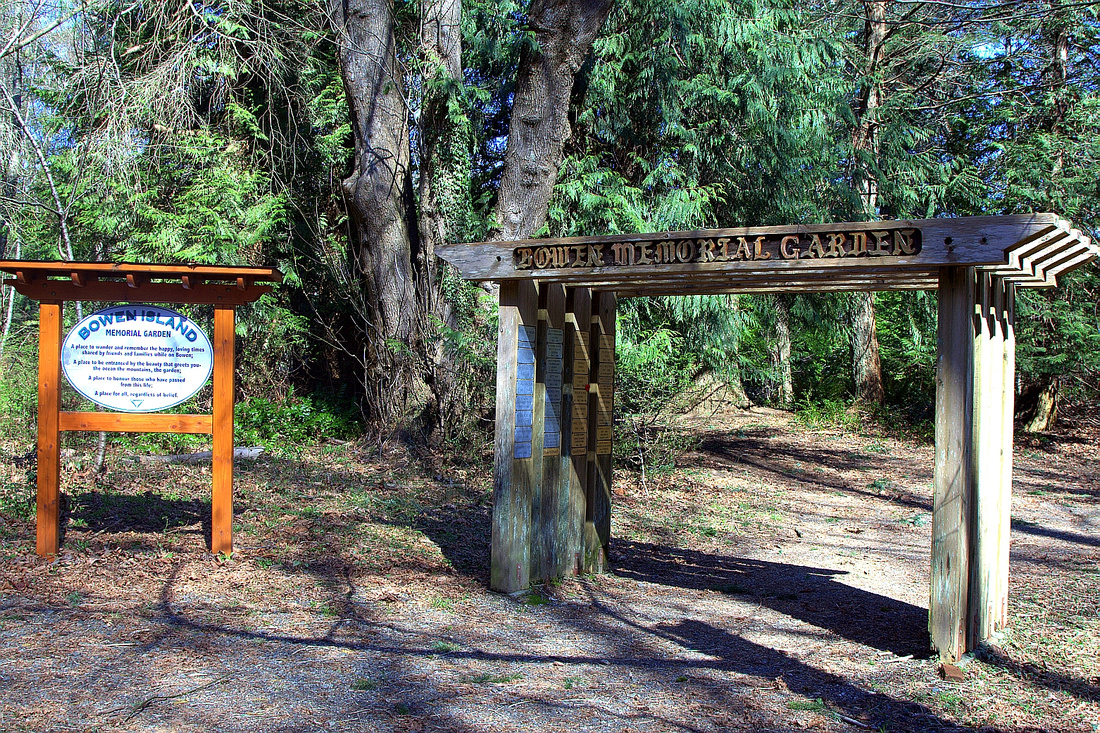 Bowen Island Memorial Garden in Crippen Regional Park
 |
|||
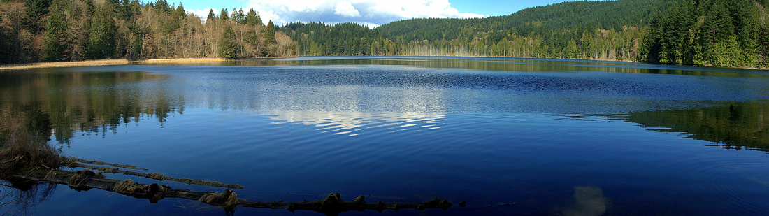 Killarney Lake ~40min from Snug Cove
 |
|||
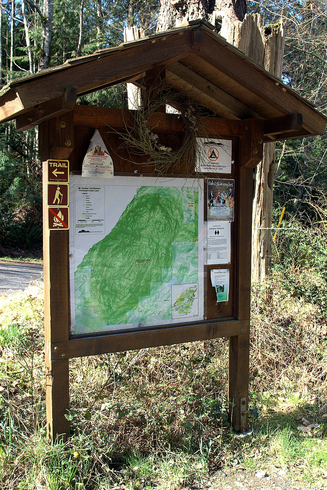 Trailhead Kiosk between posts 490 and 491 on Mt. Gardner Road above Killarney Lake
 |
|||
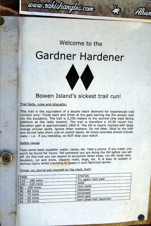 "Gardner Hardner" Trail Run Table
 |
|||
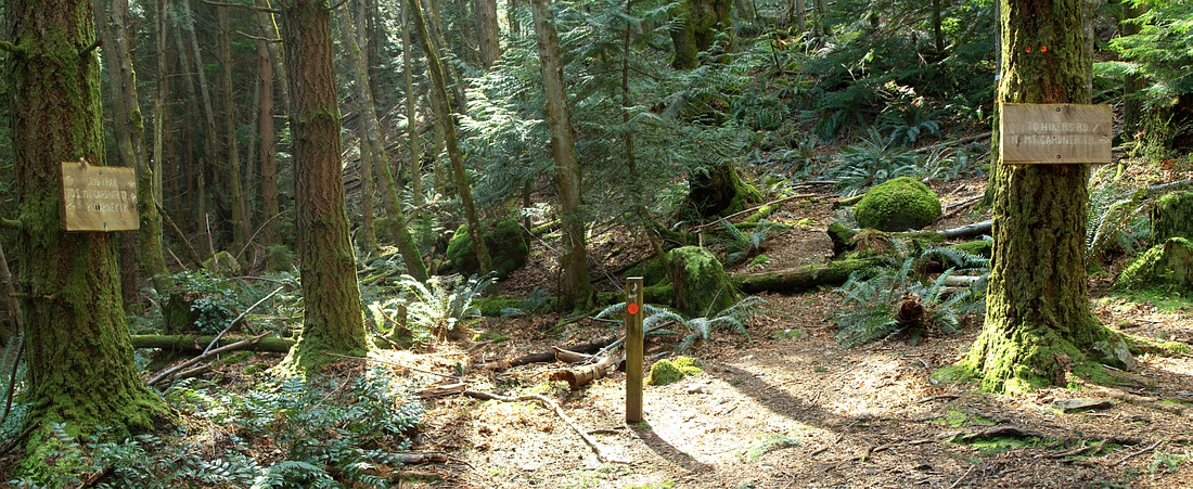 Skid Trail Junction: South Mt. Gardner Trail straight, connector to Hikers Trail and North Mt. Gardner to the right
 |
|||
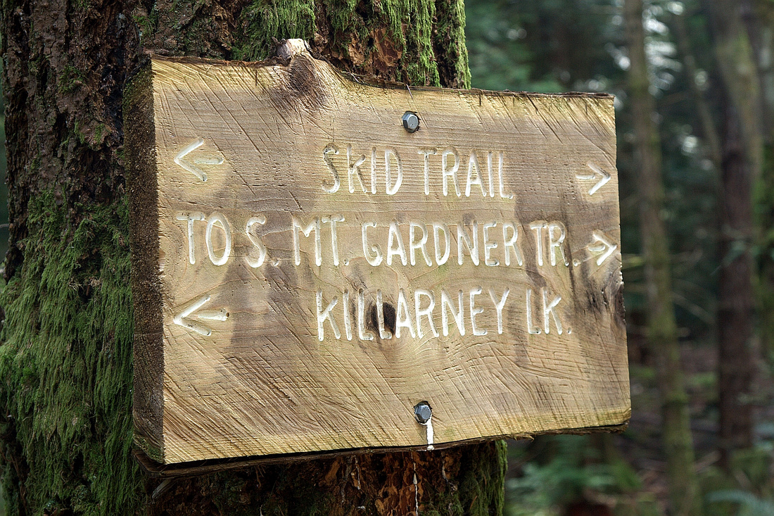 Skid Trail Junction Table
 |
|||
 Marked shortcut to South Summit -- keep straight on main trail
 |
|||
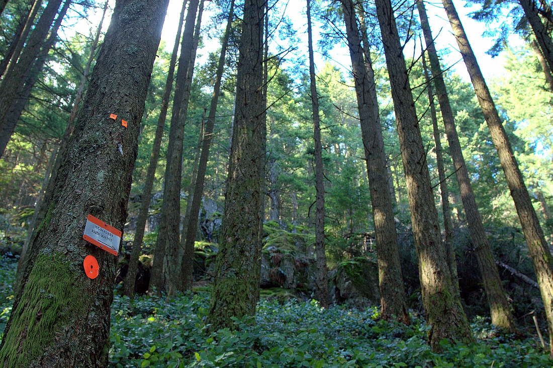
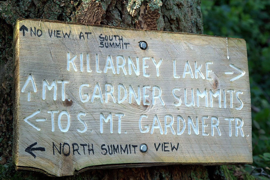 Table on south summit shortcut junction - follow arrow pointing to North Summit
 |
|||
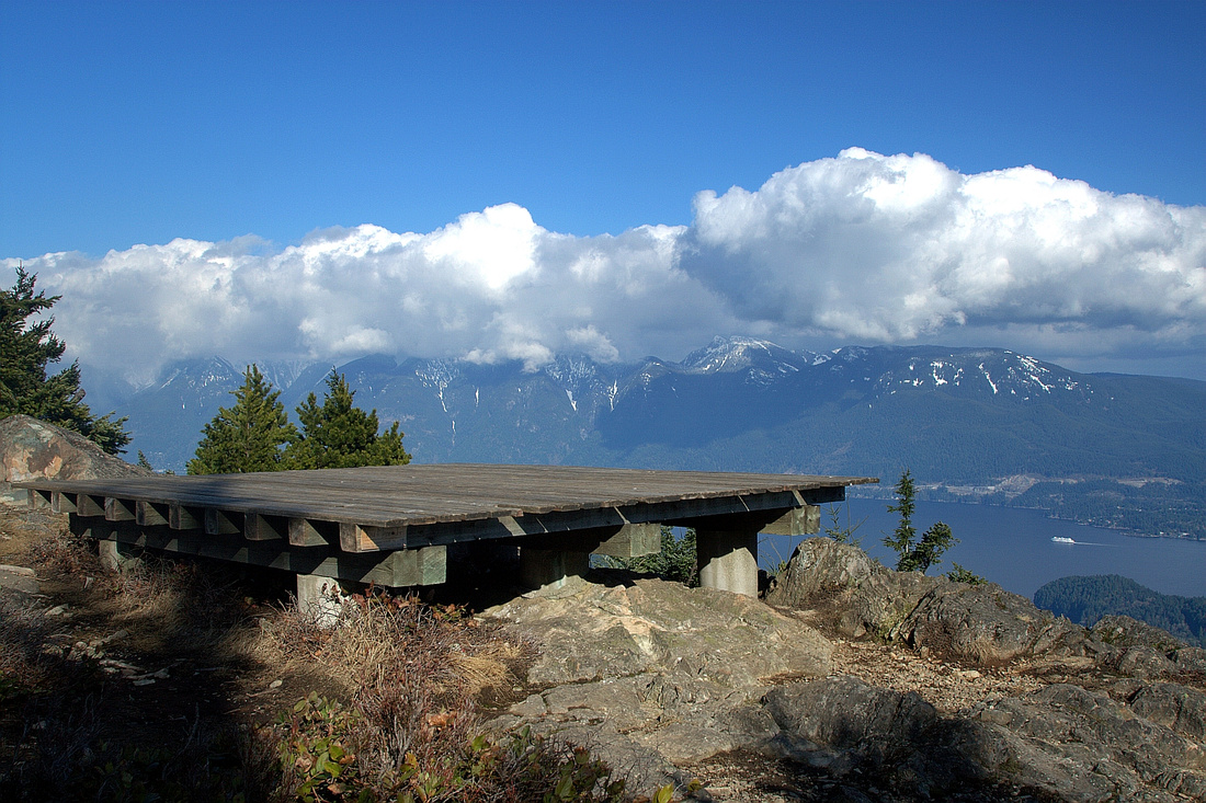 North Summit Helipad and fantastic views
 |
|||
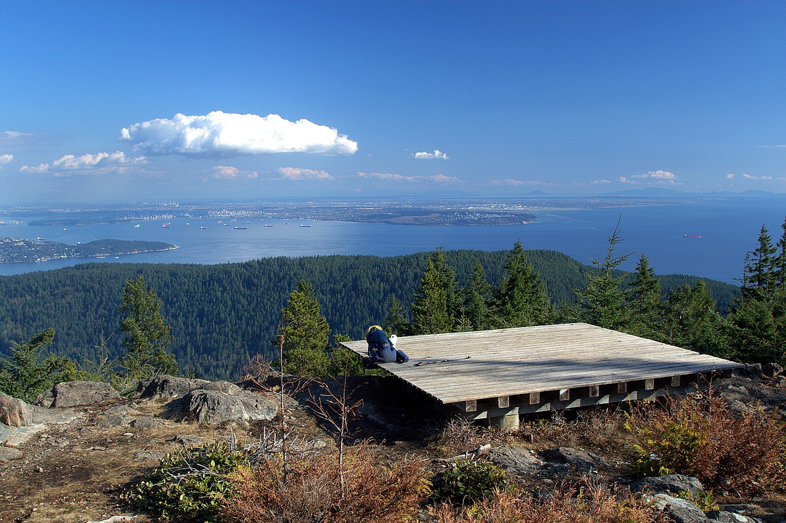 Alternate view from North Summit. Burrard Strait and UBC Peninsula Center
 |
|||
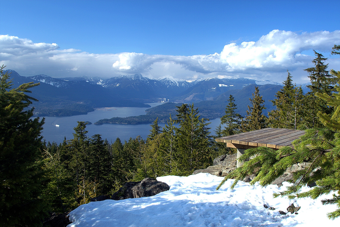 West Helipad with fantastic views of Sechelt Peninsula and distant peaks of Tetrahedron Park
 |
|||
 Sechelt Viewpoint on loop descent via North Gardner Trail
 |
|||
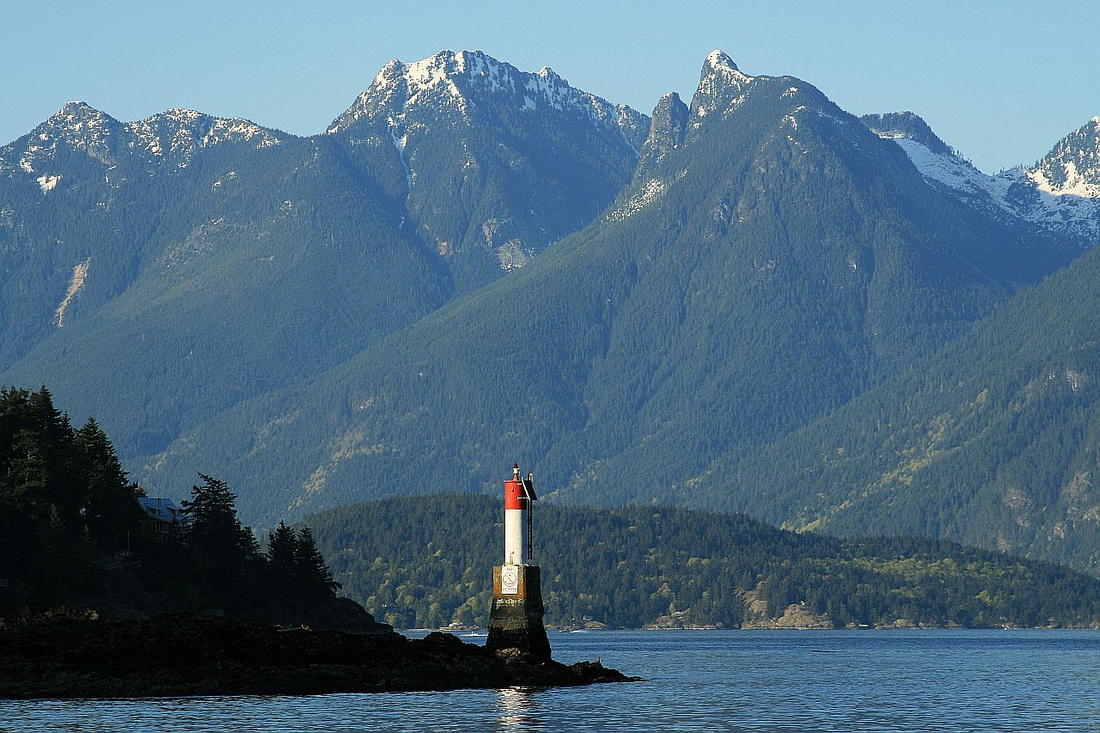 Snowy Howe Sound Crest peaks from Snug Cove on return. L-R: Hat, Brunswick, Harvey
 |
Abstract
| Overall Difficulty | D3 | Moderate low elevation hike with some steep sections. West side is more challenging | |||
| Snow Factor | S2 | East side generally snow free year round due to low elevation. West side often snowbound/icy in early season | |||
| Scenery | Ferry crossing to Snug Cove is very picturesque! Killarney Lake and some old-growth forest. Spectacular views of Howe Sound and Sechelt Peninsula from Mt. Gardner | ||||
| Trail/Marking | Very Good | Well defined and marked network of trails. Minor navigation issues at Killarney Lake | |||
| Suggested Time | 5-6 hrs | Loop return from Snug Cove. Add ferry sailing + Horseshoe Bay transport | |||
| Elevation | Start: 0m Max: 740m Total: ~850m | Round Trip: 17km | |||
| Gear | Day hikers are sufficient in summer conditions. Poles are helpful. Micro-spikes in early season for loop descent on north side | ||||
| Water | Seasonal side creeks but generally dry past Killarney Lake in summer. Carry 1-2L | ||||
| Dog Friendly | Yes | Please keep dogs on leash / under control in Crippen Park on Killarney Lake trail | |||
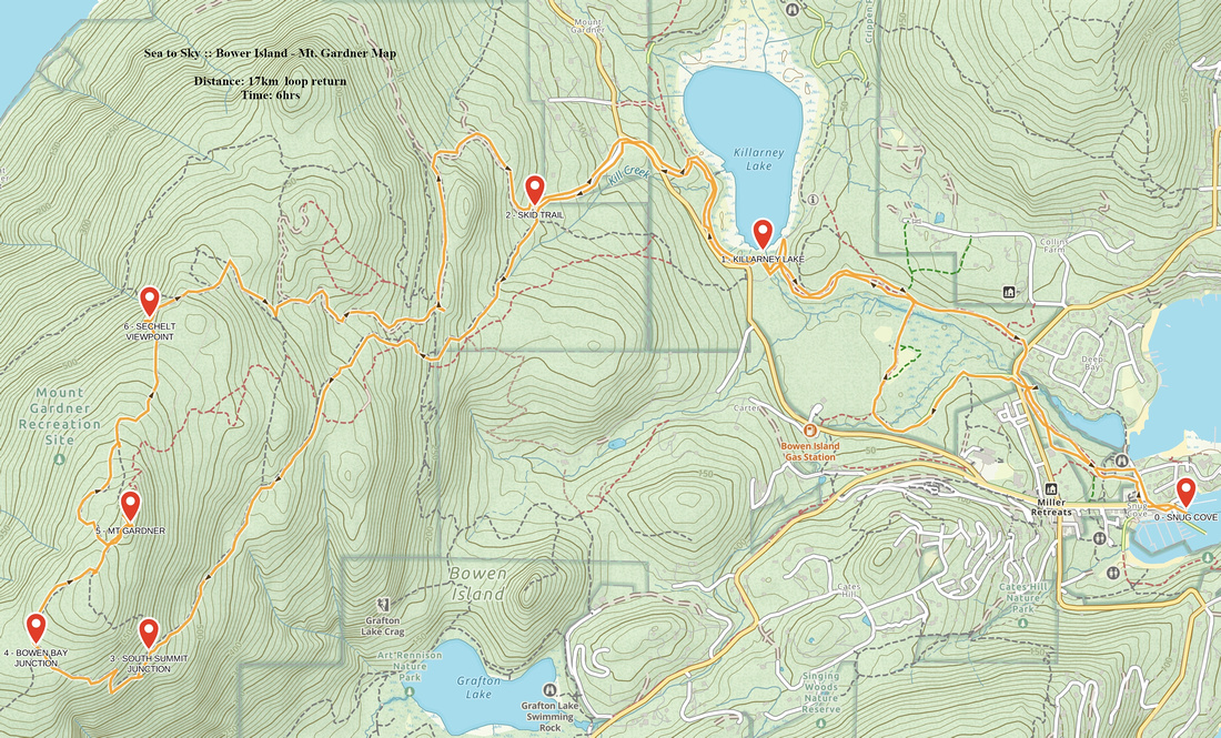 Bowen Island - Mt. Gardner GAIA Map
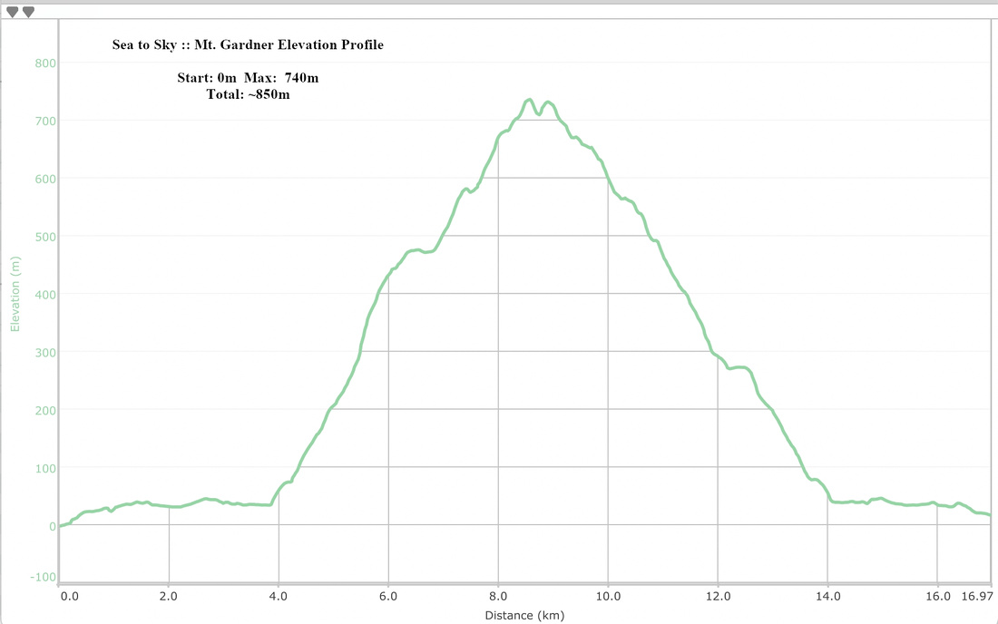 Mt. Gardner Elevation Profile