Google Map |
USA :: San Diego :: Penasquitos Canyon |
GPS Track |
|
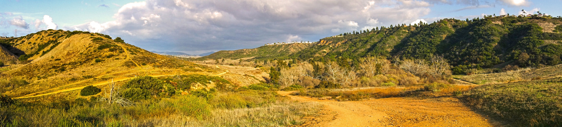
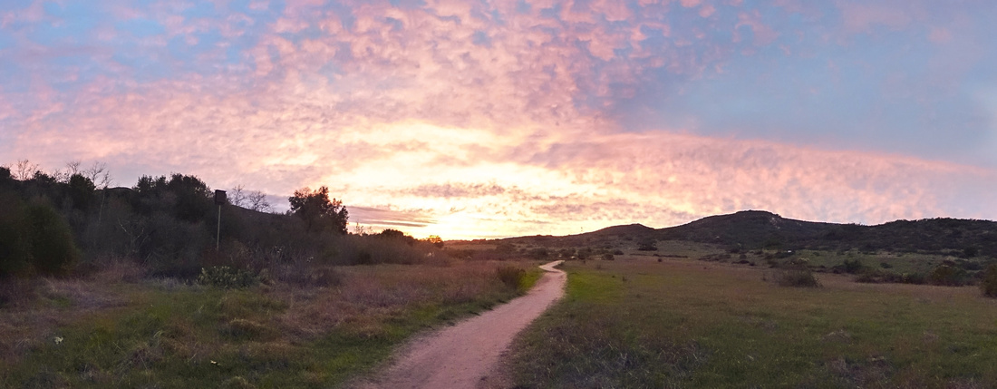
Panoramic View East from South trail; Waterfall area is ~2.5km from here |
| Trip Summary | |||
Multiple Dates, last Jan 21, 2024
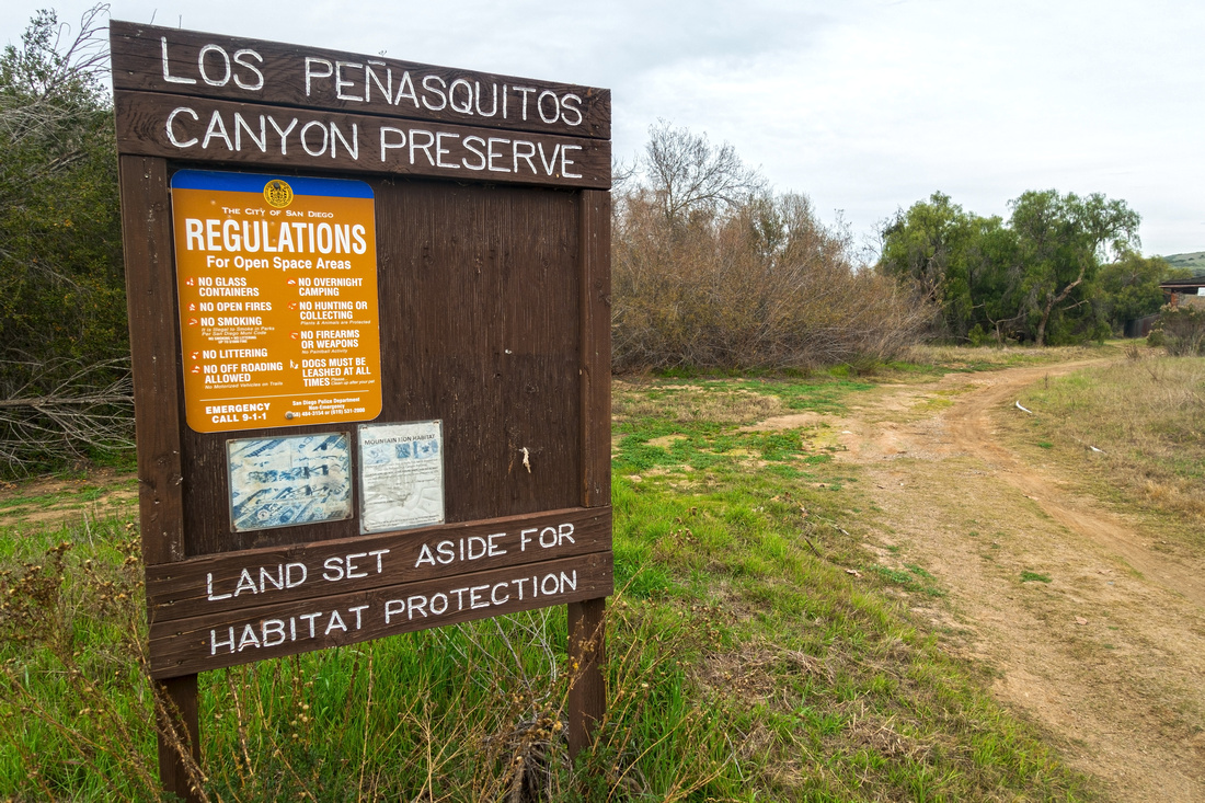
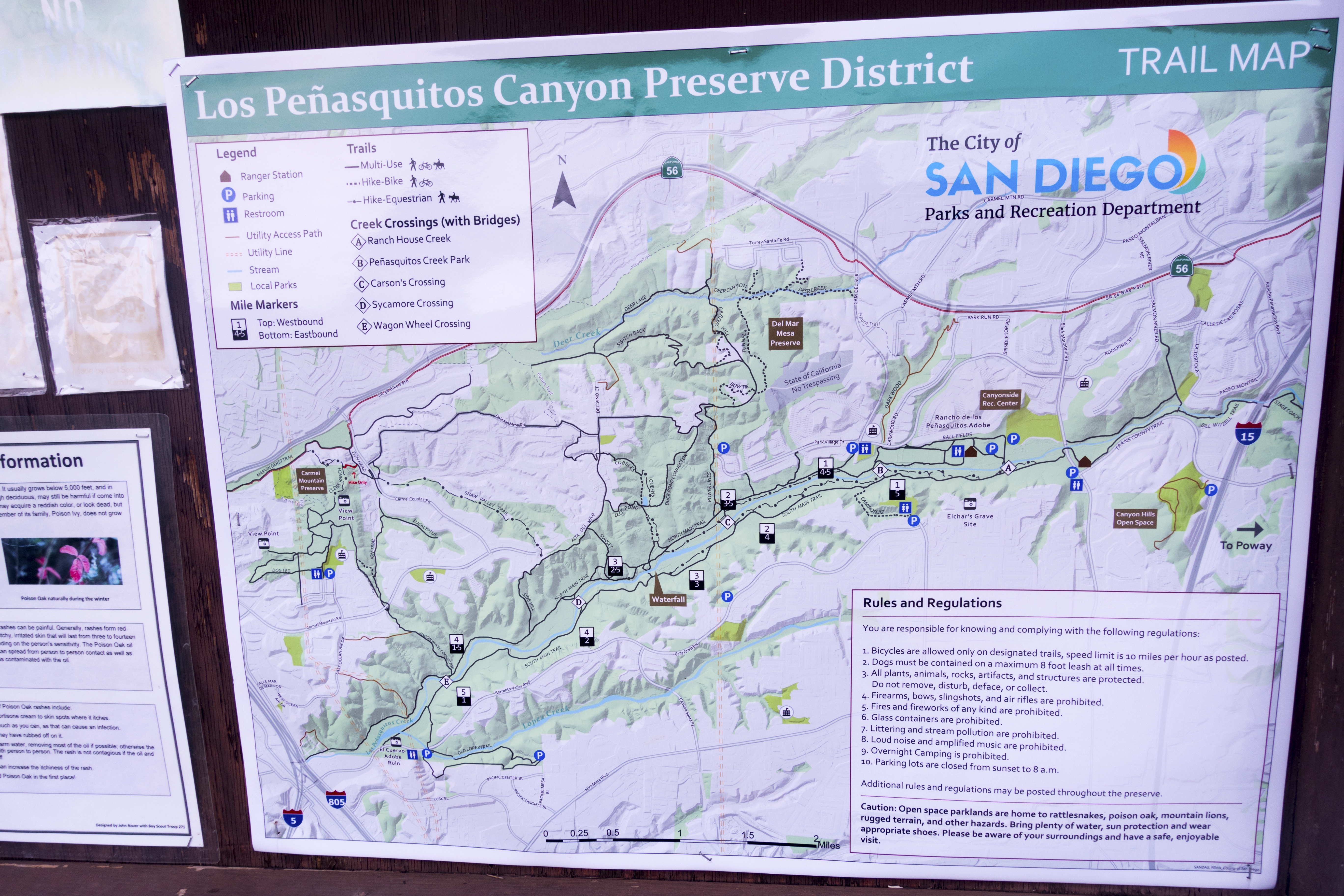
Los Penasquitos Canyon is Natural Preserve flanked by Sorrento Valley to the west and Black Mountain road to the east. It is an oasis in dense populated urban world. Area is popular with mountain bikers or trail runners - even occasional equestrian - but hiking is great option too. There are many options, ranging from after dinner walk to half-day or longer hike. There are two normal trailheads: West at Sorrento Valley Road and East at Black Mountain Road. Many other access points exist from residential areas at both sides of the Preserve. Focal Point is the waterfall, rather small chute in bouldery area about halfway between. Penasquitos Creek runs in the middle of valley and there are two main trails, on both sides of the creek. Option presented here starts from Sorrento trailhead, crosses over to North side via Wagon Wheel, follows North trail to the Waterfall, crosses back via Carson crossing and finally returns back to Sorrento via South Side trail.
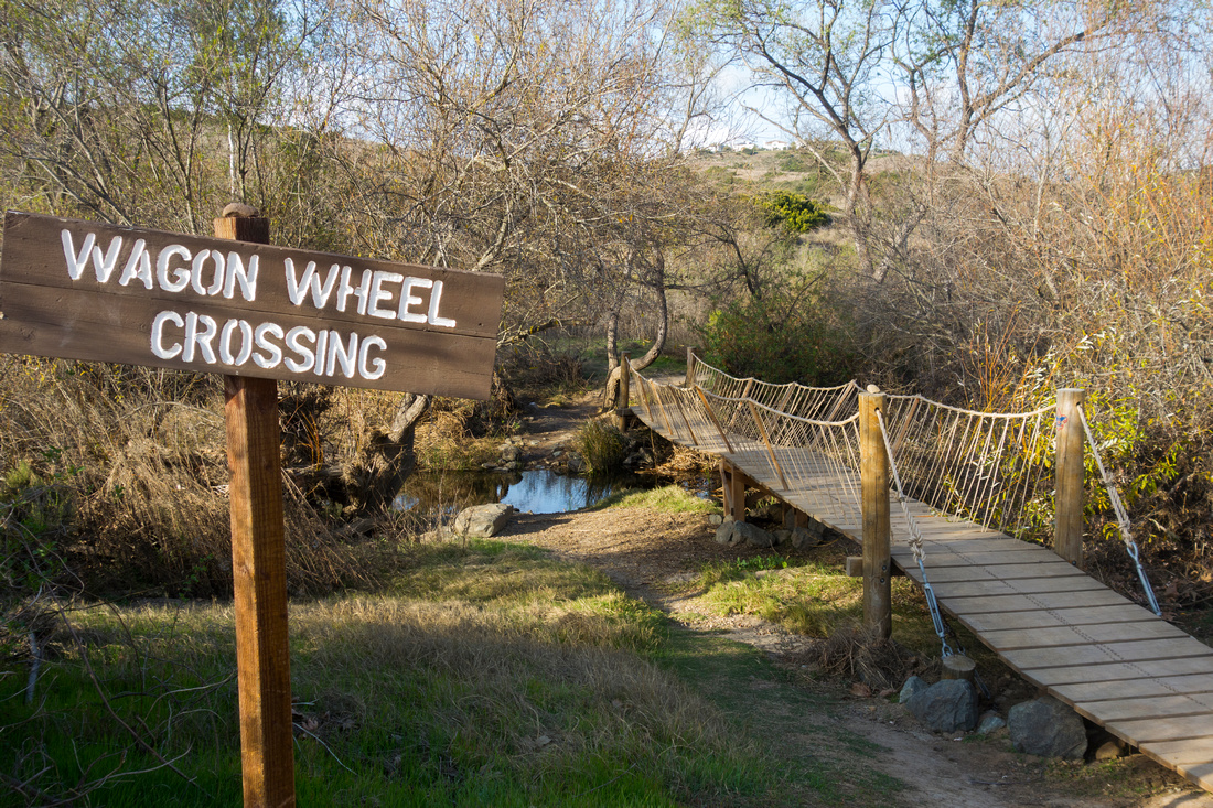
West trailhead parking lot is at south side of Sorrento Valley road, below Qualcomm building R. If the lot is closed - or if you simply plan on returning later and don't want to risk getting locked out because of silly "sunrise to sunset" rule - cars can also be parked about 1km west at some of local businesses parking lots (this might change). On my Jan `22 trip normal trailhead was locked, most likely because of Covid, so I used the alternate start. Walk on north side of the road for couple of minutes and there will be trail on your left, together with Kiosk Table (1st photo in gallery). This trail passes by El Cuervo Adobe ruin (fenced) then after muddy stretch joins normal trail; Wagon Wheel crossing is nearby. When I first hiked here way back in early 2000's there was no bridge at Wagon Wheel, but double deck has been placed since facilitating the crossing, although it has considerably deteriorated with time. On North side trail is quite nice and within an hour from crossing is Waterfall area. It will likely be busy but is still worth bit of exploring. Beyond North trail passes through lovely hammock of oak and sycamore trees, before reaching Carson Crossing (solid wood bridge). Return on South side is similar to North; some section of trail are road-like and bit rough, but there are also couple of nice valleys with meadows and large trees, specially scenic with autumn foliage.
Update Jan '24: Penasquitos Creek was swollen after Rain Storm even overflowing to Sorrento Blvd. at one point. Trail was quite muddy and while it was still possible to cross over at Wagon Wheel, Carson was submerged. Sycamore was not feasible. These kind of conditions are rare, but still possible - check out the Gallery and be prepared before you head out.
|
|
Gallery |
|||
 Sorrento Trailhead Sorrento Trailhead Penasquitos Preserve Table by El Cuervo Adobe Ruin, alternate start to normal West Trailhead
 |
|||
 |
|||
 Wagon Wheel Crossing
 to North Side (Jan '18 photo) Wagon Wheel Crossing
Wagon Wheel Crossing to North Side (Jan '18 photo) |
|||
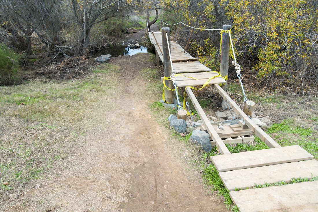 Wagon Wheel Crossing
 in Jan '22 in fair state of disrepair Wagon Wheel Crossing
Wagon Wheel Crossing in Jan '22 in fair state of disrepair |
|||
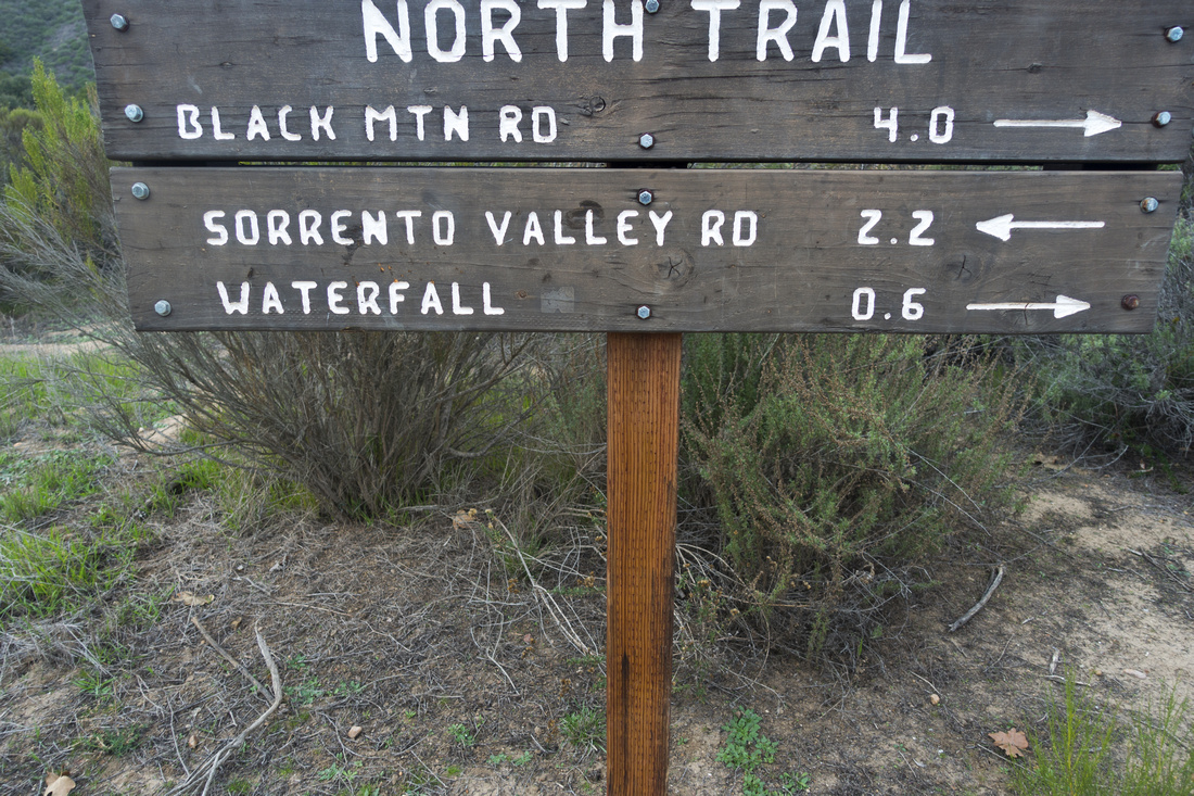 Junction Table
Junctions are well marked with table signs and distances (miles) Junction Table
Junctions are well marked with table signs and distances (miles) |
|||
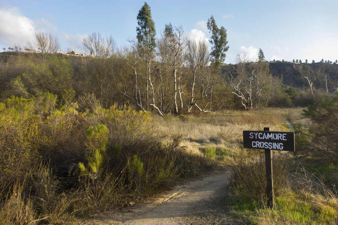 Sycamore Crossing
Sycamore Junction on North Side trail; Crossing is not bridged Sycamore Crossing
Sycamore Junction on North Side trail; Crossing is not bridged |
|||
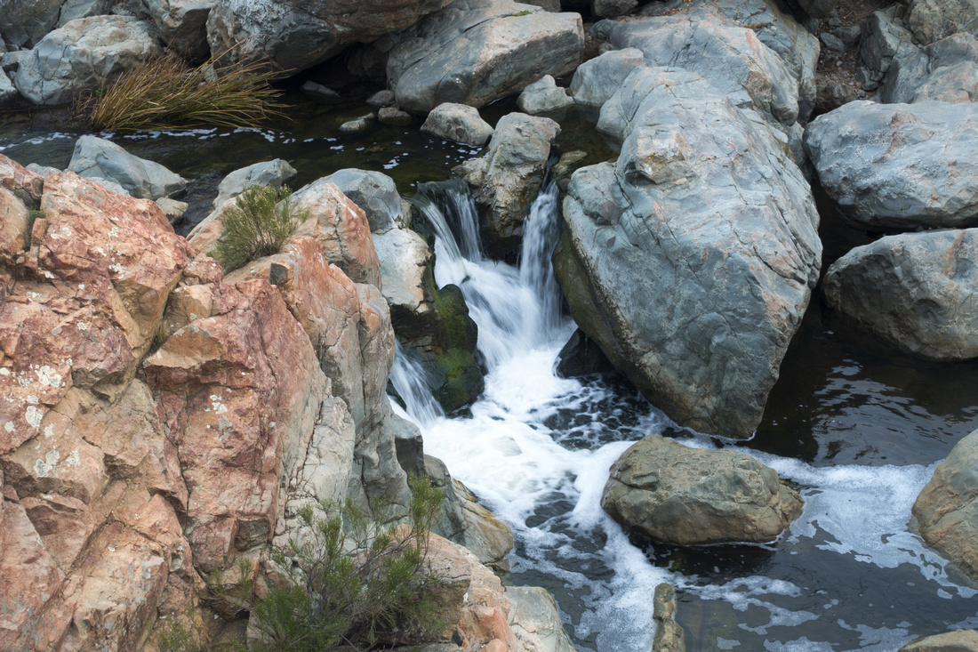
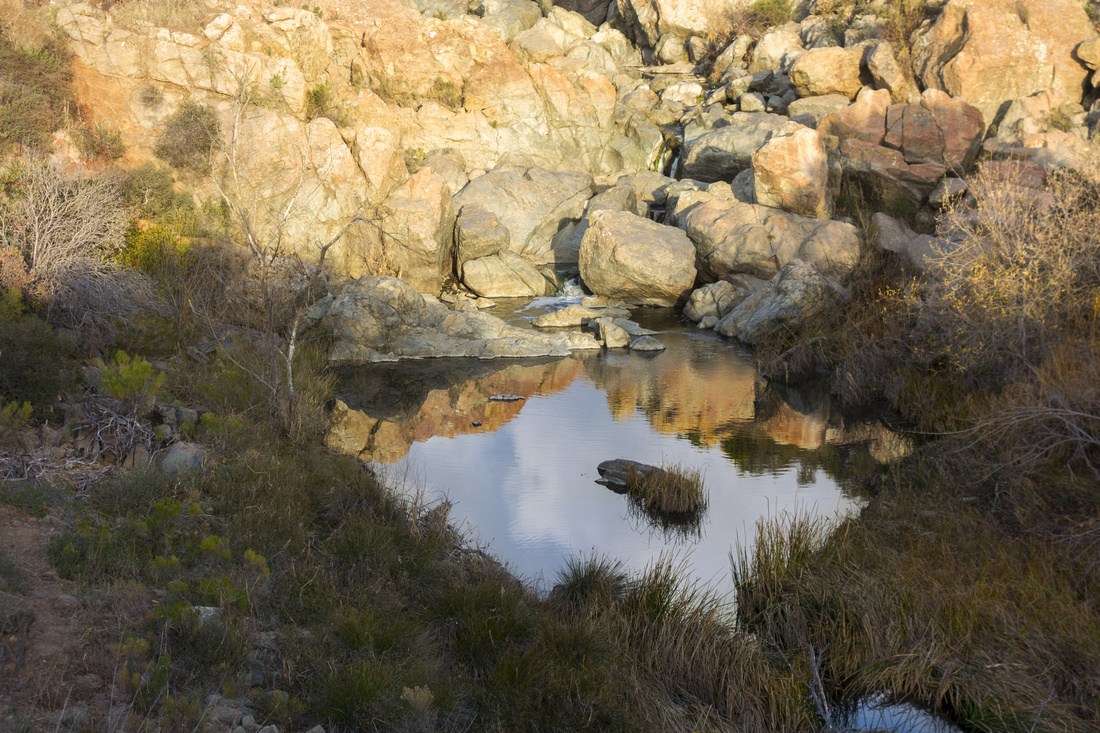 Penasquitos Pool
Water collecting in shallow pool below the Waterfall, focal area of the hike Penasquitos Pool
Water collecting in shallow pool below the Waterfall, focal area of the hike |
|||
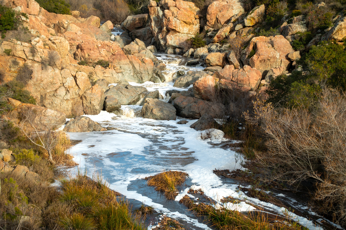 Raging Creek
Quite different conditions after Rain Storm in Jan '24 - white foam almost looks like Snow/Ice! Raging Creek
Quite different conditions after Rain Storm in Jan '24 - white foam almost looks like Snow/Ice! |
|||
 The Waterfall
Canyon Waterfall; depending on water level it is possible, but tricky to cross over at this point The Waterfall
Canyon Waterfall; depending on water level it is possible, but tricky to cross over at this point |
|||
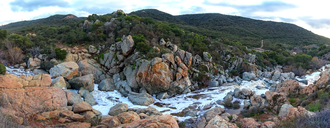 Gorge Panorama
North Side Panorama above Waterfall Area with Penasquitos Creek raging after Jan '24 weekend Rain Storm Gorge Panorama
North Side Panorama above Waterfall Area with Penasquitos Creek raging after Jan '24 weekend Rain Storm |
|||
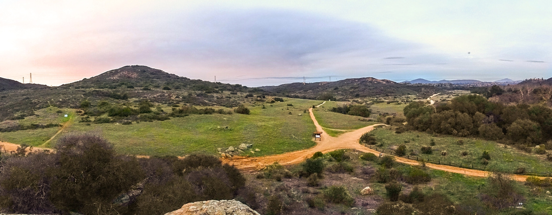 North Side Panorama
Panoramic View of North Side trail from rock outcrop above the Waterfall North Side Panorama
Panoramic View of North Side trail from rock outcrop above the Waterfall |
|||
 Sunset Colors
Looking west at burning sunset sky from North trail section between the Waterfall and Carson Crossing Sunset Colors
Looking west at burning sunset sky from North trail section between the Waterfall and Carson Crossing |
|||
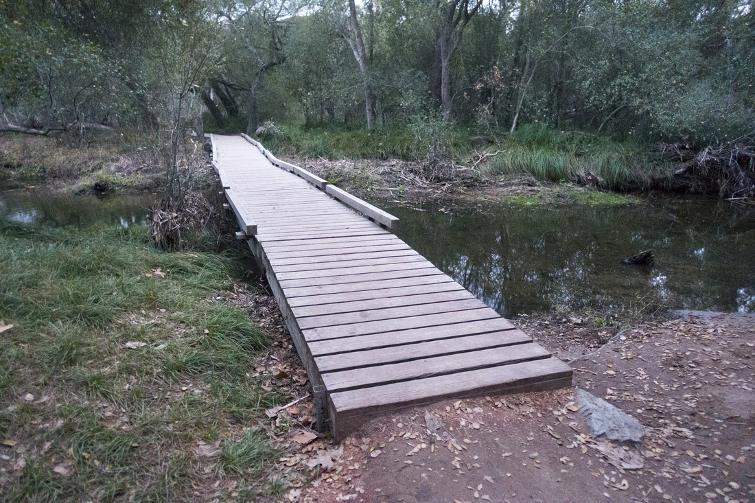 Carson Crossing
Sturdy Carson Crossing Bridge Carson Crossing
Sturdy Carson Crossing Bridge |
|||
 Carson Bridge
 in Jan '24; Crossing of this channel was still feasible despite swollen Creek ... Carson Bridge
Carson Bridge in Jan '24; Crossing of this channel was still feasible despite swollen Creek ... |
|||
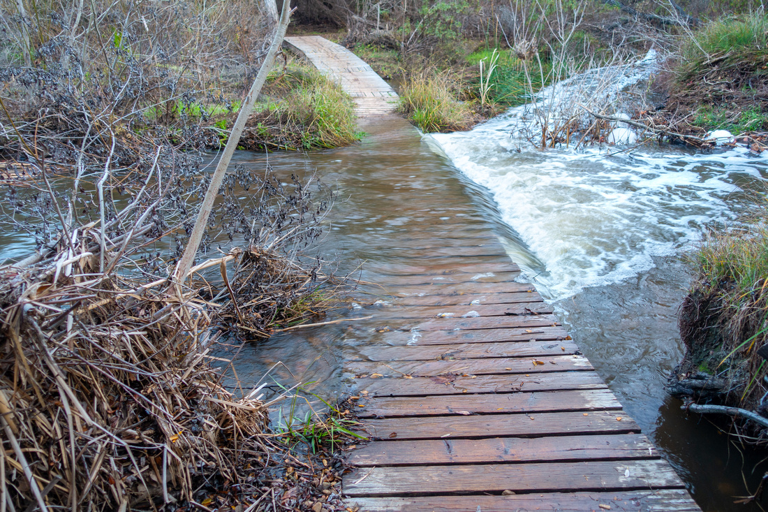 Submerged Planks
... but Planks over narrower channel were overflowing making crossing wet, if not dangerous Submerged Planks
... but Planks over narrower channel were overflowing making crossing wet, if not dangerous |
|||
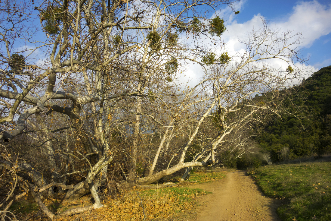 South Trail Groove
South Trail Section between the Waterfall and Wagon Wheel Crossing South Trail Groove
South Trail Section between the Waterfall and Wagon Wheel Crossing |
Abstract
| Overall Difficulty | D2 | Mostly flat hike with couple of small hills. Bridged water crossings (Jan '22), overflowing after Rain Storm in Jan '24. Some optional harder scrambling on bluffs around the waterfall | |||
| Scenery | Los Penasquitos Natural Preserve, Sycamore Trees, Meadows and landmark Waterfall | ||||
| Trail/Marking | Excellent | Trails are well defined and junctions marked | |||
| Suggested Time | 3 hrs | For proposed loop option. Many shorter / longer alternatives exist | |||
| Elevation | +- 175m | Round Trip: ~12km | |||
| Gear | Day Hikers or running shoes | ||||
| Water | Penasquitos Creek, but water needs to be treated. Bring 1L or more depending on season | ||||
| Dog Friendly | Yes | Dogs are allowed, but must be leashed at all times | |||
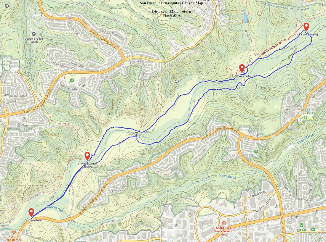 Penasquitos Canyon GAIA Map
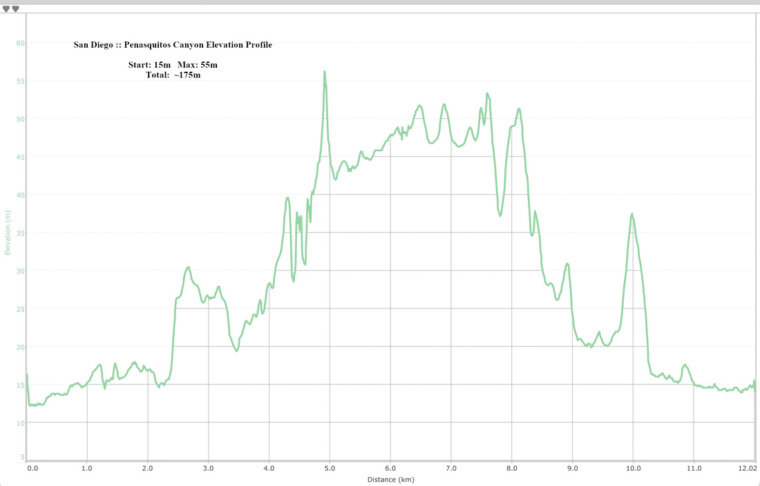 Penasquitos Canyon Elevation Profile