Google Map |
BC Coast :: Sea to Sky :: Deeks Peak |
GPS Track |
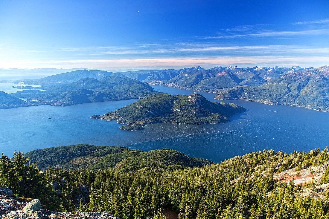 
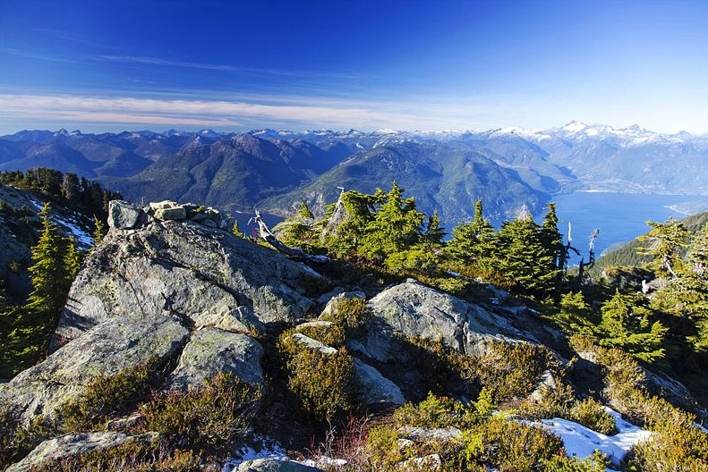
Fantastic view of Howe Sound and Anvil Island from Deeks Bypass. Bowen Island left, Sechelt Peninsula right |
|||
| Trip Summary | |||
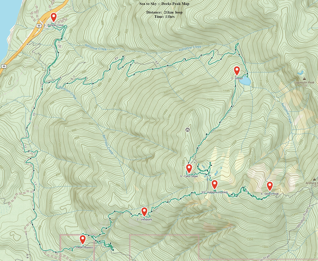
October 28, 2013Deeks peak is superb outing on north end of Howe Sound Crest Trail (HSCT). There are 3 possible ways up - standard approach via Kallahne Lake, scramble route from Deeks/Windsor col and finally less frequented but most aesthetic ascent via "Old Bypass". Consequently, loop is most logical choice. If you wish to include nearby Mt. Windsor (and bag 2 peaks at the same time!), logical return is via standard Mt. Windsor / Deeks Lake trail. Neither of these 3 options is entirely straightforward and includes some elements of route-finding. Presented here is Old Bypass - Kallahne lake loop that is likely the most scenic option that spends largest amount of time above treeline.
Deeks Bypass branches off from standard Deeks Lake trail and ascends steep westerly slopes below the summit ridge. Parking is at HSCT north terminus at Porteau Cove; with high-clearance vehicle it is sometimes possible to drive up past the gate and up old forest road for another ~3km to Deeks Lake Trailhead. However note that Kallahne route ends at Bertrand Creek drainage only about 1km from Porteau cove, so it is probably better not to bother driving up if you plan on descending this way. Old Bypass leaves HSCT as initial steep bit above logging road tapers off about 1hr walk from Porteau Cove parking. "Old Bypass" metal plate might still be there, otherwise use GPS Track (download link on top of this page, Waypoint "1 - Deeks Bypass". This old trail is in reasonably good shape and sporadic flagging points in right direction whenever in doubt. Around ~1000m elevation trail reaches open area with spectacular views of Howe Sound (leading photo on this page) - logical spot for the break. Above this viewpoint trail is less defined and eventually totally vanishes. Continue up in direction of Deeks ridge seen 200-300m vertical above. Final part is the steepest; you will probably emerge to bit of meadow. Follow left side of drainage to rock plateau above where Kallahne route joins up and turn right. Remainder is delightfully open ridgewalk with fantastic views in all directions! Bit of trail and occasional flag come and go, so some route-finding is necessary. Cross several bumps until directly below the largest one -- this is Deeks Peak summit. Turn left and easily scrabble to the summit cairn; about 1hr from Old Bypass/Kallahne route junction.
Return via Deeks/Windsor col requires significant amount of route-finding and is much more difficult descending. Best route trends slightly right from Deeks summit, before reaching set of cliffs. Carefully scramble down; easiest part is poorly flagged and not obvious. For suggested return via Kallahne Lake, retrace your steps along the ridge past Old Bypass junction, then descend to large alpine plateau with couple of seasonal tarns. This is critical route-finding spot. Several small trails head around tarns, and appear to run in circles. Most of them end at open ridge west with good views of Howe Sound. Kallahne lake and exit valley are visible from here and appear close, but do not attempt to head down from here. Instead, turn sharp left immediately as you drop down. Do not follow trail heading north, instead contour around first tarn. Trail picks up and heads west, climbing bit of rocky ridge. Spot a flag there. Drop down in the bush and find bit of trail. Goal is to intersect sizeable talus slope which will have well-worn trail beaten in. At bottom of this scree slope find a cairn; turn sharp right and cross rocky ravine. Head right at end, and exit on top of rocky gully/drainage where good trail resumes in direction to Kallahne Lake. While descending you might spot odd structure on Deeks west ridge. This is Ministry of Highways Weather station. Small helipad used to be there as well, and it is possible to bushwhack there from bottom of descent talus slope.
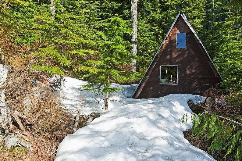
If descending this way, visit to Kallahne Lake log shelter is must (see photos). Finally cross lake outlet, and pick-up trail that descends back to HSCT; about 1 1/2 hours from the lake (last 1/2 hour on old logging road). Although trail is reasonably well defined, it is fairly bushy and focus will be required. Finally turn right as you join HSCT and walk back to Porteau parking.
|
|
Gallery |
|||
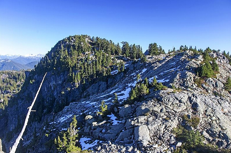 Final ridgewalk leading to summit just left of center
 |
|||
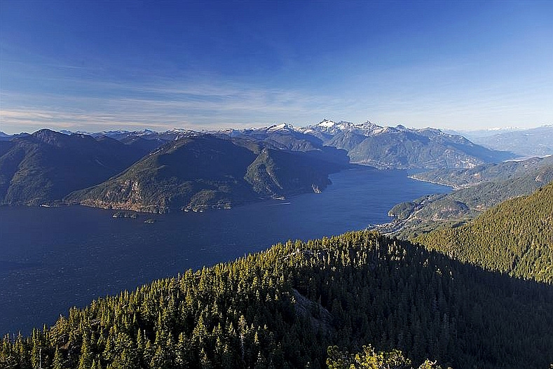 Howe Sound from Deeks summit. Distant snowy peaks of Tantalus range center right
 |
|||
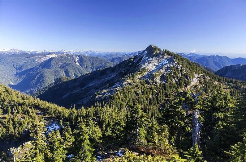 Windsor Peak from Deeks summit. Descent to Deeks/Windsor col is feasible, but involves some route-finding as there are cliffs below not seen from this angle
 |
|||
 View NW from Deeks summit
 |
|||
 Kallahne shelter on loop descent
 |
|||
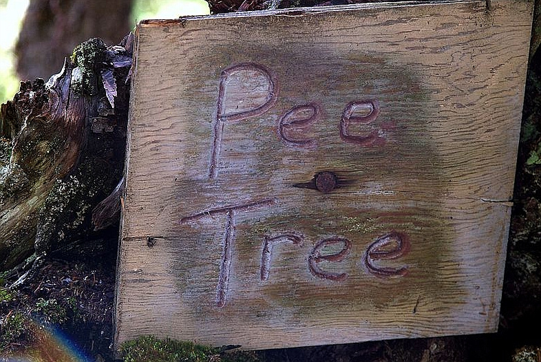 Infamous "Pee Tree" by the shelter
 |
|||
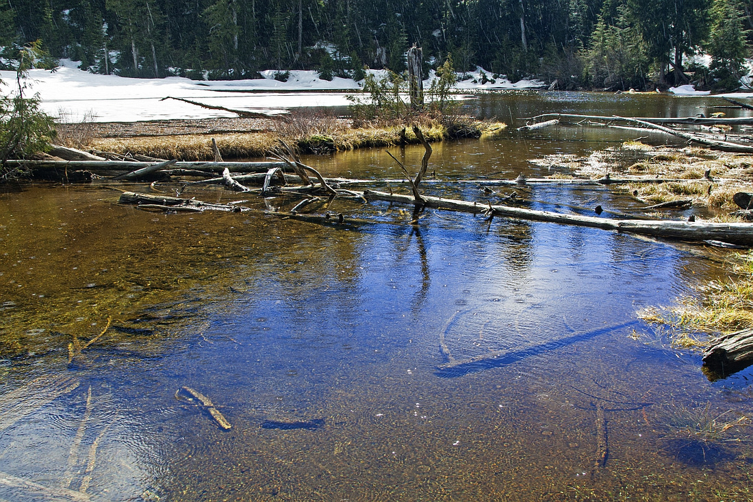 Kallahne (Lost) Lake, sometimes day hike or overnight destination on its own
 |
Abstract
| Overall Difficulty | D6 | Steep sections with bushwhack. Considerable elevation gain. | |||
| Snow Factor | S3 | Steep but mostly forested slopes on old bypass trail present moderate avalanche danger. Less risk on Kallahne route and/or Deeks Lake/Windsor col approach | |||
| Scenery | Exceptional Howe Sound panorama, including Sechelt peninsula and distant Tantalus range. Mt. Windsor and number of peaks along Howe Sound Crest. Kallahne lake on loop return descent | ||||
| Trail/Marking | Poor | Well defined Deeks Lake (HSCT) trail for a short time only, occasionally flagged route afterwards with route-finding | |||
| Suggested Time | 11 hr | Loop return via Kallahne Lake. Add ~1 hr if continuing to Windsor Peak and returning via Deeks Lake | |||
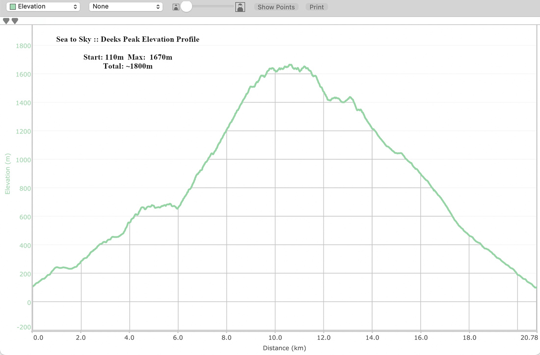
| Elevation | Start: 110m Max: 1670m Total: ~1800m | Round Trip: 21km | |||
| Gear | Full boots. Hiking poles and GPS essential. Snowshoes in winter (skis not practical) | ||||
| Water | Old Bypass trail is dry. Water can be found on descent at Kallahne Lake. Carry 3-4L | ||||
| Dog Friendly | Yes | Standard back-country travel precautions. Area frequented by black bears | |||
 Deeks Peak GAIA Map
 Deeks Peak Elevation Profile