Google Map |
Rockies :: Kananaskis :: Green Monster |
GPS Track |
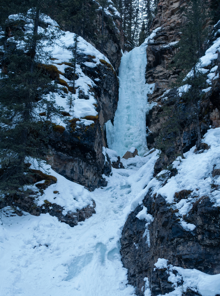
Upper Evan Thomas Canyon with view of "Green Monster"; Greenish Hue to which waterfall owes its name is not embellished |
|||
| Trip Summary | |||
March 18, 2024Winter Trip up Even Thomas Creek, well known for several Ice Climbs. "Green Monster" is the most popular and most scenic, but it is not so easy to get to. Problem is narrowing of the Canyon by Even Thomas Creek Waterfall; continuing up the creek is not feasible anymore and one must use bypass on left (north) side. This bypass is not trivial and would be quite dangerous without chains. Spikes are a must. Upper canyon is quite scenic with lots of pools and snow bridges (that will also become dangerous as weather warms up).
From Evan Thomas parking follow Fireroad for ~20min, then drop right to Creek level (Waypoint "1, 6 - Creek Junction" on GPS Track), then head upstream. Trail up the creek is usually well broken in winter and going is easy. Depending on timing there might be some snow bridges or open water to jump across. 45min or so brings you to Upper Canyon where further progress is not practical - see Gallery. Crux is narrow ledge where slip is not an option; use chain and go slow. Turn back if unsure in your abilities as return is the same way. After descending back to creek level going becomes easy and quite scenic. Green Monster is 15-20min further up the Canyon. There are several minor Ice Falls along the way, but you will know you are at the Monster when you see it. On weekends this spot is usually quite busy with Ice Climbers and Hikers alike.
After clearing the Crux on return, loop return via Summer trail is option. Unmarked connector will be on north (right, coming back) side few minutes past Canyon mouth - Waypoint "2, 4 - Canyon". If trail is broken this longer return will provide variety. It will take ~20min from Creek level to Evan Thomas Fireroad where you turn left (Waypoint "5 - Fireroad"). On my trip there was some fresh deadfall but it didn't present problems.
|
|
Gallery |
|||
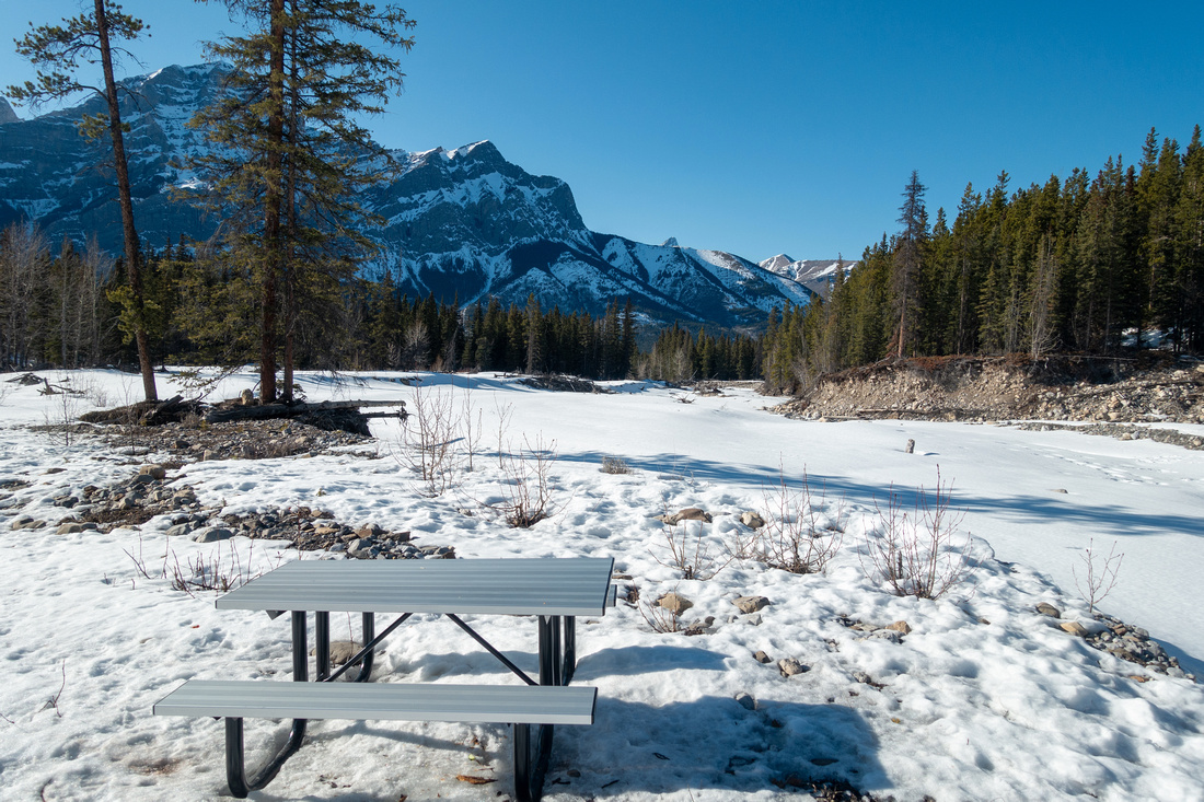 Picnic Bench
 with view of Mt. Kidd ~20min from Evan Thomas Parking Picnic Bench
Picnic Bench with view of Mt. Kidd ~20min from Evan Thomas Parking |
|||
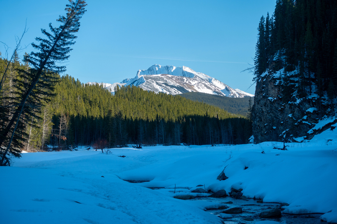 Mt. Fisher
Sunlit Ridge of Mt. Fisher (Kane difficult) as broken trail follows Evan Thomas creek upstream Mt. Fisher
Sunlit Ridge of Mt. Fisher (Kane difficult) as broken trail follows Evan Thomas creek upstream |
|||
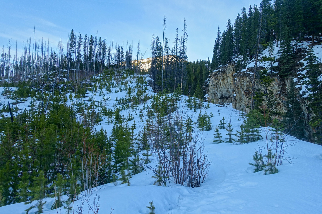
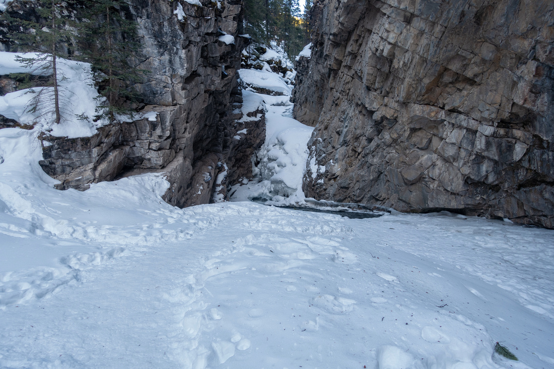
 Canyon Narrowing
Gorge becomes more narrow as it approaches Evan Thomas Creek Waterfall and upper Canyon. Summer Trail / Evan Thomas Fireroad connector is just behind the curve on left side Canyon Narrowing
Gorge becomes more narrow as it approaches Evan Thomas Creek Waterfall and upper Canyon. Summer Trail / Evan Thomas Fireroad connector is just behind the curve on left side |
|||
|
|
|||
|
|
|||
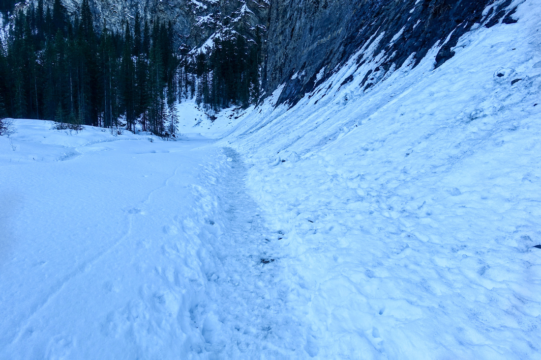
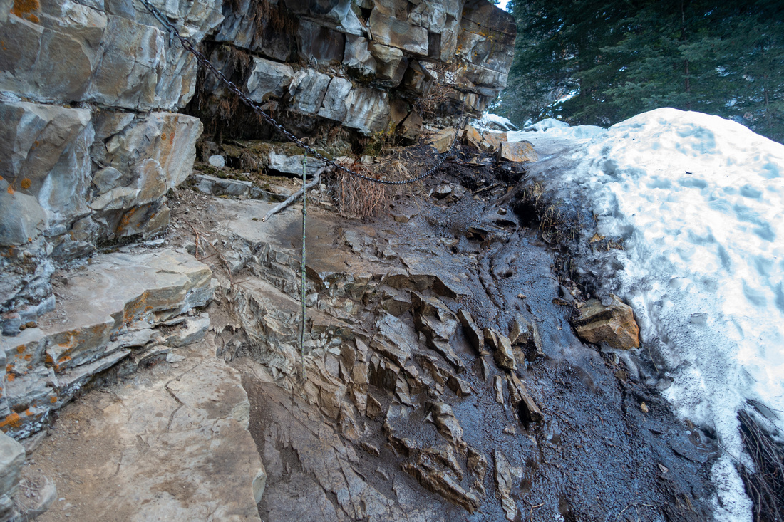 Bypass Trail
First part of bypass trail climbs up steep Rock; I found rope and chain helpful on return Bypass Trail
First part of bypass trail climbs up steep Rock; I found rope and chain helpful on return |
|||
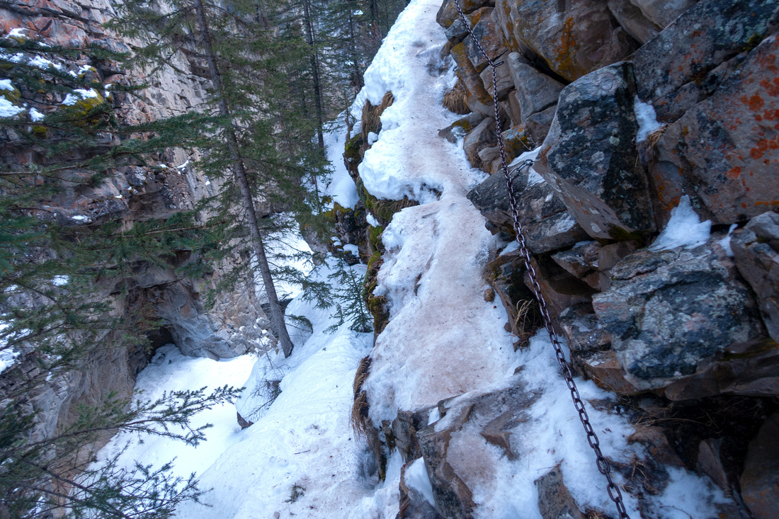 Crux Ledge
Crux: Narrow Icy ledge, looking back - slip is not an option. With weekend crowds this spot is bottleneck and can be quite dangerous. Spikes are a must. Hold the chain and go slowly. Crux Ledge
Crux: Narrow Icy ledge, looking back - slip is not an option. With weekend crowds this spot is bottleneck and can be quite dangerous. Spikes are a must. Hold the chain and go slowly. |
|||
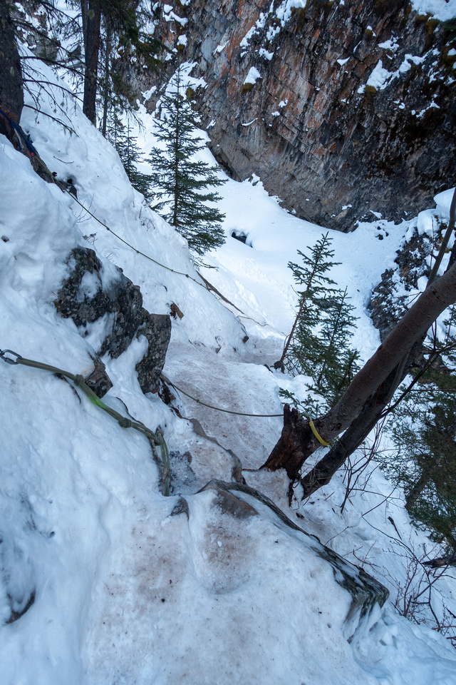 Crux Descent
Awkward descent back to Creek level; Rope is quite helpful Crux Descent
Awkward descent back to Creek level; Rope is quite helpful |
|||
 Snow Descent
Looking back at descent slope after dropping to Creek level; Climbing on return will be easier Snow Descent
Looking back at descent slope after dropping to Creek level; Climbing on return will be easier |
|||
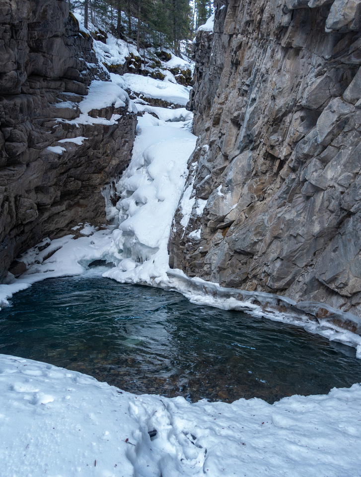
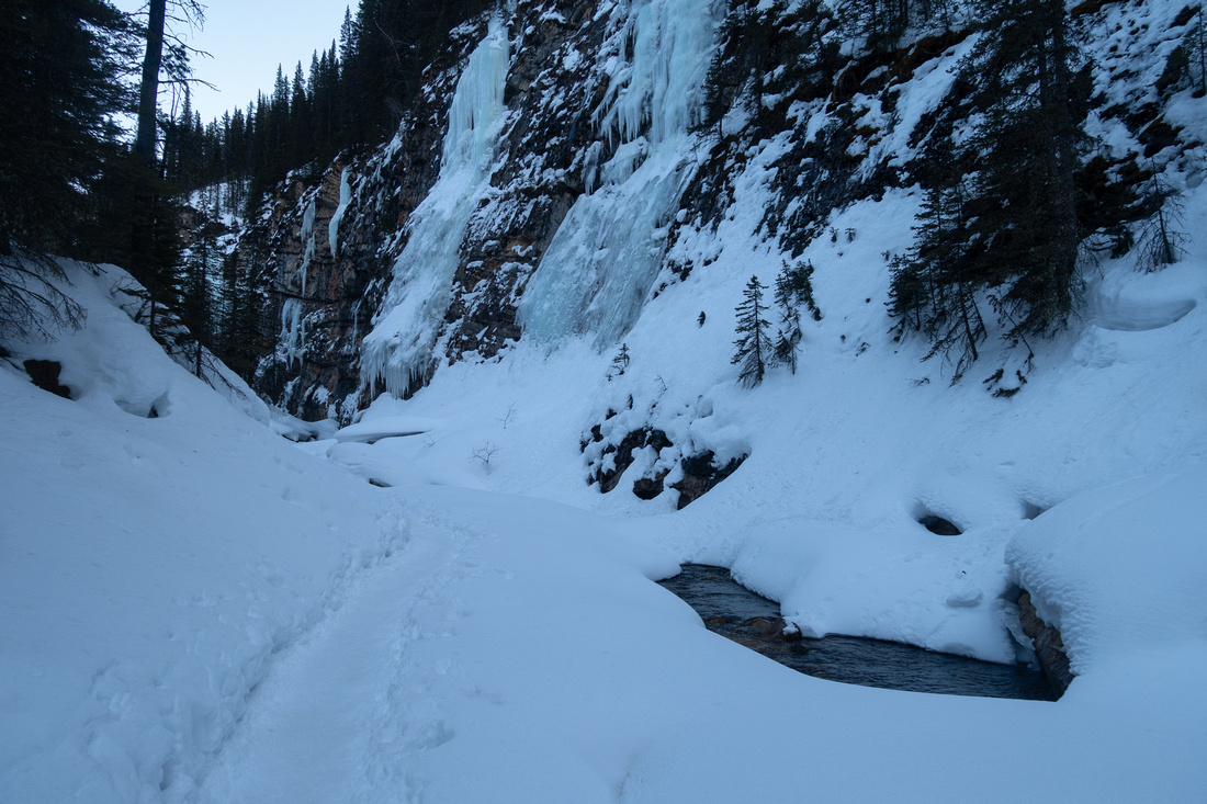 Upper Canyon
Scenic going in upper Canyon past couple of Ice falls. There are several snow bridges to cross and water could be heard below; if you go you must evaluate conditions carefully. In summer conditions passing here might not be feasible and this is primary reason why this is winter trip Upper Canyon
Scenic going in upper Canyon past couple of Ice falls. There are several snow bridges to cross and water could be heard below; if you go you must evaluate conditions carefully. In summer conditions passing here might not be feasible and this is primary reason why this is winter trip |
|||
 The Slurpee
One of side Ice Falls, apparently called "The Slurpee" The Slurpee
One of side Ice Falls, apparently called "The Slurpee" |
|||
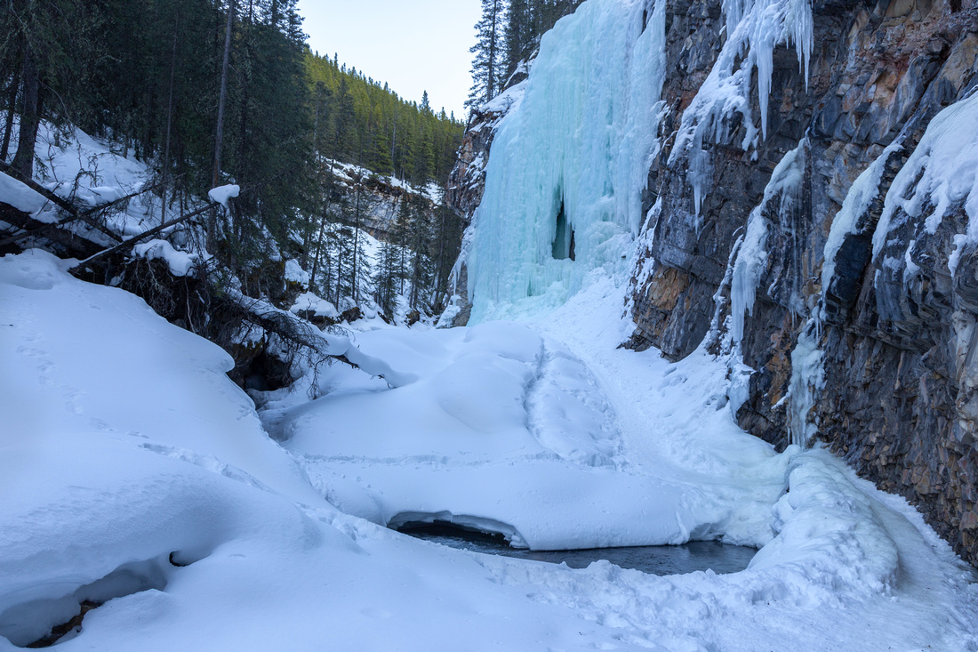
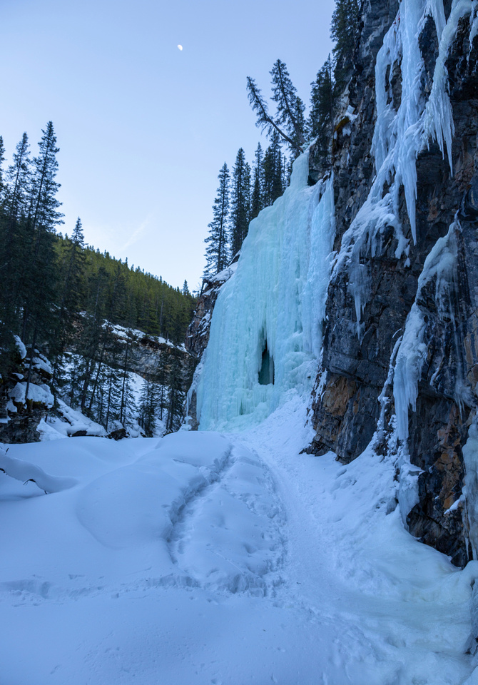 Green Monster
 and turnaround point. Apparently area can be quite busy with ice climbers and hikers on weekend Green Monster
Green Monster and turnaround point. Apparently area can be quite busy with ice climbers and hikers on weekend |
|||
 Evan Thomas Connector
Summer Trail / Evan Thomas Fireroad connector on optional Loop return Evan Thomas Connector
Summer Trail / Evan Thomas Fireroad connector on optional Loop return |
|||
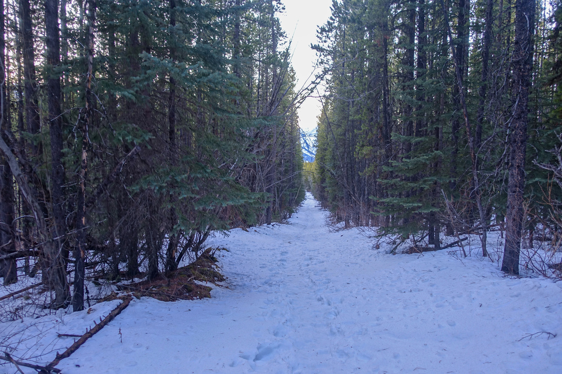 Evan Thomas Fireroad
Rather monotonous return via Evan Thomas Fireroad; on my Trip there was also some fresh Deadfall that might cause problems to cyclists in summer unless cleared Evan Thomas Fireroad
Rather monotonous return via Evan Thomas Fireroad; on my Trip there was also some fresh Deadfall that might cause problems to cyclists in summer unless cleared |
Abstract
| Overall Difficulty | D5 | Unavoidable Upper Canyon bypass with narrow icy ledge and steep snow | |||
| Snow Factor | S3 | Winter Trip. Several Snow bridges, depending on season | |||
| Scenery | Evan Thomas Creek Canyon. Several Frozen Ice Falls. Kananaskis Valley and Front Range Peaks | ||||
| Trail/Marking | Good | Straightforward Evan Thomas Fireroad. Creek level trail usually well broken. Summer connector junction not marked | |||
| Suggested Time | 4hr | Loop return via Summer Trail, less if coming back same way | |||
| Elevation | Start: 1520 m Max: 1720 m Total: ~550 m (loop return) | Round Trip: ~12 km | |||
| Gear | Micro Spikes essential, Gaiters and Hiking Poles recommended | ||||
| Water | Evan Thomas Creek or snow melt. No need to carry more than 0.5L | ||||
| Dog Friendly | No | Recommend leaving dogs at home because of narrow ledge crux - possible traffic jam | |||
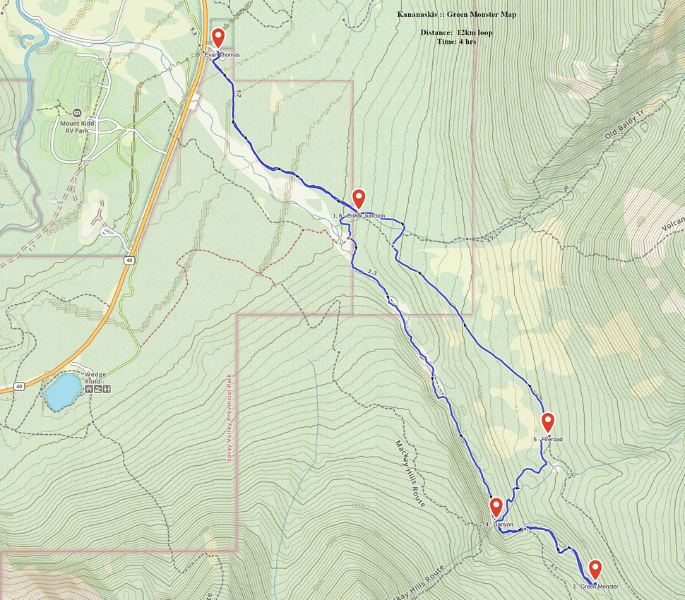 Green Monster GAIA Map
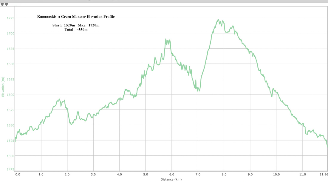 Green Monster Elevation Profile Green Monster Elevation Profile
|