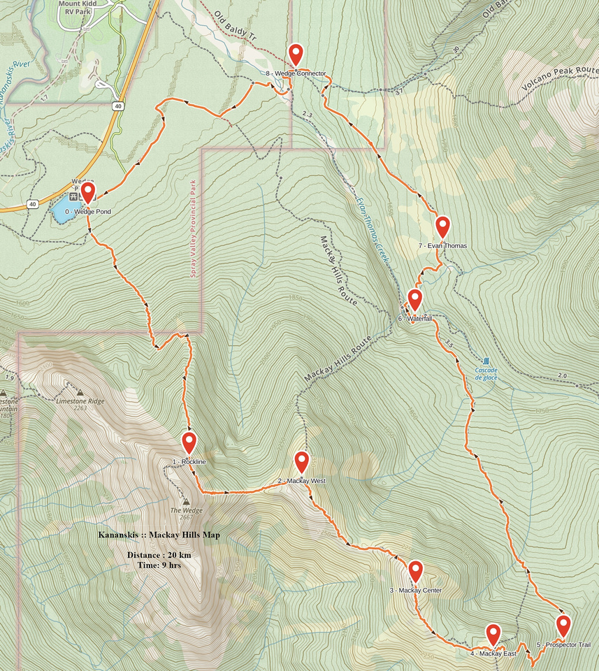
Google Map |
Rockies :: Kananaskis :: Mackay Hills |
GPS Track |
|
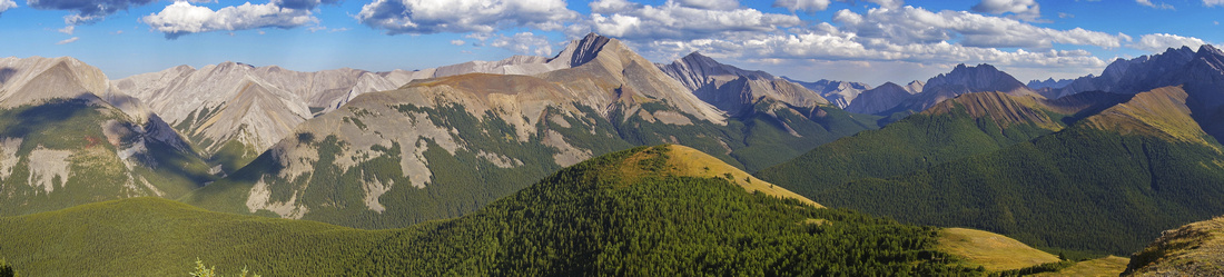 
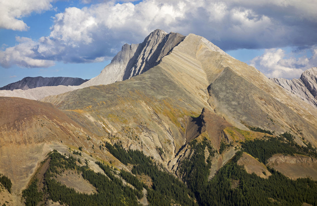
Panoramic View east from Mackay Center to Front Ranges and Alberta Foothills. Mackay East is grassy hill in foreground; Mt. Fisher behind |
|||
| Trip Summary | |||
August 22, 2017
Mackay Hills are 3 knobs along the grassy ridge extending from Wedge Mtn rising above Hwy40 corridor and Rocky Creek/Evan Thomas further east. It is superb ridgewalk that leads itself naturally to a loop, but access is non-trivial challenge. Most reports as well as Daffern K-country guidebook advocate clockwise direction; problem with this is boring ~12km+ long trudge along Evan Thomas road going in and tedious descent on return. Daffern advocates 4 descent options; except for Wedge High, they all lead into more or less bushwhacking. Wedge High is the cleanest option that benefits from scramblers access trail, but adds non-trivial distance/elevation that can not feel good at the end of long day.
For that reason counter-clockwise direction is far better option. Starting from Wedge Pond (as opposed to Evan Thomas trailhead) and clearing steep part early in the day while fresh works well and avoids all bushwhack issues. Upon traversing all 3 Mackay Hills better return option exists. Old Prospector road (not mentioned in Daffern guidebook or anywhere online) cuts return time by 4-5km and at least an hour -- when compared to "standard way" via Rocky creek / Evan Thomas road. Added benefit: neat waterfall in Evan Thomas canyon. Except for one avoidable rock step on Mackay Center peak entire loop is non-technical, but due to overall length, elevation gain and route finding issues should be attempted by fit and experienced hikers only.
Start from Wedge Pond parking lot on Kananaskis Trail (Hwy 40) some 20 min south from Trans-Canada. Find Wedge scramblers access trail: Easiest is to cross the gate and follow road that curls to the right. (Do NOT go left into bike path; this is Wedge Connector that ends in Evan Thomas parking lot, and your return path). Road drops to Wedge pond; watch for side trail on the left side. Initially it is a bit overgrown but improves soon as it follows drainage that empties into Wedge pond. Trail soon steepens and sections are eroded; it becomes clear why it is much better suited for ascending than descending. It reaches treeline in just over an hour, then switchbacks open slopes (1st photo in gallery) -- views are terrific here. Finally it follows grassy rib interspersed with pine trees and larches to rockline and start of Wedge scrambling route. It takes ~2 hours of moderate pace and 800m vertical to this point. Mackay West (also called "Mackay Mountain") is directly across to the left. Follow faint, but distinct trail that traverses below the cliffs; despite what appearance might suggest, it is very easy to follow. Only real danger is from rockfall that might be triggered by scramblers above, so cross this section fast. Resist urge to sidehill too soon and complete the traverse -- it takes only 10-15 minutes. At the end turn left and descend to saddle below Mackay Mountain; vertical drop that must be regained in entirety is ~150m. Slope is steeper on Wedge side, but it is entirely hiking; poles are of significant help here. It takes 45min to an hour to cross from end of scramblers approach trail to Mackay Mtn, or ~3 hrs from parking at Wedge Pond.
Mackay Center peak lies east and it will take about an hour. Descent to intervening low point is not entirely straightforward as there are couple of small rock outcrops, but none present a problem. Note side trail that cuts on the right side in dirt -- one could also cut around Center peak this way. Climbing the peak up obvious crumbly ridge is only semi-technical part; bit of lose talus in lower part, and one rock band higher up that can easily be bypassed on left (north) side. Center summit also has cairn and is by couple of meters higher than West summit (Mackay Mountain). Views east to Kananaskis Foothills and Elbow/Sheep wildland are terrific; Mount Fisher (Kane difficult scramble) dominates the horizon. Mackay East peak is the grassy hill about 30 minutes of easy hiking from Center, and is the only one that does not have a cairn.
For return there are 2 options. Longer one is to drop grassy slopes on the north (right) side, pickup trail at treeline and descend to Rocky Creek Pass, then turn left and hike back via Rocky Creek / Evan Thomas. Shorter and better option is to find old Prospector trail that cuts across wooded north slopes of Mackay Hills. For this option plunge into the forest directly from Mackay East, roughly aiming just left of Mt. Fisher. Slopes are steep-ish but forest is open and bushwhack minimal. Couple of animal trails are intercepted lower down, but when you come to this Prospector Trail you will know it. Turn left and follow this trail (right would bring you to Rocky Creek Pass). It is well defined with minimal deadfall; couple of small drainages are crossed along the way and could provide water source. Trail briefly disappears in marshy meadow further down but is easily found on the far end. Eventually it descends to Evan Thomas creek near huge drainage coming off between Mackay Center and West. Beautiful little waterfall is just upstream and would be worthy easy half-day hike from Evan Thomas parking lot on its own. Upper Canyon has several Ice Falls, in particular infamous "Green Monster", that are quite popular with Ice Climbers but this is strictly a winter trip - see here for more details.
From the waterfall cross Evan Thomas creek (rock hop) and hike up on well defined horse trail that intercepts standard Evan Thomas road some 5km from the parking. You can also hike down the creek directly - there is no trail and there are a couple of creek crossings. You will also pass by couple of waterfalls that are popular with ice-climbers in winter, but dry out in late summer. When you reach Wedge connector turn left and close the loop by hiking back couple of kms on valley floor back to Wedge Pond. |
|
Gallery |
|||
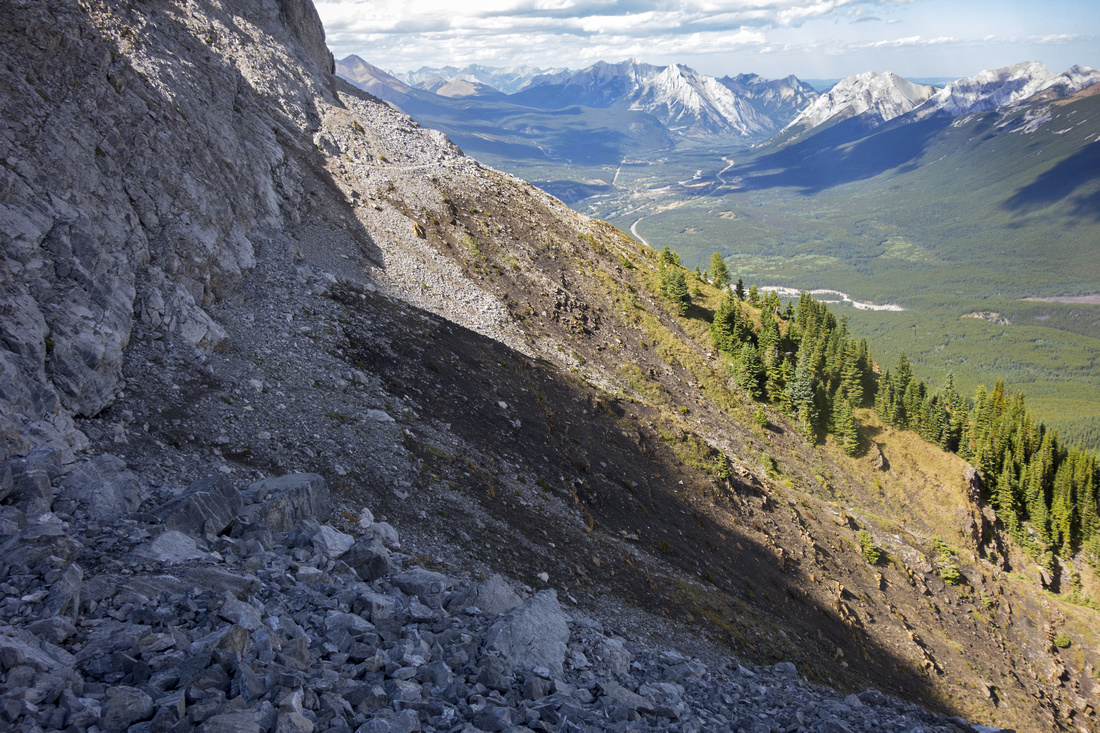
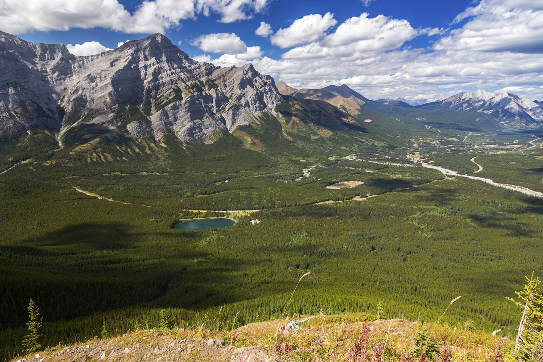 Kananaskis Valley and Mt. Kidd from Mt. Wedge ascent slopes
 |
|||
 "Wedge High" Traverse below scramble slopes of Wedge Mountain
 |
|||
 Mackay Mtn (L) and Center Peak (R) from "Wedge High" traverse.
 |
|||
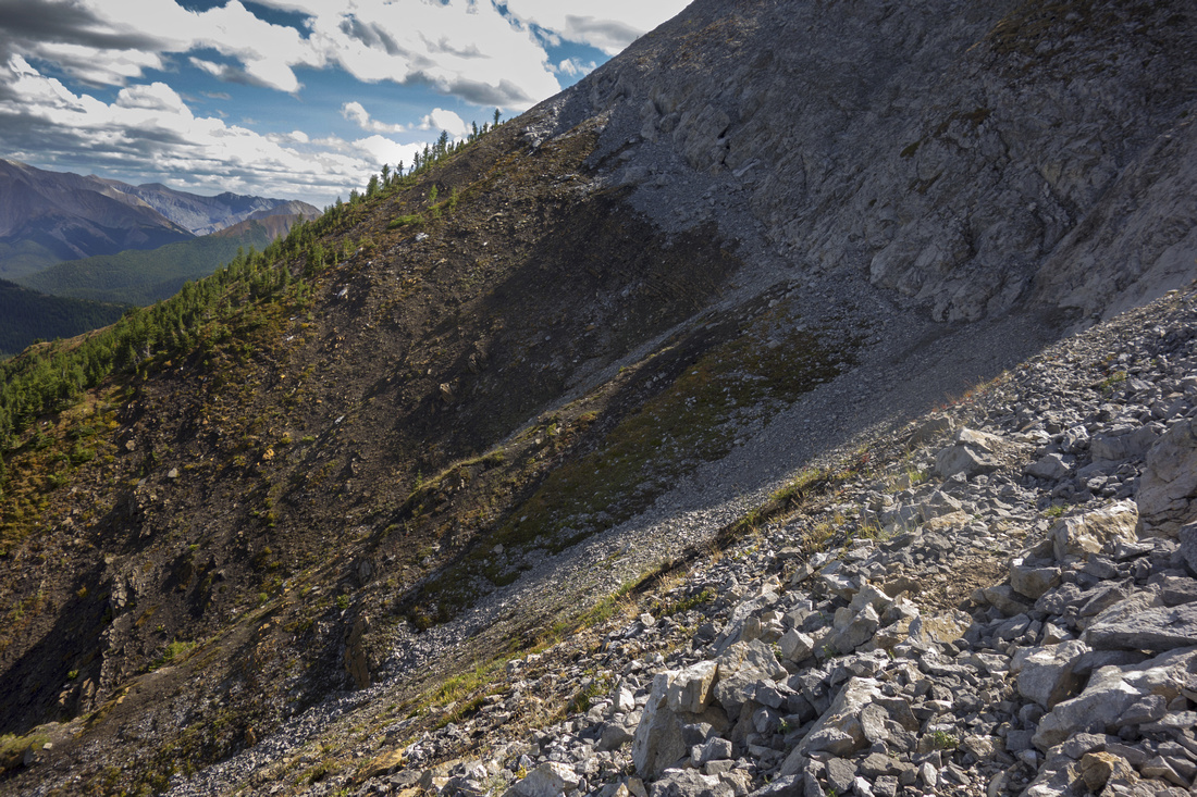
 End of "Wedge High" looking back.
 |
|||
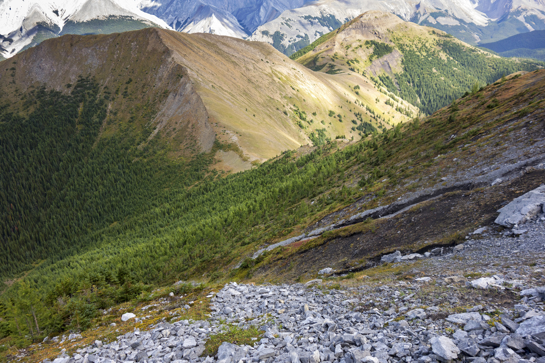
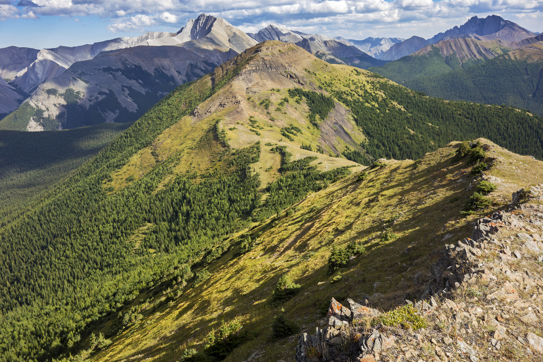 Ridge from Mackay Mtn to Center Peak
 |
|||
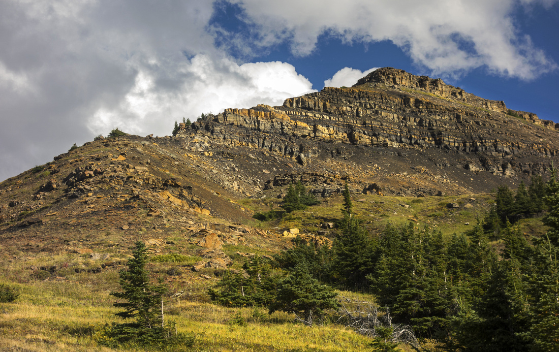 Center Peak ascent Ridge is an easy class 2 scramble
 |
|||
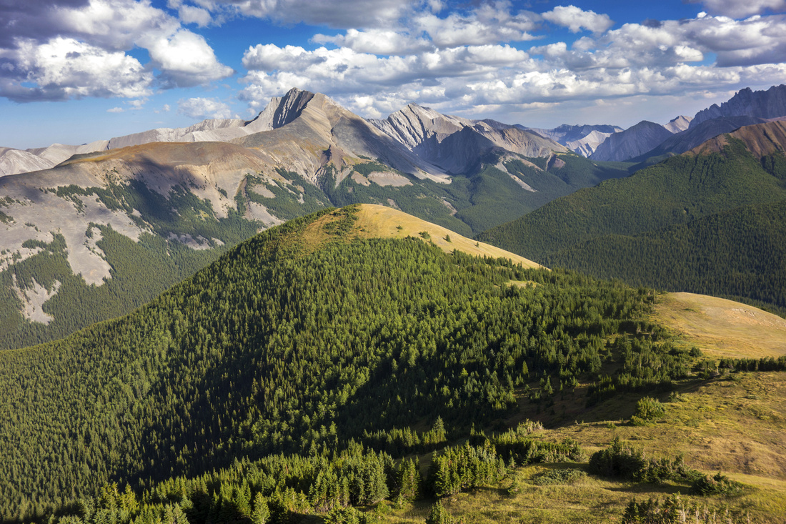 Easy grassy slope from Mackay Center to Mackay East. Mt. Fisher behind
 |
|||
 Mt. Fisher telephoto; difficult Kane scramble
 |
|||
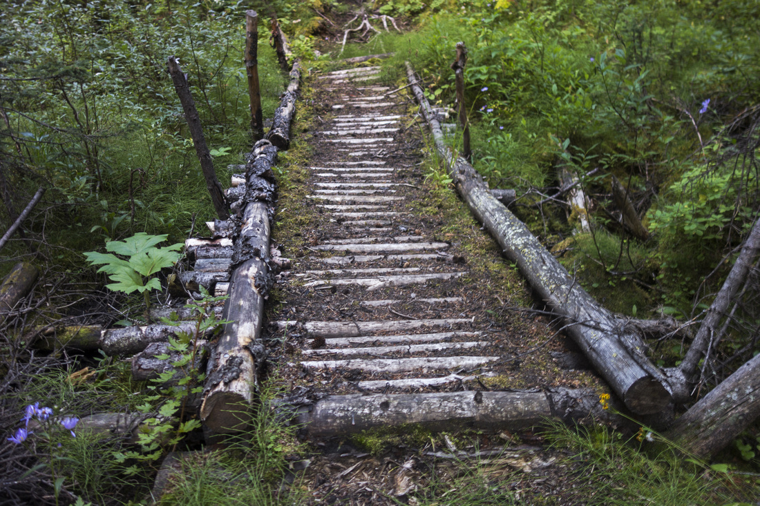 Log bridge on old Prospector Trail on return
 |
|||
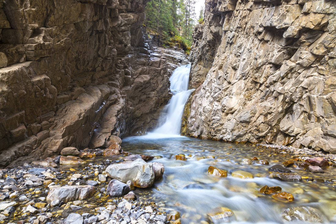 Evan Thomas Canyon Waterfall; worthy destination on its own
 |
Abstract
| Overall Difficulty | D4/5 | Steep sections, loose talus slopes with couple of class 2 scrambling moves. Non-bridged creek crossings. Bushwhack and route-finding. | |||
| Snow Factor | S3 | Winter safe except for portion under Wedge (if using "Wedge High" option, as described on this page). Length of the journey probably makes winter day-trips less feasible. | |||
| Scenery | Several hours of delightful ridgewalk with great view of Front Range Peaks and Kananaskis Foothills. Neat little waterfall in Evan Thomas canyon if returning via old Prospector Trail | ||||
| Trail/Marking | Good/None | Eroded scramble access trail on Wedge mountain, none on Mackay Hills. Old Prospector trail on north slope or longer return option via Evan Thomas are both reasonably well defined most of the way. | |||
| Suggested Time | 9-10 hr | For described loop starting from Wedge Pond and using old Mackay Prospector trail on return; add at least an hour if returning (or hiking in) via Evan Thomas / Rocky Creek as described in Daffern guidebook | |||
| Elevation | Start: 1570m Max: 2380 m Total: ~1500 m | Round Trip: ~20km | |||
| Gear | Day Hikers with good ankle coverage in summer. Poles suggested. GPS essential on return, regardless of option. | ||||
| Water | Small creek in lower portion of Wedge scramble access trail, dry afterwards till Evan Thomas creek. Couple of small creeks on Prospector trail are not reliable. Carry at least 3L in summer | ||||
| Dog Friendly | Yes | Standard back-country travel precautions. Evan Thomas frequented by cougars | |||
 Mackay Hills GAIA Map
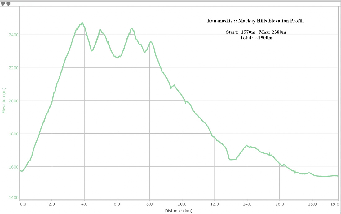 Mackay Hills Elevation Profile