Google Map |
Rockies :: Icefields :: Helen Lake Ridge |
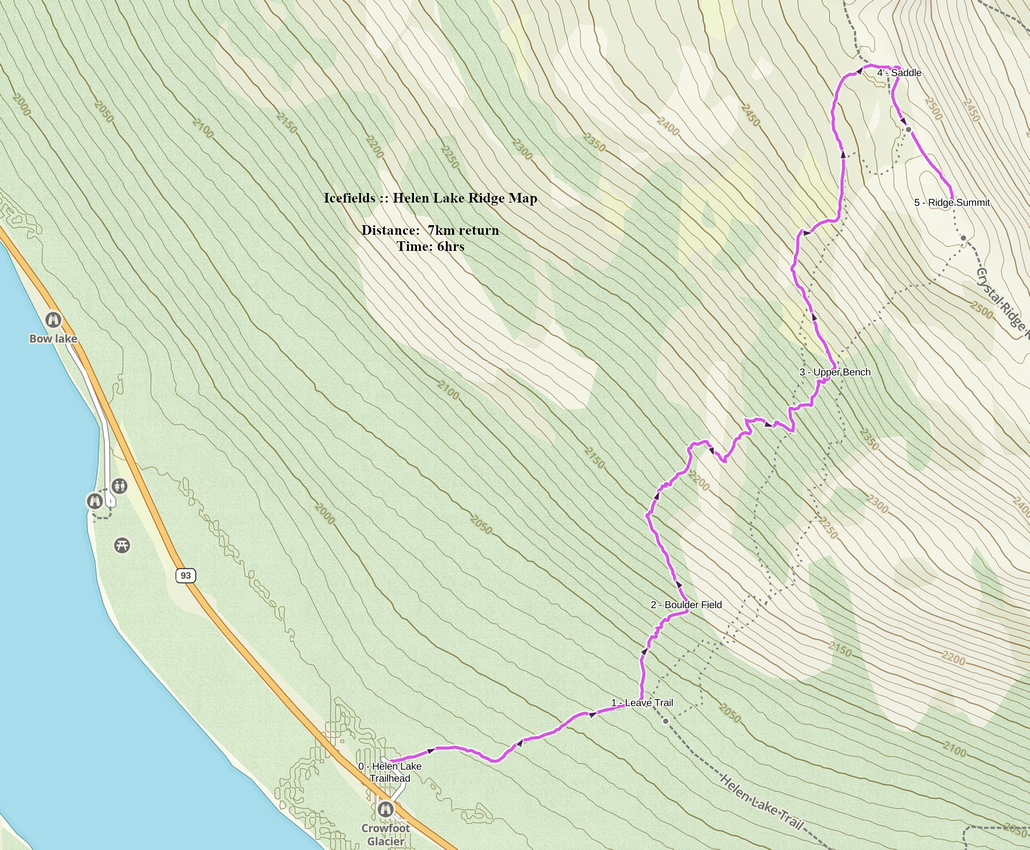
GPS Track |
|
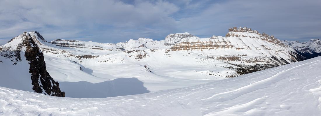
Dolomite Pass area from low saddle at Ridge north end. Helen Lake center left, Dolomite Peak upper right |
|||
| Trip Summary | |||
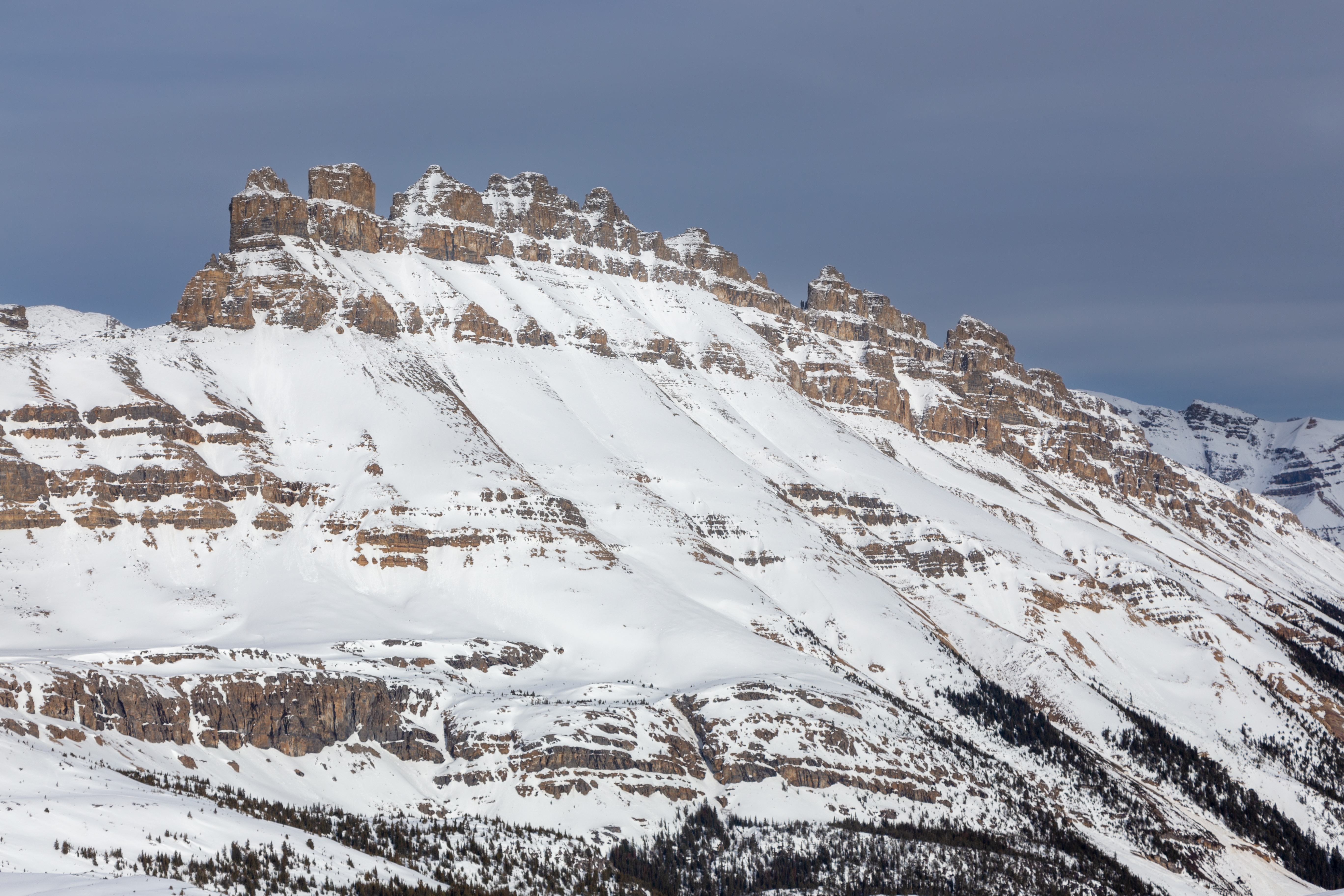
April 14, 2024Rocky Ridge separating Icefields corridor to the West and Dolomite Pass area to the East, also known by somewhat pretentious "Crystal Ridge" name. Standard Helen Lake hiking trail rounds this ridge on the south side. Craggy Highpoint offers unparalleled views of Icefields corridor, but is still largely off-radar. Feasible in summer conditions, but much more frequently done on skis or snowshoes in winter. Do not expect trails, only odd snowshoe or ski track in winter - if you are lucky. Unsupportive wet snow in springtime conditions is objectively the largest obstacle.
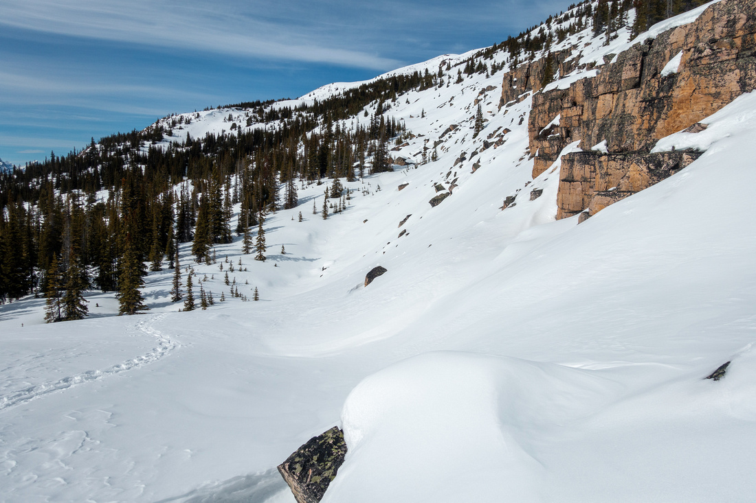
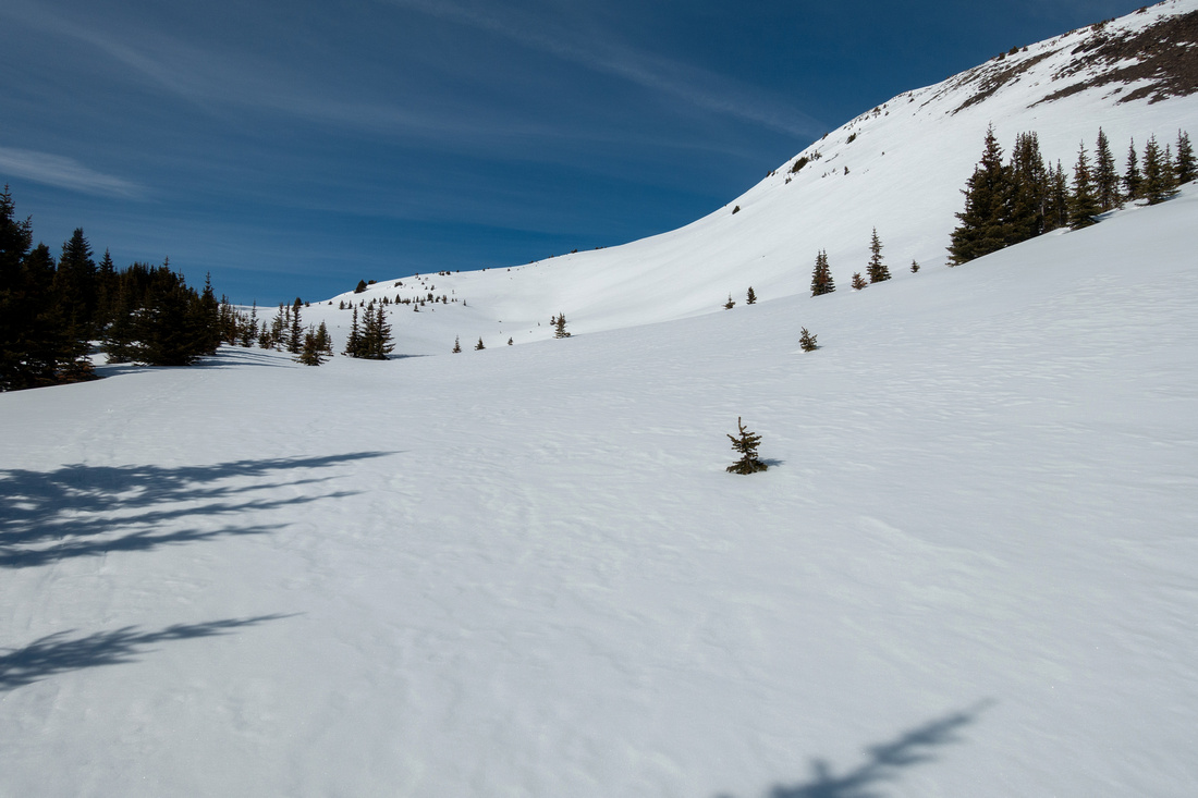
Initial part follows Helen Lake trail for ~15minutes. Leave trail as it starts contouring in southerly direction and head up through moderately dense forest. First goal is to reach wide boulder field ~15min above the trail (Waypoint "2-Boulder Field"). From here the most direct line ascends straight up; with wet snow this can be quite tricky. On my trip in April '24 I followed edge of forest on north side before heading straight up the thinning forest to mid-bench, then continued up to treeline and start of upper bench. Past all obstacles going is now straightforward and super enjoyable. View of Bow Lake/Crowfoot Mountain and Glacier to the west is simply spectacular (see Gallery). Shallow bowl directly below the ridge can present Avalanche danger; avoid by contouring on left (west) side then angle up to low col at north end of the Ridge. Views here are simply spectacular and if not windy this saddle is fantastic spot for a break. Highpoint of the ridge is some 15 minutes away. Going is easy but be wary of snow cornices projecting on east side.
Return is the same way and in stable snow conditions will be twice as fast. |
|
Gallery |
|||
 Lower Boulder Field Lower Boulder Field Lower Boulder field ~15min after leaving Helen Lake Trail. Variety of options exist; beware of moats if heading straight up
 |
|||
 Mid Bench
Mid bench after clearing up lower boulder field Mid Bench
Mid bench after clearing up lower boulder field |
|||
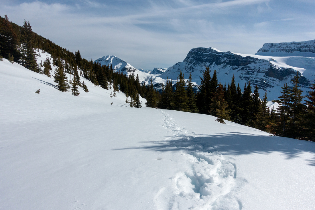 Upper Bench
Looking south after transitioning from mid to upper bench. Bow Peak upper center left Upper Bench
Looking south after transitioning from mid to upper bench. Bow Peak upper center left |
|||
 Upper Bench
Easiest and most scenic line contours upper bench on gentle left side; this also avoid avalanche risk in bowl below the ridge Upper Bench
Easiest and most scenic line contours upper bench on gentle left side; this also avoid avalanche risk in bowl below the ridge |
|||
 Upper bench Panorama
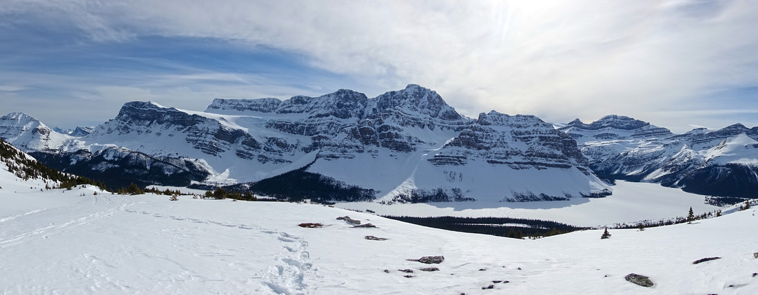
Fabulous views west from upper bench. Frozen Bow Lake lower right, Crowfoot Mtn and Glacier left Upper bench Panorama
Fabulous views west from upper bench. Frozen Bow Lake lower right, Crowfoot Mtn and Glacier left |
|||
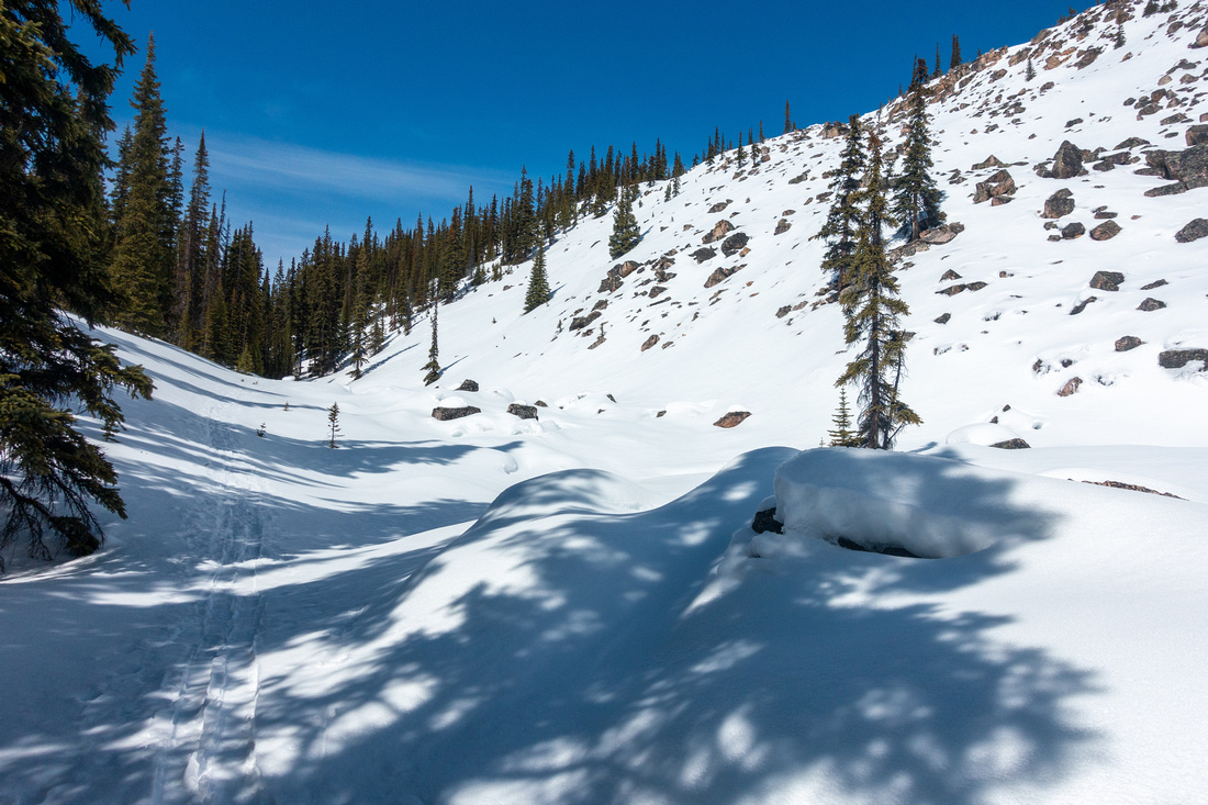
 Old Ski Tracks
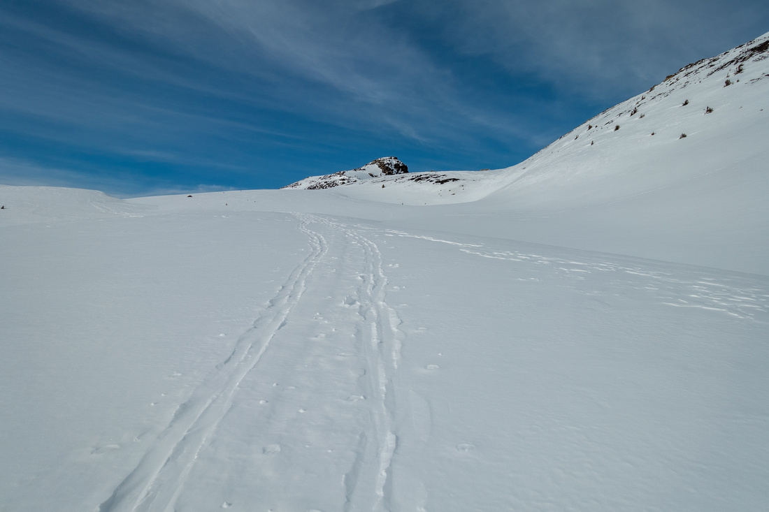
Following faded ski tracks towards low saddle at north end of Helen Lake Ridge Old Ski Tracks
Following faded ski tracks towards low saddle at north end of Helen Lake Ridge |
|||
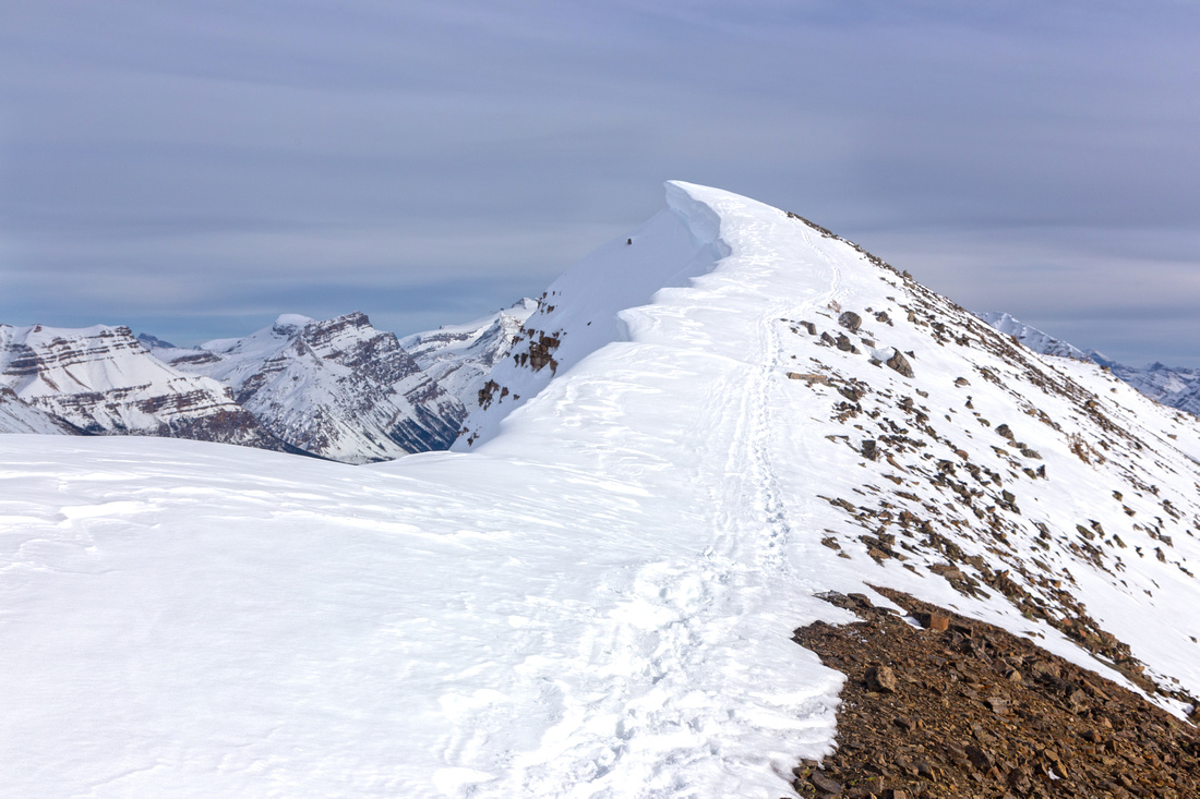
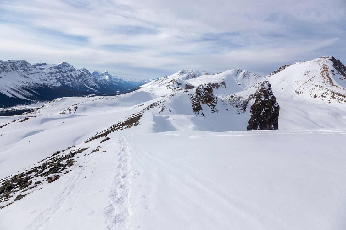
 Helen Lake Ridge
Length of Helen Lake Ridge approaching the Col Helen Lake Ridge
Length of Helen Lake Ridge approaching the Col |
|||
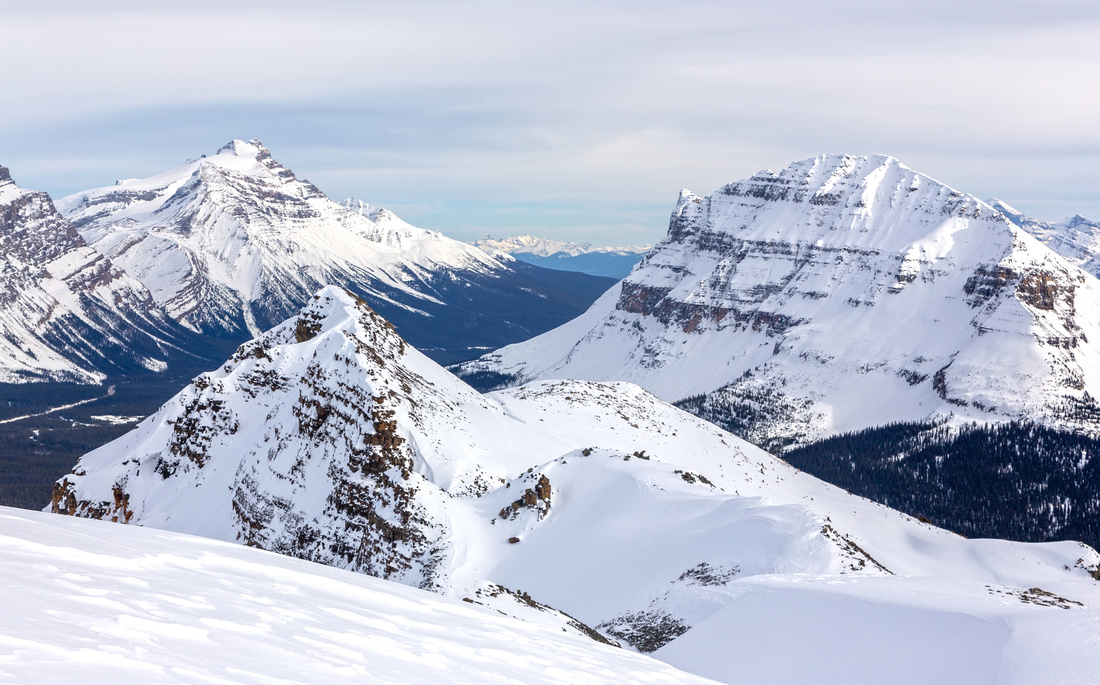
 View from the Col
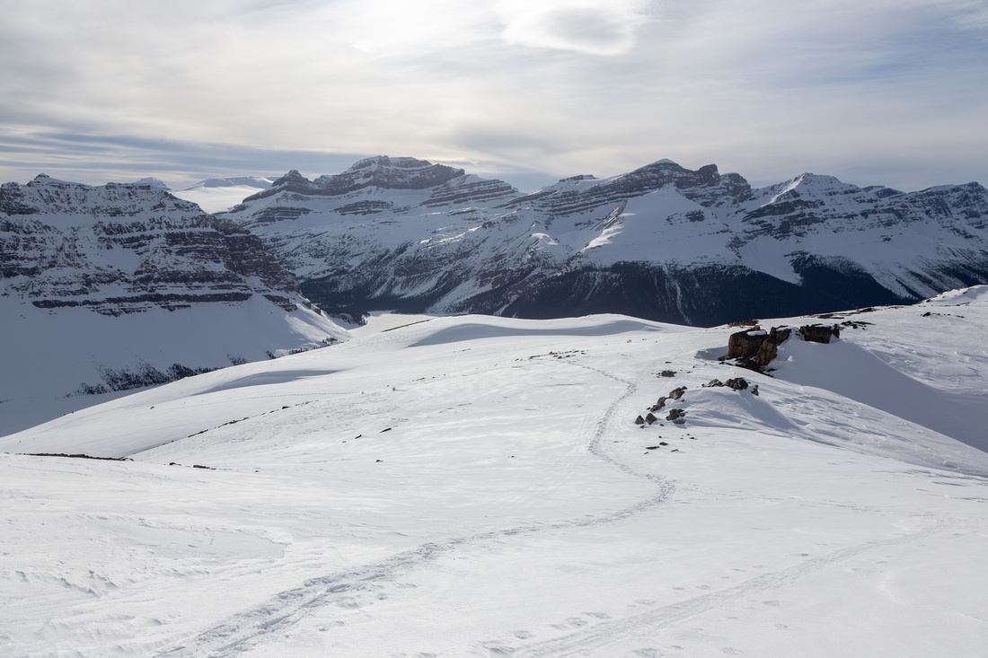
Bow Lake area Peaks from Helen Lake Ridge north end. Jimmy Simpson upper center right View from the Col
Bow Lake area Peaks from Helen Lake Ridge north end. Jimmy Simpson upper center right |
|||
 Helen Lake Ridge
Gentle ridgewalk leading to Highpoint; beware of cornices often forming on east side Helen Lake Ridge
Gentle ridgewalk leading to Highpoint; beware of cornices often forming on east side |
|||
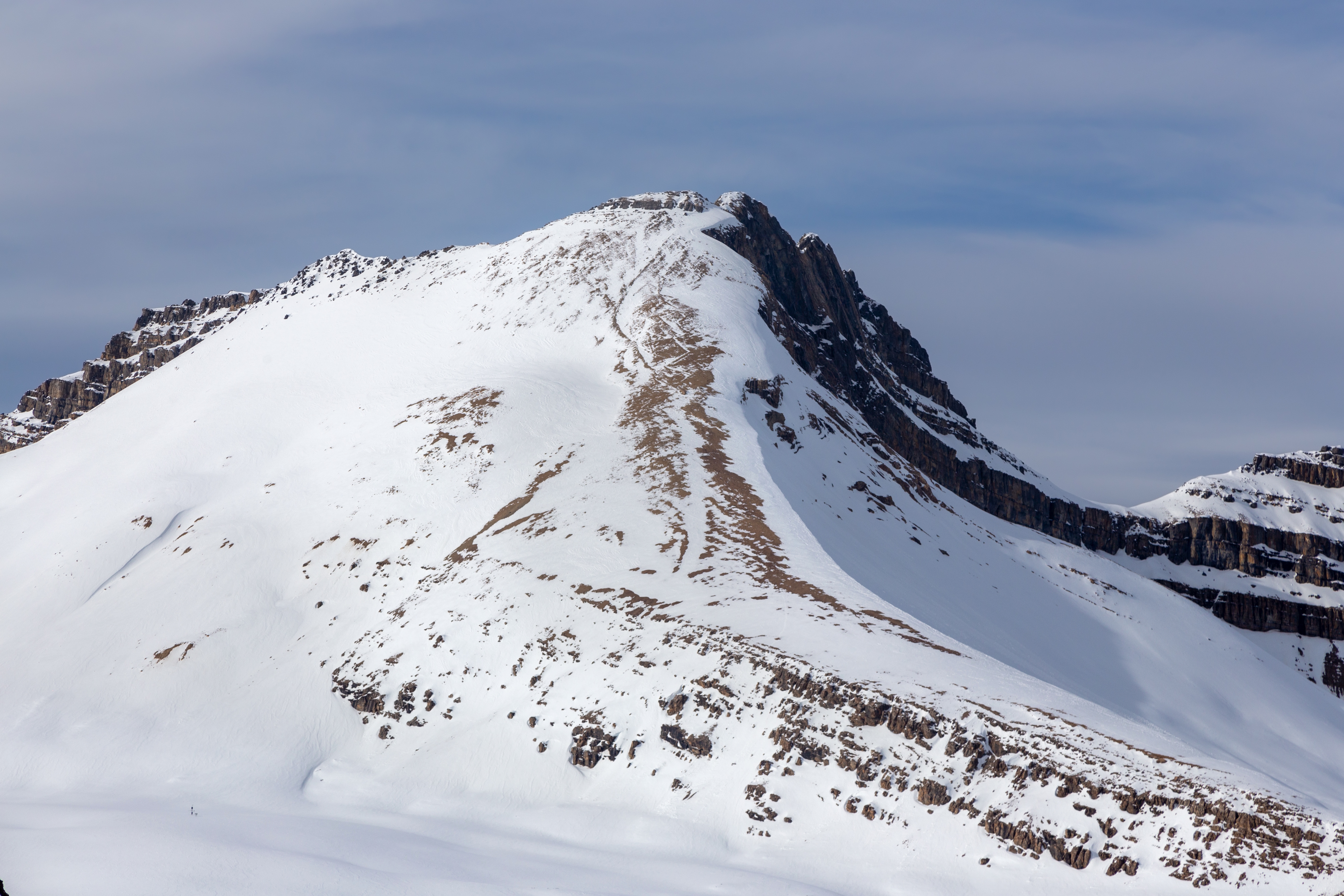
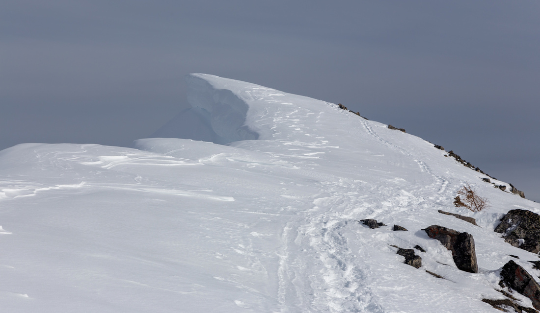 Summit Cornice
Stay well right of cornice; fall would likely be fatal Summit Cornice
Stay well right of cornice; fall would likely be fatal |
|||
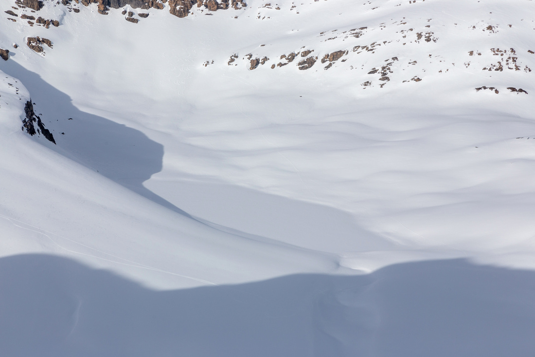
 Icefields Panorama
South views from Ridge Highpoint. Continuing to Lower bump center left is much more difficult and not recommended Icefields Panorama
South views from Ridge Highpoint. Continuing to Lower bump center left is much more difficult and not recommended |
|||
 |
|||
 Helen Lake
Snow covered Helen Lake from Ridge Highpoint. Note skier tracks descending from the Col, lower center left Helen Lake
Snow covered Helen Lake from Ridge Highpoint. Note skier tracks descending from the Col, lower center left |
|||
 |
|||
 Icefields Corridor
Descending ridge back to the Col with fab northerly views of Icefields Corridor. Pointy peak upper center left is Mt. Chephren Icefields Corridor
Descending ridge back to the Col with fab northerly views of Icefields Corridor. Pointy peak upper center left is Mt. Chephren |
Abstract
|
Overall Difficulty |
Moderately steep slopes with boulder fields and bushwhack. Normally done in winter on skis or snowshoes |
||||
|
Snow Factor |
Moderate avalanche danger. Corniced summit ridge. Wet collapsing snow and moats in springtime conditions |
||||
|
Scenery |
Bow Lake and Crowfoot Mountain/Glacier. Helen Lake and Dolomite Pass aerial view. Many well-known Icefield corridor peaks including Cirque Peak, Bow Peak, Andromache/Hector and distant Waterfowl Group |
||||
|
Trail/Marking |
None |
Odd skier or snowshoe tracks only in winter, completely off-trail in summer |
|||
|
Suggested Time |
5-6 hr |
Moderate pace in winter conditions, estimate 5 hrs in summer (return) |
|||
|
Elevation |
Start: 2000 m Max: 2610m Total: ~630m |
Round Trip: ~7 km | |||
|
Gear |
Snowshoes or skis in winter, standard hiking gear in summer |
||||
|
Water |
Snow melt. Carry 1L in winter, more in summer |
||||
|
Dog Friendly |
No |
Likely not a good candidate to bring dog in winter. Standard back-country precautions in summer |
|||
 Helen Lake Ridge GAIA Map
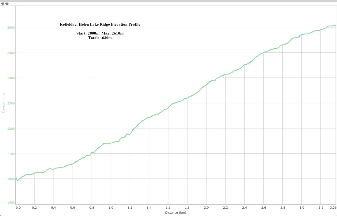 Helen Lake Ridge Elevation Profile