Google Map |
Rockies :: Icefields :: Mt. Jimmy Simpson |
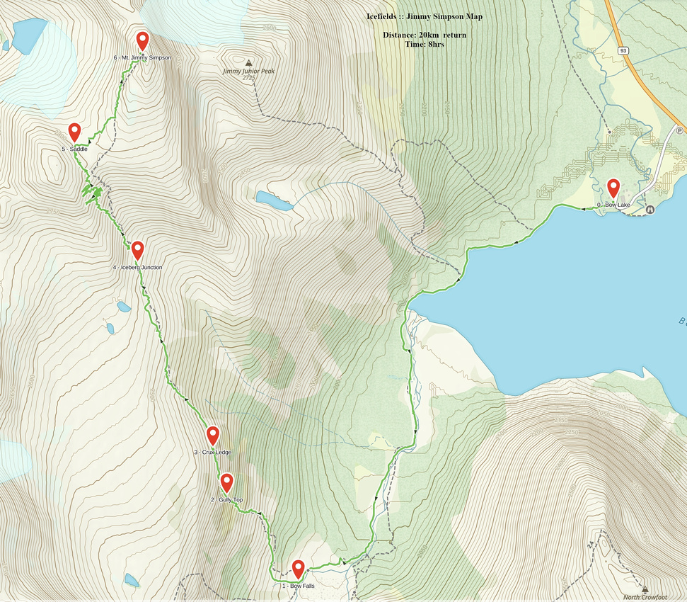
GPS Track |
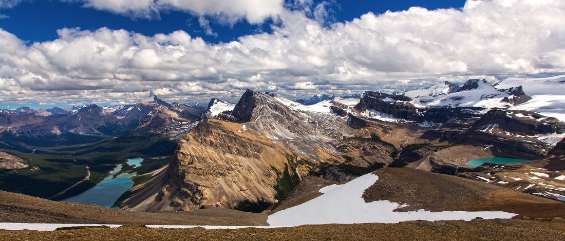 
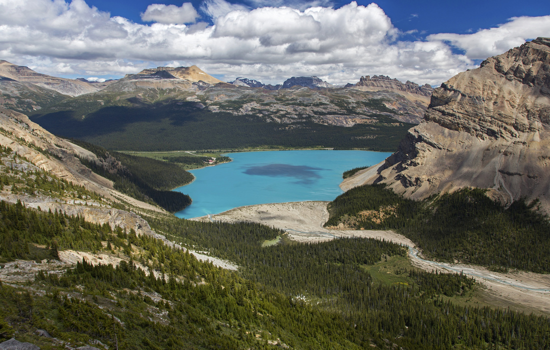
Panoramic view south from the summit. Bow Lake left; Iceberg Lake far right, Crowfoot Mountain center |
|||
| Trip Summary | |||
July 24, 2016Mt. Jimmy Simpson is fantastic ascent starting from Bow Lake some 30 minutes north of Lake Louise. At almost 3000m of altitude, summit offers breathtaking scenery in the heart of the Icefields. Entire trip is above the treeline offering views right from the start. Initial part is shared with popular tourist trail to Bow Falls, but rest is still infrequently visited and solitude is likely. Although not in Scrambles guidebook, route has picked up popularity due to several online reports on Internet. Technically it is not overly challenging, but it is not a cakewalk either. There are couple of class 2 rock steps and one very awkward talus slope to content with. Routefinding on ascent ledges below Portal peak is now less of an issue as cairns mark the easiest way. Loop return via Iceberg Lake is possible, but more difficult and elevates grade up a notch (D6). Start early, and pick-up cloudless bluebird day!
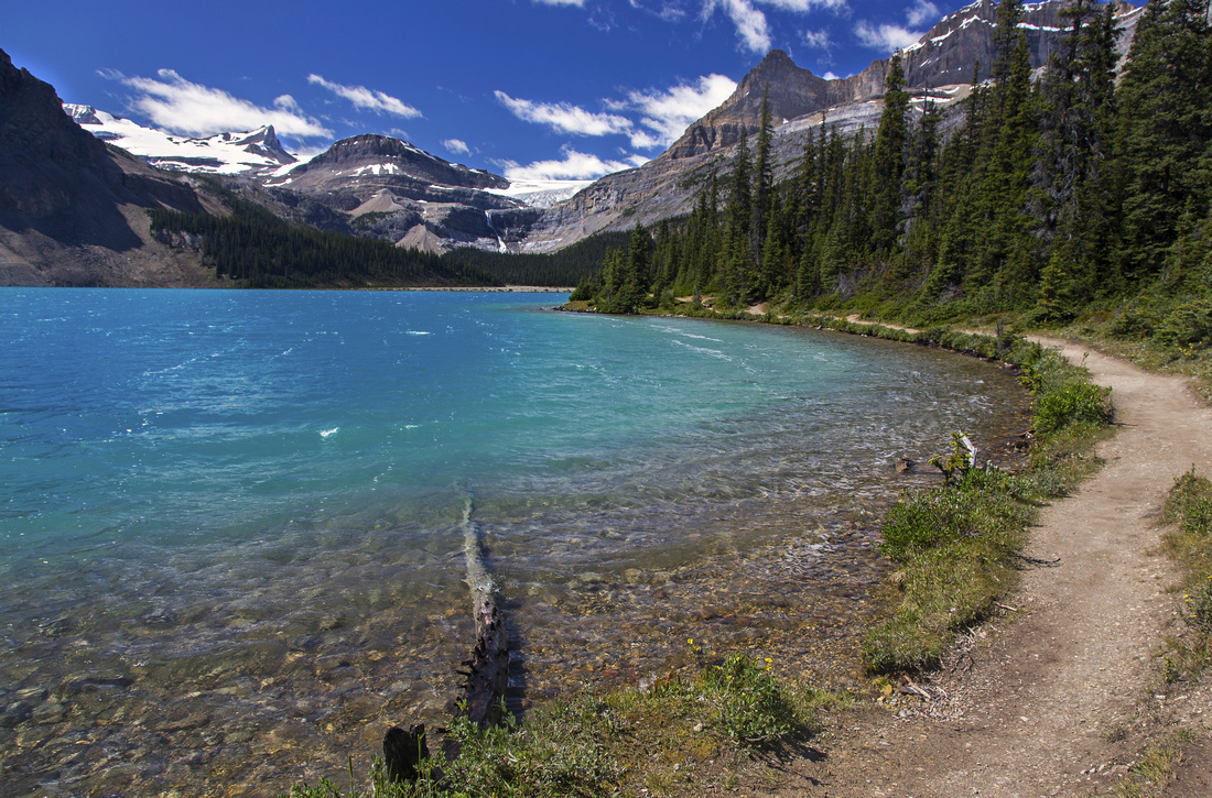
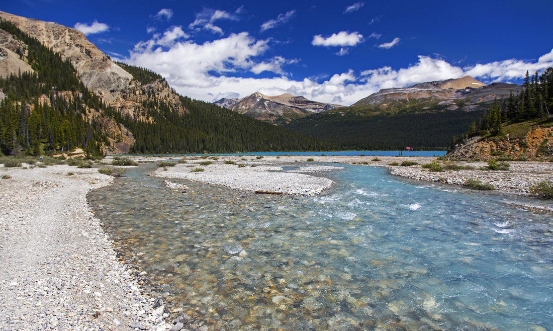
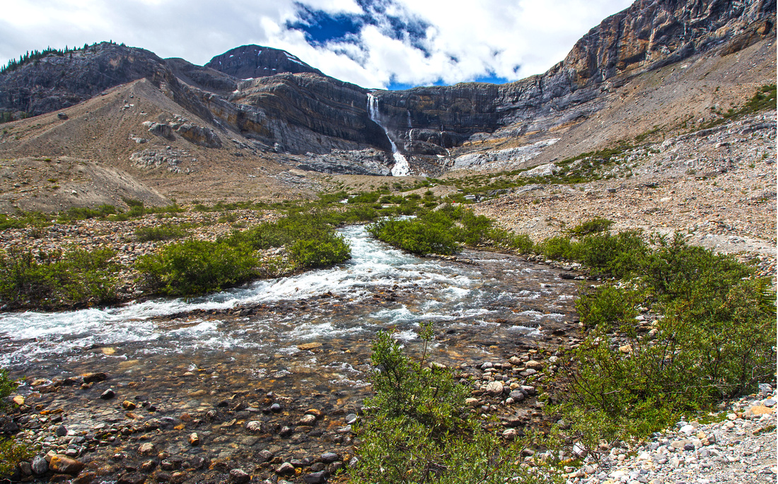
Hike Bow Falls trail starting from Num-Ti-Jah lodge on north side of Bow Lake. Good trail leads around the lake, then continues along the flats. When water is low it is possible (and better) to walk along the flats; otherwise follow trail at edge of forest on the right side. Past the canyon where mountaineering access to Bow Hut splits across the wedged chokestone to the left, trail descends to glacial valley below Bow Falls. Ascent route for Mt. Jimmy Simpson is to the right. Don't head up too early though; instead hike towards the falls, then angle right on grassy draw directly below the cliffs. Good trail and cairns develop soon. Past the brief boulder field, turn left and ascend steep talus slope then continue up following the cairns. There are many possibilities but again cairns mark the easiest way. Crux is brief class 2 rock step and probably the only bit you will need to use your hands the entire day. Climb directly (lose) or on the left side around bulging overhang; it is a bit exposed but rock is more solid. Past this obstacle cairns lead to lower ledge and onwards towards the summit that is now visible on the horizon, still fair bit away. Pleasant hiking on meadows leads to boulder field and real crux -- steep and awkward talus slope that must be climbed to the col. Snow helps here; otherwise easiest is to stick to the right side of seasonal waterfall. Hiking poles help here. Rock is lose and in a group there is real danger -- use your climbing helmets, or split into several groups. Remainder of ascent to the col is much easier and leads quickly to the col. Don't angle right here; it is worth hiking to the col, as views on the other side reveal unexpected and very beautiful tarn that is frozen deep into the summer. It could be visited, but lower part of the slope is glaciated according to the topo maps.
From the saddle summit is 20-30 minutes away. It is hands-in-your-pockets hiking, but there is still ~200m vertical to gain. You won't likely notice as views are simply breathtaking. There are too many peaks to talk about, but stunning eye-catcher to the north is Caldron Lake and fantastic valley below Mistaya Peak. From the summit you can also enjoy bird-eye view of Bow Lake over 1000 vertical meters below! Many tourists drive the Icefields and take photos from the road, but far fewer have the privilege of seeing it from above -- keep this in mind. Persistent cornice hugs the east side of the summit ridge, so be careful. Return is the same way, and will take at least an hour less.
Optional loop return via Iceberg Lake:
|
|
Gallery |
|||
 Hiking around Bow Lake on well-defined trail to Bow Falls
 |
|||
 View back to Bow Lake from glacial flats on west side
 |
|||
 Glacial basin below Bow Falls. Route heads up to the right
 |
|||
 Closer view of Bow Falls fed by Iceberg Lake
 |
|||
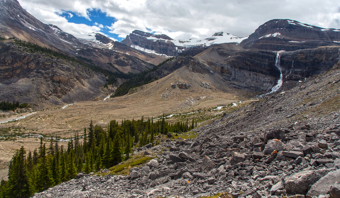 Bow Falls basin from lower ascent slopes
 |
|||
 View east to Bow Lake and Bow Falls hiking trail
 |
|||
 Crux part on the ledges: brief class 2 rock step
 |
|||
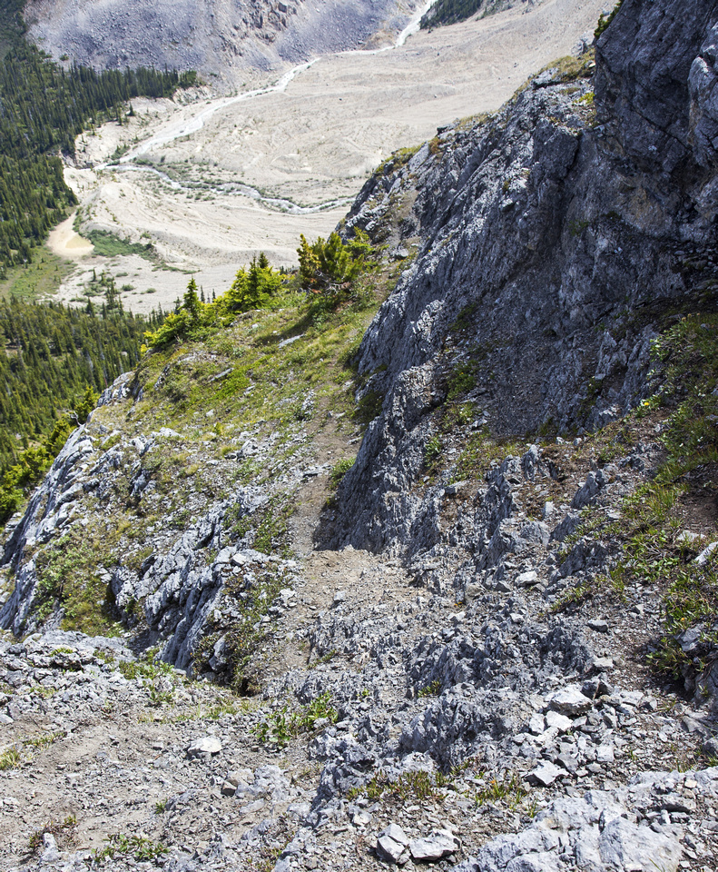 Alternate view of the crux
 |
|||
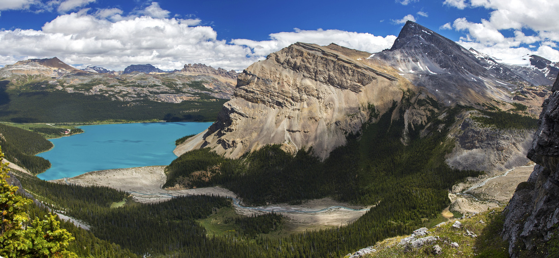 Panoramic view of Bow Lake; Crowfoot Mtn. to the right
 |
|||
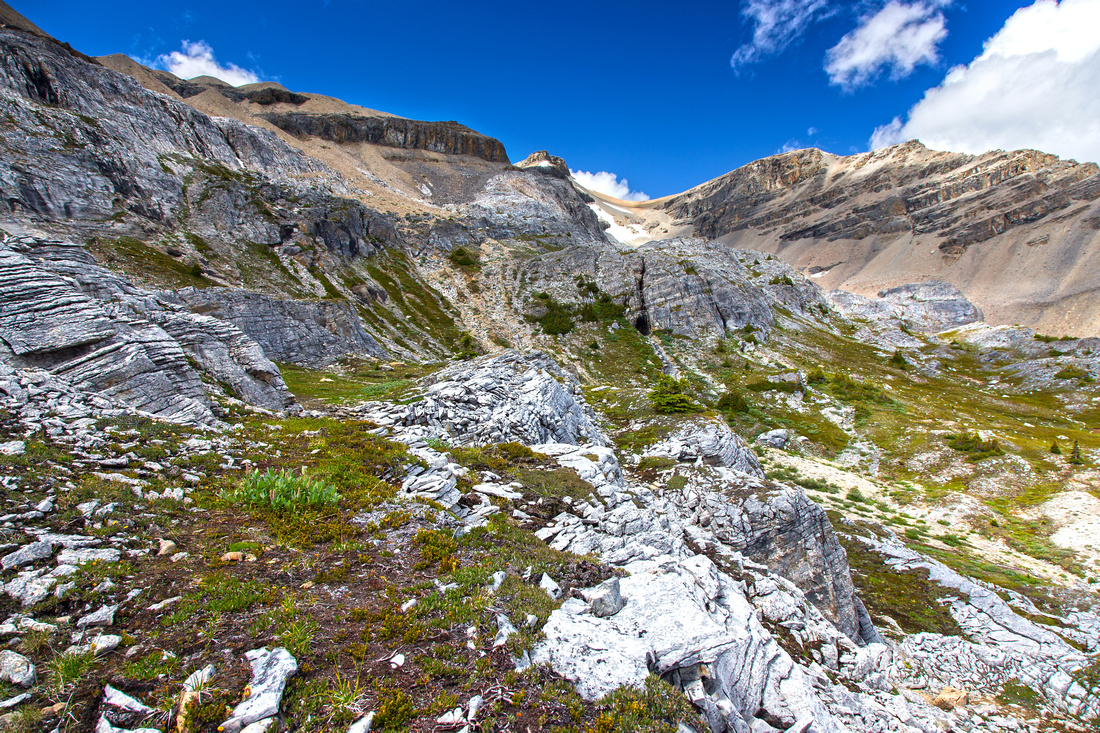 Grassy bench above the ledges. Summit is in upper right
 |
|||
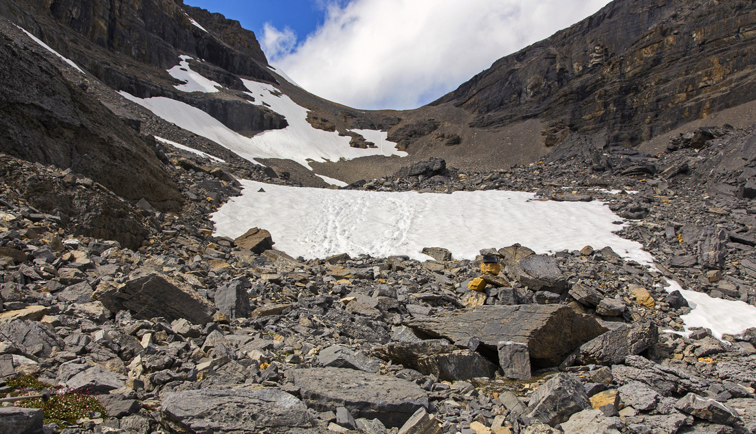 Rocky basin leading to the col. Very lose talus slope ahead
 |
|||
 Looking back from the col; most of ascent route is visible
 |
|||
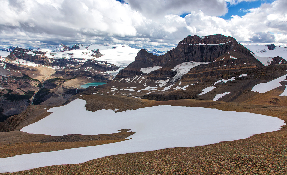
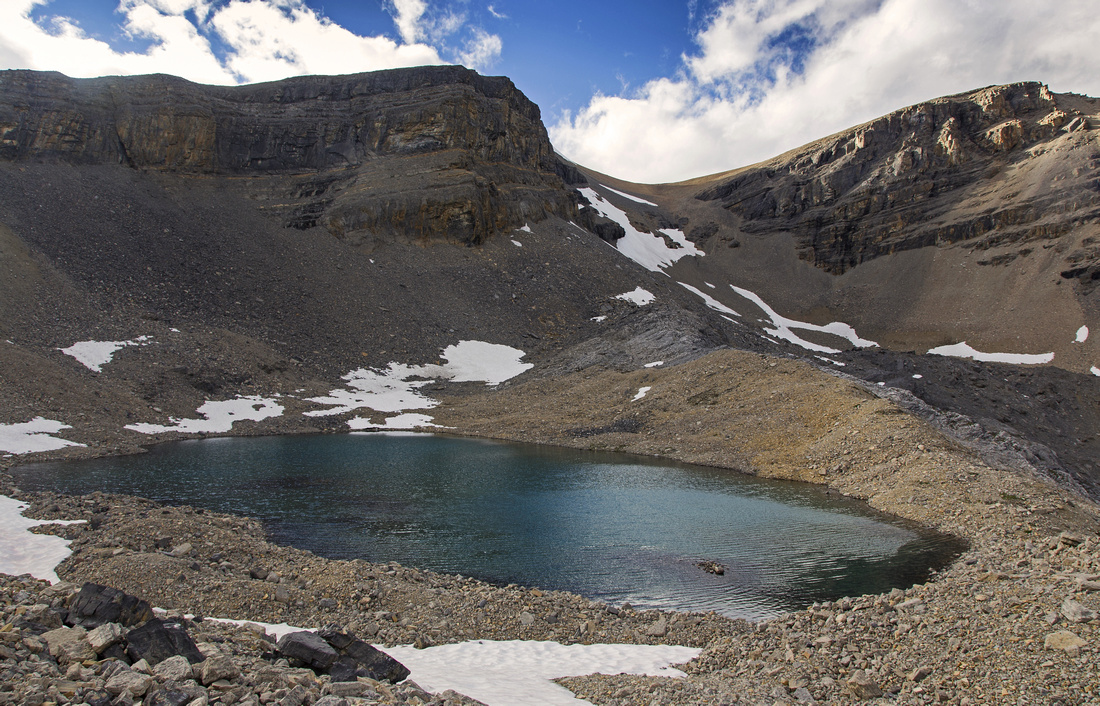
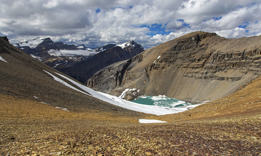 Unexpected glacial tarn on the other side of the col
 |
|||
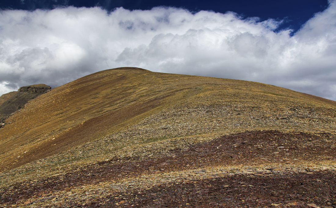 Gentle talus slopes above the col. Summit is ~200m vertical away
 |
|||
 Caldron Lake and Mistaya Peak from near the summit
 |
|||
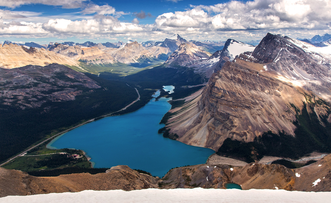 Bow Lake and Icefields Parkway from the summit
 |
|||
 View down on the east side from the summit
 |
|||
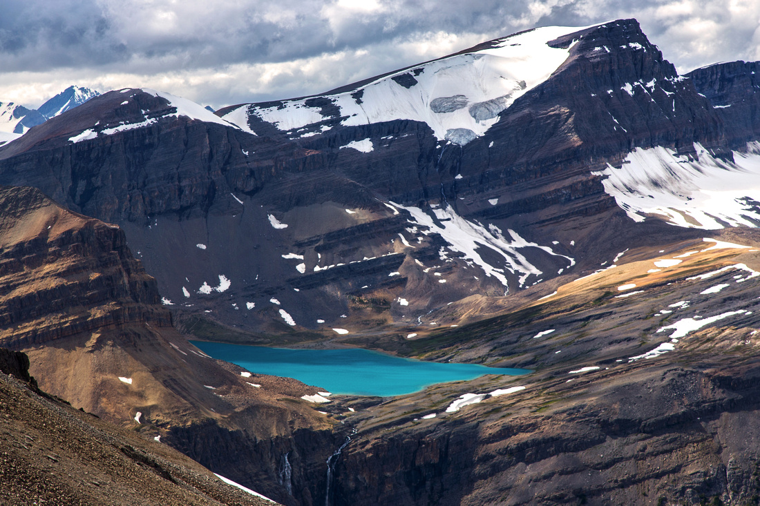
 Iceberg Lake, Portal Peak and Mt. Thompson
 |
|||
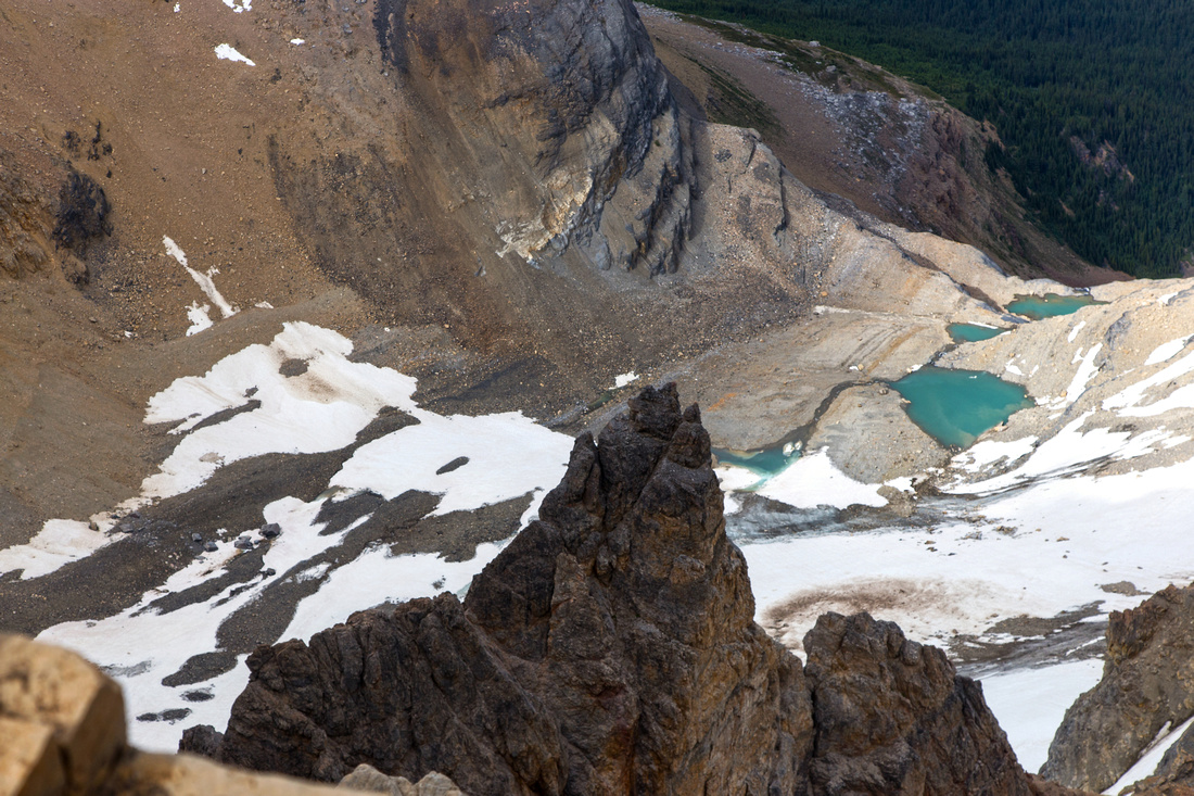
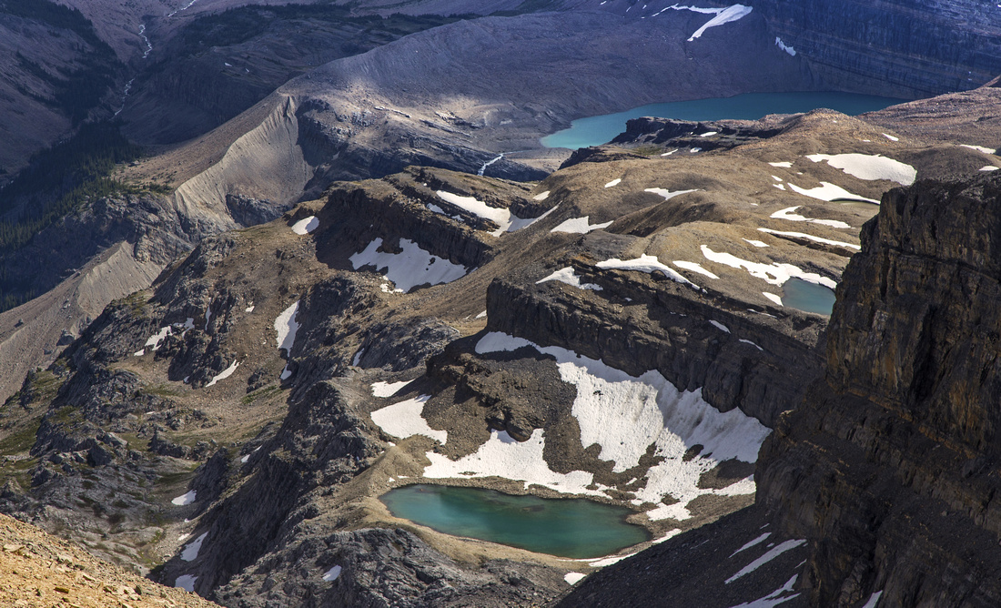 Plateau dotted with tarns below Portal Peak
 |
|||
 View back to Jimmy Simpson enroute to Iceberg Lake
 |
Abstract
|
Overall Difficulty |
Scramble on ledges with couple of class 2 rock steps. Awkward and very loose talus slope. Routefinding |
||||
|
Snow Factor |
Steep slopes with avalanche potential. Not a popular winter objective; most traffic heads for Bow Hut and Wapta traverse. |
||||
|
Scenery |
Spectacular hike around Bow Lake. Magnificent waterfall draining Iceberg Lake. Panoramic view from the summit including many Icefield peaks, bird-eye view of Bow Lake and Caldron basin. |
||||
|
Trail/Marking |
Good |
Marked and well-traveled trail for first hour to flats below Bow Falls. Well cairned route with distinct trail most of the way after |
|||
|
Suggested Time |
7-8 hr |
If returning the same way. Add several hours for Iceberg Lake loop |
|||
|
Elevation |
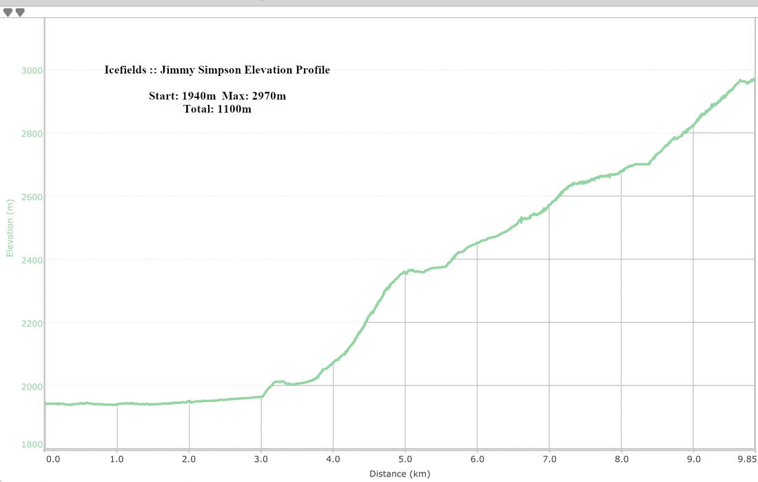
Start: 1940 m Max: 2970m Total: ~1100m |
Round Trip: 20km (if coming back the same way; for loop return via Iceberg Lake ~25km) | |||
|
Gear |
Full hiking boots, gaiters and poles. Climbing helmet essential in group (rockfall danger). GPS helpful |
||||
|
Water |
Glacial creeks in valley floor. Small streams draining from shelf below Portal peak. Snow patches. Carry 2L |
||||
|
Dog Friendly |
Yes |
Dogs not recommended if returning via Iceberg Lake because of glacial creek crossings |
|||
 Jimmy Simpson GAIA Map
 Jimmy Simpson Elevation