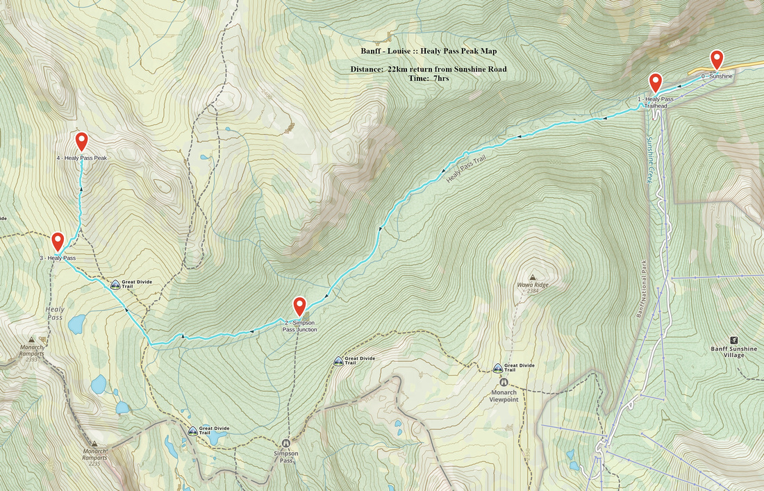
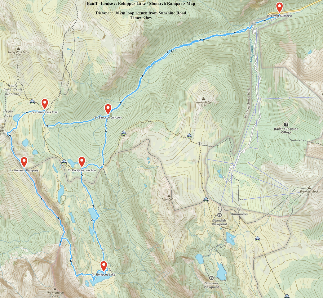
Rockies :: Banff-Louise :: Healy Pass Alpine Hikes |
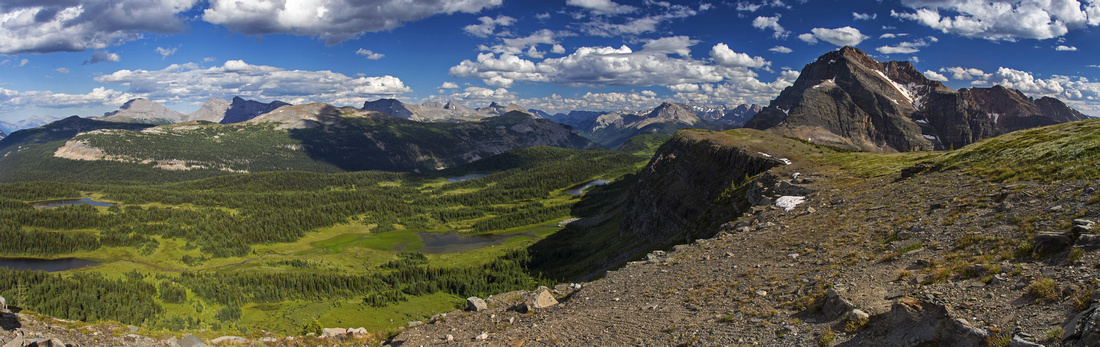 
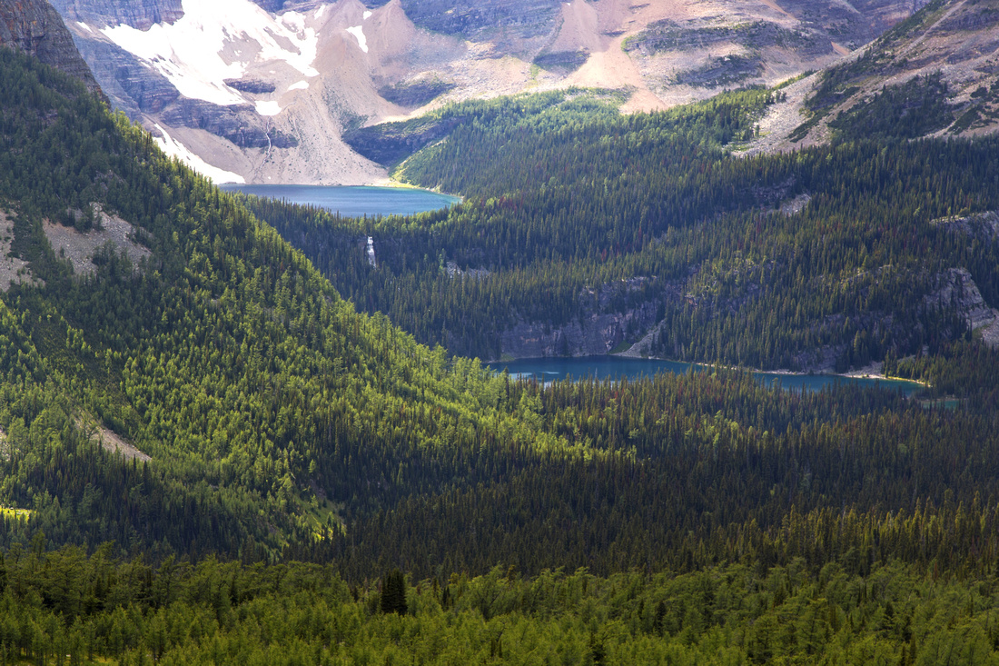
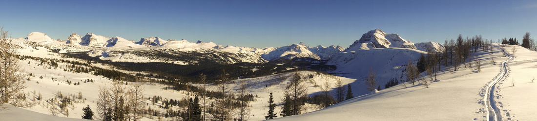
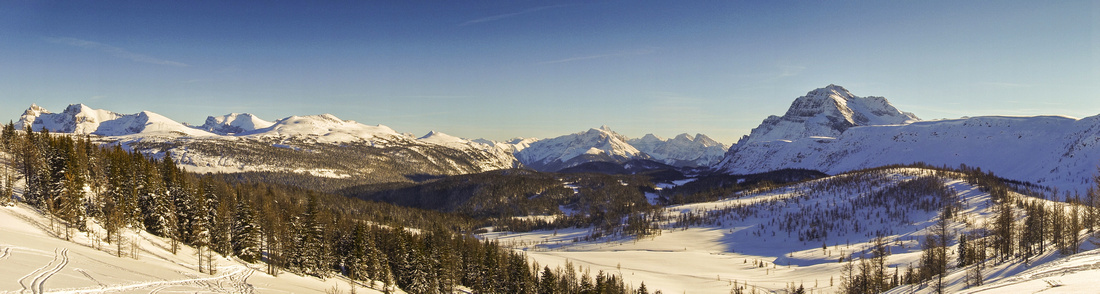
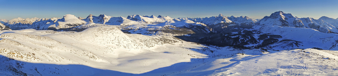
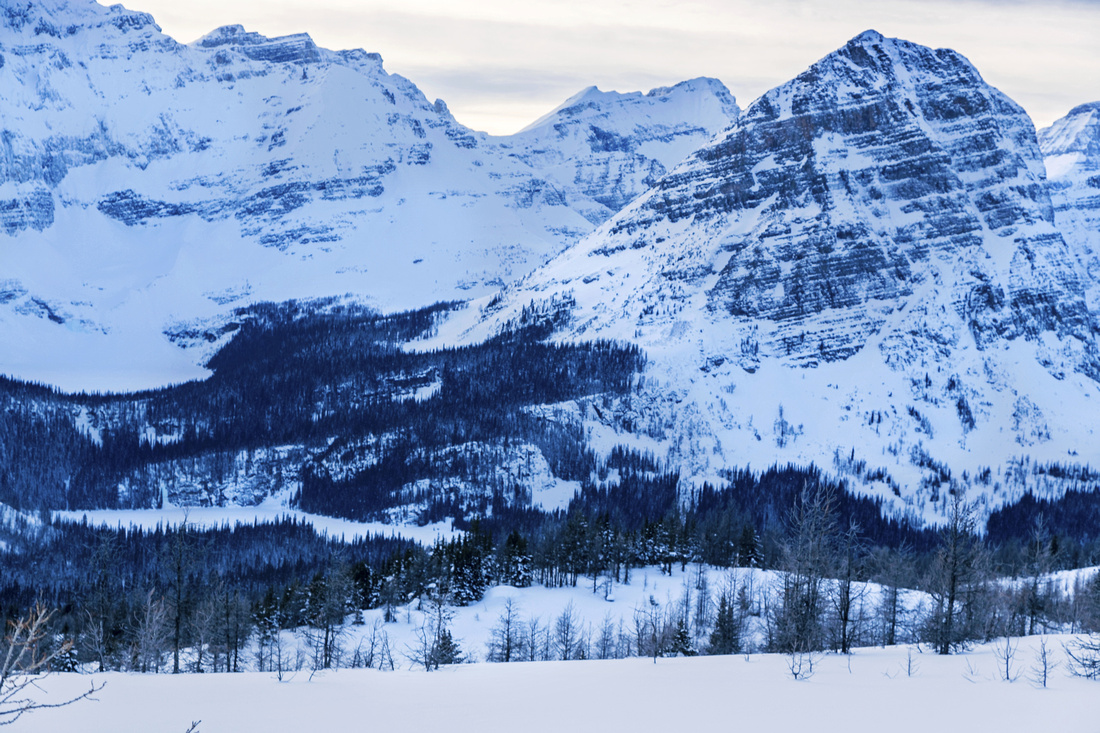
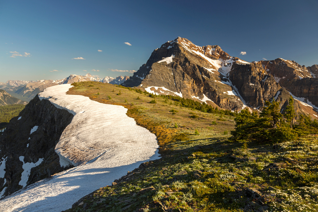
Healy pass environs from Monarch Ramparts. Simpson pass center left, Monarch right. Mt. Assiniboine far in the distance |
|||
|
Healy Pass is exceptional alpine area lying on continental divide along Alberta/BC provincial border. In the fall it is one of best places to see golden larches; in summer, meadows full of wildflowers are prime example of what summer hiking in Canadian Rockies can offer. Access trail stays below treeline most of the way but it can be done fast and trudge is small price to pay for scenic awards that follow. Some people just day-hike to the pass, but for more energetic hikers here are couple of different ideas to extend the day from the pass:
Note that Alpine environment is fragile and in season Parks Canada usually restricts hiking beyond established trail in full season. Thus Healy Pass Peak is best done as winter snowshoe trip, while Eohippus lake trail can be used as alternate access to Monarch Ramparts in summer. |
|||
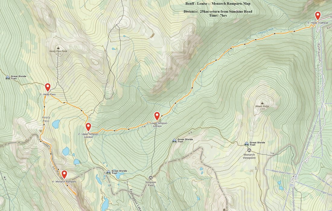
| Healy Pass Access Description | |||
|
Drive Sunshine access road branching west from Trans-Canada highway some 10 minutes north of Banff townsite; park here. Healy Pass trail starts along the ski run behind the day-lodge. You can also follow upper complex access road, then transfer down as it curls left (south). This is the trailhead, with post showing direction and distances. Follow well-defined trail along south side of Healy creek, then cross on good bridge to the north side. Healy Creek campground and lower Simpson Pass junction are around 5km mark; continue on the main trail. Next couple of kilometers are bit steeper with bit of roots but going is still easy. You reach alpine meadows around 8km mark near bridged creek crossing and upper Simpson Pass junction. Trail sign informs you that there are still 1.5 km to the pass. Abundance of larches or wildflowers -- depending on the season -- makes this last bit exceptionally scenic! Beware though, this is also prime grizzly bear habitat; on my visit in the fall of 2006 I've seen huge bruin roaming in the meadows directly below the trail! Continuing over the pass main trail descends to Egypt Lakes back-country campground and shelter (~3km and ~400m elevation loss). It is usually used as 3 days overnight trip ( see this and this). |
|||
| Healy Pass Access Gallery | |||
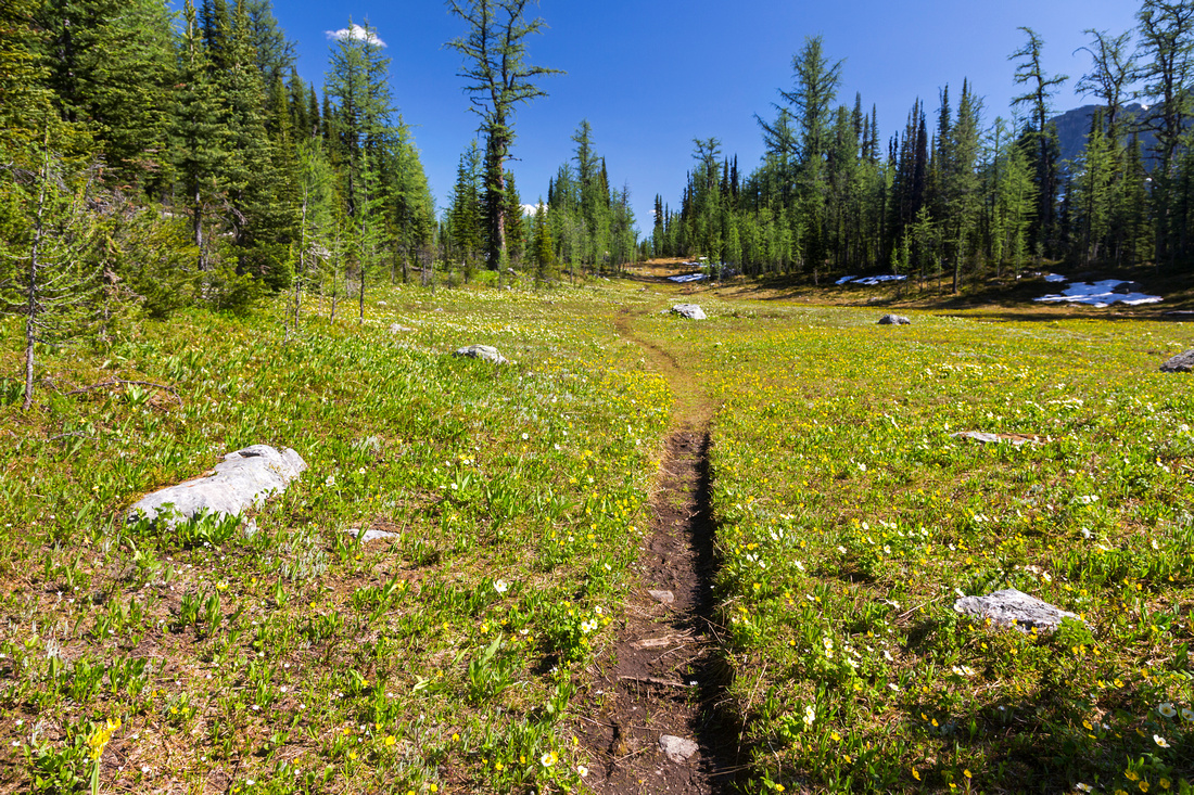
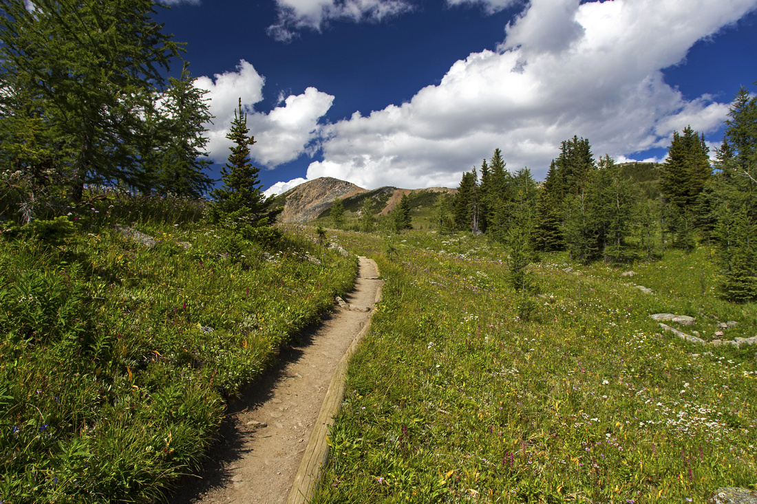 Delightful alpine hiking below Healy Pass in summer
 |
|||
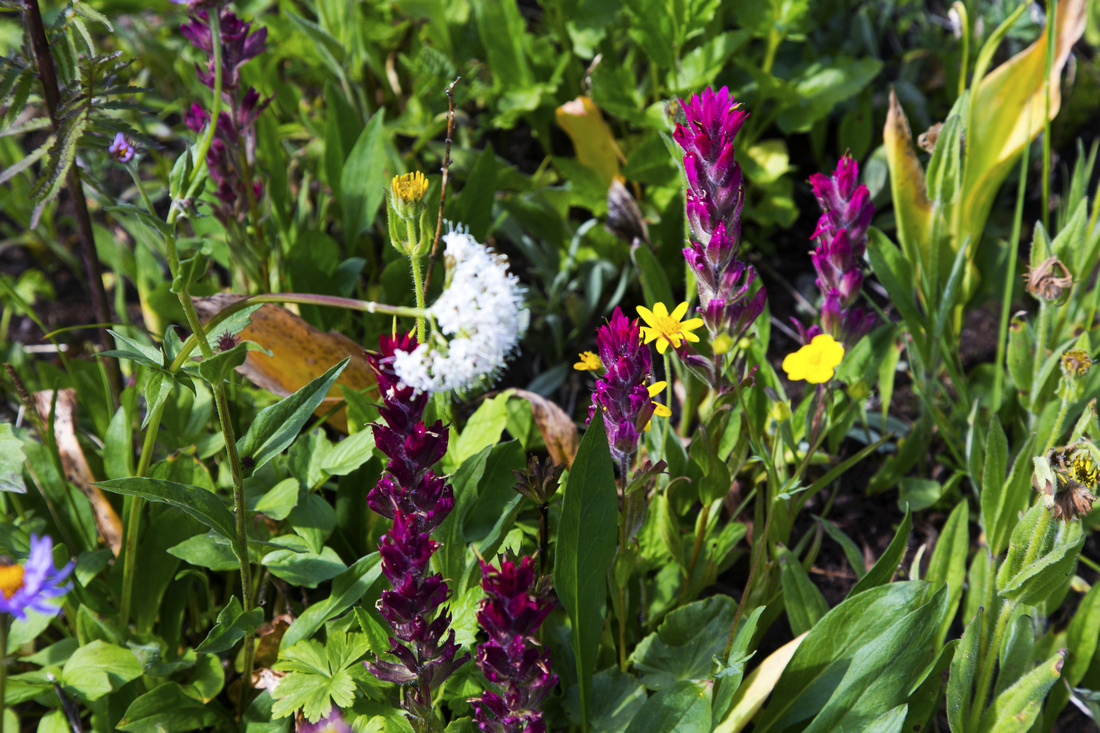
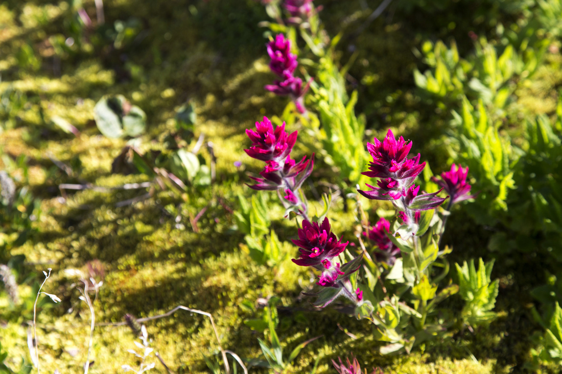 Abundance of Indian Paintbrush in alpine meadows in summer
 |
|||
 View south from the Pass. "Monarch Lake" in the center
 |
|||
 Telephoto of Egypt Lake area from Healy Pass
 |
|||
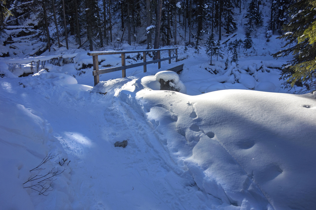 Bridge shortly after Sunshine ski out junction (winter trip)
 |
|||
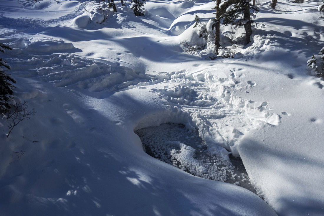 Lovely winter scenery ~2km mark as trail crosses Healy creek
 |
|||
 Avalanche gully coming off Mt. Bourgeau ~5km mark (winter trip)
 |
|||
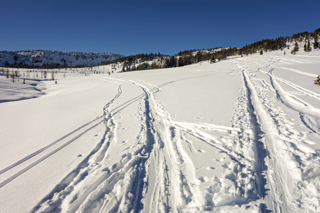 Multitude of ski tracks below Healy Pass
 |
|||
| Healy Pass / Monarch Ramparts | GPS Track | ||
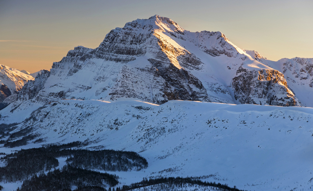
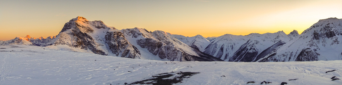 Winter sunset at windswept south end of Ramparts
 |
|||
| Description | |||
|
After reaching Healy Pass turn left and follow good trail ascending semi-open ridge towards Monarch Ramparts. This trail is well defined, but way is obvious. Above (unofficially named) "Monarch Lake" transfer to upper ridge and continue for couple of kilometers towards Monarch Peak. Hiking is exceptional to say the least! Continental Divide marker at high-point is logical turnaround spot, but you can also continue to south end and descend to Eohippus Lake, then return along the meadows below the Ramparts. Shortcut (off-trail) around "Monarch Lake" brings you back to Healy Pass trail just above upper Simpson Pass junction. |
|||
| Gallery |
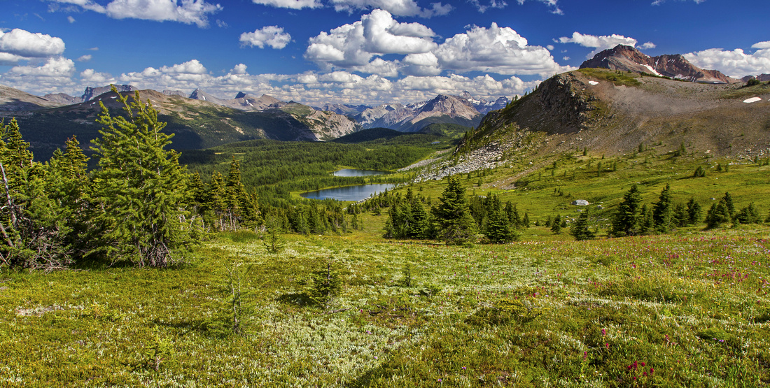
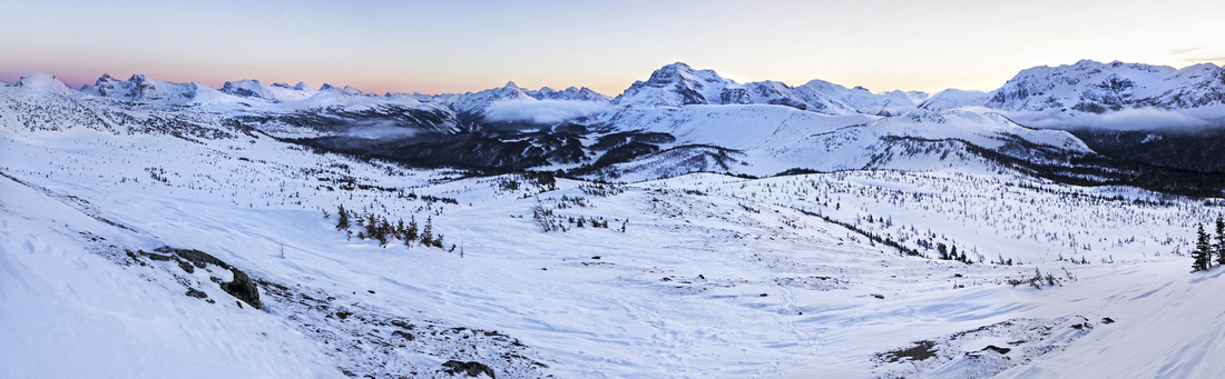
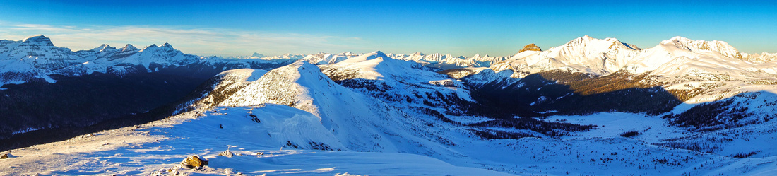
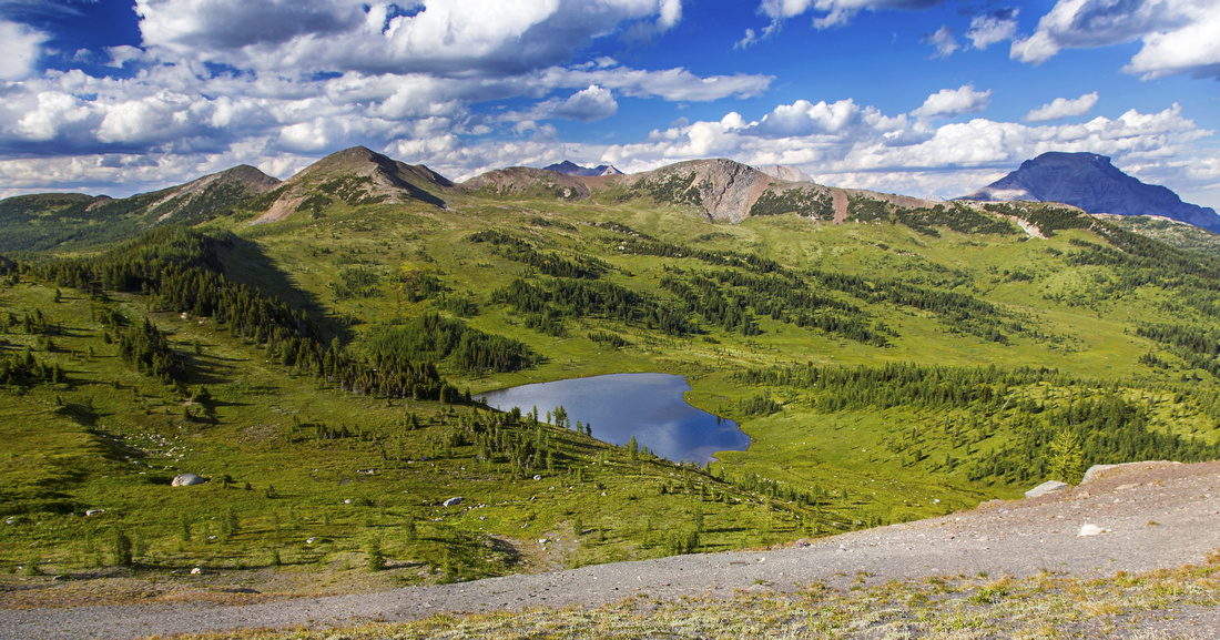 Panoramic views of Healy Pass alpine from the Ramparts
 |
|||
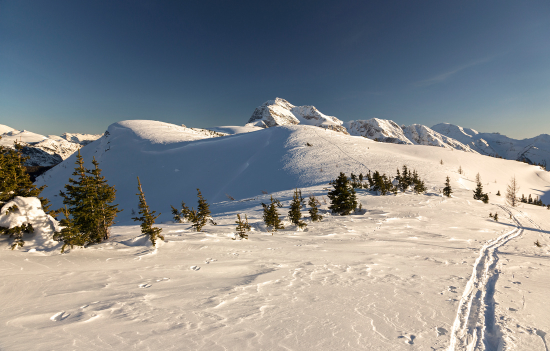
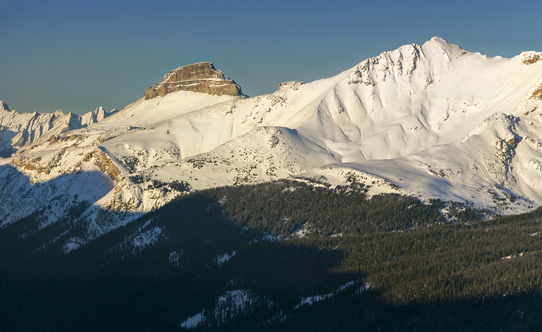
 North end of the Ramparts with view of "Healy Pass Peak"
 |
|||
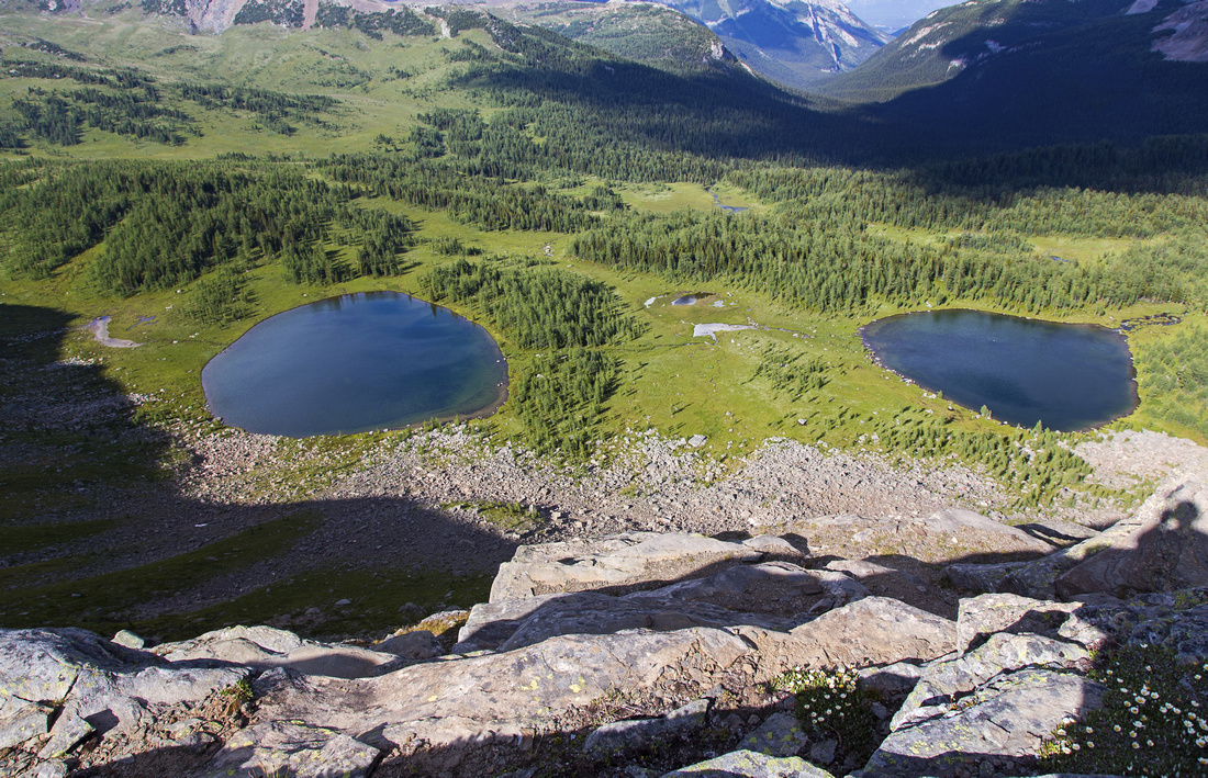 Two Alpine Eyes below Monarch Ramparts
 |
|||
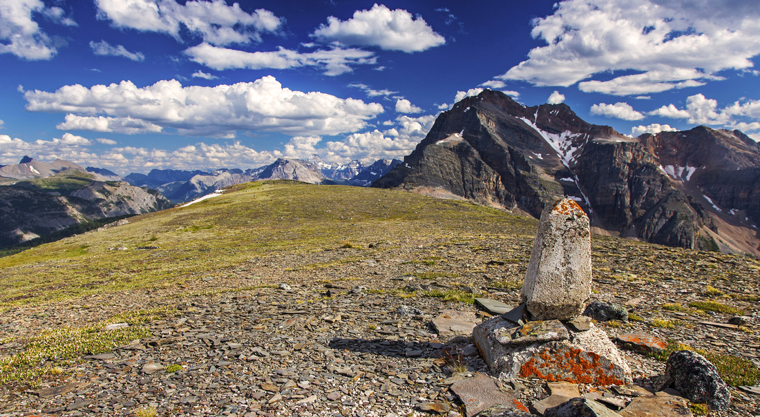 Continental Divide marker on high-point of the Ramparts
 |
|||
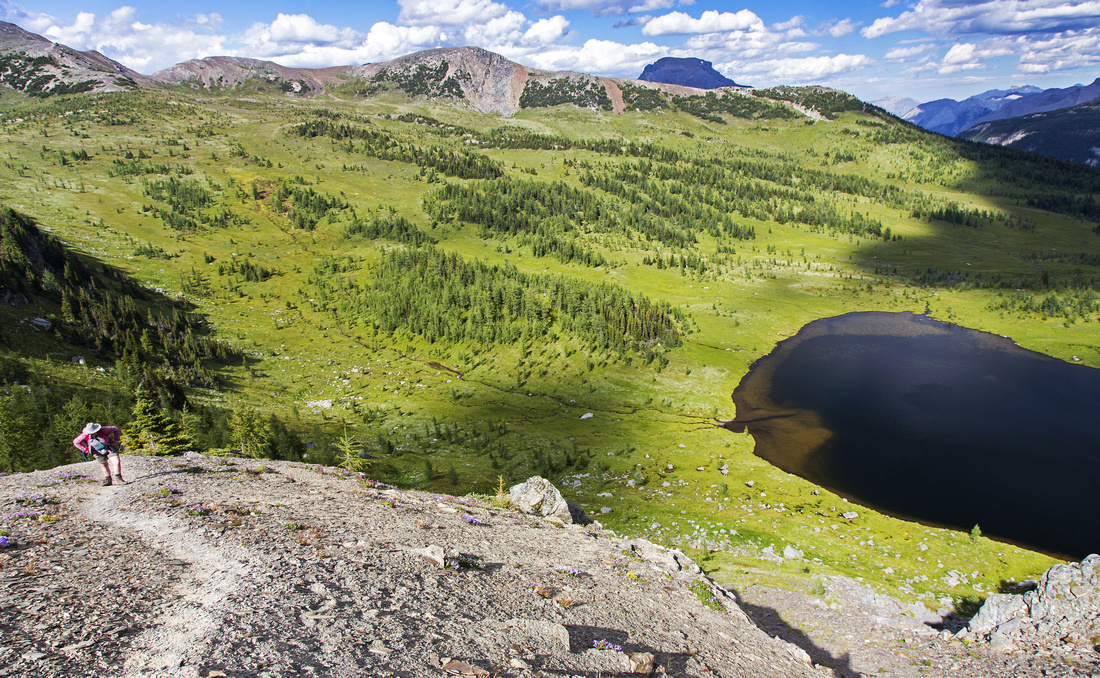
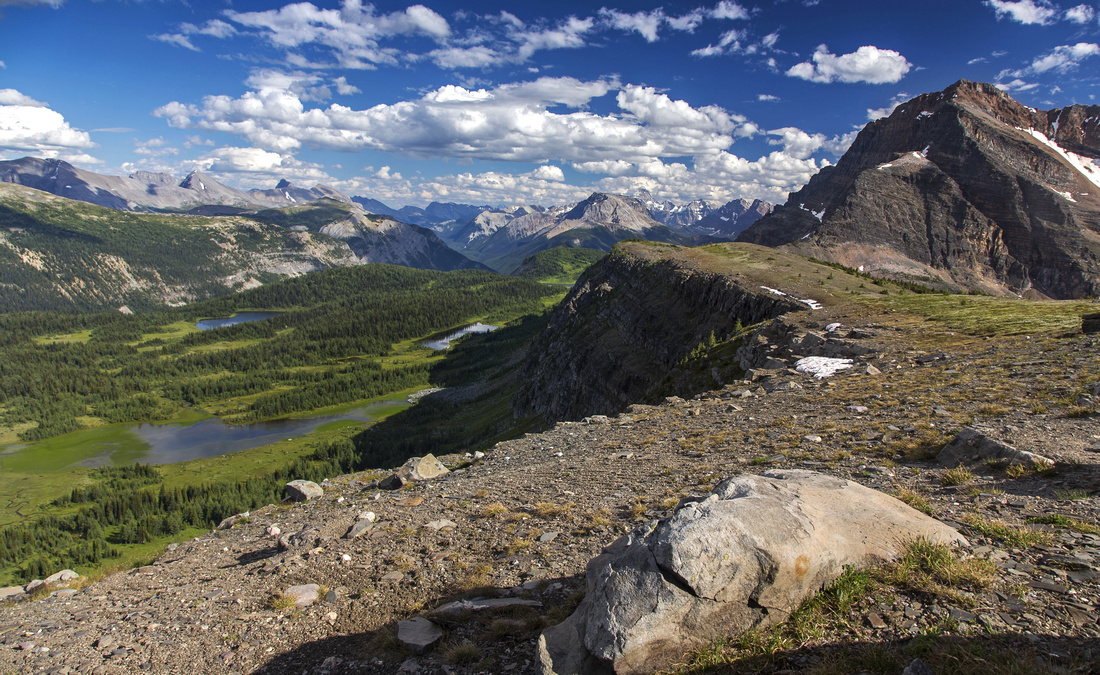 South End of the Ramparts. Eohippus lake behind
 |
|||
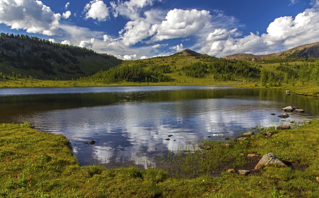 Terrific hiking by "Monarch Lake" on return to main trail
 |
|||
 Profusion of alpine wildflowers in alpine meadows by "Monarch Lake"
 |
|||
 Ski Track on north end of Ramparts above Healy Pass (winter trip)
 |
|||
 Center portion of Monarch Ramparts (winter trip)
 |
|||
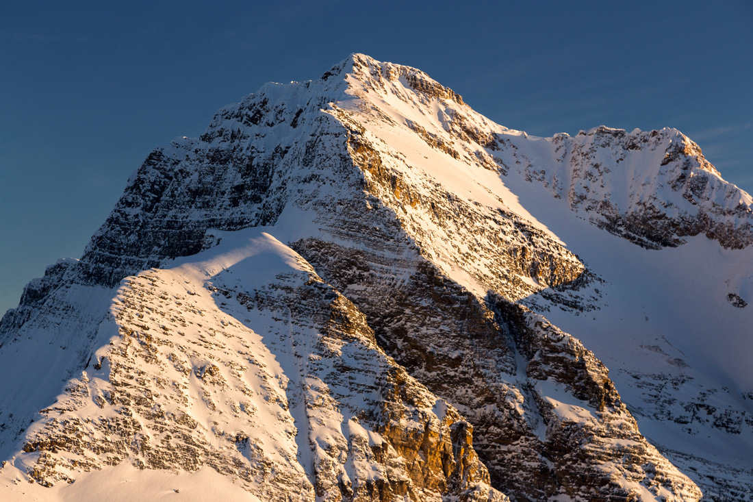 Monarch cliffs lit by setting sun (winter trip)
 |
|||
 Monarch Ramparts GAIA Map
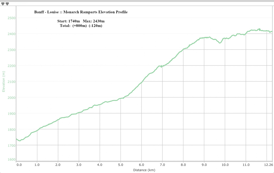 Monarch Ramparts Elevation Profile
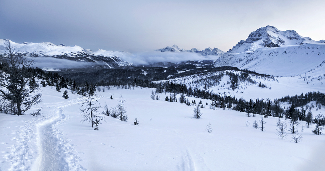
| Healy Pass Peak | GPS Track | ||
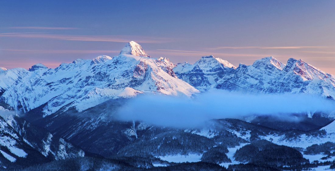
 Sweeping winter panorama from Healy Pass Peak. Monarch Ramparts just right of center, Monarch behind, distant Assiniboine to the left
 |
|||
| Description | |||
|
From Healy Pass turn right and ascend gentle ridge through stunts of larch trees and later low pine towards obvious high-point above. Going is easy and ridge wide. It takes 30-40 minutes from the pass to the "summit" that hosts large cairn (but usually no register). Fabulous views unfold north and you can study length of Pharaoh Creek between Egypt and Shadow Lake. To the right are Pilot and Mt. Brett -- both Kane scrambles; Bourgeau is further to the right. In the distance is host of familiar peaks of Lake Louise area. Much further exploration is possible as ridge is gentle and several lower bumps can also be visited; when your sense of adventure has been satisfied simply drop south and reconnect with Healy Pass trail. |
|||
| Gallery |
 Bare larch trees at Healy Pass
 |
|||
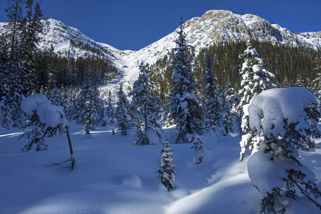
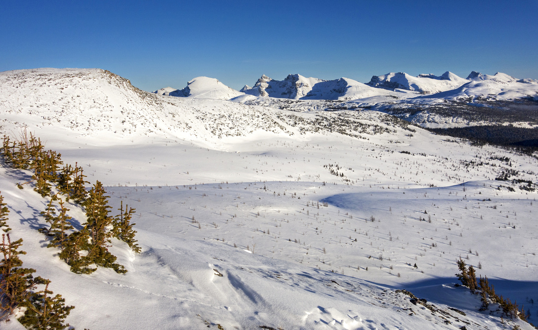
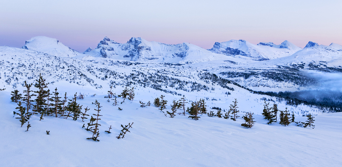
 Fabulous panorama south above Healy Pass (right); note mix of skier / snowshoe tracks
 |
|||
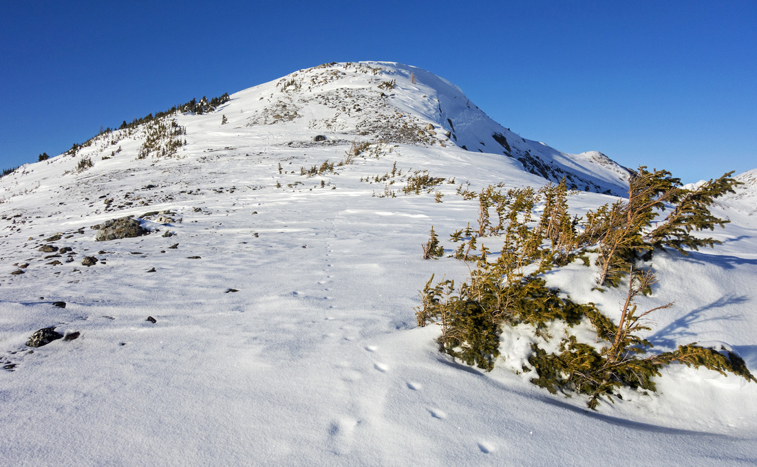 Final bit of windswept ridge just below summit block
 |
|||
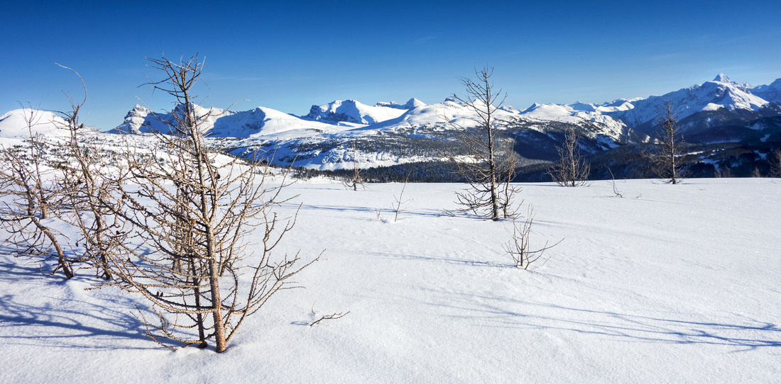
 Views east towards peaks above Sunshine Core area
 |
|||
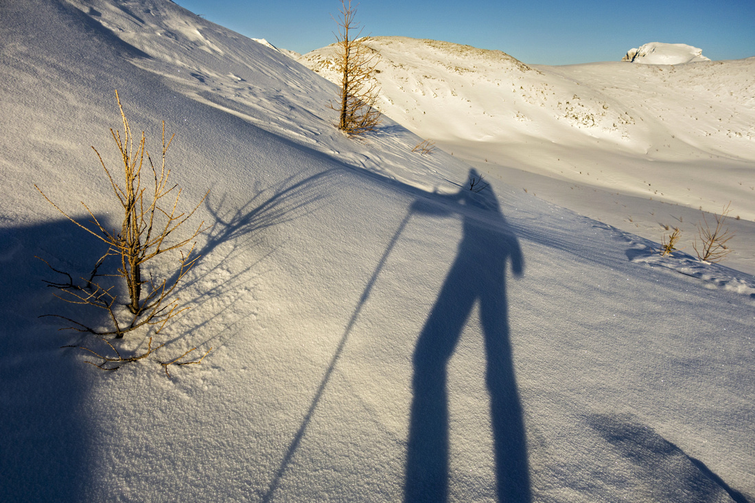 Late afternoon sun casting long shadows just below the summit
 |
|||
 Panoramic view south from Healy Pass Peak
 |
|||
 Panoramic view north from Healy Pass Peak
 |
|||
 Pilot (L) and Brett (R) - both Kane Scrambles
 |
|||
 Gentle slopes of Mt. Bourgeau, one of easiest scrambles in Kane book
 |
|||
 Egypt Lake area; Pharoah peak right (easy scramble)
 |
|||
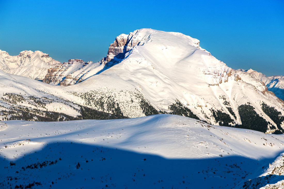
 Monarch looks fabulous lit by setting sun. Eohippus lake area extreme center left
 |
|||
 Telephoto of Mt. Assiniboine - "Matterhorn of the Rockies" - with sublime sunset alpine glow
 |
|||
 Beautiful alpine glow toward Sunshine Core area on descent
 |
|||
 Below Healy Pass on return, with still amazing light; hike out is easily done with headlamp
 |
 Healy Pass Peak GAIA Map
 Healy Pass Peak Elevation Profile
| Eohippus Lake / Monarch Ramparts Loop | GPS Track | ||
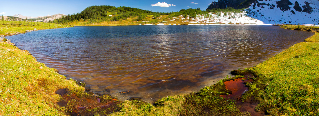 Panoramic View of Eohippus Lake. Unofficial trail up south end of Monarch Ramparts is to the right
 |
|||
| Description | |||
|
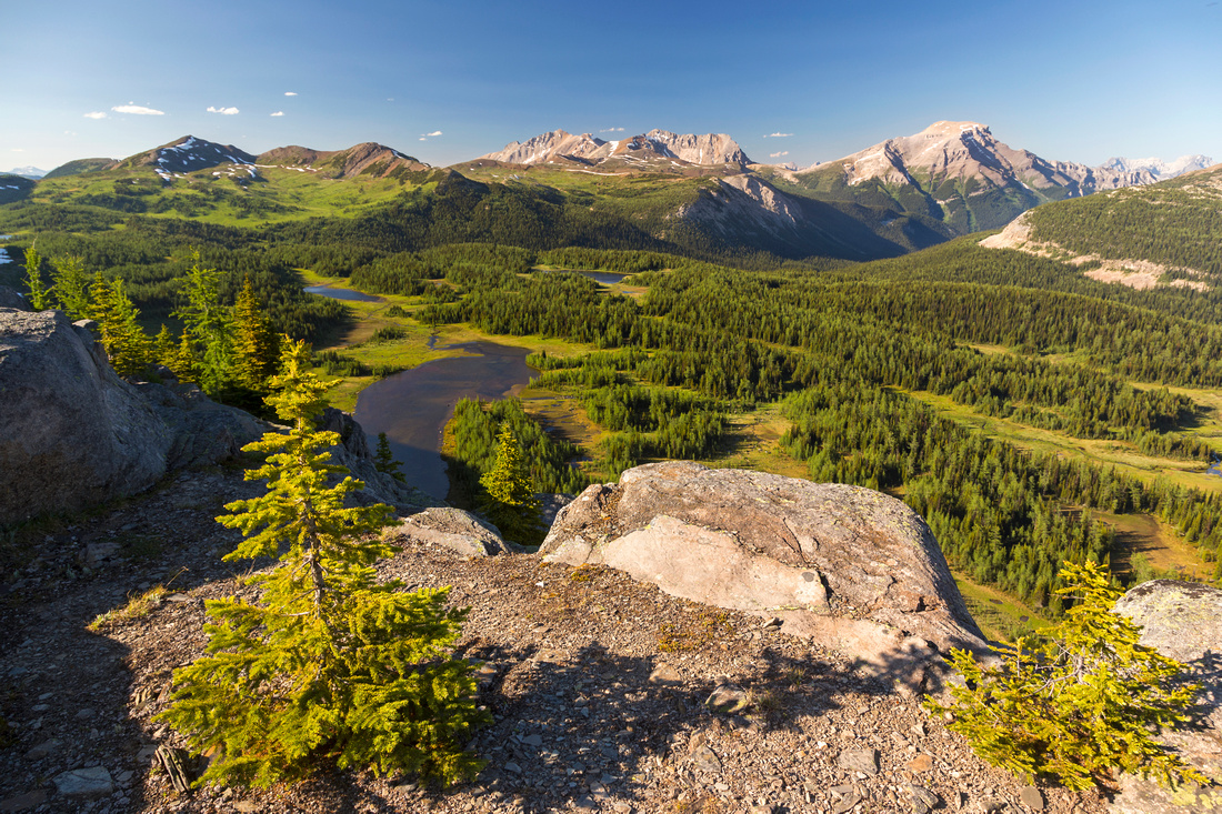
Official Eohippus Lake trail branches off Simpson Pass trail near Healy Pass alpine meadows. This junction is marked. Easiest and fastest way is to hike standard Healy Pass trail, then branch off to Simpson past km 5 junction -- or hike Simpson from Sunshine upper area which is more scenic, but does lose elevation. Either way, hike is very scenic past this junction as it traverses expansive alpine meadows dotted with larches as well as one large lake (pic 1 in gallery). Trail rises a bit past this lake, then descends to Eohippus. You can return the same way, but recommended is to hike up to south end of Monarch Ramparts then loop back via Healy Pass trail. This is fairly long day (~30km), but the most rewarding trip in the area, specially in the fall when larches are turning golden. Way is obvious and good trail exists, but if snow covered simply climb lower bench above Eohippus and hike this gentle ramp to the top. Kane scramblers would now drop into talus basin to access ascent gully; hikers simply continue north for one of best alpine hikes Banff NP offers. This loop can also be done in reverse and there is little benefit in choosing one over the other. |
|||
| Gallery | |||
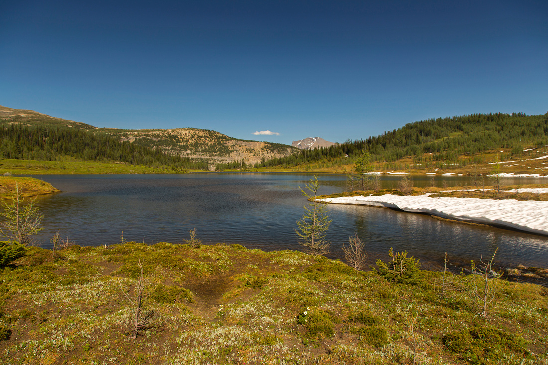
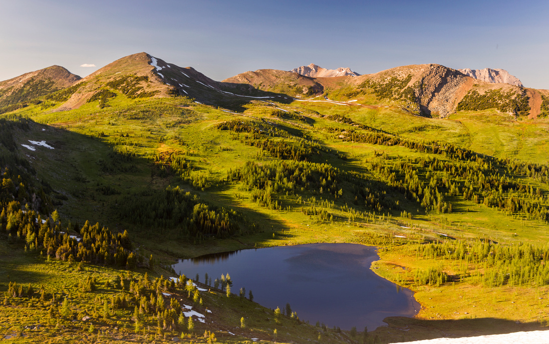
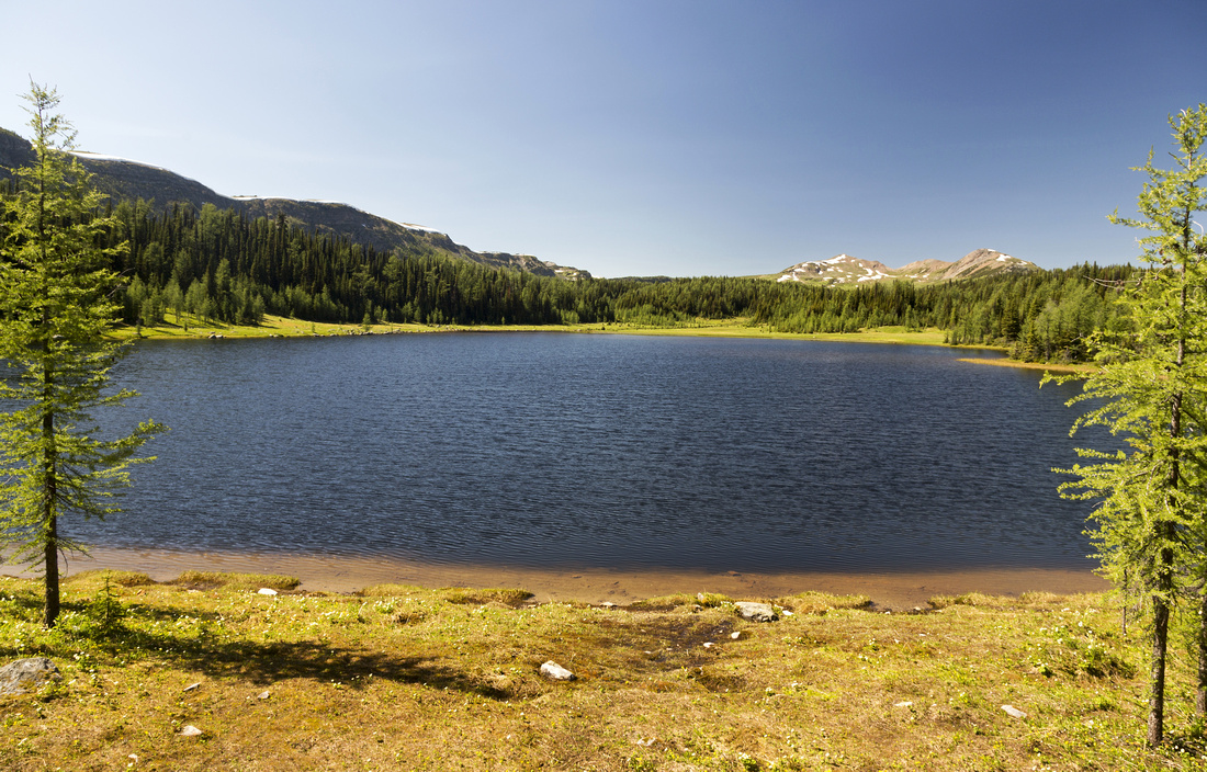 Unnamed lake ~15min past Simpson/Eohippus Junction. Healy Pass Peak just right of center in distance; Monarch Ramparts upper left
 |
|||
 Hiking gorgeous alpine meadows towards Eohippus Lake
 |
|||
 Eohippus Lake looking east to Sunshine Core area
 |
|||
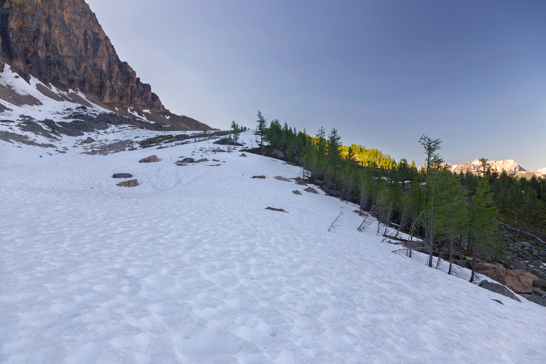 Talus bench between Eohippus Lake and Monarch Ramparts is often snowbound till late summer as Monarch casts shade most of the day
 |
|||
 Eohippus Lake from south end of Monarch Ramparts
 |
|||
 Looking back to Monarch while looping back to Healy Pass
 |
|||
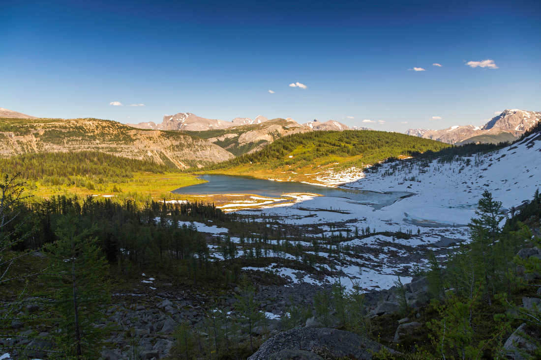
 "Valley of the Lakes" below center part of Monarch Ramparts. Healy Pass upper left. Mt. Bourgeau upper right
 |
|||
 Late Afternoon sunshine casting beautiful light over Healy Pass Environs; Healy Pass Peak upper center left
 |
 Eohippus Lake / Monarch Ramparts GAIA Map
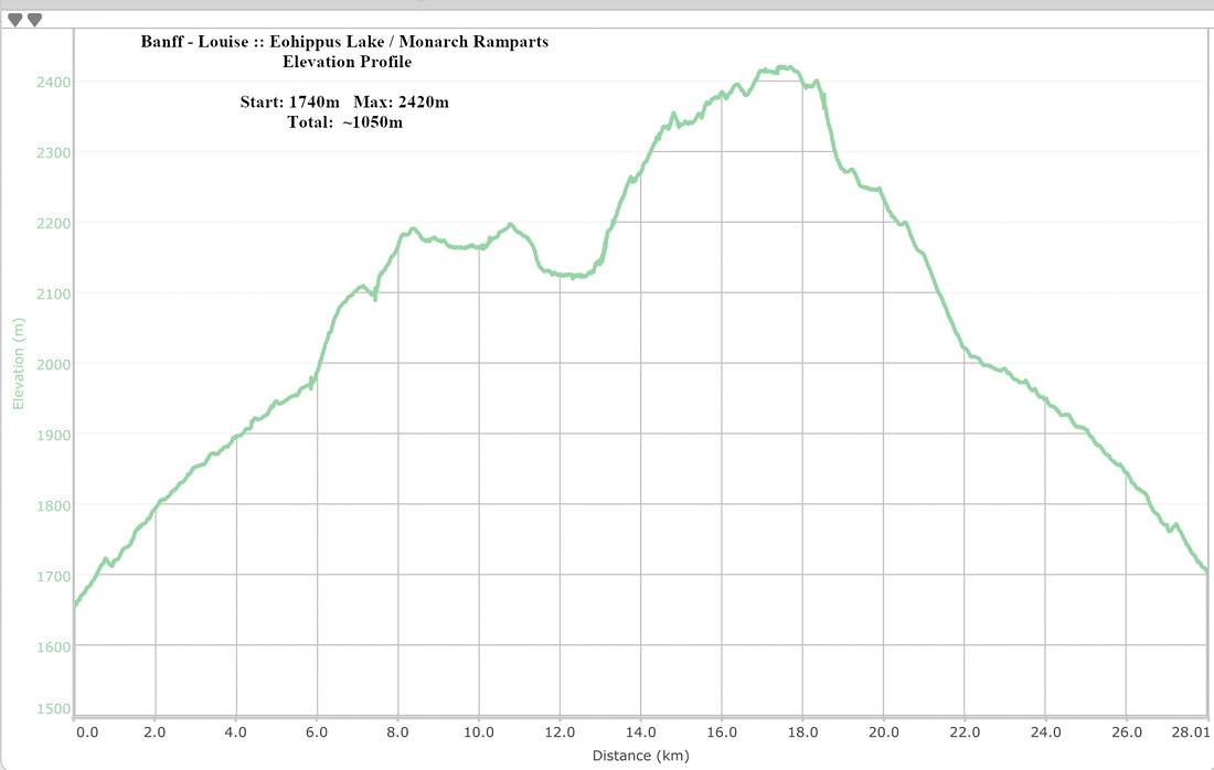 Eohippus Lake - Monarch Ramparts Elevation Profile
Abstract
| Overall Difficulty | D3-4 | Easy trail hiking for Healy Pass and Eohippus Lake. Moderate steep talus slopes for Healy Pass Peak and ascending Monarch Ramparts from Eohippus Lake. Full Eohippus / Monarch loop is very long day | |||
| Snow Factor | S2 | Winter safe trip with minor avi danger from couple of gullies below Mt. Bourgeau on Healy Pass trail | |||
| Scenery | Healy alpine area with wildflower carpets in summer and golden larches in autumn. Several alpine lakes. Rugged Monarch Mountain. Far reaching views from Healy Pass Peak | ||||
| Trail/Marking | Excellent / None | Official park maintained trail to Healy Pass; off-trail for Monarch Ramparts and Healy Pass Peak | |||
| Suggested Time | Varies | 5 hrs return for Healy Pass only. Add ~2 hrs for Healy Pass Peak, 3 hrs for Monarch Ramparts end to end. Full Eohippus - Monarch loop ~10 hrs return | |||
| Elevation |
|
Distance:
|
|||
| Gear | Full Hiking boots or day-hikers. Snowshoes or skis for winter trips | ||||
| Water | Healy creek on approach to Healy Pass, several creeks in Eohippus Alpine Meadows. Ramparts and Healy Pass Peak are dry. Carry ~1L | ||||
| Dog Friendly | Yes | Please keep dogs under control as this is prime grizzly bear country and for consideration to other hikers | |||