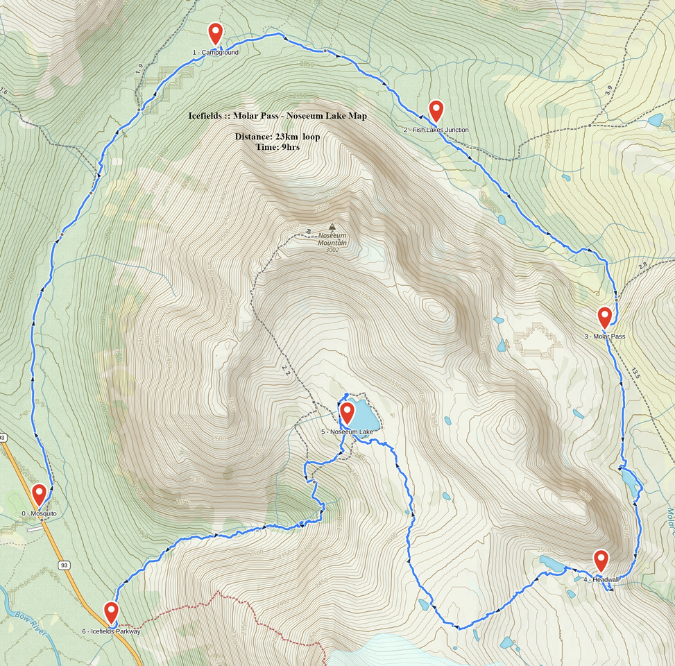
Google Map |
Rockies :: Icefields :: Molar to Noseeum |
GPS Track |
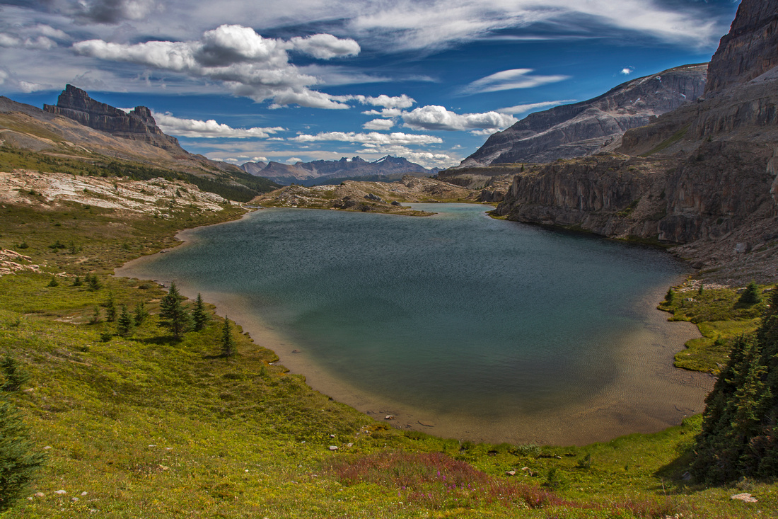 
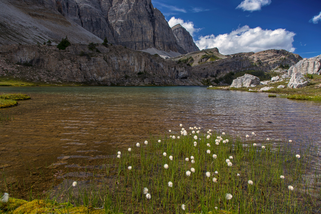
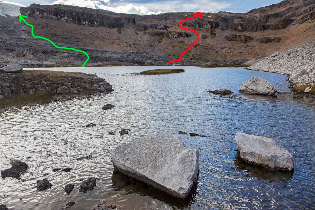
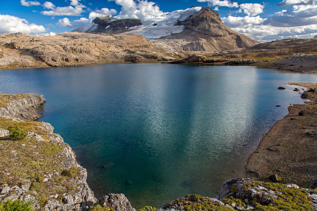
Hiking past beautiful tarn between Molar pass and headwall leading to Noseeum basin |
|||
| Trip Summary | |||
August 19, 2015Fantastic exploratory loop hike in the heart of Icefields. Except for first couple of hours, entire journey is off-trail in sometimes rough terrain with fair amount of route-finding. But if one stays on easiest route whole thing is surprisingly logical and hardly classifies as scramble. Clock-wise direction might be preferred, as this way tricky part from Molar Pass to Noseeum basin is ascended. However in that case descent to Icefields parkway will be equally tricky as easiest path is not easy to find. (Detail instructions on hike via Noseeum creek). Parking is at Mosquito creek hostel and campground on west side of Icefields Parkway, some 20 minutes from Lake Louise. Driving in note unsigned Noseeum creek about a kilometer south; when doing clockwise loop, this is where hike will finish.
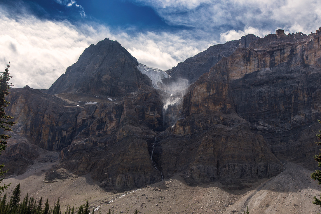
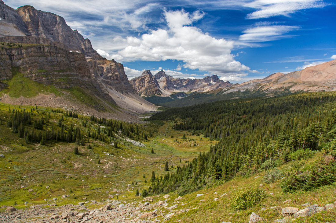
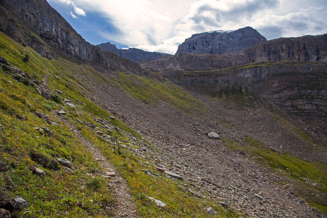
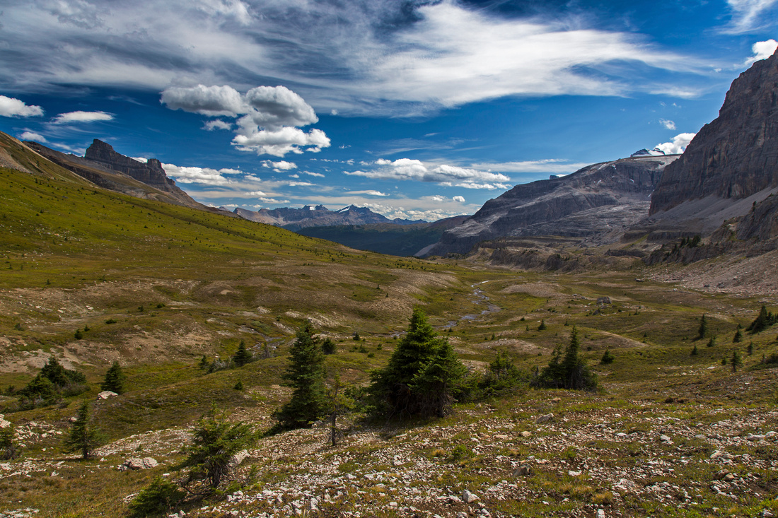
Second part involves finding the way over 2 sets of cliffs, separated by mid-plateau that holds another beautiful and unexpected lake. From "Molar tarn" hike up grassy bench, where lower headwall can be seen (frequent bear diggings here, so be alert). There are 2 ways up this obstacle. Scree plod on the right side is likely tedious, but otherwise would not offer a challenge. Better way is to descend slightly to the left, then pick your way up set of ledges. You might end up scrambling shallow dirt gully that calls for use of hands at couple of spots, but is otherwise easy. It is encouraging to find sizable cairn on top of this gully, although it is probably built for hikers coming down to indicate easiest spot to break lower headwall. Pause here for great views of Molar mountain behind you, then continue around south (left) side of the lake. Upper headwall can be breached in 2 possible ways. Most direct is to tackle it head on. Scree is tedious, but manageable. From top (unofficially named "Noseeum Pass") simply descend down grassy ramp towards Noseeum Lake. Second option is to circle around the headwall on left (south) side. Couple of cairns and bits of trail in scree testify this is popular option. It is recommended if you do not plan on going to Noseeum lake. Terrain is surprisingly stable and travel easy. Views of Molar glacier are phenomenal on this stretch. You can break cliffs at several spots that would involve various degrees of scrambling, or you can keep going till moraine loops directly opposite Molar glacier. At this point cliffs have eroded to (usually rock-hard) moraine slope. Another pretty lake awaits just below. Third part involves descent from Noseeum basin and scramble down Noseeum creek to the highway. Full details are in aforementioned Noseeum trip report. If not going to the lake (option 2 in second part), you can angle down (left) about 15-20 minutes past glacial moraine. Finding the spot to pick up Noseeum "trail" will not be easy, and many parties have reportedly gotten in some serious and unpleasant scrambling. GPS is of real help here. Upon reaching the highway, walk for 10-15 minutes to Mosquito hostel where you left your vehicle. |
|
Gallery |
|||
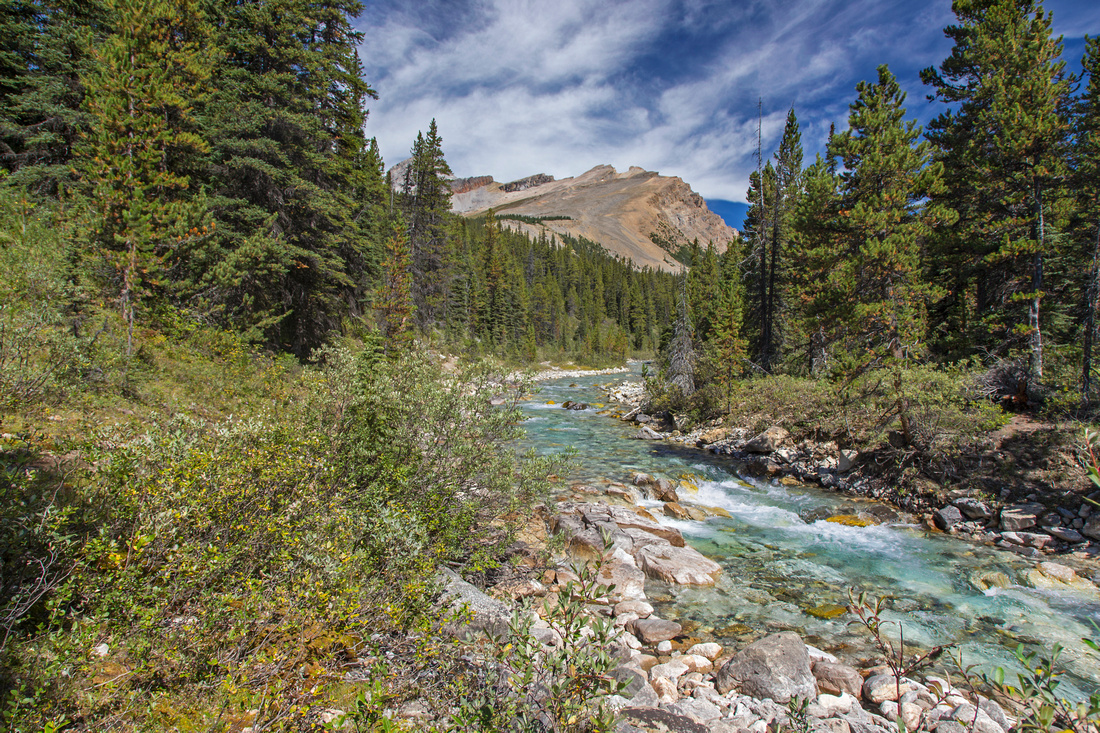 Hiking Molar Pass trail along Mosquito creek
 |
|||
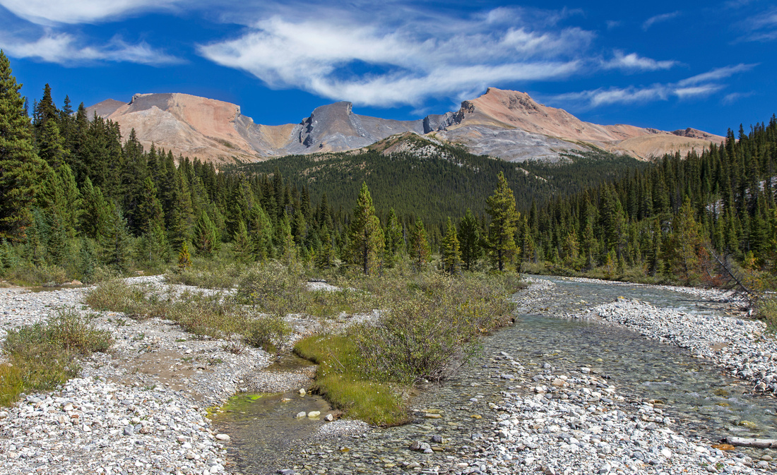 Quartzite (L), Ramp (C) and Mosquito Peak (L)
 |
|||
 Fish Lakes/Molar pass junction around 8km mark
 |
|||
 Pocket glacier at east side of Noseeum peak
 |
|||
 View back Mosquito creek valley near Molar Pass
 |
|||
 Approaching Molar Pass; about 2 1/2 hrs from trailhead
 |
|||
 Expansive views south from Molar pass. Leave trail and hike right across meadows
 |
|||
 Hiking around unnamed tarn below Andromache N4
 |
|||
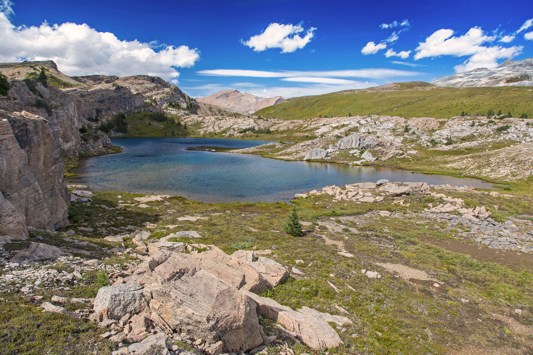 Unnamed tarn and Molar pass on approach to Noseeum headwall
 |
|||
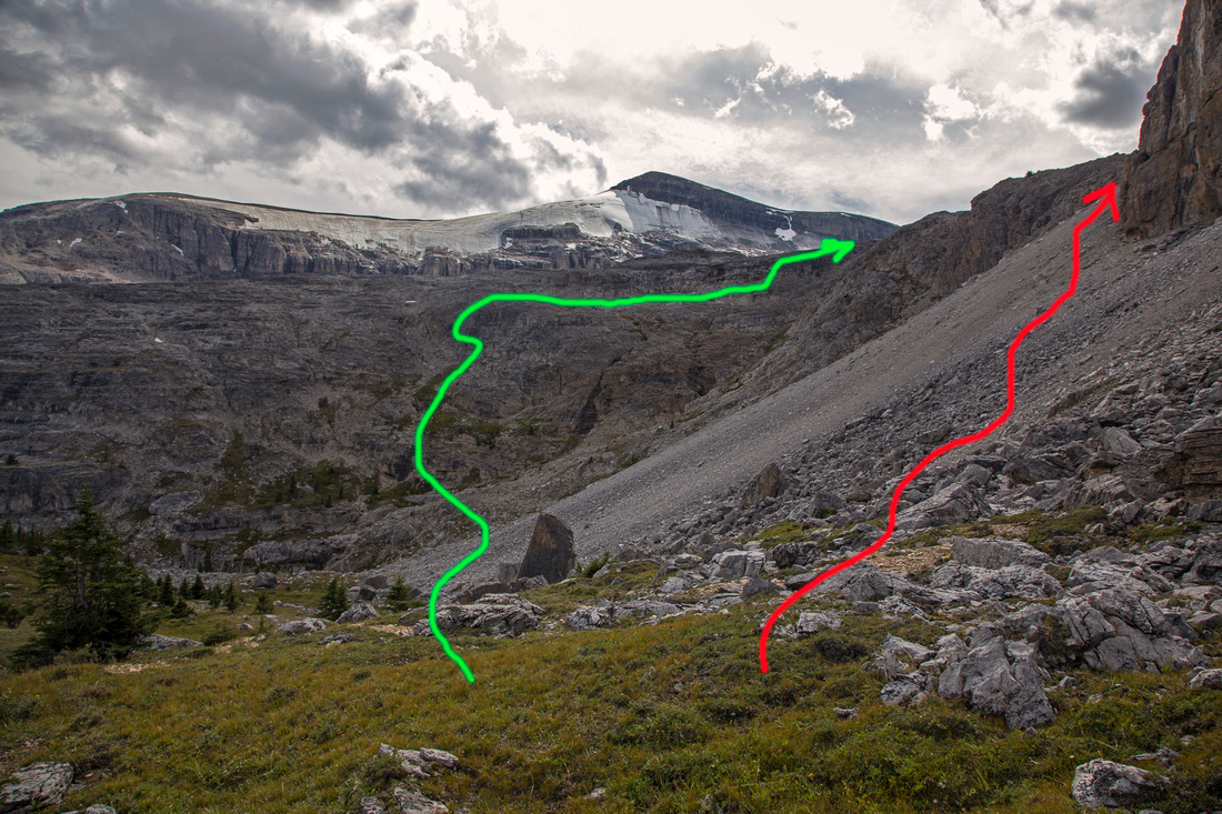 Lower Noseeum headwall with 2 alternate routes up
 |
|||
 View back to Molar mountain above lower headwall
 |
|||
 Upper Noseeum headwall with 2 alternate routes up
 |
|||
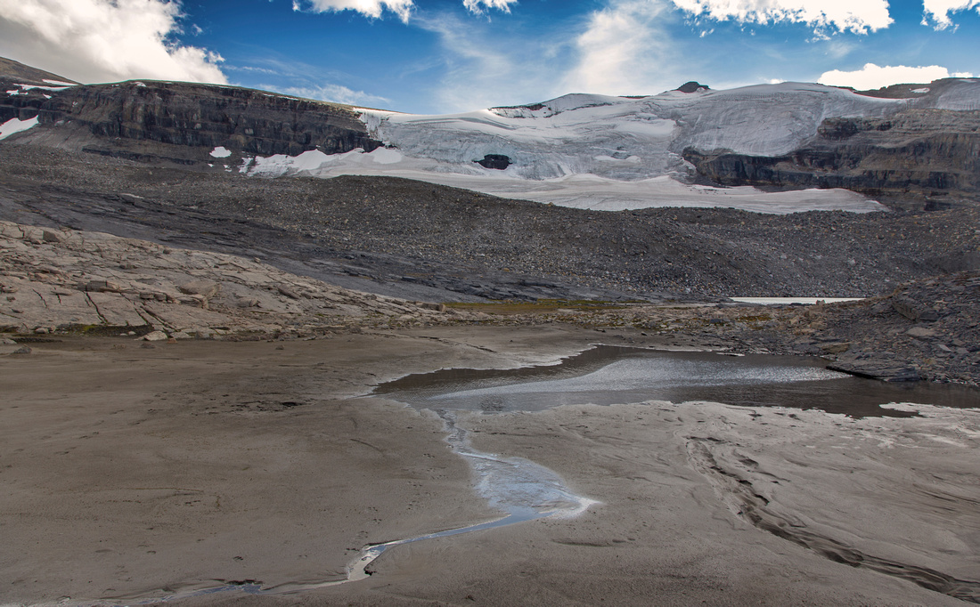 Molar glacier from south side of upper headwall
 |
|||
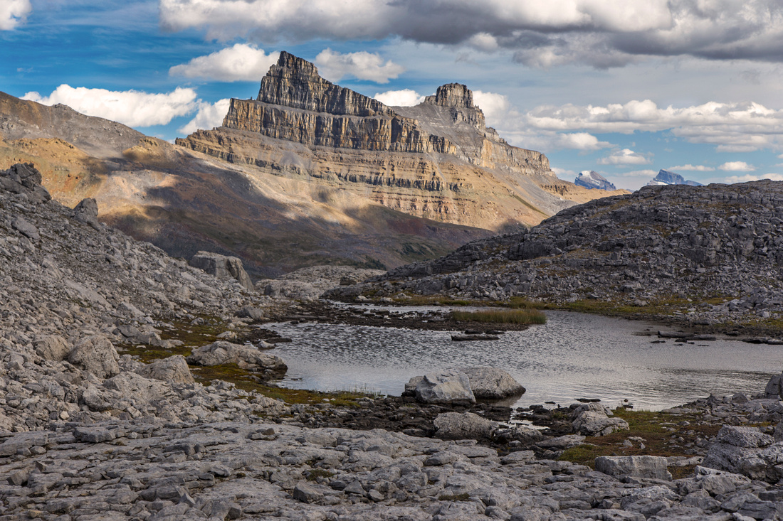
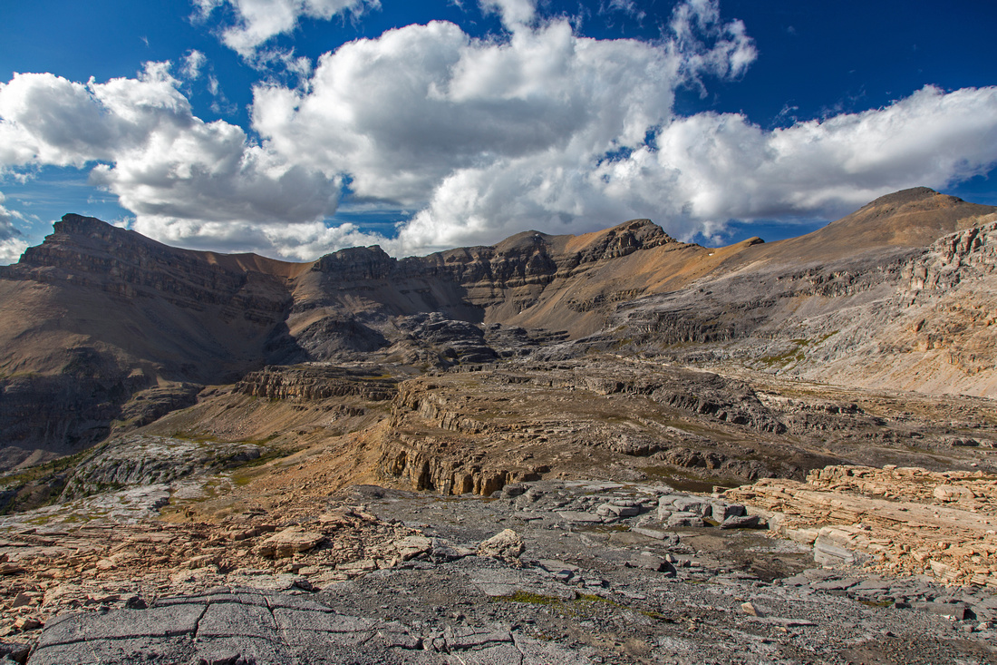 Noseeum basin. Drop left if not going to the lake
 |
|||
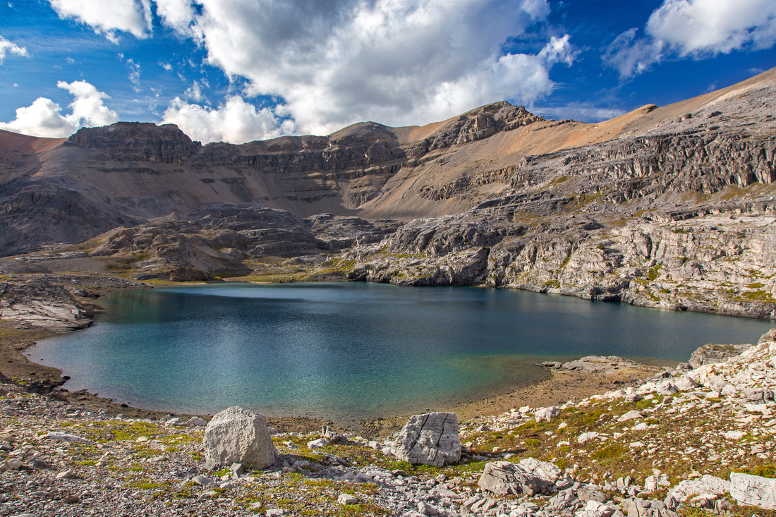 Noseeum lake; takes about 3 hours from Molar pass
 |
|||
 North side of Noseeum lake; Mt. Andromache behind
 |
Abstract
| Overall Difficulty | D5 | Off-trail hiking, considerate route-finding with some easy scrambling. Steep scree sections or hard glacial moraines. | |||
| Snow Factor | S5 | Not feasible in winter due to steep headwall west of Noseeum basin (avalanche danger) | |||
| Scenery | Expansive meadows on Molar pass with beautiful tarn tucked under Noseeum cliffs. Molar glacier beneath Mt. Andromache. Noseeum lake and several waterfalls on descent to Icefields Parkway | ||||
| Trail/Marking | Excellent / none | Wide and signed park trail to Molar pass, none afterwards. Occasional cairns on ascent of Noseeum basin. | |||
| Suggested Time | 8-9 hr | Complete time for full loop. Less if not going to Noseeum lake | |||
| Elevation | Start: 1960m Max: 2650m Total: ~1050 m | Round Trip: 22.5 km | |||
| Gear | Hiking boots and poles only. GPS helpful for route-finding on descent from Noseeum basin to Icefields parkway. | ||||
| Water | Mosquito creek on hike to Molar pass. Several tarns and waterfalss in Noseeum basin. Carry 1-2L | ||||
| Dog Friendly | Yes | Standard griz-country precautions | |||
 Molar To Noseeum GAIA Map
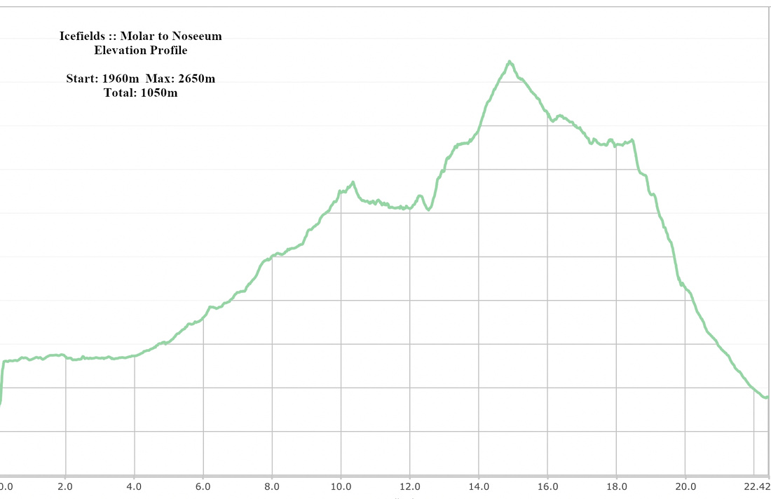 Molar To Noseeum Elevation