Google Map |
Rockies :: Alberta Foothills :: Jumpingpound Mtn |
GPS Track |
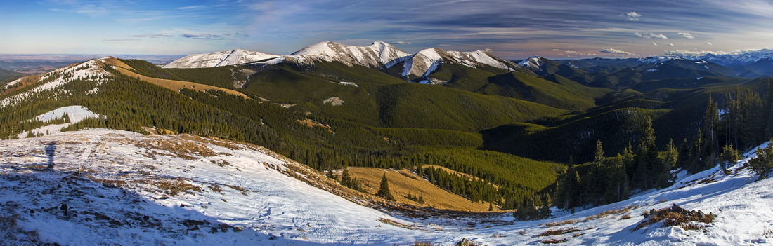 
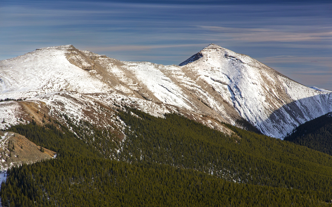
Panoramic Views east from Jumpingpound Summit. Moose Mtn. center, Prairie Mtn. to its left. Prairies and Calgary far upper left |
|||
| Trip Summary | |||
October 21, 2016Jumpingpound is fantastic ridgewalk with open views on east side of Powderface road in front ranges of K-country. Many variations are possible; presented here is loop hike that ascends the ridge from Lusk Pass trailhead and descends back to Powderface road via "Jumpingpound summit trail" (most direct route). Bicycle or 2 cars are good idea in this case, as return involves ~5km of rather mundane gravel road walk. Otherwise return the same way -- or if the time is short, simply ascend via the summit trail. It is also possible to approach starting at Canyon Creek further south along Powderface road, or even do a full day by starting from Dawson trailhead near Sibbald junction and traversing Cox Hill along the way. Note that Powderface road is closed December 1 - May 14.
Park at Lusk Pass trailhead, about 11km from Sibbald trail junction. Road is fairly rough at spots, due to damage in spring '13 epic floods but still 2WD passable. If coming from Calgary, it is also possible - but a bit longer - to approach via Bragg Creek / Elbow Trail, instead of Sibbald road. There is parking room at both sides of the road. TCT (Trans-Canada trail) sign is here too. Cross the bridge over Jumpingpound creek (brand new post floods) then settle for long series of switchbacks. Mind the mountain bikers. ~1hr of steady ascent (4km, 450m vertical) brings you to junction with Cox Hill trail. Continue right and break treeline. Trail ascends to the ridge, then briefly dips in the forest again on the left (east) side. From there it is delightful open ridgewalk with sweeping views all around, leading to Jumpingpound 'summit' -- highest bump along the ridge. Moose Mtn. looks fantastic from this angle lit by late afternoon light. You can readily study connecting ridge that curls NE before ascending Moose mountain -- fantastic long day option.
From Jumpingpound summit either return the same way, or drop south and follow trail to the junction with east ridge. Continuing straight would eventually bring you to Canyon Creek; turn right and descend to Powderface Road (about 3km from the summit only). Hopefully second car, or at least a bicycle is waiting here in order to avoid 5km road walking back to Lusk Pass trailhead. |
|
Gallery |
|||
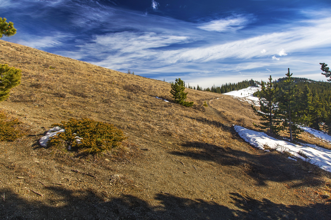 Start of Jumpingpound Ridge at Cox Hill junction
 |
|||
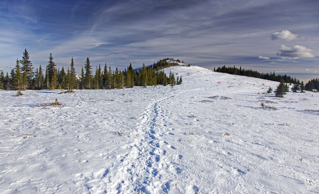
 Open ridge with views east to Moose Mountain
 |
|||
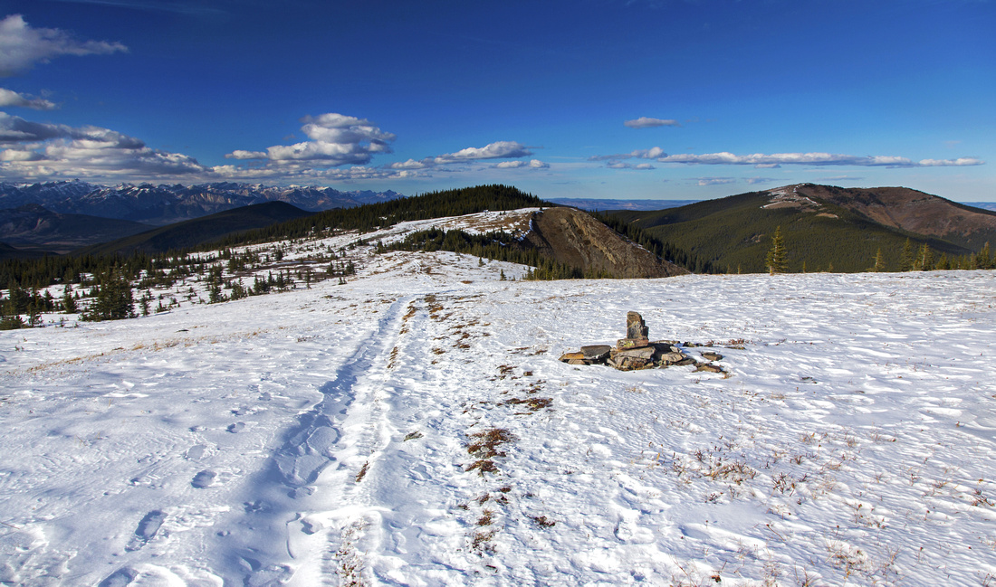
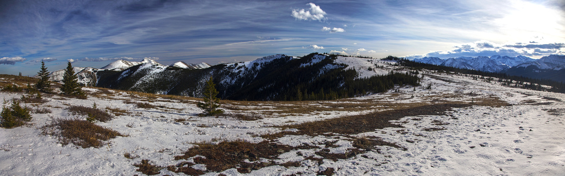 Central part of the ridge. Summit is bump in the center
 |
|||
 Looking back length of north ridge. Cox Hill center right
 |
|||
 Final summit approach. South ridge trail forks on the right
 |
|||
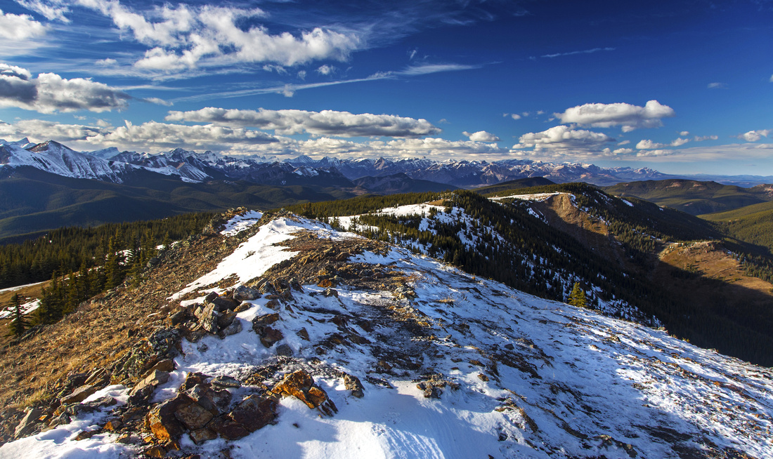 Summit views looking NW to sea of front-range peaks
 |
|||
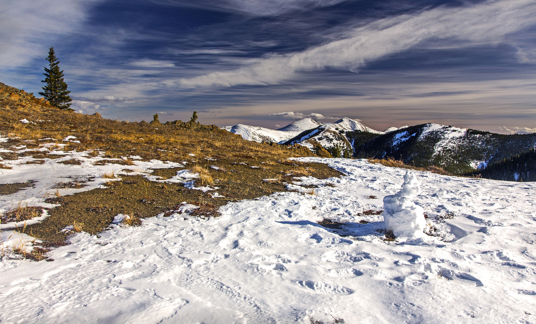
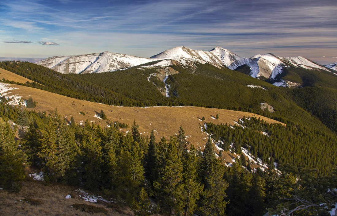 Summit views NE to Moose Mountain group
 |
|||
 Connecting ridge between Moose north and south summits
 |
Abstract
| Overall Difficulty | D3 | Moderately steep ascent to the treeline followed by ridge-walk on open terrain | |||
| Snow Factor | S2 | Ridge is frequently windblown and free of snow. Snowshoes or spikes might be required on the ascent | |||
| Scenery | Sweeping scenery of front ranges and foothills | ||||
| Trail/Marking | Excellent | Wide switchbacks to the ridge, shared with mountain bikers. All junctions are marked. Trail fades on occasion in open terrain along the ridge but way is obvious. | |||
| Suggested Time | 5-6 hrs | Time for approach from Lusk Pass trailhead. Much variations are possible to shorten or extend the day | |||
| Elevation | Start: 1640m Max: 2250m Total: ~650m | Round Trip: ~16km (return via Powderface road) | |||
| Gear | Day hikers sufficient in dry conditions. Micro-spikes useful in shoulder season or winter because of ice below treeline. Wind-breaker essential as ridge is wind-blown year round | ||||
| Water | Dry hike. Carry 1.5-2L | ||||
| Dog Friendly | Yes | Standard back-country travel precautions | |||
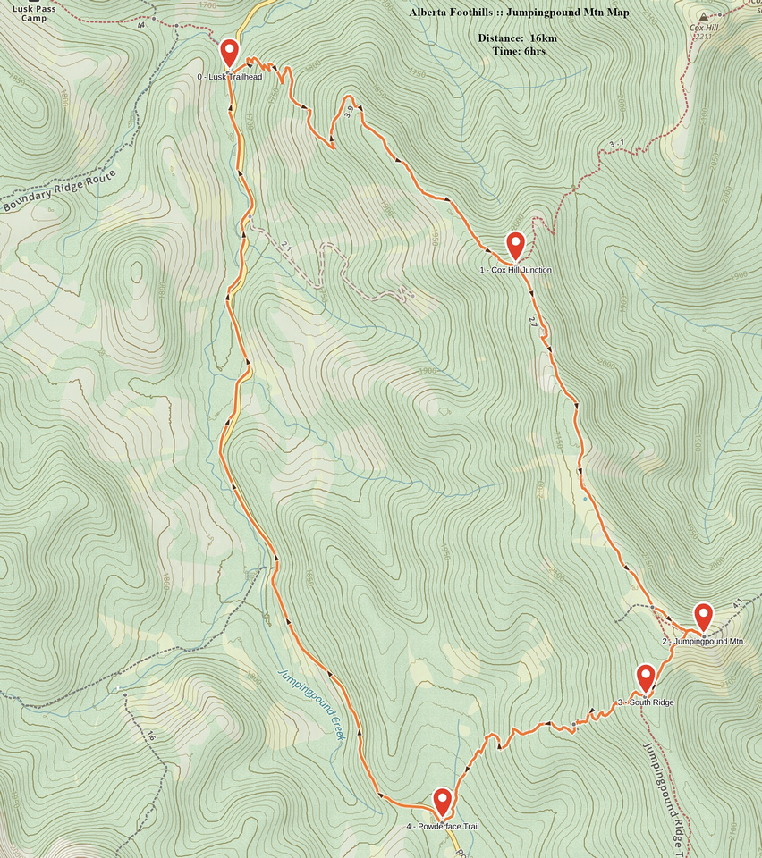 Jumpingpound GAIA Map
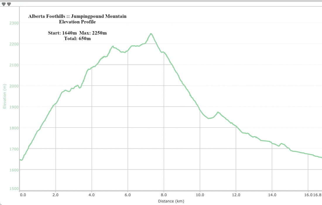 Jumpingpound Elevation Profile