Google Map |
USA :: Joshua Tree :: Barker Dam |
GPS Track |
|
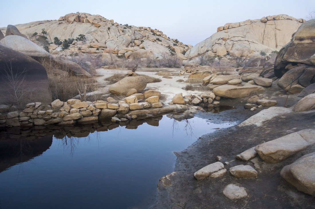
Water in the Desert! Small Barker Reservoir, sometimes completely dry |
| Trip Summary | |||
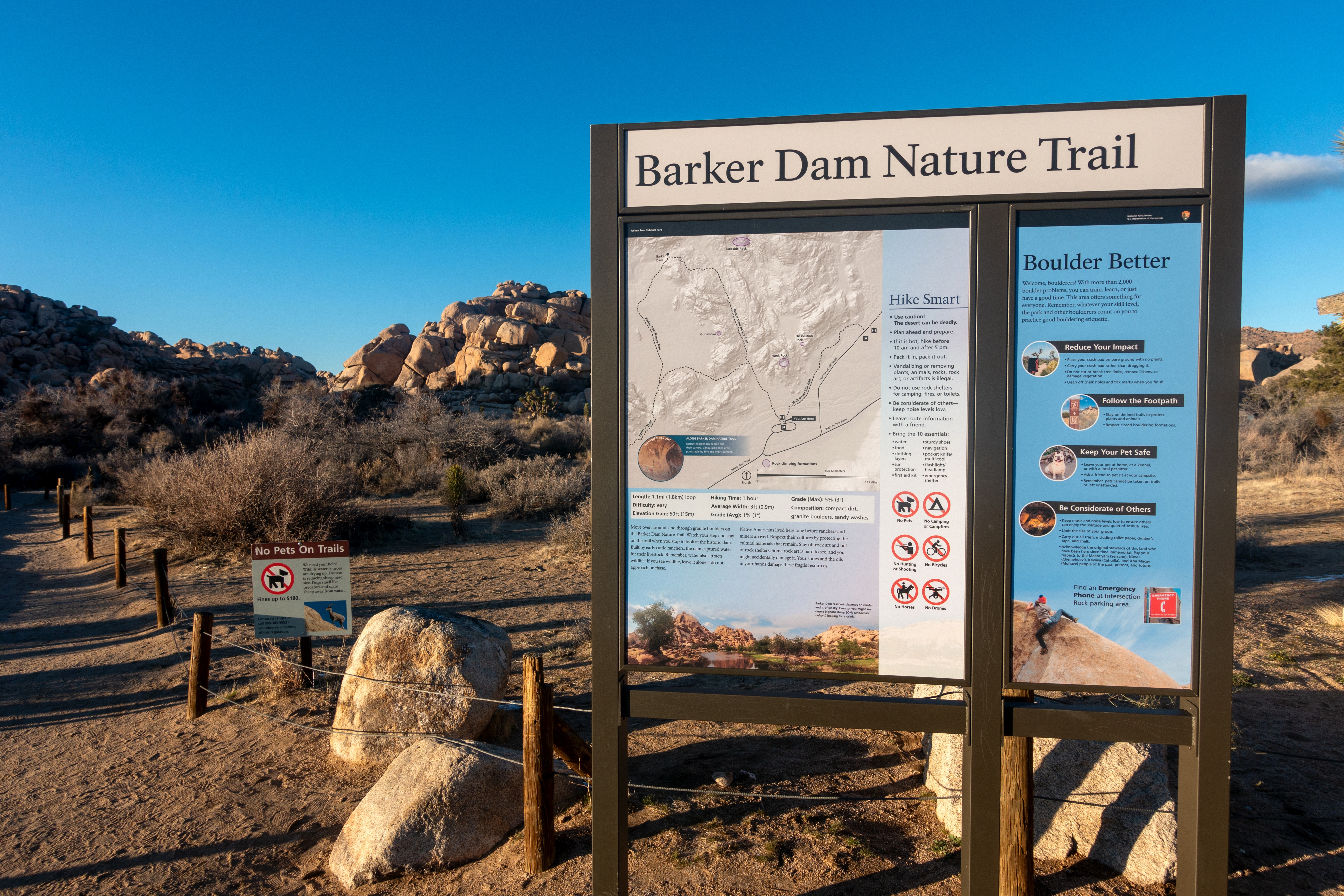
Multiple Dates, Last Feb 10, 2024Barker Dam Nature loop trail is popular easy Family friendly outing leading to site of Historic Dam constructed by early cattleman. Hike is very short (3km only) but there is plenty of scenic interest including interesting Petroglyphs Cave, while several granite walls are popular in rock climber community. Clockwise direction is what most people end up doing, and this is how photos in the Gallery are organized. Keep left at signed junction 7-8min past the parking lot, then after checking out Petroglyphs continue across the valley and climb short granite steps to Dam crest. Depending on season, reservoir can be full or dry or anything in between; on my Visit in Feb '24 only mud puddle remained. Unsigned trail can be followed for awhile into boulder strewn valley north of the Dam but soon deteriorates and completely vanishes. Find trail on south side of the Reservoir and close the loop by hiking back to the junction.
Visit to the area can be extended by visiting nearby Wonderland Ranch Ruins; ~10min walk from main Barker Parking Lot. |
|
Gallery |
|||||||
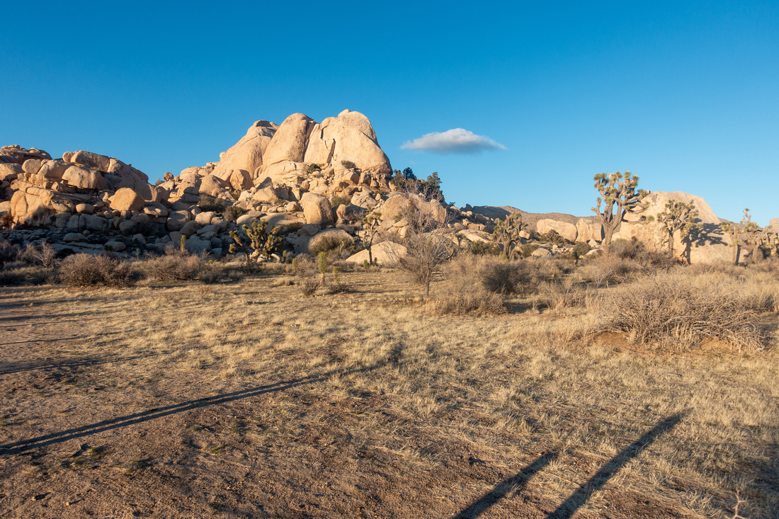 Barker Meadow Barker Meadow Rock outcroppings and inevitable Joshua Trees from Parking Lot at end of Barker Dam Road
 |
|||||||
 |
|||||||
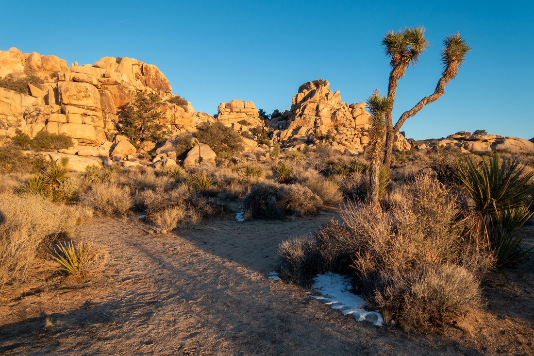
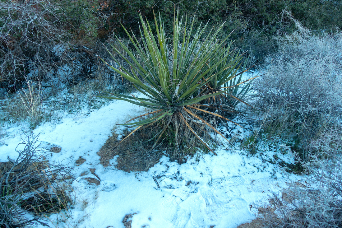 Desert Snow
Fresh dusting of snow in early Feb '24, fairly unusual for Mojave Desert Desert Snow
Fresh dusting of snow in early Feb '24, fairly unusual for Mojave Desert |
|||||||
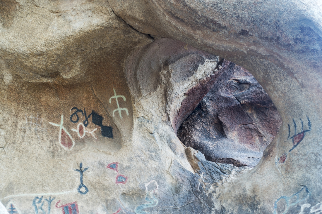 Petroglyphs Cave
Petroglyphs cave, a short side trip off main Barker Trail Petroglyphs Cave
Petroglyphs cave, a short side trip off main Barker Trail |
|||||||
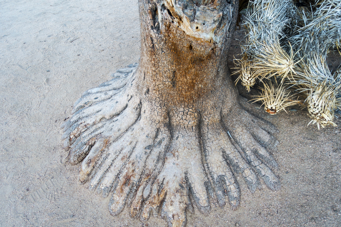 Multi Finger Foot
Interesting Desert Tree with Roots resembling Foot fingers Multi Finger Foot
Interesting Desert Tree with Roots resembling Foot fingers |
|||||||
 Barker Trail
Approaching the Dam on clockwise loop with late afternoon sun reflecting off granite boulders Barker Trail
Approaching the Dam on clockwise loop with late afternoon sun reflecting off granite boulders |
|||||||
|
|
|||||||
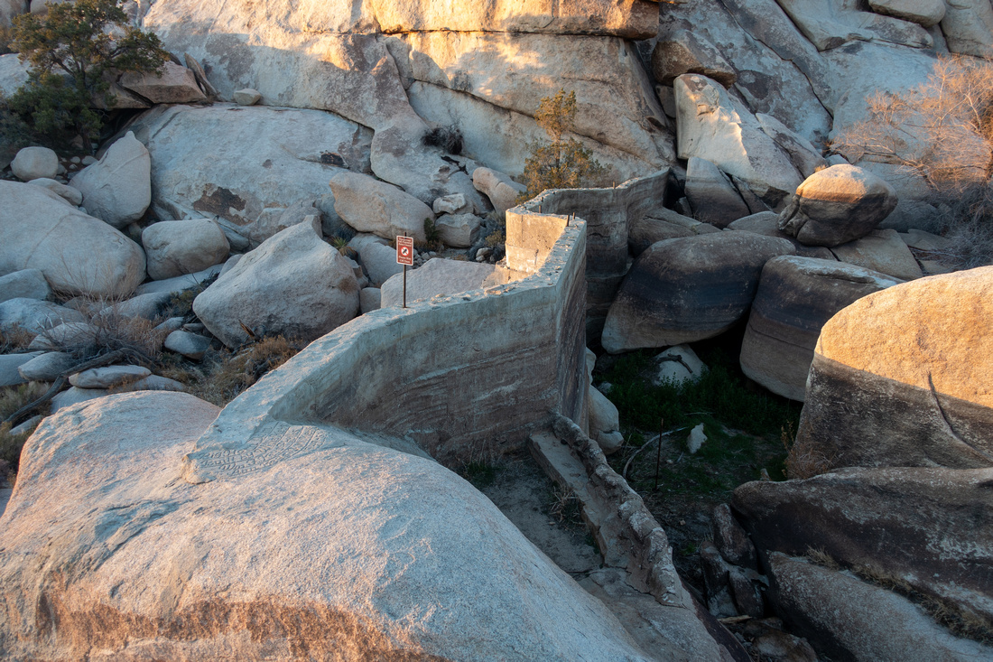
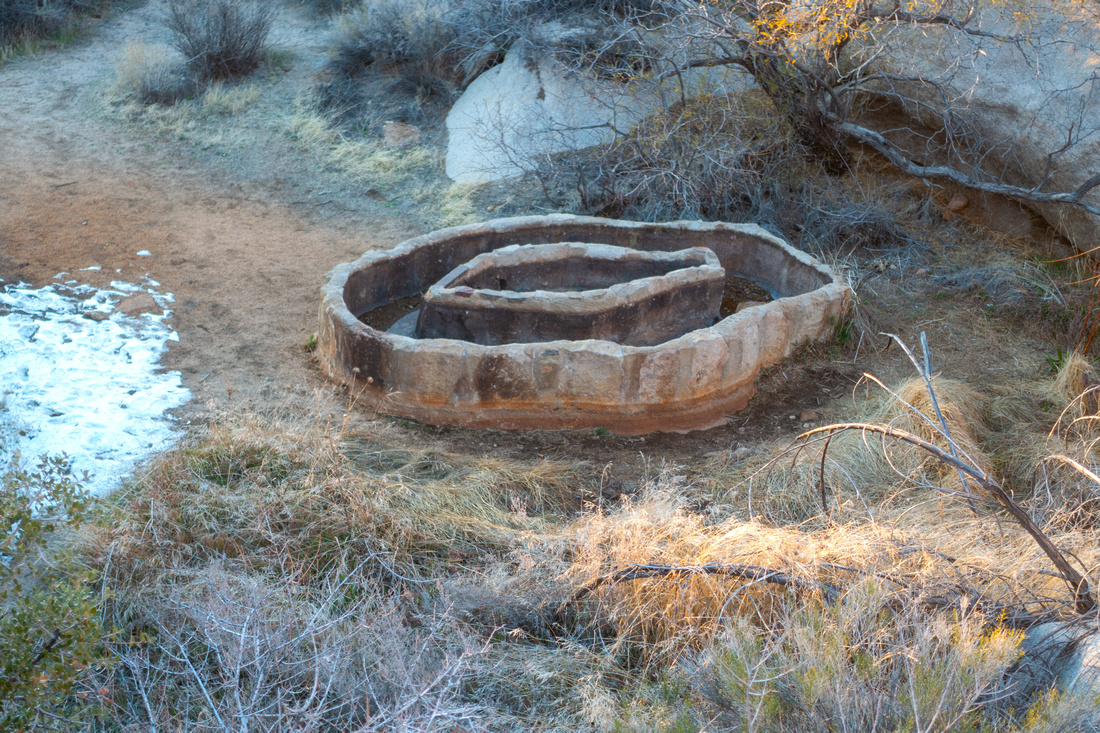 Barker Well
Interesting well-like structure in grassy plain just downstream of Barker Dam Barker Well
Interesting well-like structure in grassy plain just downstream of Barker Dam |
|||||||
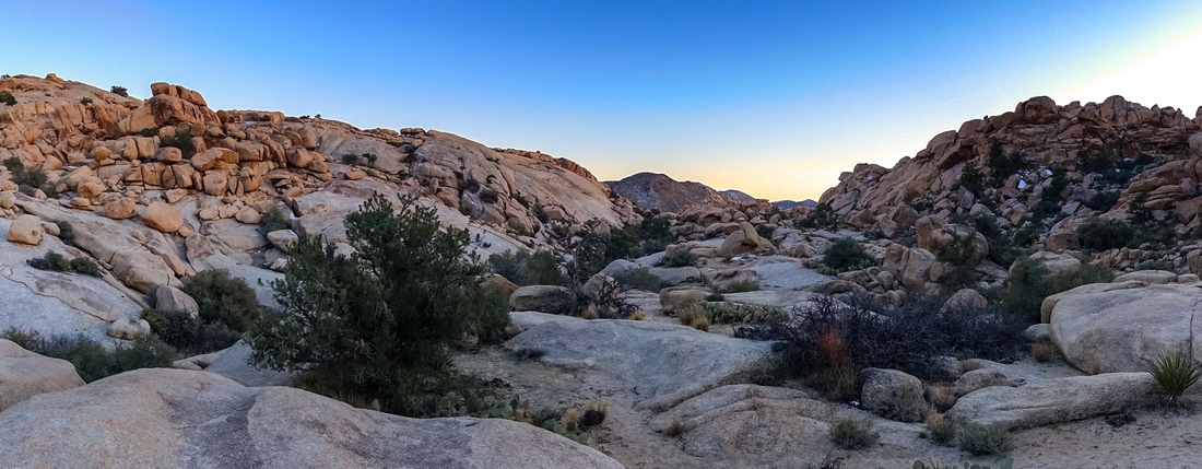 Granite Boulder Panorama while exploring valley north of Barker Dam
 |
|||||||
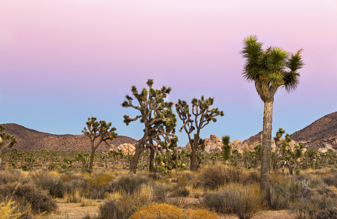 Joshua Sunset
Joshua Trees and Pink Sky as Sun has set behind Mojave Desert while hiking back to the Parking Lot Joshua Sunset
Joshua Trees and Pink Sky as Sun has set behind Mojave Desert while hiking back to the Parking Lot |
|||||||
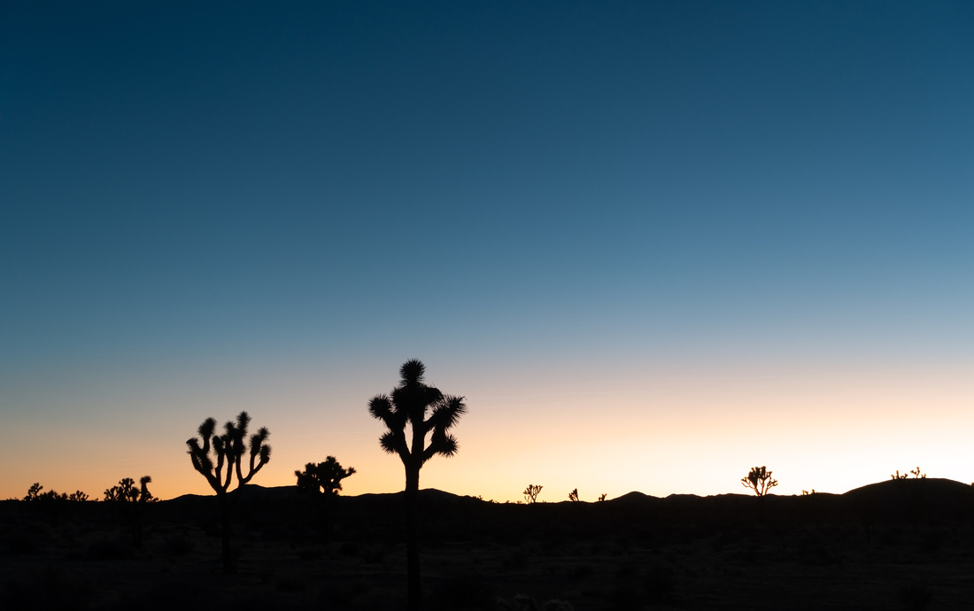 Joshua Sunset
Joshua Tree Silhouettes against post sunset sky Joshua Sunset
Joshua Tree Silhouettes against post sunset sky |
Abstract
| Overall Difficulty | D1/2 | Short and easy walk with couple of rock steps at Dam site | |||
| Scenery | Barker Dam, Petroglyphs Cave, Joshua Tree and typical Mojave Desert Landscape | ||||
| Trail/Marking | Excellent | Official wide trail with trailhead map and marked junctions | |||
| Suggested Time | 1-2 hrs | Casual pace, allowing for exploration of valley north of the Dam | |||
| Elevation | Start: 1295m Max: 1310m Total: ~60m | Round Trip: ~3km | |||
| Gear | Day Hikers are sufficient | ||||
| Water | Dry Hike; Carry 0.5L depending on season | ||||
| Dog Friendly | No | Dogs are allowed in Joshua Park, but must stay within 50m from road, picnic area or campground and are prohibited on hiking trails | |||
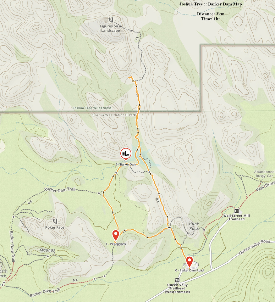 Barker Dam GAIA Map
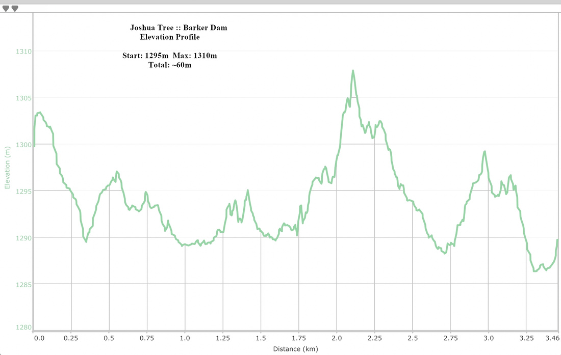 Barker Dam Elevation Profile