Google Map |
Rockies :: Icefields :: Survey Peak |
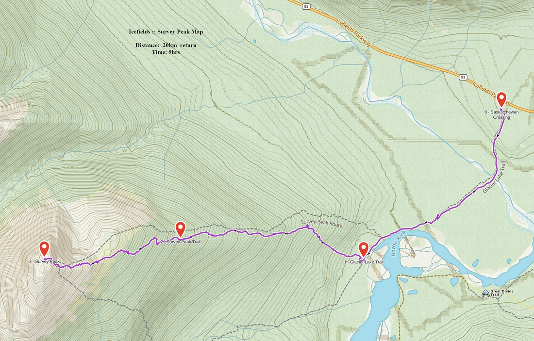
GPS Track |
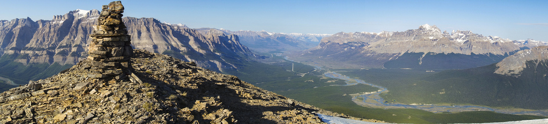 
Panoramic View east at 2680m Survey Peak Summit |
|||
| Trip Summary | |||
July 5, 2018Survey Peak is infrequently ascended summit along the Icefield Parkway corridor. It rises at north side of Howse River Flats near Saskatchewan River Crossing. Well established hiking trail to Glacier Lake/SE Lyell Glacier circles the peak on south side and provides easy initial approach. Forested south slopes one must ascend to treeline present the main problem and there is not much information available. Good trail with minimal bushwhack exists and avoids most of the difficulties. It does not connect entirely to treeline and fades away around ~2060m (~200m below treeline). However at this point forest is mostly open and bushwhack is reduced to the minimum.
Initial part follows Glacier Lake trail for about ~3.2km. Faded flag some ~15min past Howse viewpoint by red Adirondacks indicates the spot to leave the trail and head into the forest. By keeping slightly right and following couple of flags you can pick up start of fairly well defined "Survey Peak Trail". This is wonderful trail; never too steep with fairly distinct footbed and very little bush. You have to keep focus as it occasionally fades away, but flags are always present at critical points and you don't have to look hard to find it again. You gain about 600m vertical on this trail to the point when it levels out and starts contouring the peak in westerly direction. At this point (~2060m elevation, Waypoint 2 - Survey Peak Trail on GPS track; see gallery) leave the trail and head up the forest. Stay generally in NW direction you have been following so far, ignoring several side trails along the way -- they lead nowhere. Within 30-40min you reach treeline. Ascend meadowy slopes to the top, then turn left and approach SE talus slopes that lead to the summit ~300m vertical above.
Easiest line up talus stays close to the ridge on climber right. If you venture further left, terrain is more lose. Summit is marked by human size cairn, that had register and was quite surprising considering relative obscurity of this peak. Walk ~5min to the end of west ridge for even better views that include Mt. Forbes (highest in Banff National Park), Mt. Erasmus, Mt. Outram as well as distant Lyell Icefield. Glacier lake lies 1000 vertical meters below, while Howse River Flats leading to historic Howse Pass fade in the distance and just beg you to go exploring!
Survey peak is straightforward trip in summer conditions and technically off-trail hiking for the most part. Main difficulty on my trip were mosquitoes; relentless swarms that started almost at trailhead and did not let go until close to the summit. Highly recommended ascent on the Icefields for people comfortable with GPS, finding their own trail and typical Rockies talus slopes scrambling. |
|
Gallery |
|||
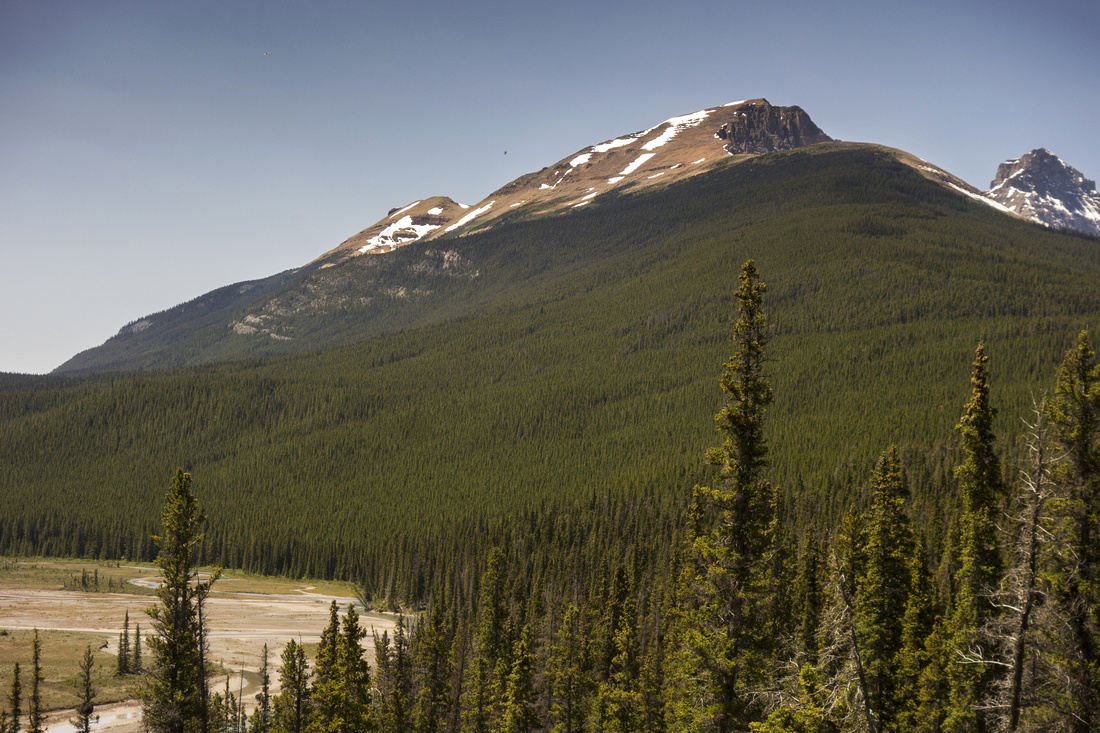 Survey Peak forested east slopes from Howse River viewpoint by Red Adirondacks 30min from parking
 |
|||
Red flag marking the start of "Survey Peak Trail" ~3.2km from trailhead and ~15min from Howse viewpoint |
|||
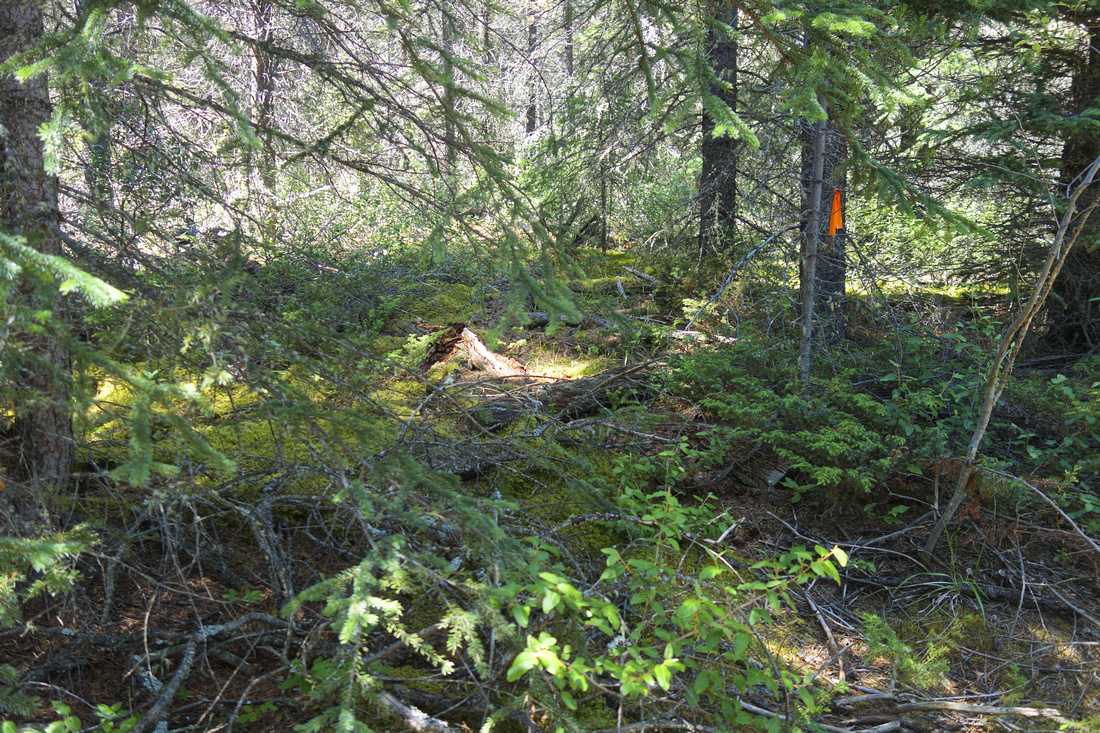
End of "Survey Peak Trail" ~2050m elevation (note flag). Faint path continues and eventually fades away; turn right and head up |
|||
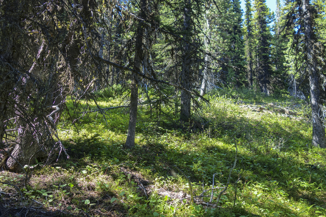
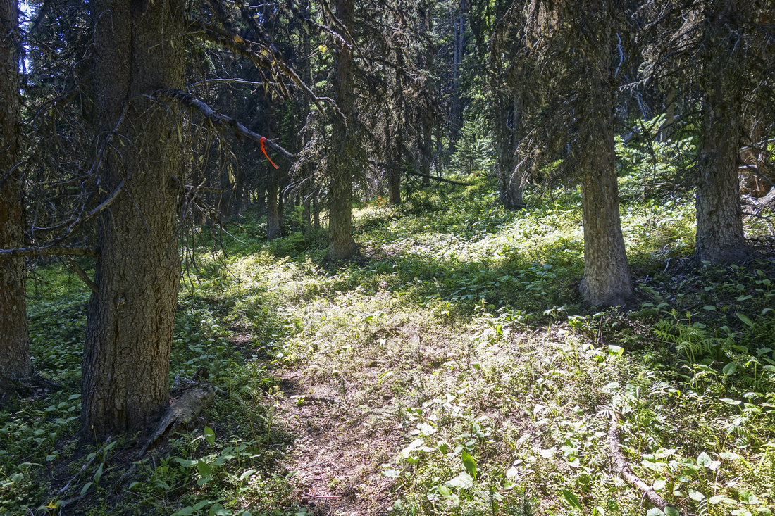
Mostly open forest with little bushwhack. Ignore all the side trails |
|||
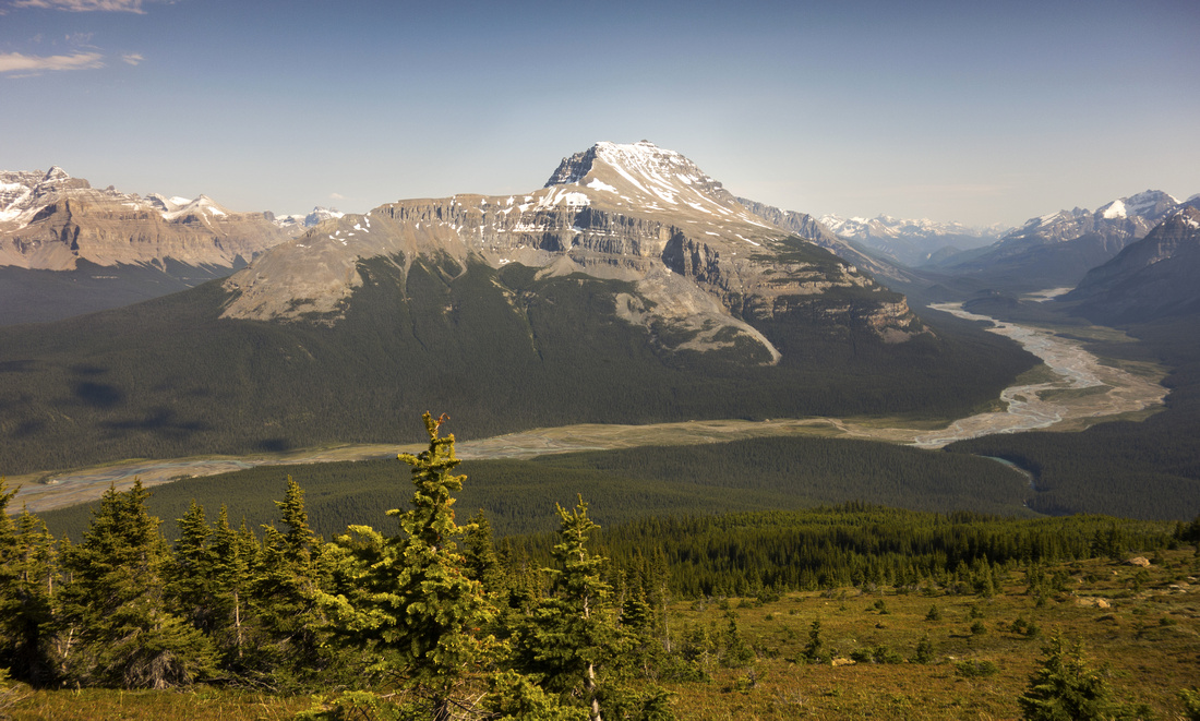
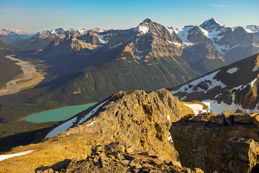
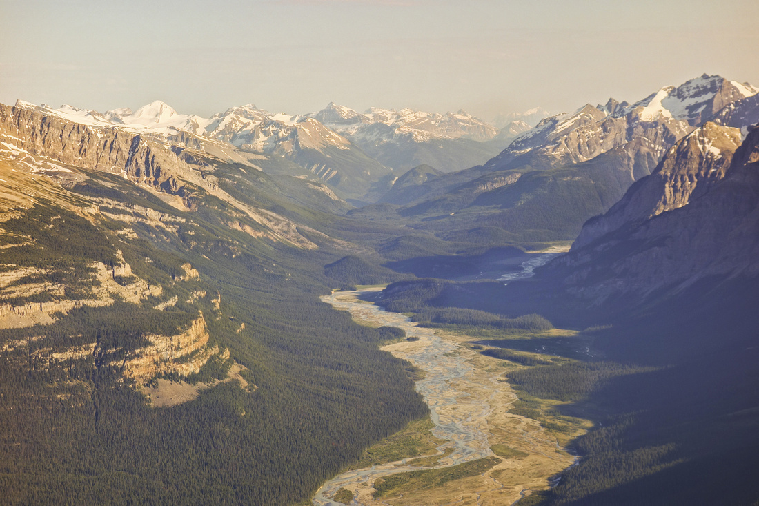
Fabulous views across Howse River Flats unfold above treeline. Mt. Sarbach across |
|||
Heading across the meadows to final ascent slope. Mt. Forbes distance left |
|||
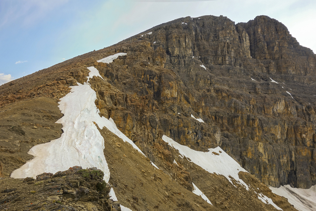
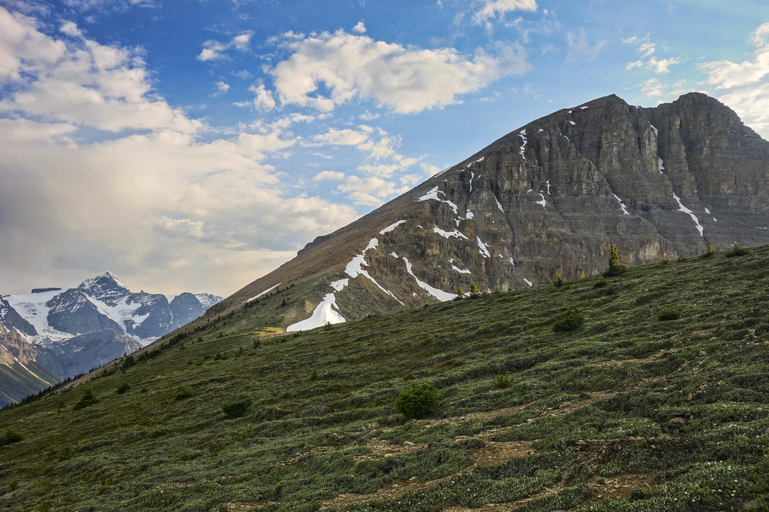
Starting up the talus. Summit is ~300m vertical above. Easiest line stays climber right, close to the ridge |
|||

Pausing for a breather with fabulous views back to Mt. Sarbach and Mt. Murchinson. |
|||
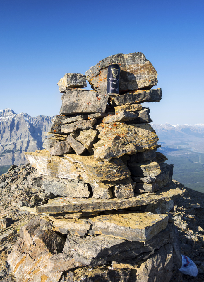
Surprising Refreshment waiting at Survey Peak summit cairn! |
|||
View from west end of summit ridge. Glacier lake below, Mt. Outram and Mt. Forbes across |
|||
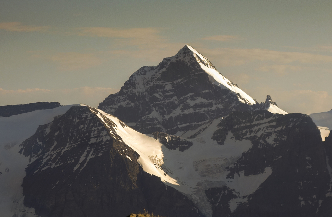
Mt. Forbes (3612m, highest in Banff National Park) |
|||
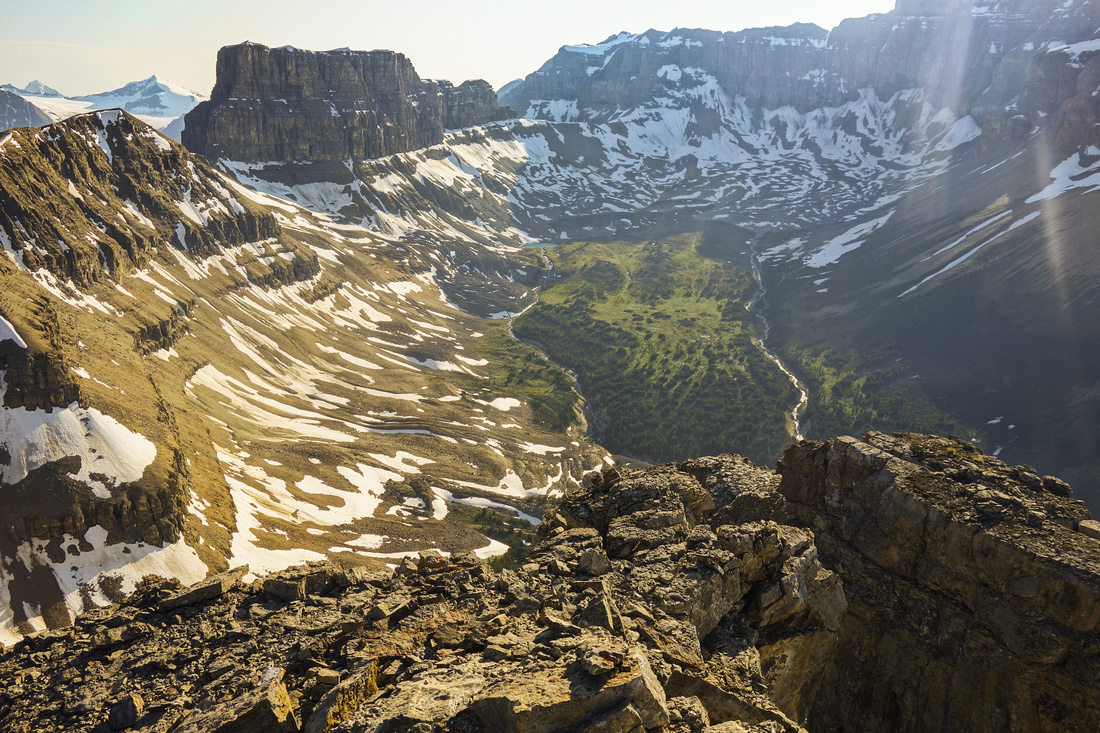
Delightful hanging valley below Mt. Erasmus on north side. Would be quite difficult to get into |
|||
Hazy telephoto down Howse River flats leading to historic Howse Pass |
|||
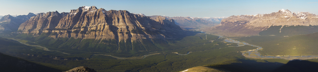
One more pano looking east. Descent is much faster and takes about 3hrs back to the parking |
Abstract
| Overall Difficulty | D6 | Off trail hiking with routefinding and some bushwhack. Moderately lose final talus slope. Considerable elevation gain | |||
| Snow Factor | S3 | Talus slope above treeline requiring stable snow conditions. Possibility of deep post-holing. Short daylight hours make winter ascent fairly challenging | |||
| Scenery | Scenic Howse River overlook by red Adirondacks 2.3hr into the hike. Fantastic views of Howse Flats and many remote peaks of Banff National Park, including Mt. Forbes, Mt. Outram, Mt. Wilson and Mt. Sarbach. | ||||
| Trail/Marking | Poor / None | Official Glacier Lake trail initially followed by faint forest path. Some flagging. Entirely off-trail for final 200m vertical to treeline and summit | |||
| Suggested Time | 8-9 hr | Summer time assuming dry conditions. Winter ascent will likely take longer | |||
| Elevation | Start: 1430m Max: 2680m Total: ~1430 m | Round Trip: ~20km | |||
| Gear | Full hiking shoes. Gaiters (bush) and Hiking Poles (talus slope stability). GPS essential. Snowshoes in winter (axe not required) | ||||
| Water | Dry after Howse Flats; carry 3-4L min on a hot summer day | ||||
| Dog Friendly | No | Prime bear and wolf country; Pets not recommended | |||
 Survey Peak GAIA Map
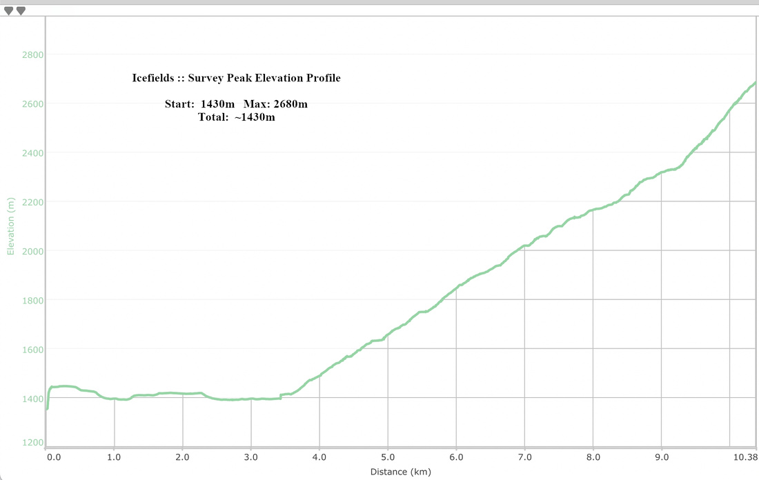 Survey Peak Elevation Profile