Google Map |
Rockies :: Canmore and Bow Valley ::Heart - MacEwan Horseshoe |
GPS Track |
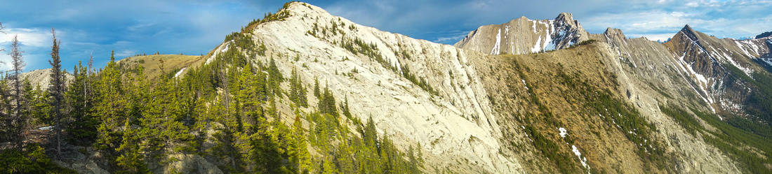 
Tree covered rib leading to "MacEwan Peak" -- apex of the Horseshoe. Connecting Ridge to Twin Towers right |
|||
| Trip Summary | |||
May 29, 2017
Heart Horseshoe is popular year-round objective. Highest point, now named "MacEwan Peak", is fantastic viewpoint and well worth the effort. Ascent is challenging with moderate/difficult scrambling, but once past Heart summit it becomes delightful open ridgewalk. Loop is preferable option. If returning the same way be ware that crux rock step will be more difficult on descent. Scramble of Twin Towers from MacEwan is feasible but much more difficult and borders technical climbing at one point. Upon descent to Acephale Creek on loop return, it is possible to extend the day by visiting Acephale Crags.
Parking is at official Heart Creek Trailhead near 1-A overpass in Exshaw; if coming from Calgary exit right and cross the highway. Follow well defined and popular trail for 10-15 minutes till you reach Heart Creek; Heart Mountain trailhead is on the other side. If water is high, it might be necessary to drop back to the highway to cross over. From there it is only 1-way: up. Over the years many boots (and running shoes) have significantly eroded the trail; it is generally easiest to stay as far right as possible. This offers easier footing and some entertaining, easy scrambling up rock slabs with good grip when rock is dry. Crux is about 2/3 of the way up: Unavoidable 4-5m rock step that starts with slight overhang. It is not too difficult but potential for injury exists. If you had problems ascending the crux, you might have to return via horseshoe anyways as descending this rock feature is more challenging. Second non-trivial scramble step is some 10 mins past the crux -- rocky gully that can be ascended on either side, although staying in the middle might work the best; Near the top exit via briefly exposed, but wide enough ledge on the right side. There are no more difficulties past this and Heart summit is another 10-15 minutes away.
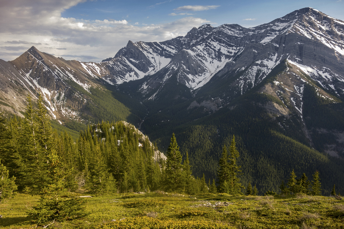
From Heart summit (cairn, but no register) entire Horseshoe can be seen. MacEwan still appears quite far away. Good trail marks the way and going is easy, except bit of narrow but avoidable rock crest soon after descent from Heart summit. This ridge becomes partially treed and shadier east (left) side might have snow till late spring while right end is dry. It takes about 30-40 minutes to MacEwan and this portion is highlight of the day with fantastic views down to head of Heart Creek and well as impressive Twin Towers. MacEwan summit has register but it often has no proper log book and is filled with business cards and various parchments instead. Summit views are great and include somewhat unexpected view of Barrier Lake; it looks feasible to drop on east side to Jewell Pass, but return logistics back to Heart Parking would be considerable. Connecting ridge to Twin Towers appears straightforward, but hidden from this side is the crux halfway down; big drop that includes some difficult scrambling or even low class 5 technical moves. For more details see So page; pic 8 shows two options on the crux.
From MacEwan simply follow ridge that curves NE over 2 more bumps, before descending down to Acephale Creek. This descent is much easier than ascent rib on Heart; there is some light scrambling in upper part, but going is generally straightforward. Upon dropping to treeline trail descends more steeply to junction with Acephale Crags; turn right then left upon exiting to Powerline near the highway. Follow trail generally parallel to Trans-Canada back to Heart Trailhead. In summer Heart Horseshoe is great after-work trip from Canmore, or even Calgary when days are long. Fast and fit person could complete the loop in 3-4 hours, but 5-6 is more common. |
|
Gallery |
|||
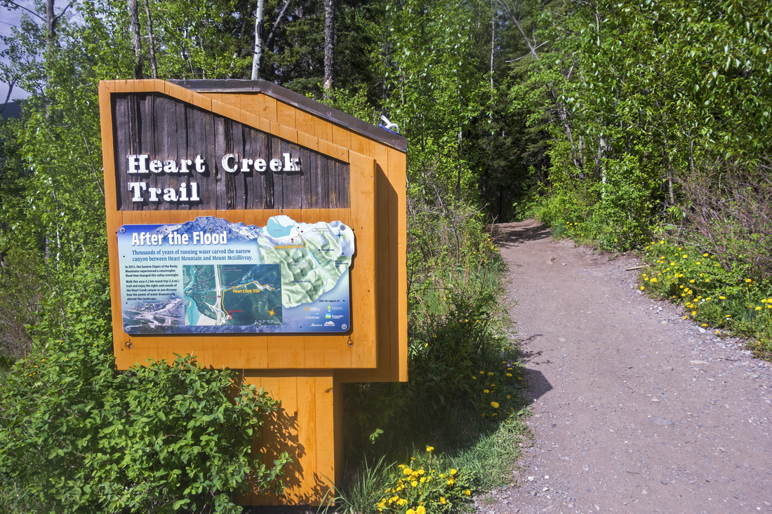 Heart Creek Trailhead near 1A overpass at Exshaw
 |
|||
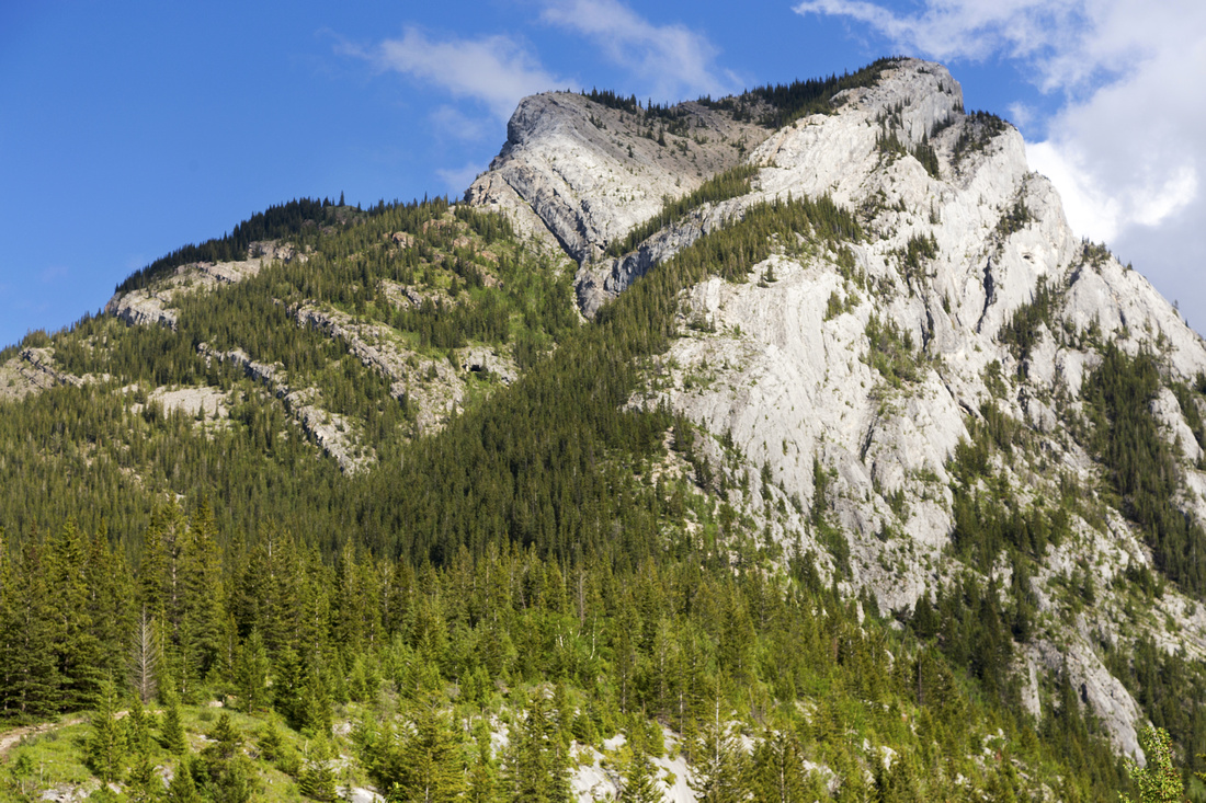 Classic view of Heart Mountain from Heart Creek
 |
|||
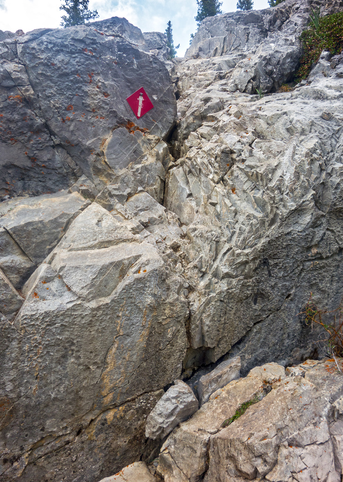 (In)famous Heart crux Rock Step 2/3 of the way up
 |
|||
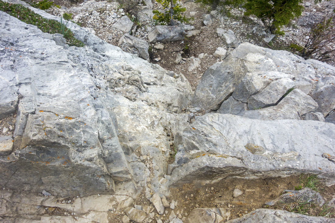 Looking down the crux -- stiff class 3 or low class 4
 |
|||
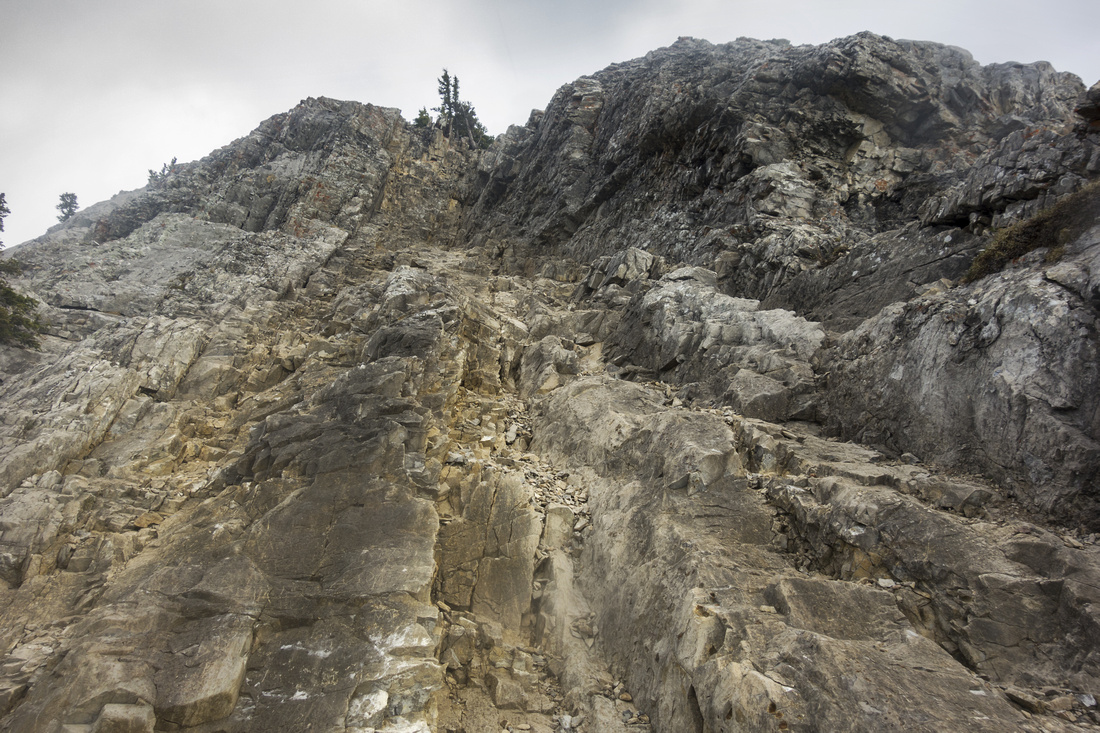 Upper Scramble step - exit on the right near the top
 |
|||
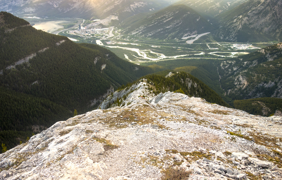
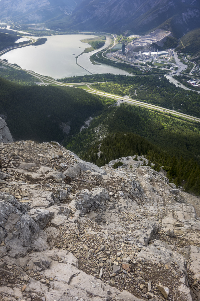 Past all difficulties, looking back to Exshaw and Lac De Arcs
 |
|||
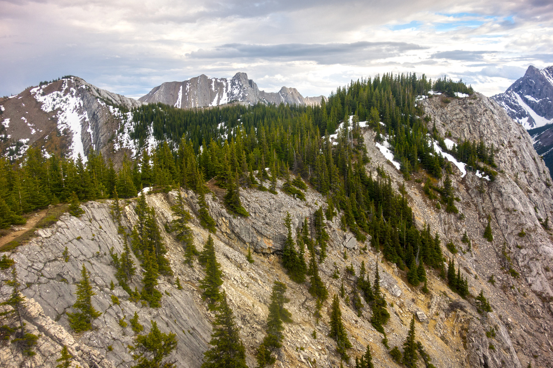 Partially treed ridge between Heart and MacEwan
 |
|||
 Upper reaches of Heart Creek from MacEwan Ridge
 |
|||
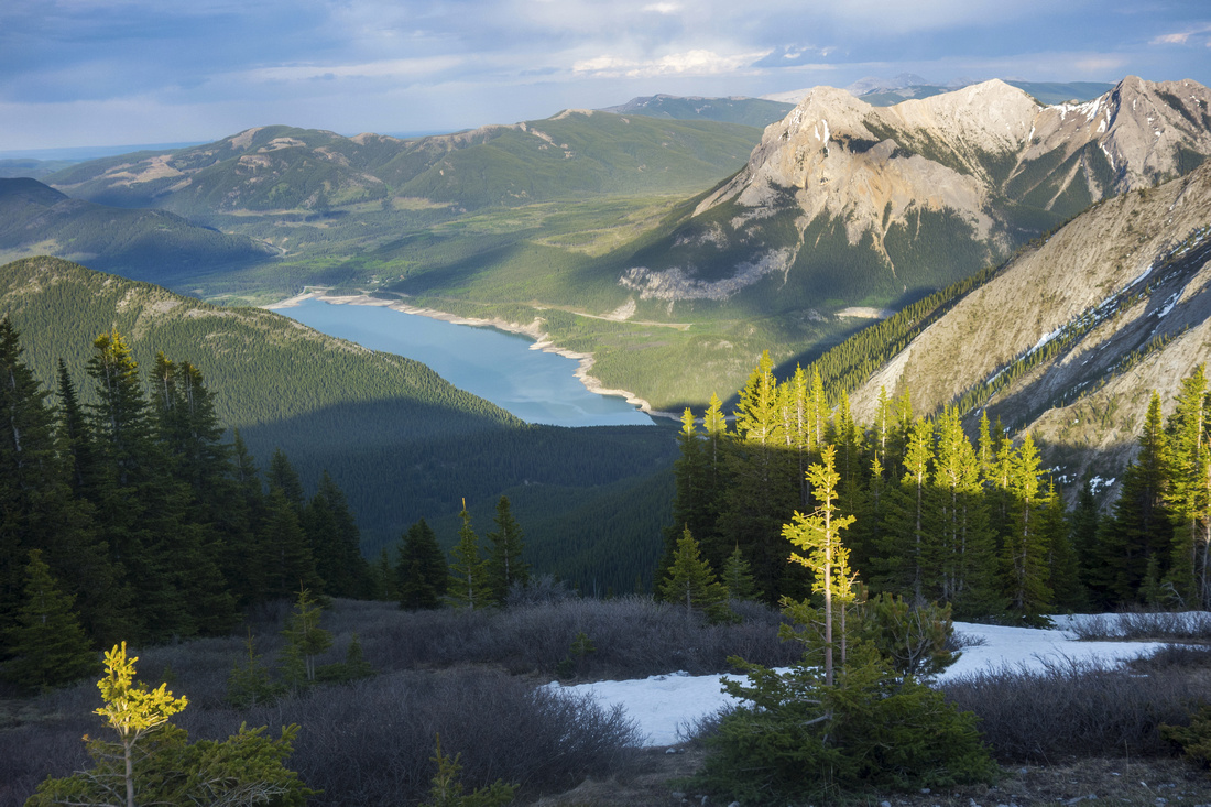 Barrier Lake and Mt. Baldy from MacEwan Peak
 |
|||
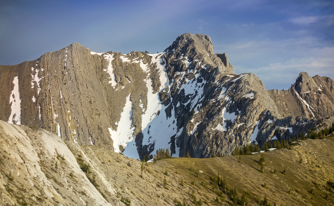 MacEwan Peak - Twin Towers connecting ridge
 |
|||
 Eroded, but easy, descent to Acephale creek
 |
|||
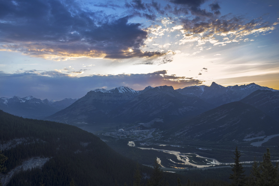 Sunset skies over the Front Ranges near treeline
 |
Abstract
| Overall Difficulty | D5 | Steep and lose sections. One hard rock-step (stiff class 3 or low class 4) on ascent. Several class 2 scrambling moves, including mildly exposed ledge near Heart summit. Many different options exist. | |||
| Snow Factor | S3 | Windblown and snow free most of the year, but if snowy / icy crux step could be dangerous specially if coming down the same way | |||
| Scenery | Great view of Foothills and Front Range Peaks from Horseshoe Ridge. Rugged Twin Towers in from MacEwan summit. | ||||
| Trail/Marking | Good | Well defined, but eroded trail; becomes less defined above Treeline, but way is obvious. Heart Creek junction is marked. | |||
| Suggested Time | 5-6 hr | For full horseshoe; less if going just to Heart summit and returning the same way. (Difficult) scramble extension to Twin Towers will add ~3 hrs (return) from MacEwan Peak. | |||
| Elevation | Start: 1350m Max: 2180 m Total: ~1050 m | Round Trip: ~12.5 km (full horseshoe) | |||
| Gear | Light hikers are sufficient; full hikers preferable for ankle support on steep and rubbly descent. Hiking pole(s) strongly recommended. Icers / micro-spikes could be an asset in winter. | ||||
| Water | Heart Creek on start, and Acephale Creek on return but no reliable water source above; dry hike. Carry 2-3L, depending on season | ||||
| Dog Friendly | Yes | Black bears are often seen in Heart mountain area in late spring/early summer | |||
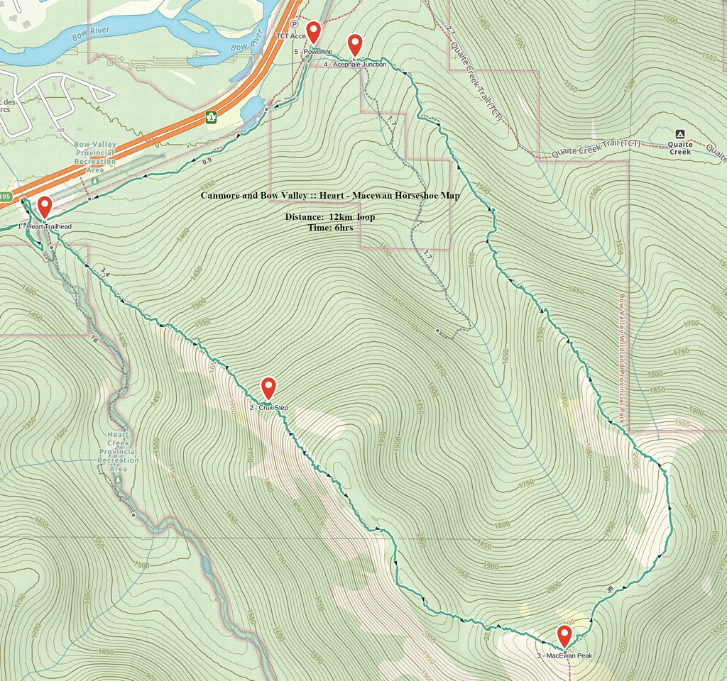 Heart - MacEwan Horseshoe GAIA Map
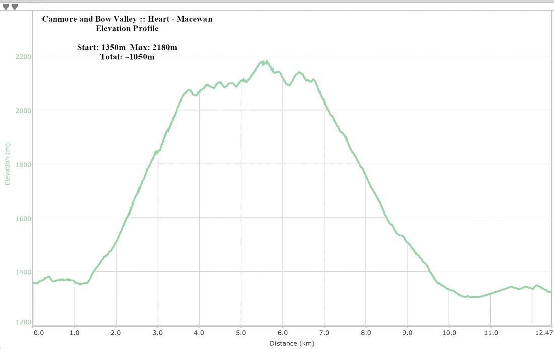 Heart - Macewan Horseshow Elevation Profile