MapElevation |
USA :: Zion :: West Rim |
GPS Track |
|
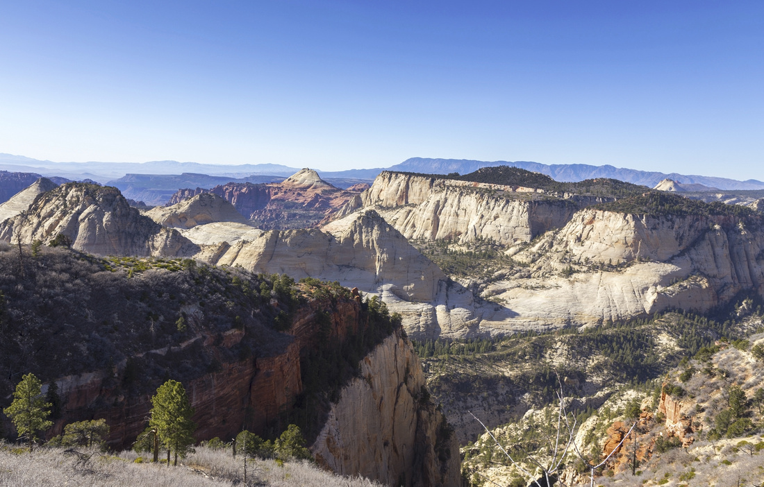
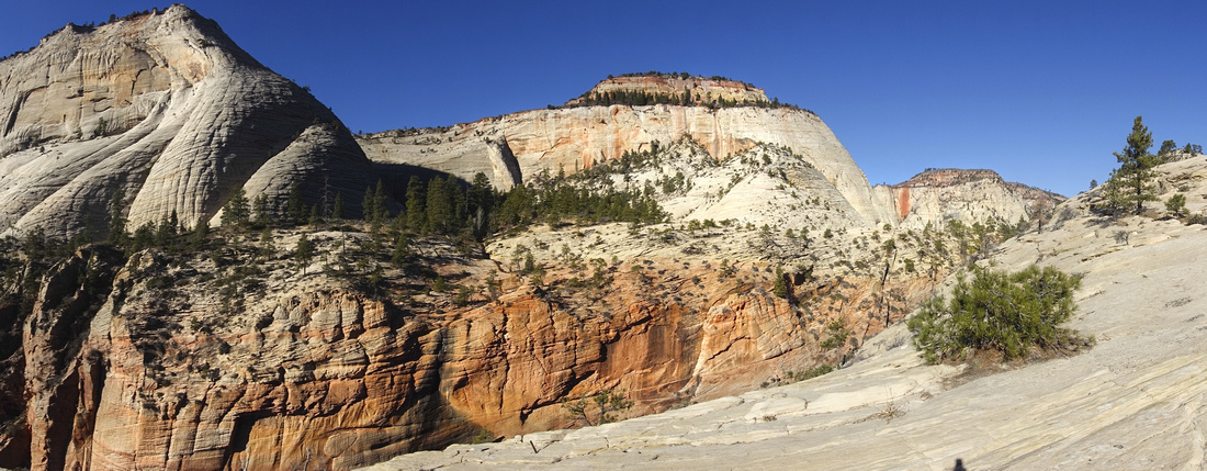
West Rim Panorama from Horse Pasture Plateau |
| Trip Summary | |||
November 22, 2021
Truly classic hike, well beyond the limits of Zion National Park. Trail connects Zion Canyon (Grotto Shuttle Stop #6) and Lava Point on West Rim. While one-way traverse is possible and frequently done, it does introduce logistic problems regarding the transportation. Top-down direction is preferred for traverse because of elevation. Alternative is partial out-and-back from either end, with Zion Canyon being more frequently used start. For such trips NPS advises Cabin Springs as maximum day-hiker turnaround point, but for fit hikers loop of Horse Pasture Plateau can be included without problems. Trip presented on this page was done in this fashion, and although I was weary of last shuttle time leaving Grotto, I never felt rushed. Some people also backpack; in this case there are 6 designated wilderness campgrounds on Horse Pasture Plateau. Facilities are non-existent and you have to be 100% self-reliant (including water as only meager source is at Cabin Springs).
If day-hiking, I advise catching first shuttle leaving Parks Center in Springdale usually around sunrise to give yourself maximum possible time to enjoy outrageous scenery. Note time of last shuttle; if you miss it, you will have to walk ~7km at the end of the day! Cycling to trailhead is valid alternative if you brought your bike. First part of the hike is shared with uber-popular Angels Landing trail; despite catching first bus from Springdale I still needed elbow room hiking to Scouts Landing! But crowds will thin out after that and, depending on season, you might have the rest entirely to yourself. Trail climbs to open slickrock then following Footprint Signs (see Gallery) descends to vast rocky landscape known as "Little Siberia". Approaching head of Behunin Canyon below White Cliffs is the major highlight; jaw dropping ascent on diagonal trail chiseled on ledge slicing the rock, and not for the faint of heart. While trail is always wide - narrowest point is ~1m maybe - it is not for everyone and fall down the edge would kill. If attempting this part when snowy or icy, micro-spikes are a must. After reaching signed Cabin Springs junction, loop around Horse Pasture Plateau can be done in either direction. I've seen clockwise recommendations on Internet, but I advise CCW as it leaves best for last. Signed Potato Hollow junction at top of Plateau is turnaround point. If you ascended in CCW direction (Telephone Canyon first), next hour or so are one of best scenic high-elevation walks you will ever experience. Most of signed back-country campground areas are in this part.
Descending the White Cliffs ledge on return will be as exciting as the ascent. Super fit hikers could probably include Angels Landing as extension, but having done it before and with ~28km under my belt for the day I just joined swarming crowds descending down Walter Wiggles and Refrigerator Canyon back to Grotto Trailhead. Highly recommended Trip and possibly personal 2021 Hike of the Year. If or rather when I hike north part (Lava Point to Potato Hollow) this page will be updated.
|
|
Gallery |
|||
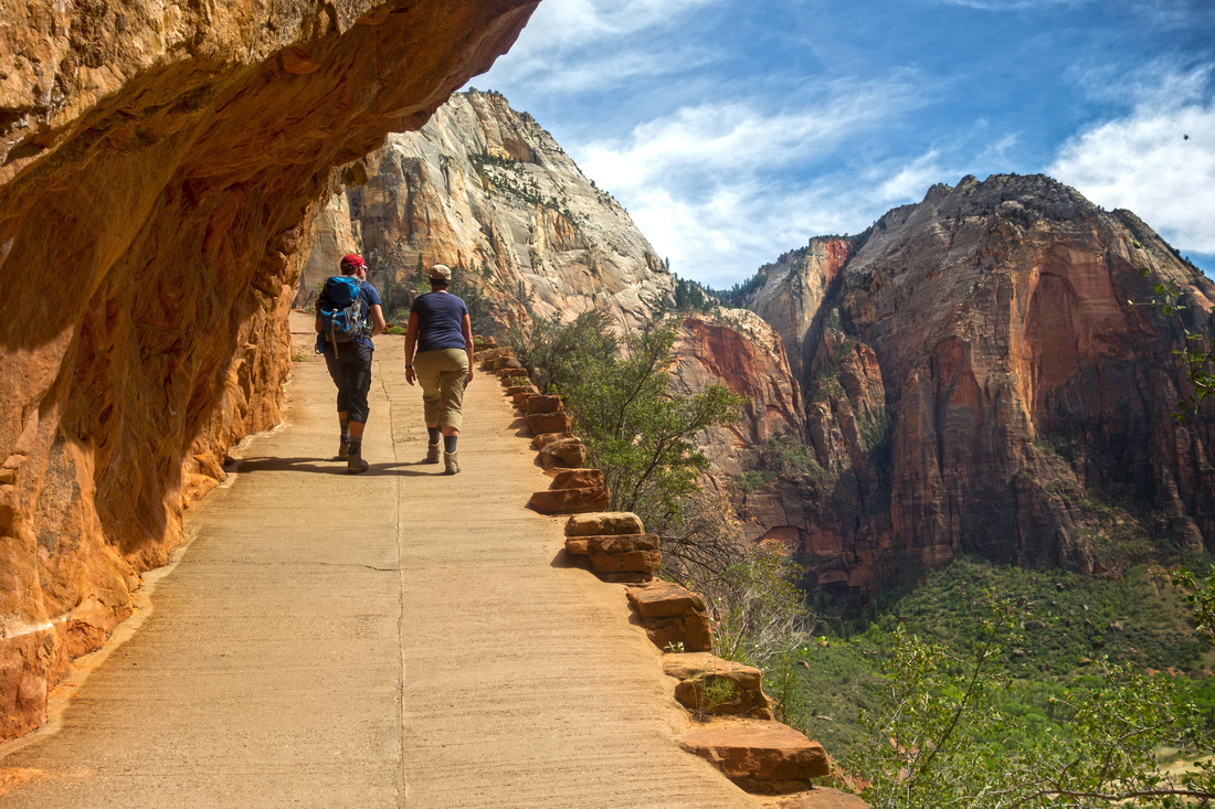 Zion Hikers Zion Hikers Ascending towards Refrigerator Canyon and Scouts Landing
 |
|||
 Walter's Wiggles
Looking down infamous Walter's Wiggles, series of tight switchbacks rising above Refrigerator Canyon to Scouts Landing Walter's Wiggles
Looking down infamous Walter's Wiggles, series of tight switchbacks rising above Refrigerator Canyon to Scouts Landing |
|||
 |
|||
|
|
|||
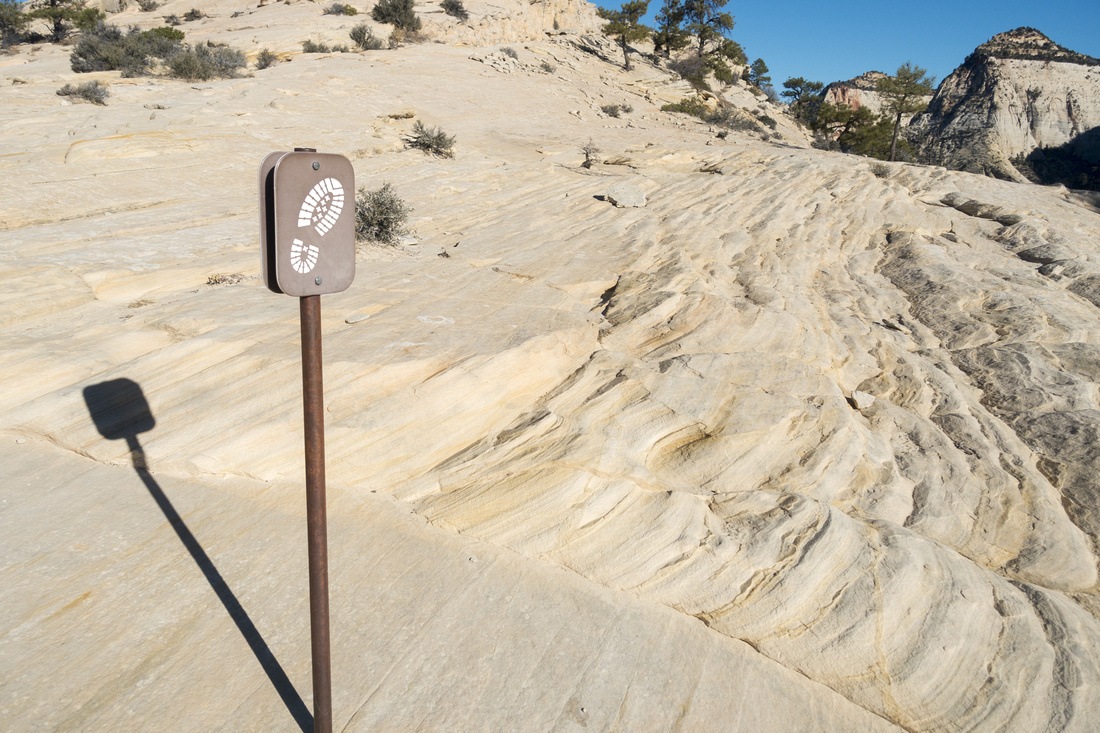 Footprint Sign
NPS built these very neat markers indicating direction. I found them quite useful, particularly at this spot where inclination would be to continue straight towards treed patch upper right Footprint Sign
NPS built these very neat markers indicating direction. I found them quite useful, particularly at this spot where inclination would be to continue straight towards treed patch upper right |
|||
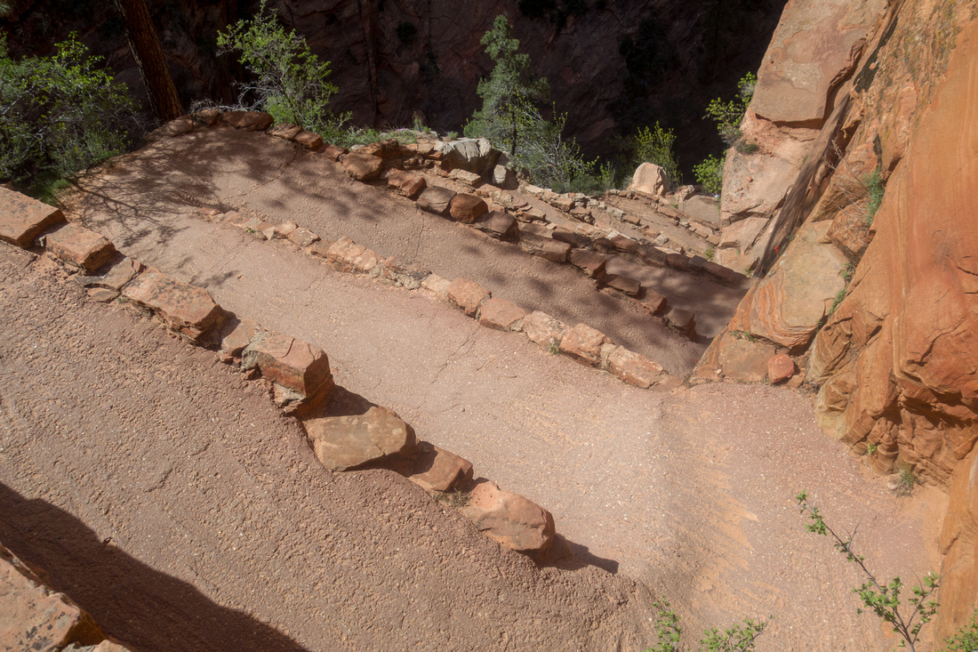
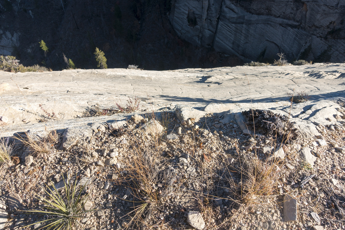
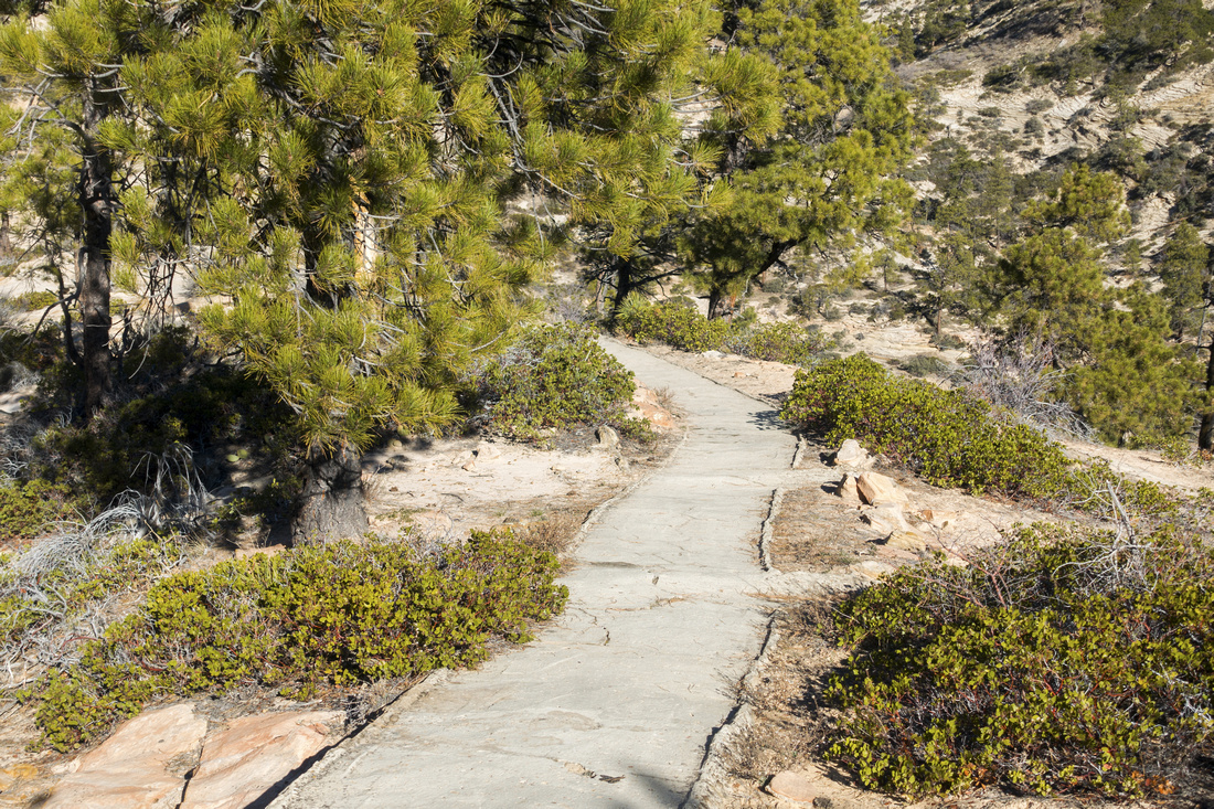 Stone Footpath
Descending to "Little Siberia"; it took some effort to build this neat stone path Stone Footpath
Descending to "Little Siberia"; it took some effort to build this neat stone path |
|||
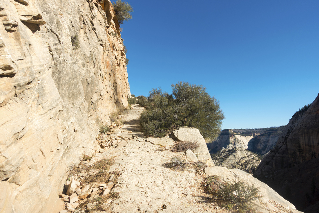
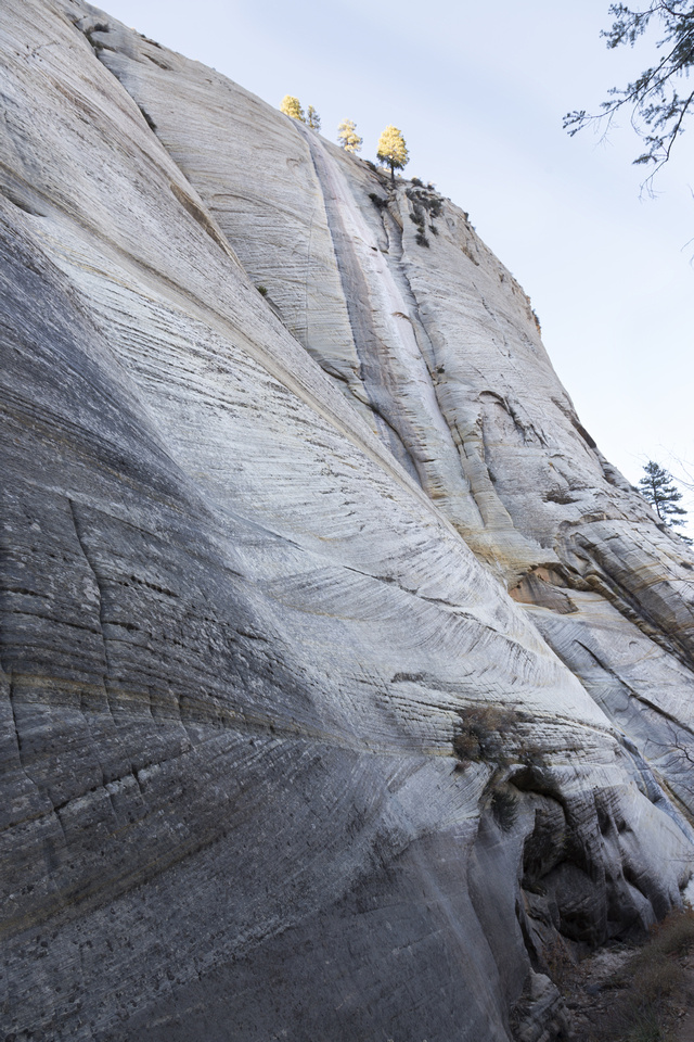
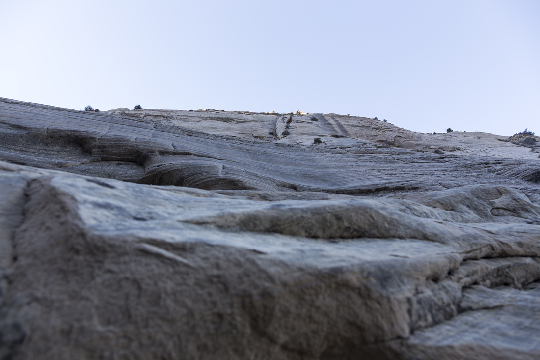 Below the Cliff
Passing below White Cliffs; hard to believe trail cuts across the ledge halfway up Below the Cliff
Passing below White Cliffs; hard to believe trail cuts across the ledge halfway up |
|||
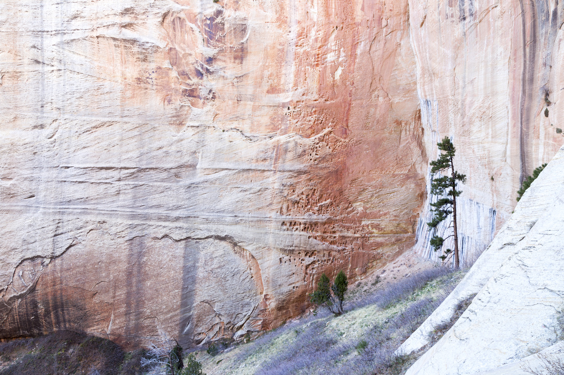 Red Wall
Cutting corner at head of Behunin Canyon by that red cliff seen before and starting ascent to Cabin Spring junction Red Wall
Cutting corner at head of Behunin Canyon by that red cliff seen before and starting ascent to Cabin Spring junction |
|||
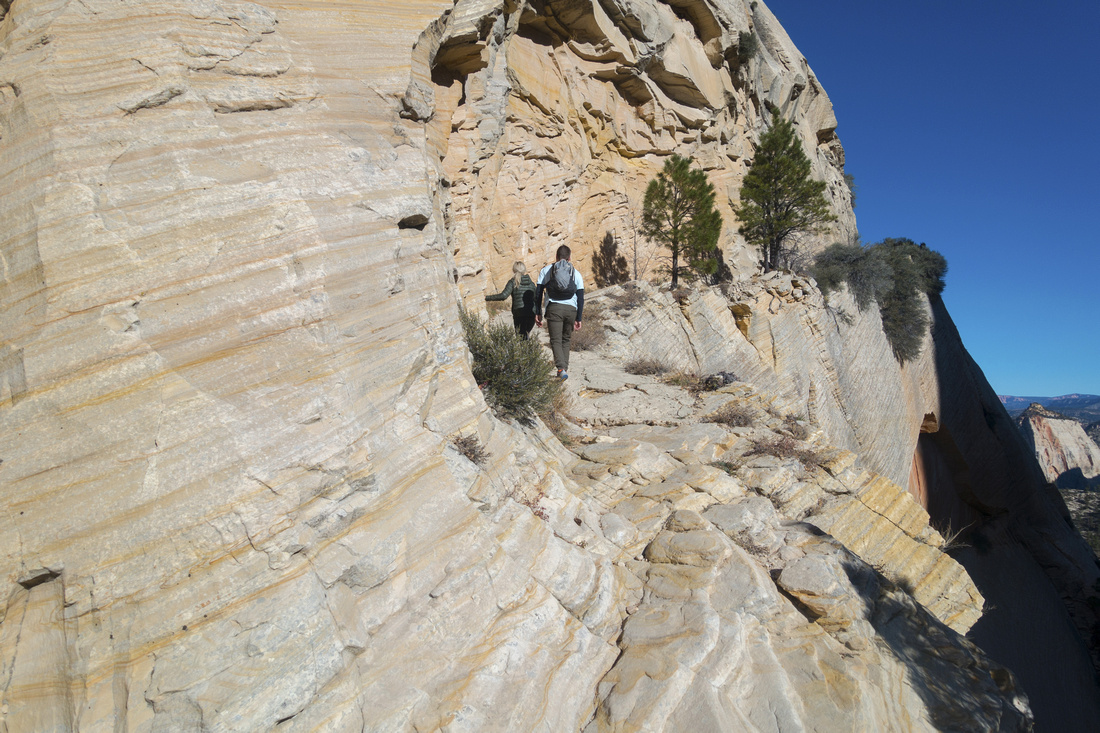 Hiker's Ledge
Hikers ascending ledge slicing through White Cliffs; despite appearance it is quite safe, although I'd not advise descending when icy Hiker's Ledge
Hikers ascending ledge slicing through White Cliffs; despite appearance it is quite safe, although I'd not advise descending when icy |
|||
 The Abyss
Vertical drop-off ascending the ledge; fall would be deadly The Abyss
Vertical drop-off ascending the ledge; fall would be deadly |
|||
 Upper Ledge
Topping out of upper Telephone Canyon and approaching Lava Point junction Upper Ledge
Topping out of upper Telephone Canyon and approaching Lava Point junction |
|||
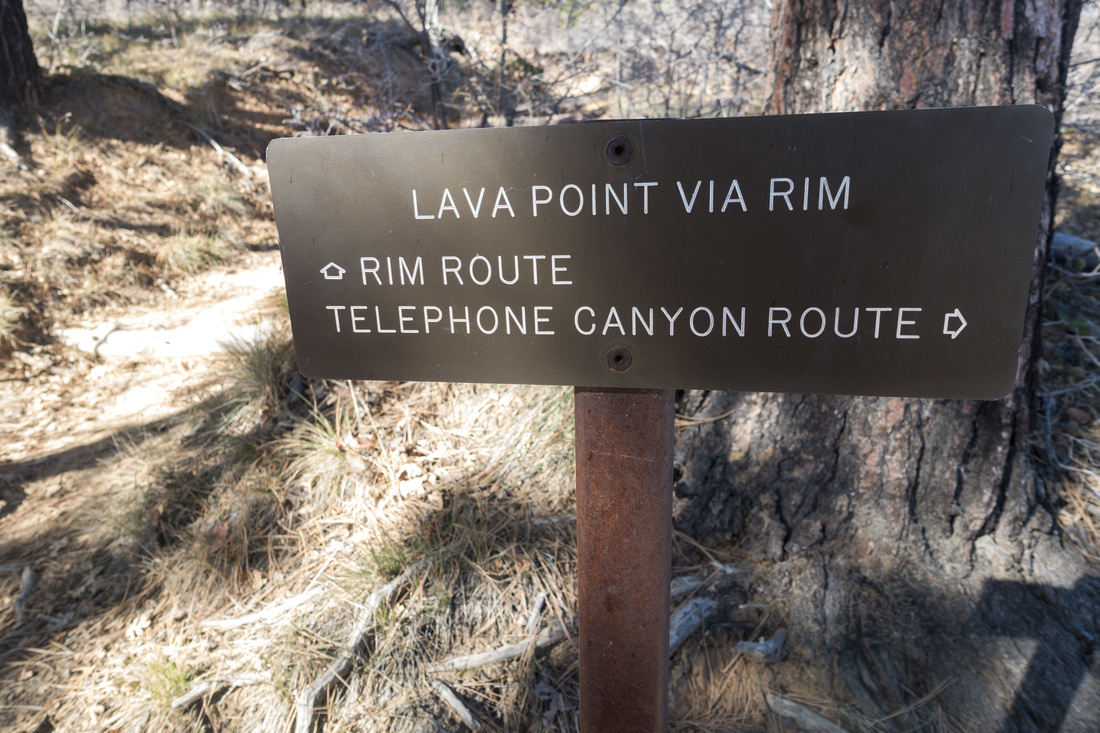 Lava Point Junction
, maximum turnaround point for day-hikers starting from Zion canyon. Closing Horse Pasture Plateau loop is preferred in CCW direction (Telephone Canyon in, Rim Route out) Lava Point Junction
Lava Point Junction, maximum turnaround point for day-hikers starting from Zion canyon. Closing Horse Pasture Plateau loop is preferred in CCW direction (Telephone Canyon in, Rim Route out) |
|||
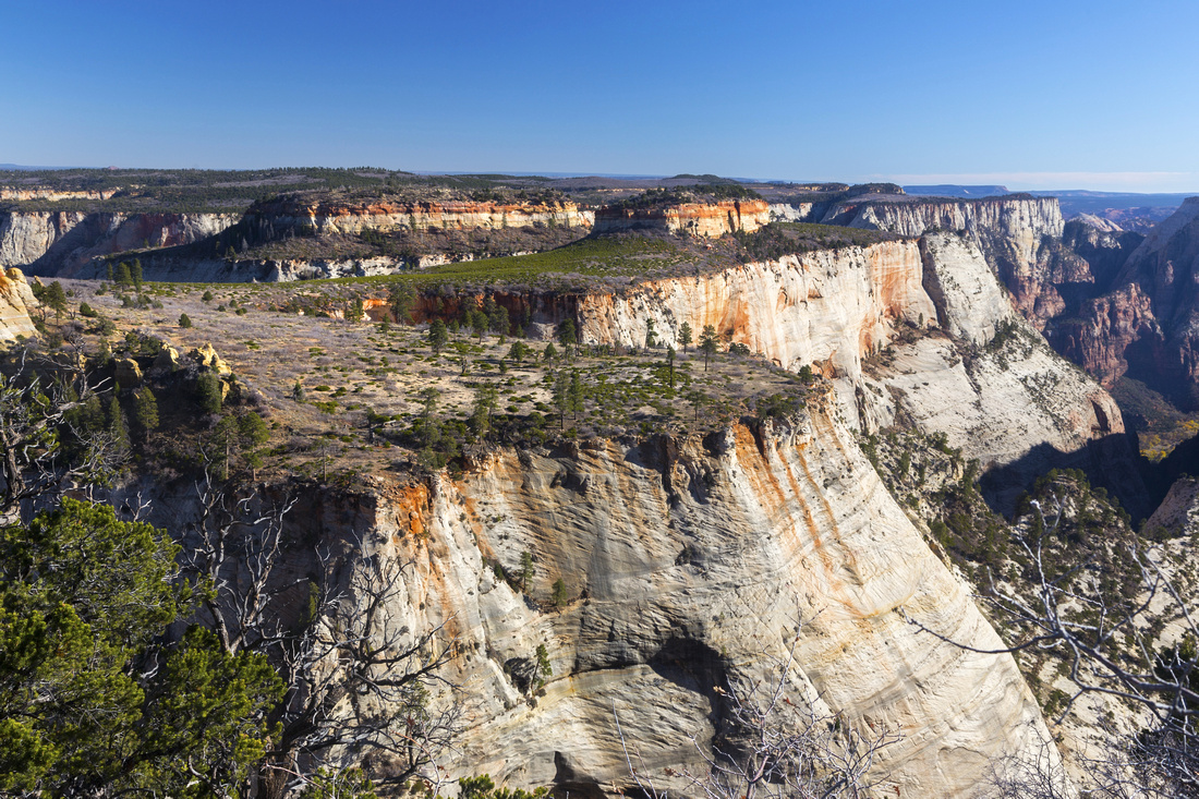
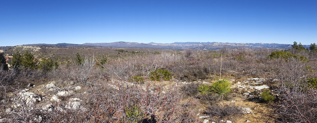 Potato Hollow Panorama
Looking north towards Potato Hollow from open viewpoint slightly below Lava Junction; trail descends on left side, out of photo Potato Hollow Panorama
Looking north towards Potato Hollow from open viewpoint slightly below Lava Junction; trail descends on left side, out of photo |
|||
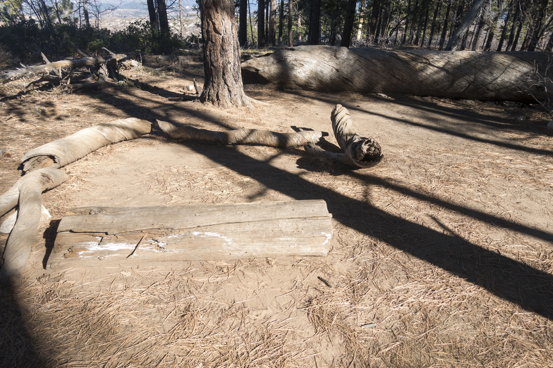 West Rim Campsite
One of six designated campsites on Horse Pasture Plateau. Facilities are non-existent - no food cache, no outhouse, no water source - and you have to be 100% self dependent if you plan to overnight here. Location is quite pretty though West Rim Campsite
One of six designated campsites on Horse Pasture Plateau. Facilities are non-existent - no food cache, no outhouse, no water source - and you have to be 100% self dependent if you plan to overnight here. Location is quite pretty though |
|||
 Behunin Canyon
Looking down into Behunin Canyon (extreme right) on descent to Cabin Springs junction. Plateau directly across would be wonderful to explore but I do not know if non-technical route exists Behunin Canyon
Looking down into Behunin Canyon (extreme right) on descent to Cabin Springs junction. Plateau directly across would be wonderful to explore but I do not know if non-technical route exists |
|||
|
One last look at White Cliffs on return; yes trail cuts through the ledge in upper part |
Abstract
(Zion Canyon - Horse Pasture Plateau loop out-and-back)
| Overall Difficulty | D4 | Moderately steep sections. Mild exposure ascending White Cliffs. Considerable overall distance/elevation for day trip | |||
| Scenery | Sweeping 360 Panorama from Horse Pasture Plateau. White Cliffs, Little Siberia and several other classic Zion landmarks | ||||
| Trail/Marking | Very Good | Most of trail to Scouts Landing is paved, well defined with direction markers and signed junctions afterwards | |||
| Suggested Time | 8 hrs | Moderate Pace with full loop of Horse Pasture Plateau. Less (5-6 hrs) if turning back at Cabin Spring Junction | |||
| Elevation | Start: 1200m Max: 2250m Total: ~1450m | Round Trip: ~28km | |||
| Gear | Day Hikers or Full Hiking boots. Poles helpful. Spikes in winter if Horse Pasture ascent is icy | ||||
| Water | Cabin Springs - meager but usually reliable. Water must be filtered. Carry 2L or more depending on season | ||||
| Dog Friendly | No | Dogs are allowed in Zion National Park, but must stay within 50m from road, picnic area or campgrounds and are prohibited on hiking trails | |||