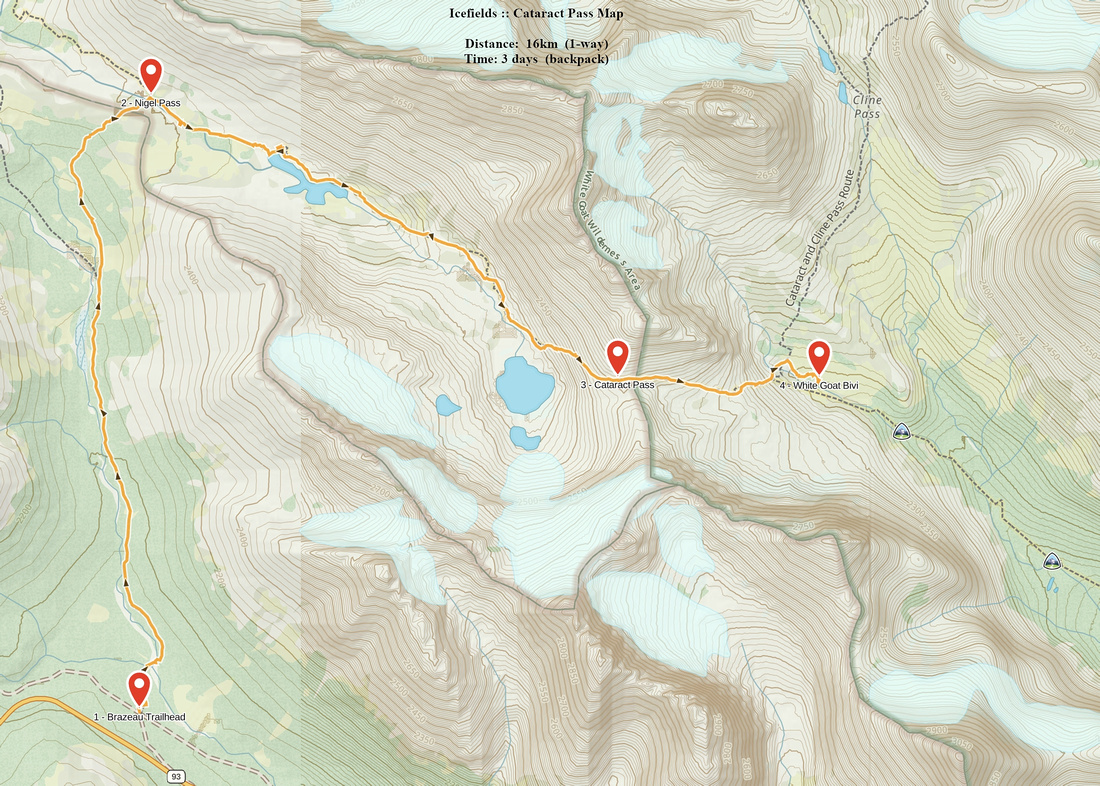
Google Map |
Rockies :: Icefields :: Cataract Pass |
GPS Track |
|
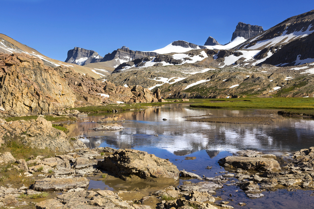
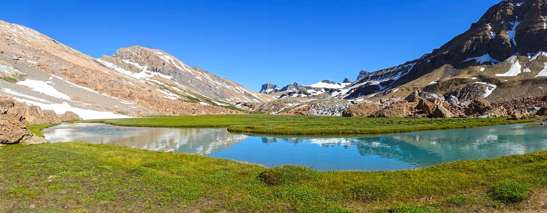
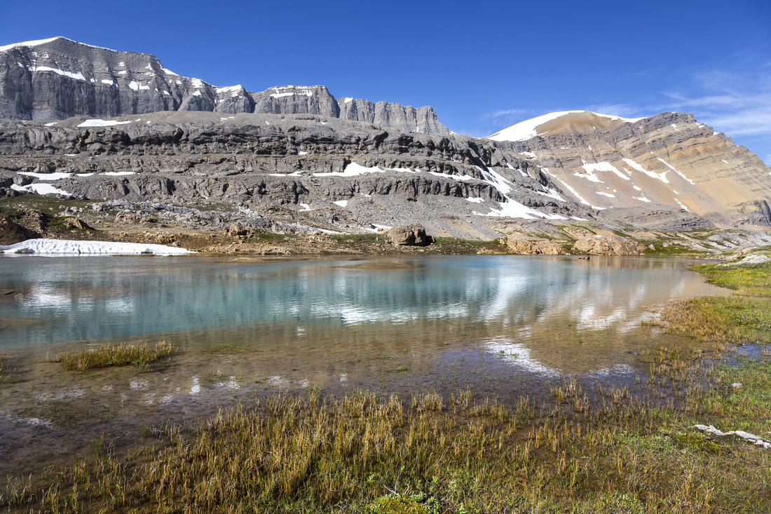
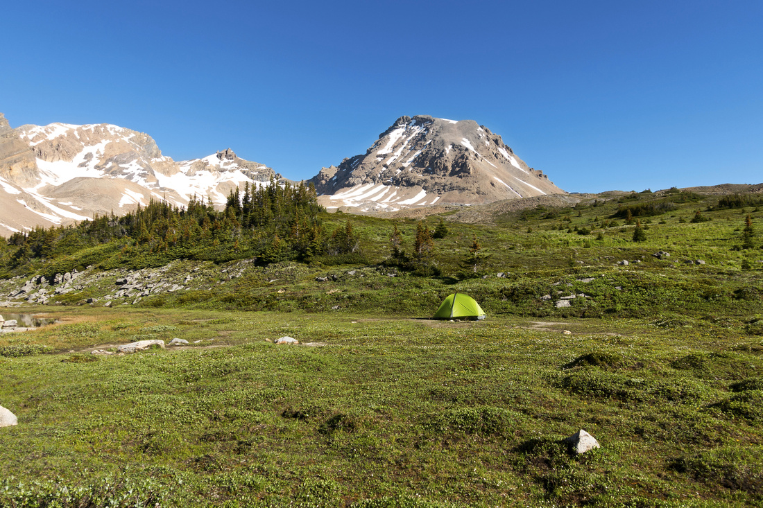
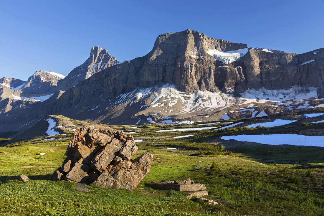
Brazeau Canyon south of Nigel Pass approaching Cataract Pass (low saddle upper center left) |
|||
|
Cataract Pass route into White Goat Wilderness is very special adventure. After hiking Rockies for 25+ years I am not easily taken back by nature beauty, but this was an exception. Most people ironically flock to overhyped JNP Brazeau loop / South Boundary trails, completely unaware of this gem. Initial part is popular Nigel Pass hike where solitude will be hard to find, but after fording Brazeau River below the Pass and leaving main trail you are likely to be on your own. Following Brazeau Canyon upstream is serious scenic overload with eye candies behind every corner. Strong day-hikers can reach large glacial tarn in upper valley below Cataract Pass, but it is far better to backpack. Usual bivi spot is in White Goat at other side of Cataract Pass, already outside National Park, and random camping is permitted. This is an option only for experienced backpackers as you will be completely your own - there are no food shelters, outhouses or picnic tables. Food cache mechanism is a must, and 'leave no trace' has whole new meaning. My visit in late July during exceptionally clear summer of 2020 was over 3 days, with central day spent exploring the area while camping both nights at Cataract Headwaters. This is approach I recommend whenever possible, as it avoids breaking/setting up the camp every day and allows 'luxury' of hiking with light pack only. Detail report and galleries consist of following 3 parts:
Icefields - Nigel Pass - Cataract Headwaters hike, normally done in single day, is split in 2 parts because Nigel Pass is so popular & I thought it might be a good idea to make it a standalone one. I returned the same way but many different options exist for long(er) backpacks and/or loop returns; see part 3 (Cline Pass and Valley of the Lakes) for this discussion. |
| Nigel Pass to Cataract Creek Headwaters | ||
|
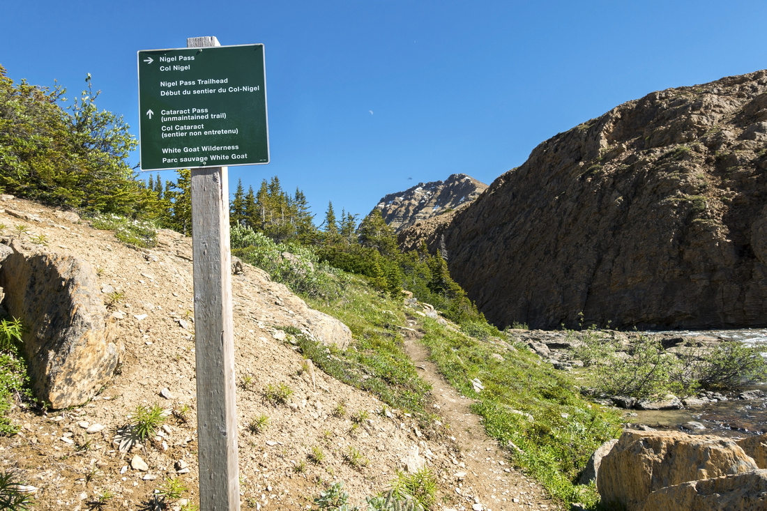
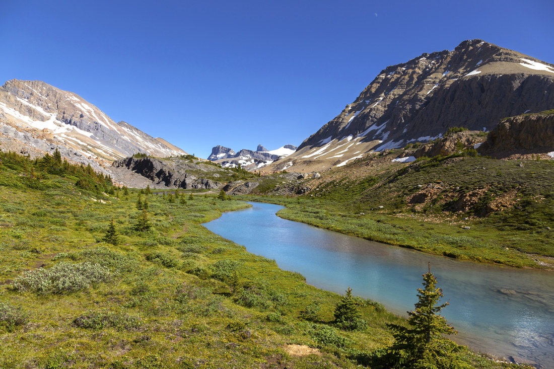
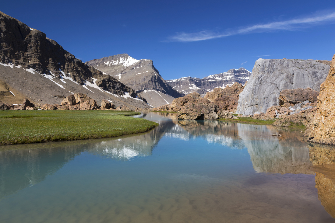
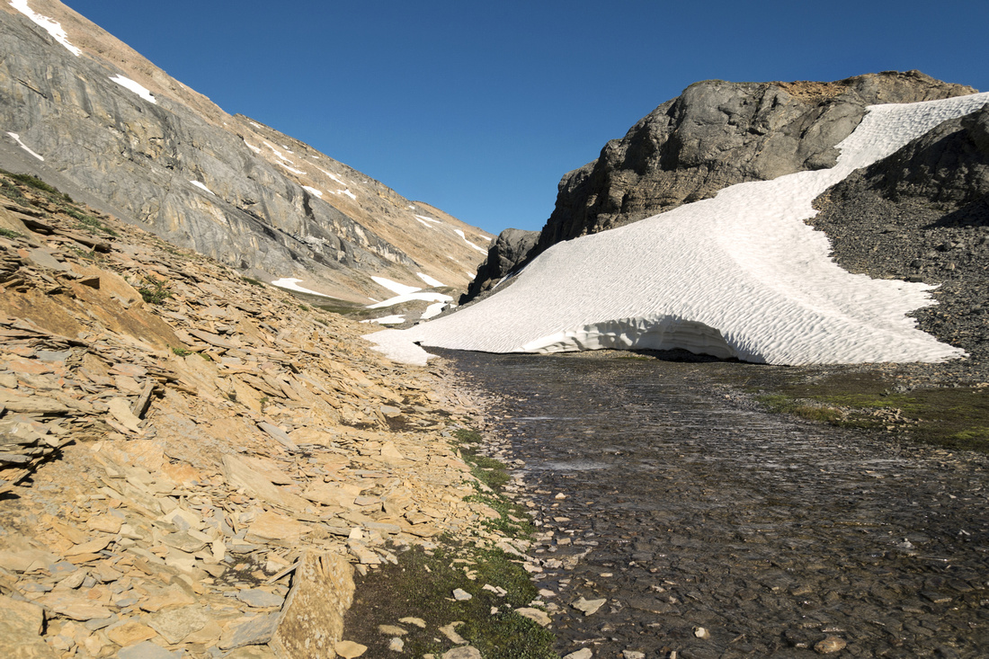
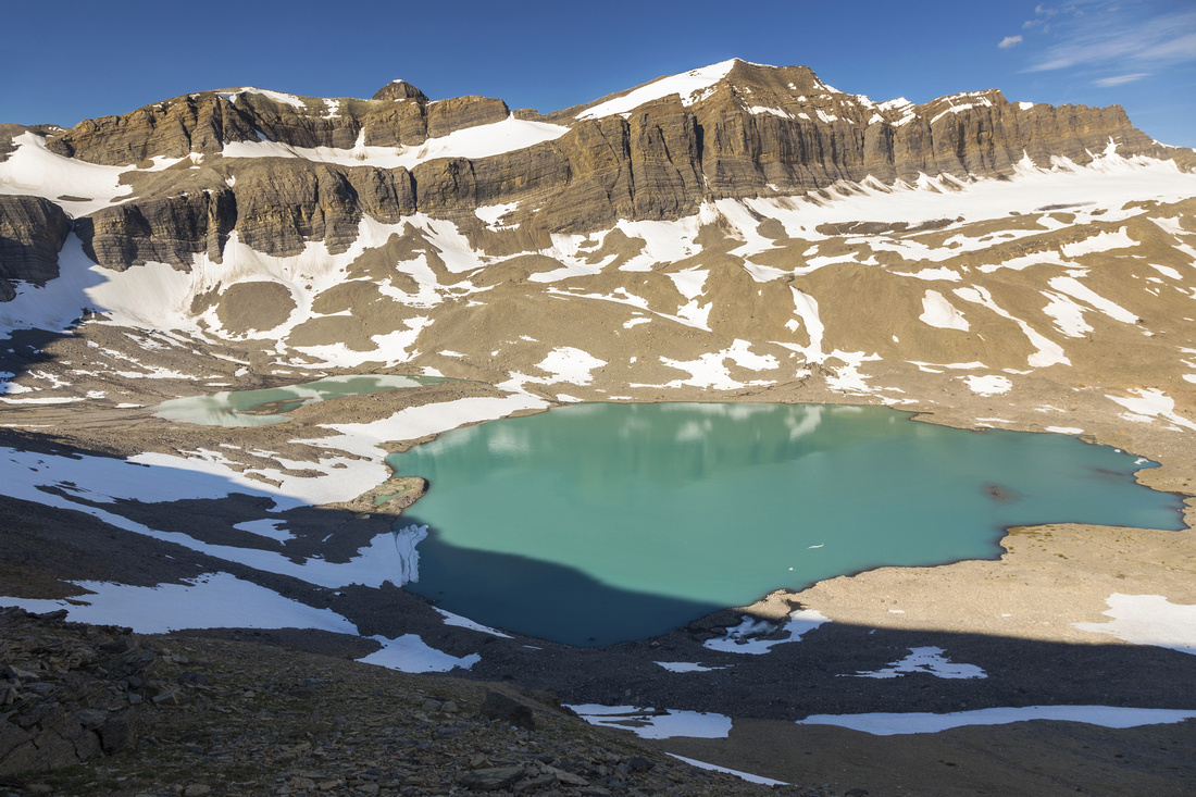
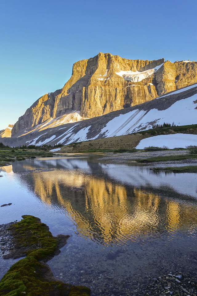
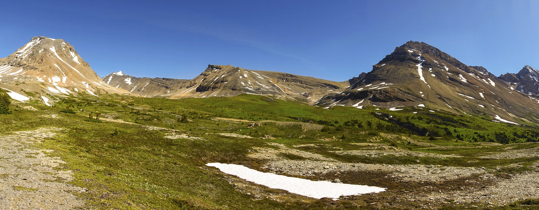
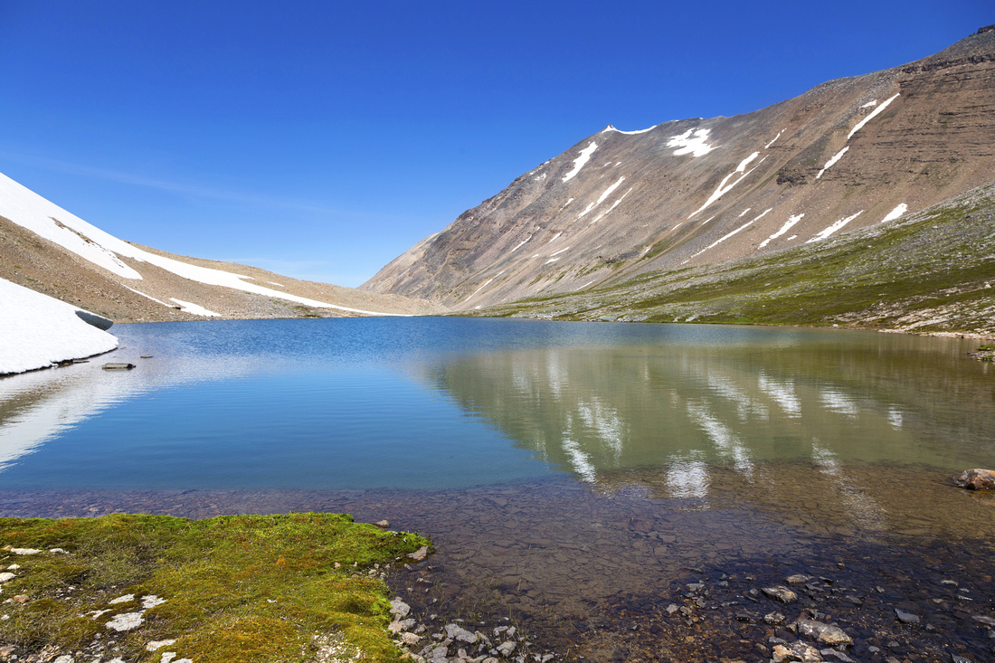
After fording Brazeau river below Nigel Pass, White Goat Wilderness trail turns right by the sign. It is considerably less defined compared to Nigel 'highway', but still easy to follow. It is also much less busy, and you might have it to yourself having left steady stream of backpackers destined for Brazeau Loop/South Boundary Trail behind. Initially Cataract trail climbs above the canyon and within 10 minutes tops on small rise with fabulous views (2nd photo in gallery below) - taste of things to come! From now on this has to be of most scenic hikes in Canadian Rockies. Trail follows left (east) bank of Brazeau River towards Cataract Pass visible in the distance but still fair bit away. After crossing first boulder field (follow cairns) comes potentially confusing bit. Second boulder field bars the way and there appears to be no easy way across. Easiest would probably be just to take boots off and wade for couple of minutes up Brazeau River, but clambering across the boulders is easier than it looks. After crossing this obstacle all difficulties are behind and delightful hiking ahead! Trail generally stays by the river and further up where rock straddles upper valley it follows canyon on the left side. Final bit of scenic overload is directly below Cataract Pass -- glacially fed lake, and ultimate source of Brazeau River. It is a very, very special place and logical turnaround spot for day-hikers. About 1.5 hours from Nigel Pass, one way.
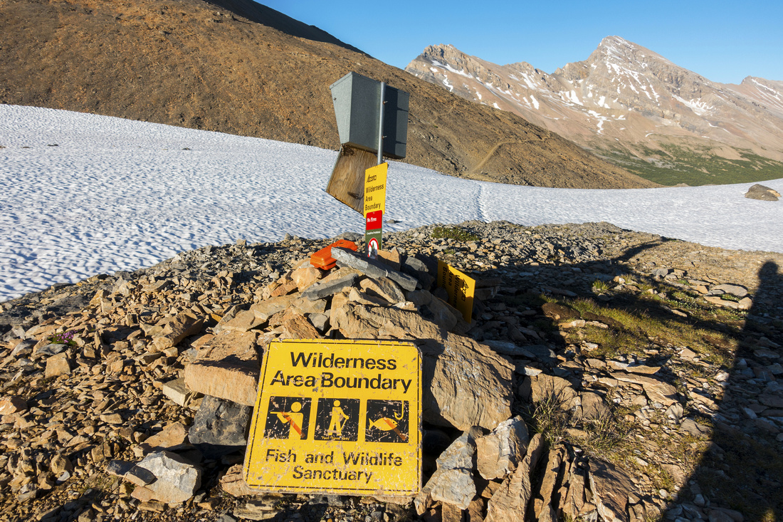
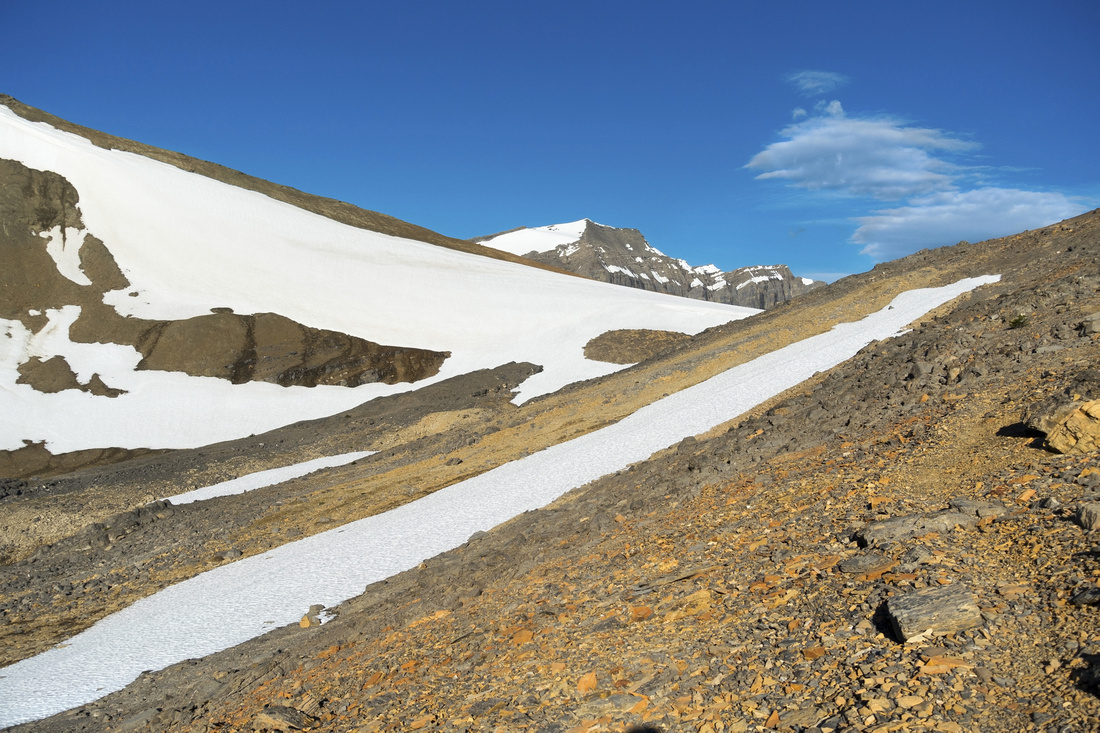
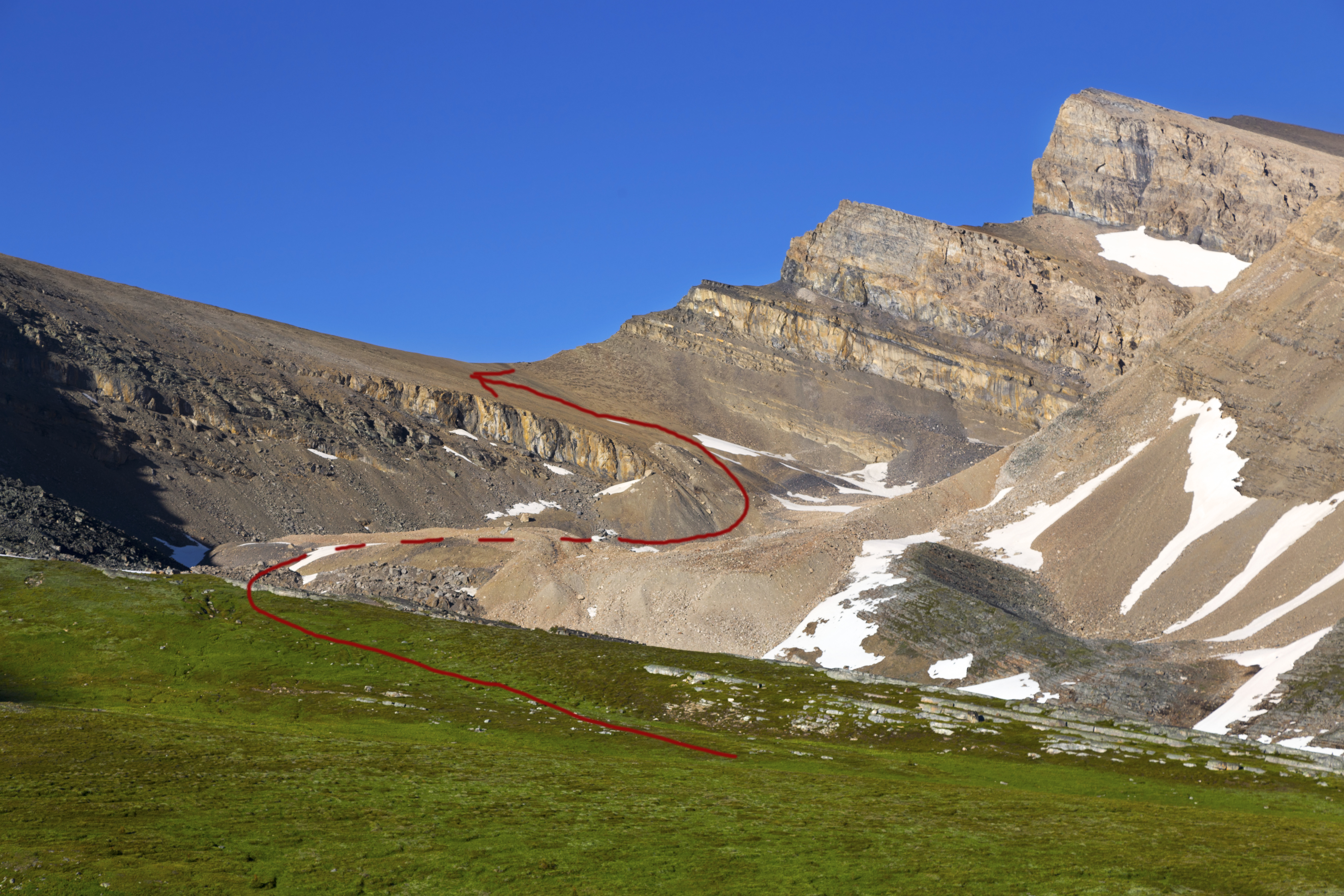
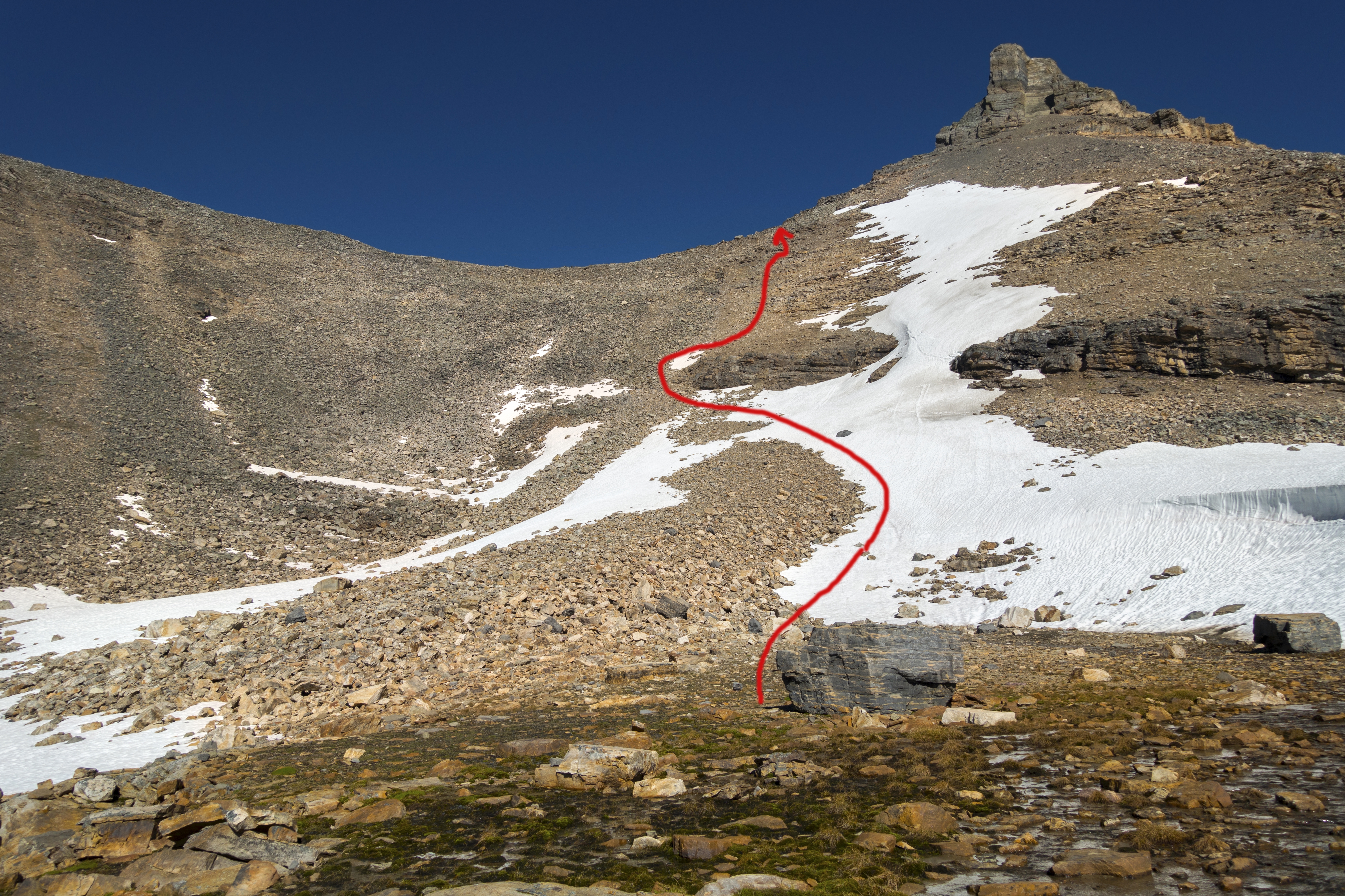
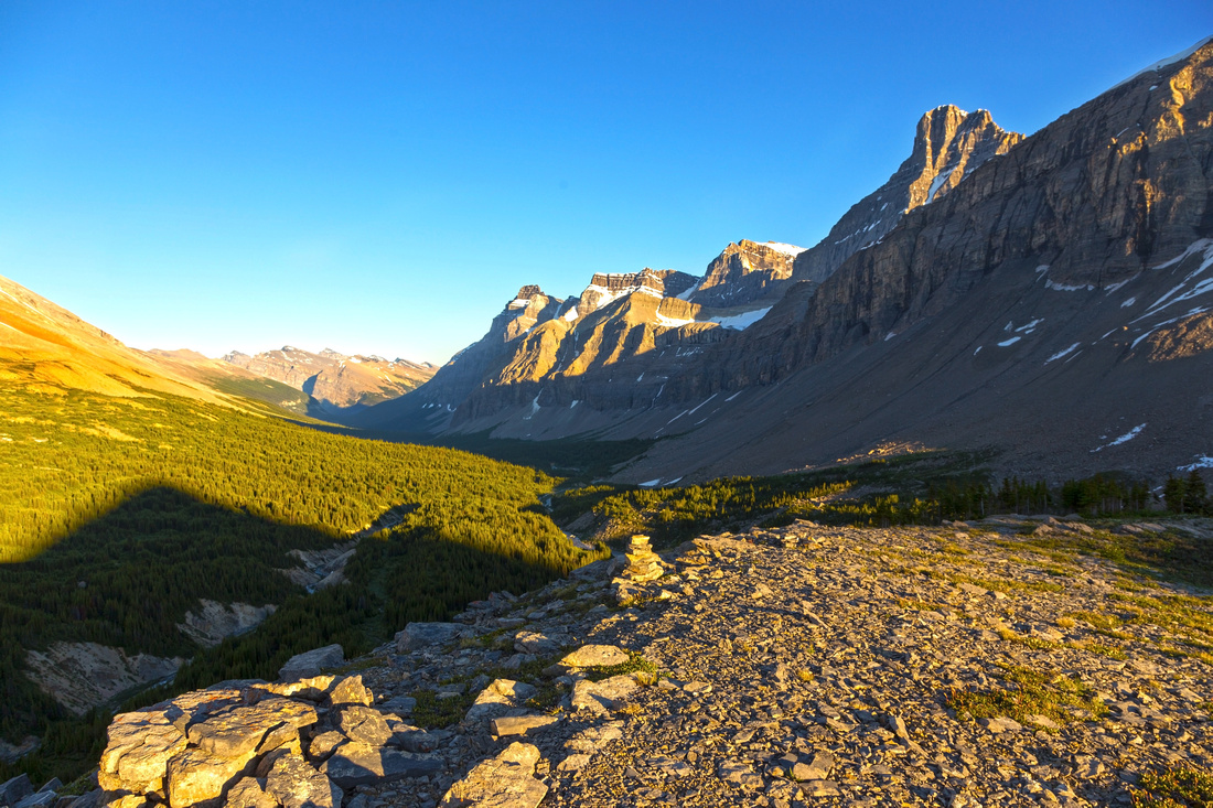
Cataract Pass is reached in another 20-25 minutes climbing up good scree trail rising diagonally to the right. It is easier than it looks from below, even with overnight backpack. The pass is also Jasper National Park boundary (sign); what lies beyond is Alberta White Goat Wilderness where random camping is allowed. Usual bivi spot are meadows in Cataract Creek Headwaters on the east side of the Pass. Trail descends quite gradually for at least a kilometer through barren alpine landscape, then drops quite steeply. Snow patch persist here most of the year and will allow great glissade! Upon descending to the creek pitch tent where you like; best spots are slightly downstream where Cataract creek temporarily sinks underground. Follow right (west) bank for few minutes to get there. Great Divide Trail continues beyond and descends down the valley towards Pinto Lake. |
||
| Gallery | ||
 Cataract Pass Trailhead Cataract Pass Trailhead Marker after Brazeau River crossing below Nigel Pass
 |
|||
 Beautiful Brazeau River
Beautiful meadow ~10 min past the junction as Brazeau canyon briefly opens up. Trail heads up scree / boulder slope on the left side Beautiful Brazeau River
Beautiful meadow ~10 min past the junction as Brazeau canyon briefly opens up. Trail heads up scree / boulder slope on the left side |
|||
 Brazeau River Canyon
Picture perfect calm water of Brazeau river after crossing the boulder slide. Nigel Peak in the distance upper right Brazeau River Canyon
Picture perfect calm water of Brazeau river after crossing the boulder slide. Nigel Peak in the distance upper right |
|||
 Brazeau River Panorama
Mid Part of Brazeau canyon looking towards Cataract Pass distance center. Good trail continues on the left side Brazeau River Panorama
Mid Part of Brazeau canyon looking towards Cataract Pass distance center. Good trail continues on the left side |
|||
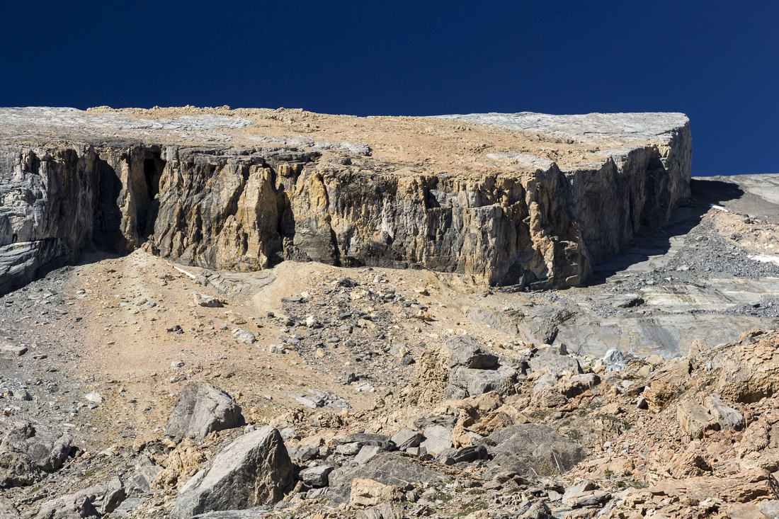 Brazeau Cliffs
Rugged cliffs on Brazeau Canyon east side Brazeau Cliffs
Rugged cliffs on Brazeau Canyon east side |
|||
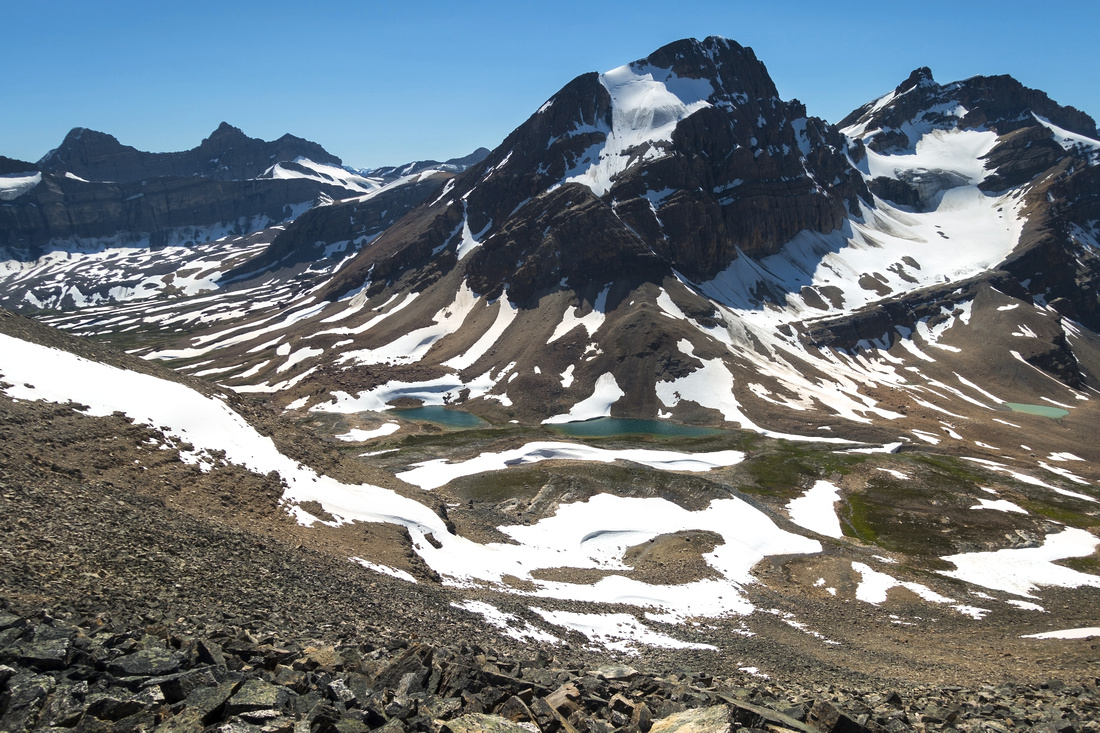
 Upper Brazeau Canyon
Skirting the rock wall straddling the upper valley. Main Brazeau channel stays on the other side Upper Brazeau Canyon
Skirting the rock wall straddling the upper valley. Main Brazeau channel stays on the other side |
|||
 Upper Brazeau Canyon
Looking back towards Nigel Pass area Upper Brazeau Canyon
Looking back towards Nigel Pass area |
|||
 Brazeau River Birthplace
Top of the valley and Brazeau River birthplace Brazeau River Birthplace
Top of the valley and Brazeau River birthplace |
|||
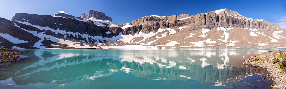 Brazeau River Source
Gorgeous and wider than expected alpine tarn - ultimate source of Brazeau River Brazeau River Source
Gorgeous and wider than expected alpine tarn - ultimate source of Brazeau River |
|||
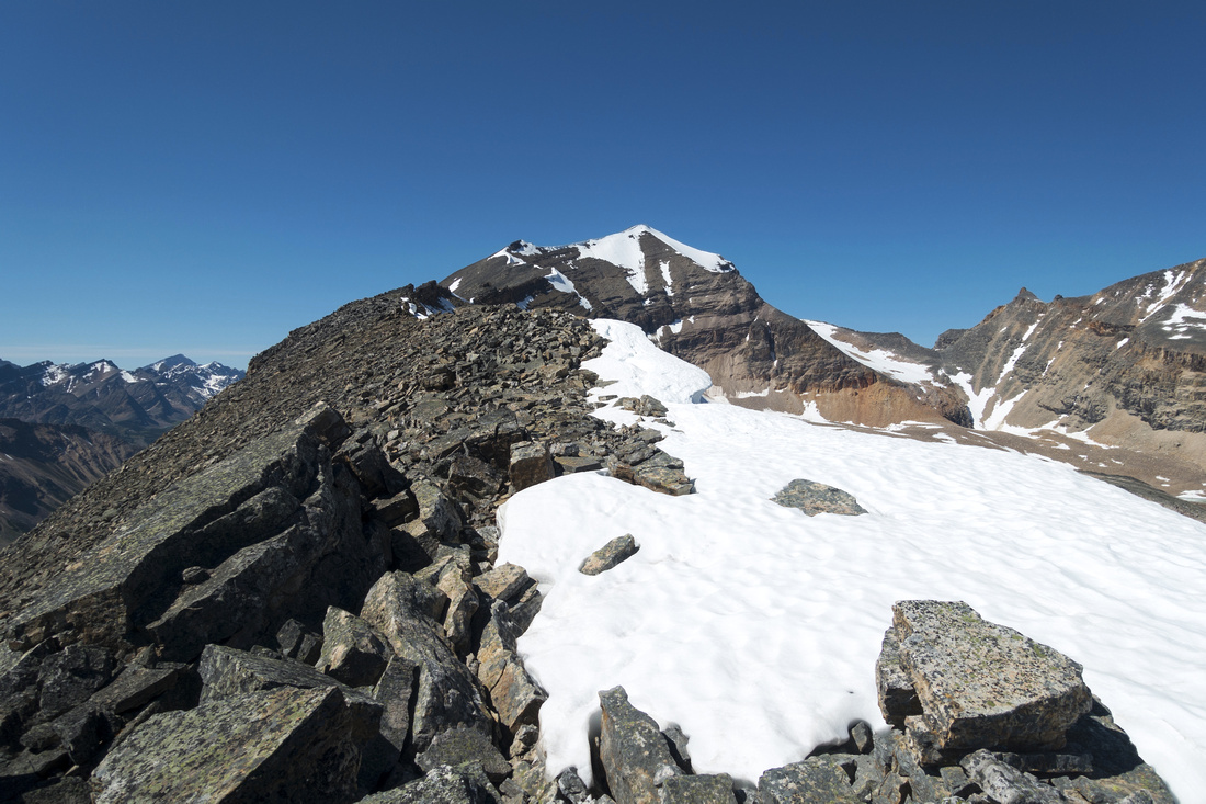
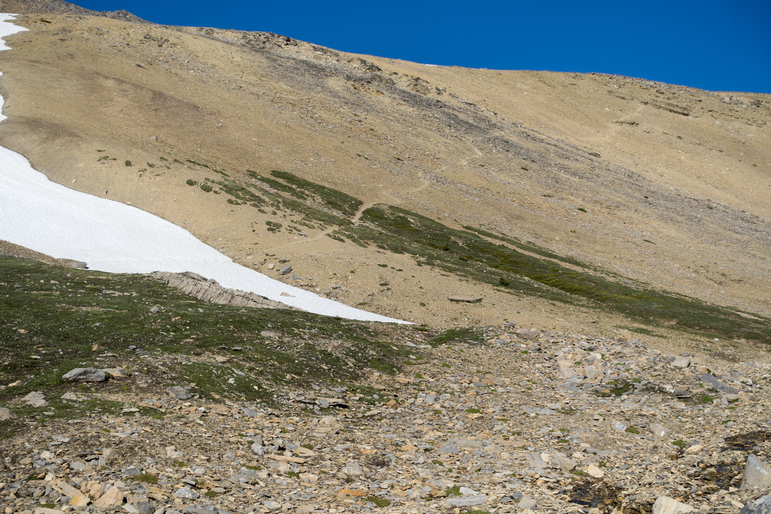 Cataract Pass Route
Talus trail climbing to Cataract Pass from top of valley. Takes 15-20min only to White Goat Wilderness boundary from here Cataract Pass Route
Talus trail climbing to Cataract Pass from top of valley. Takes 15-20min only to White Goat Wilderness boundary from here |
|||
 |
|||
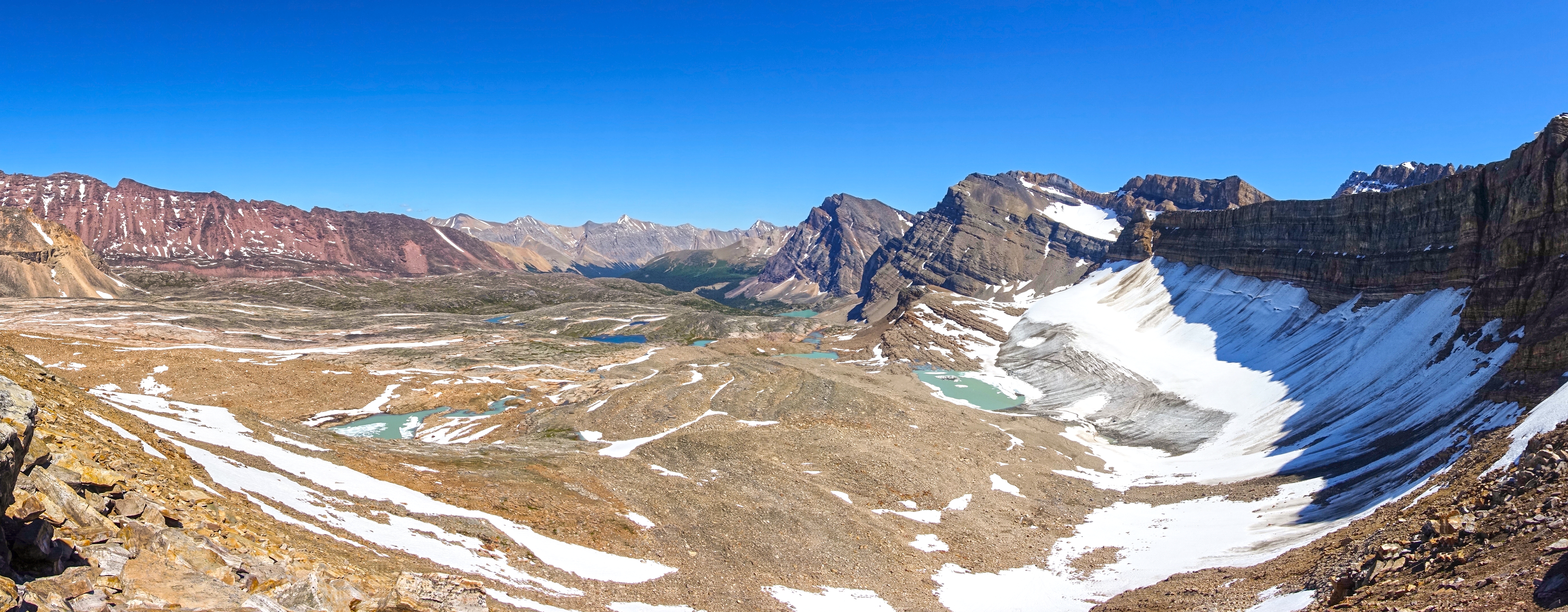
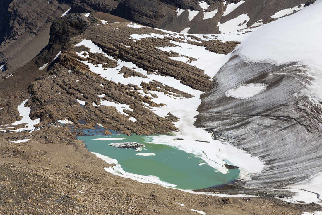
 Cataract Pass Panorama
Aerial view of alpine tarn at top of Brazeau canyon Cataract Pass Panorama
Aerial view of alpine tarn at top of Brazeau canyon |
|||
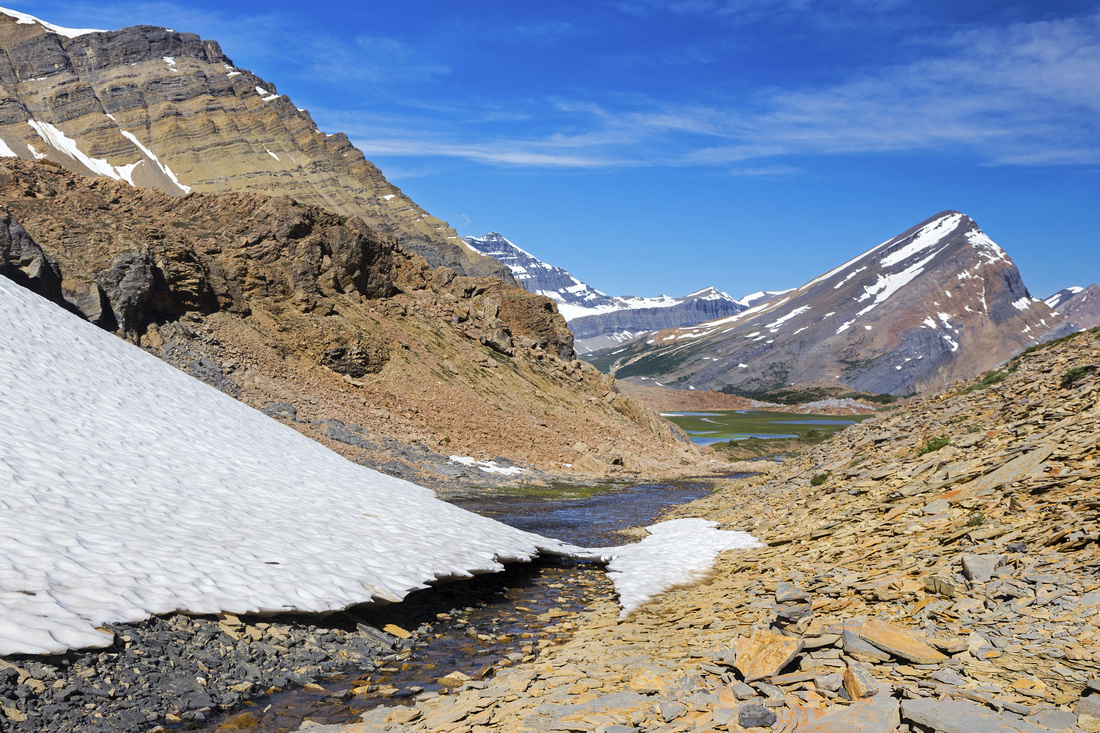
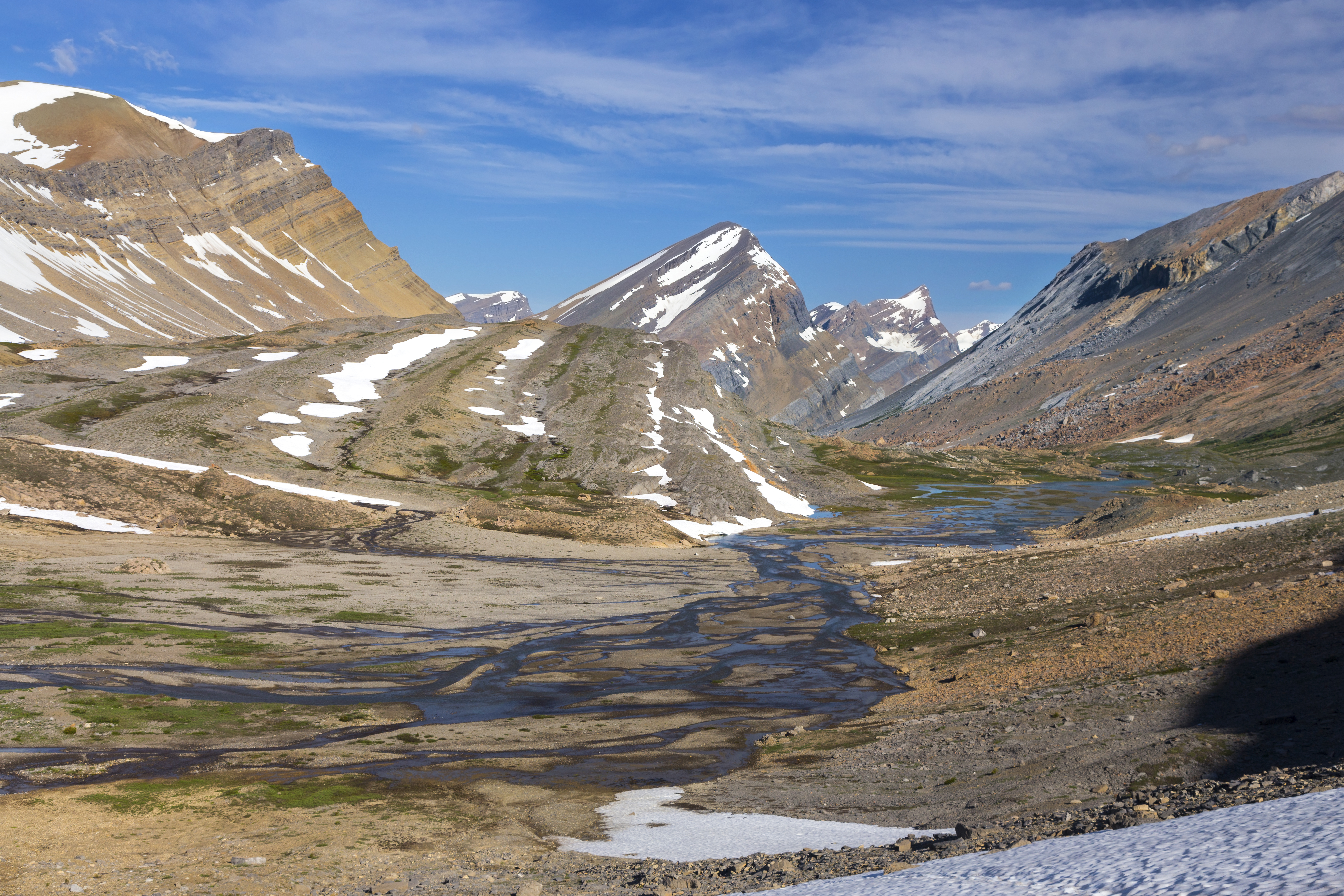
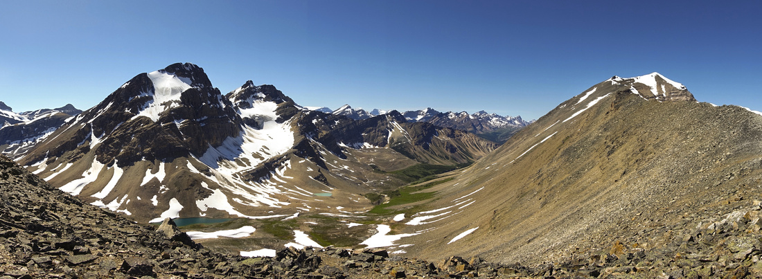
 White Goat Boundary
Entering White Goat Wilderness at top of Cataract Pass. Trail descends gently across barren landscape for ~1km before dropping steeply to Cataract Creek Headwaters. Mt. Stewart upper right White Goat Boundary
Entering White Goat Wilderness at top of Cataract Pass. Trail descends gently across barren landscape for ~1km before dropping steeply to Cataract Creek Headwaters. Mt. Stewart upper right |
|||
 Cataract Pass Descent
View back to Cataract Pass already inside Wild Goat Cataract Pass Descent
View back to Cataract Pass already inside Wild Goat |
|||
 |
|||
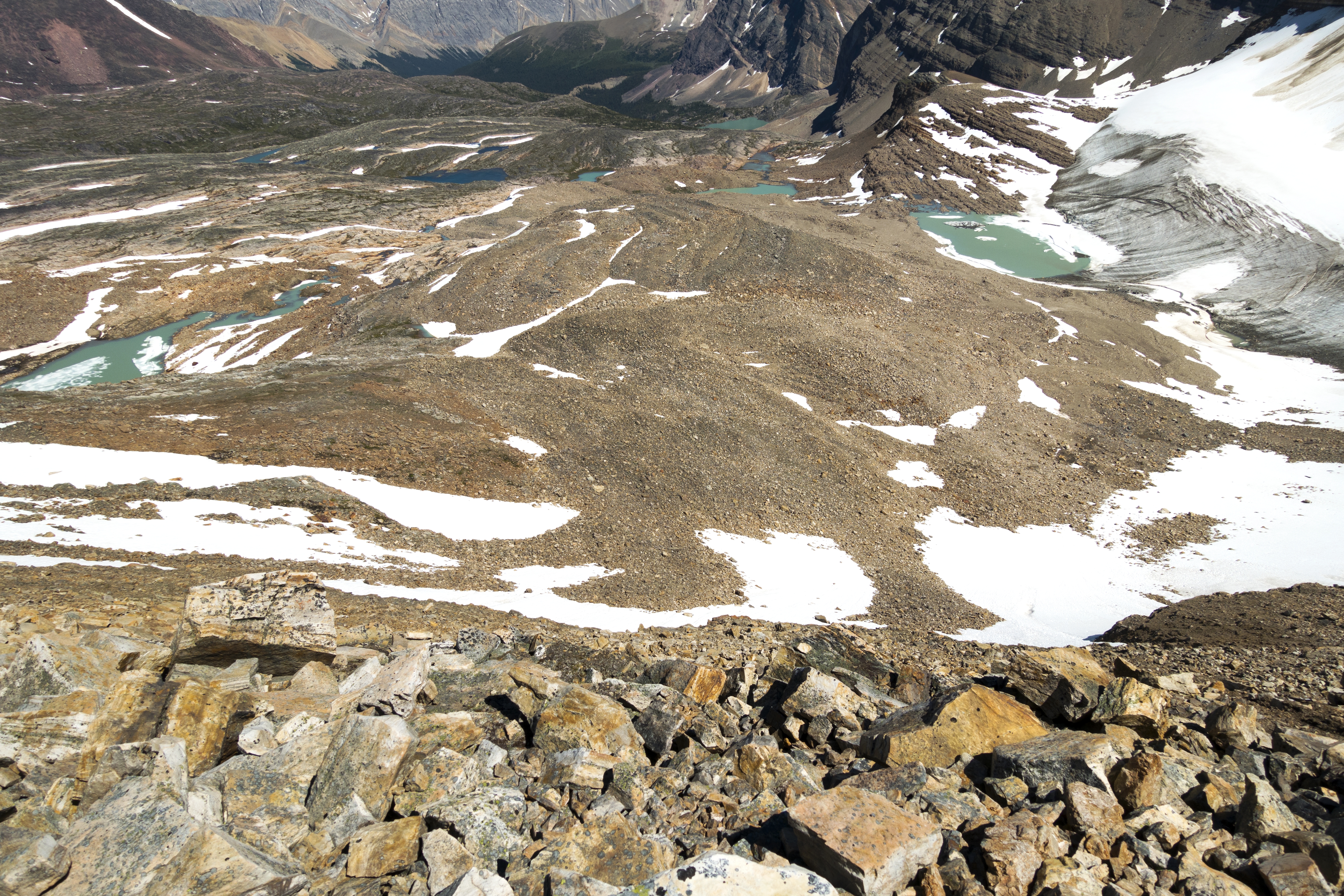
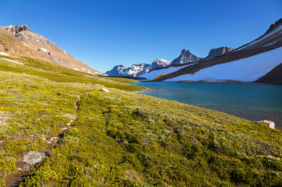
 Infinity Pool
Fabulous Cirrus Wall reflections in upper Cataract Creek near bivi site Infinity Pool
Fabulous Cirrus Wall reflections in upper Cataract Creek near bivi site |
|||
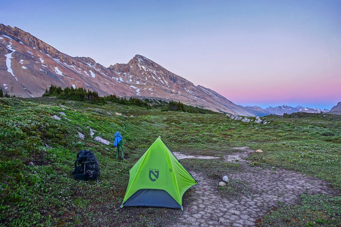 Cataract Bivi Site
Alpenglow at bivi site. Mt. Stewart upper center; distant peaks of Pinto Lake area center right Cataract Bivi Site
Alpenglow at bivi site. Mt. Stewart upper center; distant peaks of Pinto Lake area center right |
|||
| Cline Pass and Valley of the Lakes | |||
|
Many further hiking options exist from Cataract Creek Headwaters bivi site. It would be a shame to return back right away without exploring White Goat Wilderness a bit more. On my trip I decided to wonder fantastic alpine carrying only day pack without specific destination in mind; only real must was peek into remove "Valley of the Lakes" or "Afternoon Lakes Valley". Tentative list of possible destinations:
Some information gathered about exploring beyond Valley of the Lakes: Continuing east one can descend to McDonald Creek, then follow downstream and loop back to Pinto Lake. It is also possible to scramble col above McDonald creek headwaters and drop into Brazeau River valley. Only beta I could find online is this flickr photo album by Rick Collier, sadly without map or much description. Finally, loop option would follow McDonald Creek for few km, then branch west up McDonald Lakes valley and over "Stewart col" down to Cataract headwaters. I have not heard of anyone doing this route, but believe it might go as scramble only. Crux would likely be Stewart col descent; it appears very steep on Google Maps but it might be scree only. Area map, taken from ClubTread post (note dotted lines across Valley of the Lakes and McDonald creek valley): |
|||
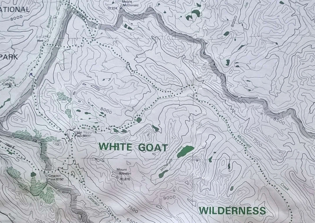 White Goat Map White Goat Map
|
|||
|
Brief description of my hike to Cline Pass and Afternoon Col Scramble:
From Cataract bivi site Cline Pass is ~3km away. There is no trail, but none is needed. It is wonderfully open alpine area with wildflower carpets and bubbling creeks. There was also quite a lot of bear diggings, so be careful! I angled towards top of valley then turned left and descended to Cline Pass, intercepting bit of trail between two lakes at the pass. This would be a nice bivi spot as well, and surprisingly it was bug free, despite more swampy nature of nearby terrain. Afternoon col is directly above and despite appearance going is not straightforward. Boulder field is very lose and there is real danger for ankle sprain or worse. Going in group would likely require climbing helmet. Best option is on climber right. I utilized bit of snowpatch in lower part, then circled around small rock band following bit of 'trail' and scrambled higher. Worst bit was near the top; cairn at Afternoon Col became visible already, but I continued straight up and intercepted ridgeline some ~100m vertical above the col on south side. Again, care is needed even on this ridge as boulders shift and balance is real issue. It will take at least an hour from Cline Pass to Afternoon Col, probably more with overnight pack. Drop from the col into Valley of the Lakes is considerably steeper from Cline Pass side and I could not see all the way to the bottom. On Google Maps there appear to be some cliff bands, but I could not confirm that. Descent on this side with heavy pack would like be quite demanding. After break I continued towards Mt. Willis but this was slow going as well & I eventually decided to call it a day on a nice rise some 30min above Afternoon col. On descent back to Cline Pass I followed mostly the same line and made it down unscathed with some due diligence.
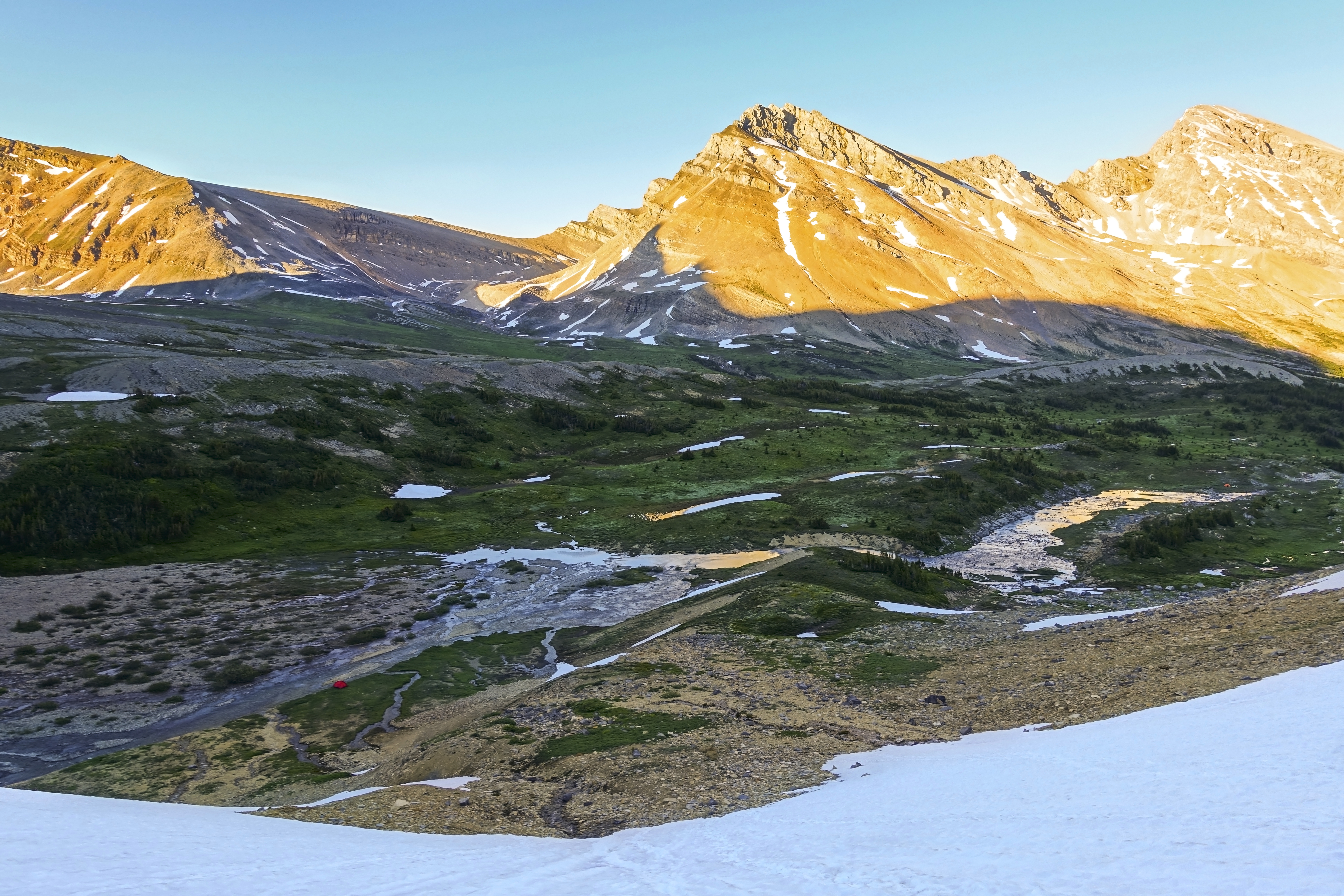
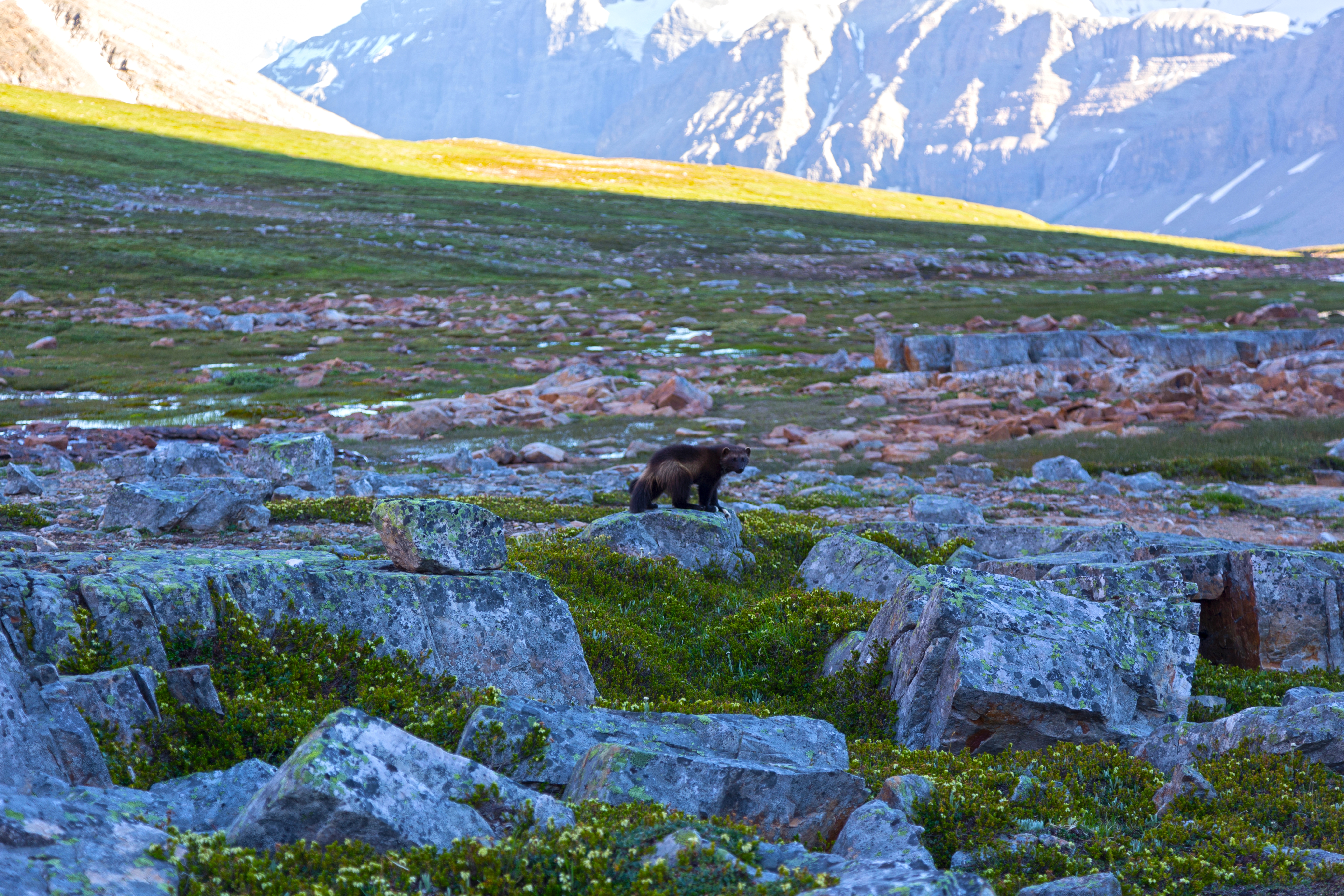
On return back to Cataract bivi I had lucky encounter with group of Wolverines! This was first time I got to see this animal in the wild. They were playing and chasing each other; I watched them for 15-20 seconds before they noticed me and ran away. What a moment! Before dropping back to the camp I decided to hike up small rise looking down Cataract creek and had dinner; it takes only 10-15 min from bivi site and is highly recommended for sunset views. The next day I hiked out retracting my steps from Day 1 via Cataract Pass; Temperatures were high and I abandoned loop return via Cline Canyon in fear of unknown Brazeau River crossing, likely best left for September. Photo Story below: |
|||
| Gallery | |||
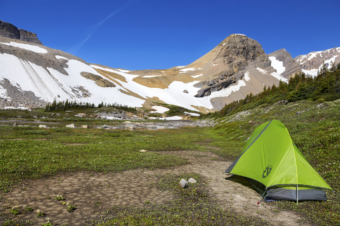 Cataract Bivi Site
Morning at bivi site, looking west towards steep snowy slope below Cataract Pass Cataract Bivi Site
Morning at bivi site, looking west towards steep snowy slope below Cataract Pass |
|||
 Cataract Meadows Bivi
Alternate view of bivi site looking north across alpine meadow leading to Cline Pass. Guardgoat Peak (above tent) is one of few named peaks in the area Cataract Meadows Bivi
Alternate view of bivi site looking north across alpine meadow leading to Cline Pass. Guardgoat Peak (above tent) is one of few named peaks in the area |
|||
 Cataract Meadows Alpine
Beautiful alpine leading to Cline Pass center left Cataract Meadows Alpine
Beautiful alpine leading to Cline Pass center left |
|||
 |
|||
 Cline Pass Tarn
One of two tarns at Cline Pass. Mt. Willis upper center right Cline Pass Tarn
One of two tarns at Cline Pass. Mt. Willis upper center right |
|||
 |
|||
 |
|||
 Cline Pass Panorama
Afternoon Col Pano; Guardgoat Mtn left, Cline river canon (alternate route back to Brazeau) center, Mt. Willis right Cline Pass Panorama
Afternoon Col Pano; Guardgoat Mtn left, Cline river canon (alternate route back to Brazeau) center, Mt. Willis right |
|||
 |
|||
 Valley of the Lakes Glacier
Telephoto of gorgeous glaciated tarn on south side of Valley of the Lakes Valley of the Lakes Glacier
Telephoto of gorgeous glaciated tarn on south side of Valley of the Lakes |
|||
 Mount Willis Ridge
Long ridge leading to Mt. Willis (center). It is much more involved from what this photo might suggest as shifting boulders persist throughout and require extreme care. Cliff band upper center left needs to be bypassed on climber left. Low "V" saddle on horizon at right side of photo is potential route into Valley of the Lakes from Brazeau side Mount Willis Ridge
Long ridge leading to Mt. Willis (center). It is much more involved from what this photo might suggest as shifting boulders persist throughout and require extreme care. Cliff band upper center left needs to be bypassed on climber left. Low "V" saddle on horizon at right side of photo is potential route into Valley of the Lakes from Brazeau side |
|||
 Cline Pass Aerial View
View back down to Cline Pass. Once again easiest route is skier left Cline Pass Aerial View
View back down to Cline Pass. Once again easiest route is skier left |
|||
 Cline Pass Alpine
Hiking back past upper Cline Tarn after descent in gorgeous afternoon sunshine Cline Pass Alpine
Hiking back past upper Cline Tarn after descent in gorgeous afternoon sunshine |
|||
 Cline - Cataract Alpine
Descending towards Cataract bivi site with superb late afternoon lighting of imposing Cirrus Wall Cline - Cataract Alpine
Descending towards Cataract bivi site with superb late afternoon lighting of imposing Cirrus Wall |
|||
 |
|||
 Cataract Creek Valley
Cataract Creek valley from rise above bivi site (note cairn). Trail on skier right side of the valley links with Pinto Lake and is part of Great Divide Trail Cataract Creek Valley
Cataract Creek valley from rise above bivi site (note cairn). Trail on skier right side of the valley links with Pinto Lake and is part of Great Divide Trail |
|||
Abstract (Icefields to Cataract Creek Headwaters Bivi Site)
| Overall Difficulty | D4 | Gentle hiking on official Parks trail to Nigel pass followed by Brazeau Canyon route. One awkward boulder field crossing with some class 2 scrambling. Talus slope on Cataract Pass ascent with possibility of steep snow on Cataract Headwaters descent on the other side of the pass | |||
| Snow Factor | S3 | Trip could be skied in winter (too long for snowshoes). Descent from Cataract Pass on east side is steep and snow persists most of the year | |||
| Scenery | Spectacular Brazeau River canyon. Prime Icefields scenery with meadows, tarns and glaciers. Seldom visited White Goat Wilderness | ||||
| Trail/Marking | Very Good / Fair | Official and maintained Parks Canada trail with signposts to Nigel Pass (first part of Brazeau Loop). Unofficial route with cairns beyond. Some confusing boulder field crossings in lower Brazeau canyon | |||
| Suggested Time | 6 hr | One way from Icefields Parkway to Cataract Creek headwaters bivi site. 8 hrs return time if dayhiking just to tarn below Cataract Pass | |||
| Elevation | Start: 1930m Max: 2500m (Cataract Pass) Total: (+735m)(-415m) (Cataract Headwaters) | 16 km (Cataract Headwaters one-way) | |||
| Gear | Full hiking boots with gaiters and poles. Food storage (containers, ursacks, etc.) for Cataract Headwaters bivouac with standard backpacking gear | ||||
| Water | Brazeau River and side streams. No need to carry more than 1L at any time | ||||
| Dog Friendly | Yes | Consider not bringing dogs for overnight trips into Wild Goat Wilderness; fine if day-hiking only to tarn at top of Brazeau Canyon valley | |||
 Cataract Pass GAIA Map
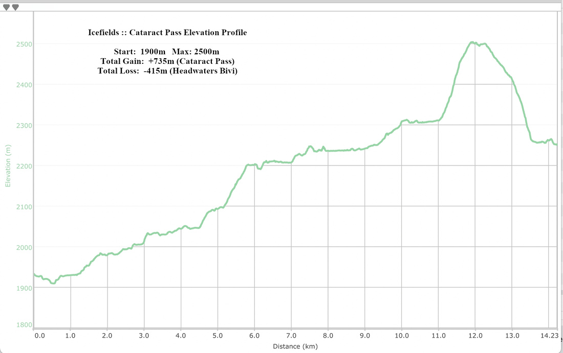 Cataract Pass Elevation Profile