Google Map |
Rockies :: Banff-Louise :: Muleshoe Ridge |
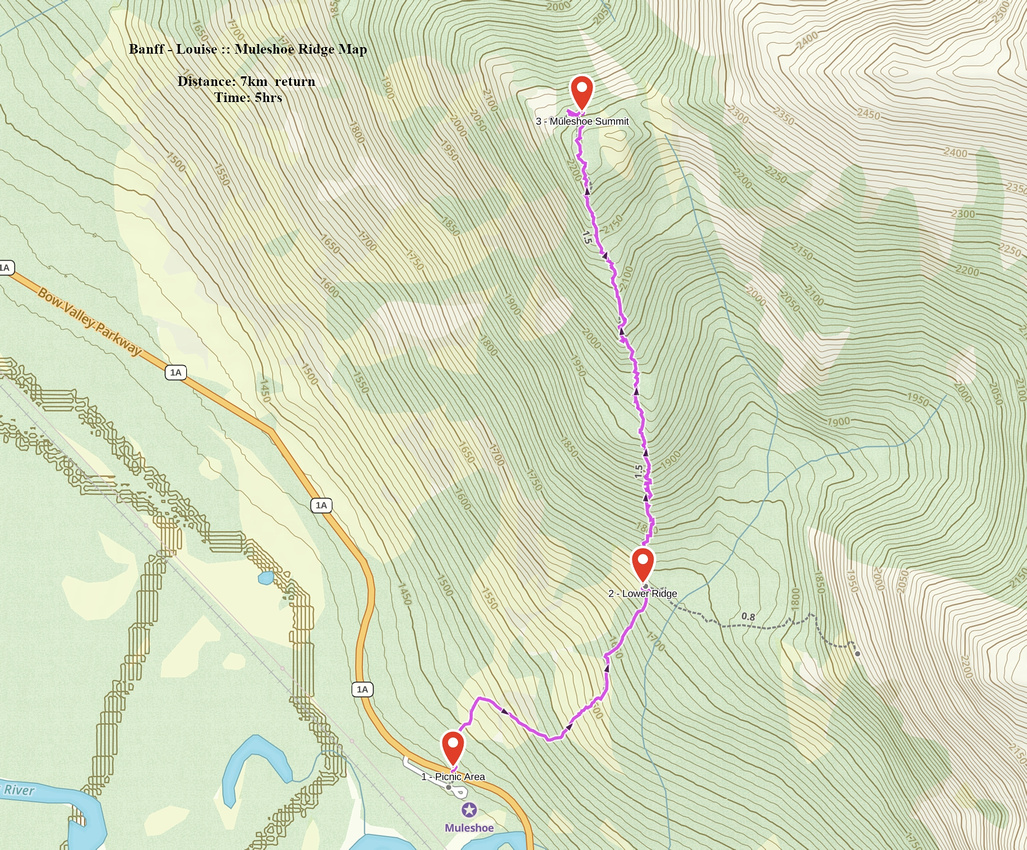
GPS Track |
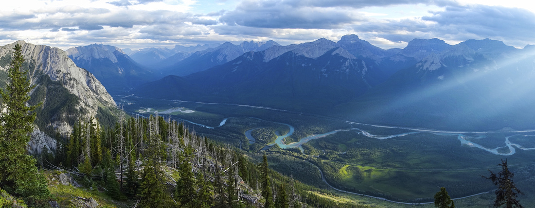 
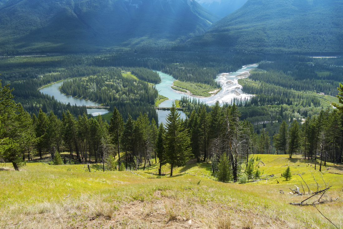
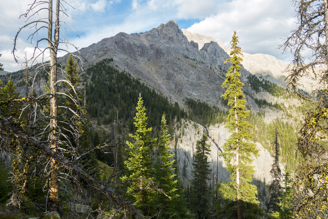
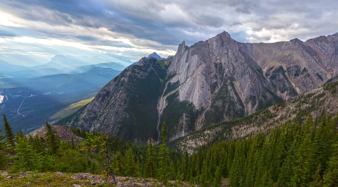
Panoramic view of Bow Valley from upper part of Muleshoe Ridge, past the deadfall. Oxbow to which ridge owes its name is lower center |
|||
| Trip Summary | |||
August 9, 2021
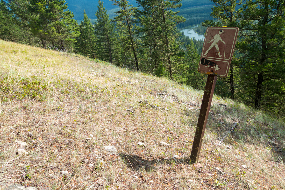
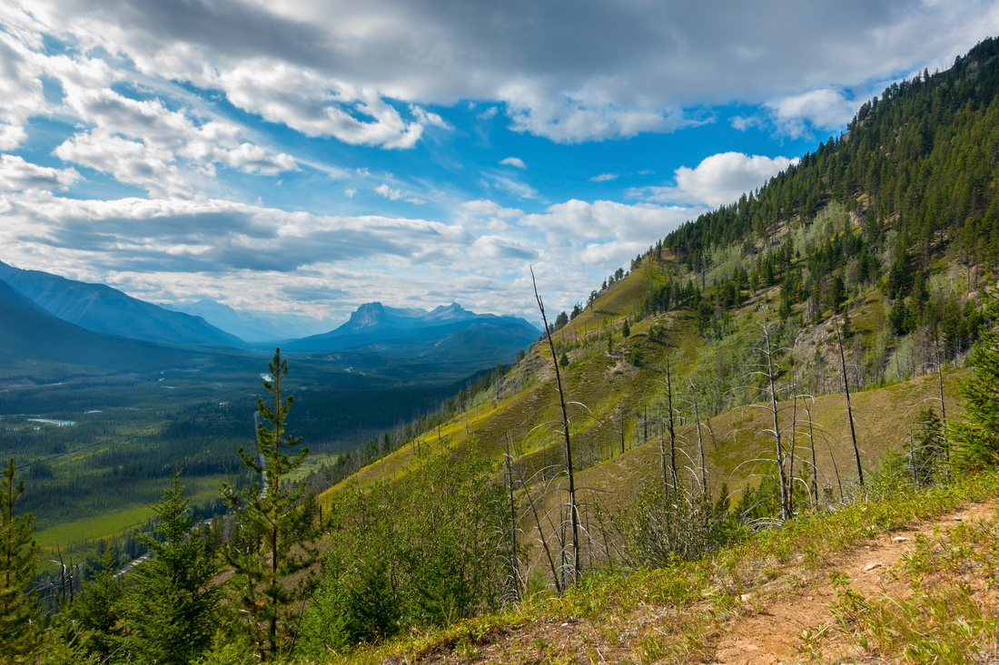
Muleshoe Ridge is west outlier of Mt. Cory. It owes its name to Bow River Oxbow directly below. Ridge is visible nicely on east side as one drives past Sunshine turnoff towards Lake Louise. Parks Canada have built nice picnic area along 1A highway, but as this road faces at least semi-permanent closure it is largely unused now. Trail is mentioned in Patton/Robinson Canadian Rockies Trail Guide, but authors advise turning back at Muleshoe Meadows after "255 meters of relentless climb". If you continue further up, views will improve considerably but going is not easy. Entire ridge is very steep and although there is defined trail most of the way, it is more or less straight up with little switchbacks; this grade becomes quite taxing at knees on descent. Deadfall in upper ridge significantly impedes the progress, but is manageable. Highpoint is forested, but short drop to opening on north side grants fab views of Bow Valley. It is possible to continue across intervening saddle to talus slopes below Mt. Corry, although this way does not connect all the way to the summit (peakbaggers use published Kane route instead). Ridge is entirely dry - closest drinking water is ~2km along 1a towards Banff (good spot to fill-up when cycling).
Drive or cycle Bow Valley Parkway for ~5km from Banff side to signed Muleshoe Picnic Area. Trail starts opposite Washroom on other side of the road and might be hard to find in summer as area is getting quite overgrown. After crossing stand of Aspen trees trail gets better defined; it turns right and climbs old reclaimed slopes to old weathered hiking sign, then charges straight up to Muleshoe Meadows. This is very pleasant stretch but after passing by junction with cairn (right branch descends to canyon and is climber access route), grade resumes. Turn back here if short on time. After reaching upper part grade mellows, but significant deadfall develops. Initially it is bypassed on climber right, but soon you are forced back to the ridge and must navigate this mess. Use caution as there are lots of hard dry spikes that can puncture your skin. Finally bypass obvious rock outcrop past all difficulties on the left side and reach forested highpoint. Descend a bit north to opening and enjoy great views of Bow Valley, with landmark "Finger" directly across. Return the same way |
|
Gallery |
|||
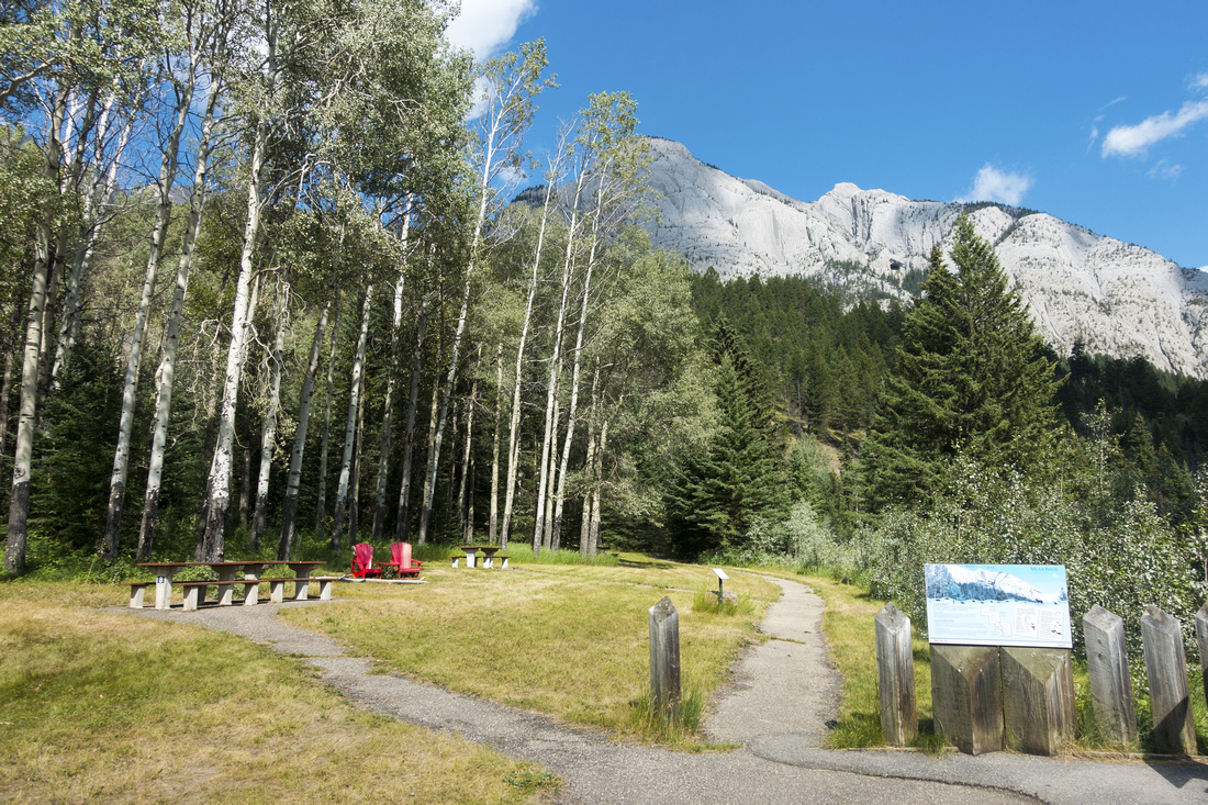 Muleshoe Picnic Area
 below Bow Valley Parkway. Walk back to the road and find trail start directly opposite the Restroom Muleshoe Picnic Area
Muleshoe Picnic Area below Bow Valley Parkway. Walk back to the road and find trail start directly opposite the Restroom |
|||
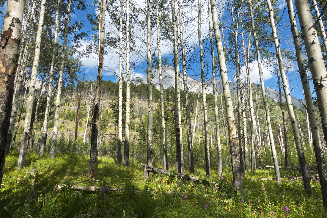 Aspen Forest
Starting up stand of Aspen trees above Muleshoe Picnic Area. Trail traverses grassy slopes to the right, then heads straight up to Muleshoe Meadows Aspen Forest
Starting up stand of Aspen trees above Muleshoe Picnic Area. Trail traverses grassy slopes to the right, then heads straight up to Muleshoe Meadows |
|||
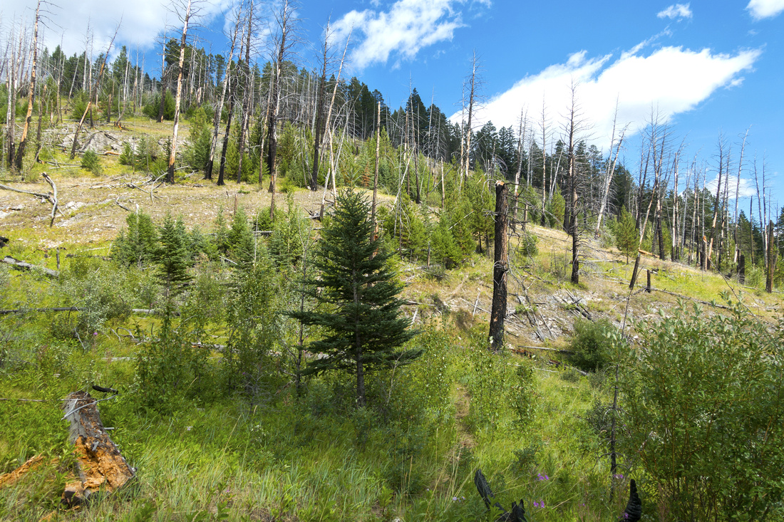 Old Burn Reclamation
Old prescribed burn area getting slowly reclaimed with young growth Old Burn Reclamation
Old prescribed burn area getting slowly reclaimed with young growth |
|||
 Hiking Sign
Weathered Hiking Sign looking back. Trail climbs steeply to Muleshoe Meadows Hiking Sign
Weathered Hiking Sign looking back. Trail climbs steeply to Muleshoe Meadows |
|||
 The Oxbow
Bow River Oxbow comes into view The Oxbow
Bow River Oxbow comes into view |
|||
 Bow Valley
Northerly views of Bow Valley Corridor at start of Muleshoe Meadows. Castle Mtn area distance center Bow Valley
Northerly views of Bow Valley Corridor at start of Muleshoe Meadows. Castle Mtn area distance center |
|||
 Muleshoe Meadows
Pleasant Hiking approaching start of Muleshoe Ridge. Canadian Rockies Trail Guide advises turning back here, but if you continue views will get much better higher up Muleshoe Meadows
Pleasant Hiking approaching start of Muleshoe Ridge. Canadian Rockies Trail Guide advises turning back here, but if you continue views will get much better higher up |
|||
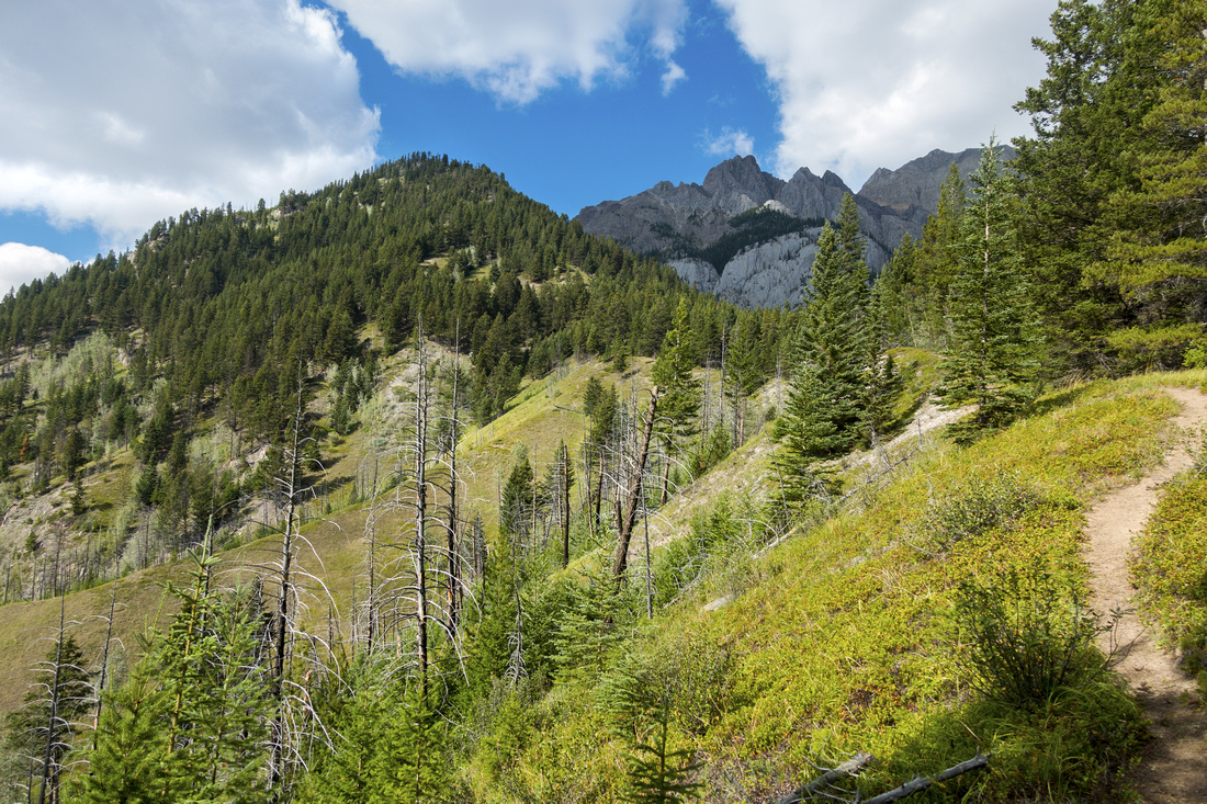
 Mt. Cory
View of Mt. Corry approaching upper part of Muleshoe Ridge Mt. Cory
View of Mt. Corry approaching upper part of Muleshoe Ridge |
|||
 Overgrown Area
Start of Overgrown area with lots of deadfall Overgrown Area
Start of Overgrown area with lots of deadfall |
|||
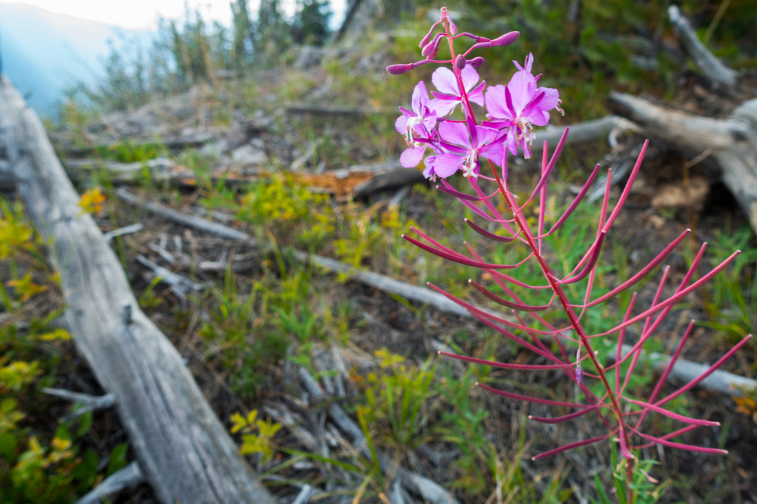 Fireweed Blossom
Abundant Fireweed Blossoms while navigating the Deadfall Fireweed Blossom
Abundant Fireweed Blossoms while navigating the Deadfall |
|||
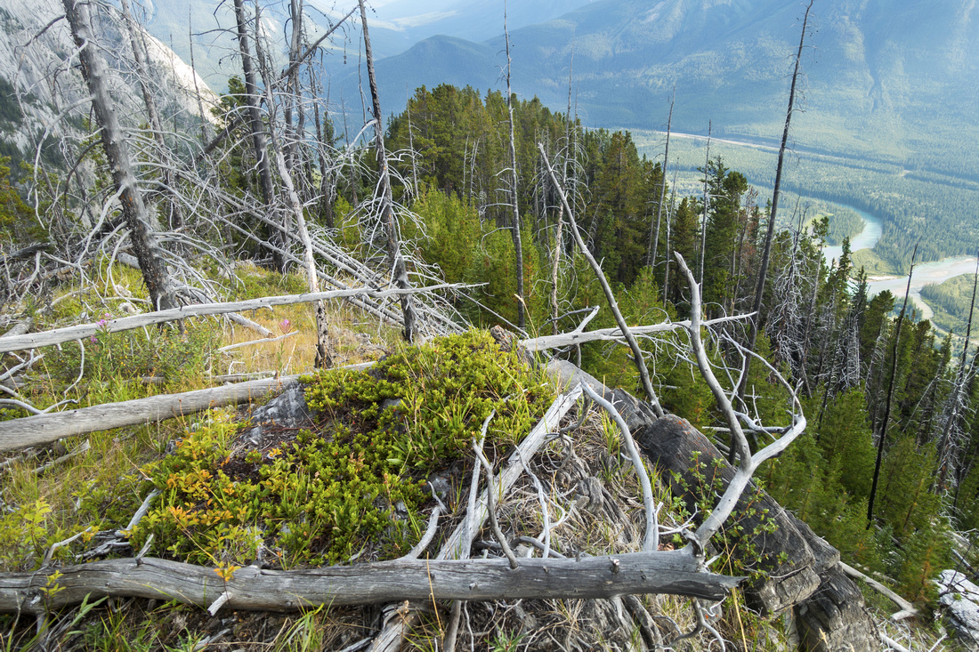 Deadfall Area
Looking back at end of Deadfall area; this photo does not reveal the worst Deadfall Area
Looking back at end of Deadfall area; this photo does not reveal the worst |
|||
 Rock Outcrop
Bits of trail navigate this rock outcrop to the left. Ridge highpoint is ~5 min from here Rock Outcrop
Bits of trail navigate this rock outcrop to the left. Ridge highpoint is ~5 min from here |
|||
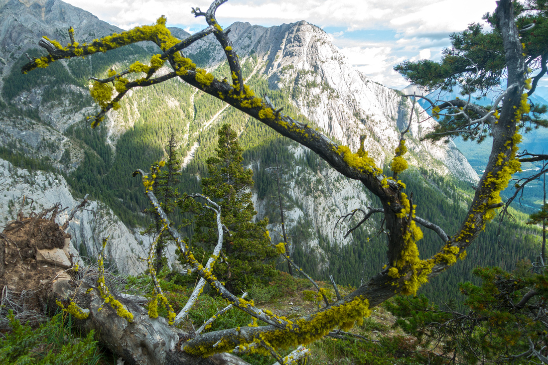
 Summit Views
Northerly views from clearing just below forested ridge highpoint with landmark "Finger" in center Summit Views
Northerly views from clearing just below forested ridge highpoint with landmark "Finger" in center |
|||
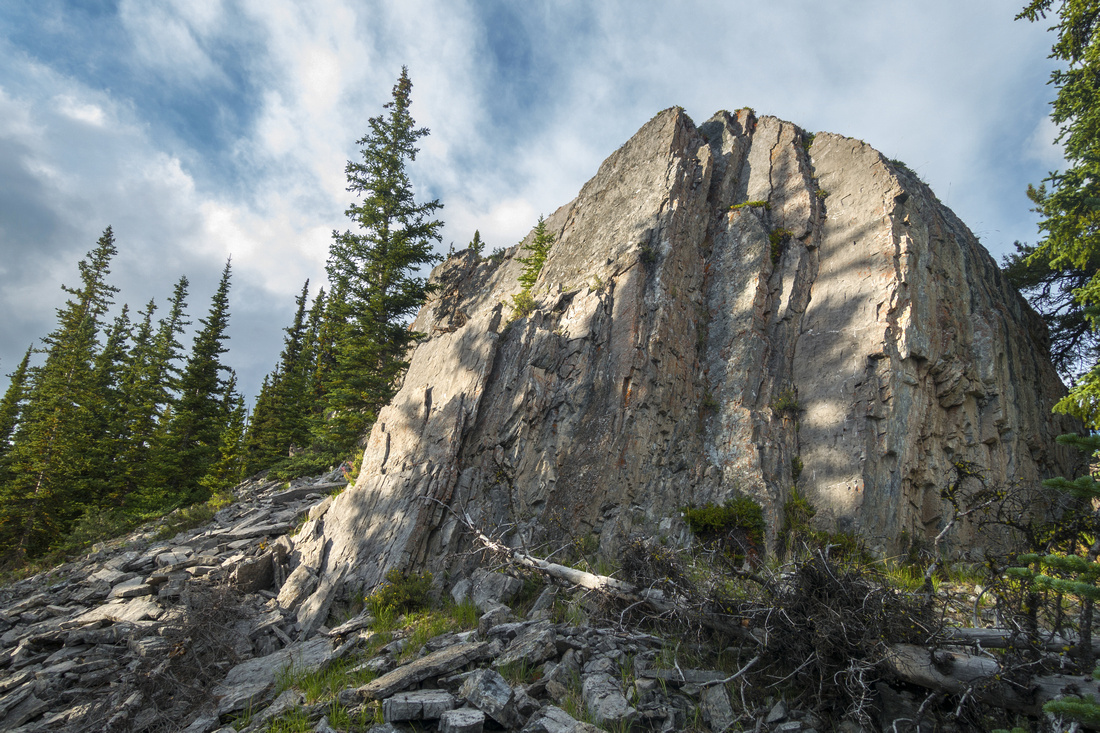
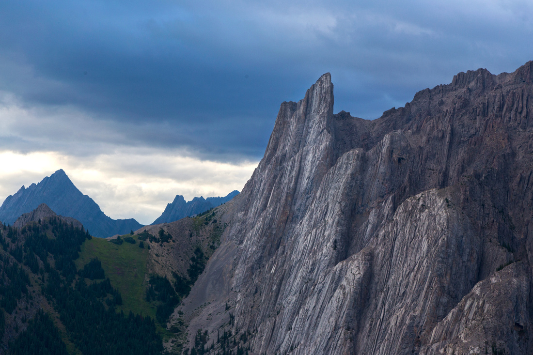 The Finger
Closer look at "The Finger" with rock strata typical for Rockies Front Ranges The Finger
Closer look at "The Finger" with rock strata typical for Rockies Front Ranges |
Abstract
|
Overall Difficulty |
Very steep trail with some eroded parts. Difficult area criss-crossed with deadfall in upper ridge |
||||
|
Snow Factor |
Little avalanche danger due to forested slopes, but terrain is steep. Deadfall in upper ridge will make snowshoe travel difficult |
||||
|
Scenery |
Great views of Bow Valley and Sunshine area Peaks. Close-up of Mt. Cory west side |
||||
|
Trail/Marking |
Poor/None |
Faint trail in the beginning with no trail sign (as of summer '21), improves higher up but disappears in upper ridge |
|||
|
Suggested Time |
5 hrs |
Add 1-2 hrs if venturing further up Cory Ridge. Does not include cycling time if Bow Valley Parkway is closed to vehicle traffic |
|||
|
Elevation |
Start: 1430m Max: 2215m Total: ~850m |
Round Trip: 7km | |||
|
Gear |
Full hiking boots preferred to day-hikers. Poles very helpful on descent. Gaiters might help while crossing deadfall, but not required |
||||
|
Water |
No source of water - carry at least 2L |
||||
|
Dog Friendly |
Yes |
Standard Back-country precautions |
|||
 Muleshoe Ridge GAIA Map
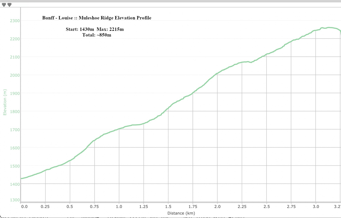 Muleshoe Ridge Elevation Profile