Google Map |
BC Coast :: North Shore :: Hanes Crossover |
GPS Track |
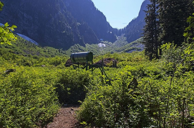 
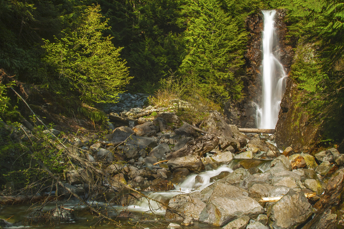
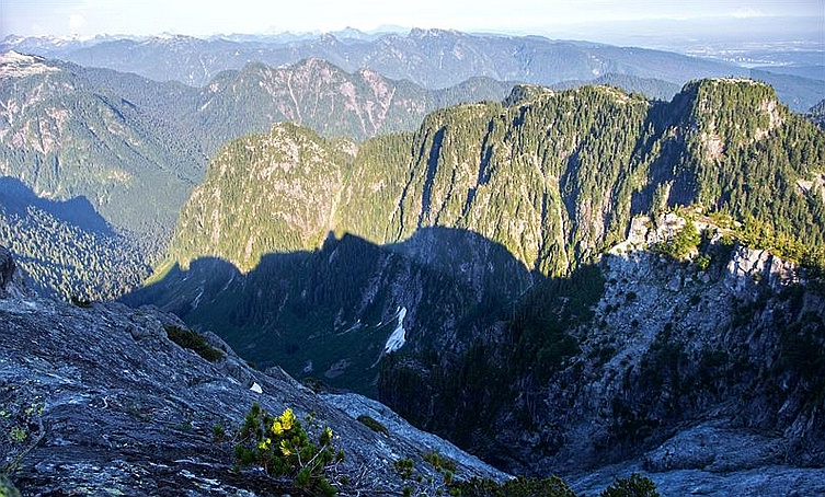
North Shore Rescue Cache as trail reaches Hanes Valley treeline. Crown Pass just right of upper center is much farther than it looks |
|||
| Trip Summary | |||
August 9, 2013
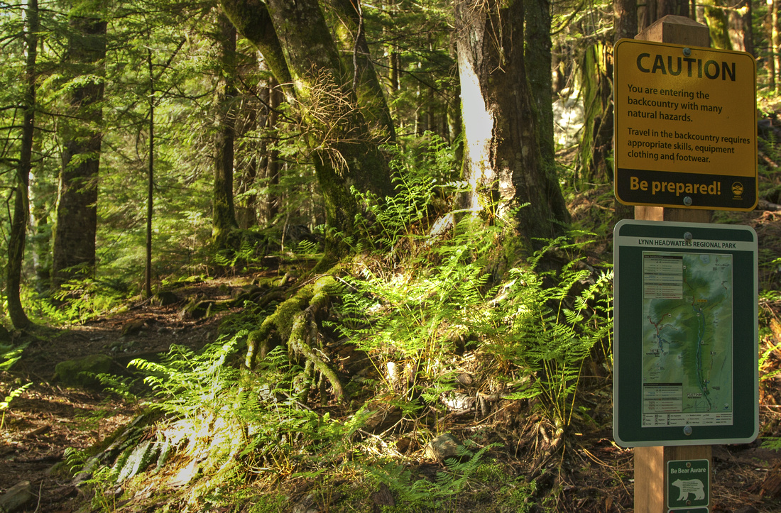
1-way traverse between two main North Shore hubs and way more difficult than one might initially expect. Hanes valley is amazing wilderness at doorstep of major metropolitan city, but do not underestimate the route -- unprepared hikers, lulled by easy start got lost and needed to be rescued. Lynn Creek crossing is non-trivial and at certain times of the year even impossible - check conditions and plan your timing accordingly. Hike can be done in either direction but Lynn - Grouse is much preferred for couple of reasons: 1) Boulder field in upper Hanes valley is much easier to ascend than descend 2) If not being able to cross Lynn creek, return back on Headwaters trail is not a big deal; finding this obstacle near the end of the day and being forced to climb back to Grouse would be horrible. Another issue that needs to be considered is transport logistics as hike ends at different point from the start.
Park at top of Lynn Valley road; note gate closing time. Considering you will not be coming back the same way (hopefully!) it is preferred to leave the car before the gate at one of side streets and walk couple of km to Lynn Canyon. Hike by the creek to 3rd Debris Chute, then transfer up to Headwaters trail and continue to Coliseum junction ~7km mark; keep straight. Nearby Norvan Falls side-trip is recommended if you have never been there before, but water might be just a trickle in mid to late summer which is the optimal timing for this trip. Reach Hanes junction in another 20-25 min, still on good trail - this is now going to change. Main trail continues straight for Lynn Lake; turn left and descend to Lynn creek. This is the crux and water level must be low for safe crossing. First channel, a simple rock hop, would be impossible during spring runoffs. Second channel has large log (gallery photo) on my trip that was safe to walk on, but water also needs to be low. Check your footing carefully in order not to slip! Beyond the crossing trail finally start gaining elevation and becomes very pleasant. It is true North Shore trail in emerald green setting with some impressive old growth. Reach treeline in about an hour from creek crossing near strategically placed NSR cache (lead photo on this page). This is logical spot for the break.
Beyond NSR Cache trail fades away but way is obvious - up the boulder field to low point on horizon: Crown Pass. It looks deceptively close. Terrain is rough and on a hot summer afternoon will be an owen. Boulders shift and terrain is unstable; ankle sprain so far away would be terrible, be careful. Crater Slabs route, climber access (stiff class 4 / low class 5) to Crown Mountain branches to the right. Finally after ~1.5 hour you reach upper end of boulder field; swing right and look for flags where trail resumes and leads to Crown Pass low saddle, completely forested. Parks sign is welcome here and from now on you are on official trail, although it is still quite rough. With enough energy (and time) Crown Mtn. can be reached in another hour but this would probably leave you completely bagged; perhaps it is better to leave it for another day. Turn left and ascend to Goat Pass in about 30minutes. This part is quite rough with several slabs where ropes have been placed (much more helpful when descending this way). Finally from Goat Pass hike back following flags and markers to Grouse Skyride upper terminal and back to 'civilization' -- lodge refreshments, even if horribly overpriced, can be enjoyed here.
For return back to Lynn Valley couple of options are available. With two cars obvious choice is simple gondola download (not free), or alternatively hike down the Grind or BCMC back to second vehicle. Otherwise one can use Public Transit from lower Grouse to Lynn Valley. Alternatively one can hike down Mountain Highway and reconnect via Baden Powell with Lynn Valley, which will add another 1.5hr at least to total tally and leave totally sore muscles at the end of the day.
|
|
Gallery |
|||
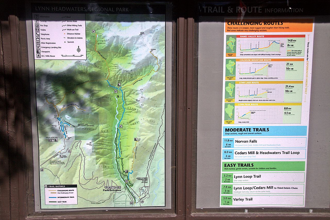 Lynn Headwaters Official Trail Map near the parking
 |
|||
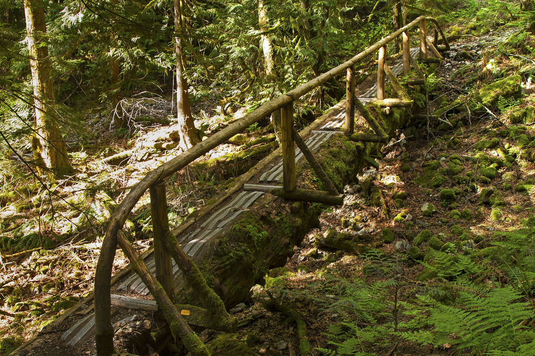 Beautiful log bridge along the Headwaters trail ~5 km mark
 |
|||
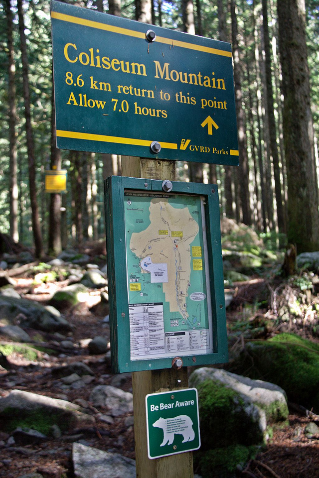 Coliseum Mtn junction ~ 7km mark; keep straight on main trail
 |
|||
 Norvan Falls - brief, but worthy detour just past Coliseum Junction
 |
|||
 Hanes junction at 9km mark; main trail continues straight to Lynn Lake. Turn left and descend to creek crossing
 |
|||
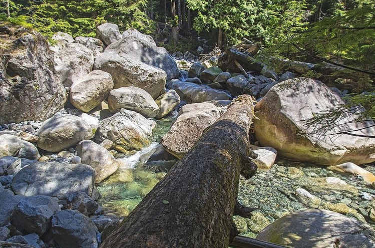 Tricky Lynn creek crossing, looking back. My trip was in August and conditions were quite benign, but in spring this log is sometimes submerged by raging water & impossible to cross
 |
|||
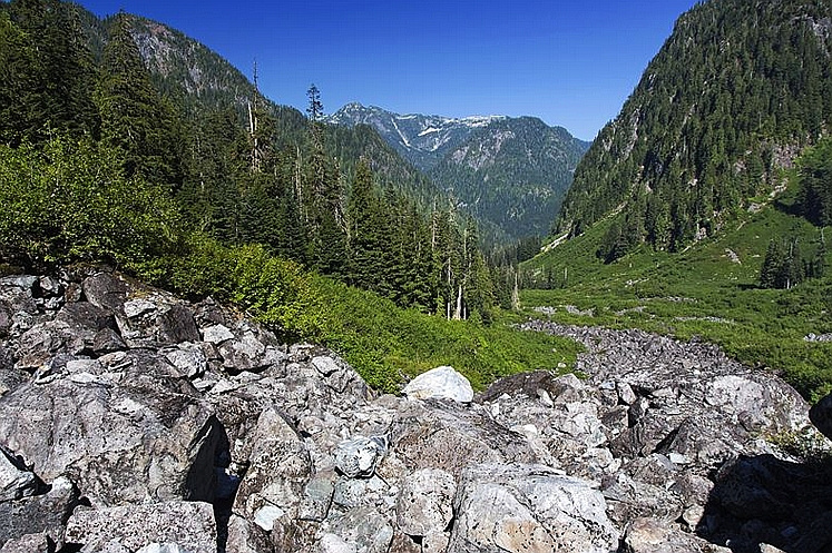 Looking down Hanes valley while climbing Boulder slope to Crown Pass. Coliseum - Burwell center distance
 |
|||
 View of Hanes Valley near top of Crater Slabs route
 |
|||
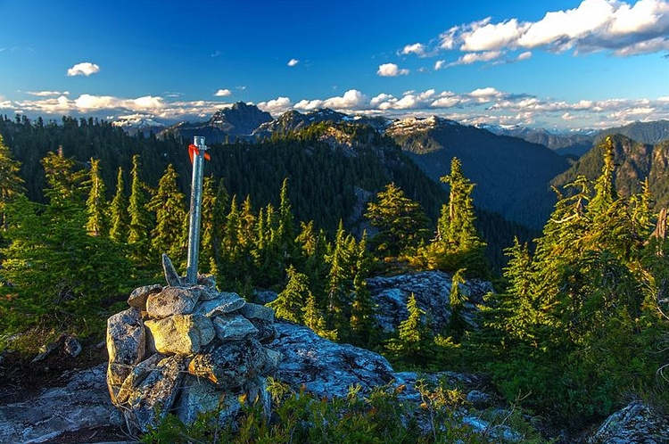 Hiking back to upper Skyride Terminal in Grouse alpine looking north
 |
Abstract
| Overall Difficulty | D6 | Rough back-country route, typical for North shore mountains. Tricky Lynn creek crossing at 9km mark, dangerous even impossible during spring runoffs. Difficult boulder field in upper Hanes valley and several rope assisted steps below Goat Pass | |||
| Snow Factor | S4 | Avalanche Danger in upper Hanes Valley. Possibility of soft and non-supportive spring snow. Winter trip not recommeded | |||
| Scenery | Classic North Shore with old growth forest, creeks and boulder fields. Panoramic lower mainland views in Grouse alpine | ||||
| Trail/Marking | Very Good/Fair | Well defined and marked Lynn Headwaters trail followed by flagged route in Hanes valley and up to Goat Pass ending with official Grouse back-country trail to Skyride | |||
| Suggested Time | 8 hrs | 1-way crossover ending at Grouse upper Terminal and does not include return back to Lynn start (gondola/bus or walk). Crown extension will add ~2 hrs. | |||
| Elevation | Start: 200m (Lynn Valley) Max: 1295m (Goat Pass) Total: ~1250m | Total: ~18.5 km (Grouse Skyride upper Terminal only) | |||
| Gear | Full hiking boots preferred to day-hikers (ankle support is important on shifting boulders in upper Hanes valley). Poles are recommended. Snowshoes / icers in winter conditions | ||||
| Water | Lynn creek crossing at 11km mark. Seasonal snowpatches in Hanes valley but dry later in summer. Carry 2-3L on a hot summer day | ||||
| Dog Friendly | No | Dogs not permitted on Grouse Skyride and Grouse Grind on return | |||
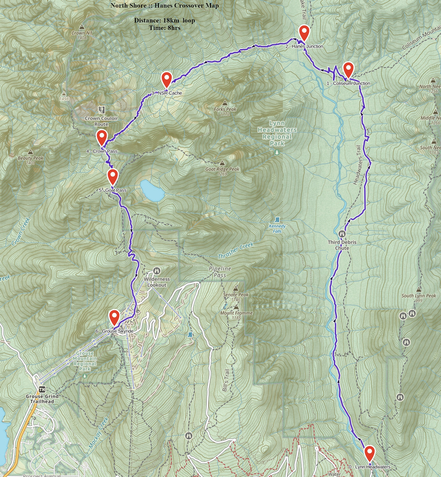 Hanes Crossover GAIA Map
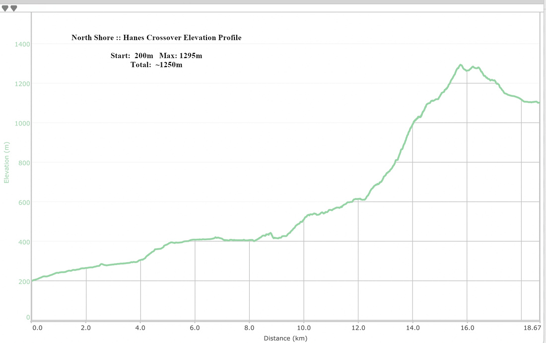 Hanes Crossover Elevation Profile