Google Map |
Rockies :: Yoho :: Yoho Peak |
GPS Track |
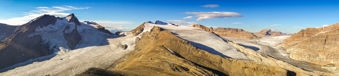 
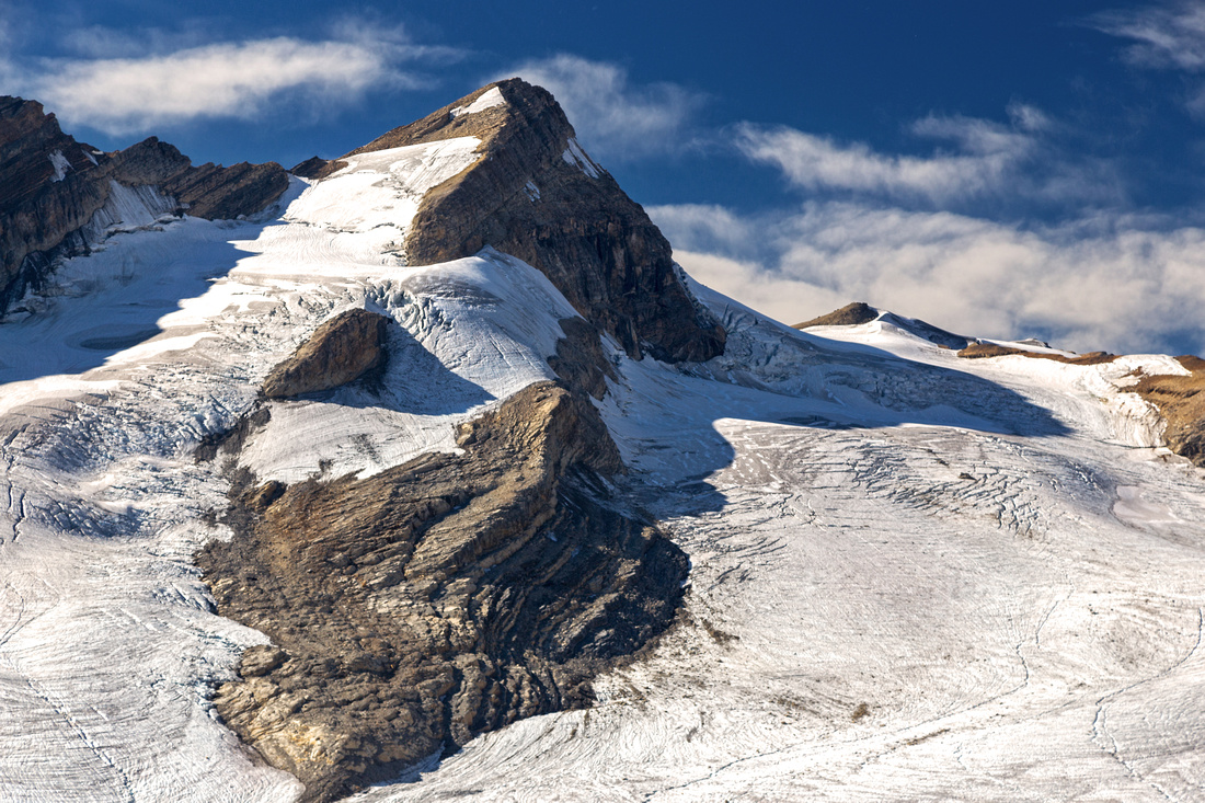
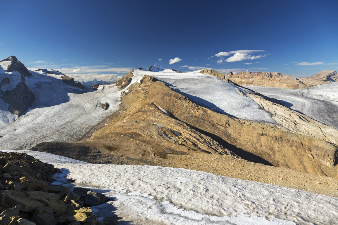
Panoramic view north from Yoho Peak. Mont Des Poilus upper left, Des Poilus icefield below, Mt. Collie roughly center, Yoho Glacier to the right |
|||
| Trip Summary | |||
September 11, 2017Yoho peak trip is in spectacular surroundings and in every possible sense classic Rockies. Approach utilizes well-developed trail system in Yoho Valley following by mountaineer access trail to Des Poilus Glacier in unofficially named "Waterfall Valley" between Whaleback/Isolated Peak and Yoho Peak/Mt. Collie. Trip is a scramble, but easy - nothing more difficult than fairly straightforward talus slope followed by low angle blocky ridge that rarely calls for uses of hands. However, trip is long -- too long perhaps for a day trip; trail runners aside, most people will need well over 10 hours return time. Good bivi options exist in upper Waterfall Valley in this case. Alpine Club of Canada "Guy Hut" on saddle between Collie and Yoho peak is open only in winter and locked during the summer.
From parking at Takakkaw Falls follow Yoho valley trail to Laughing Falls -- about 45 mins. Then you have a choice - going left via Little Yoho Valley is shorter distance wise but steeper and will require considerable elevation loss on descent from Whaleback. Better option is to continue to Twin Falls Chalet, then ascend to lip of Twin Falls via well-graded (but unnecessarily roundabout) Whaleback trail. Twin Falls are additional scenic reward and well worth a visit along the way. It will take 2 1/2 - 3 hours from Takakkaw parking to bridge upstream from Twin Falls Top and start of Waterfall valley trail. If coming via Chalet, this trail forks right just before the bridge; if coming from Little Yoho / Whaleback, leave trail immediately after crossing the bridge and head off upstream angling right then pick up the trail higher up. This trail is narrow but well defined. It climbs in fairly low angle through thinning sub-alpine forest for next couple of kilometers then vanishes after reaching lovely tarn below west slopes of Yoho peak. This tarn would be a great bivi spot & much preferred to glacial moraine higher up by Des Poilus glacier which is more frequently used.
From the tarn make your way up towards the glacier; there are several options, but best is to stay low on the right side and ascend valley directly below Yoho peak. Grass and karst initially it eventually transforms into scree, but going is easy. Snipets of trail and odd cairn could be found here as well. Steep talus slopes to the right could also be used for ascent (or descent) to Yoho peak, but it is not recommended. Continue towards the glacier as otherwise you'd miss most of scenic rewards that are still lying ahead. Finally reach the moraine directly above Des Poilus glacier, some 2 hrs from Whaleback Junction. This is fantastic place and glaciated Mont Des Poilus steals the snow; equally impressive is heavily cracked Icefield eventually ending in large and unexpected lake -- "Des Poilus Tarn". This viewpoint would be a fantastic day trip by itself; considering overall length of the journey this is recommended turnaround point.
Continuing to Yoho Peak will add ~3 hours and several 100's vertical meters on lose and scrambly terrain. Traverse lose sides then scramble to low saddle lying ahead to the left - pick your way. Poles are of huge help here, specially on descent. In upper part bits of trail and cairns magically re-appear. Finally you gain sight of "Guy Hut" -- unexpected, and more like some lunar base situated in barred alpine environment. It is not necessary to go all the way to the Hut; it will be closed in summer anyways, but it does offer unique visual perspective, specially for photographers. Nice porch can also be used as bit of shelter and good break spot. From the Hut final bit is low angle ridge that is as easy as it appears. Small pocket glacier to the left is easily avoided and there is no exposure. It takes about 45 mins from the Hut to high-point and summit register, for one of best panoramas Rockies have to offer.
For return there are several options. It is possible to continue south from the summit, then either drop on talus to the lake in upper Waterfall Valley or traverse entire ridge as Nugara did. Either way you will end up on Whaleback trail near the bridge. For hike-out same dilemma presents itself: Twin Falls Chalet or Whaleback. Ascent of Whaleback after already (too) long day will be a drag, so it is best although longer to return via Chalet. |
|
Gallery |
|||
 Laughing Falls near Little Yoho Junction on Yoho Valley Trail ~4km from Takkakaw parking
 |
|||
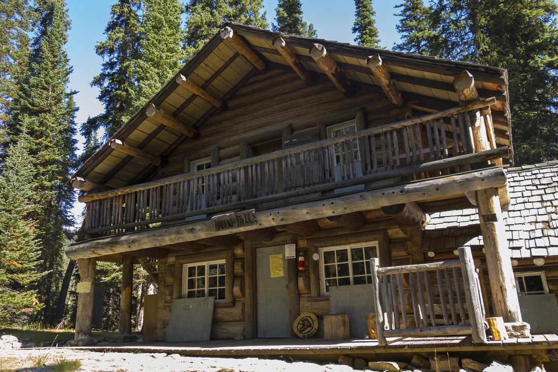 Twin Falls Chalet, 8km and ~1hr 45min of fast pace
 |
|||
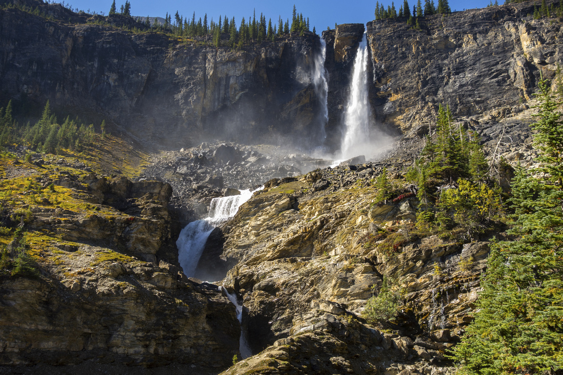 Twin Falls - worthy brief side trip from Chalet
 |
|||
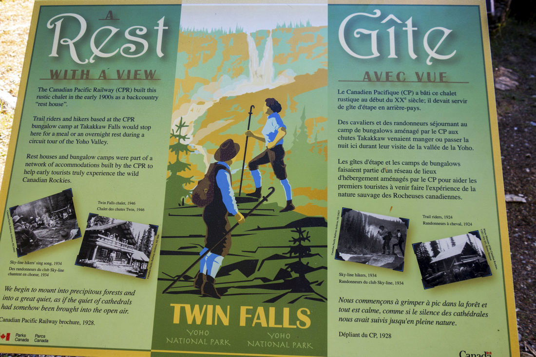 Lots of Rockies History at Twin Falls Chalet
 |
|||
 Lip of Twin Falls on Whaleback Trail
 |
|||
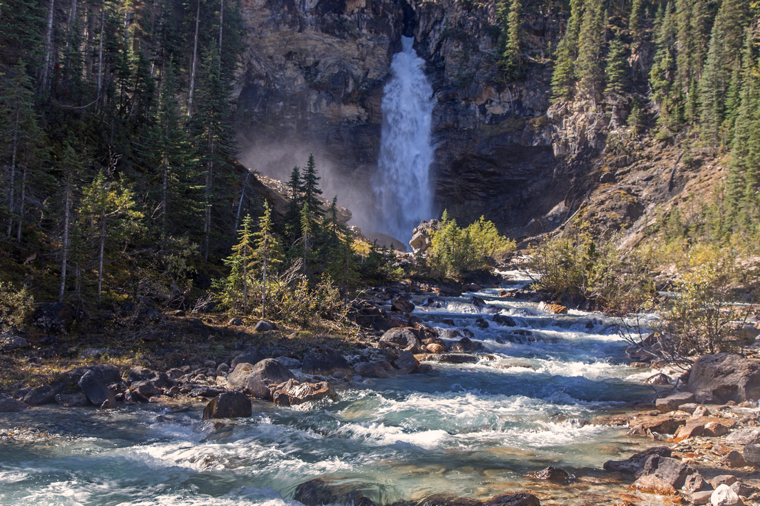
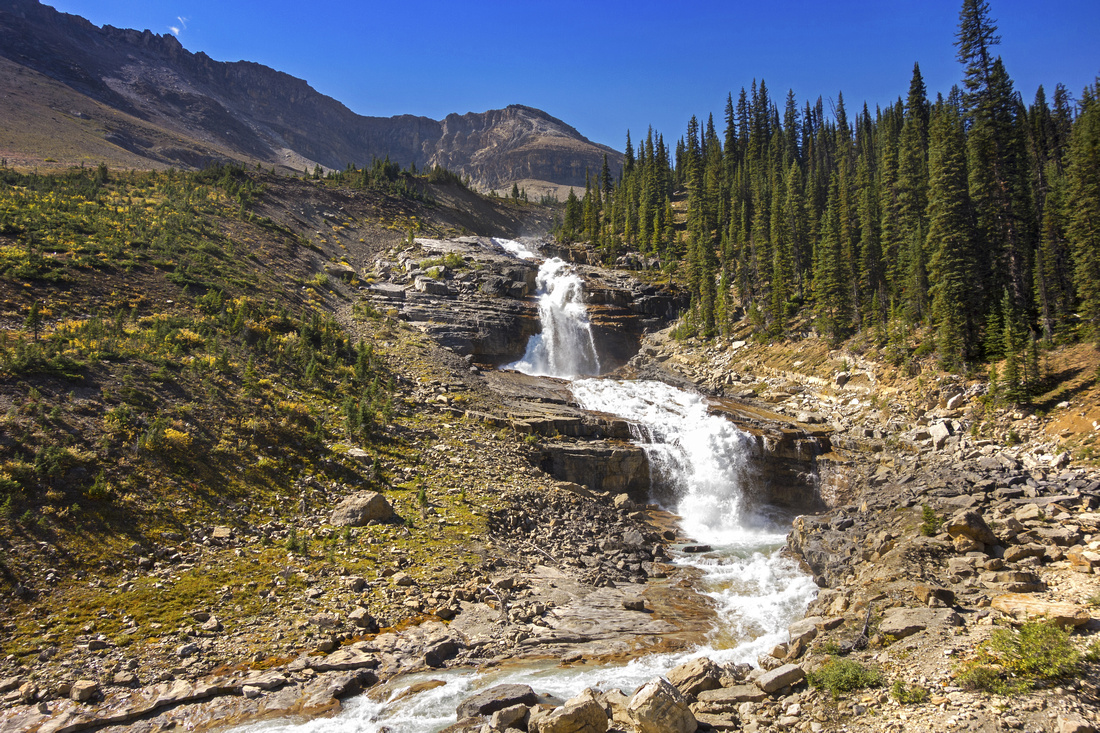 Most accessible Falls at start of Waterfall Valley
 |
|||
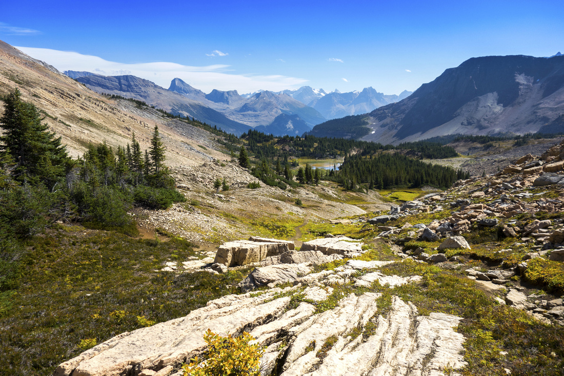
 Trail becomes faint past Tarn in upper Valley (good bivi spot). Aim for rocky draw slightly left of center
 |
|||
 Hiking past the Tarn with view back to Waterfall Valley
 |
|||
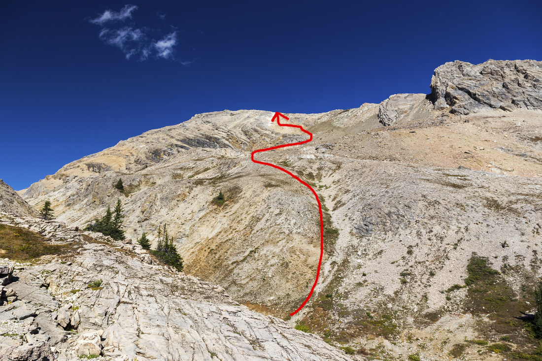 Alternate access to Yoho Peak, better for descent
 |
|||
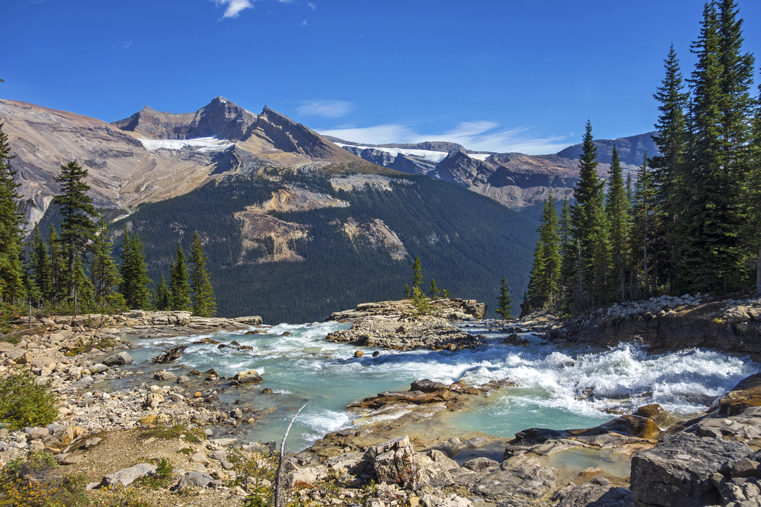
 Approaching Des Poilus glacier; stay to the right
 |
|||
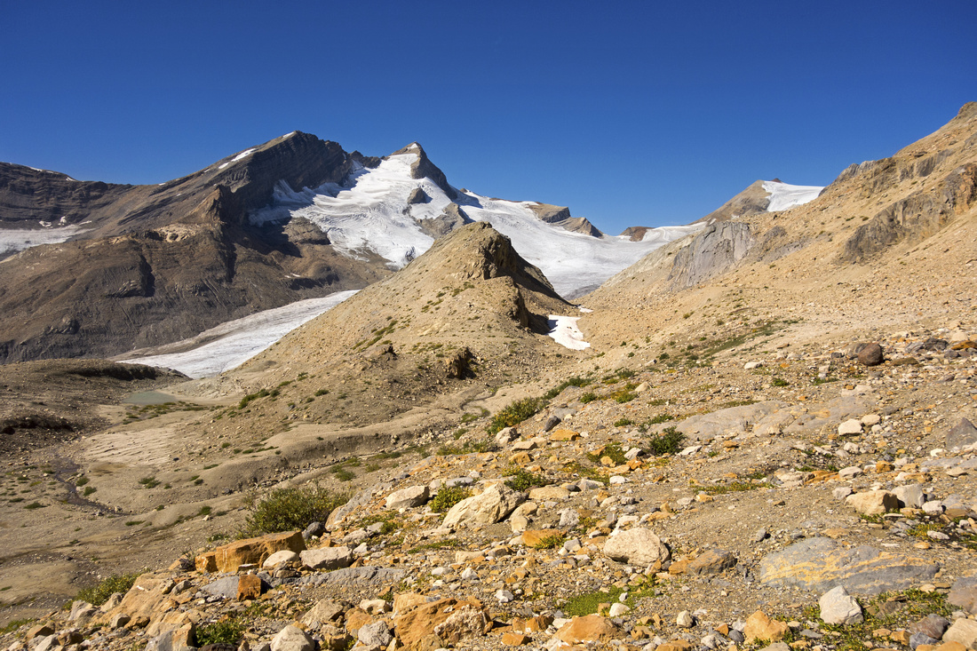
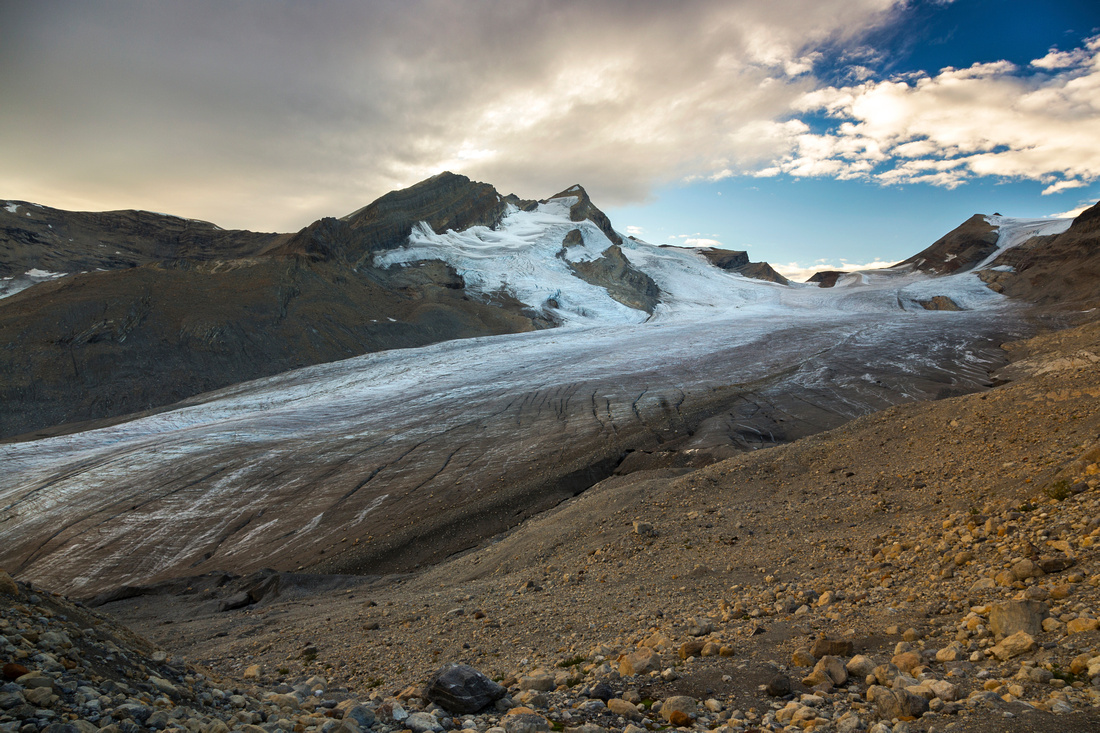
 Mont Des Poilus and Icefield; ~2hrs from Whaleback
 |
|||
 Zoom on Mont Des Poilus - strictly mountaineering
 |
|||
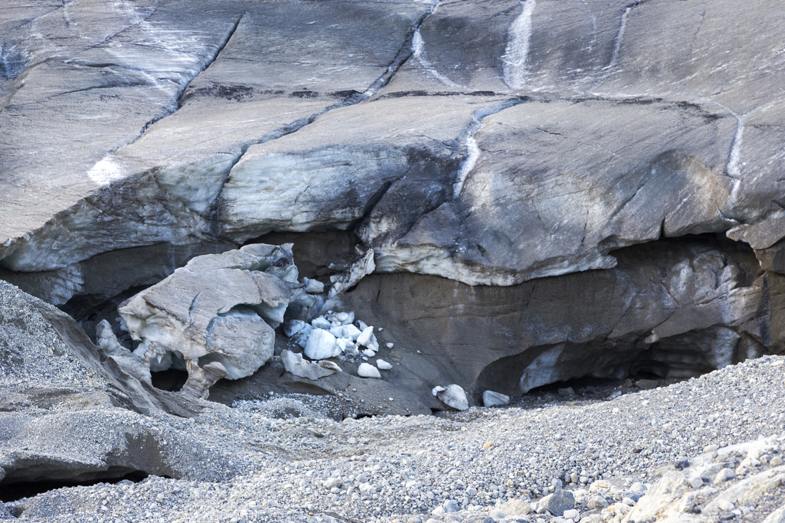
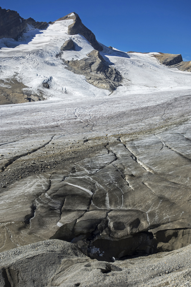 Cracked Snout of Des Poilus Glacier
 |
|||
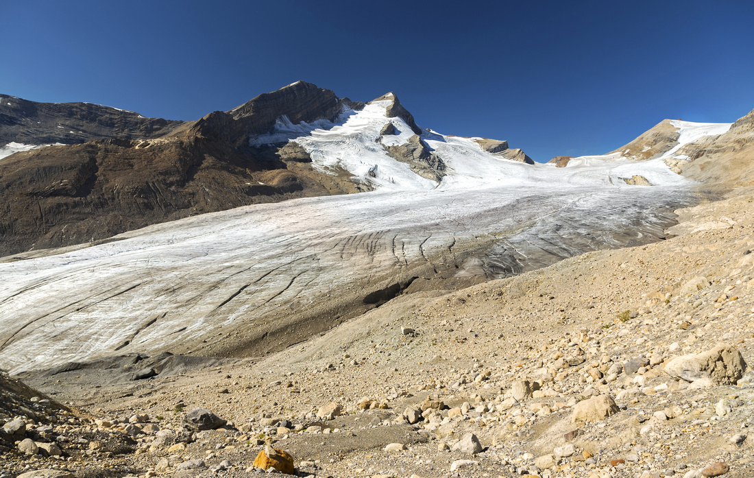
 Huge Crevasses at heavily cracked Des Poilus Icefield
 |
|||
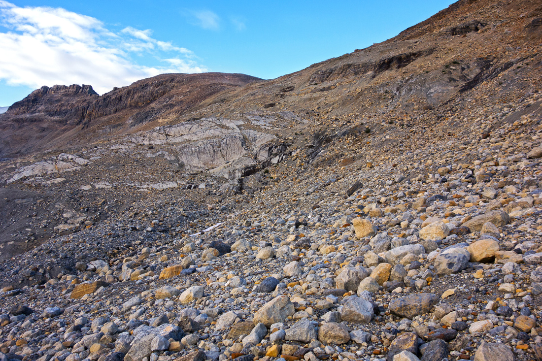 Talus slope above the Glacier - aim for low point in upper center
 |
|||
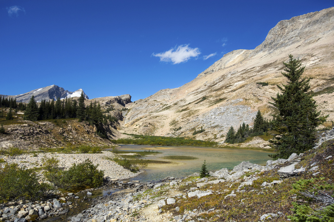
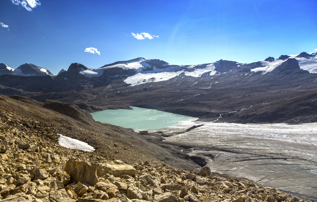 View back to large and unexpected "Des Poilus Tarn"
 |
|||
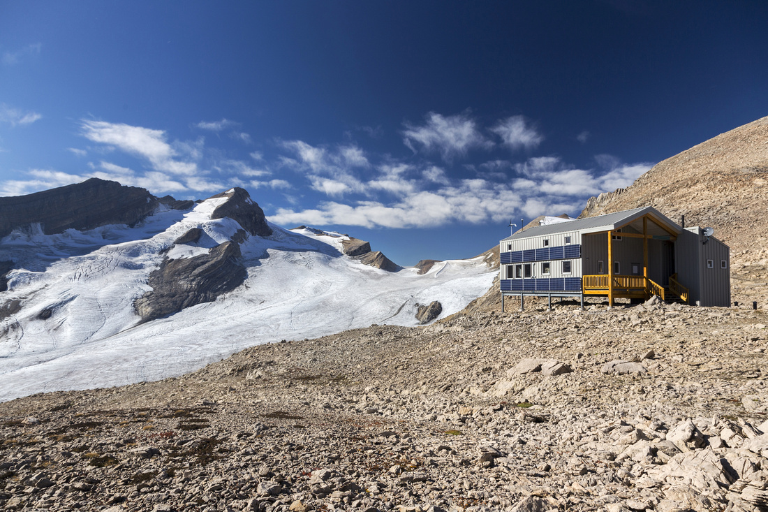 ACC "Guy Hut" at Yoho Peak / Mt. Collie saddle
 |
|||
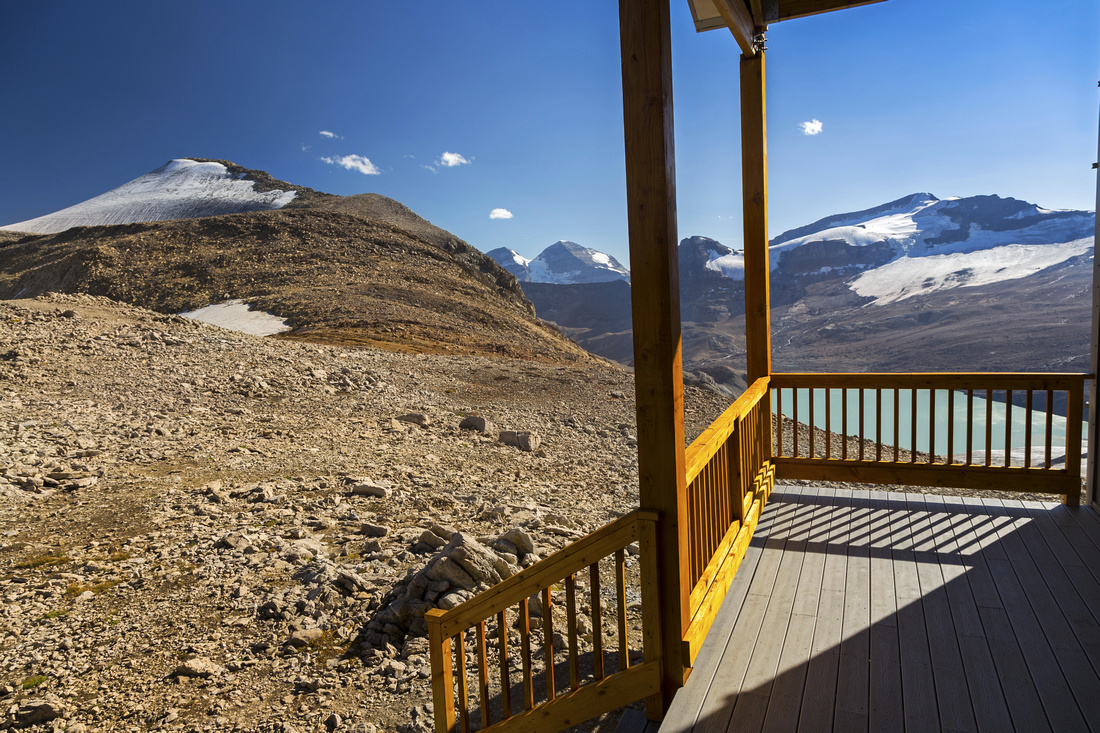 "Guy Hut" Porch looking towards Yoho Peak
 |
|||
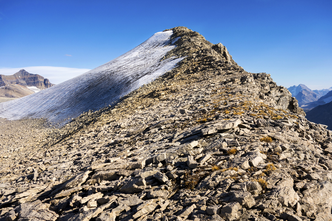 Pocket glacier (L) abuts Yoho Peak ascent ridge, but is easily avoided
 |
|||
 Summit view north. "Guy Hut" tiny dot distance center
 |
|||
 You never know when you are going to need one! Interesting content of summit register on Yoho Peak
 |
|||
 Looking west from the summit to Balfour Pass and Diableret Falls
 |
|||
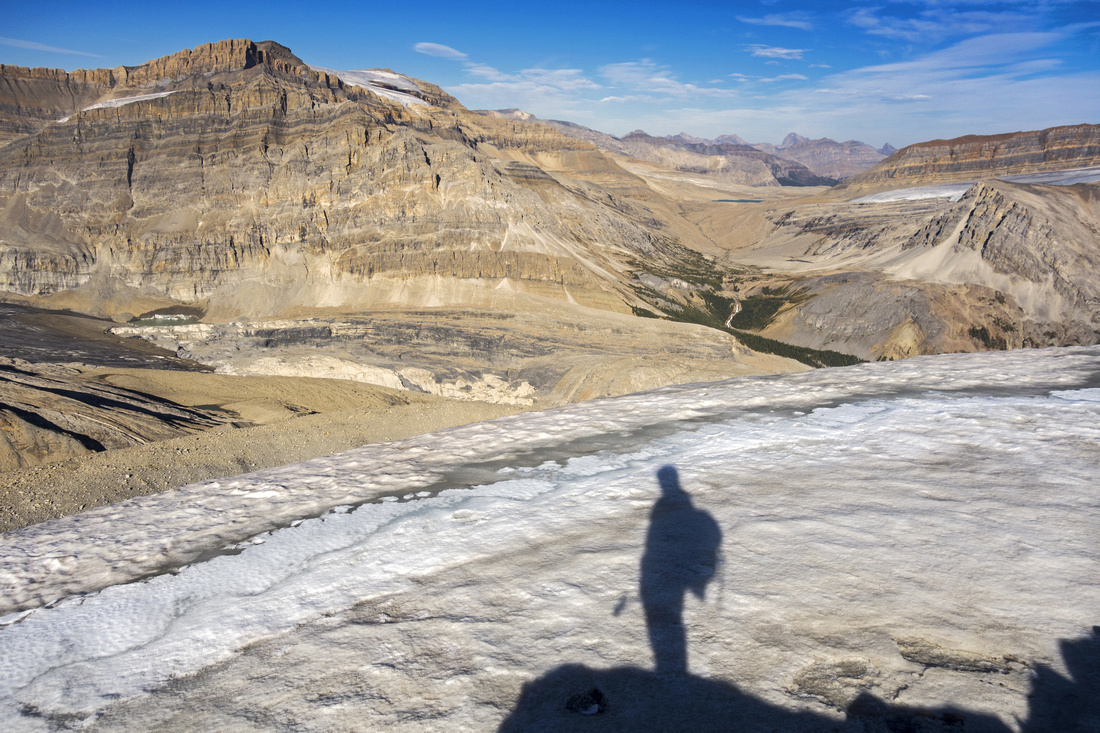
 Des Poilus at Dusk; long hike back by headlamp awaits
 |
Abstract
| Overall Difficulty | D6 | Extremely long day scramble or overnight bivouac. Unbridged glacial creek crossings. Talus/boulder scramble with some lose parts in upper half. Micro-terrain routefinding. Significant total distance and elevation gain | |||
| Snow Factor | S3 | Steep snow slope above Des Poilus glacier, but otherwise little avi danger. In reality winter ascent is limited to multi-day ski trips as Takakkaw road is not plowed and approach is via Wapta. Snowshoe trip is definitely not feasible. Skiers will benefit from new Louise and Richard Guy Hut ("Guy Hut") on saddle between Yoho Peak and Mt. Collie. For more info and reservations see Alpine Club of Canada website | |||
| Scenery | Essential Rockies. Several waterfalls on approach - starting with tourist but spectacular Takakkaw Falls right at the parking, following with Laughing Falls, Twin Falls and finally several in "Waterfall Valley". Mind blowing Des Poilus Icefield. Vast panorama and many distant Rockies peaks from 2770m summit of Yoho Peak | ||||
| Trail/Marking | Good / none | Official wide park trail to Twin Falls / Whaleback, followed by unofficial mountaineer access trail to "Waterfall Valley". This Trail vanishes in upper alpine & some route-finding is required. Micro-terrain and talus slopes with occasional cairns. | |||
| Suggested Time | 12-14 hr | Return time from Takakkaw Falls with steady, moderate to fast pace. Trip is better suited for overnight/backpack | |||
| Elevation | Start: 1550m Max: 2770m Total: ~2000m | Round Trip: ~38km | |||
| Gear | Hiking boots and poles. Gaiters helpful for talus slopes. Overnight gear for bivi (note that Guy Hut is open in winter only) | ||||
| Water | Many creeks and glacial melts all the way to snout of Des Poilus Glacier, none above. No need to carry more than 1-1.5L | ||||
| Dog Friendly | Yes | Standard back-country travel precautions. Prime grizzly country -- keep control of your pet | |||
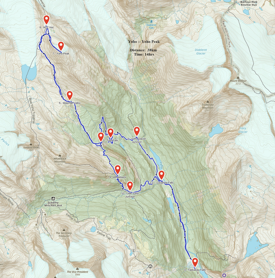 Yoho Peak GAIA Map
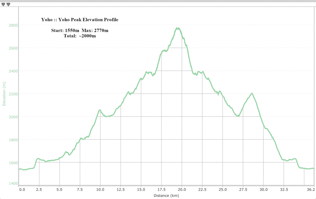 Yoho Peak Elevation Profile