Google Map |
Rockies :: Yoho :: Wapta Highline |
GPS Track |
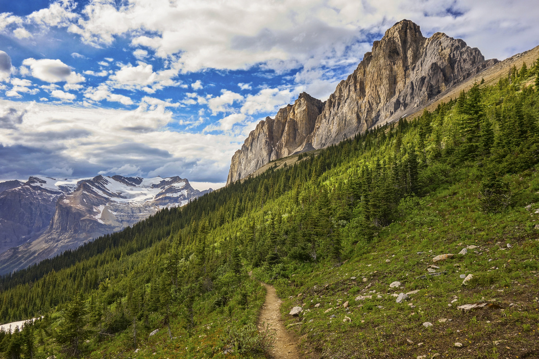 
View back towards Wapta Mountain (R) and distant Presidents / Emerald Glacier (L) as Highline trail approaches Burgess Pass |
|||
| Trip Summary | |||
July 13, 2018Wapta Highline, also called Emerald Triangle, is labelled as one of best loop day hikes in Canadian Rockies (Patton/Robinson "The Canadian Rockies Trail Guide"). Loop links 3 official Parks Canada trails thus forming triangle above tourist-popular Emerald Lake in Yoho National Park. Central part also connects with 3 Kane scrambles -- Wapta (difficult), Field (easy) and Burgess (moderate). Clockwise direction is preferable as Burgess Pass trail is steep and entirely forested with ~850m of elevation, thus serving better for descent. From Yoho Pass side trip to scenic Yoho Lake with back-country campground is recommended extension. Slopes on south side of Wapta mountain contain famous "Burgess Shale" -- Unesco World Heritage site. It is not allowed to venture into Walcott Quary site without official Parks Canada escort. Gallery photos are in sequential order and tell the story: |
|
Gallery |
|||
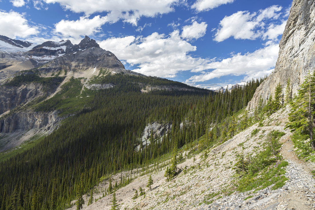
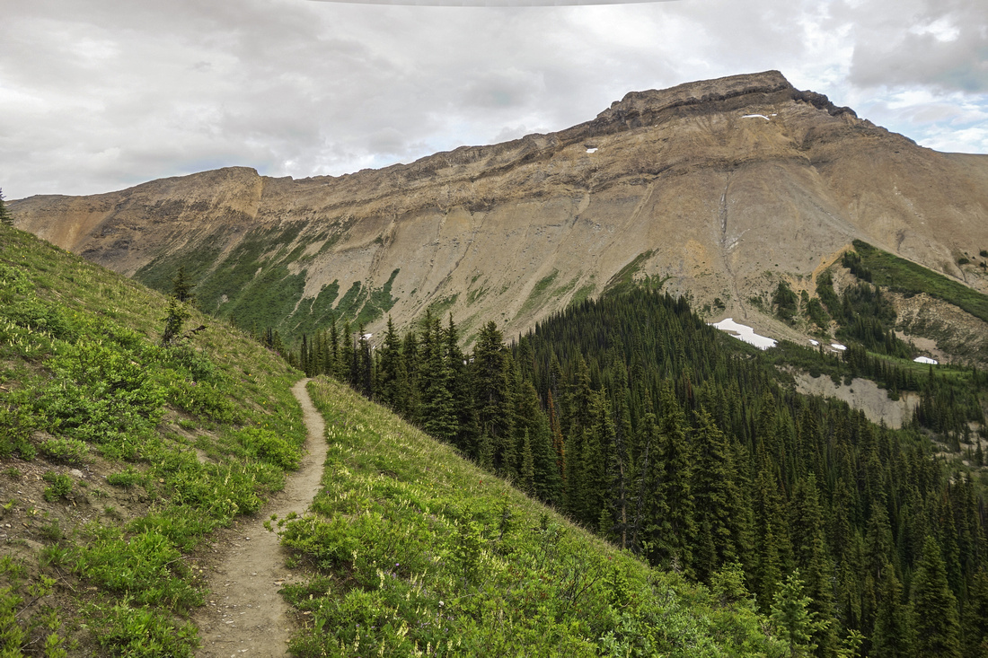
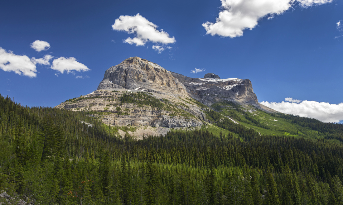 Wapta Mtn. from trail ascending to Yoho Pass (extreme left). Highline trail runs beneath cliffs and across avalanche slopes in center part of photo.
 |
|||
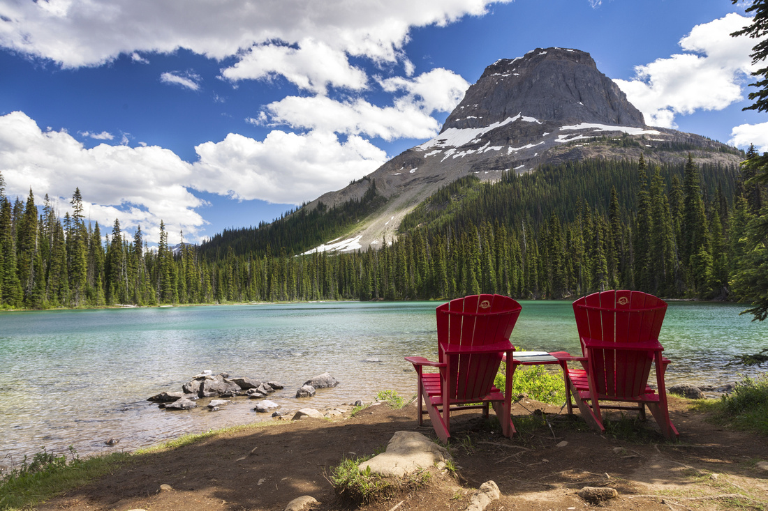
Parks Canada Red Adirondacks at Yoho Lake with north aspect of Wapta Mtn. in upper right |
|||
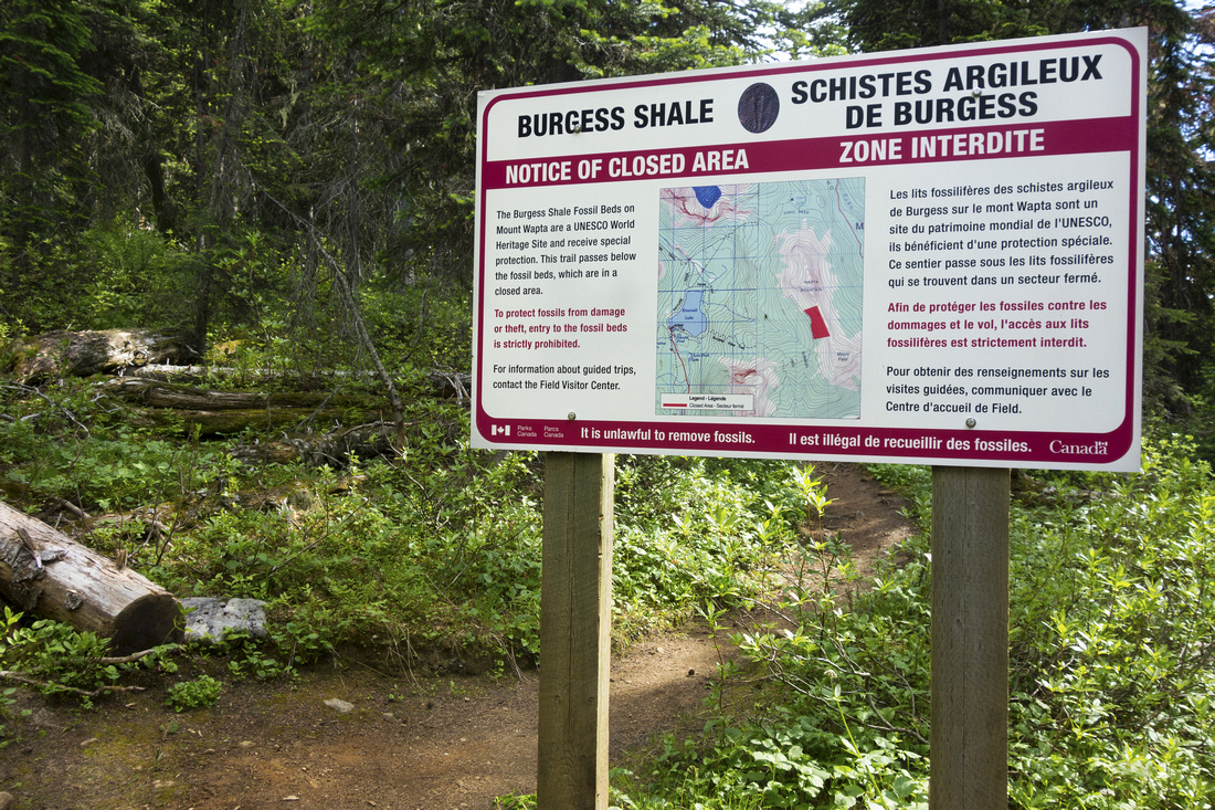
Burgess Shale Sign marking protected area at Yoho Pass; there is one at Burgess Pass as well |
|||
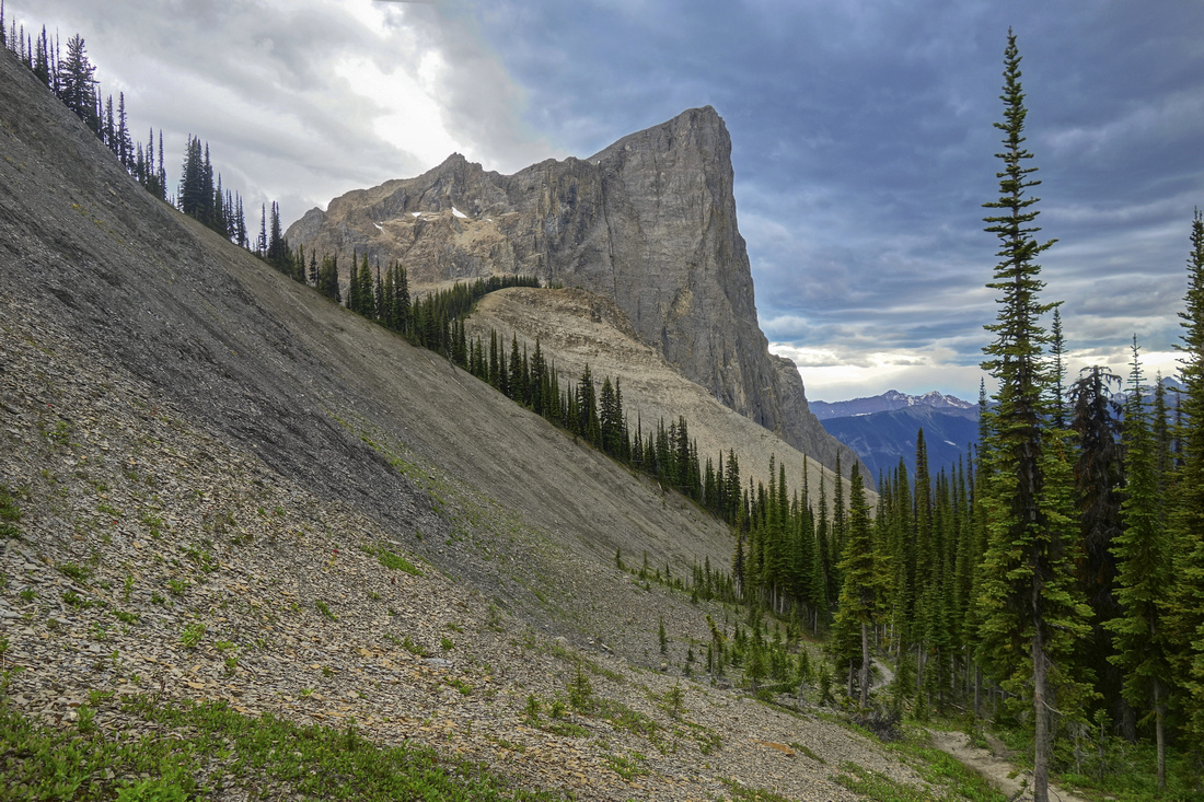
View back towards Yoho Pass as Highline Trail traverses below steep Wapta cliffs in initial part |
|||
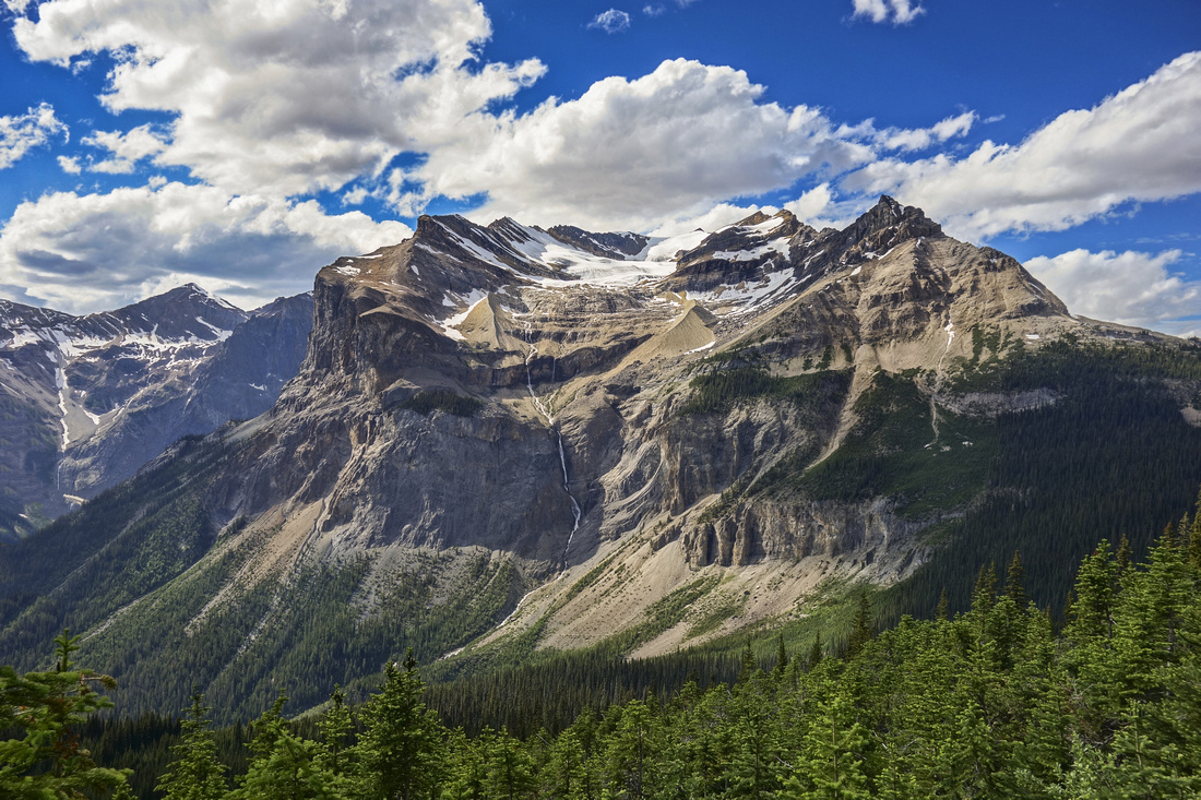
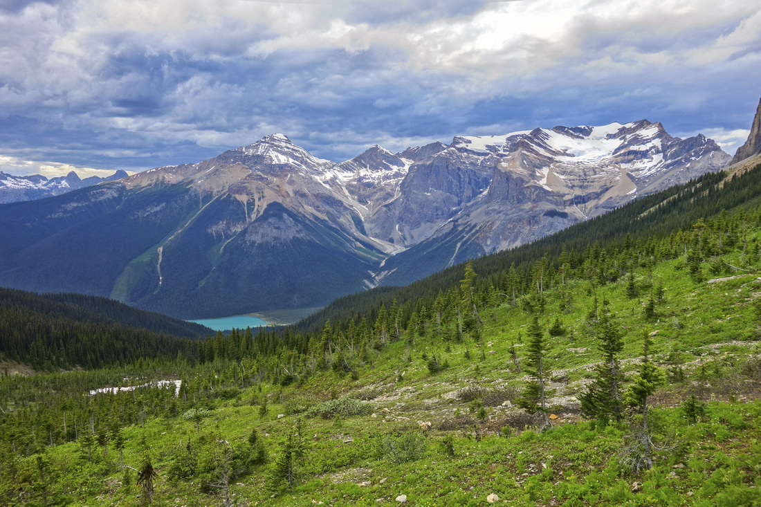
Terrific View towards The Presidents |
|||
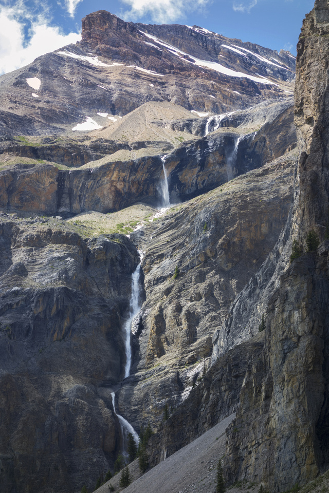
Closer look at magnificent waterfall draining Emerald Glacier |
|||
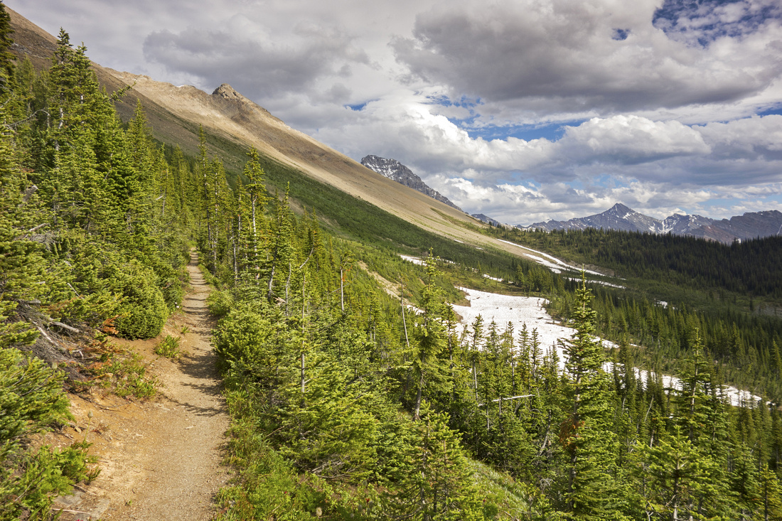
Approaching Burgess Pass (far right). Mt. Field upper left showing easy ascent slopes |
|||
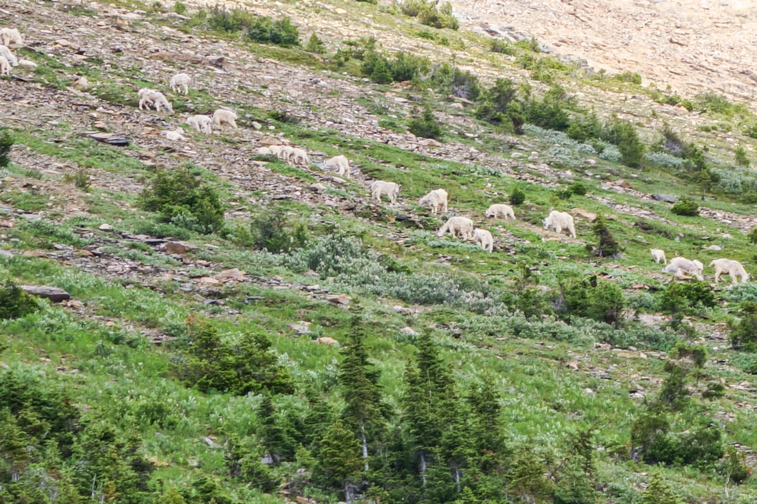
Mountain Goats in Burgess Shale above the trail |
|||
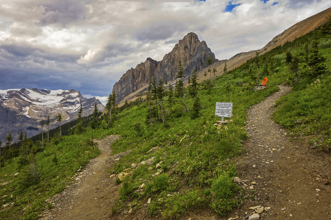
Walcott Quarry junction, looking back. Note Signs |
|||
View down to Emerald Lake from Avalanche Slopes below Mt. Field |
|||
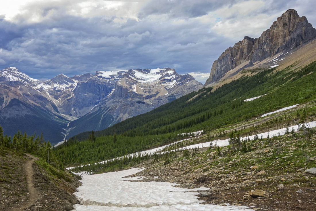
View back towards Wapta Mtn as trail crosses drainage gully coming down from Mt. Field. This is where scramblers would leave the trail and head up Mt. Field, some 400m vertical above |
|||
Look at Mt. Field from Burgess Pass. This is same spot as in Kane scrambles book --- photo which in turn Alan took from Bob Spirko. See here |
|||
View of Mt. Burgess just below Burgess Pass as trail plunges towards treeline and starts descent to Emerald Lake |
Abstract
| Overall Difficulty | D4 | Trail hiking with some steeper parts. Possible sections with deadfall below Burgess Pass. Considerable overall distance and cumulative elevation | |||
| Snow Factor | S4 | Steep avalanche slopes below Wapta mountain. Not recommended in winter | |||
| Scenery | Spectacular Alpine trail with views of Lakes and Glaciated Peaks, including Presidents and Emerald Glacier | ||||
| Trail/Marking | Excellent | Official Parks Canada Trails. All junctions are marked | |||
| Suggested Time | 8-9 hr | Moderate pace including side trip to Yoho Lake. Ascent of Mt. Field from Burgess pass will add ~2 hours | |||
| Elevation | Start: 1300m Max: 2200m Total: ~1050 m | Round Trip: ~21.5km (incl. Yoho Lake) | |||
| Gear | Day-hikers or full hiking boots. Poles recommended | ||||
| Water | Emerald Glacier drainage on Yoho Pass approach. Avalanche gullies below Wapta Mtn and side creeks below Burgess Pass (seasonal). Carry 1.5-2L | ||||
| Dog Friendly | Yes | Standard back-country travel precautions. | |||
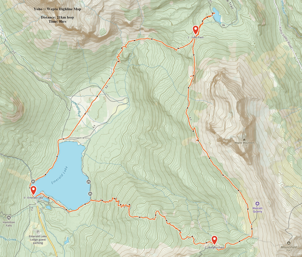 Wapta Highline GAIA Map
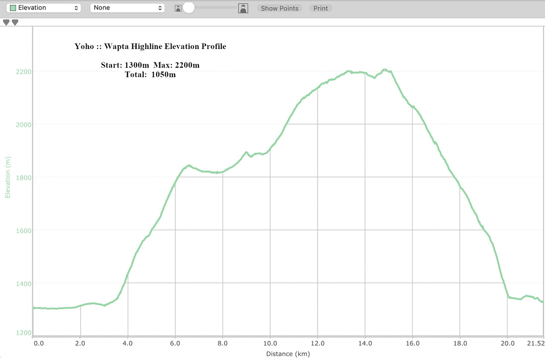 Wapta Highline Elevation Profile