Google Map |
Rockies :: Kananaskis :: Upper Kananaskis Lake Circuit |
GPS Track |
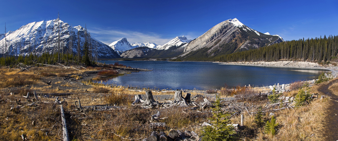 
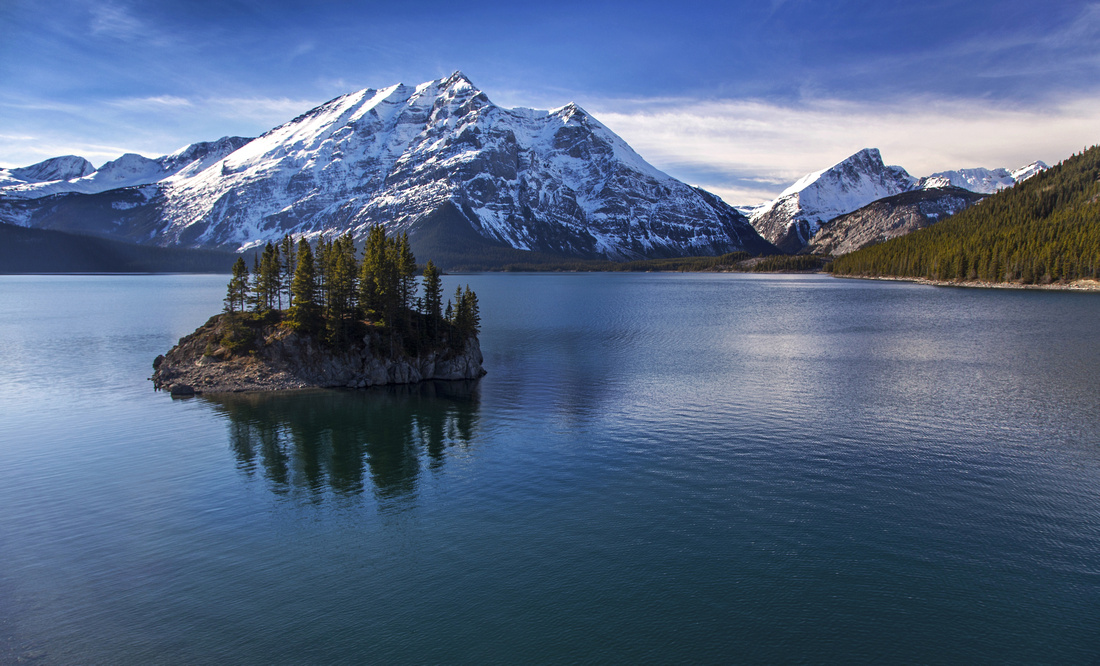
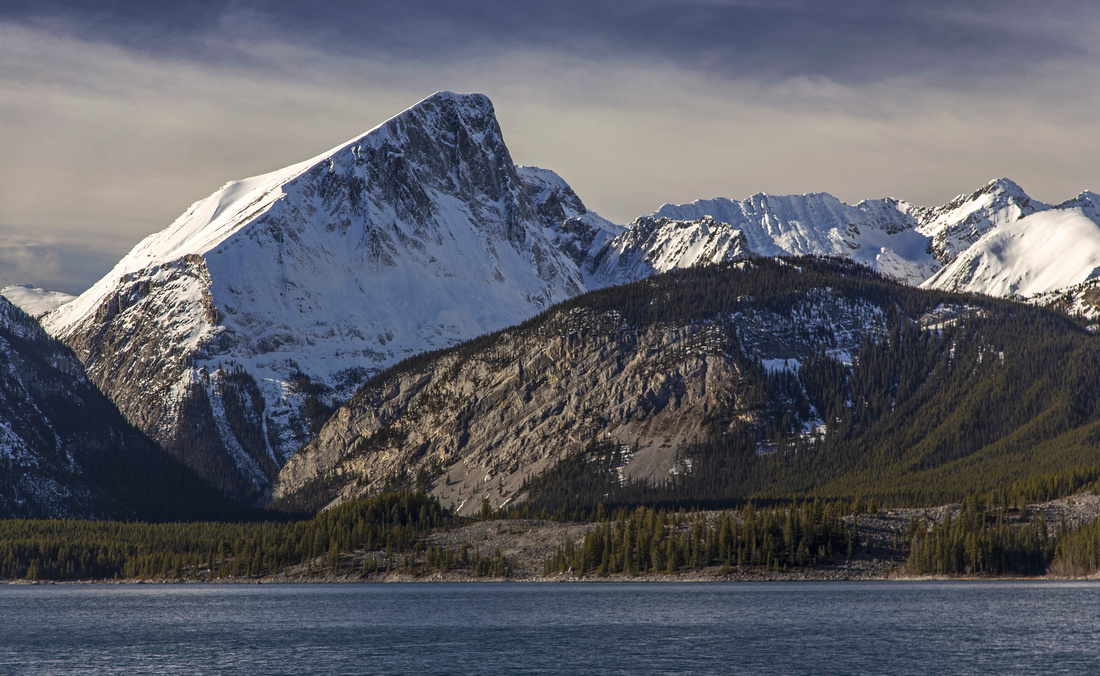
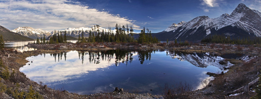
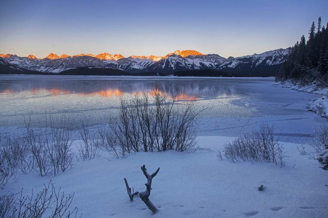
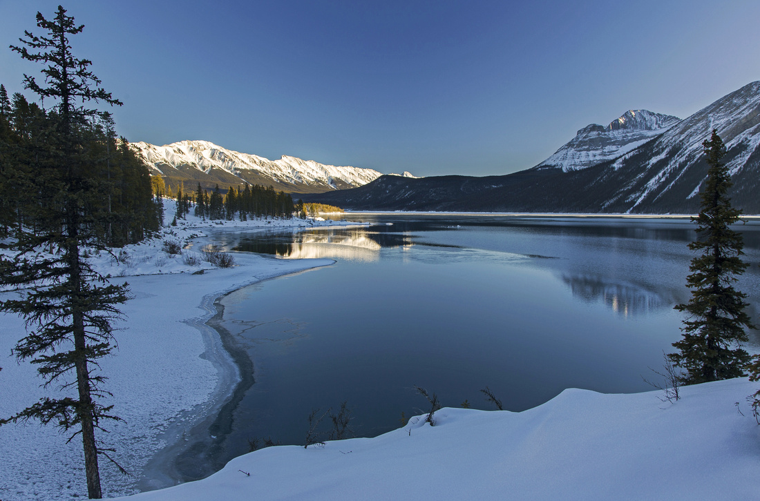
Beautiful section of trail between Boat Launch and Interlakes. Mt. Indefatiguable just right of center, Mt. Lyauteu left; Mt. Putnik in between |
|||
| Trip Summary | |||
November 4, 2016Circuit around upper Kananaskis lake is extremely scenic any time of the year. Trip is fairly undemanding as there is little elevation gain, making it suitable for less experienced and/or fit hikers. Most scenic portion is 4km stretch between Boat launch and Interlakes -- highly recommended when time is short or enthusiasm low for full loop. North side is more sunny, while shadier south side below Mt. Sarrail has long stretch through trees, but in calm conditions offers fantastic reflections of Mt. Indefatiguable. Side trip to Hidden Lake below towering Mt. Lyauteu is pleasant extension that allows taste of Aster lake trail
There are 2 possible starts -- Boat Launch parking area or North Interlakes. Boat Launch and counter-clockwise direction are recommended for best light conditions from photography perspective. Trail crosses the Upper Lake dam, then meanders around small bays with sweeping views west across the lake towards Mt. Putnik. Section just before Interlakes can be icy in late fall season. From Interlakes cross the intake pipe on steel bridge then follow Three Isle Lake trail on north side, taking lower branch. Cycling is allowed on this section. There are some outstanding views south towards Mt. Sarrail, Mt. Foch and The Turret from this stretch. Only significant elevation gain is brief climb to top of Palliser slide; look back for sweeping views SE across the lake towards Mt. Pocaterra. Trail then descends to west side and beautifully situated Point Campground with great lakefront tent sites -- what a fantastic place to wake up! This would also be great choice for first overnight experience, or family backpack trip. Next highlight are Lower Kananaskis Falls and bridge over Kananaskis River, 10-15 minutes past the campground. Trail continues towards the west side; this section is least interesting as travel is mainly through trees. Aster Lake junction is reached about 20-30 minutes past the bridge. It is unmarked but obvious. If time (and energy) allows, it is worth hiking first part --about a kilometer-- to Hidden Lake. This is typical sinkhole, and depending on time of year water level can vary from full requiring bushwhack when heading for Aster Lake to completely dried / empty in late fall season. Remainder of Lake Circuit follows south side and offers some fantastic views of Mt. Indefatiguable. Eventually trail reaches marked Rawson Lake junction. Upper Lake parking and end of the loop is 10-15 minutes from bridge across Sarrail creek, rebuild past 2013 historic floods. |
|
Gallery |
|||
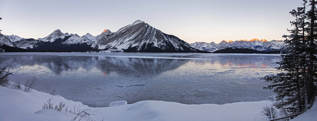
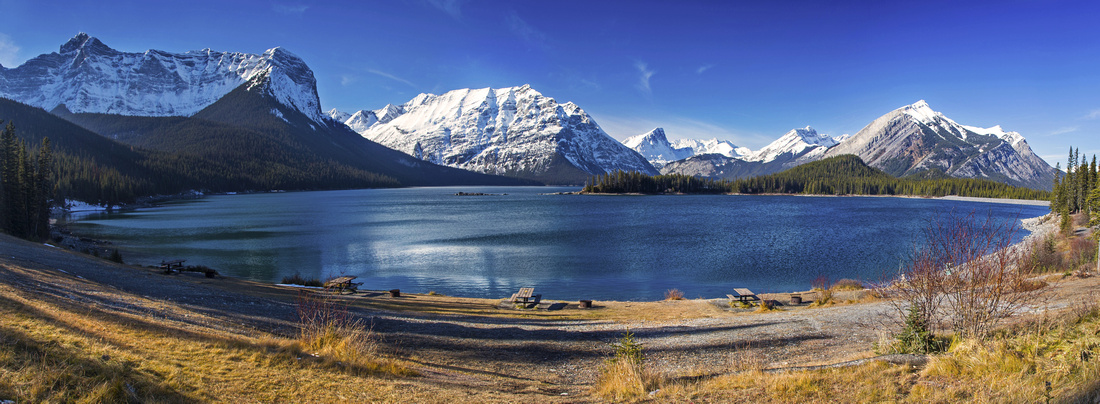 Panoramic view of upper K-lake from west parking lot
 |
|||
 Trail between Boat launch and Interlakes
 |
|||
 One of several bays between Boat launch and Interlakes
 |
|||
 Sweeping views west just before Interlakes
 |
|||
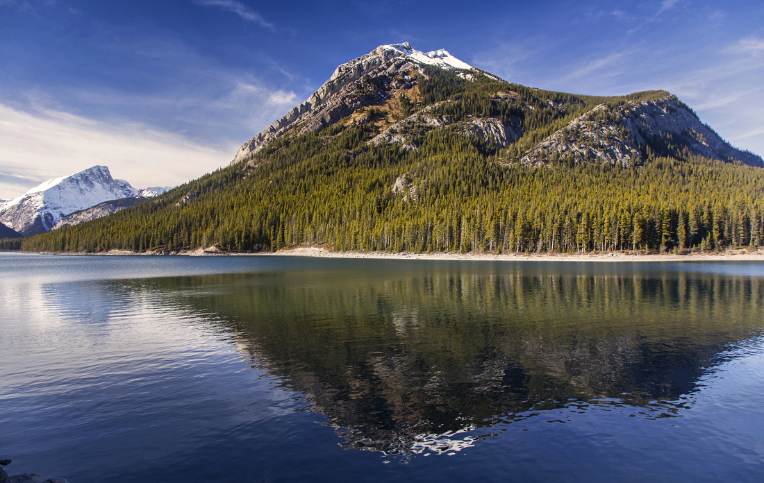 Mt. Indefatiguable reflections near Interlakes area
 |
|||
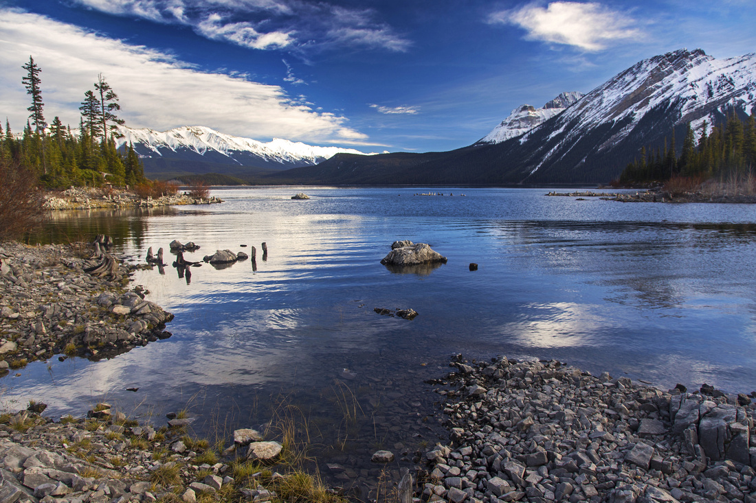
 View east across lower Kananaskis Lake from Interlakes
 |
|||
 Crossing Palliser slide on north side; Mt. Lyauteu left
 |
|||
 Telephoto of Mt. Putnik from Palliser slide
 |
|||
 Approaching Point Campground on west side
 |
|||
 View east from Point Campground lakefront tent sites
 |
|||
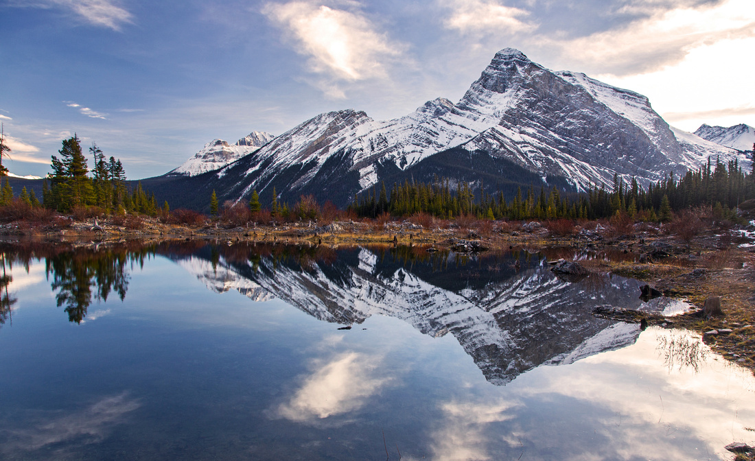 Mt. Sarrail reflections from Point Campground
 |
|||
 Panoramic view east from Point Campground
 |
|||
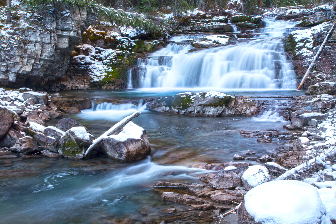 Lower Kananaskis Falls ~10 min past Point Campground
 |
|||
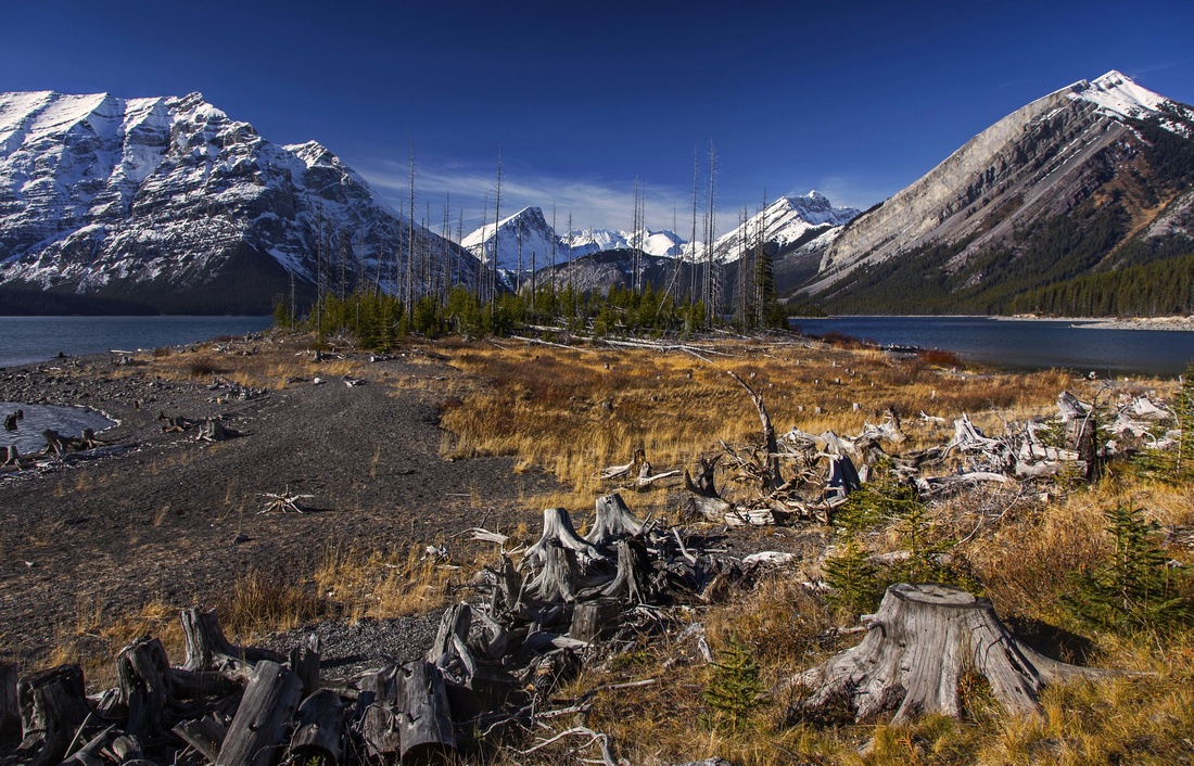
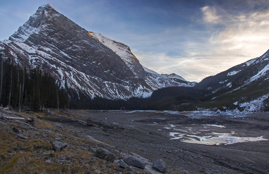 Drained Hidden lake on south side bellow Mt. Sarrail left
 |
|||
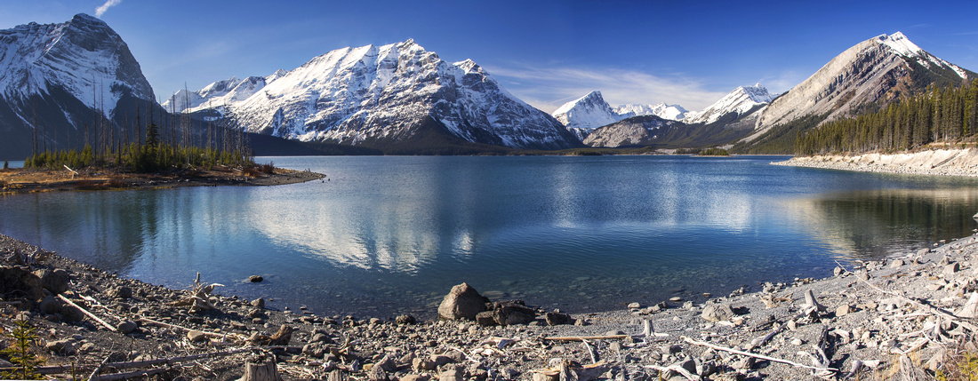
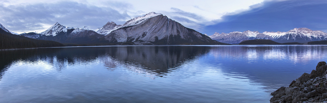 Panoramic view across the lake from south side
 |
|||
 Sunset from west side in typical winter setting
 |
|||
 Panoramic view of upper K-lake from west parking lot
 |
|||
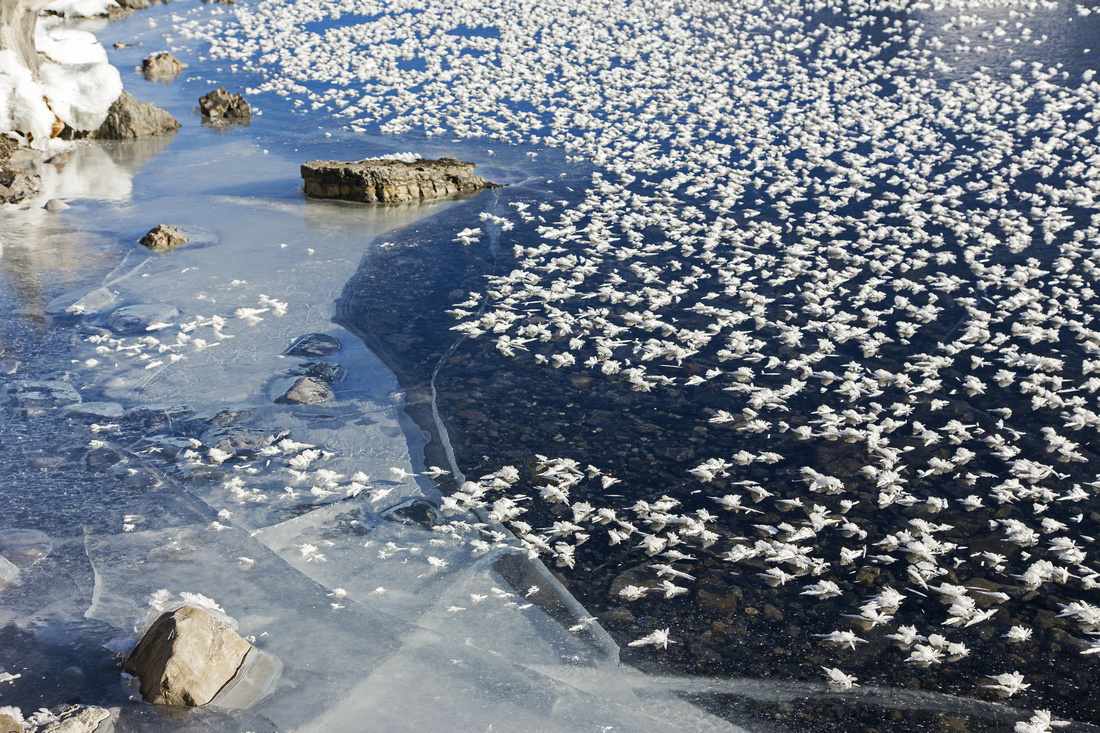 Hoary Frost on frozen lake surface along sunny north side
 |
|||
 View south from Palliser slide in winter setting
 |
|||
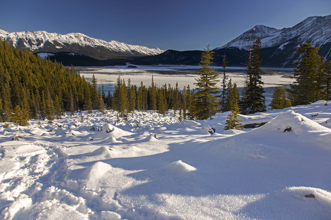
 Point campground area as lake is starting to freeze
 |
Abstract
| Overall Difficulty | D3 | Mainly level trail hiking with minor ups and downs. Shadier south side might be muddy or icy, depending on season | |||
| Snow Factor | S2 | Some avalanche danger at couple of gullies coming off Mt. Sarrail on the south side | |||
| Scenery | Jaw dropping views of upper K-Lake basin and surrounding mountains from different vantage points | ||||
| Trail/Marking | Excellent | Wide and well defined trail with marked junctions | |||
| Suggested Time | 5 hrs | Relaxed to moderate pace with breaks and optional side trip to Hidden Lake | |||
| Elevation | Start: 1720m Max: 1770 m Total: ~300m | Round Trip: ~16km (add ~1.5 km for Hidden Lake) | |||
| Gear | Day hikers sufficient in dry conditions. Micro-spikes could be useful in shoulder season because of ice; snowshoes in winter | ||||
| Water | Kananaskis River on west side of the lake; Sarrail and Foch creeks on the south side. Carry ~1L | ||||
| Dog Friendly | Yes | Standard back-country travel precautions | |||
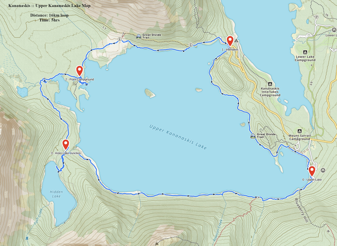 Upper K-Lake Circuit GAIA Map
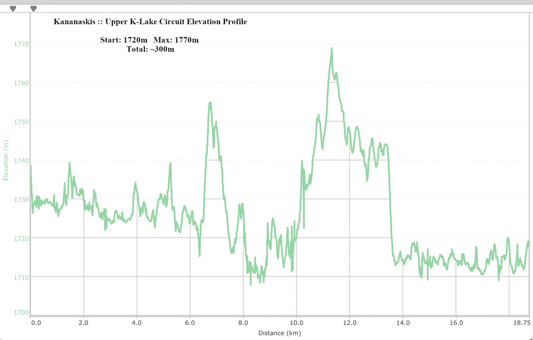 Upper K-Lake Circuit Elevation Profile