Google Map |
Rockies :: Kananaskis :: Rummel Ridge |
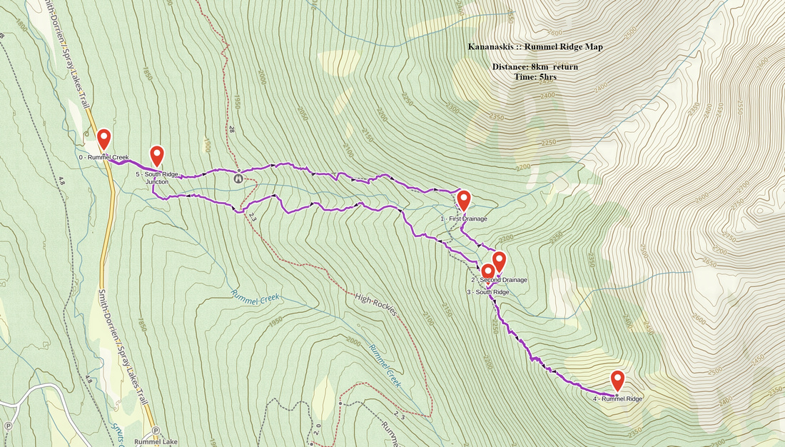
GPS Track |
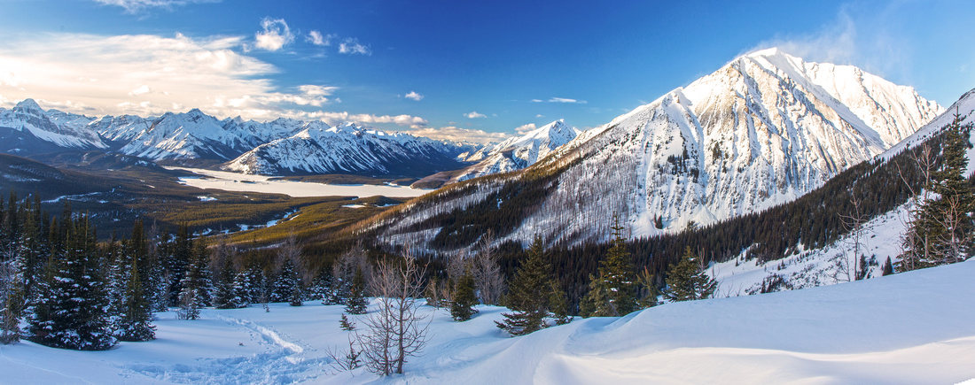 
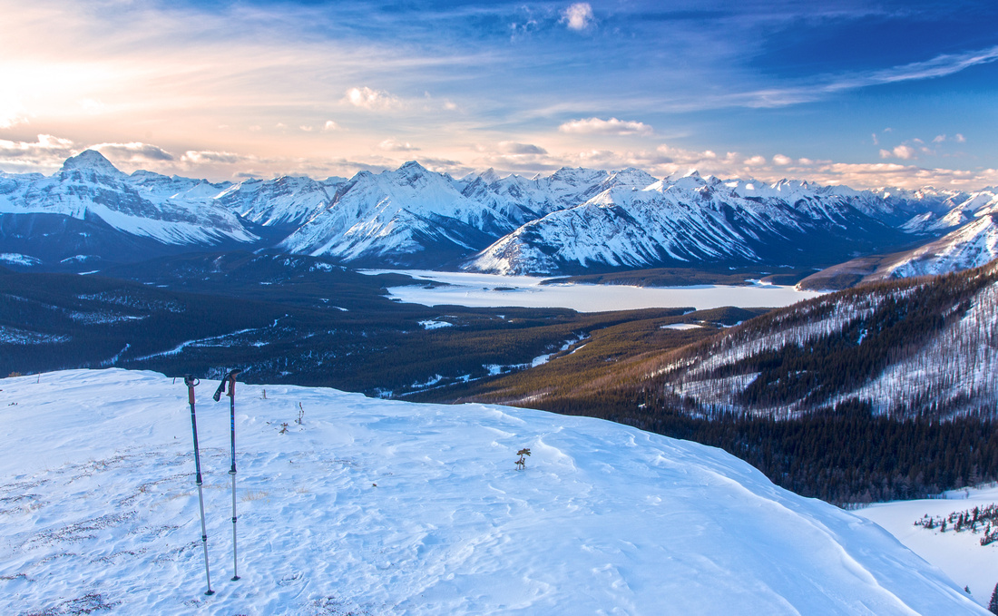
Westerly views from final ascent slopes. Spray lakes center, Mt. Engadine right, Assiniboine far left |
|||
| Trip Summary | |||
February 15, 2016Winter ascent to nub on north side of Rummel lake culminating with exceptional viewpoint. Hike has been described in Nugara snowshoeing guidebook (Trip #22), but approach described here is more logical and less strenuous. Parking is at shoulder of Smith-Dorrien at signed Rummel creek crossing (~1.3 km north from Mt. Engadine lodge junction). Summit is visible as high point of forested ridge above. There are 2 options. More direct, but less scenic is ridge south of Rummel drainage where entire trip is in fairly dense trees with views opening up just before the summit. Better option is to head up at north side of the drainage towards cirque sandwiched between Tower and Mt. Engadine. Ascent follows semi-open clearcut through section dotted with burned trees and is often used by skiers. It is necessary to eventually cross Rummel drainage and join the south ridge, but higher up banks have eroded significantly so crossing can be done without much trouble. Both options share the final ~200 vertical meters towards open and windswept summit. Several options for further exploration are possible. Nugara suggest west ridge of the Tower -- it rises directly above Rummel ridge, separated by low col. This ridge looks straightforward, but it further on becomes technical and does not connect to true (Kane) summit. Interesting alternative for return is to drop from Rummel/Tower col south and head in towards Mt. Galatea aiming for Rummel lake. This loop trip would be most satisfactory overview of the area, but snow conditions must be favorable as there are open slopes that must be crossed. Do not expect broken trail for this one and note that final bit would be 15-20 min walk on the highway back to Rummel creek parking. Finally it also appears possible to return by dropping to Rummel/Tower col, then descend shallow gully and connect with north ridge. Slopes are not too steep, but there is high avalanche hazard. Most people will probably choose either south or north ridge as shown on GPS track -- or perhaps both. In that case it is suggested to head up on north side and return via south. |
|
Gallery |
|||
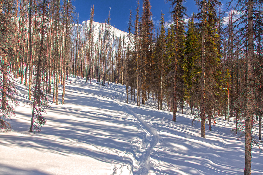 Gently angled north ridge through burned trees
 |
|||
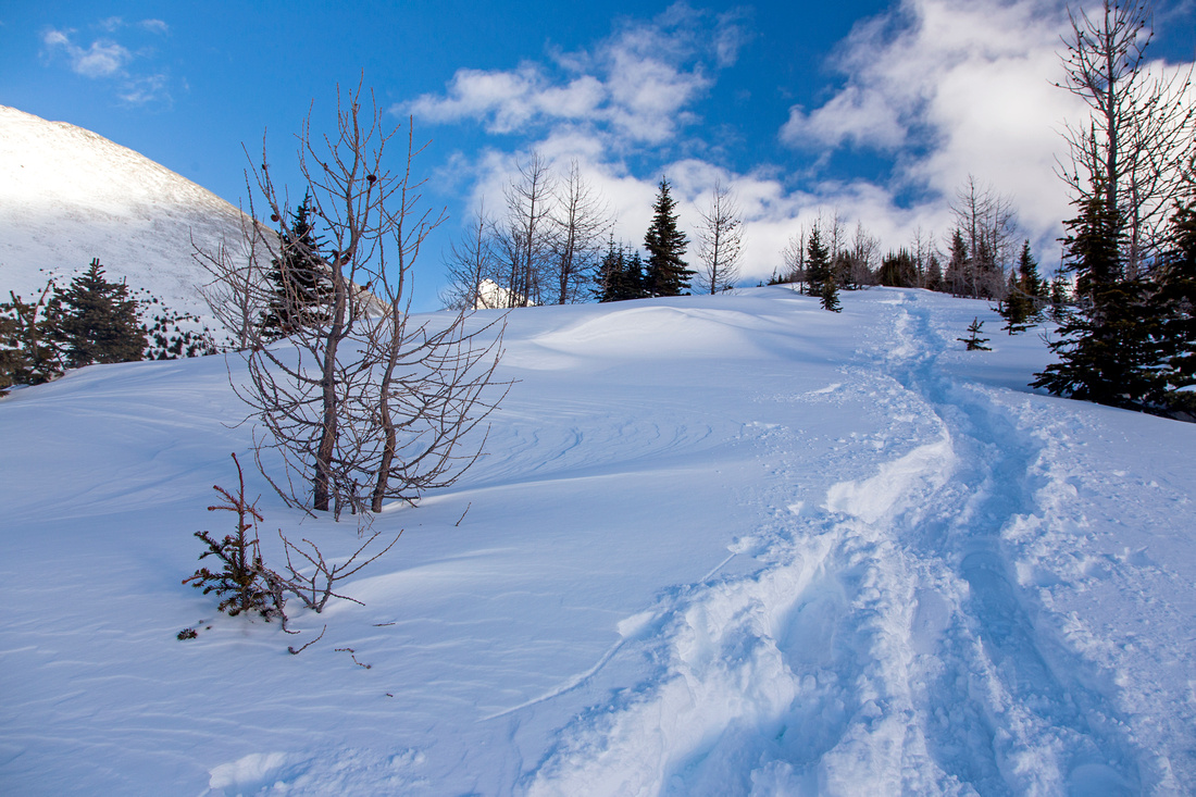 Final section of south ridge above treeline
 |
|||
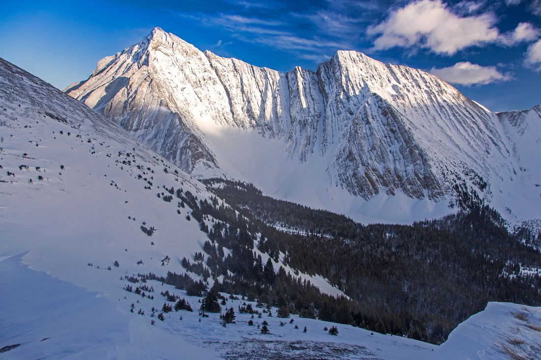
Summit view to Mt. Galatea. Rummel lake below |
|||
 View east from the summit towards Spray Lakes
 |
Abstract
| Overall Difficulty | D4 | Moderately steep snow slopes. Drainage crossings and routefinding. Normally done as winter snowshoe trip only. | |||
| Snow Factor | S3 | Ascent is mainly below treeline with low avalanche danger. Couple of steeper sections on crossing of Rummel creek drainage. | |||
| Scenery | Exceptional views towards Spray Lakes, Mt. Assiniboine and many peaks west of Smith-Dorrien. Towering Mt. Galatea above Rummel Lake cirque, Mt. Engadine to the north | ||||
| Trail/Marking | Poor | Occasional flags on north ridge and Rummel drainage crossings. Expect lots of hard work if trail has not been broken. | |||
| Suggested Time | 5 hr | Time estimate for ascent via longer north ridge and loop return on south. Less for south ridge only. | |||
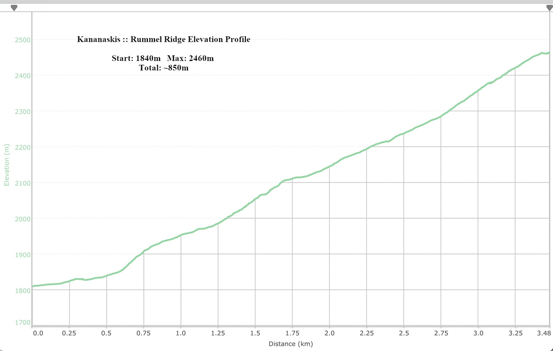
| Elevation | Start: 1840 m Max: 2460 m Total: ~650 m | Round Trip: ~7.5 km | |||
| Gear | Full hiking boots, poles and gaitors. GPS is asset. Avalanche gear normally not required as majority of the trip is below treeline | ||||
| Water | Rummel drainage if flowing or snow-melt. Carry ~1L | ||||
| Dog Friendly | Yes | Standard back-country travel precautions | |||
 Rummel Ridge GAIA Map
 Rummel Ridge Elevation Profile