Google Map |
Rockies :: Kananaskis :: Red Ridge via Sparrowhawk Tarns |
GPS Track |
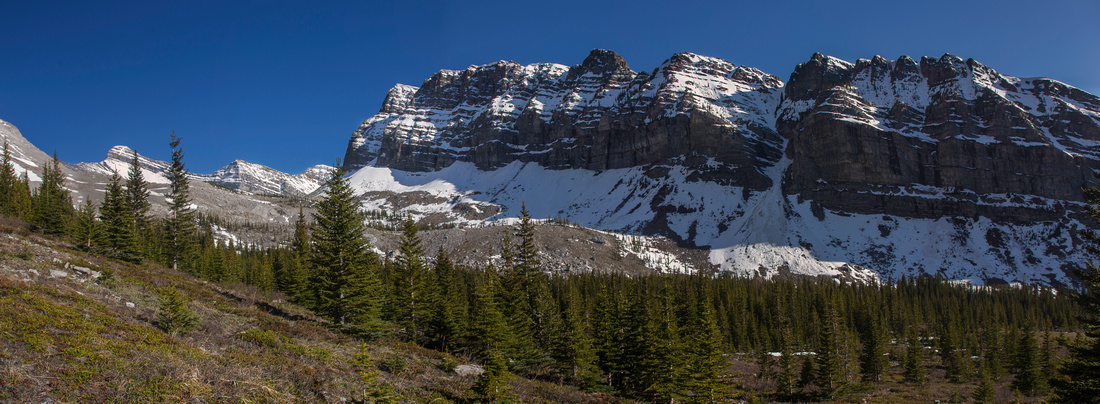 
Red Ridge from Sparrowhawk Tarns Trail; Mt. Bogart left center distance |
|||
| Trip Summary | |||
July 2, 2015Red Ridge is unofficially named ridge rising south of Sparrowhawk creek valley. It is best seen on alternate descent from Read's Tower (cover photo). Both Read' s Tower and Red Ridge are described in Mike Potter's "Ridgewalks in the Canadian Rockies" guidebook (4 hrs trail, 8 hrs off-trail). While day trip is feasible, due to total amount of elevation gain, numerous ups-and-downs, loose talus slopes and route-finding problems it is better to split it in two. Red ridge is also popular snowshoe trip in winter by heading up directly from Hwy 742 (Smith-Dorrien). Full loop (not feasible in winter) is recommended option as it includes visit to very pictoresque set of tarns below Mt. Bogart west ridge. Direction presented here heads to Sparrowhawk tarns first, but opposite might be preferable due to route-finding problems in lower part of the ridge, as well as steep talus slope above tarns bowl that are easier to descend than ascend. Park at Sparrowhawk day use and follow well-defined and cleared Tarns trail to upper valley. Trail disappears as it approaches bowl below Mt. Bogart west ridge, but way is obvious. This section is simply delightful; open terrain with rock garden, soft mossy grass and awesome views north to Mt. Sparrowhawk and Read's Tower. Tarns are further away than you'd expect and there are 3 terraces separated by easy rock steps. There is no official campground, but it would be lovely to bivi here. From upper tarn large scree fan is obvious; ascend about halfway (bits of trail in places), then turn right and traverse diagonally on good scree to the col below east outlier of Red ridge. This ascent is easier than it might appear from below. It is also key why full loop is not feasible in winter conditions, as it would be avalanche prone. There is no trail along the ridge. Going is easy initially, but 15 minutes or so after the highpoint comes the "big step" - significant drop on very lose talus, followed by rock scramble on the other side. This part is not a cakewalk and at times feels more like a moderate scramble. Past this rotten section, conditions ease but ordeal is not over. Couple more of ups-and-downs on lose talus, followed by long descent on crunchy plates. In the middle of this field is humongous pyramid-shaped cairn; it is very confusing and does not signify anything. It is unclear where to drop off the ridge; various guidebooks talk of trail descending to drainage on skier left near treeline, but it is not easy to find. Do NOT angle left before treeline under any circumstances as boulder field is very loose and utterly uncomfortable. Best might be to simply trash to Smith Dorrien in most direct line. If angling left at treeline, couple of game trails along with blue flagging exist, but they soon disappear and you will have to trash anyways. Final bit is 15 min or so road walk back to the parking, depending where you emerged from the forest. If ascending this way regardless of season, it is best to just get your bearings and make a beeline to treeline. |
|
Gallery |
|||
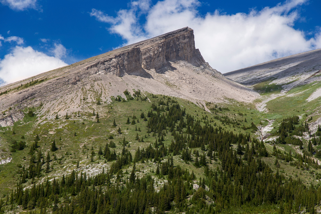 Read's Tower from Sparrowhawk Tarns Trail
 |
|||
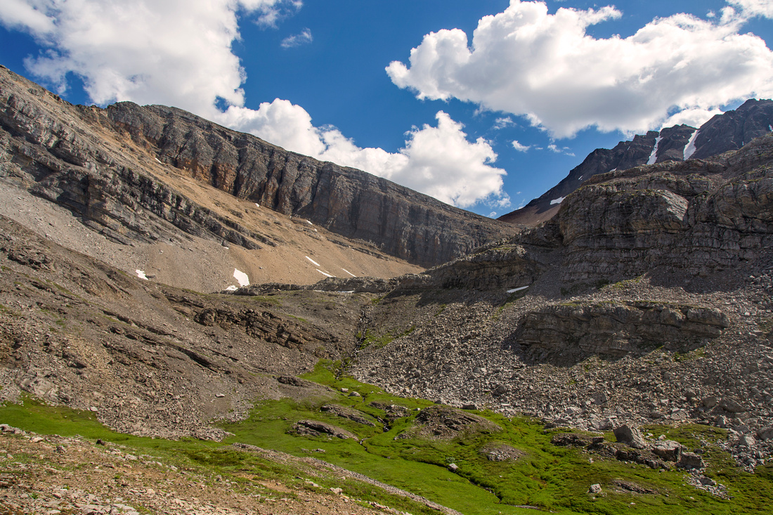 Entering bowl below Mt. Bogart west ridge
 |
|||
 Arriving to first tarn in ~2 hrs of moderate pace
 |
|||
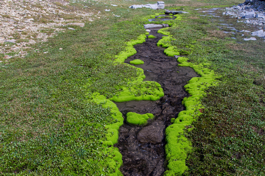 Lovely terrace that just begs for overnight stay
 |
|||
 View back the approach valley
 |
|||
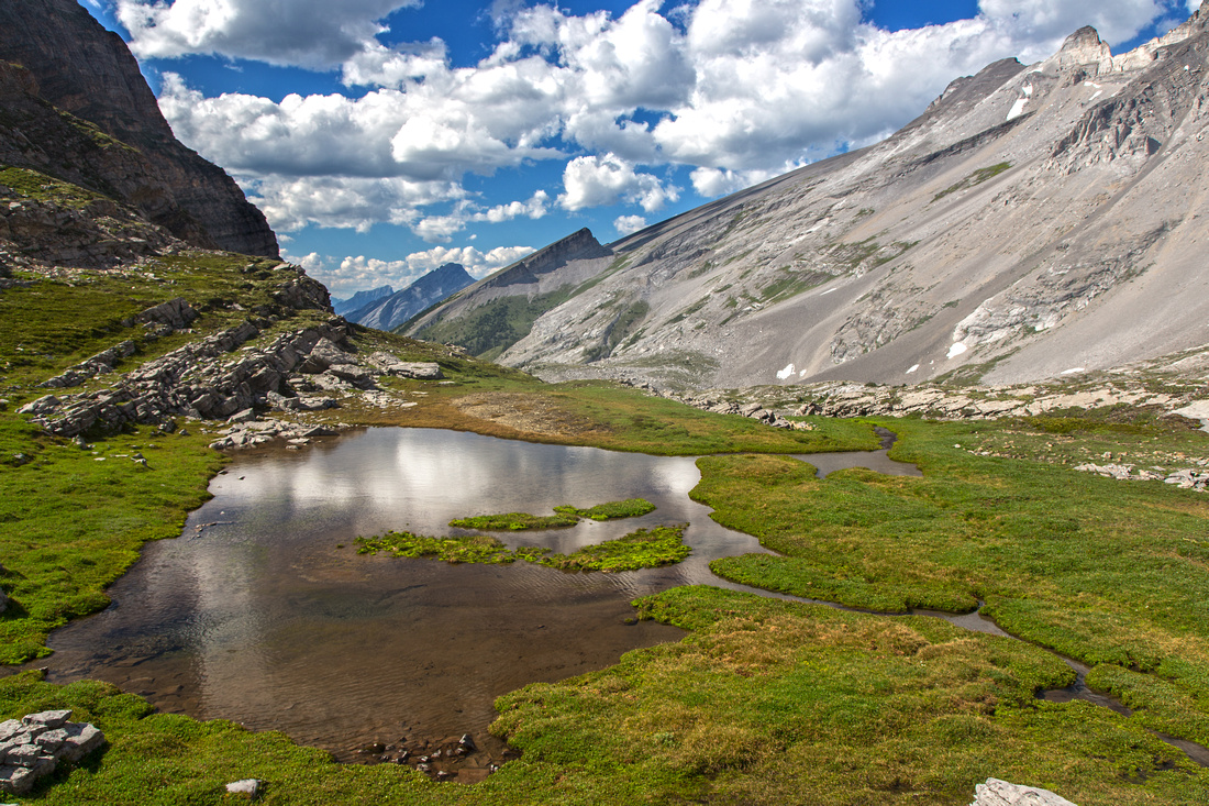
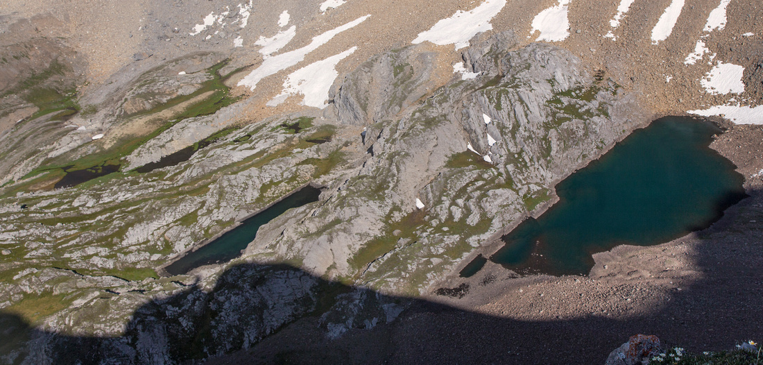
 Second Tarn. Ramp behind is access for Mt. Bogart
 |
|||
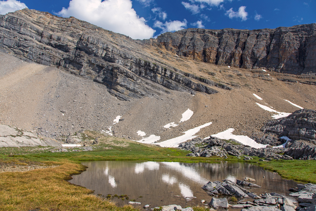
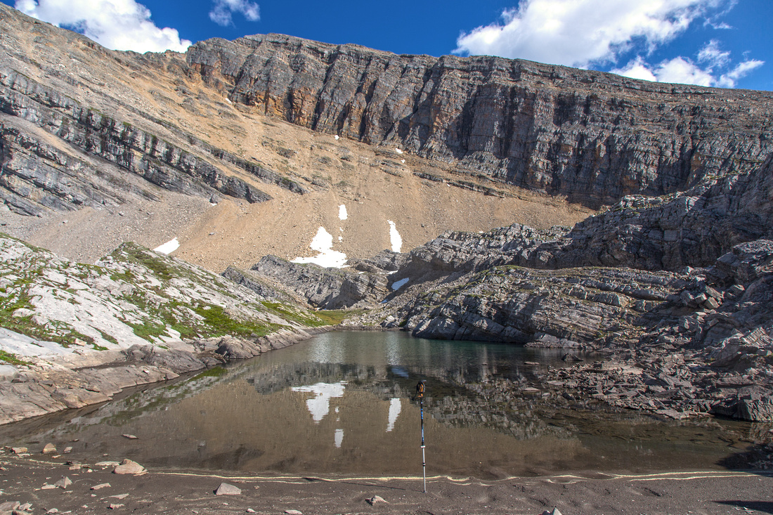
 Third tarn below scree fan leading to Red ridge
 |
|||
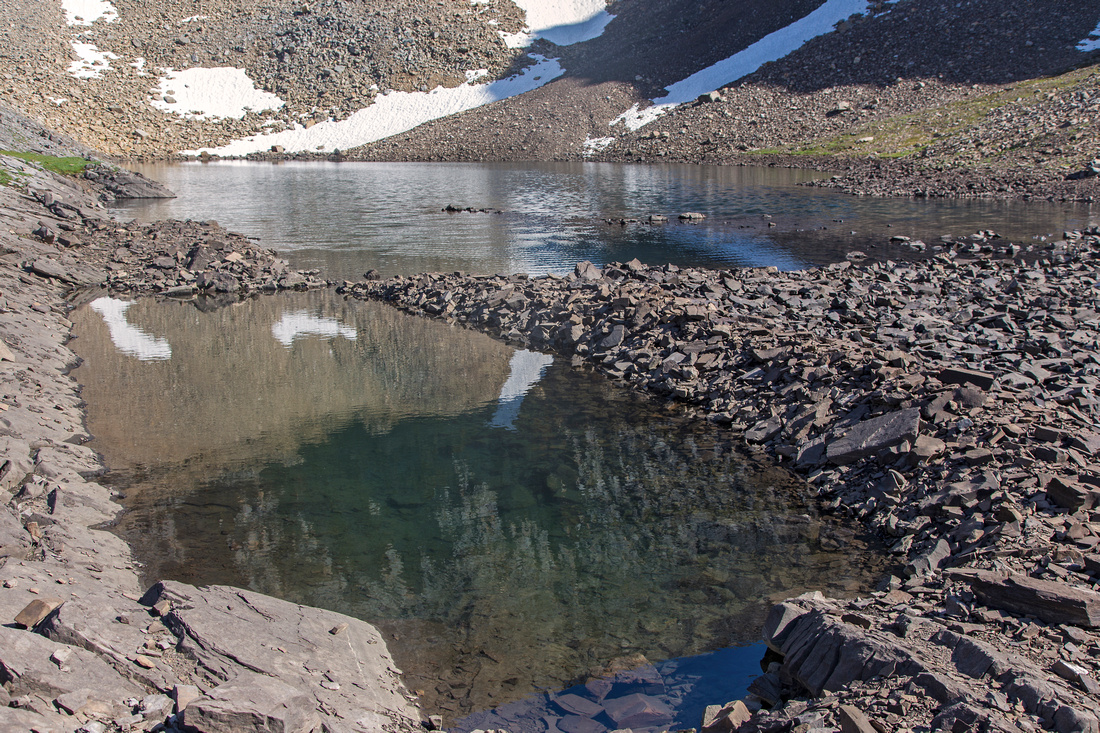
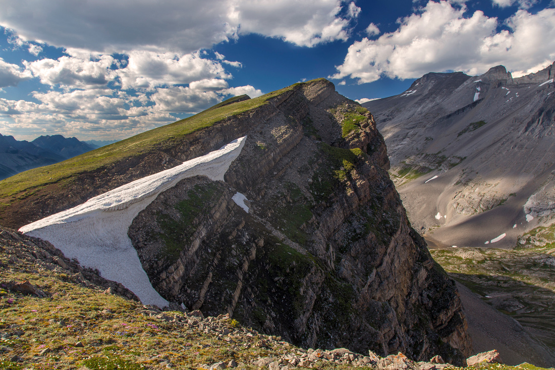
 View down to Sparrowhawk Tarns after scrambling talus fan to Red Ridge outlier
 |
|||
 Red Ridge highpoint from east outlier
 |
|||
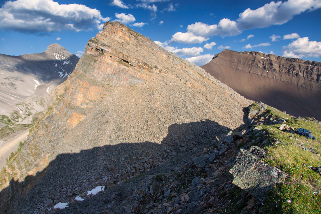 Scrambly bit nicknamed "Rotten Red Ridge"
 |
|||
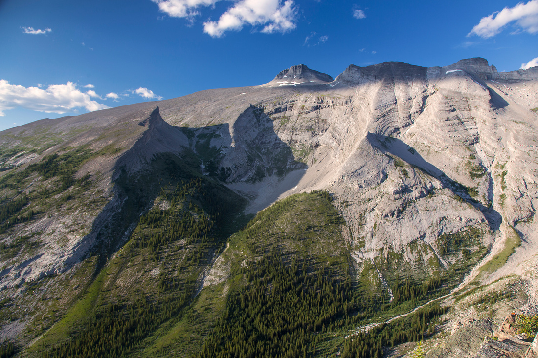 View north to Read's Tower and Mt. Sparrowhawk
 |
|||
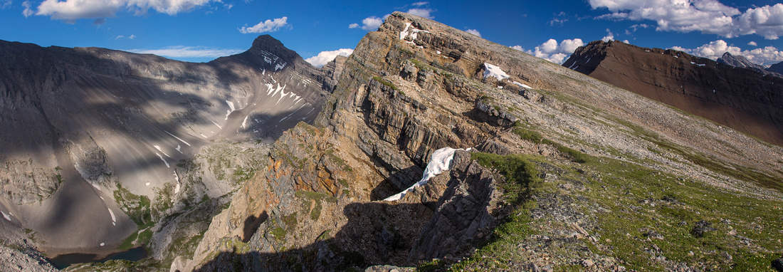 Panoramic view of Red Ridge. Mt. Bogart left of center
 |
Abstract
| Overall Difficulty | D5 | Steep talus slope above Sparrowhawk Tarns. Loose talus scramble on Red ridge. Significant route-finding | |||
| Snow Factor | S3 | Frequently done on snowshoes in winter directly from Smith-Dorrien. Full loop not recommended in winter due to high avalanche danger on steep slope above Sparrowhawk Tarns | |||
| Scenery | Picture-perfect Sparrowhawk Tarns. Superb views of Spray Reservoir and many nearby peaks from Red Ridge | ||||
| Trail/Marking | Good / none | Good trail with cairns to mouth of tarns valley, none afterwards. Significant route-finding problems below treeline on Red Ridge | |||
| Suggested Time | 7 hr | Return time for full loop. Going just to the tarns is 3-4 hr return trip. Traversing ridge directly from Spray road (snowshoe trip) will depend on snow conditions and how far you go; ~5 hr return is realistic | |||
| Elevation | Start: 1730m Max: 2650m Total: ~1100m (loop) | Round Trip: 15km (loop) | |||
| Gear | Hiking boots and poles. Gaiters helpful on scree slope above the tarns. GPS useful in lower portion of Red ridge | ||||
| Water | Sparrowhawk Creek and Tarns. No water source along Red Ridge. Carry 1-2L | ||||
| Dog Friendly | Yes | Lose talus slopes should not present the problem, but be weary of sharp rock that might hurt paws | |||
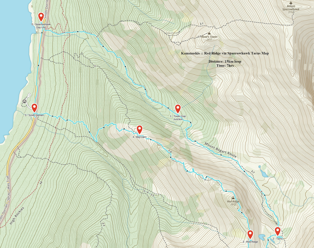 Red Ridge via Sparrowhawk Tarns GAIA Map
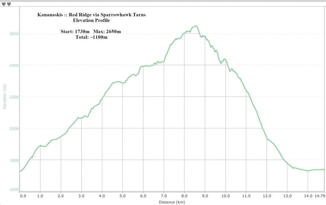 Red Ridge via Sparrowhawk Tarns Elevation Profile