Google Map |
Rockies :: Kananaskis :: Rae Lake |
GPS Track |
|
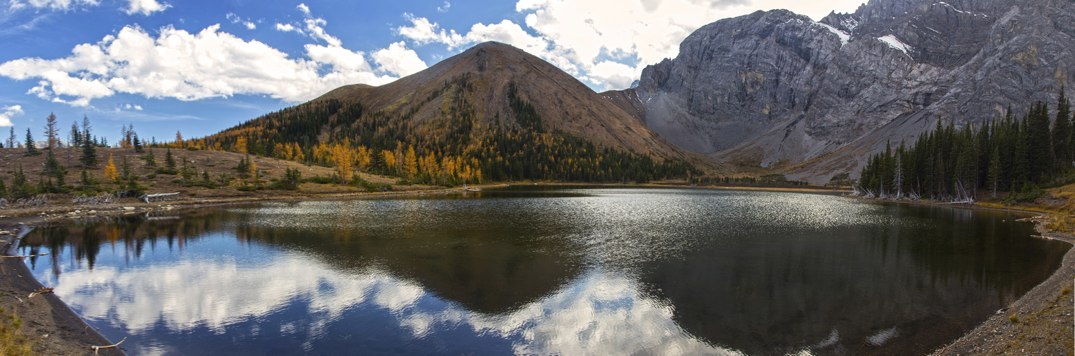
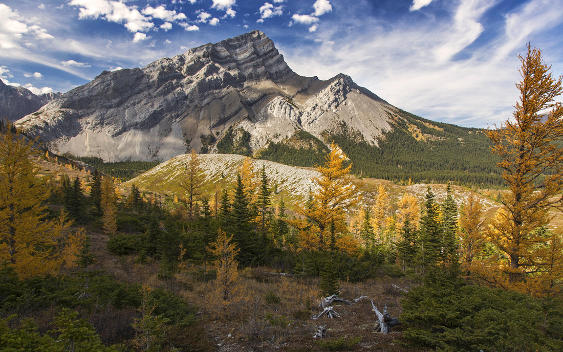
Panoramic view of Rae Lake from north side. Main camping area is by lake outlet just left of center |
|||
| Trip Summary | |||
September 29, 2016Rae Lake is still infrequently visited destination in Tombstone Area. Most visitors just flock to Elbow Lake, but In 2nd half of September when larches shed their golden needles on approach slopes below Mt. Rae it becomes very scenic -and recommended- trip. It can easily be done as day-hike, but backpack is well-worth considering. Although not official, there are many flat camping spots around the lake. There are several options to extend the day - loop return via Sheep road, Sheep Lakes, 'mandatory' side trip to Edworthy Falls or even additional hike to Tombstone Lakes (well-worth trip on its own. Parties sometimes use Rae lake as first stop on multi-day backpack to Rae Creek Hills/Burns Lake. The only drawback is that east aspects below Mt. Rae lose sun fairly early in the day; in the fall cirque that holds Rae lake is usually completely in shade after 3 pm.
Parking is at Elbow Lake trailhead, few kilometers north from Highwood Pass along Hwy 40 (Kananaskis Trail). Elbow Lake is very busy and parking spot fills fast on weekends. It has unfortunately seen several break-ins in the past; do not leave anything valuable in the vehicle. Follow wide trail/road to Elbow Pass and down to Elbow lake, easily reached in less than 1/2 hour. This is the steepest part of the day. Back-country campground is at right (south) side of the lake and is starting point of Rae Glacier Trail; for Rae Lake continue on left side, then down the Tombstone road shared with horses. This part can be muddy as it is shared with horses. Tombstone Pass is very scenic and expansive meadows grant fantastic views -- well worth a break. From the pass road descends towards Little Elbow / Sheep junction. It is not necessary to descend all the way -- watch for cairn on right (south) side of the road some 15-20 minutes past Tombstone Pass. Follow this side trail; soon it emerges at open meadows dotted with larches. Side ridge is well worth hiking up for far reaching views. Trail forks; left branch descends to Sheep road -- this is where you will come back if you elect to do loop return. Continue on right branch that rises through thinning stands of larch and pine trees to obvious wide ridge above. Trail is indistinct at several places, but even if you lose it general direction is obvious. Finally you top out on ridge and start gentle descent to the lake. If you are camping, main spot is near the lake outlet but if busy more quiet option can also be found by contouring the lake on right side to meadows on far end.
Return the same way (shorter), or to extend the day find trail on south side of lake outlet. This trail descends to Sheep road in about 30 minutes from the lake. Make noise here as there have been grizzly encounters. Once on Sheep road, if you have time it is worth hiking a bit south for good views from the shoulder just before road starts descent. Otherwise turn left and hike back. Sheep lakes on east side are another side-trip option; there is back-country campground there as well, but more often used by hunters. Just before road starts descent to Little Elbow junction watch for cairn - shortcut back to Tombstone road. Do not miss visit to Edworthy Falls; trail descends to the base of falls, but best viewpoint is from above when falls first come into view (did you bring the tripod?) |
|
Gallery |
|||
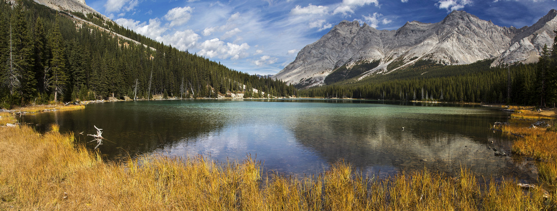 Elbow Lake Panorama Elbow Lake Panorama Panoramic view from west side of Elbow Lake ~30 min from the parking
 |
|||
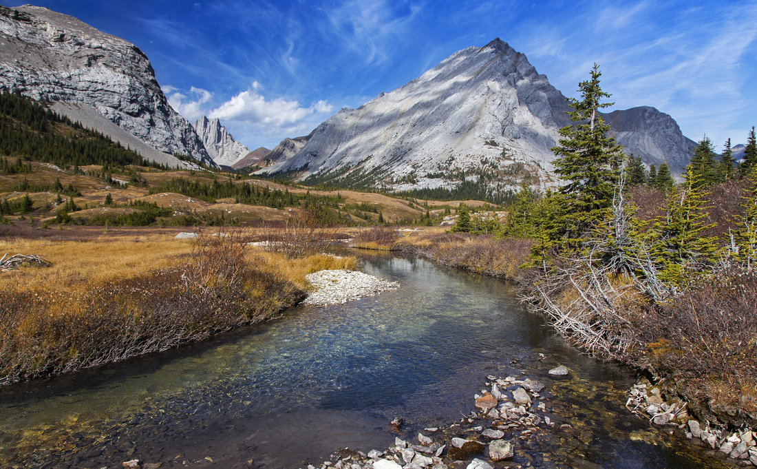 Elbow River and Tombstone Pass
Elbow River with views to South Tombstone Peak rising above Tombstone Pass Elbow River and Tombstone Pass
Elbow River with views to South Tombstone Peak rising above Tombstone Pass |
|||
 |
|||
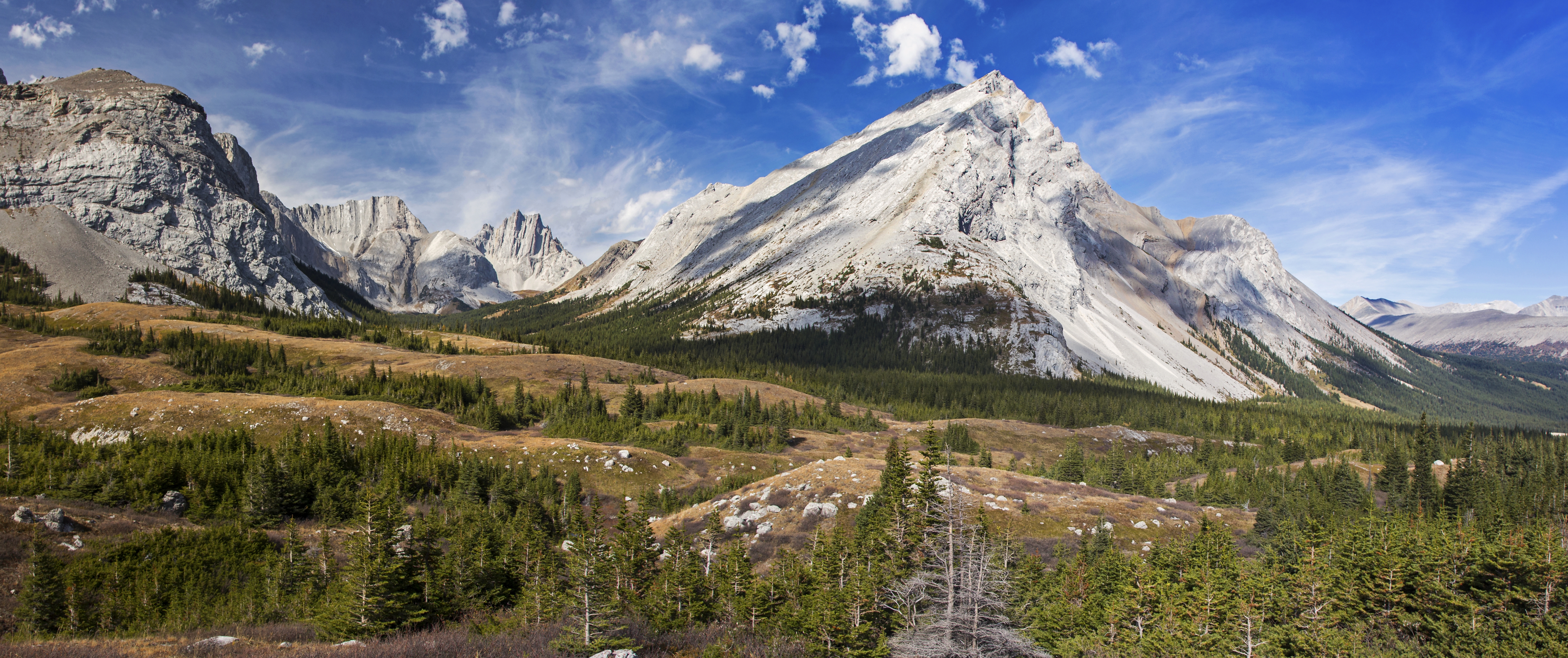
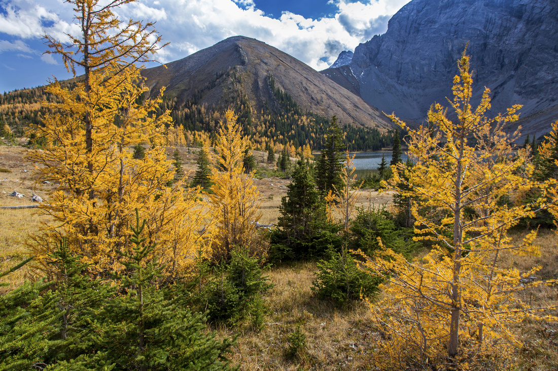
 South Tombstone Peak
 from larch slopes below Rae Lake South Tombstone Peak
South Tombstone Peak from larch slopes below Rae Lake |
|||
 Rae Lake Larches
Descent to Rae Lake through stand of golden larches. Trail vanishes at this point Rae Lake Larches
Descent to Rae Lake through stand of golden larches. Trail vanishes at this point |
|||
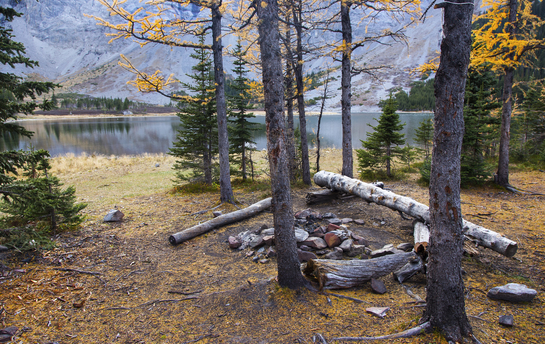 Rae Lake Campsite
Main camping area near Rae lake outlet Rae Lake Campsite
Main camping area near Rae lake outlet |
|||
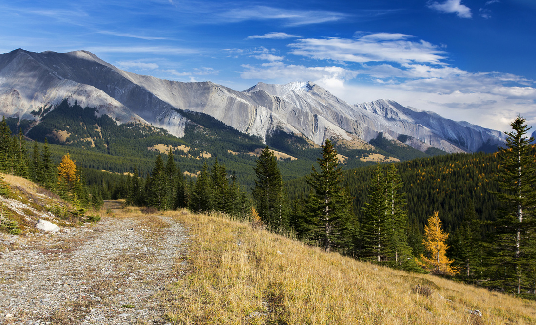 Sheep Road
Optional loop return via Sheep Road with great views of front ranges Sheep Road
Optional loop return via Sheep Road with great views of front ranges |
|||
 |
Abstract
| Overall Difficulty | D3 | Mostly easy trail hiking. Steep section to Elbow Pass and some muddy bits around Tombstone Pass. | |||
| Snow Factor | S2 | Route stays well away from avalanche slopes. Would be very good moderate x-country ski objective | |||
| Scenery | Elbow and Rea Lakes. Scenic Tombstone Pass. Picture perfect Edworthy Falls. Far reaching views into Sheep area | ||||
| Trail/Marking | Very Good | Initially wide and shared with horses to Sheep/Little Elbow junction. Shortcut marked by cairn. Some indistinct section afterwards, but way is obvious | |||
| Suggested Time | 6-7 hrs | Round trip with loop return via Sheep trail and side trip to Edworthy Falls | |||
| Elevation | Start: 1950m Max: 2200m Total: ~600m | Round Trip: ~20km | |||
| Gear | Day hikers or full hiking boots. x-country skis or snowshoes in winter | ||||
| Water | Elbow River and Rae Lake outlet. Carry 1L | ||||
| Dog Friendly | Yes | Standard back-country travel precautions | |||
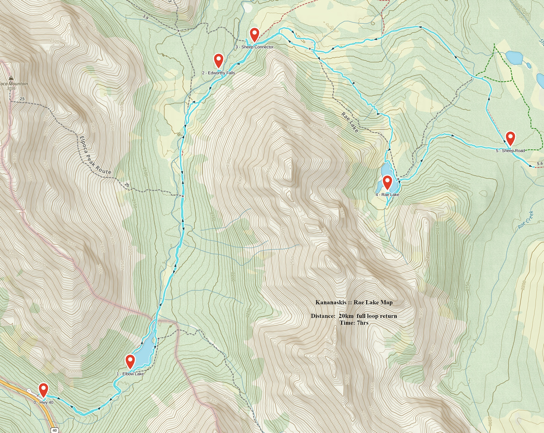 Rae Lake GAIA Map
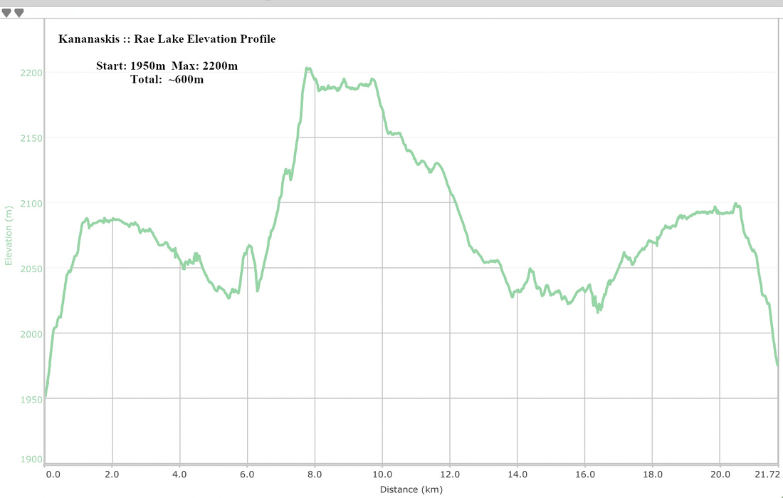 Rae Lake Elevation Profile
Rae Glacier
Rae Glacier is typically done as side-trip from Elbow Lake campground, but also sometimes on its own. I tend to do it as "bike and hike" trip in first part of June, before seasonal re-opening of Hwy 40 -- road cycle from K-lakes turnoff gate to Elbow Lake trailhead, out-and-back hike to Rae Glacier, followed by exhilarating ride back. Regardless how you do it here are the basics:
From Elbow Lake follow trail on right (south) side reaching Rae Glacier drainage some 10 minutes past the Campground - ultimate source of (very young) Elbow River and Calgary drinking water! Turn right (overgrown trail across the creek will merge with standard Elbow Trail shortly). Rae Glacier trail follows climber right side of the creek; portions have been washed out, but going is relatively easy, and there are sporadic cairns and flags. In another 10-15 minutes there is quite pretty and rather unexpected Canyon, well worth checking out. Trail climbs moderately still on right side and reaches treeline, some 30 minutes from Elbow Campground. Higher up, past another washed out portion of the creek is the fork: continuing straight talus trail climbs into alpine cirque with small lake fed by miniscule Rae Glacier at head of valley. It is really hard to call it a "glacier" as there is almost none of it left. Towering Mt. Rae is above, but standard scramble access is from the other side.
From creek fork below option is to visit east side cirque; sizeable waterfall coming down suggests there might be hidden tarn above, but this is not the case as creek disappears in the upper part and cirque is entirely dry. However according to Daffern, this cirque is ultimate source of Elbow River so it is worth checking it out. Both can easily be combined in single trip, suggested ~3hrs return from the Campground, roughly 4-5km and ~250m elevation with light scrambling by washed out Elbow creek.
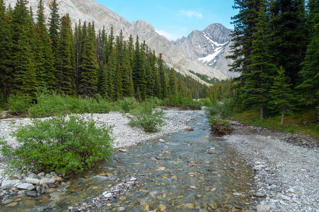 Elbow Creek
Very young Elbow River ~10 min from Elbow Campground; go right
Elbow Creek
Very young Elbow River ~10 min from Elbow Campground; go right
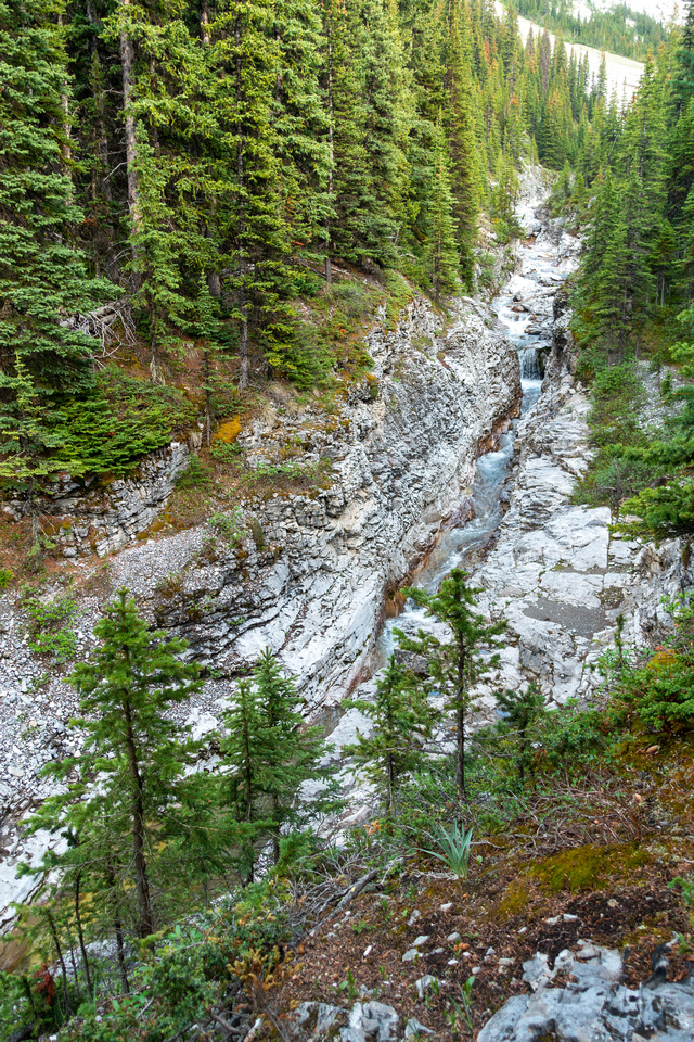 Elbow Creek Canyon
Rather pretty Canyon higher up, trail stays on climber right
Elbow Creek Canyon
Rather pretty Canyon higher up, trail stays on climber right
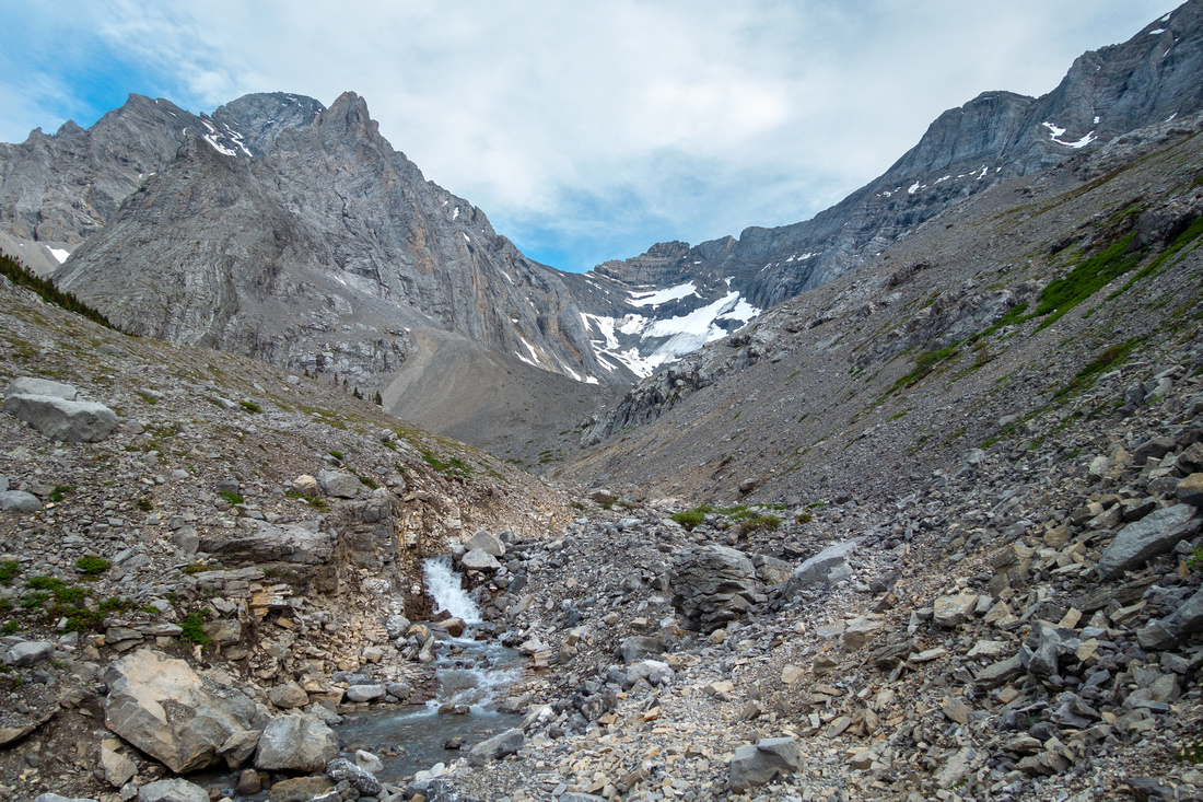 Rae Glacier
Upper Elbow creek; Rae Glacier in center. Trail is fairly washed out here and going is slow
Rae Glacier
Upper Elbow creek; Rae Glacier in center. Trail is fairly washed out here and going is slow
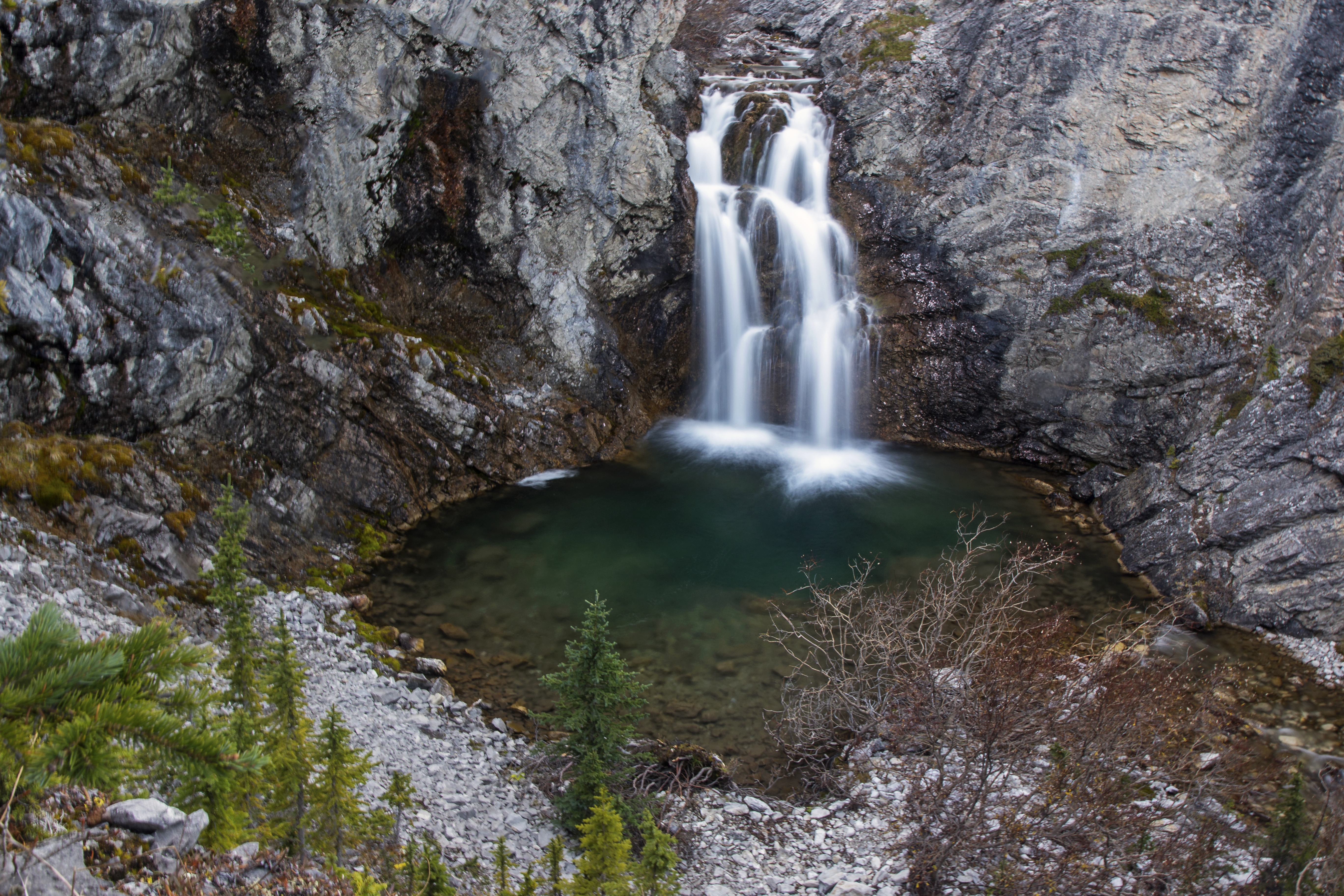
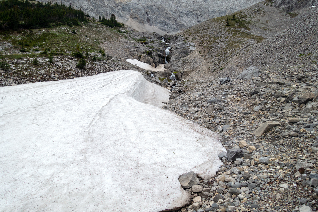 Rae Falls
Good trail climbing to east side cirque past the forks. Creek disappears underground just above the Waterfall
Rae Falls
Good trail climbing to east side cirque past the forks. Creek disappears underground just above the Waterfall
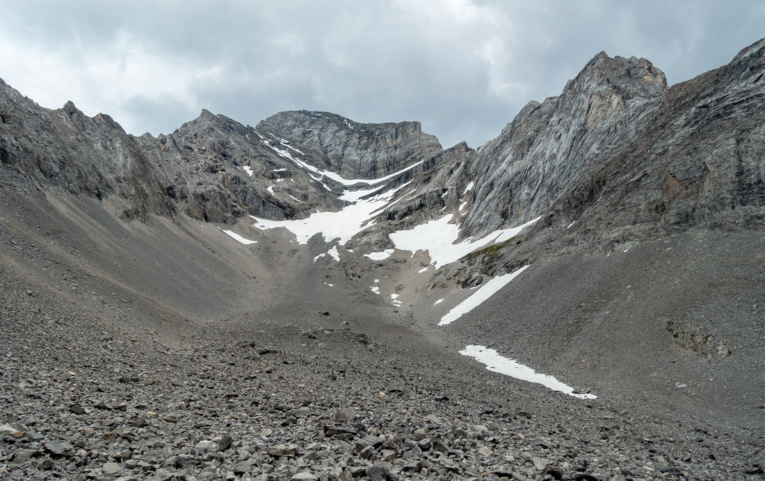 Rae Cirque
East Rae Cirque, with Mt. Rae Looming above (Rae Lake is at the other side of cliffs to the left). Permanent neve upper center is, according to Daffern, ultimate source of Elbow River
Rae Cirque
East Rae Cirque, with Mt. Rae Looming above (Rae Lake is at the other side of cliffs to the left). Permanent neve upper center is, according to Daffern, ultimate source of Elbow River