Google Map |
Rockies :: Kananaskis :: Picklejar Lakes |
GPS Track |
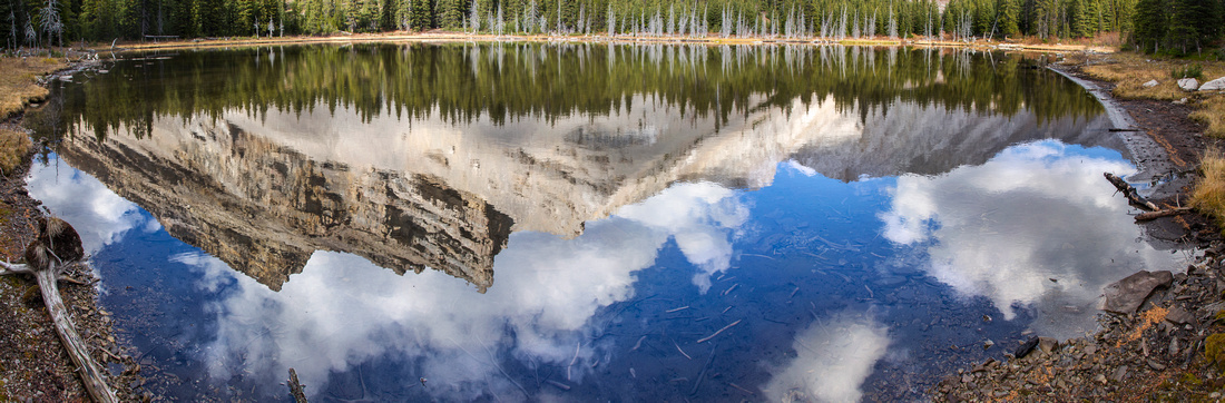 
Third Picklejar Lake. Trail continues on left side past several fire pits and camp spots |
|||
| Trip Summary | |||
October 2, 2015"The fishing is so good it's like catching fish in a picklejar" - hence this rather exotic name for set of 4 lakes in nice alpine environment and popular hiking/backpacking/fishing/hunting destination. Hike 209 in K-country trail guide 3rd Edition, Vol 2 (would be somewhere in Vol 5 in new edition). It is a short, but very nice hike up left (north) side of Lantern creek. Sign at trailhead warns of grizzly accident in 2014, so caution is needed. Takes about an hour of brisk pace to the col / low point of Lineham ridge. Scrambling trail continues up the ridge, while hiking trail descends over much washout to the shores of 4th lake. From there lakes 3, 2 and 1 are reached in short succession. Camping is allowed, but there are no facilities. Usual spot is at far (east) end of 4th lake, but there are several good sites on small forested rise between 4th and 3rd lake. Much room for exploration around the lakes and several fire sites are testimony of popularity. Beyond 1st lake faint trail continues towards optional scramble descent from Lineham ridge. |
|
Gallery |
|||
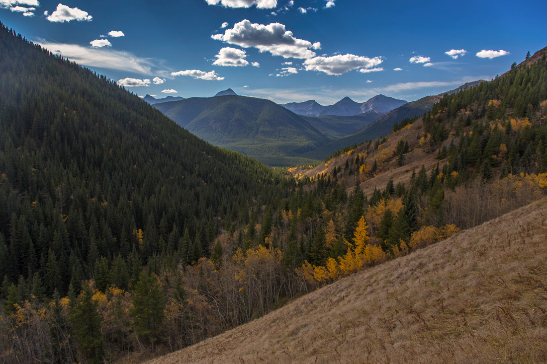 View back along Lantern Creek ~30 min from start
 |
|||
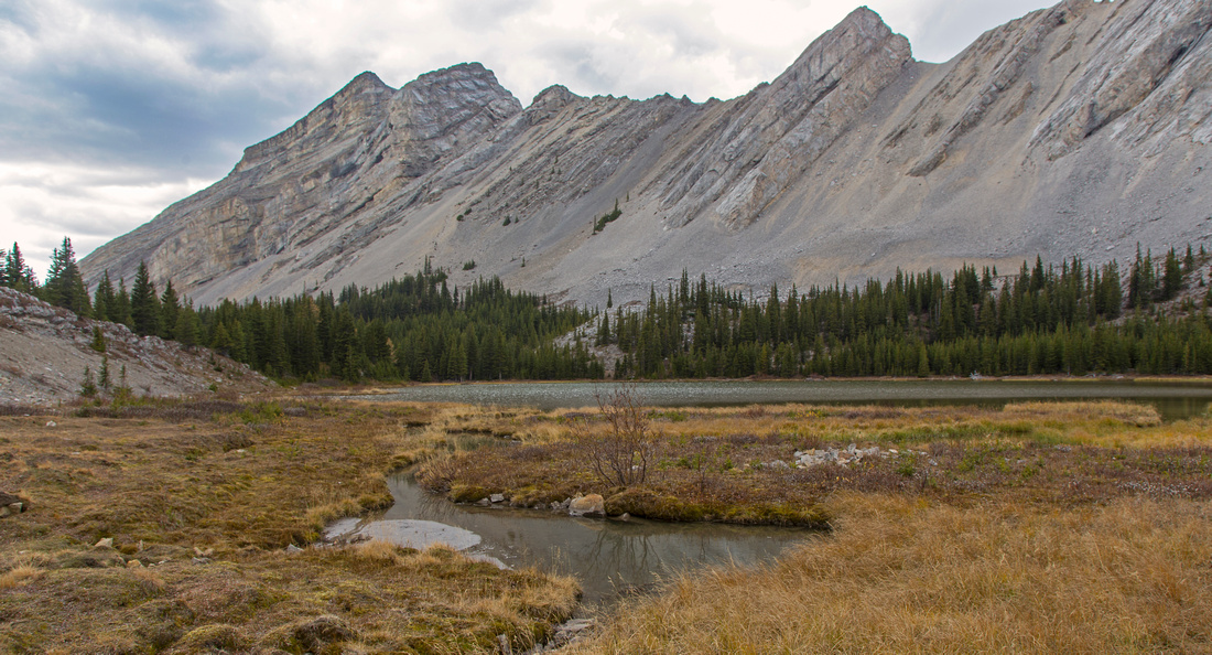
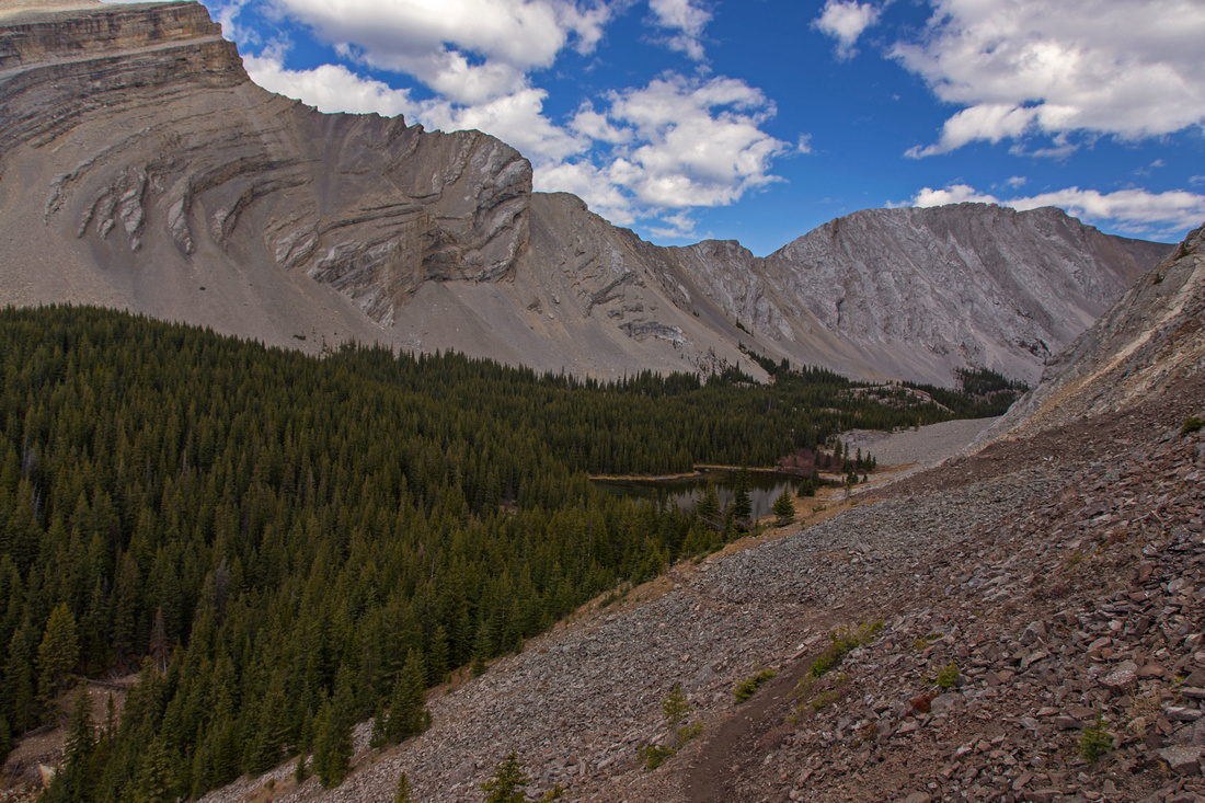 Descending 4th lake in bowl under Lineham Ridge
 |
|||
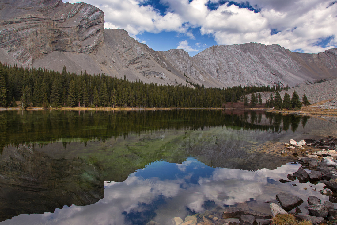
4th Picklejar Lake. Trail continues on right side |
|||
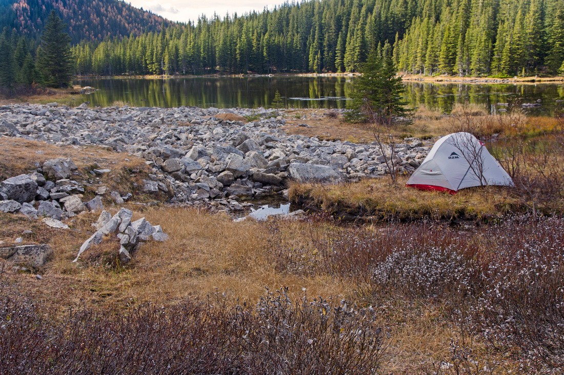 Usual camping spot at far end of 4th lake
 |
|||
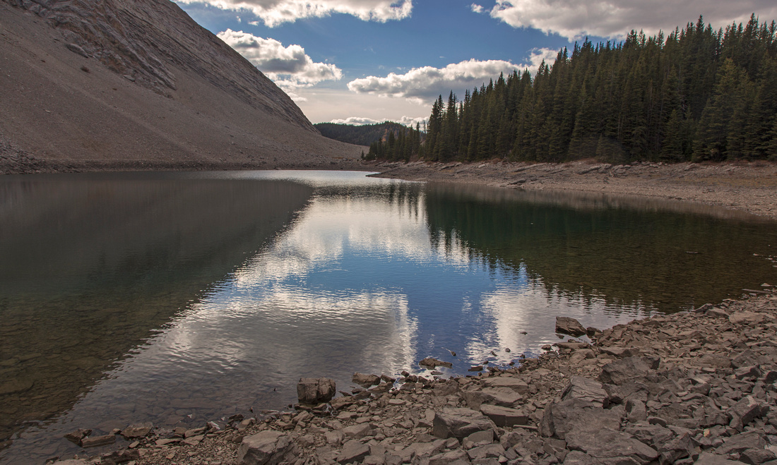 Second Picklejar Lake is the deepest and very blue
 |
|||
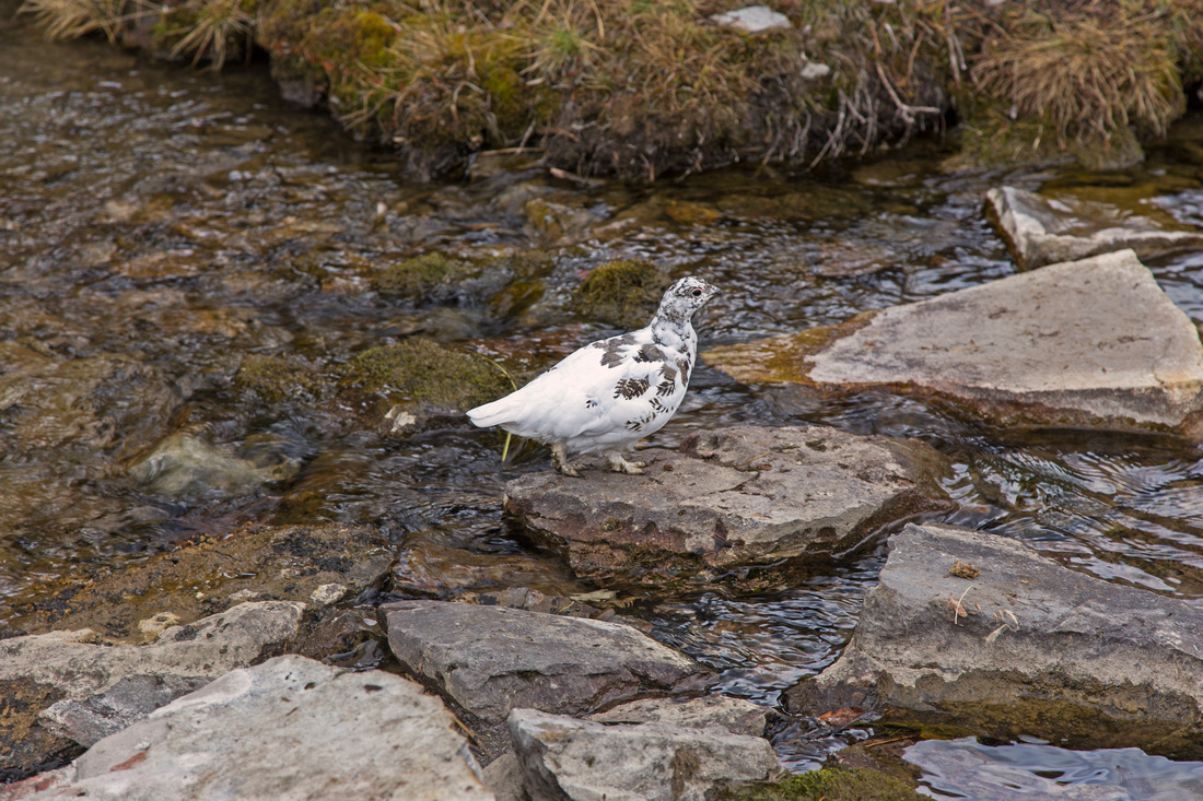 Snow Ptarmigan hoping the outlet of first lake
 |
|||
 First lake looking back. Faint trail continues to upper bowl
 |
Abstract
| Overall Difficulty | D3 | Trail hiking. Steep and eroded bit leading to low end of Lineham ridge followed by descent over much washout | |||
| Snow Factor | S3 | Steep hillside traverse on north side of Lantern creek, but low objective avalanche danger | |||
| Scenery | Very nice set of pater-noster lakes in short succession. In autumn foliage of fallen leafs makes hike up Lantern creek very nice | ||||
| Trail/Marking | Very good | Wide and well-defined trail. Beyond fire pit at shores of 3rd lake it becomes less distinct but way is obvious | |||
| Suggested Time | 3-4hr | Return time for leisurely visit to all 4 lakes | |||
| Elevation | Start: 1740m Max: 2200m Total: ~600m | Round Trip: 11km | |||
| Gear | Day hikers are enough. Poles will be helpful for steeper bit below the col and for stability on descent to 4th lake | ||||
| Water | Lantern creek, then outlets of Picklejar lakes. No need to carry more of 1L | ||||
| Dog Friendly | Yes | Keep control of your dog; several grizzly bear encounters happened in the past | |||
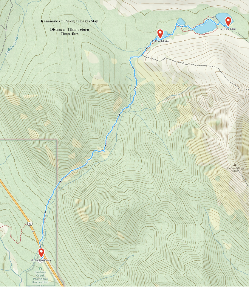 Picklejar Lakes GAIA Map
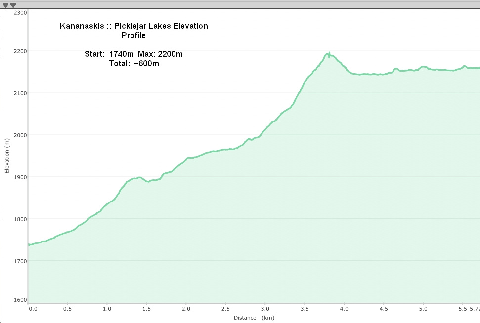 Picklejar Lakes Elevation Profile
© Autumn Sky Photography